Last Visited: August 31, 2025;
Previous Visit(s): October 27, 2023, September 4, 2022
Maps: Fisher F-18, F-19; McKenzie #6, #7
Daily Quota: 8
Fire History: Ham Lake Fire 2007, Cavity Lake Fire 2004
Nearest Ranger Station: Gunflint Ranger Station, Grand Marais, MN along Hwy. 61 on the North Shore
Portage Length from Parking Lot: None
Restroom at Entry Point: Yes
Entry Point 54 - Sea Gull Lake
Gunflint Ranger District
From Grand Marais, Minnesota, follow the Gunflint Trail for about 52 miles to the Sea Gull Lake Access Road, which will be on your left. The entry point is just past the Sea Gull Lake Community Center.
From Sea Gull Lake, there are portages to to Alpine Lake, Grandpa Lake, Paulson Lake and Rog Lake in the Boundary Waters Canoe Area. Most groups head to Alpine Lake or Rog Lake. The portage to Paulson Lake is almost a mile and a half long and relatively difficult. This portage makes for a good day hike too. Many paddlers get a tow across Sea Gull Lake to the south end of Three Mile Island. This saves about five miles of paddling.
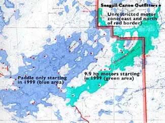
Motorboats with up to 10 hp are allowed on the portion of Sea Gull Lake east and south of Three Mile Island.
Nearly all of Sea Gull Lake was affected by either the Cavity Lake Fire which occurred in 2004 or the Ham Lake Fire of 2007.
Exploring the Entry Point
Click on the photos below to see the full resolution image - Use your browsers back button to close photo and return to this page.
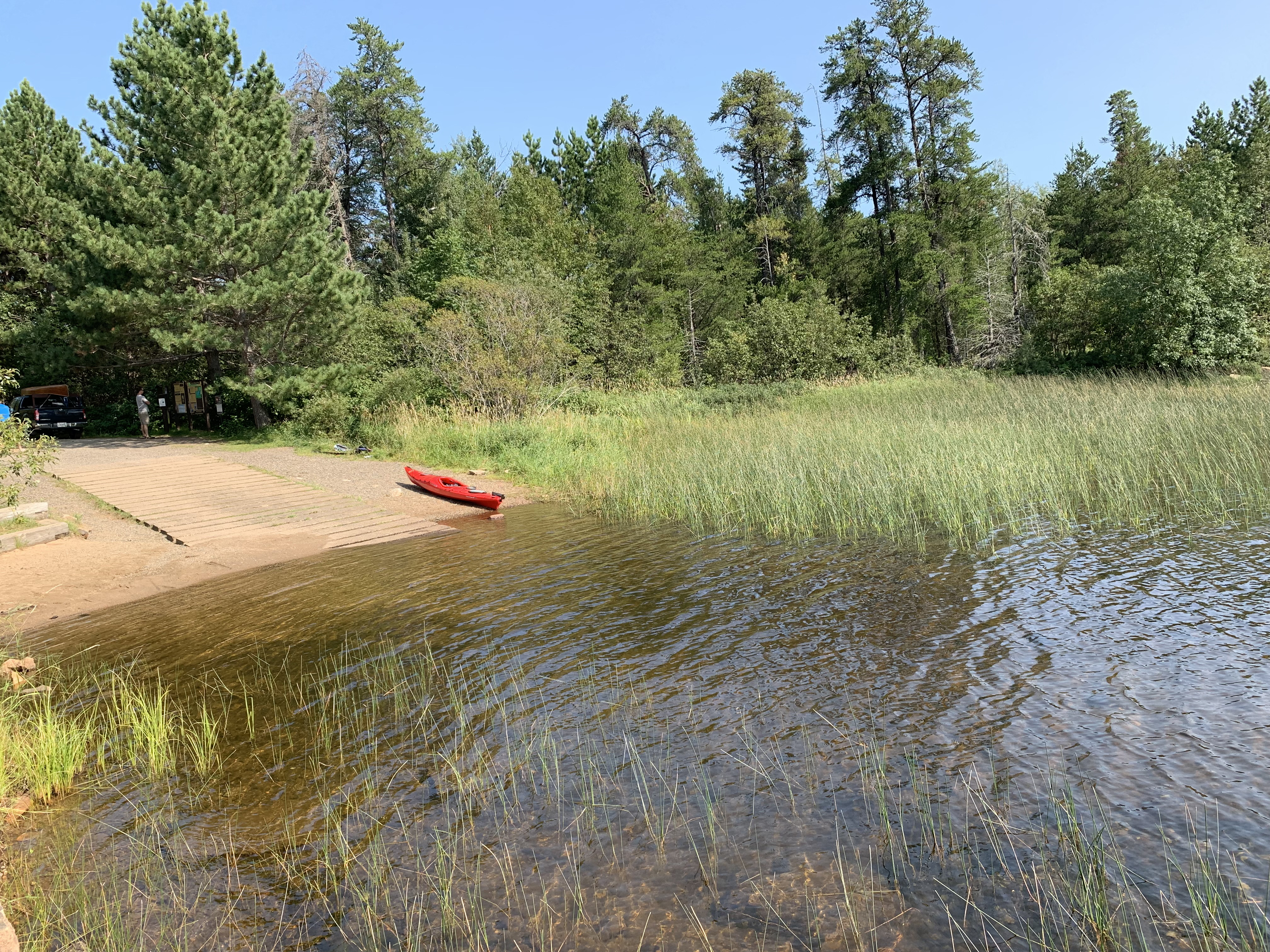
Starting in the large parking lot, walk down toward the shoreline of Sea Gull Lake (October 27, 2023).
A sizeable parking lot to accomodate cars and trucks with trailers (October 27, 2023).
The restroom is found in the parking lot (October 27, 2023).
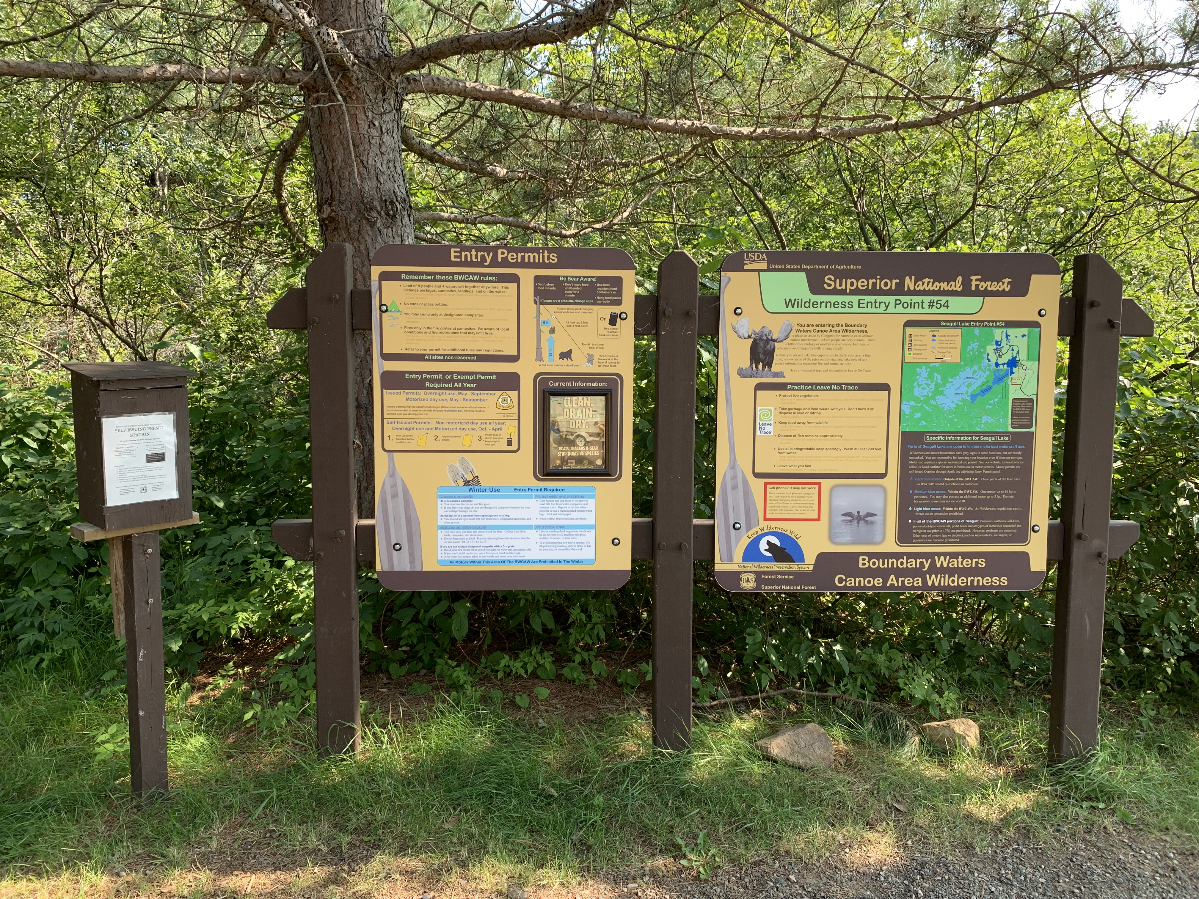
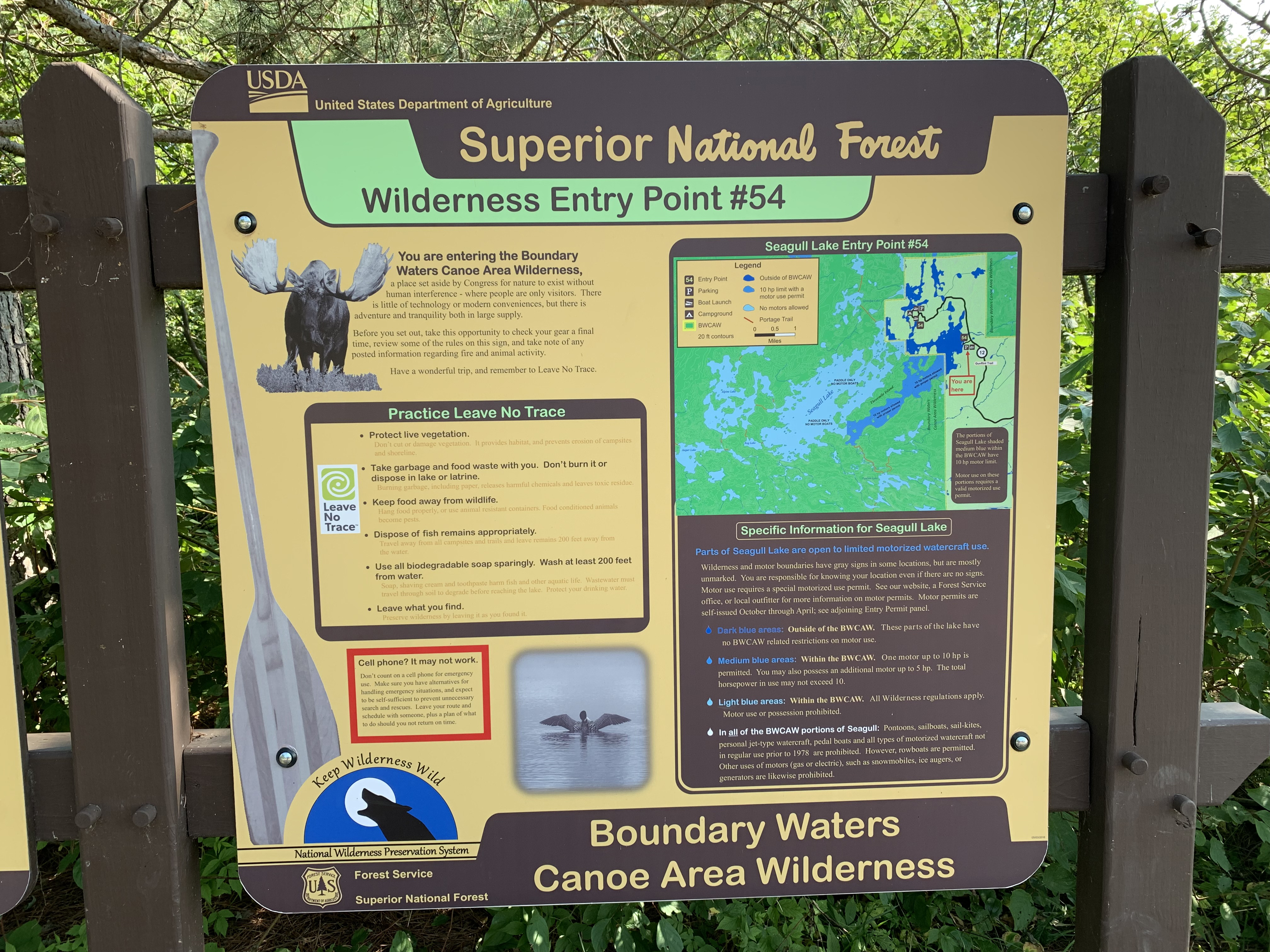
The usual bulletin boards found at most BWCA entry points. The small box on the left contains BWCA day trip permits. You need to fill one of these out if you don't have an overnight BWCA permit and are just visiting for the day (October 27, 2023).
A close up (October 27, 2023).
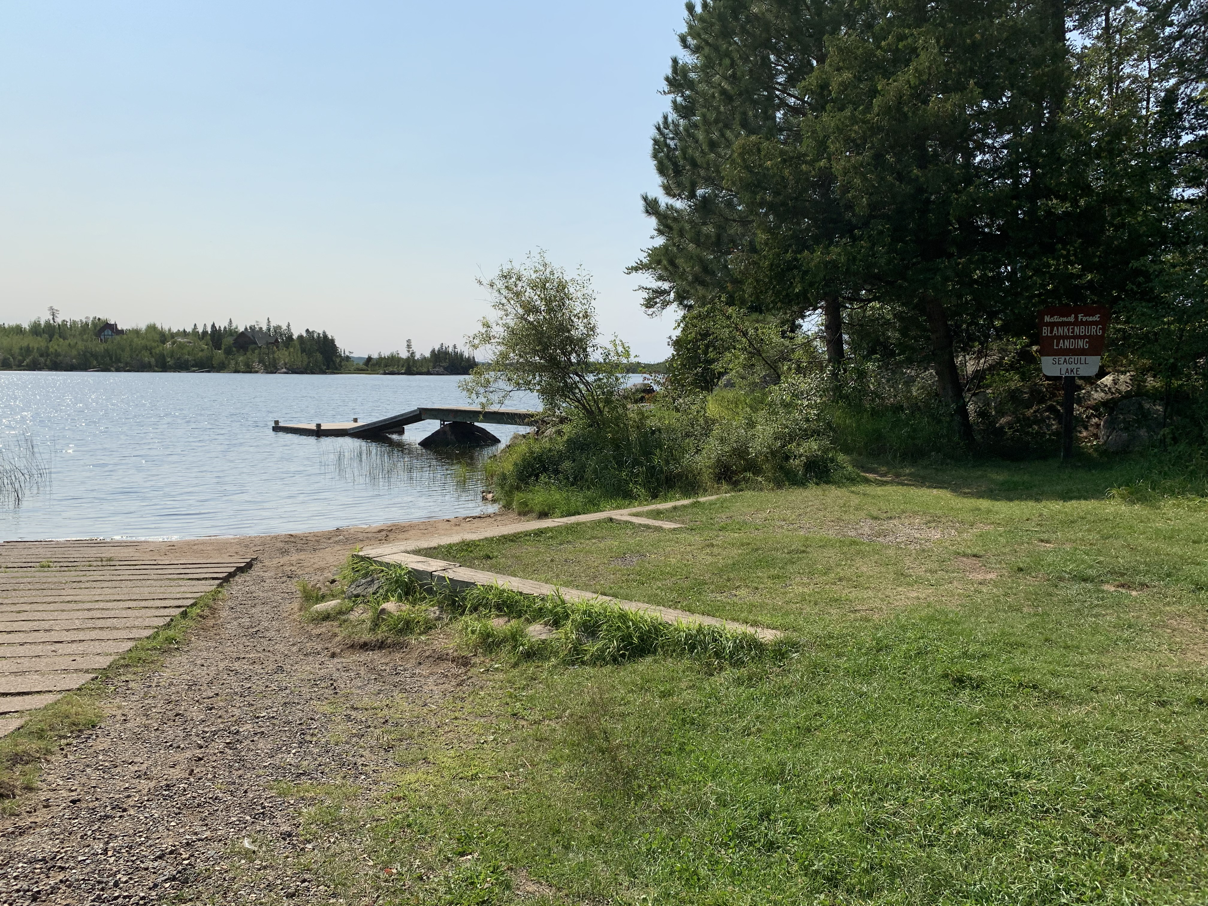
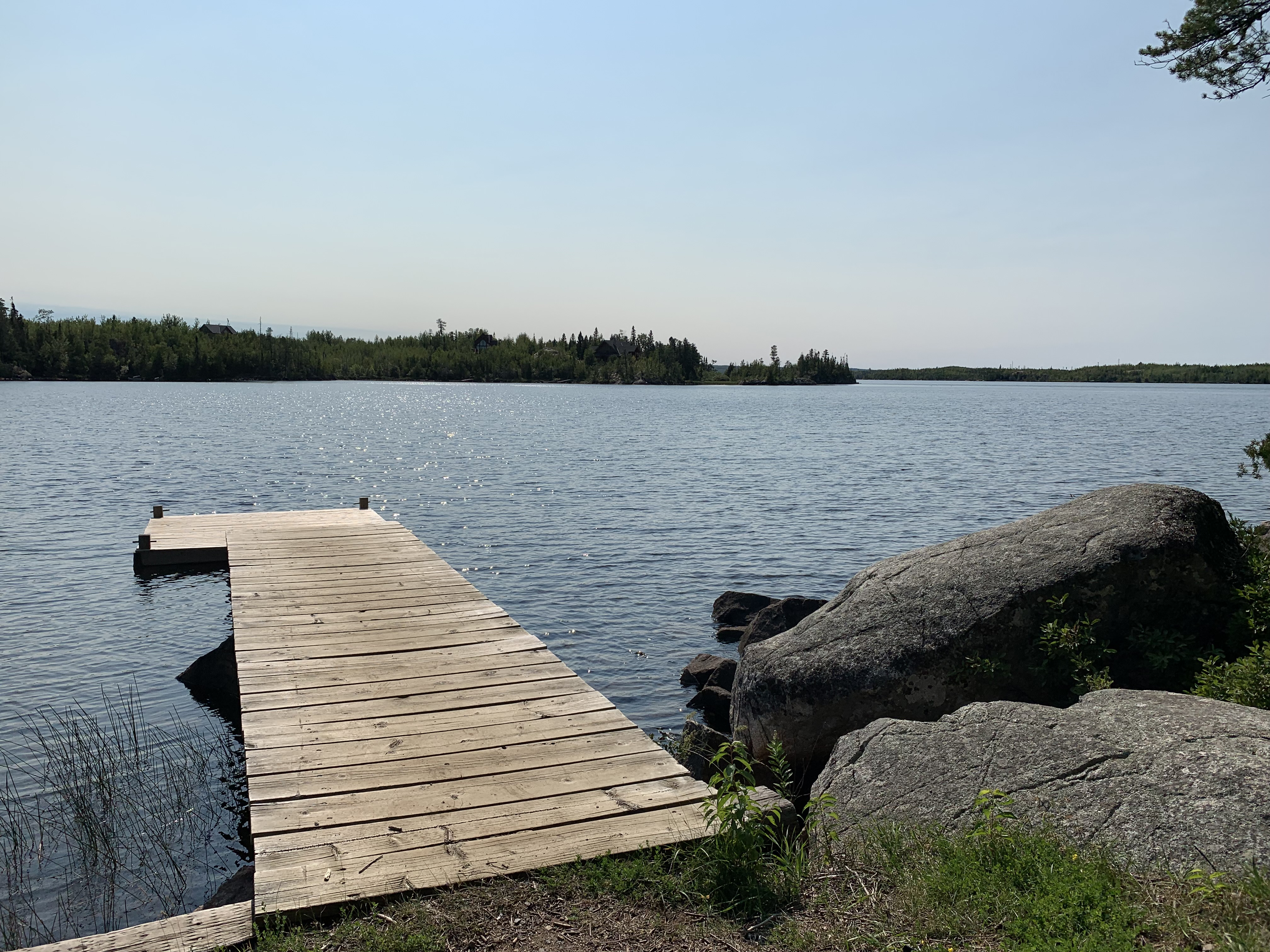
Boat ramp on the left and a public dock (October 27, 2023).
The dock at the Sea Gull Lake public access (October 27, 2023).
View of the landing (October 27, 2023).
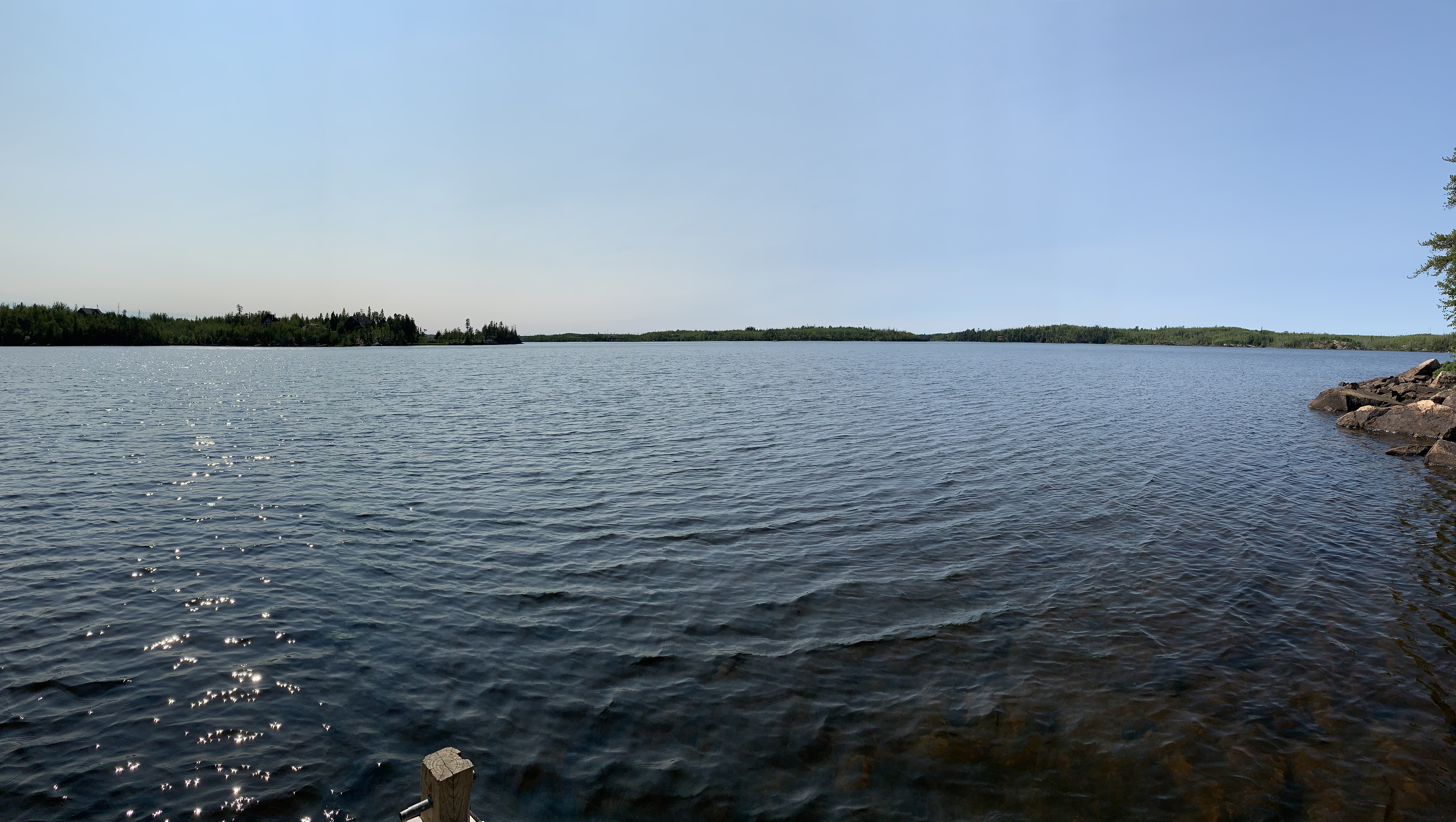
Sea Gull Lake, looking southwest. Fishhook Island is visible in the far distance (just under a mile) beyond that point that juts out from the left of your view (October 27, 2023).
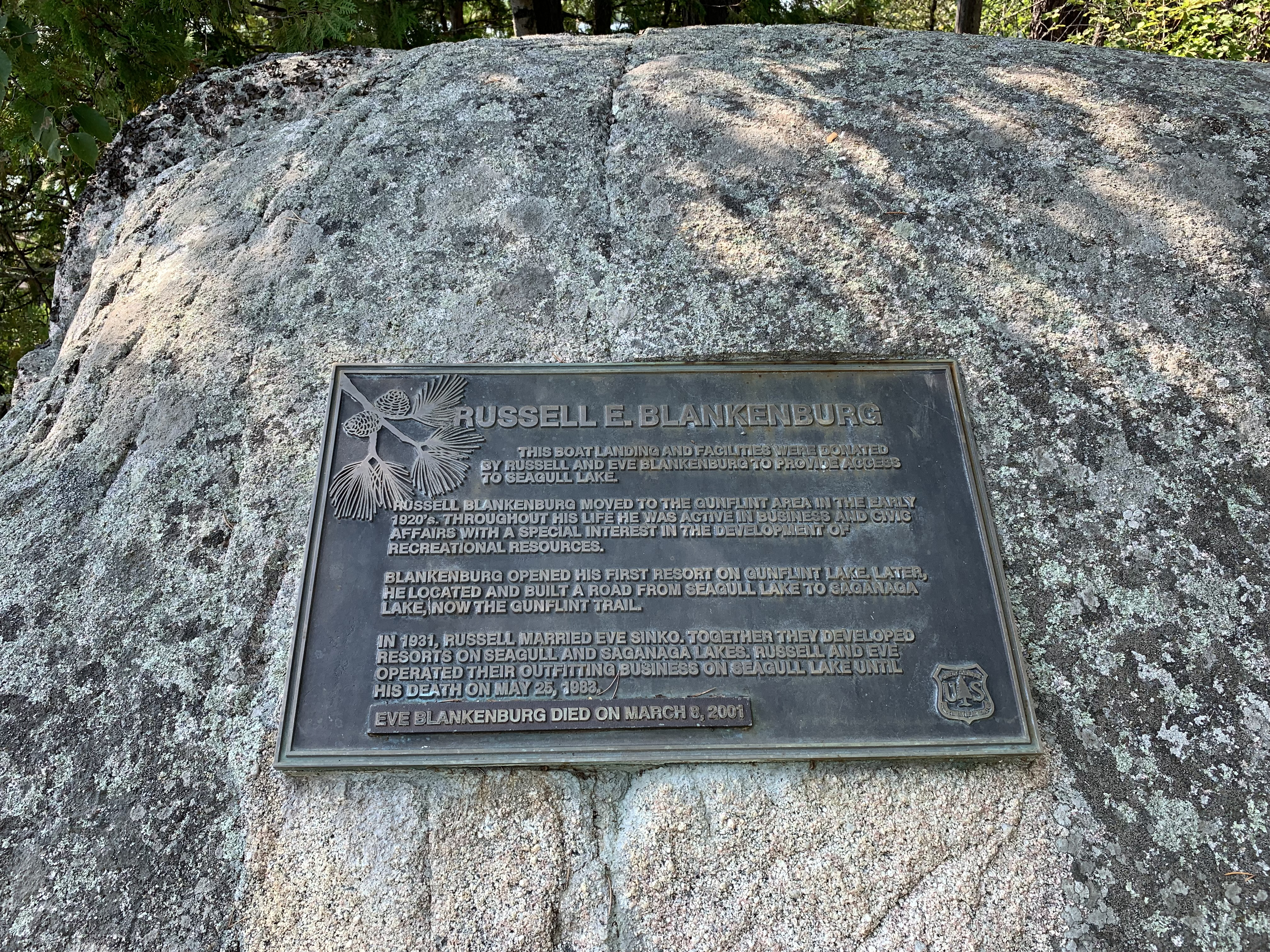
Historical marker found here near the dock (October 27, 2023).
Now that you've reached the shore of the lake, visit:SEA GULL LAKE