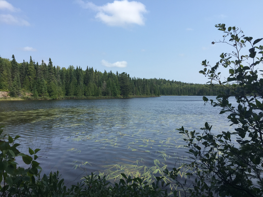
Trail Water Views: Crosses Whale Creek and passes along Whale Lake
Fire History:
Wildlife Seen on Visit: Snowshoe Hare
Campsites: 2 (both are near Whale Lake)
Highest Trail Elevation: 2301 feet
Last Visited: April 10, 2021; Previous Visit(s): August 22, 2015
Scenic Overlooks: Whale Lake, Whale Creek, Eagle Mountain Summit
TRAIL CONNECTIONS AND TRAILHEADS:
Connections: Brule Lake Trail
Trailheads: Entry Point #79
Eagle Mountain Trail
Tofte Ranger District
EAGLE MOUNTAIN TRAIL CAMPSITES: Campsite 1: Campsite on the north shore of Whale Lake, just past the junction with the Brule Lake Trail. Campsite 2: Campsite on the southwest shore of Whale Lake.
The Eagle Mountain Trail leads to the summit of Eagle Mountain over a total one way distance of around 3.7 miles. Eagle Mountain at 2,301 feet is the highest point in Minnesota and the highest elevation for over 500 miles in any direction. The lowest point in Minnesota is the shoreline of Lake Superior at 602 feet above mean sea level (depending on lake levels).
This is a very popular trail on weekends. The best time to do the trail is probably in the fall when color is at a maximum. Visit in the middle of the week if possible, to avoid the crowds. The spring is when the trail is most soggy and it can also still have ice and snow at this time. Summer is sometimes buggy. The parking lot is often filled on summer weekends, sometimes neccessitating the need to park out on the road. The surface of the trail is similar to a heavily traveled BWCA portage; it is always easy to follow. The trail is well maintained for the first 50 rods or so and then starts to resemble a typical well traveled BWCA portage. There are a few areas along the trail that are marshy, but many of these areas have board plank crossings erected. Several other places are very rocky and require a little care with footing. The only strenuous part of the Eagle Mountain Trail is the last 0.8 miles or so beyond Whale Lake. This part of the trail heads up to the summit. This last stretch will leave folks in average shape sucking some wind. Almost everyone visiting the Eagle Mountain Trail is doing the trail on a BWCA day permit. You need to fill one out before beginning your hike. The Eagle Mountain Trail begins outside of the BWCA, but enters the designated wilderness area where it crosses Whale Creek. If you plan on camping overnight, you need to go through the regular BWCA permit process and get a permit for BWCA Entry Point #79. There are two campsites along the trail, both in the Whale Lake area. The better campsite is on the lake near the junction of the Eagle Mountain Trail and the Brule Lake Trai.
The Eagle Mountain Trail is connected to the Brule Lake Trail. You can find the intersection of the two trails, which is marked with a sign, at the northwest corner of Whale Lake, at the same place the Eagle Mountain Trail gets steep and heads up toward the summit. A popular route option is to hike between the Eagle Mountain Trailhead and the Brule Lake Trailhead. The Brule Lake Trail has one established campsite located at Fishhook Lake.
You will know you are at the top of Eagle Mountain when you reach the large rock with the sign embedded into it. There are two vista viewing areas near the top, where the forest doesn't block your view. The true summit is near the second wide vista where you can see several lakes off in the distance. From the first vista area, there are surprisingly no lakes to be seen. The trail that leads to the actual summit (often marked by cairns) leads back into the woods. It is about a three to five minute walk, depending on pace. There are no views from the true summit of Eagle Mountain as it is secluded in the forest.
When you first reach Whale Lake, there is a very scenic vista of a large hill/mountain across the lake. This is NOT Eagle Mountain. Rather, this is a sister peak that is about 80 feet shorter than Eagle Mountain at about 2,220 feet. This unnamed mountain is one of the highest points in Minnesota. The saddle that separates Eagle Mountain from this unnamed sister peak is at an elevation around 2,020 feet. The Brule Lake Trail runs between Eagle Mountain and this sister peak.
Hiking the Eagle Mountain Trail
Click on the photos below to see the full resolution image - Use your browsers back button to close photo and return to this page.
The entire Eagle Mountain Trail.
The following photos of a hike along the Eagle Mountain Trail are shown in order, exactly as you will see it if starting from the Eagle Mountain Trail parking lot and following the trail all the way to near the summit of Eagle Mountain.
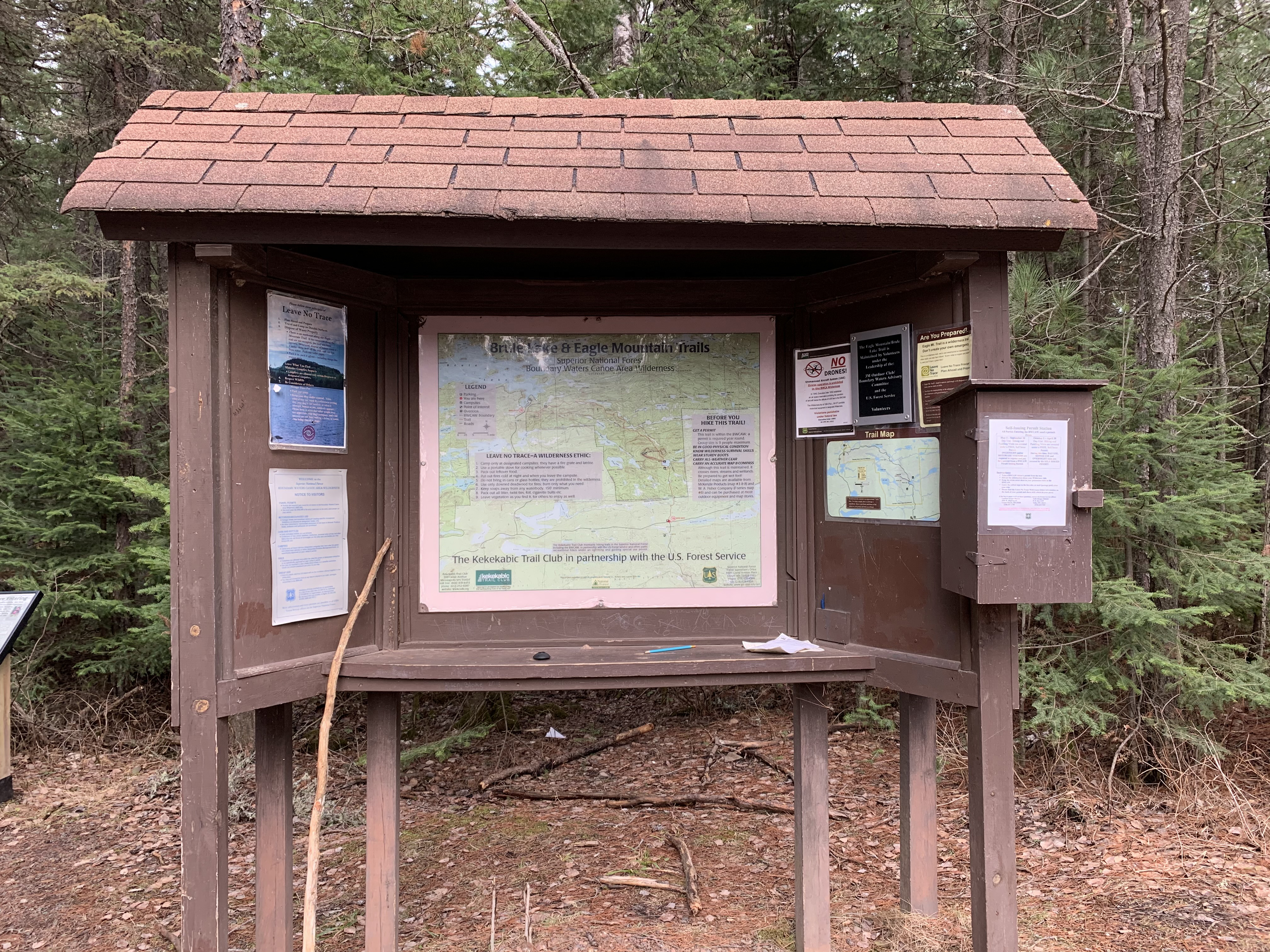
Open the box on the right of the bulletin board and fill out your BWCA day permit. You need this permit to legally traverse the Eagle Mountain Trail, as the path enters the Boundary Waters Canoe Area within the first mile. Permits are in the box as well as a handy pencil. With permit in hand, head off to the left down the trail. The first 50 rods are particularly well maintained by the U.S. Forest Service (April 2021).
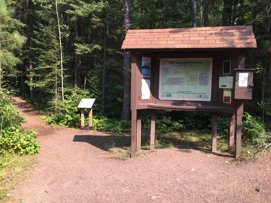
It appears the bulletin board has weathered the years fairly well (August 2015).
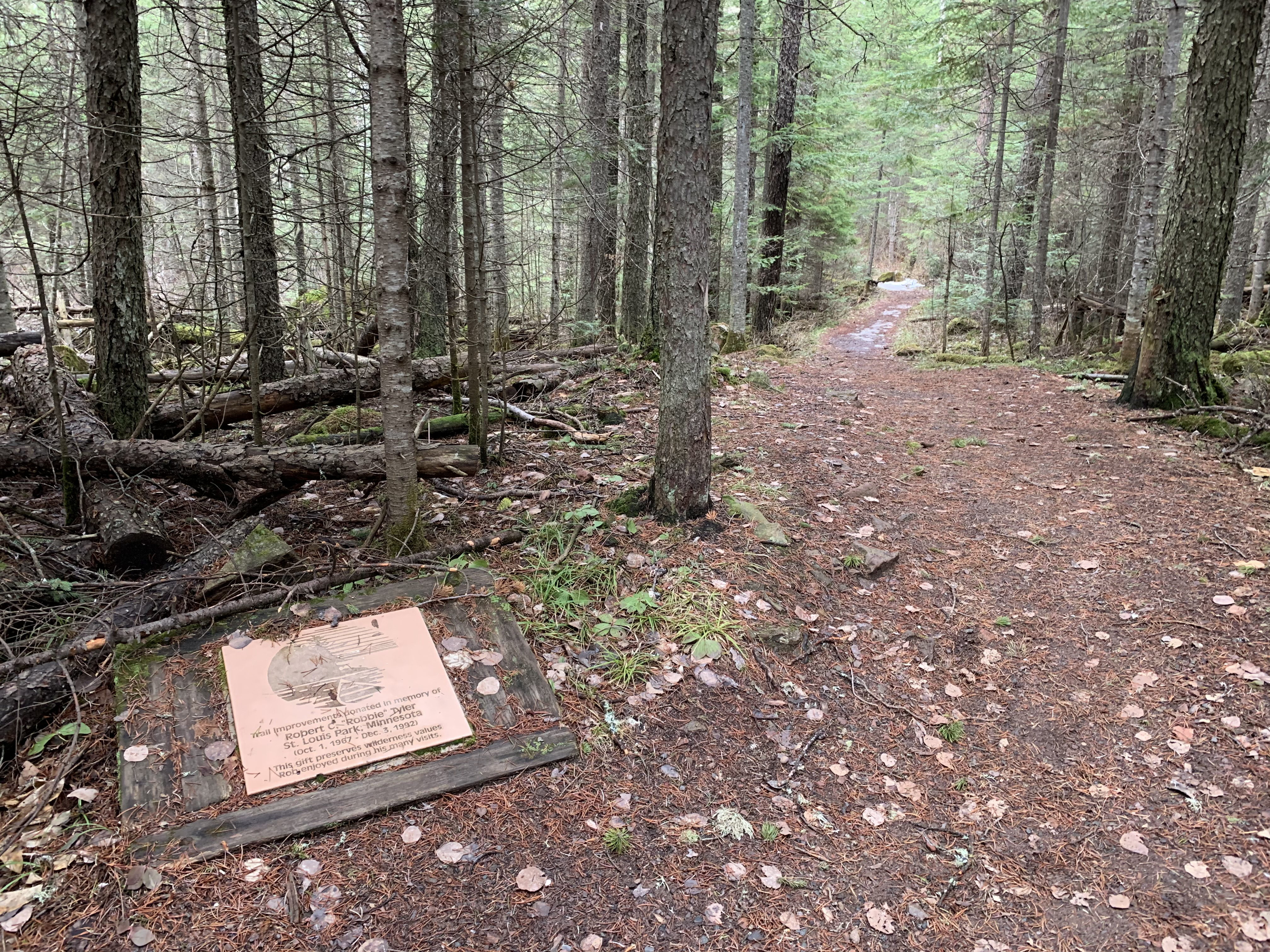
A marker to recognize a prominent supporter of the Eagle Mountain Trail (April 2021).
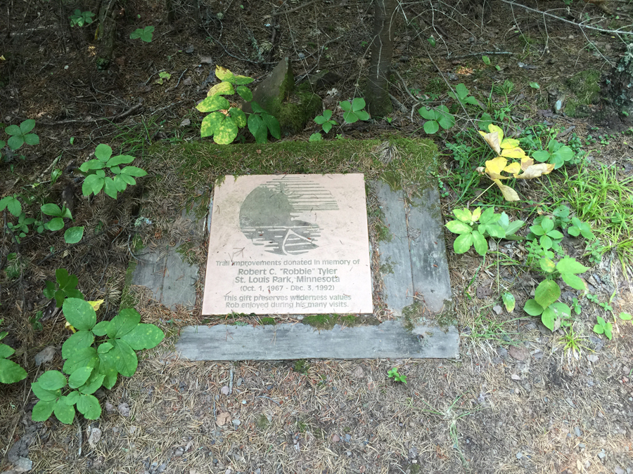
The same plaque as above, but six years earlier in the middle of summer (August 2015).
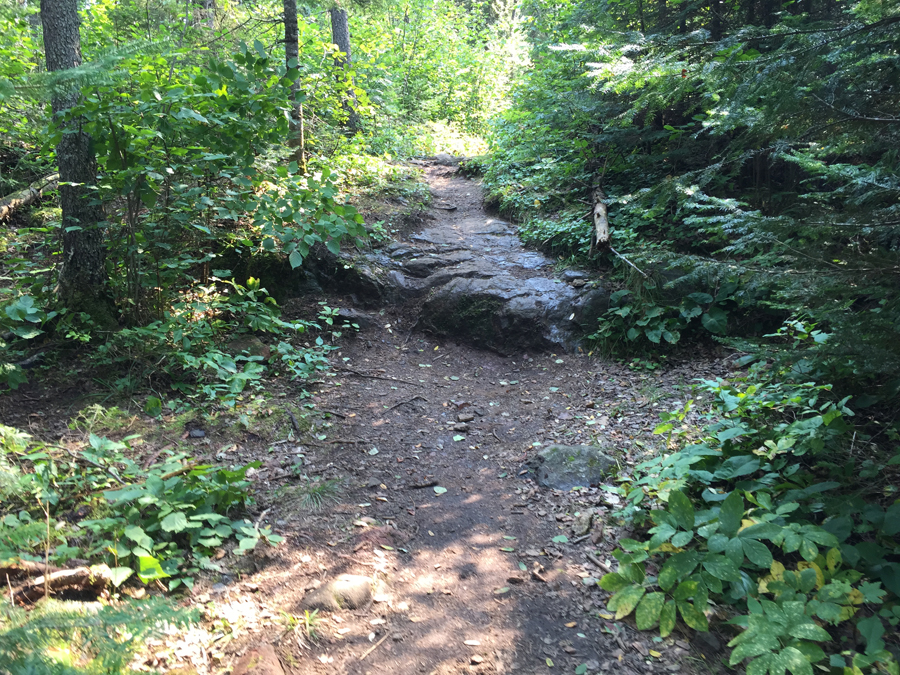
A rock outcropping exposed along the trail (August 2015).
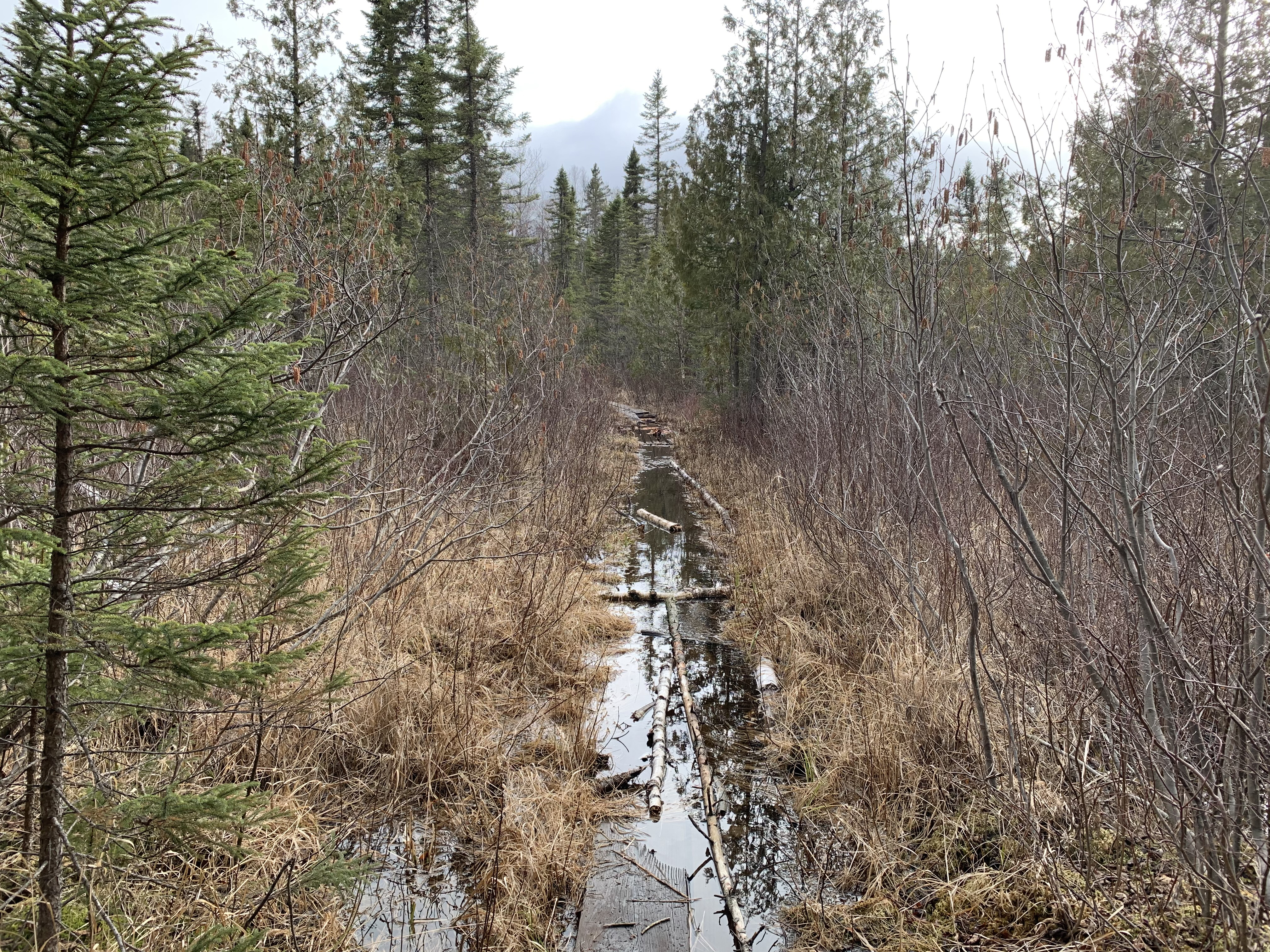
Expect a much wetter crossing of Whale Creek if you come this way early in the season (April 2021).
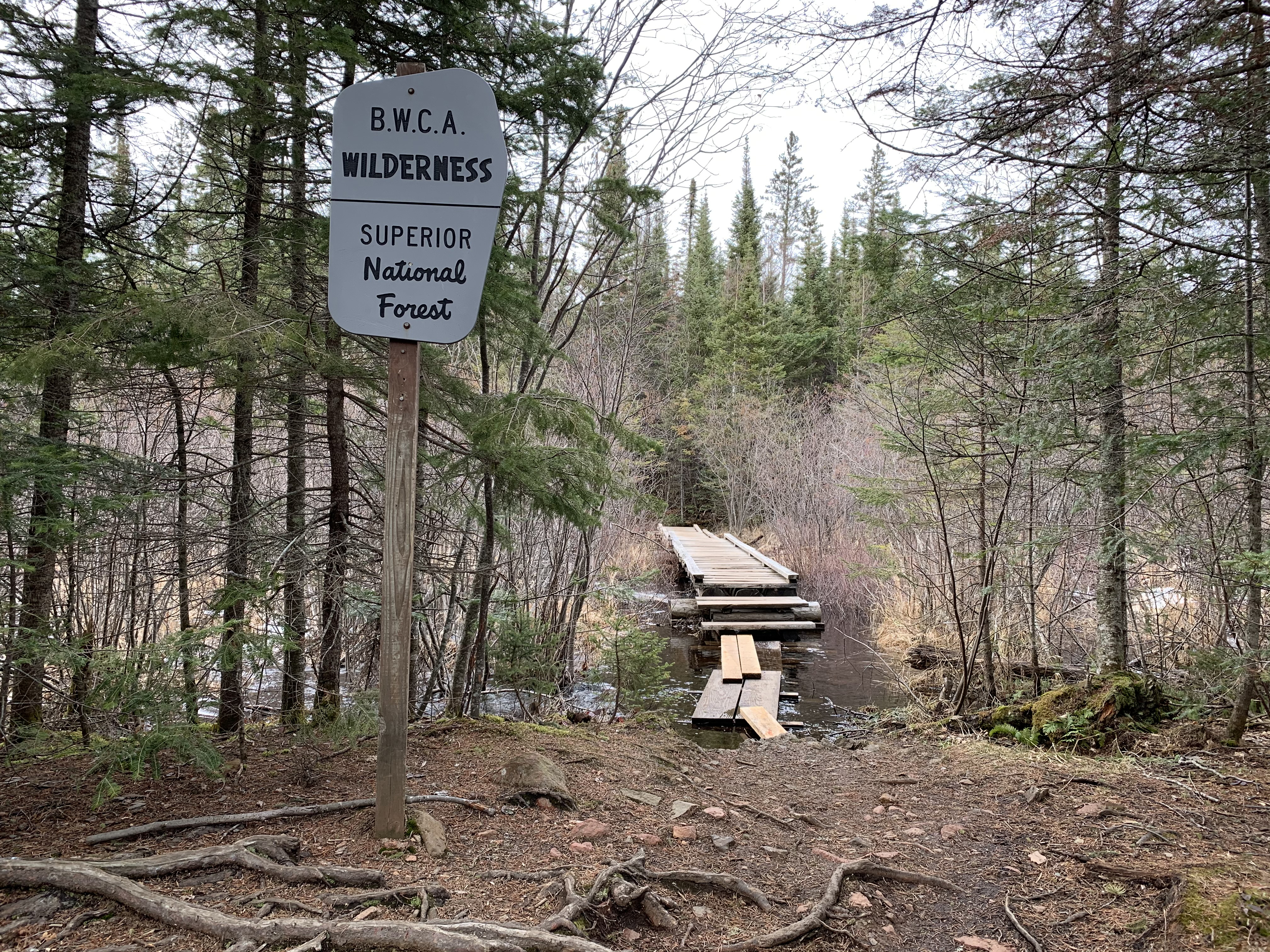
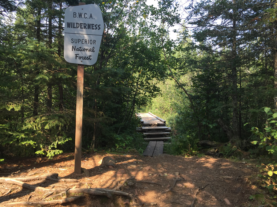
At this point you officially enter the Boundary Waters Canoe Area. The wooden bridge you see to the right of the sign is there to facilitate the crossing of Whale Creek (August 2015).
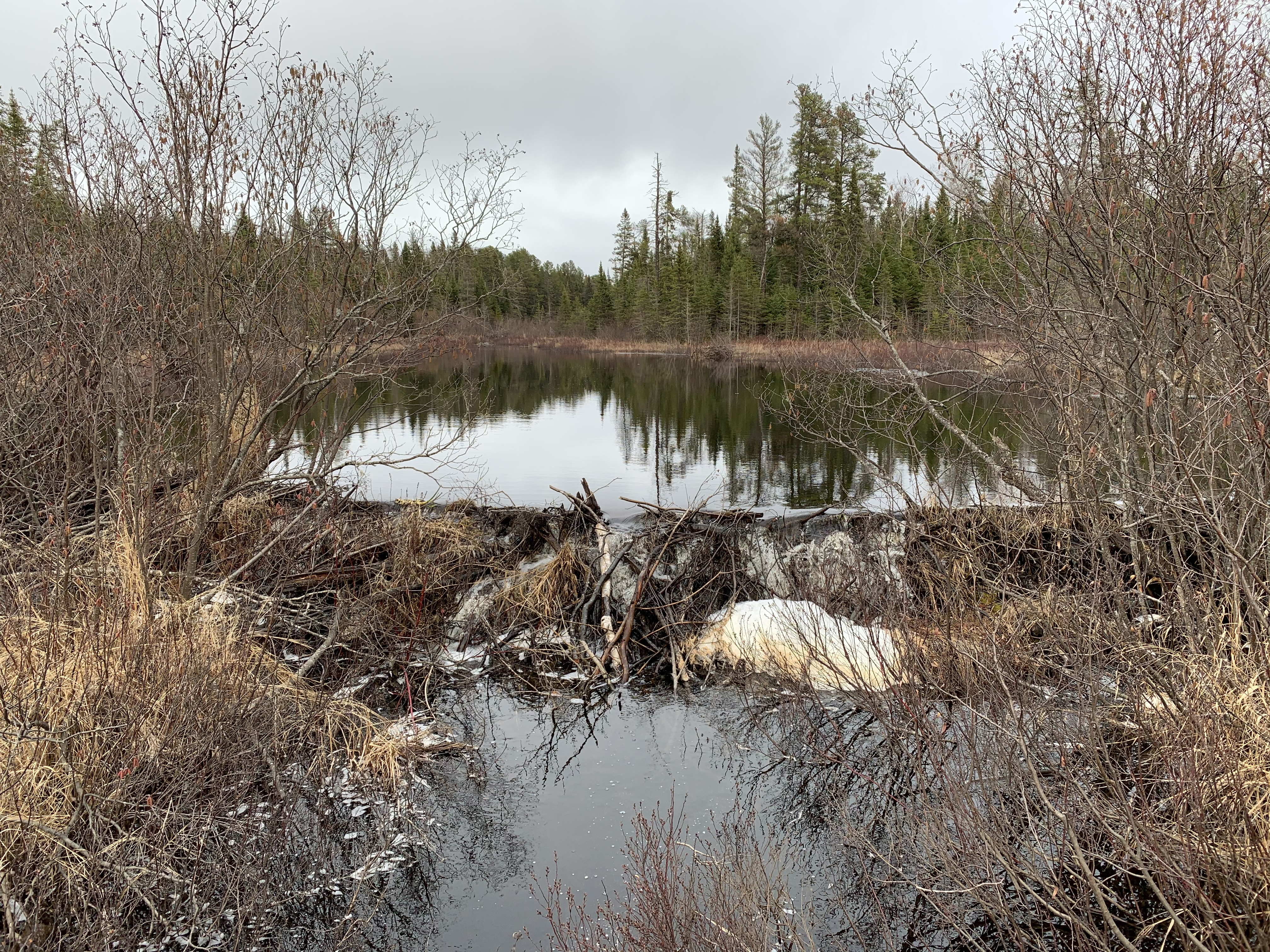
Beaver dam on Whale Creek (April 2021).
Whale Creek as seen from the little wooden bridge. There wasn't a beaver dam at this time (August 2015).
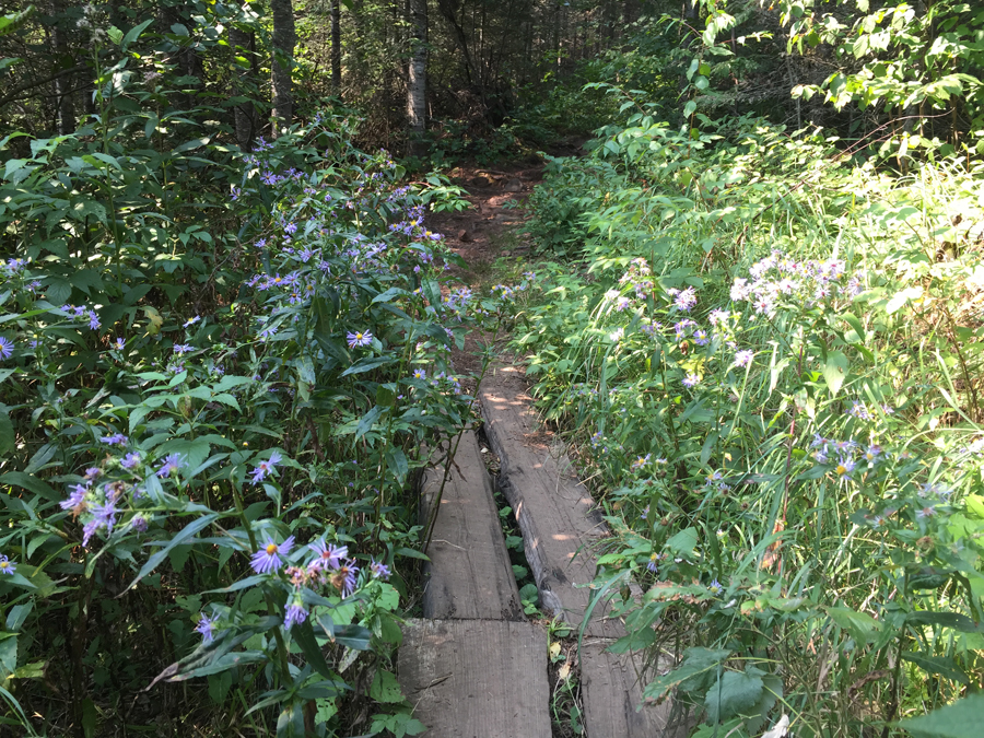
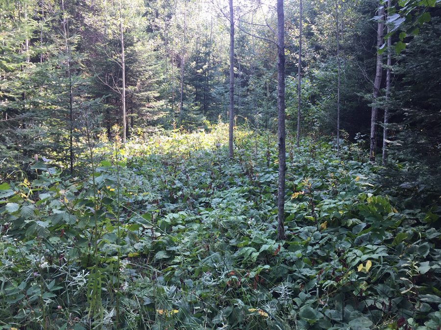
There are many boggy areas along the trail that support pretty flowers like this, but also require a board walk crossing to keep the trail from being eroded. In the spring, the trail is much wetter and there is often standing water in these areas (August 2015).
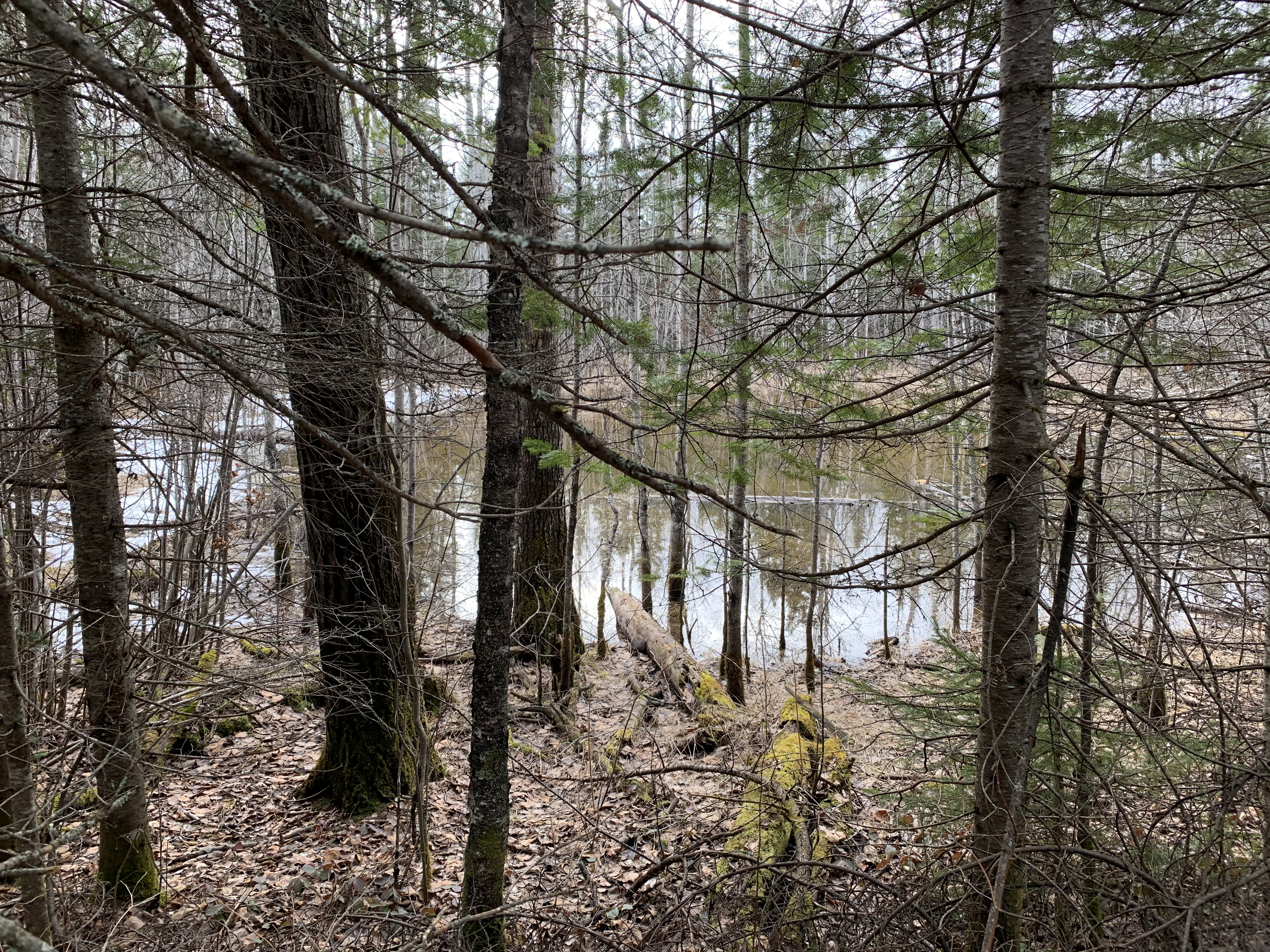
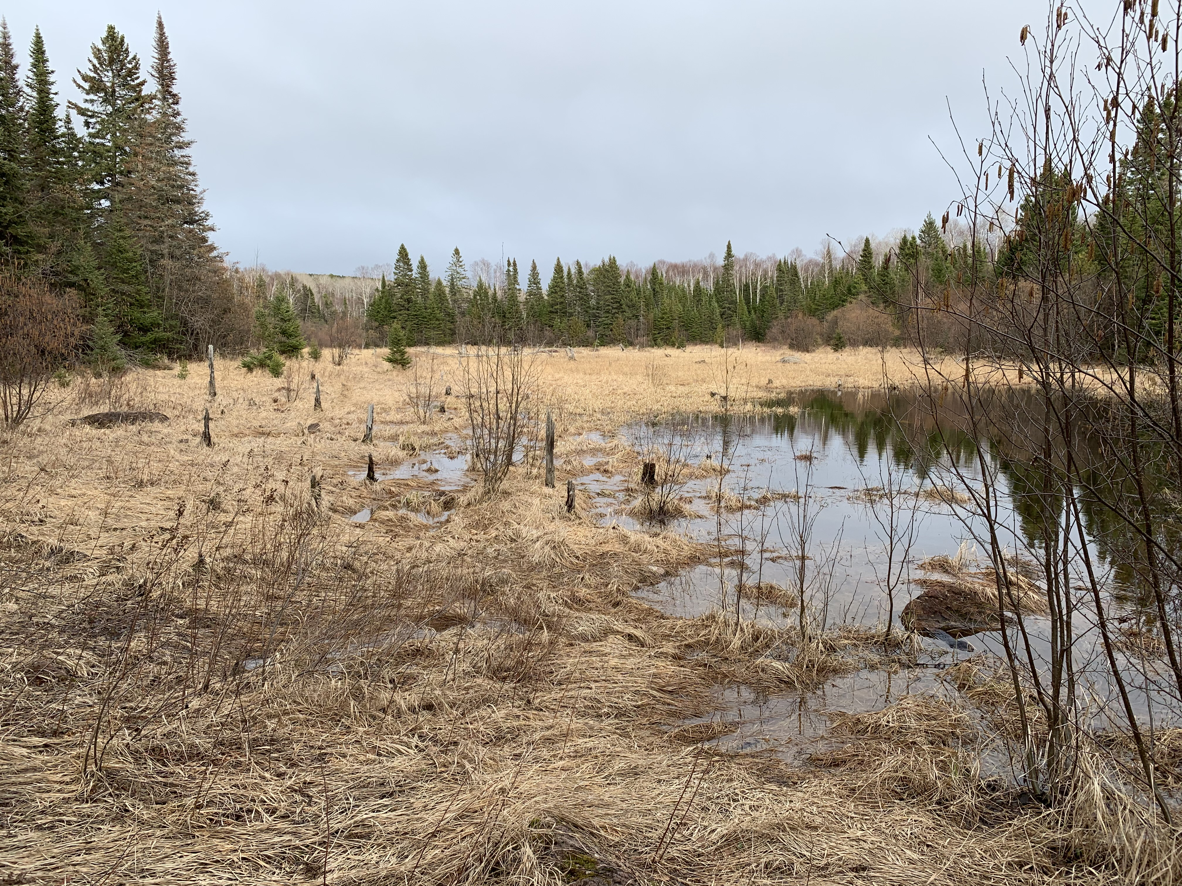
Meltwater pond in the forest (April 2021).
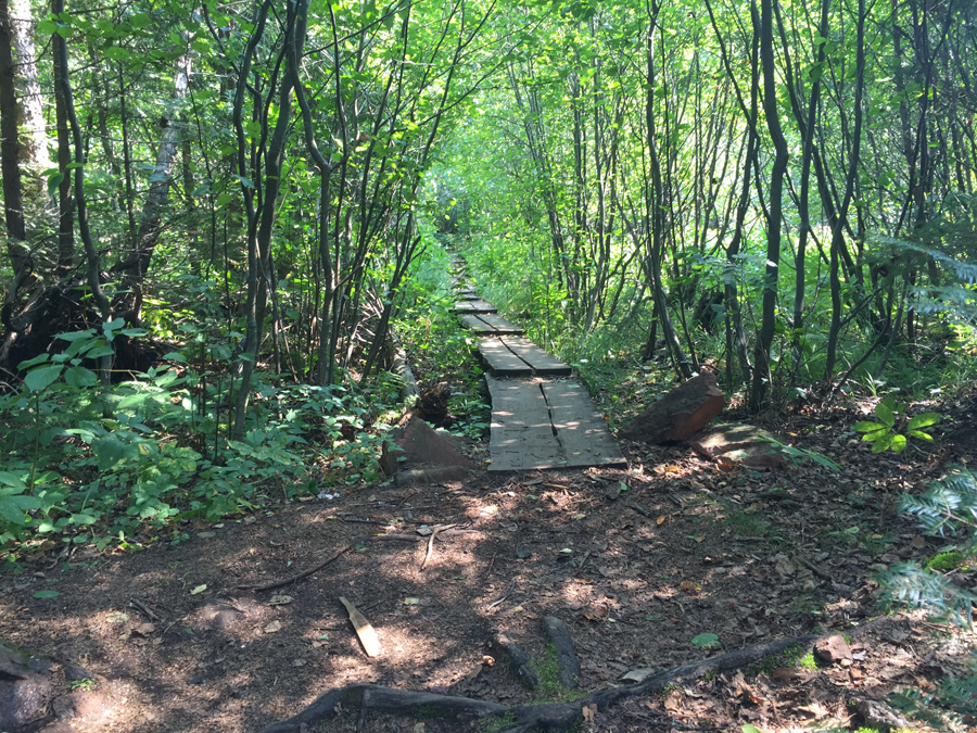
Another boardwalk making passage through a marsh easier for the many trail users (August 2015).
Bring your boots! Spring snow melt floods many of the low areas that the trail passes through (April 2021)
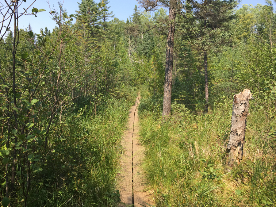
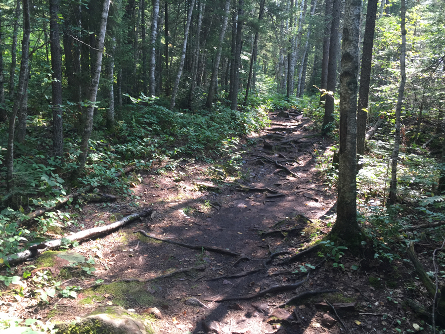
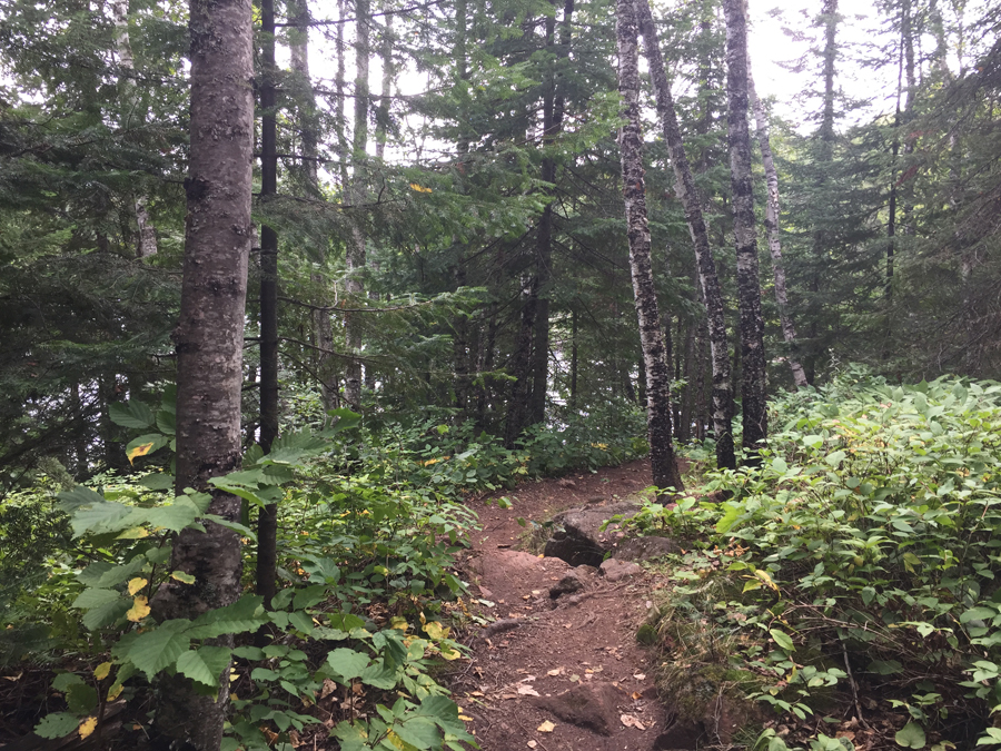
Typical view along the trail (August 2015).
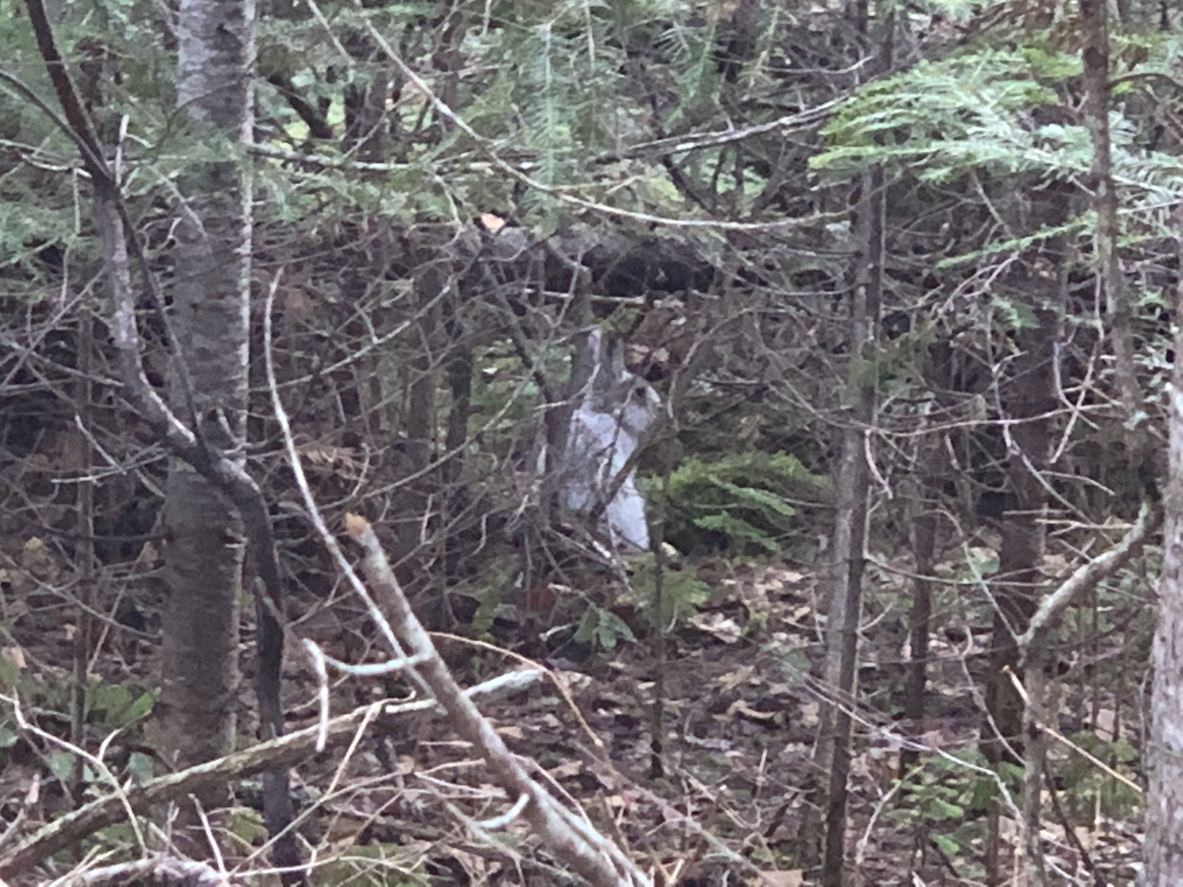
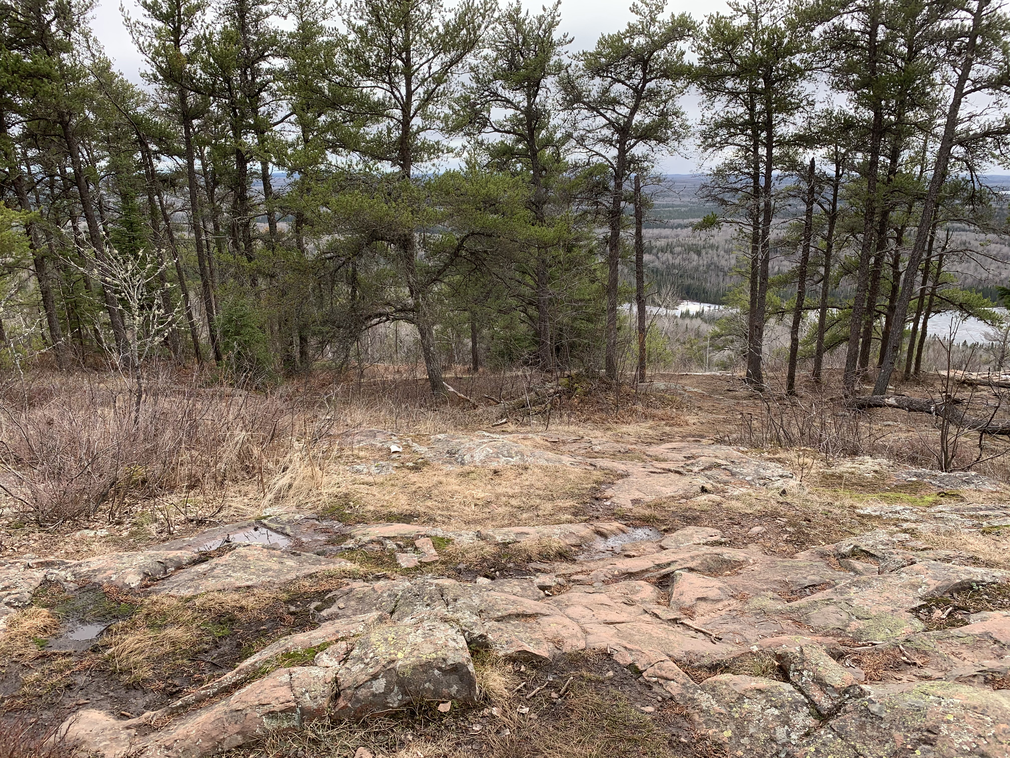
Can you see it? (Click the image to enlarge it; use your browsers Back button to come back to this page.) The critter in the woods? (April 2021)
If you have sharp eyes, you saw this snowshoe hare in the image above. It's starting to lose its winter coloring (notice the patchy fur coloring). (April 2021)
Another set of plank crossings you must traverse as you walk the Eagle Mountain Trail. This is one of the longer ones (August 2015).
Wetland along the trail. (April 2021)
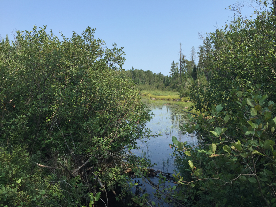
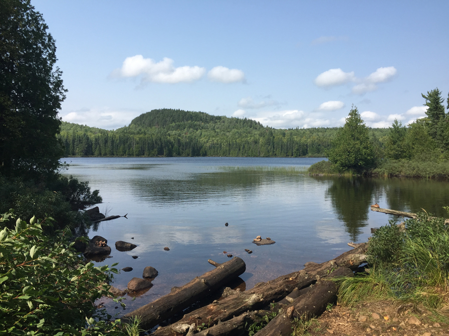
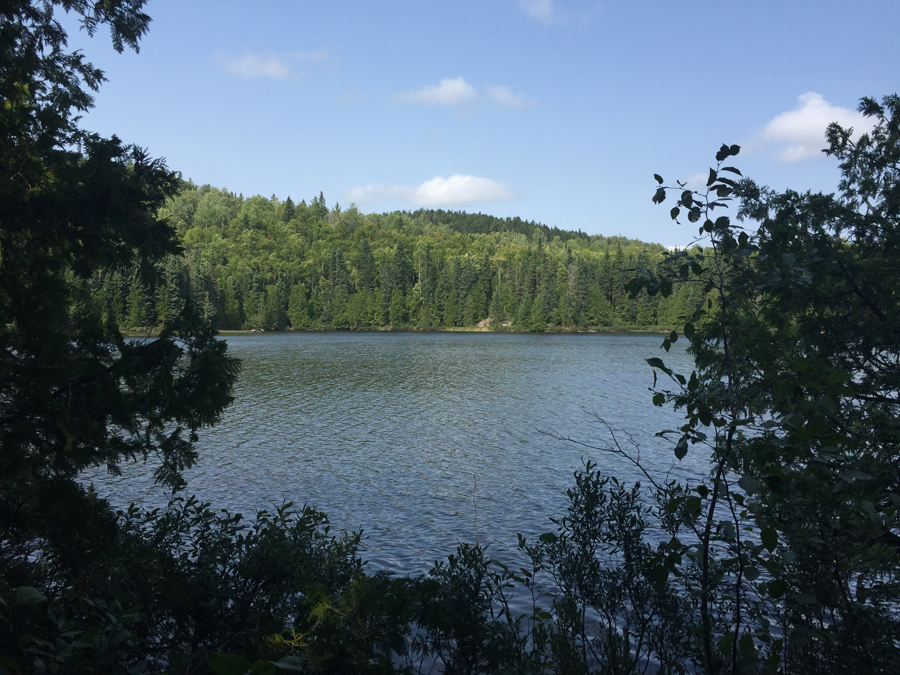
Your first view of Whale Lake. Up to this point, you have been traveling through dense forest with sporadic views. There are more things to see from this point on. That is NOT Eagle Mountain you see across the lake, it is a sister peak that is named Point 2220 (for its elevation of 2,220 feet). Eagle Mountain is to the left, out of view (August 2015).
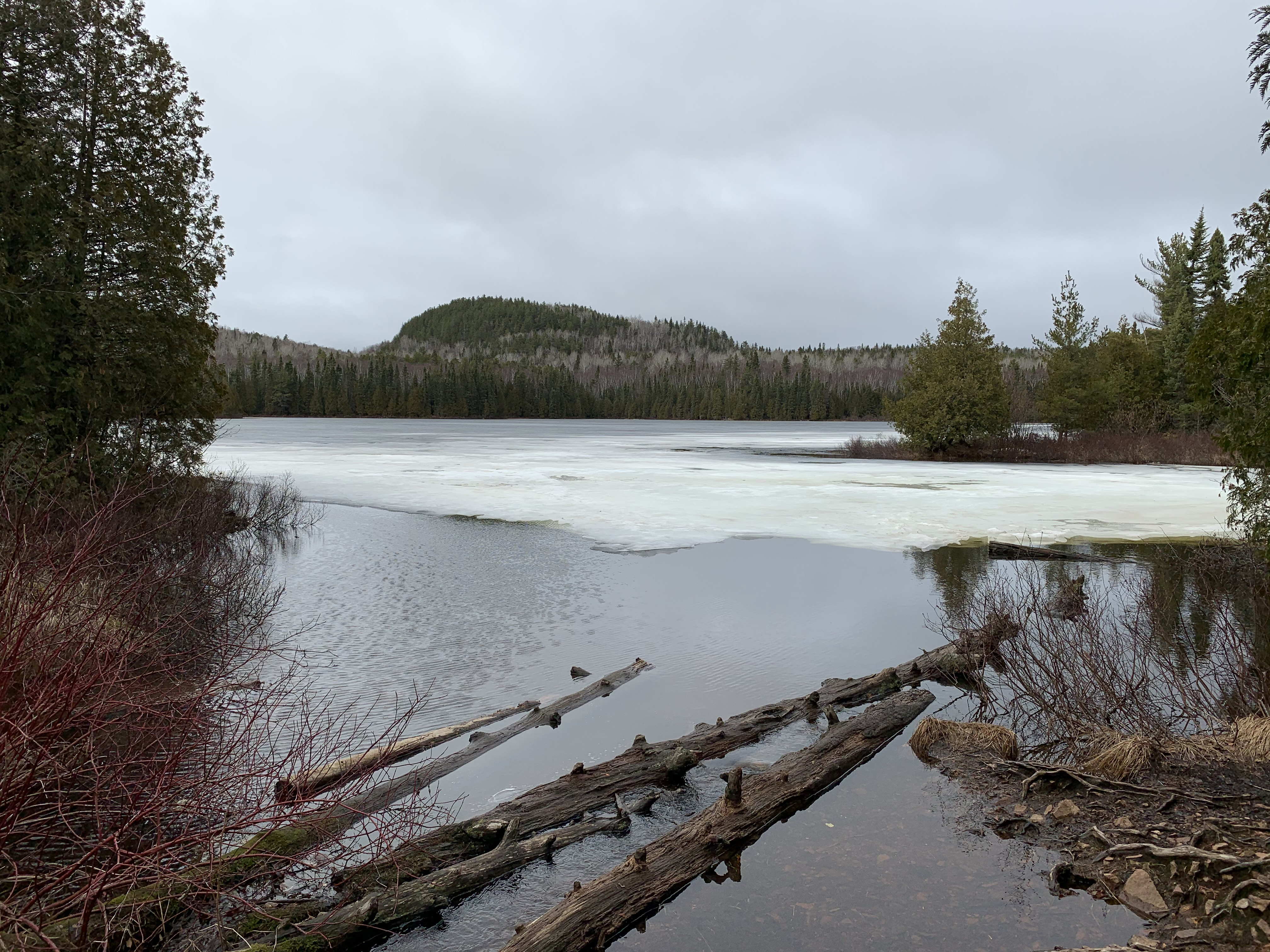
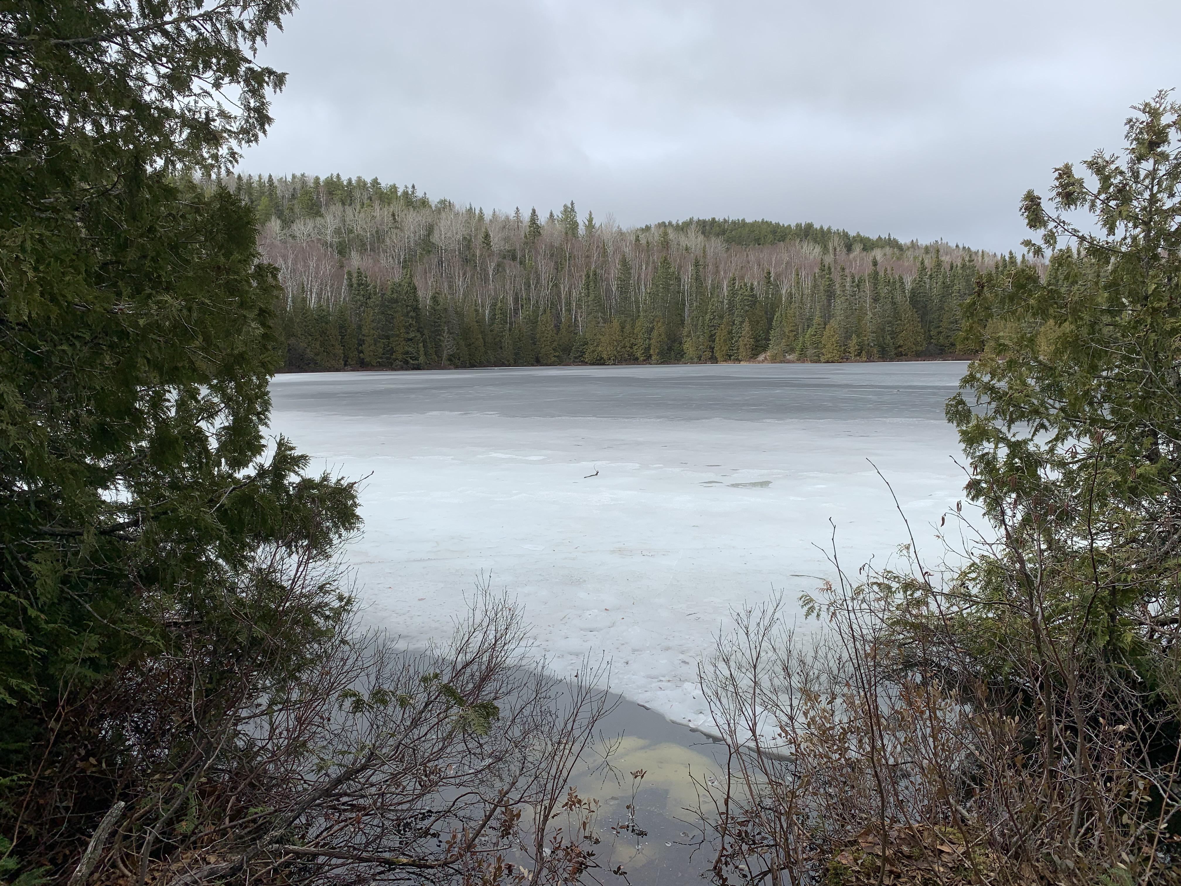
Early season view of the image above. (April 2021)
A pretty view of some shade loving plants on the forest floor (August 2015).
Whale Lake view from along its western shoreline (August 2015).
Early season view that is nearly the same views as the photo shown above (April 2021).
You are now near the northwestern corner of Whale Lake. This view is toward the east (August 2015).
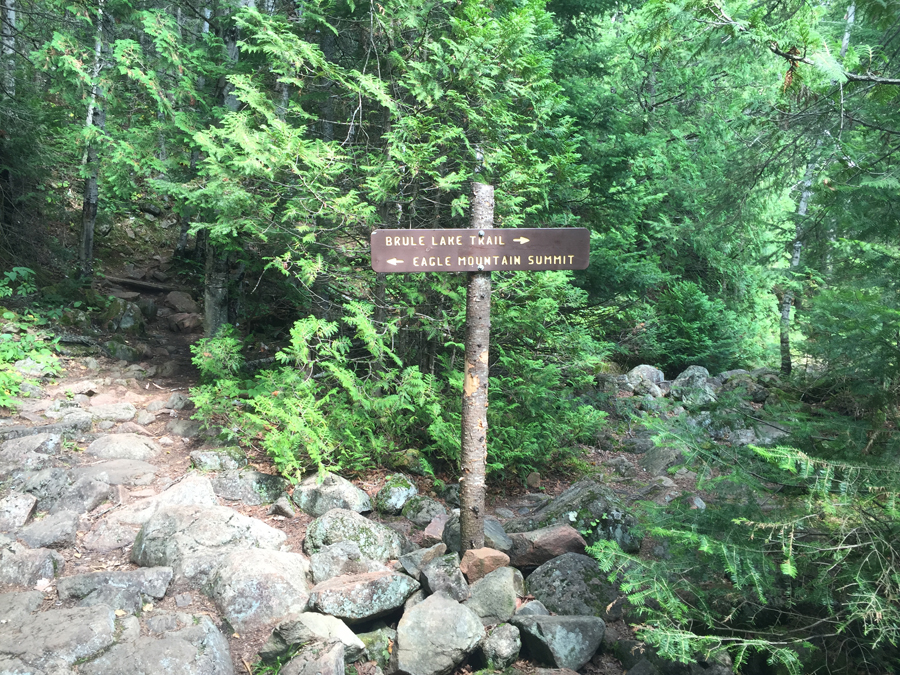
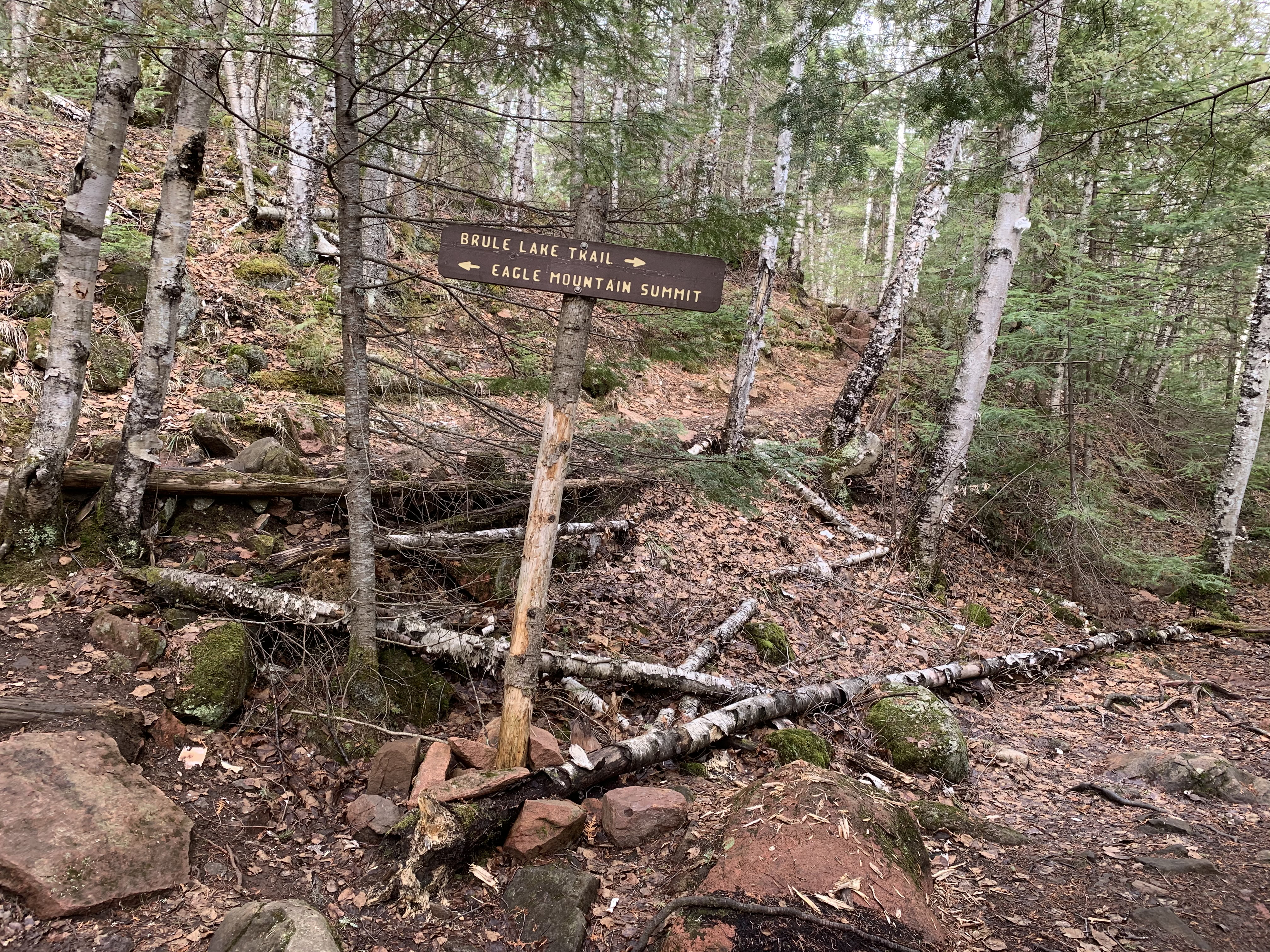
Decision time. Almost everyone goes to the left and up to the top of Eagle Mountain. The Brule Lake Trail gets probably 1% of the traffic (at most) that the Eagle Mountain Trail receives. To the right is the Brule Lake Trail and also the trail you take to get to a campsite that is on the north shore of Whale Lake (August 2015).
The same trail sign about six years later. The post has lost its bark and its a little cockeyed now (April 2021).
A last look back toward Whale Lake (just visible through the trees) just after starting up the steeper section of the trail that leads to the top of Eagle Mountain (August 2015).
The trail is steep enough in this section to make most hikers huff and puff a bit (August 2015).
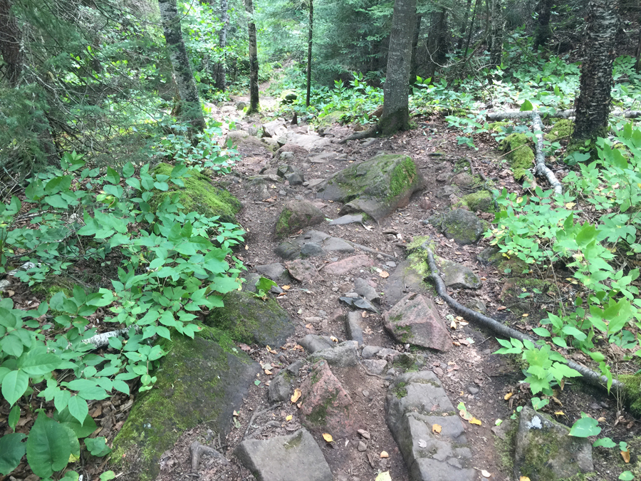
Trail is noticably rockier as it winds up toward the summit ridge (August 2015).
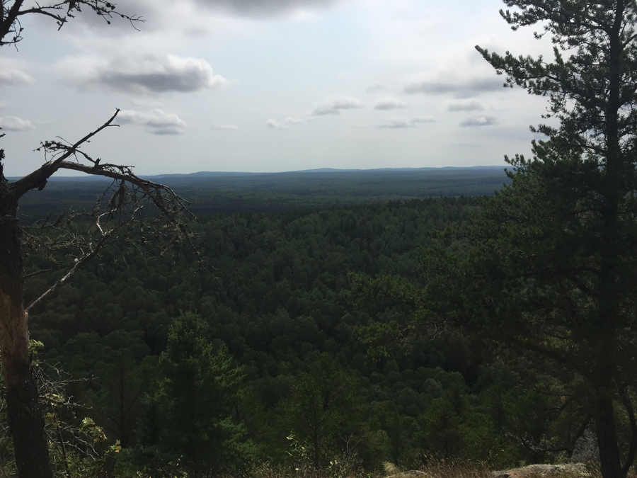
This is your first reward. The views are better just a bit farther along the summit ridge (August 2015).
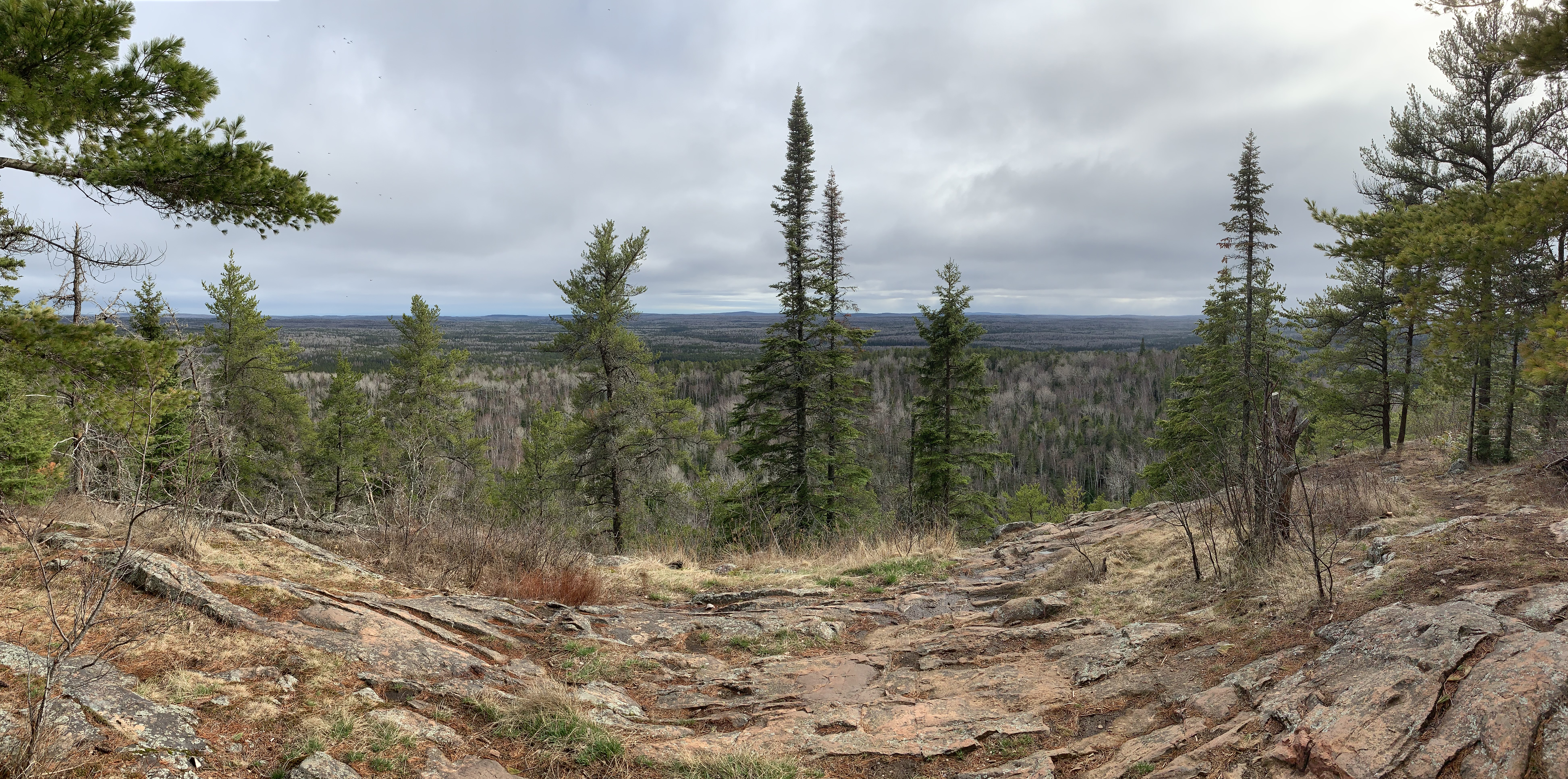
Panoramic view similar to the one shown above (April 2021).
A bit further up the trail, you can start seeing several lakes below you (April 2021).
You are almost to the top! Visit the Summit of Eagle Mountain to see photos and video of the summit area and surrounding views.