Fishing: Isabella River, Quadga Lake, Pose Lake, South Wilder Lake, North Wilder Lake, Lake Three, other small lakes
Maps: Fisher F-4; McKenzie #18 and #19
Trail Water Views: Isabella River, Quadga Lake, Pose Lake, South Wilder Lake, North Wilder Lake, Lake Three, other small lakes and creeks
Fire History: 2011 - Pagami Creek Fire
Wildlife Seen on Visit: Wolf scat
Campsites: 14 (9 visited)
Highest Trail Elevation: About 1,660 feet. (About 580 feet NW of the E most point along the loop part of the trail. This is just NW of the former connection to the currently unpassable old east loop of the Powwow Trail, about midway between The Wye and Pose Lake.)
Last Visited: May 26, 2024;
Previous Visit(s): May 12, 2023, July 25, 2021
Scenic Overlooks: Isabella River, Quadga Lake, Pose Lake, South Wilder Lake, North Wilder Lake, Lake Three, other small lakes and streams, many marshes and ponds
TRAIL CONNECTIONS AND TRAILHEADS:
To Horseshoe Lake/Lake Three: Walk the 20 rod portage
To Harbor/North Wilder Lake: Walk the 75 rod portage
To North Wilder Lake/South Wilder Lake: Walk the 160 rod portage
To Isabella Lake/Isabella River: Walk the 40 rod portage
Trailheads: BWCA Entry Point 86 - Powwow Trail
Powwow Trail
Click on the photos below to see the full resolution image - Use your browsers back button to close photo and return to this page.
Kawishiwi and Tofte Ranger Districts
POWWOW TRAIL CAMPSITES: Campsite 1: (#1927) - On south side of the Isabella River at the bridge crossing Campsite 2: (#2265) - Pose Lake Campsite Campsite 3: (#2224) - Just south of Horseshoe Lake/Lake Three portage on Lake Three
Campsite 4: (#1936) - Northwest site on Quadga Lake Campsite 5: (#2264) - South Wilder Lake - Western end of lake on north shore Campsite 6: (#2230) - North Wilder Lake - Just north of portage to Harbor Lake
Campsite 7: (#1518) - Horseshoe Lake - North shore on point just east of Lake Three portage
Campsite 8: (#2263) - Rock of Ages Lake - North end of lake Campsite 9: (#2262) - Path Lake - North shore of lake Campsite 10: (#2261) - Mirror Lake - South end of lake on west shoreline
Campsite 11: (#2260) - Superstition Lake - Middle of east shoreline Campsite 12: (#2259) - Campfire Lake - East shoreline
Campsite 13: (#Unknown) - Diana Lake - Primitive site on the east shoreline just south of channel to Wagner Lake Campsite 14: (#2258) - Marathon Lake - Primitive site on the south shoreline
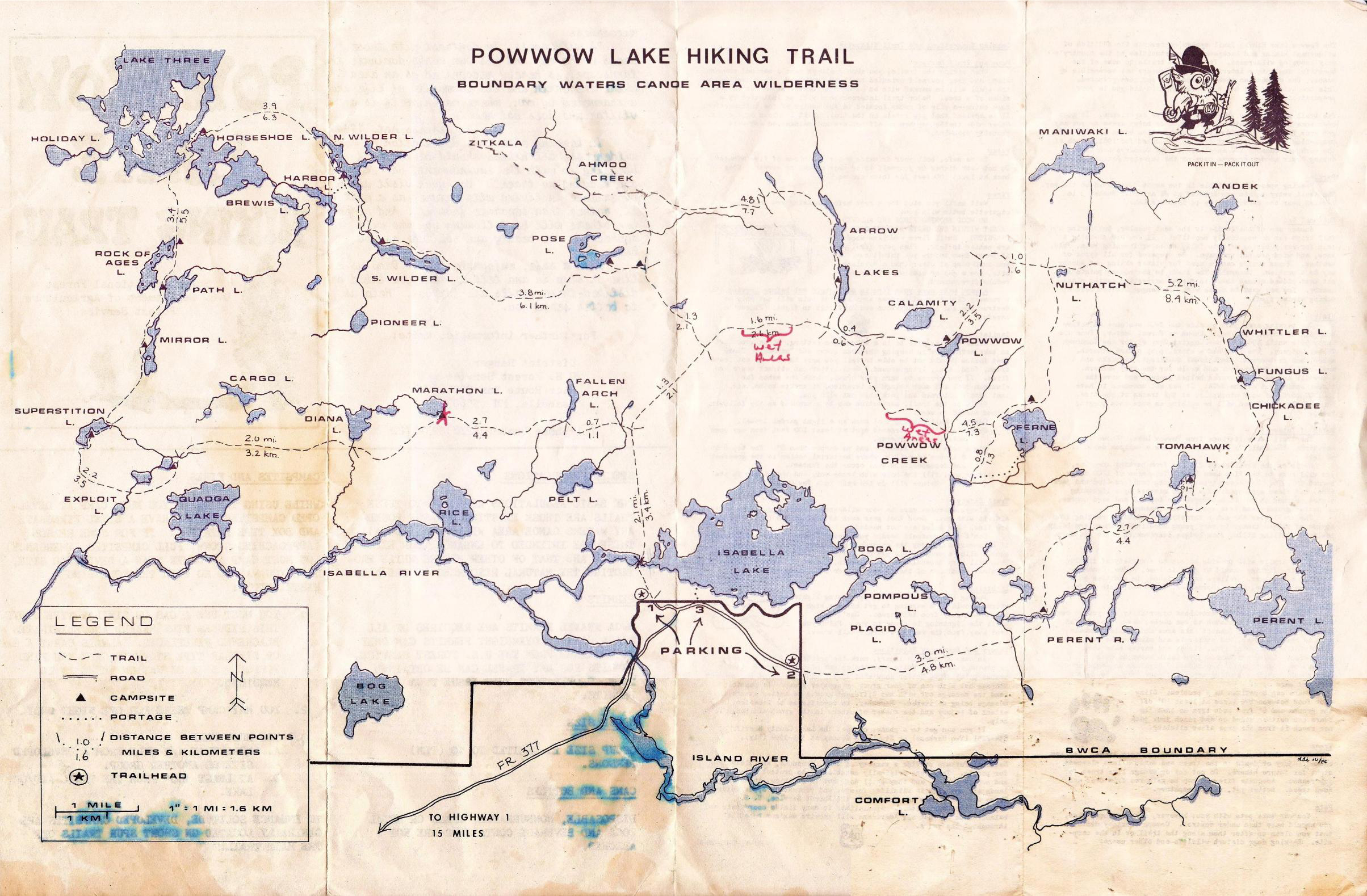
The Powwow Trail is named after Powwow Lake. Powwow Lake is in the Fungus Lake Primitive Management Area. The Trail is made up of a 2.7 mile trail known as "The Stick" that begins at the trailhead parking lot near Lake Isabella and stretches north until intersecting "The Loop" part of the trail at an intersection known as "The Wye". "The Loop" can then be traveled in either direction making a full semi-circular route, eventually bringing hikers back to "The Wye". This loop section is 27.5 miles in length. A complete hike of the Powwow Trail from trailhead start to trailhead finish ends up being 30.2-miles. The restored part of the Powwow Trail is known as the western loop. Before the 2011 Pagami Creek Fire, there used to be a second loop known logically as the eastern loop. This eastern loop had already fallen into disrepair due to lack of maintenance, but the fire finished it off. The eastern loop of the Powwow Trail has not been restored, but there is some chance that it will be in the future. Powwow Lake, for which the trail is named, was along this eastern loop of the trail. There was a third smaller loop located between Pose Lake and the Arrow Lakes. This little loop was about 7.7 miles around and provided access to Arrow Lake 2 (Middle Arrow Lake), Arrow Lake 3 (Lower Arrow Lake) and Ahmoo Creek.
The Powwow Trail was created from a series of old logging roads that wound their way through the recently logged forests of the area in 1977. The entire trail was completed by 1981. Much of it was built by the Youth Conservation Corp. The trail existed from the completion of its construction in 1981 until 2011. In the Fall of 2011 a massive wildfire sparked by lightning swept through the area, obliterating most of the Powwow Trail. This is known as the Pagami Creek Fire.
After the fire, plans were created to restore the Powwow Trail. After several years of work, mostly by volunteers of the Boundary Waters Advisory Committee, the western loop of the Powwow Trail is now fully open to hikers and is being regularly maintained. Thank you volunteers!
Old map from October 1986 of the original Powwow Trail showing both the eastern and western loops (click to see larger version).
The restored trail has been divided into logical sections on this website and they can be explored below. THE ENTIRE TRAIL CAN BE HIKED VIRTUALLY BY FOLLOWING THE SEQUENCE OF VIDEOS BELOW.
Hiking the Powwow Trail (Counterclockwise)
These two videos are a virtual non-stop hike of the entire Powwow Trail in a counterclockwise direction: Day 1: BWCA Entry Point 86 Trailhead to the Lake Three/Horseshoe Lake Portage Intersection
Day 2: Lake Three/Horseshoe Lake Portage Intersection back to the BWCA Entry Point 86 Trailhead
Coming Soon.
Powwow Trail Section Videos with Photos (counterclockwise order)
BWCA ENTRY POINT 86 TRAILHEAD TO THE ISABELLA RIVER CROSSING(1.0 MILES)
Click on the photos below to see the full resolution image - Use your browsers back button to close photo and return to this page.
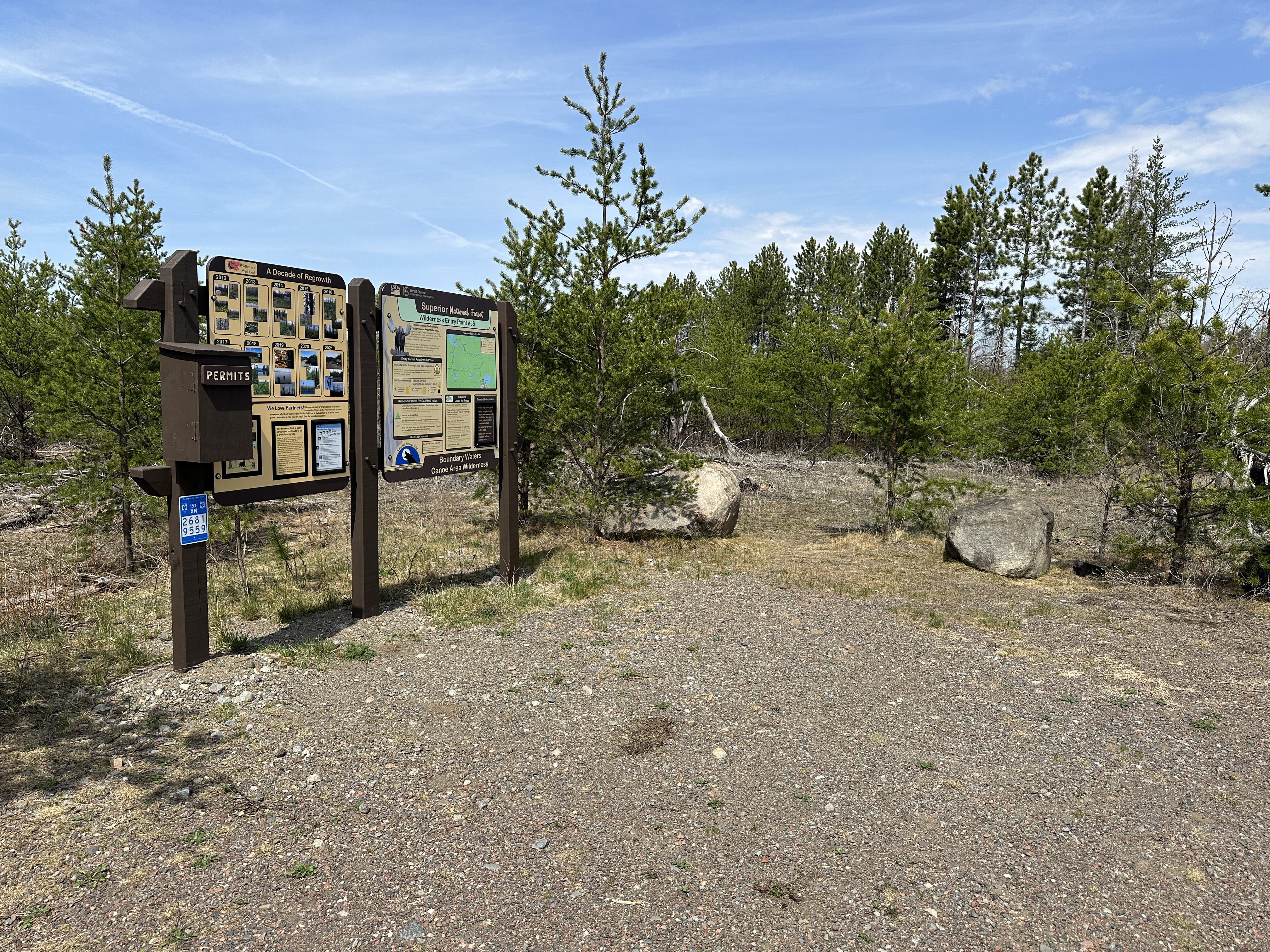
Trailhead signage. These signs replaced the one below sometime after July 2021. The trail starts just to the right of the signs between the boulders (May 12, 2023).
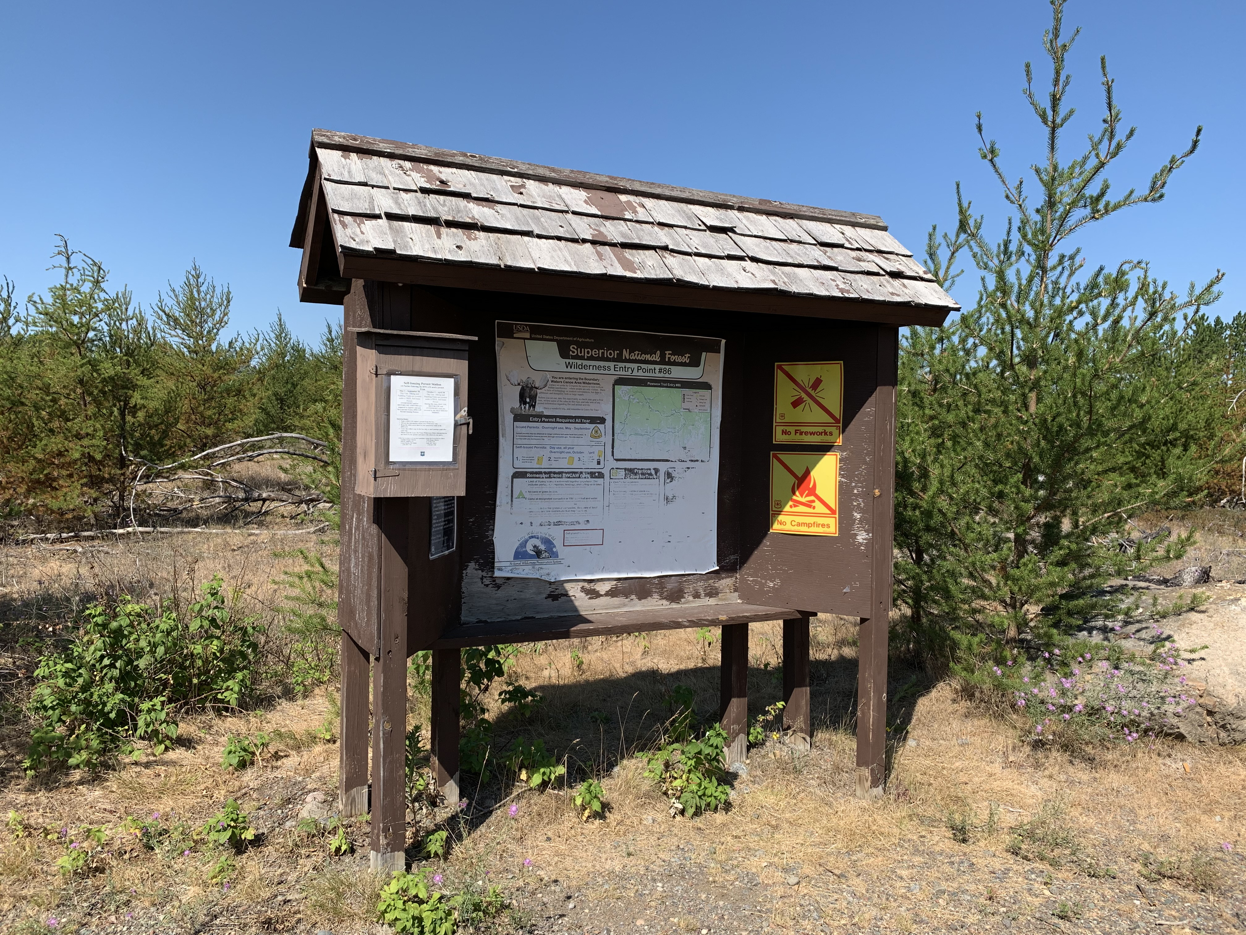
Kiosk at the trailhead. It survived the 2011 Pagami Creek Fire (July 25, 2021).
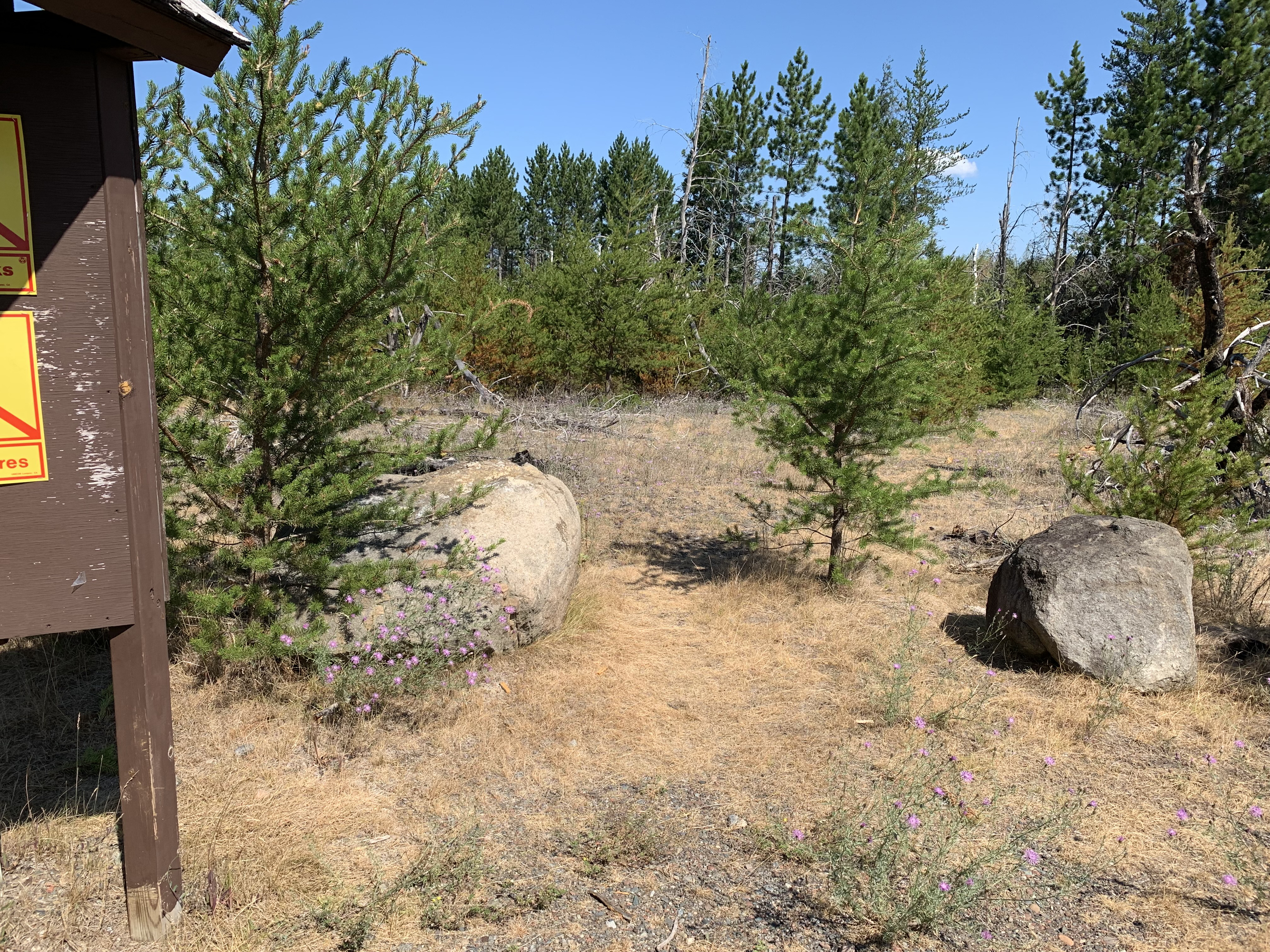
Start of the Powwow Trail. That jack pine growing between the two boulders there is the first of about "a few million" you will see as you hike the trail (July 25, 2021).
Powwow Trail from the trailhead parking lot northward to the Isabella River crossing (May 25, 2024).
Older video footage of the same hike as above (July 25, 2021).
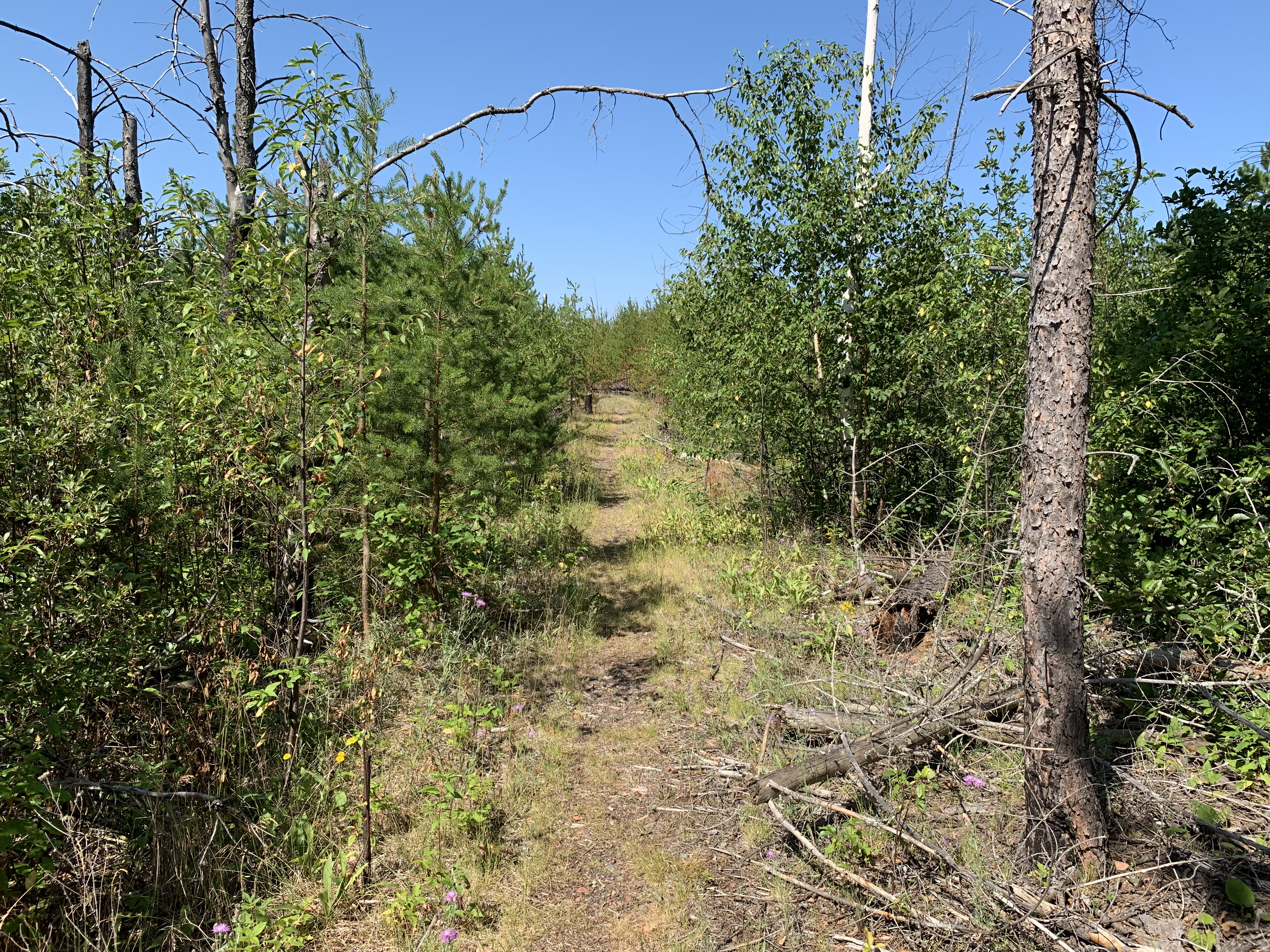
Typical view along this section of the trail (July 25, 2021).
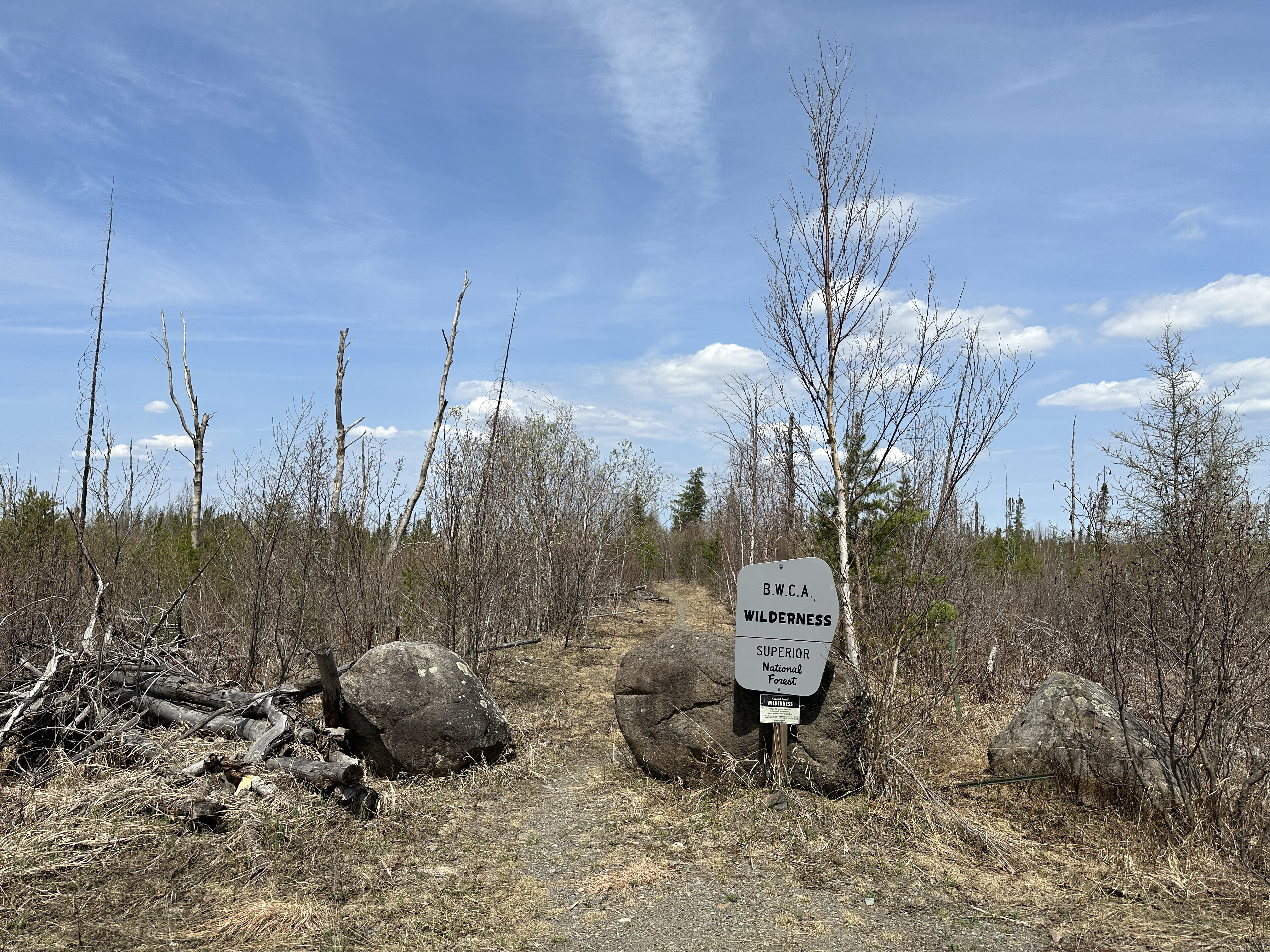
About a half mile along the trail from the trailhead, you'll come across this sign. This marks the boundary line of the BWCA (May 12, 2023).
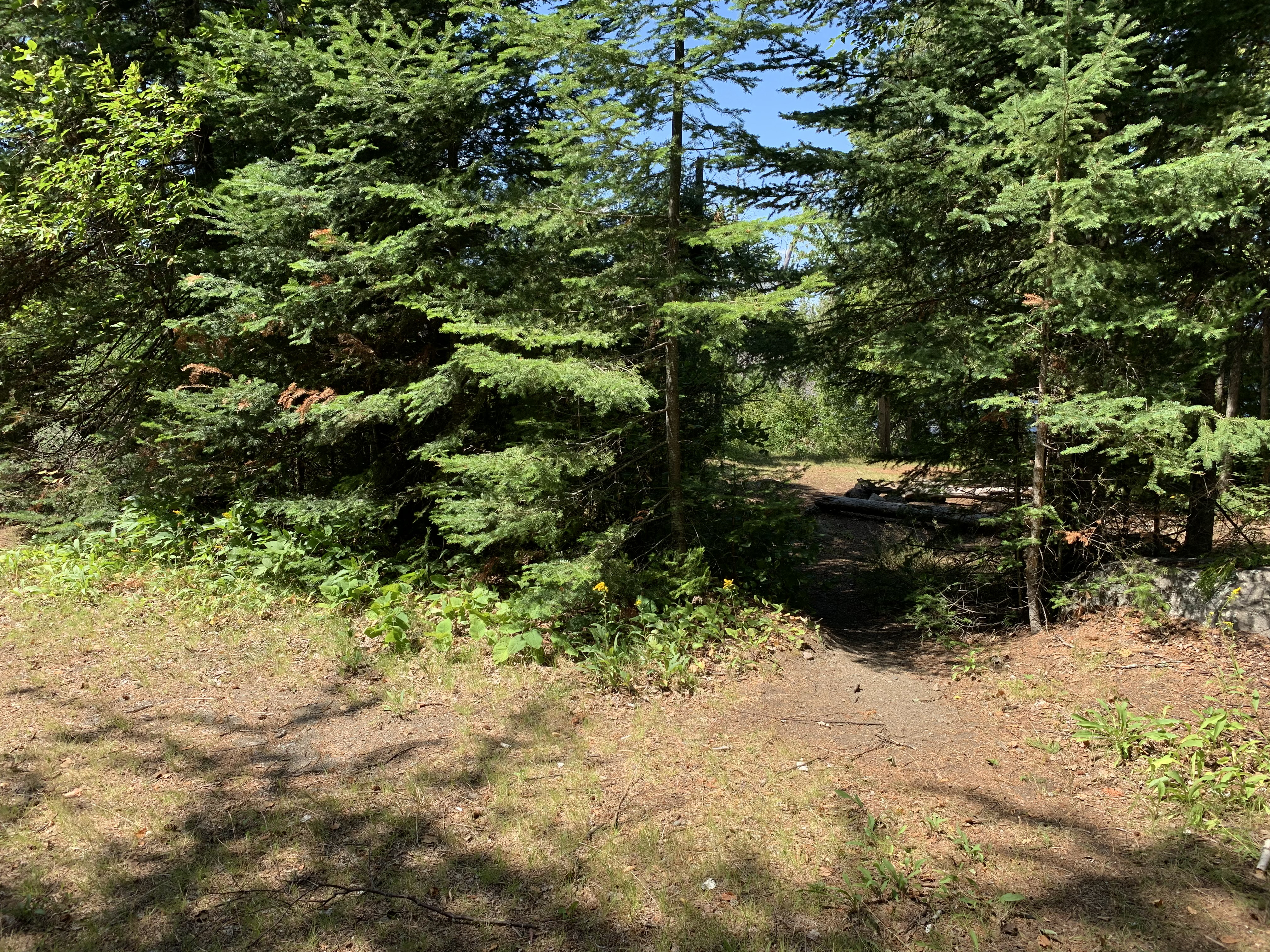
Just before reaching the Isabella River, there is a campsite on the left (west) side of the trail. This campsite can be used by Powwow Trail hikers and by canoeists paddling the Isabella River (July 25, 2021).
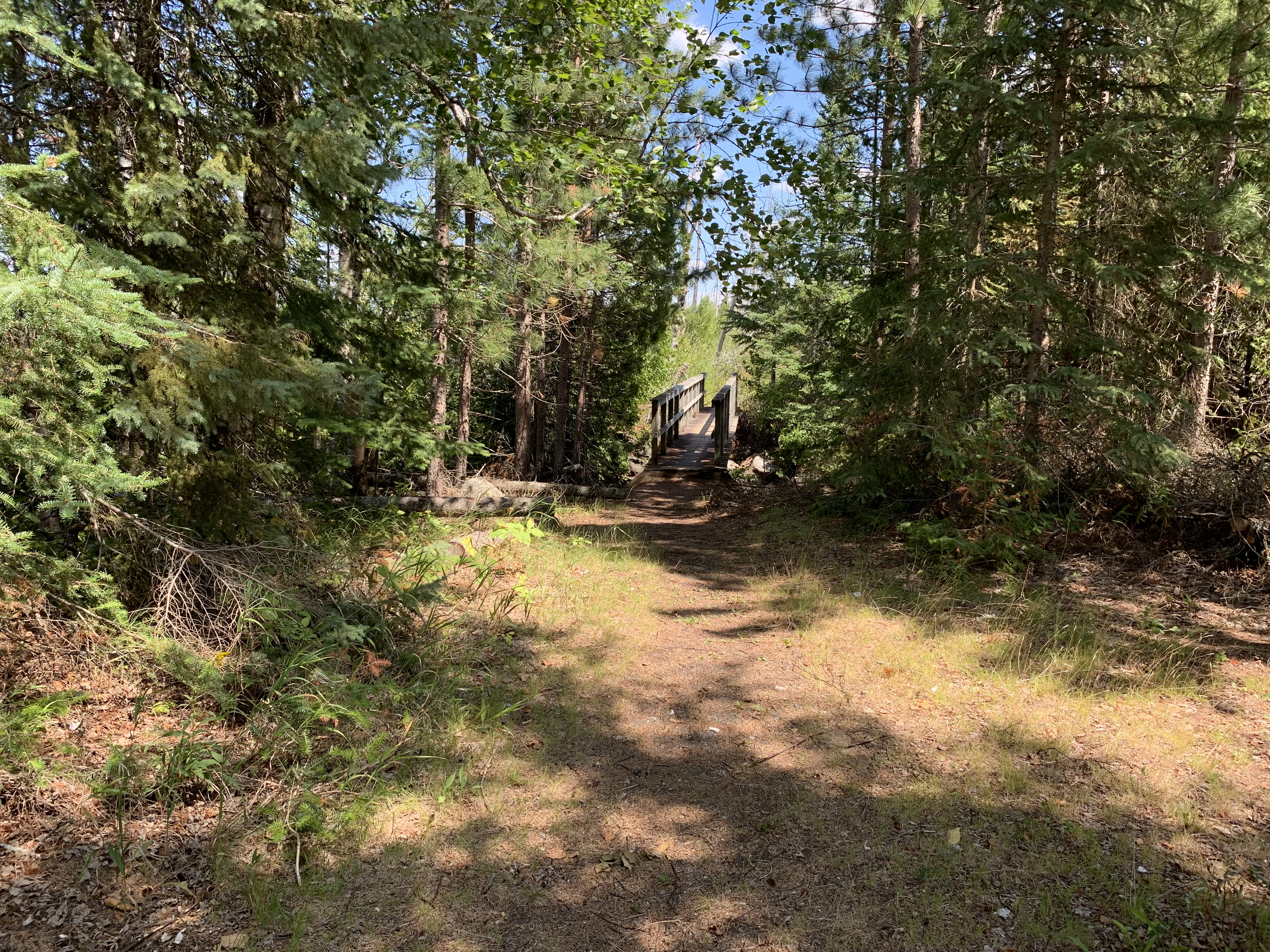
As you pass the campsite, looking further down the trail to the north, you will see the bridge over the Isabella River (July 25, 2021).
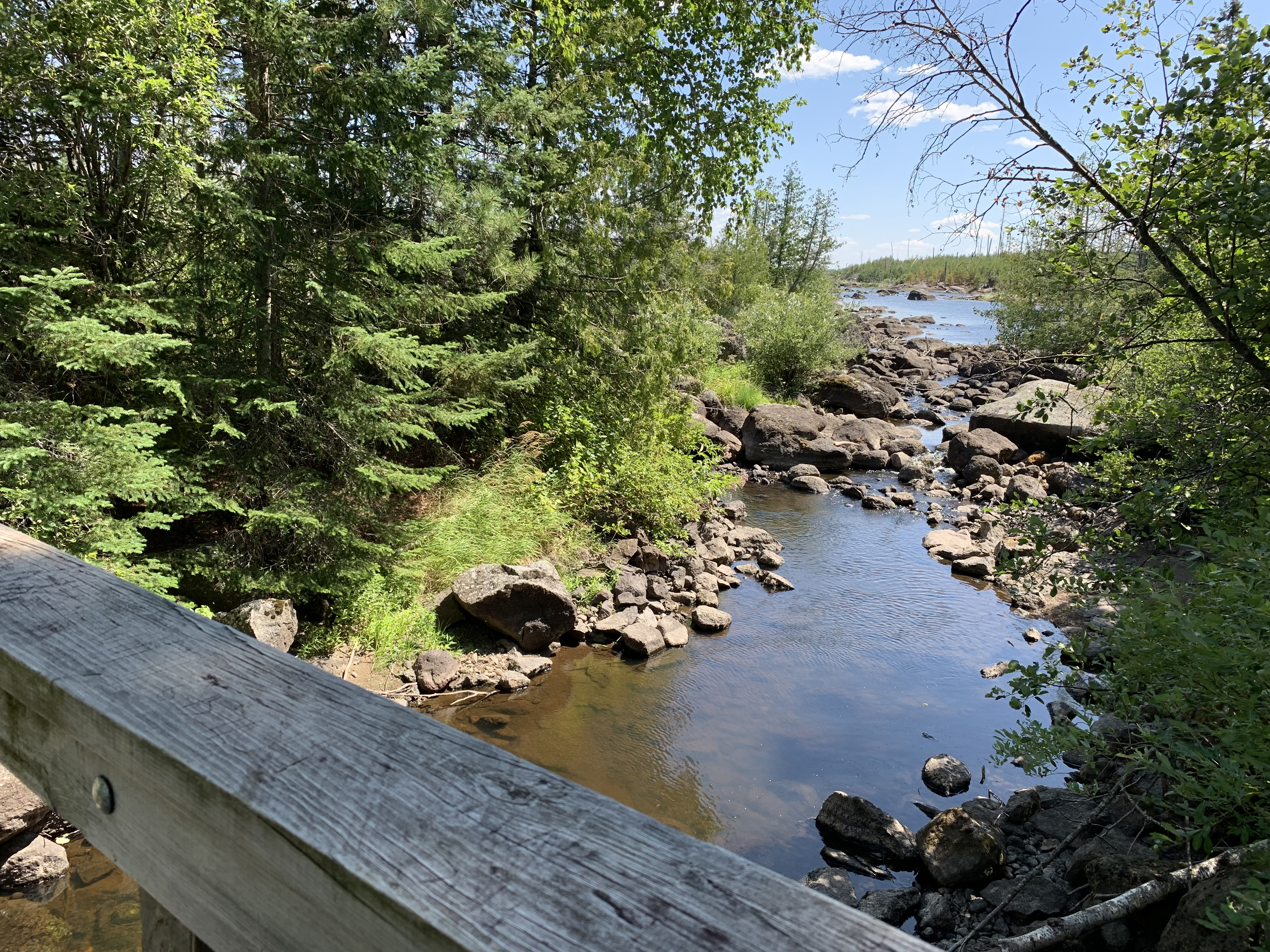
View from bridge looking upstream to the east toward Isabella Lake. This is during a period of low water levels (July 25, 2021).
Similar view from the bridge as shown above, but during very high water (May 12, 2023).
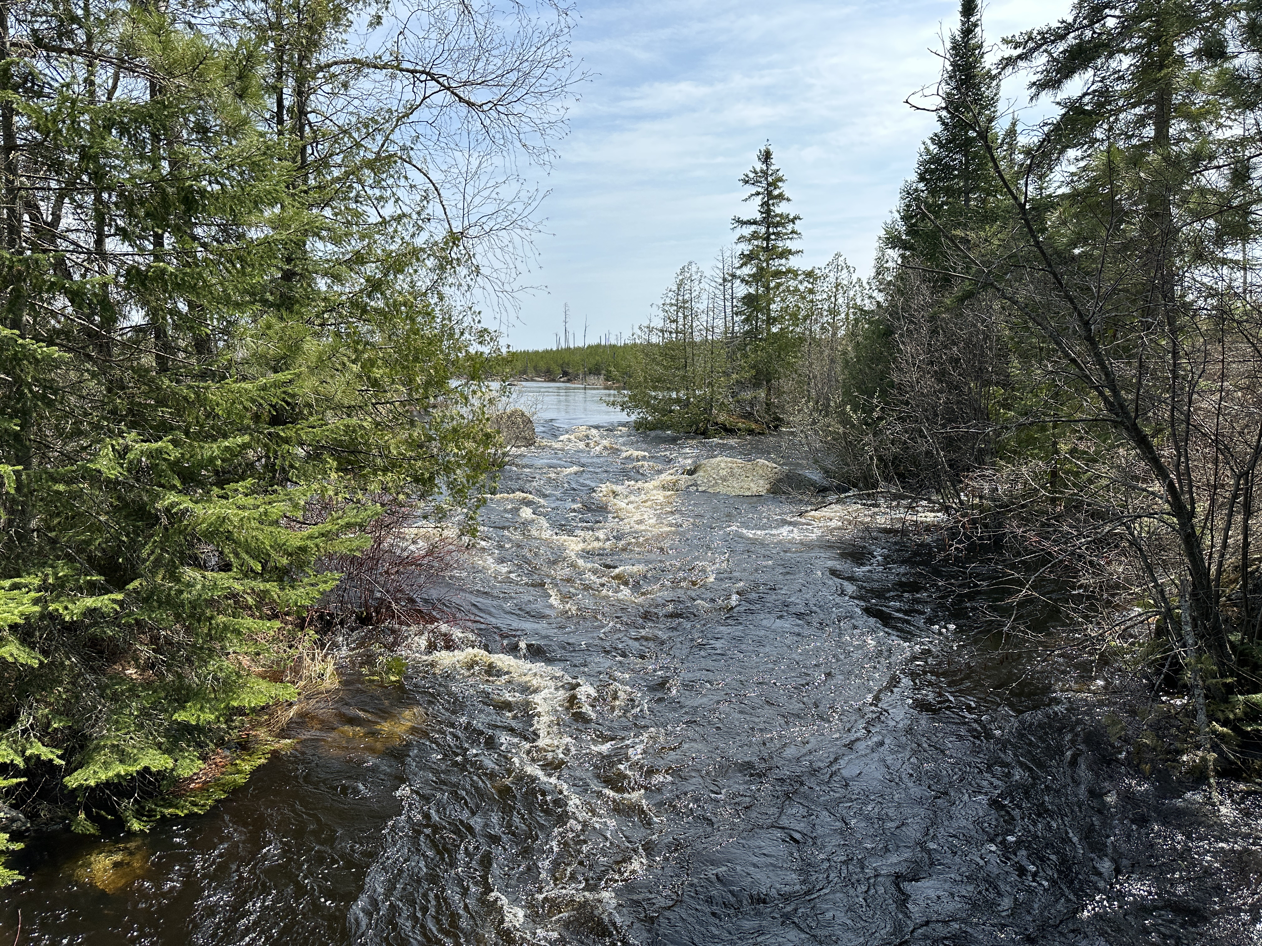
Shortly after crossing the bridge heading northbound, you will have to cross this secondary river channel. There is usually a simple log bridge here, but if that has washed away, there is a series of rocks to step on to make your way over the river. This is a view with extremely low water levels so you didn't even have to get your feet wet (July 25, 2021).
Similar view of the secondary channel as shown in the photo above, but this time with high water levels in the river. This can be a difficult crossing when water levels are like this (May 12, 2023).
ISABELLA RIVER CROSSING TO "THE WYE" (1.7-MILES)
Click on the photos below to see the full resolution image - Use your browsers back button to close photo and return to this page.
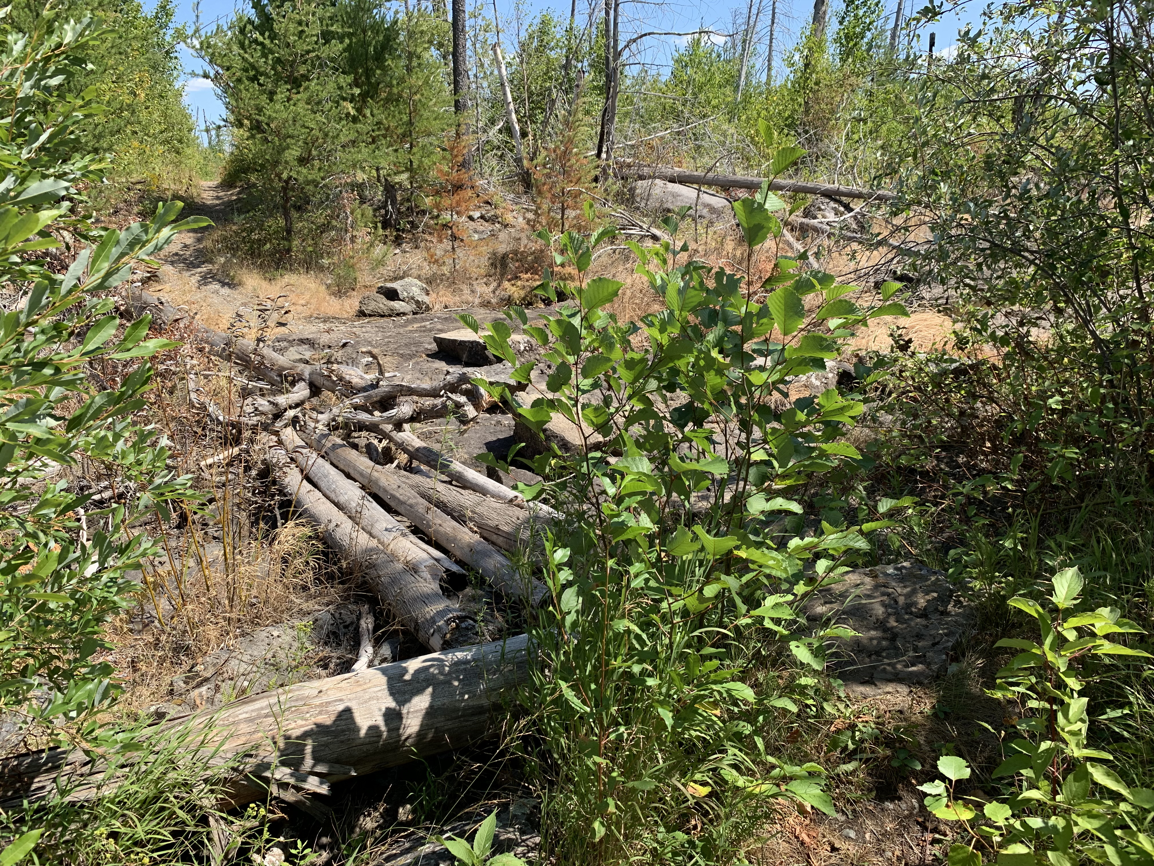
The log bridge and the stepping stones (just visible to right of bridge behind the bush). This is when there was virtually no water in the secondary channel. Just after crossing the river here, you will come to a four-way trail intersection. This is where the Powwow Trail intersects the 42 rod portage between Lake Isabella and the Isabella River. Keep going straight ahead down the Powwow Trail (July 25, 2021).
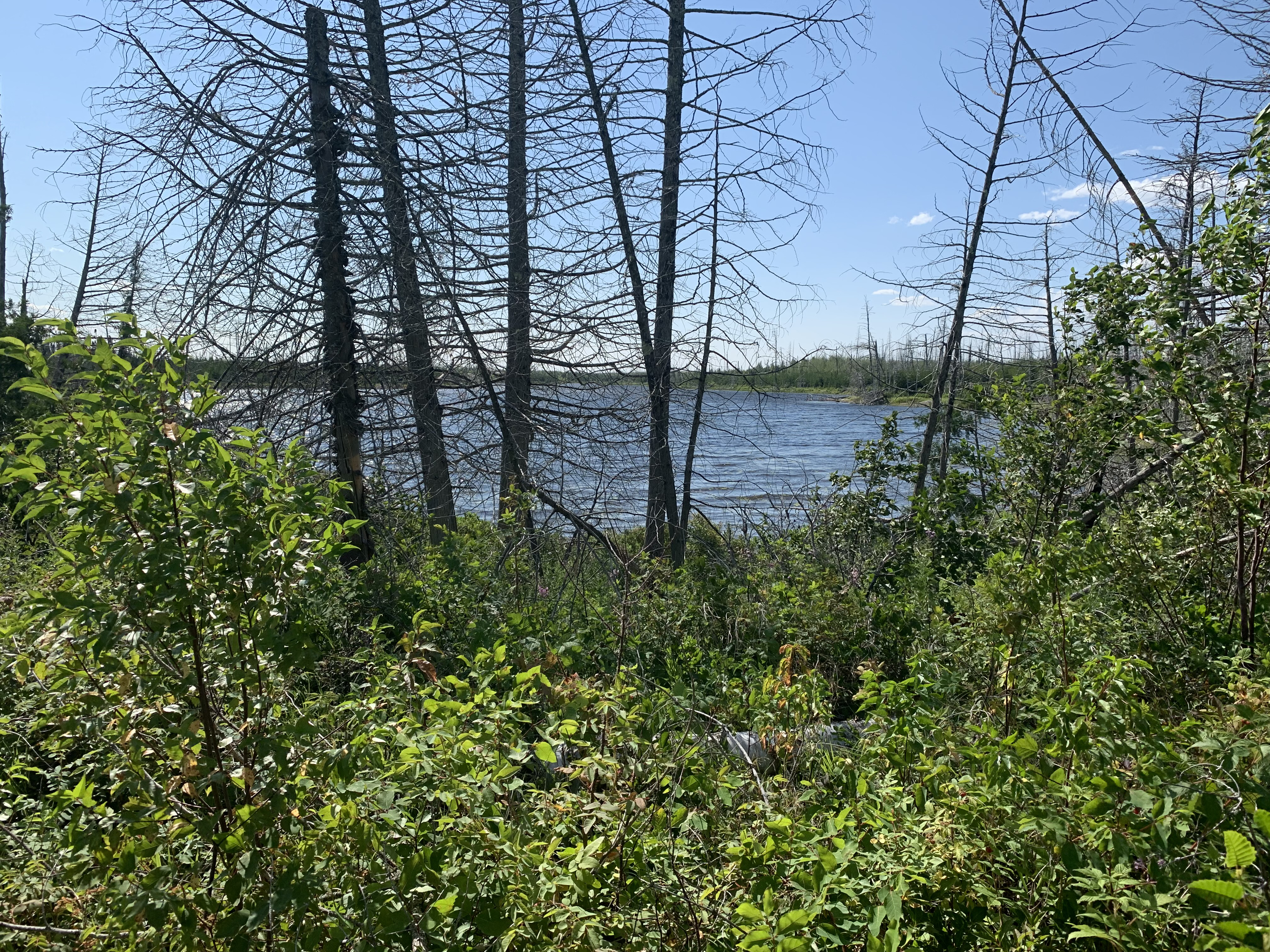
A glimpse of the Isabella River from the Powwow Trail. This is about 400 feet north of the Isabella River crossing (July 25, 2021).
Hiking from the Isabella River to "The Wye". "The Wye" is where the stick portion of the trail (that you are now hiking) meets the loop part of the Powwow Trail (May 25, 2024).
This is older video footage, but it starts slightly further north. Starting at the 42 rod portage trail between Lake Isabella and the Isabella River (just north of the bridge crossing), continue mostly north until reaching "The Wye" where "The Stick" part of the trail meets "The Loop" (July 25, 2021).
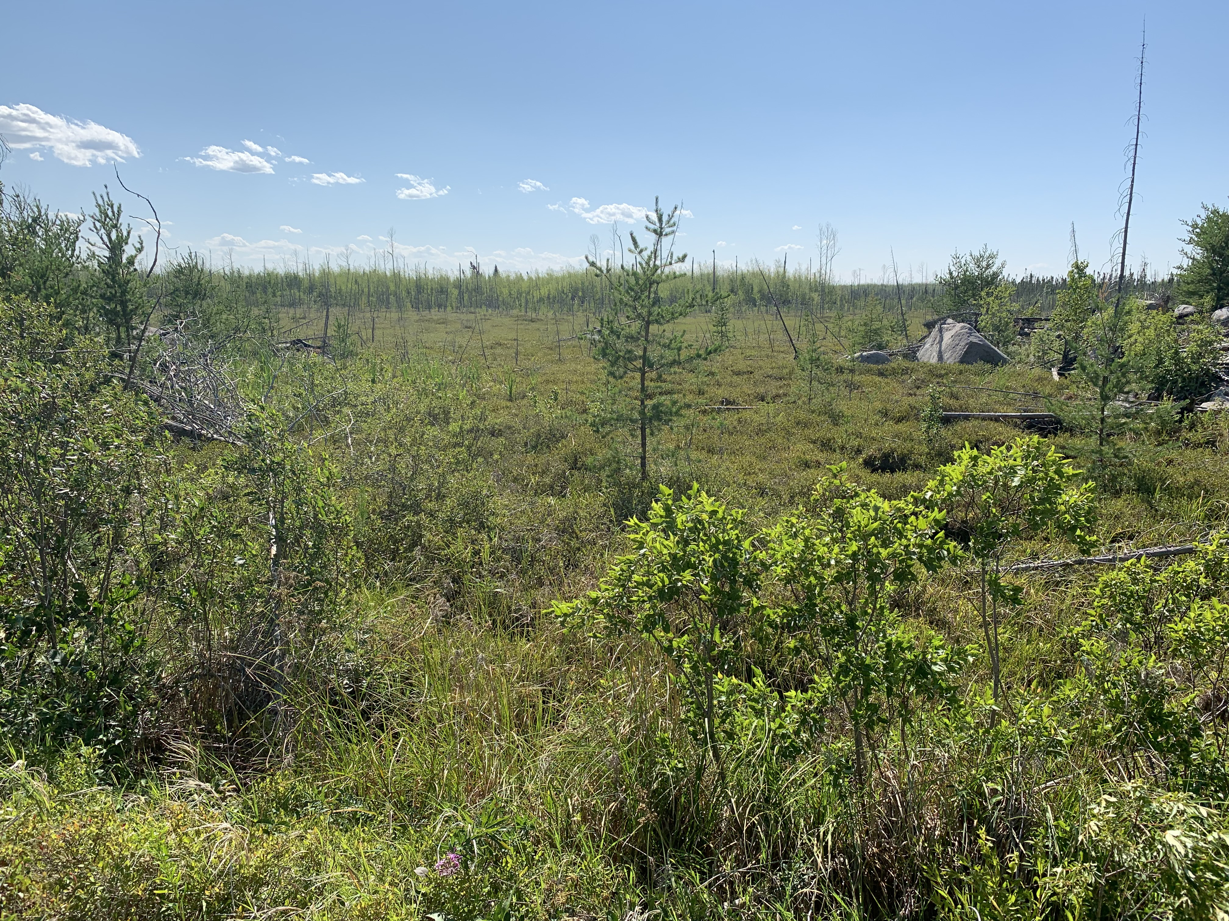
Looking to the west at a low lying area. Perhaps used to be an old lake bed (July 25, 2021).
Looking to the southeast. This image is taken about 3,900 feet south of "The Wye". You can just make out Lake Isabella in the far distance (just slightly right of center) about 0.75 miles away (July 25, 2021).
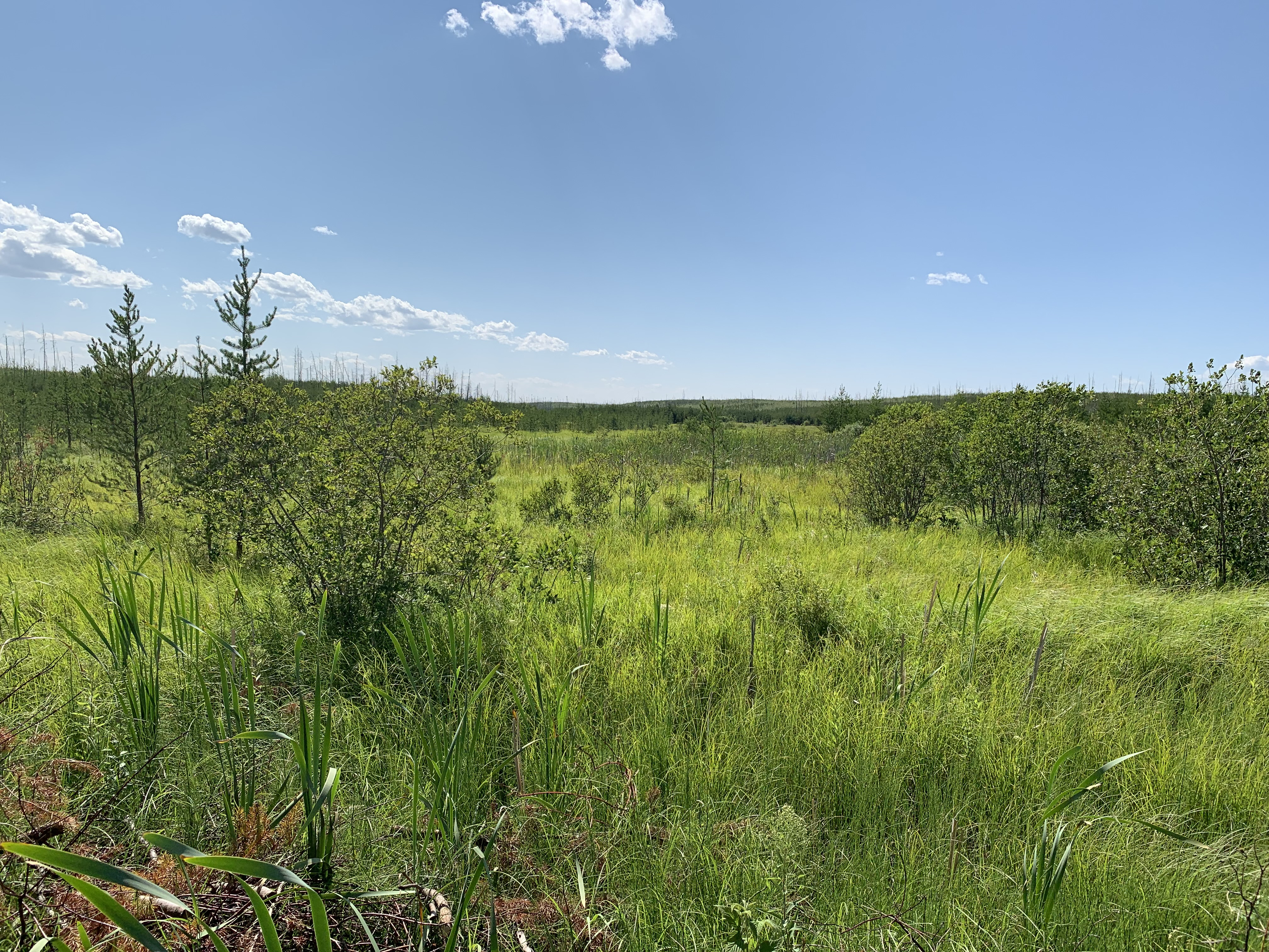
View to the west from about 1300 feet south of "The Wye". Out in that marsh Pelt Creek that flows off to the southwest and eventually drains into Pelt Lake. Pelt Lake lies about 1/2 mile to the southwest of this location (July 25, 2021).
View to the east about 800 feet before reaching "The Wye". The trail passes through several stretches of some very tall marsh grass in this area. Makes footing difficult since you can't see where you are placing your feet. There are a few big holes that you can hopefully avoid stepping in. A pole or walking stick will be useful here. Also, the trail has some muddy sections in this area. How much depends on the season and recent rainfall (July 25, 2021).
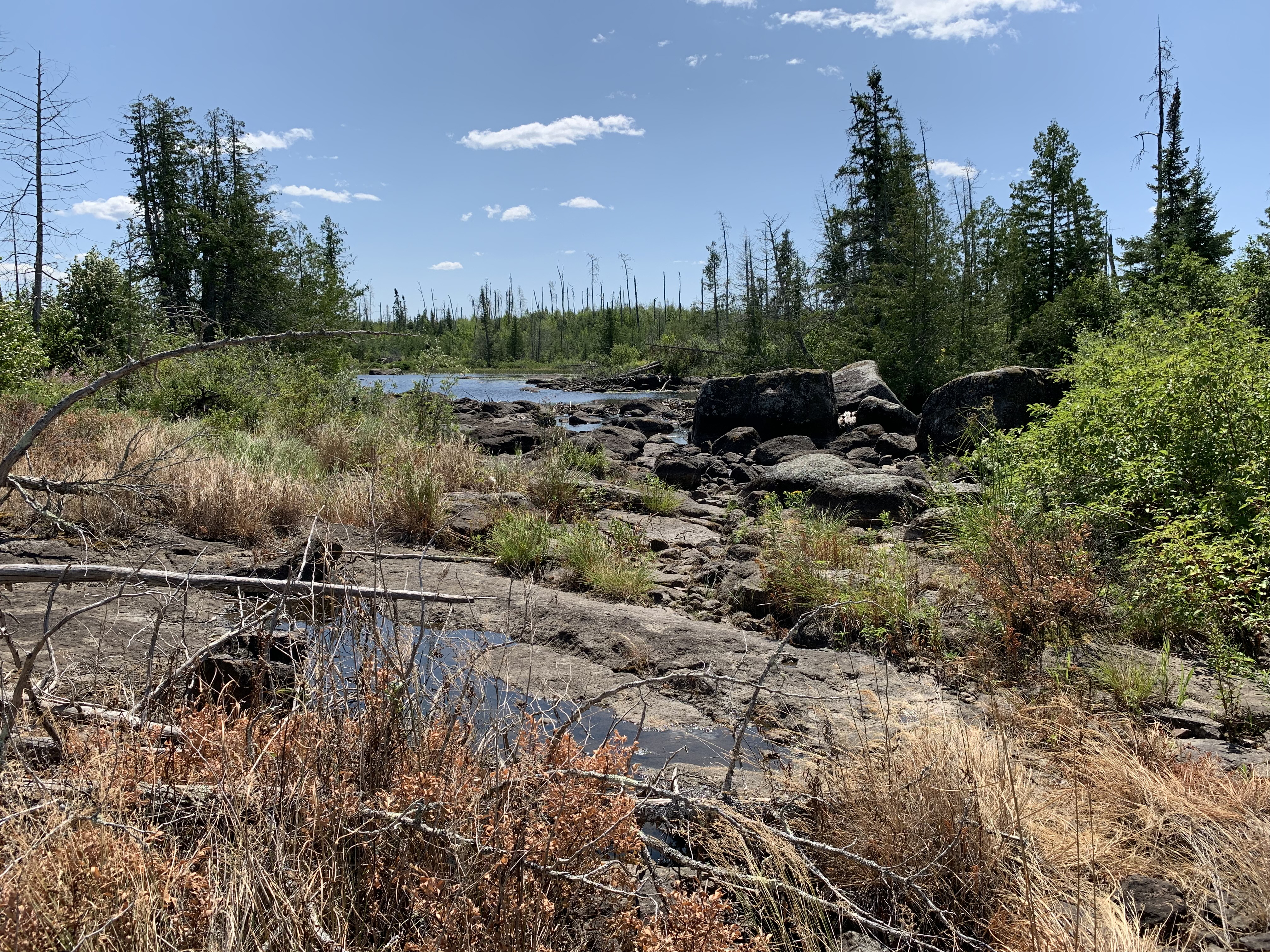
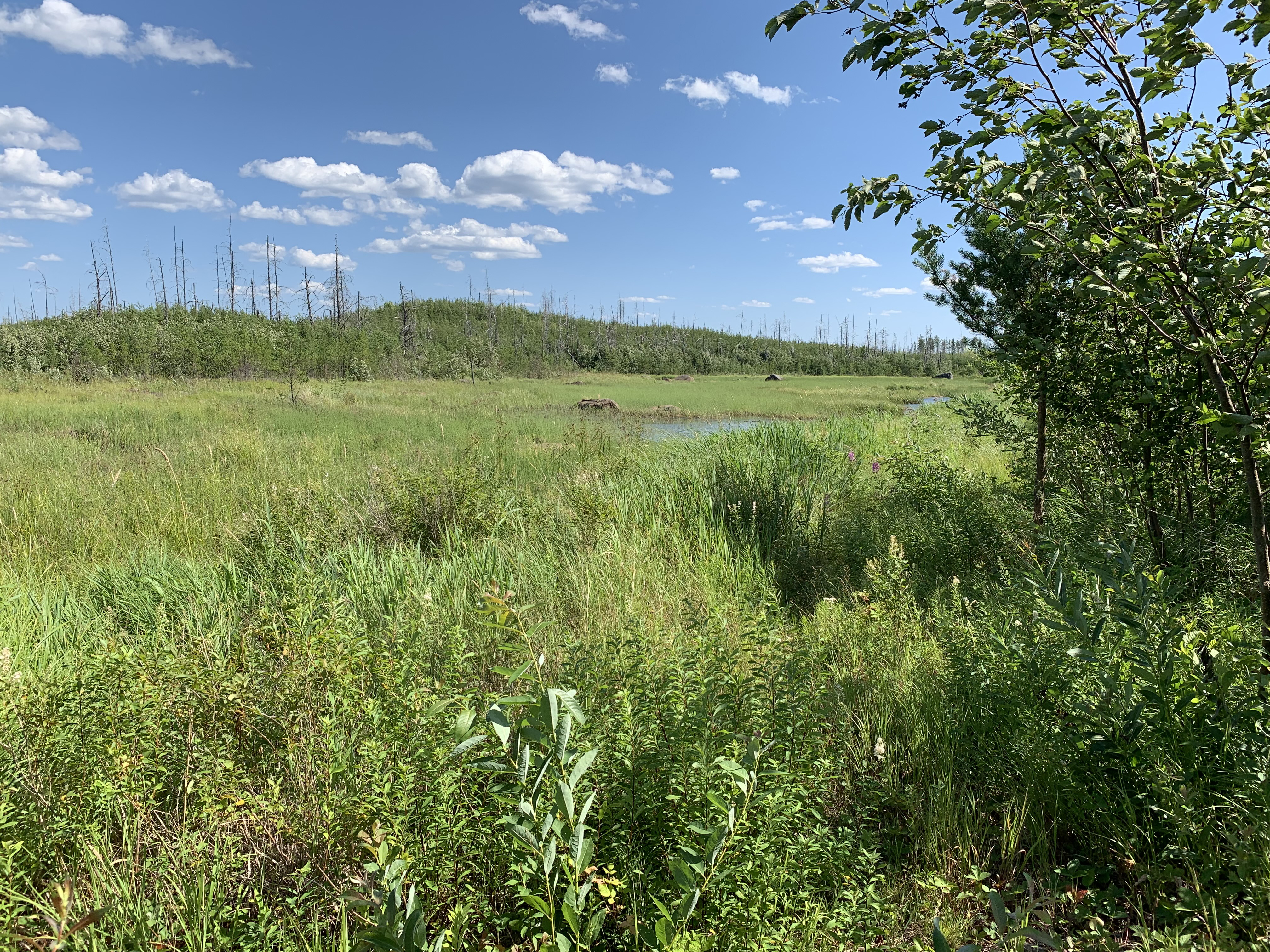
A beaver pond with a beaver's lodge (far right), just before you reach "The Wye" intersection (July 25, 2021).
"The Wye" intersection set in a thicket of jack pine. Heading to the right will take you counterclockwise around "The Loop". Left of course will mean traveling "The Loop" in a clockwise direction. It's about 27.5 miles around either way you decide to go (July 25, 2021).
"THE WYE" TO THE POSE LAKE BWCA CAMPSITE 2265 SPUR TRAIL (3.4-MILES)
There are two points of interest along this section. The first is the "Second Wye". It was at this location that the eastern loop of the Powwow Trail (hasn't been restored since the Pagami Creek Fire as of 2025) joined the existing western loop (the one you are walking). The other point of interest is where the old Lake Insula portage (which followed the old Hudson Road or North Road) split off from the Powwow Trail. At this point the Powwow Trail bends to the west, while the old portage/road goes nearly straight north. This was the location that Jason Rasmussen got lost in 1998. This story is told in the book 'Lost in the Wild' by Cary Griffith. There also used to be a campsite at this location, but it is long gone now (May 25, 2024).
Large wetland along the Powwow Trail about 1/2 mile east of the spur trail leading to the Pose Lake campsite (May 25, 2024).
POSE LAKE BWCA CAMPSITE 2265 SPUR TRAIL TO THE EAST POSE CREEK VALLEY OVERLOOK (0.6-MILES)
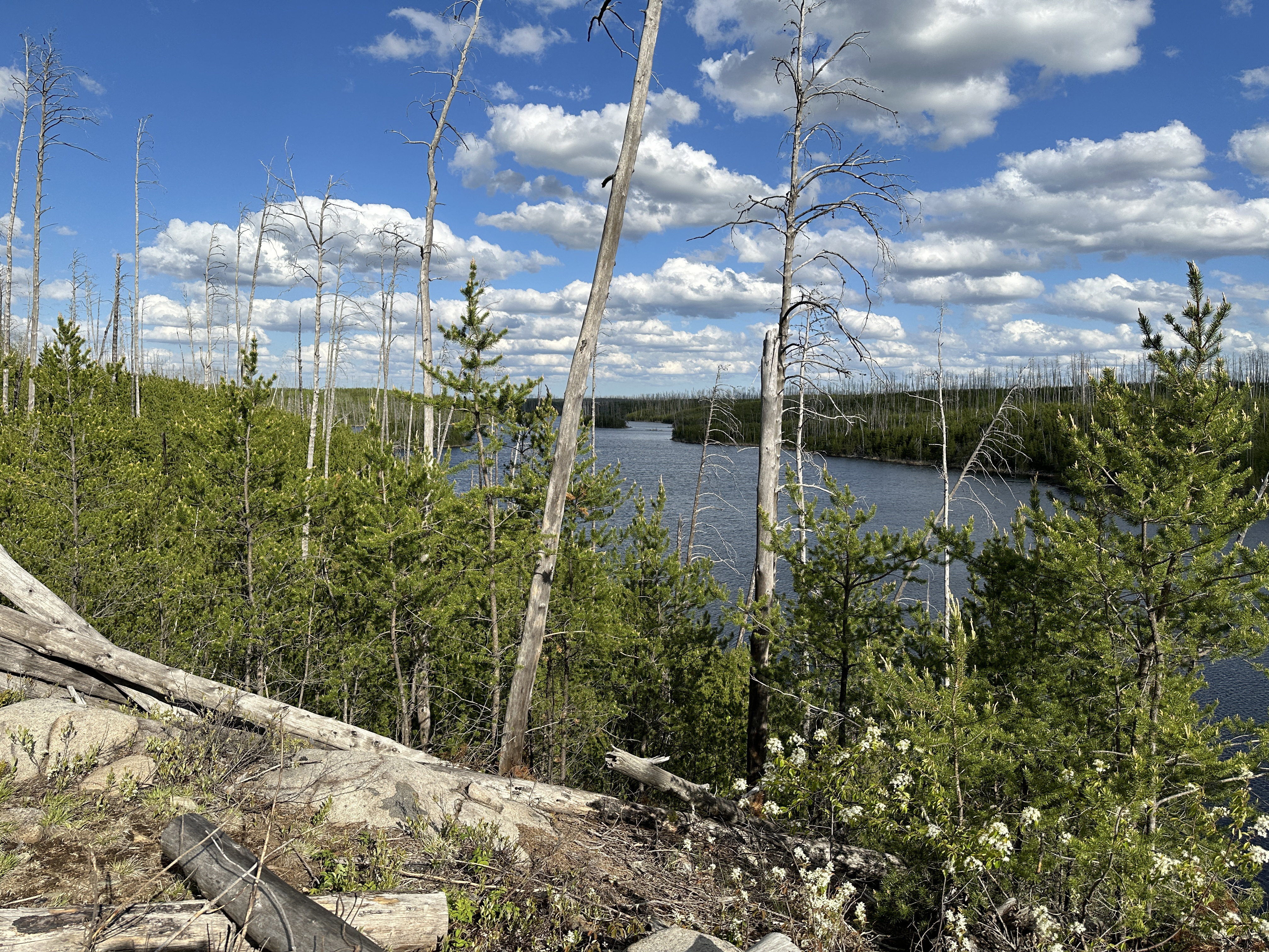
After you pass the Pose Lake Campsite spur heading in this counterclockwise direction, the Powwow Trail becomes steadily more rugged. You are rewarded by a fine view of the Pose Creek Valley (May 25, 2024).
Eastern Pose Creek Valley Overlook (May 25, 2024).
EAST POSE CREEK VALLEY OVERLOOK TO THE WEST POSE CREEK VALLEY OVERLOOK (0.5-MILES)
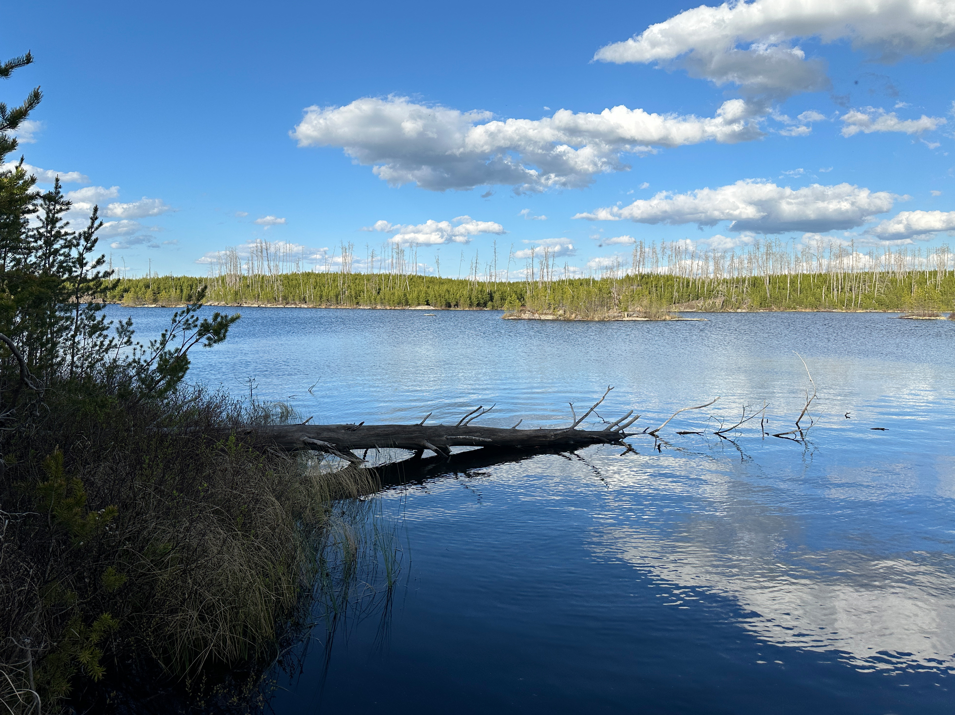
Cross Pose Creek shortly after leaving the overlook. After about half-mile you come to another overlook of the Pose Creek Valley. This one is more impressive than the last one (May 25, 2024).
This overlook offers at least a 180 degree panoramic view of the Pose Creek Valley (May 25, 2024).
WEST POSE CREEK VALLEY OVERLOOK TO THE SOUTH WILDER LAKE BWCA CAMPSITE 2264 (2.2-MILES)
This stretch of the Powwow Trail is probably the most difficult part of the hike. Difficult footing as the trail closely follows the shoreline of South Wilder Lake (May 25, 2024).
SOUTH WILDER LAKE BWCA CAMPSITE 2264 TO THE HARBOR LAKE/NORTH WILDER LAKE PORTAGE INTERSECTION (1.3-MILES)
You will cross Wilder Creek about 0.3-miles after leaving the campsite. This is another challenging part of the Powwow Trail, with lots of elevation changes and rough footing in places.
HARBOR LAKE/NORTH WILDER LAKE PORTAGE INTERSECTION TO THE NORTH WILDER LAKE BWCA CAMPSITE 2230 (0.2-MILES)
It's just a short hike from the portage intersection to this campsite. Campsite is down a short spur trail and located right on the lake (May 25, 2024).
NORTH WILDER LAKE BWCA CAMPSITE 2230 TO THE HORSESHOE LAKE/LAKE THREE PORTAGE INTERSECTION (2.7-MILES)
This is the last really hard part of the trail going in this direction around the loop. There is a beaver pond that is busy with beavers in the late evening. There is a beautiful overlook of Horseshoe Lake. A green zone of trees that managed to escape the 2011 Pagami Creek Fire is encountered right before you reach the end of this hike.
HORSESHOE LAKE/LAKE THREE PORTAGE INTERSECTION TO THE LAKE THREE BWCA CAMPSITE 2224 SPUR TRAIL (0.2-MILES)
The spur trail leading to the campsite is difficult to see. It is on the left, just a few hundred yards past the portage intersection.
LAKE THREE BWCA CAMPSITE 2224 SPUR TRAIL TO THE ROCK OF AGES LAKE BWCA CAMPSITE 2263 SPUR TRAIL (1.4-MILES)
Not long after leaving the Lake Three campsite, you will hear the sound of rushing rapids ahead of you in the quiet woods. You soon come to a creek running high. It is still springtime. You have to scoot across this creek on a log. Hike ends at the spur trail that leads to the highly sought after campsite on Rock of Ages Lake (May 26, 2024).
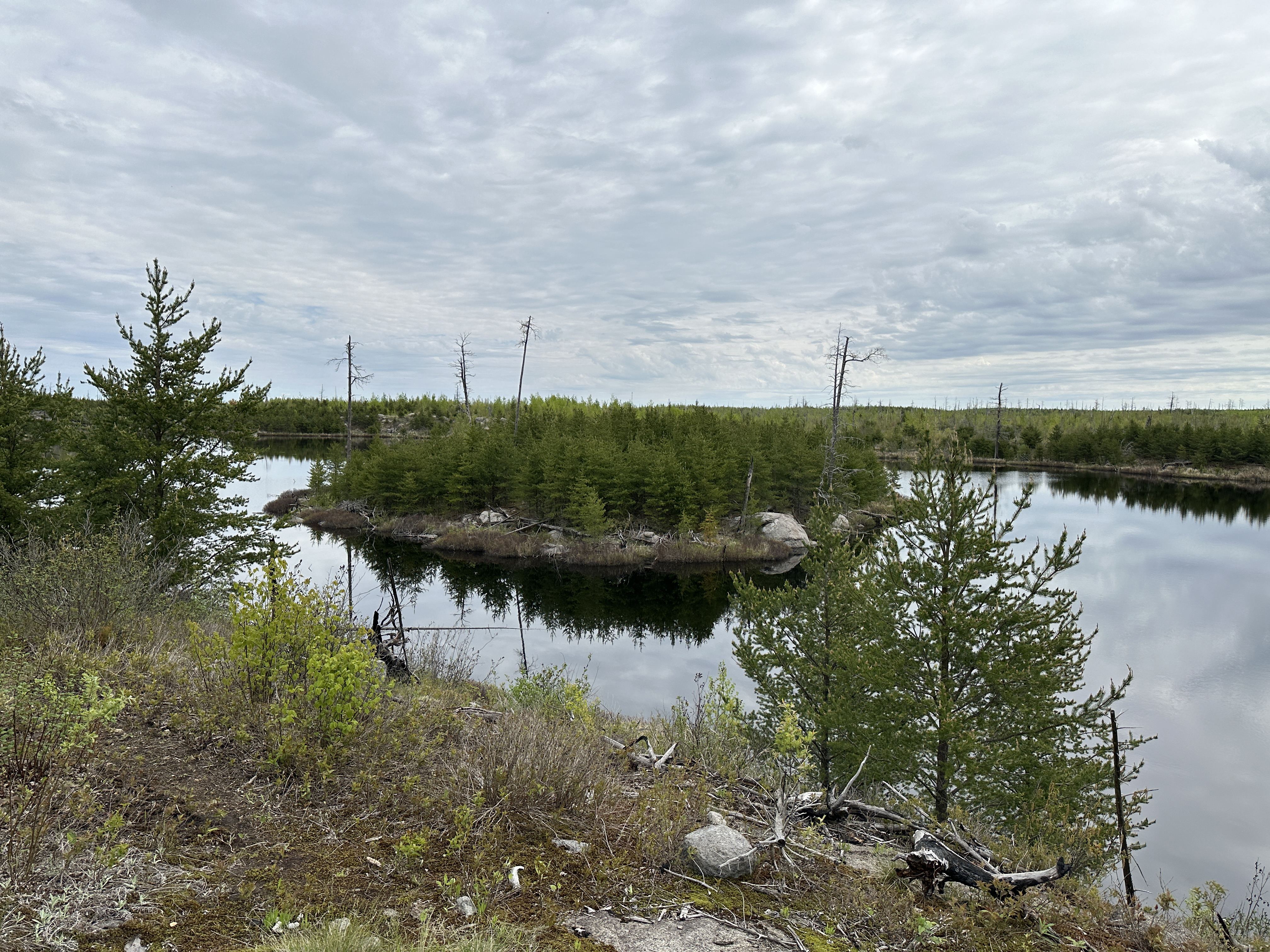
Looking at the north end of Rock of Ages Lake from the Powwow Trail (May 26, 2024).
ROCK OF AGES LAKE BWCA CAMPSITE 2263 SPUR TRAIL TO THE PATH LAKE BWCA CAMPSITE 2262 (0.6-MILES)
Short hike to the next campsite on Path Lake (May 26, 2024).
PATH LAKE BWCA CAMPSITE 2262 TO THE MIRROR LAKE BWCA CAMPSITE 2261 (1.5-MILES)
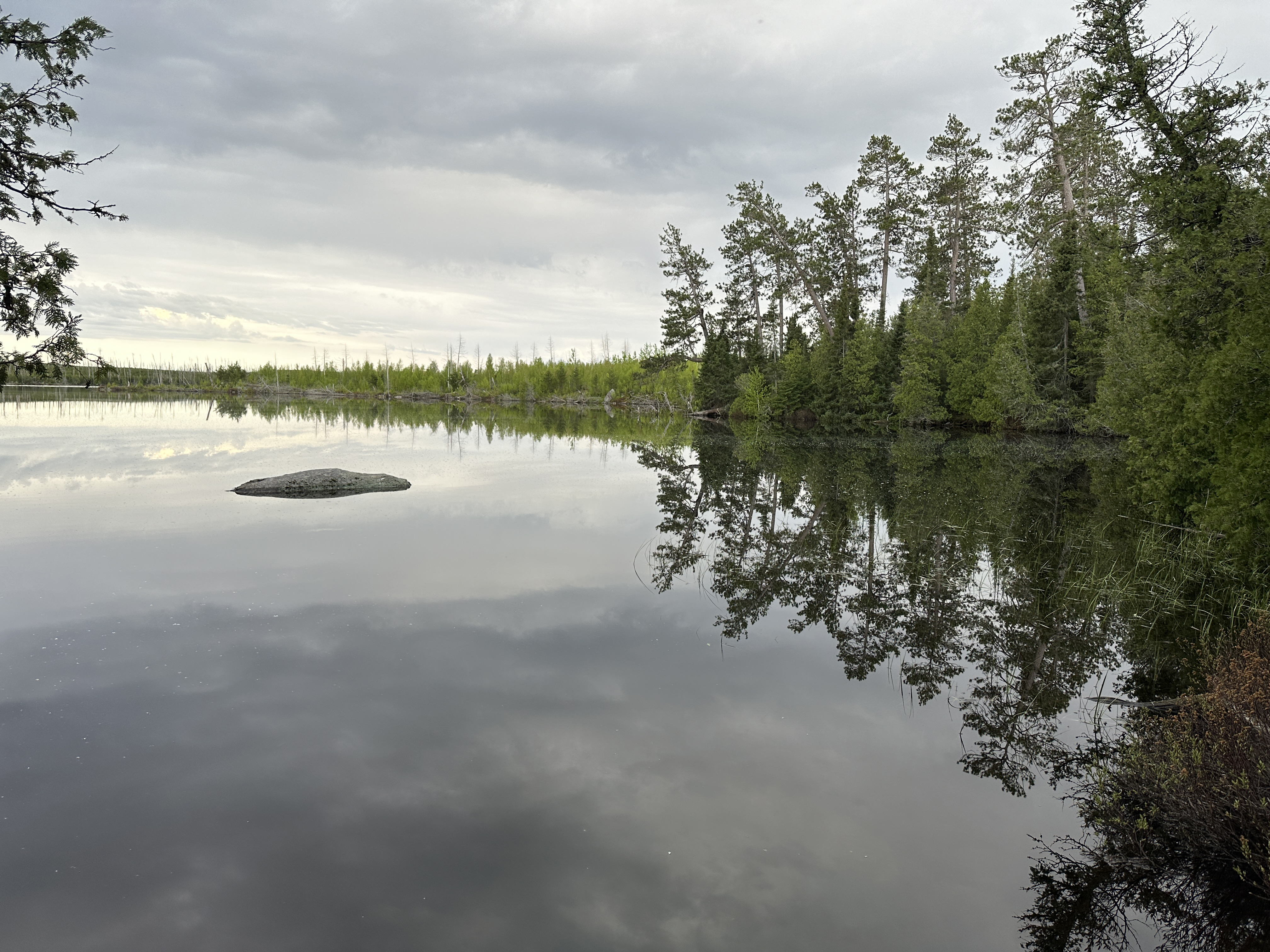
From the Path Lake Campsite, the Powwow Trail follows the west side of Path Lake. The trail then follows the western side of a steep valley through which Rock of Ages Creek flows between Mirror Lake and Path Lake. Soon after the trail reaches the north end of Mirror Lake, it crosses Rock of Ages Creek. The trail then ascends a little bit and follows the western shore of Mirror Lake until reaching the only campsite on the lake (May 26, 2024).
View to the northeast of the island in Mirror Lake from the lakes only campsite (May 26, 2024).
MIRROR LAKE BWCA CAMPSITE 2261 TO THE SUPERSTITION LAKE OVERLOOK (1.0-MILES)
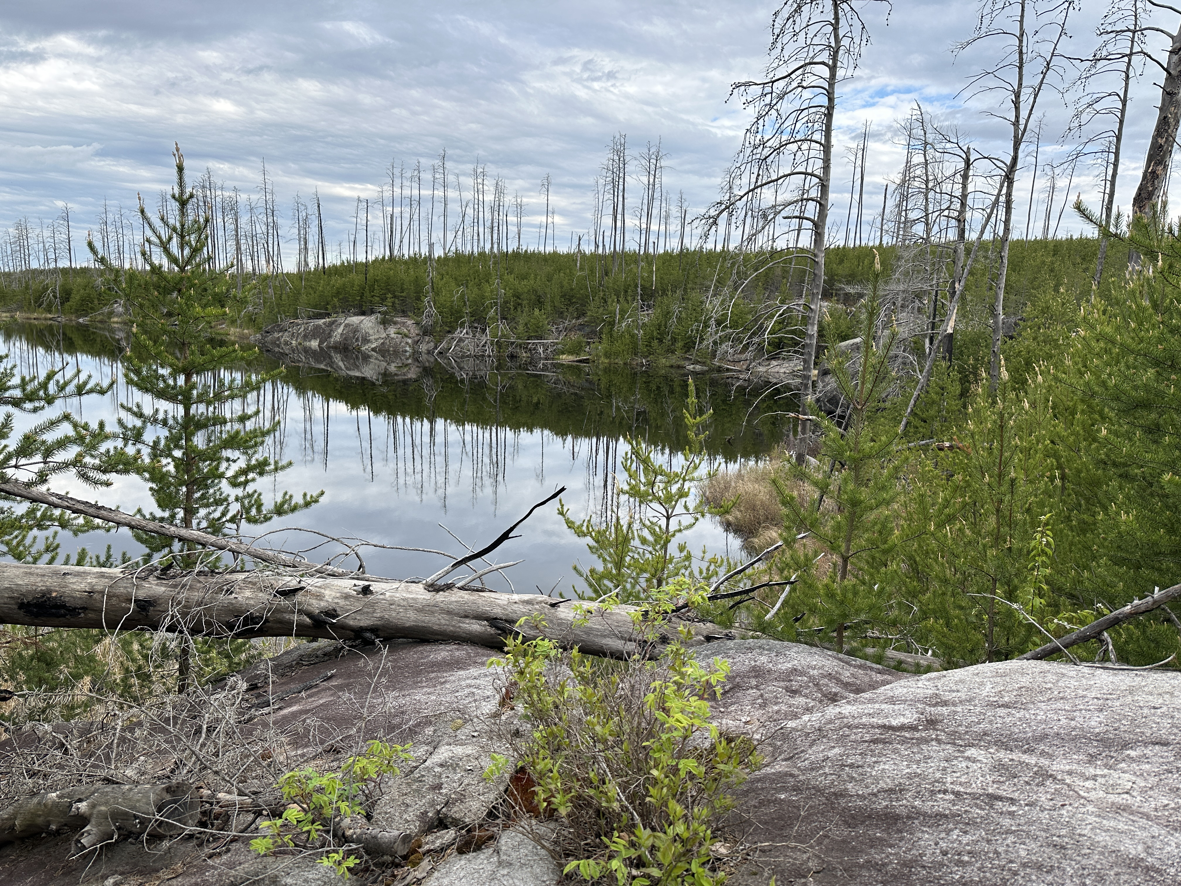
Powwow Trail continues south along the west shoreline of Mirror Lake. It then heads through a lowland valley with lots of wet areas for the last half-mile or so to the Superstition Lake Overlook. The overlook is on the eastern end of the lake, so you are looking towards the west across the lake (May 26, 2024).
SUPERSTITION LAKE OVERLOOK TO THE MYTH LAKE/EXPLOIT LAKE BEAVER DAM CROSSING (1.7-MILES)
Shortly after leaving the overlook, the Powwow Trail crosses a beaver dam where Superstition Creek flows out of the lake. The trail traces the entire eastern shoreline of Superstition Lake. The path passes by a spur trail to the lakes single campsite. At the south end of Superstition Lake, the Powwow Trail passes through old forest that wasn't burned by the fire for the next 0.6-miles. This is the longest stretch of unburned forest remaining along the western loop of the Powwow Trail. The trail bends back to the east as you leave this green area and is now following a wide path down what was once an old logging road. There is a brief glimpse of Exploit Lake through the trees not long before you reach the end of the hike where the trail again intersects Superstition Creek (May 26, 2024).
MYTH LAKE/EXPLOIT LAKE BEAVER DAM CROSSING TO THE QUADGA LAKE BWCA CAMPSITE 1936 SPUR TRAIL (0.6-MILES)
Trail continues east along the old logging road. The campsite spur trail to Quadga Lake is usually well marked (May 26, 2024).
QUADGA LAKE BWCA CAMPSITE 1936 SPUR TRAIL TO THE CAMPFIRE LAKE BWCA CAMPSITE 2259 (0.2-MILES)
A brief hike to the campsite on Campfire Lake (May 26, 2024).
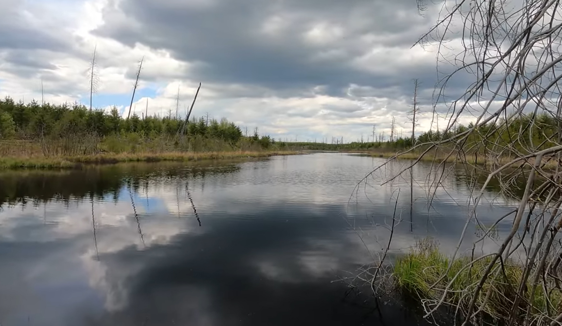
A look at Campfire Lake from near the lakes only campsite (May 26, 2024).
CAMPFIRE LAKE BWCA CAMPSITE 2259 TO DIANA LAKE AND THE DIANA CREEK CROSSING (2.2-MILES)
Continue along the logging road. The walking is fairly easy through this section. There is a small patch of standing forest just before you reach the simple log bridge over Diana Creek. There is a nice view of Diana Lake here at the end of this section (May 26, 2024).
Looking at Diana Lake from where the Powwow Trail crosses Diana Creek over a primitive log bridge as it flows out of the lake. (May 26, 2024).
DIANA LAKE AND THE DIANA CREEK CROSSING TO THE MARATHON LAKE BWCA CAMPSITE 2258 (1.3-MILES)
Keep following the trail east along the logging road. The Marathon Lake campsite is primitive with no fire grate and no latrine (May 26, 2024).
MARATHON LAKE BWCA CAMPSITE 2258 TO FALLEN ARCH LAKE (1.6-MILES)
Just before you reach "The Wye", there is a large wetland through which Pelt Creek flows. The trail crosses a beaver dam in this area. When you reach "The Wye", you have completed the loop part of the Powwow Trail. It is just 2.7-miles from this point back to the trailhead (May 26, 2024).
"THE WYE" TO THE ISABELLA RIVER (1.7-MILES)
This is a 1.7-mile hike following the remnants of an old logging road most of the way. Start out at "The Wye" where "The Stick" intersects "The Loop" portion of the Powwow Trail. At the end of this section, you must cross the Isabella River again (May 26, 2024).
Older video footage of this section (July 25, 2021).
THE ISABELLA RIVER TO THE BWCA ENTRY POINT 86 TRAILHEAD (1.0-MILES)
Once safely across the river, which is running high because of runoff from the spring snow melt, you cross the second channel on a wooden bridge. Just after passing over the bridge, you come to BWCA Campsite 1927 on your right. About 1/2 mile before reaching the trailhead, you leave the Boundary Water Canoe Area (sign marker indicates the boundary). It is nearing evening as you reach the trailhead (May 26, 2024).
Older video footage of this section (July 25, 2021).