Fishing: There are northern pike in Whale Lake. Unknown if fish are present in Fishhook Lake
Maps: Fisher F-6; McKenzie #3 or #21
Trail Water Views: At trailhead near Brule Lake; Fishhook Lake; Ball Club Creek crossing; near intersection with Eagle Mountain Trail by Whale Lake
Fire History:
Wildlife Seen on Visit: Grouse, Bald Eagle, Trumpeter Swans (on North Branch Cascade River), Ducks (Fishhook Lake), hundreds of Canadian Geese (flyover), Pine Marten (near trailhead), Moose tracks common along trail, but none seen
Campsites: 1 (at Fishhook Lake - there are also two additional campsites at Whale Lake if you are through hiking both trails)
Highest Trail Elevation: About 2,020 feet as trail crosses saddle between Eagle Mountain and the unnamed peak (known as Point 2220) due east of Eagle Mountain
Last Visited: May 27, 2021
Previous Visit(s): April 10, 2021, August 22, 2015
Scenic Overlooks: Whale Lake, North Branch Cascade River, Fishhook Lake, several unnamed ponds, Brule Lake Lookout Tower remnants, Brule Lake at the entry point
TRAIL CONNECTIONS AND TRAILHEADS:
Connections: Eagle Mountain Trail
Trailheads: BWCA Entry Point #78
Brule Lake Trail
Tofte Ranger District
BRULE LAKE TRAIL CAMPSITE: Campsite 1 (#2307): Campsite on the point in east end of Fishhook Lake
BWCA Entry Point #78 for the Brule Lake Trail is found at the end of Forest Road 326. This is also known as the Brule Lake Road. The actual start of the Brule Lake Trail doesn't start at Brule Lake, but rather about a quarter-mile back up the road. You will see the sign for it on your way to park your car at the entry point parking lot.
The Brule Lake Trail is flat to moderately rolling along most of its length, but it does have a few steep ups and downs. The trail is muddy in many places. Logs have been placed over many of these squishy areas, but ankle deep sucking mud is unavoidable. Careful of some of these log crossings, as the logs can be really slippery too. The entire trail is officially 6.7 miles long until it intersects with the Eagle Mountain Trail close to Whale Lake. (Actual length by my GPS measurements is 7.4 miles.)
The Brule Lake Trail offers several scenic vistas including Fishhook Lake and several small unnamed lakes and ponds. The location where it crosses the North Branch Cascade River is also pretty. The trail itself can be a little hard to follow in some places, but these spots are very short and you can typically find the obvious trail tread within a few yards. The amount of blowdown you encounter on the trail depends on when the most recent trail clearing work was performed. If you have hiked the Superior Hiking Trail (SHT), you will find this trail more difficult to follow and about equivalent to an "average" difficulty section of the SHT - not as easy as a flat SHT section and not as hard as one of the sections that has a lot of climbs. This trail is far less traveled than any section of the SHT.
There is a spur trail that leads to the Brule Lake Lookout Tower about a quarter mile or so from the western trailhead by Brule Lake. This trail isn't easy to find and it certainly isn't easy to hike up (quite steep). Fishhook Lake is near the middle of the trail. The trail crosses North Branch Cascade River about three miles northwest of Whale Lake. This crossing can be washed out if there has been a lot of rain or a heavy spring melt. This is a wet crossing, you will get wet feet. Easiest place to cross seems to be at the head of the small rapids. Ball Club Creek flows into the North Branch Cascade River a few hundred yards upstream from this crossing. North Branch Cascade River has its headwaters at Fishhook Lake.
Hiking the Brule Lake Trail (Brule Lake to Eagle Mountain Trail junction)
Click on the photos below to see the full resolution image - Use your browsers back button to close photo and return to this page.
HIKING FROM THE BRULE LAKE TRAILHEAD TO THE FISHHOOK LAKE CAMPSITE
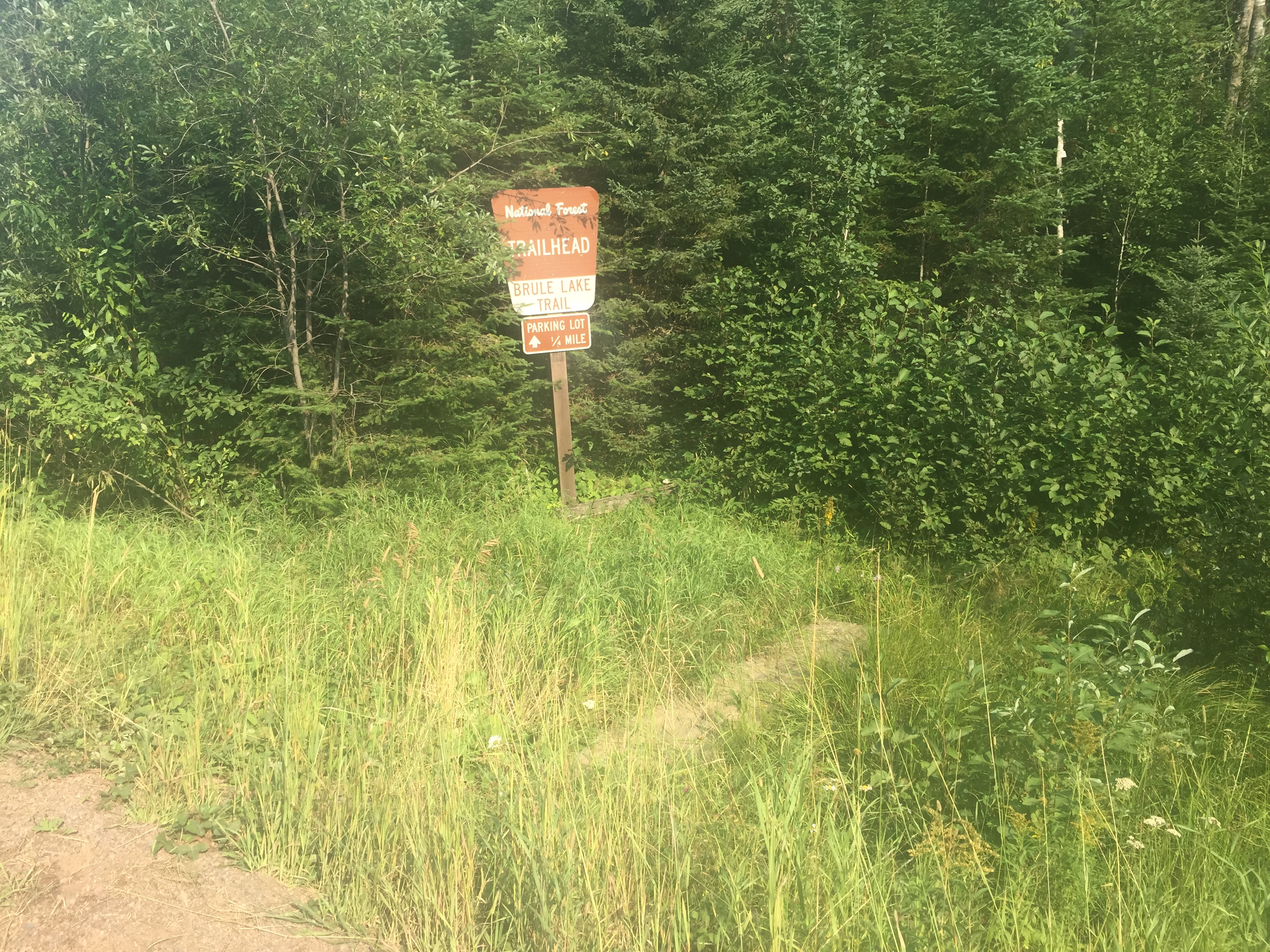
To reach the actual Brule Lake Trailhead from the Brule Lake end of the trail, follow the Brule Lake Road a bit over a 1/4 mile, beginning at the BWCA Entry Point 41 parking lot. At that point, you'll see this sign (shown below) on your left.
Shortly after you walk off the road (Brule Lake Road), you come to this permit box. You can see the trail leading into the woods just to the right of the permit box. The Brule Lake Trail is 6.7 miles long from this trailhead to the intersection with the Eagle Mountain Trail. It is another 2.8 miles from there to the Eagle Mountain Trail parking lot (BWCA Entry Point #79).
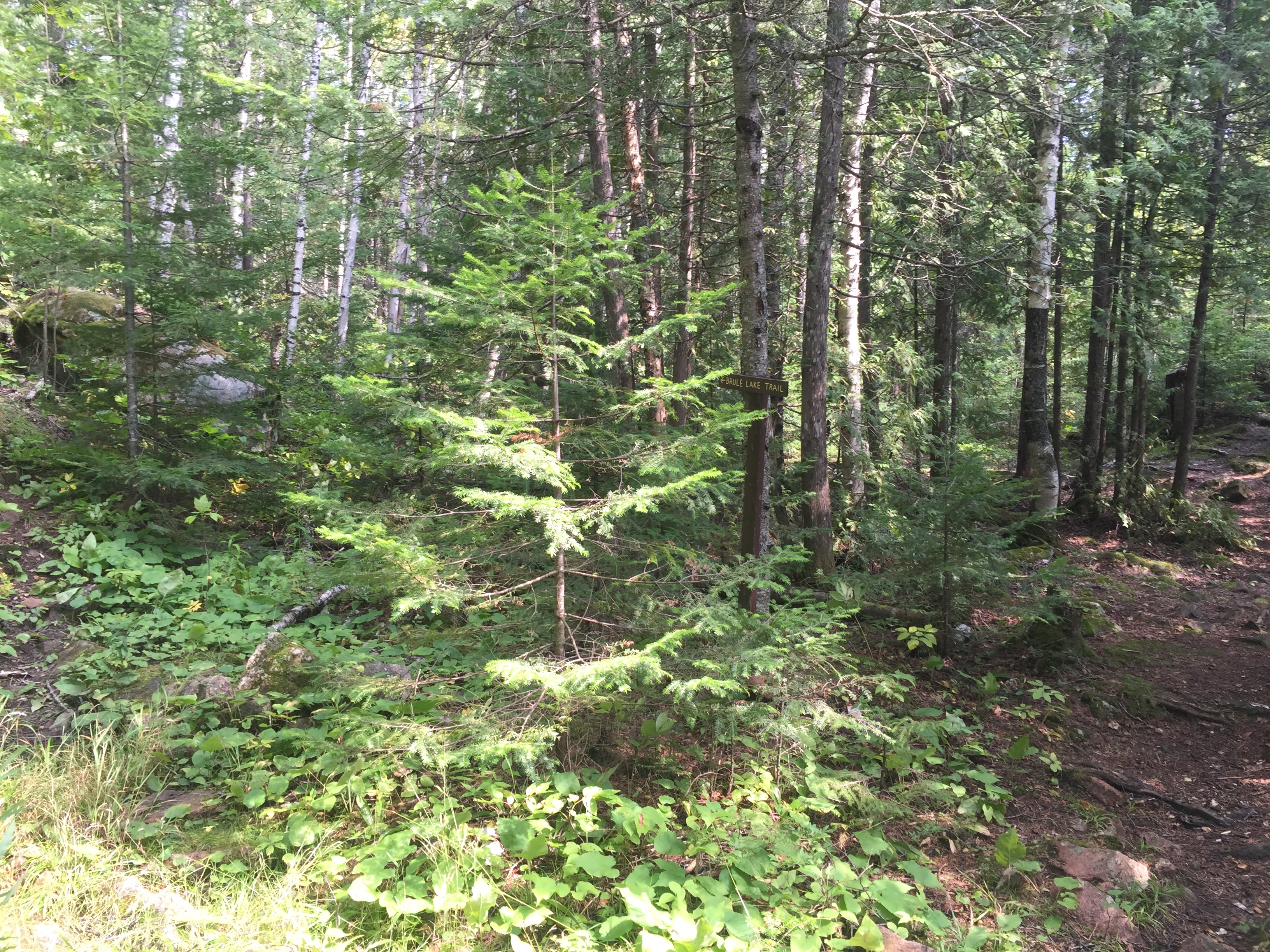
Standing on the road, there is a wood plank that crosses a ditch that leads up to this sign and day permit box. This is located just a few feet into the woods. This is the official trailhead for the Brule Lake Trail. The parking lot is a little over one-quarter mile up the road from here (it's the same as the Brule Lake entry point parking lot).
This section of the Brule Lake Trail begins at the Brule Lake Trailhead and continues until reaching the access trail leading to the Fishhook Lake campsite.
This is the start of the access trail leading to the Fishhook Lake Campsite. It is easy to spot this location as you hike along the Brule Lake Trail, so you probably won't walk by it if you are looking for a place to camp. This is the only campsite along this trail. There are also two other campsites along the connected Eagle Mountain Trail.
HIKING FROM FISHHOOK LAKE CAMPSITE TO THE NORTH BRANCH CASCADE RIVER CROSSING
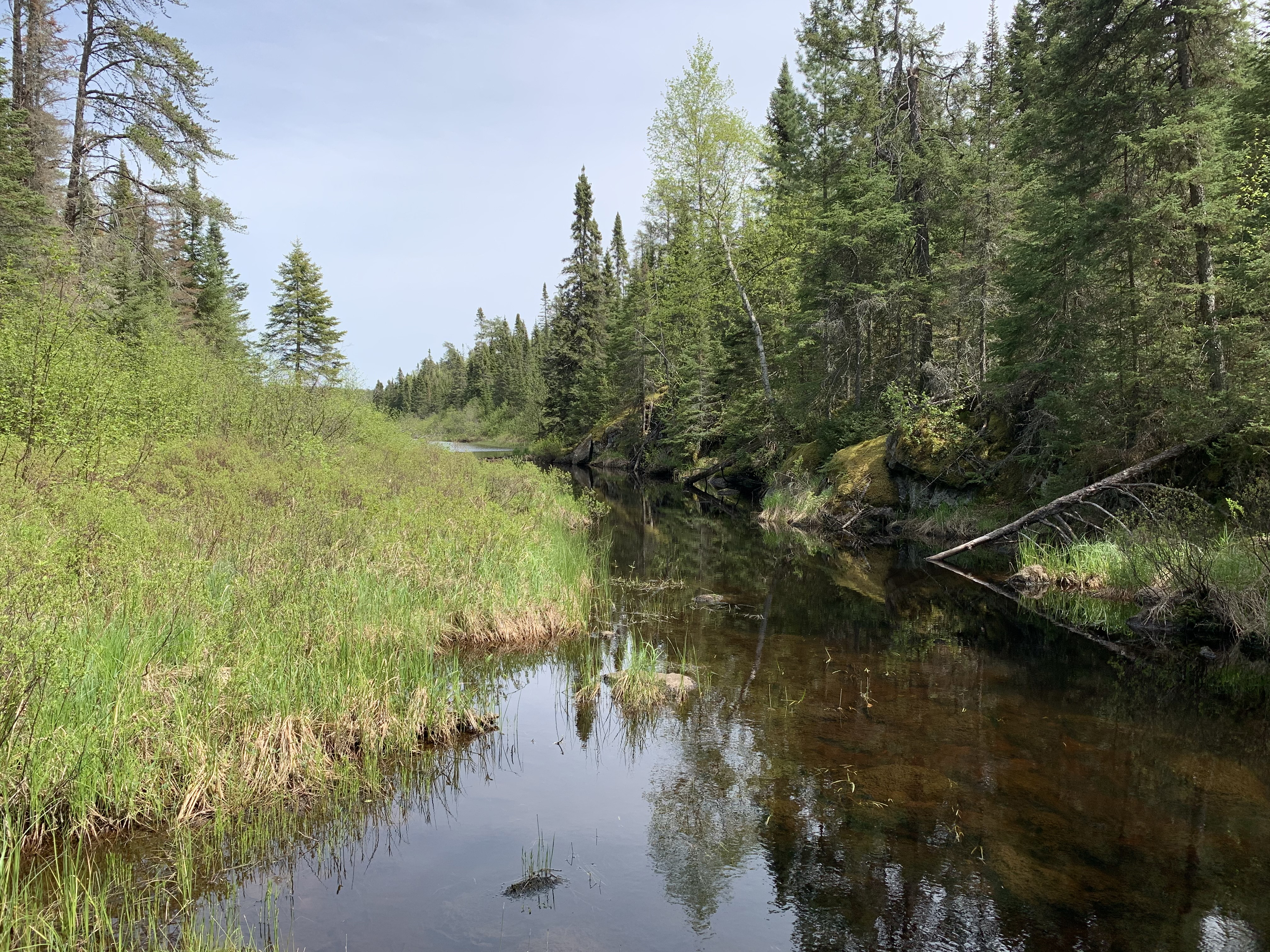
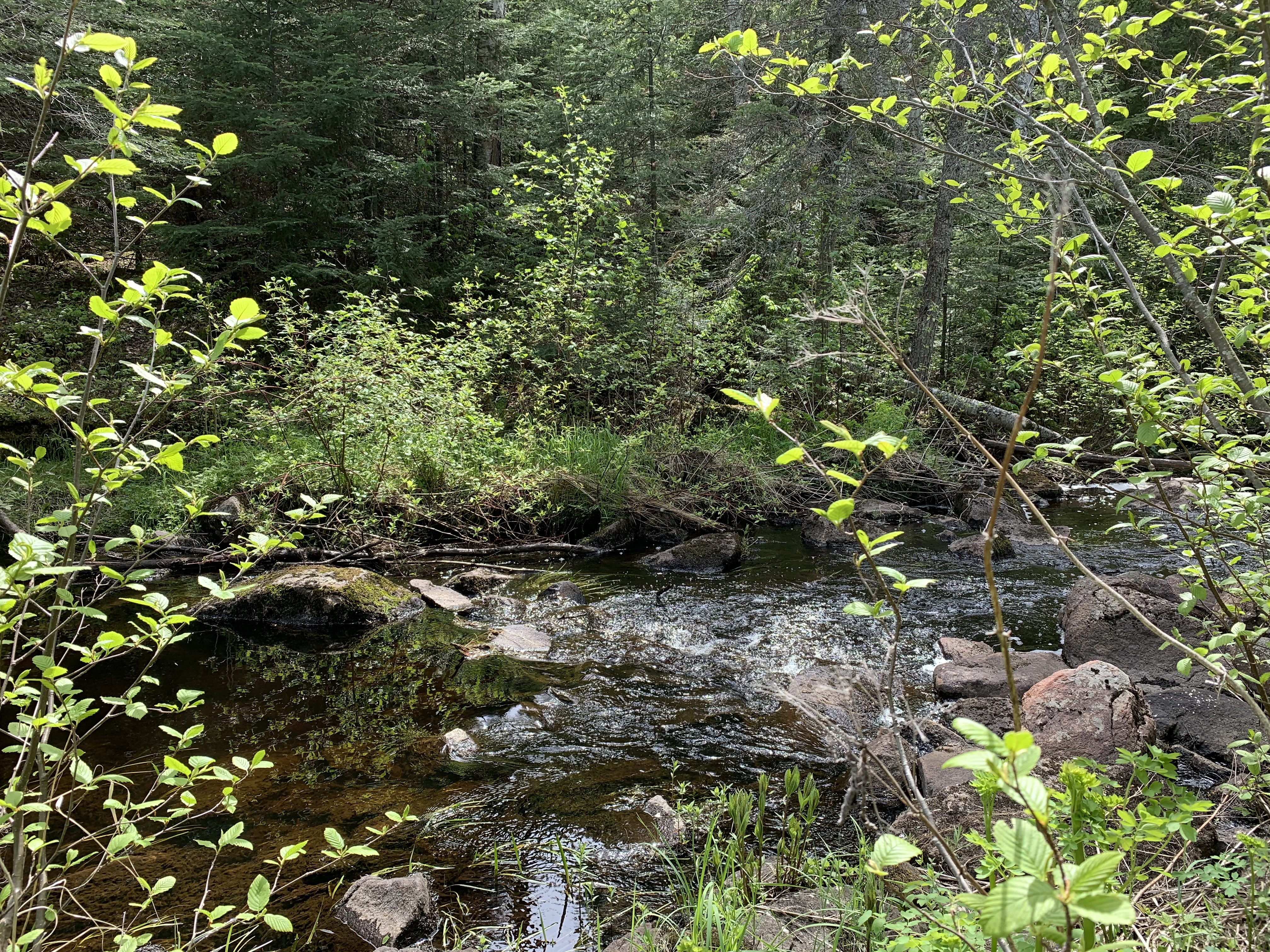
This is the North Branch Cascade River. The view here is upstream from the location where the trail crosses the river (which is about 10 feet to your right out of view).
Hiking Brule Lake Trail from the Fishhook Lake campsite access trail junction to the North Branch Cascade River crossing.
Picking your way across these boulders at the head of these small rapids is probably the easiest place to make your way across the river.
If you plan to continue on to the Eagle Mountain Trail and then to the summit of Eagle Mountain, you will be able to see the North Branch Cascade River from a different perspective.
HIKING FROM THE NORTH BRANCH CASCADE RIVER CROSSING TO THE EAGLE MOUNTAIN TRAIL JUNCTION
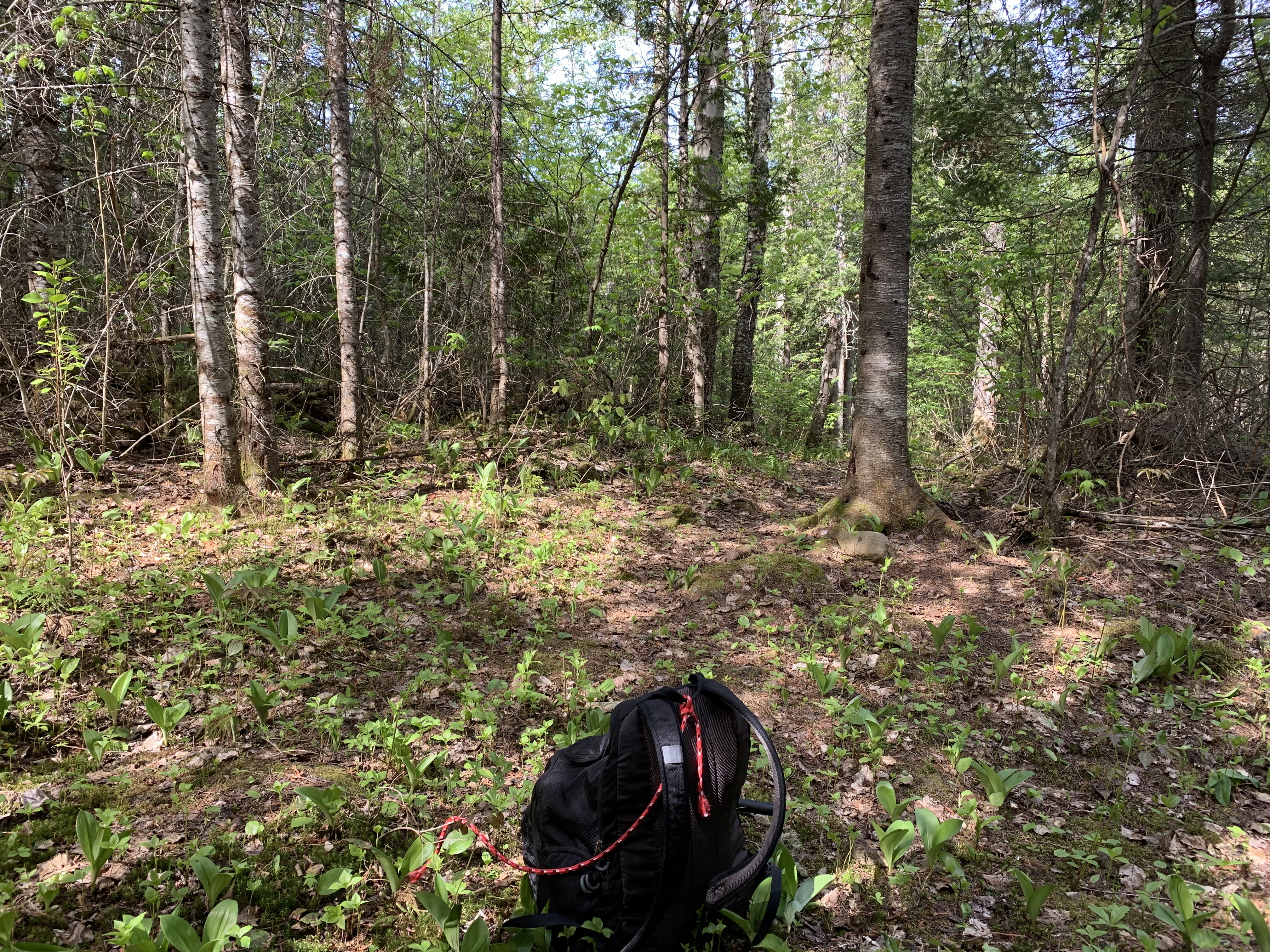
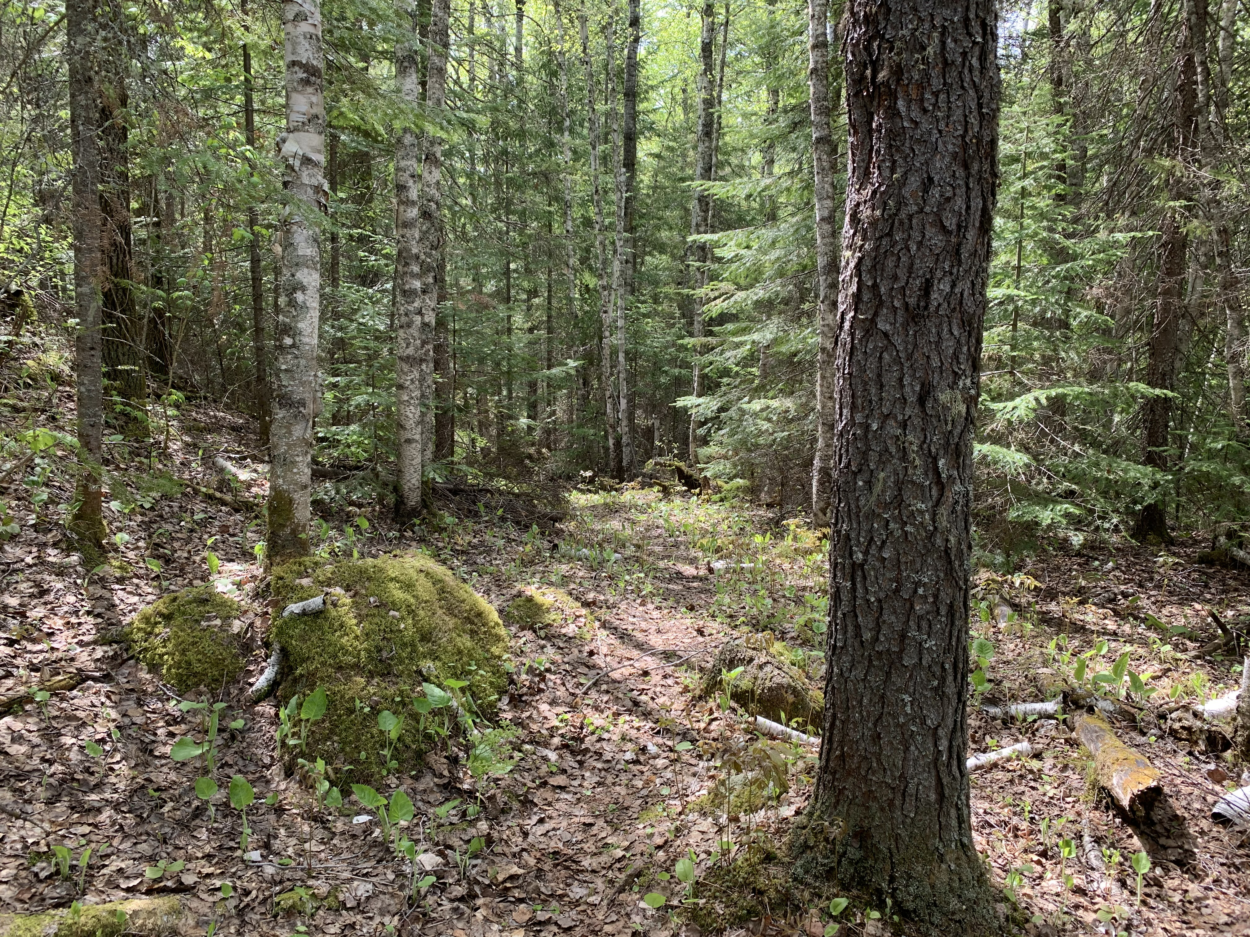
Typical trail view in late spring. This is about 1.3 miles from the junction of the Brule Lake Trail and the Eagle Mountain Trail (May 27, 2021).
PART ONE:
After crossing the North Branch Cascade River, continue hiking toward the junction with the Eagle Mountain Trail. This section is shown as a two part video. The first part was recorded in late May. The second part (shown below) was recorded in early April when there were still a few piles of snow on the ground.
PART TWO:
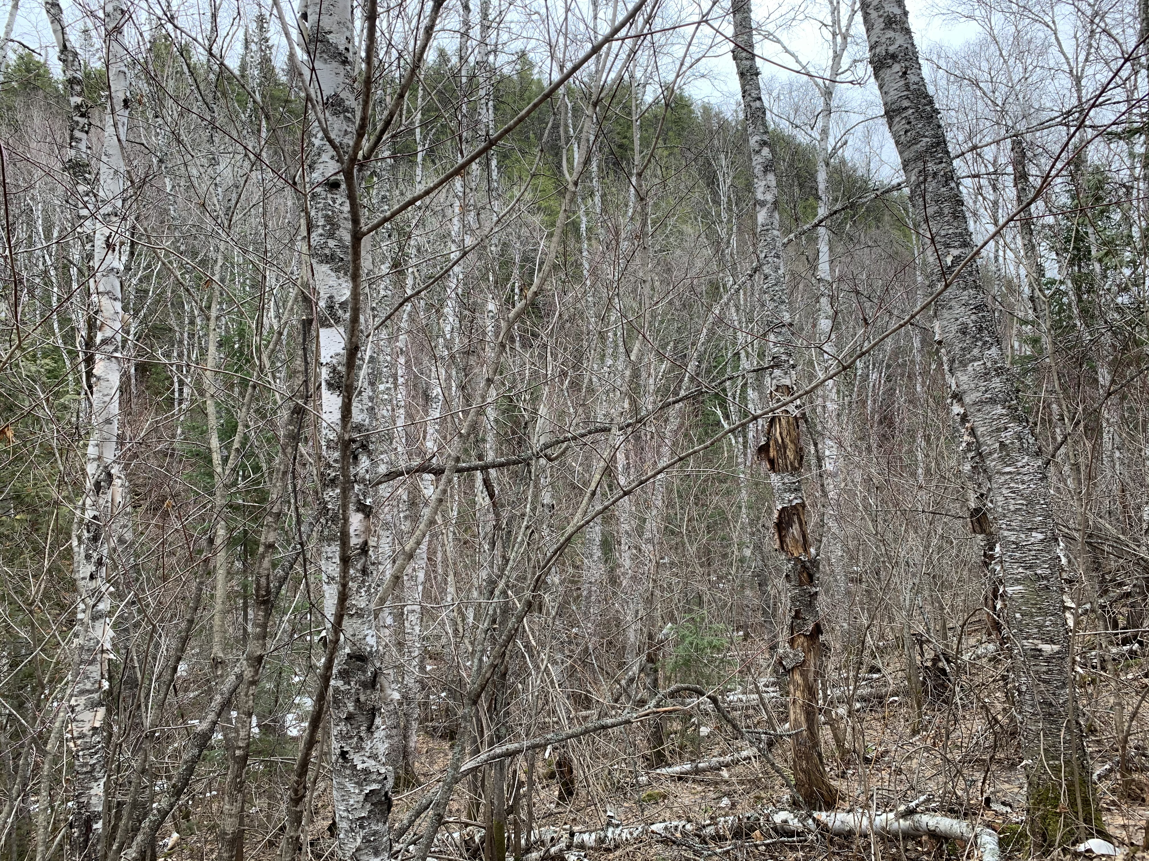
This is the last 1.3 miles of the Brule Lake Trail before reaching the junction with the Eagle Mountain Trail near Whale Lake. Before reaching the junction, this trail passes to the east of Eagle Mountain and to the west of Point 2220, an unnamed sister peak of Eagle Mountain, through a forested valley. This section of the trail was recorded in early April, while the video shown above was recorded in late May of the same year. Therefore, a little snow is left in places. This video picks up exactly where the video above leaves off, traveling in the same direction.
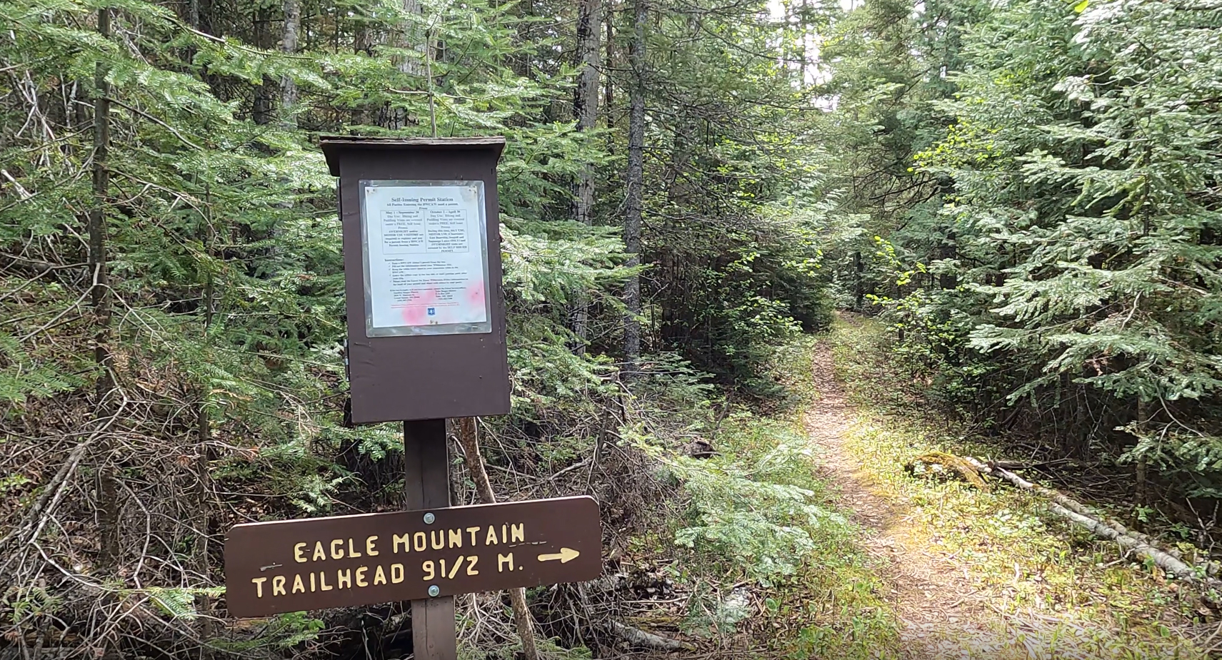
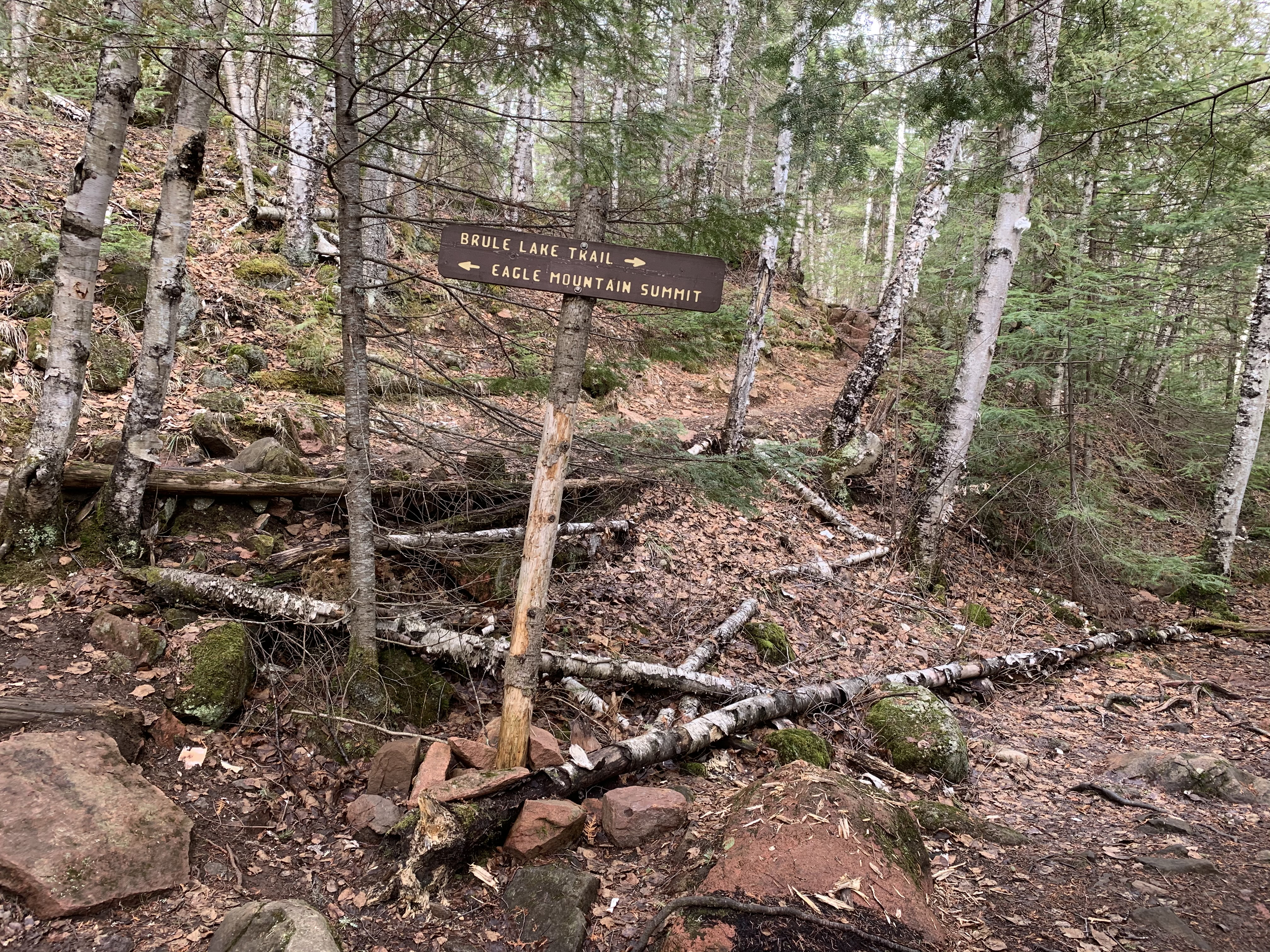
Junction of the Brule Lake Trail and the Eagle Mountain Trail. The Eagle Mountain Trail heads up in the middle of your view toward the summit. The Brule Lake Trail heads off to your right from whence you came.
Hiking the Brule Lake Trail (Eagle Mountain Trail junction to Brule Lake)
Click on the photos below to see the full resolution image - Use your browsers back button to close photo and return to this page.
HIKING FROM THE EAGLE MOUNTAIN TRAIL JUNCTION TO THE NORTH BRANCH CASCADE RIVER CROSSING
Junction of the Brule Lake Trail and the Eagle Mountain Trail. The Eagle Mountain Trail heads up in the middle of your view. The Brule Lake Trail heads off to your right.
The small sign near the middle of your view points out that the Brule Lake Trail goes to the left here. The trail on the right is the trail leads to the campsite on the north side of Whale Lake. It was very difficult to follow the Brule Lake Trail on this end, at the time of last visit. The trail becomes much easier to follow after about 1/4 mile. To ensure you stay on the trail, know that you are hiking up to a low ridge that overlooks a valley. To your right as you head toward Brule Lake will be Point 2220, a mountain nearly as high as Eagle Mountain. Use it as a guide until the trail becomes more clear. Also look for sawn logs, a sure sign that you are on the trail. The cut logs are mostly the work of trail clearing crews.
PART ONE:
This is the first 1.3 miles of the Brule Lake Trail starting from the junction with the Eagle Mountain Trail and ending about 0.6 miles before reaching the North Cascade River crossing. This is heading in the direction of Brule Lake.
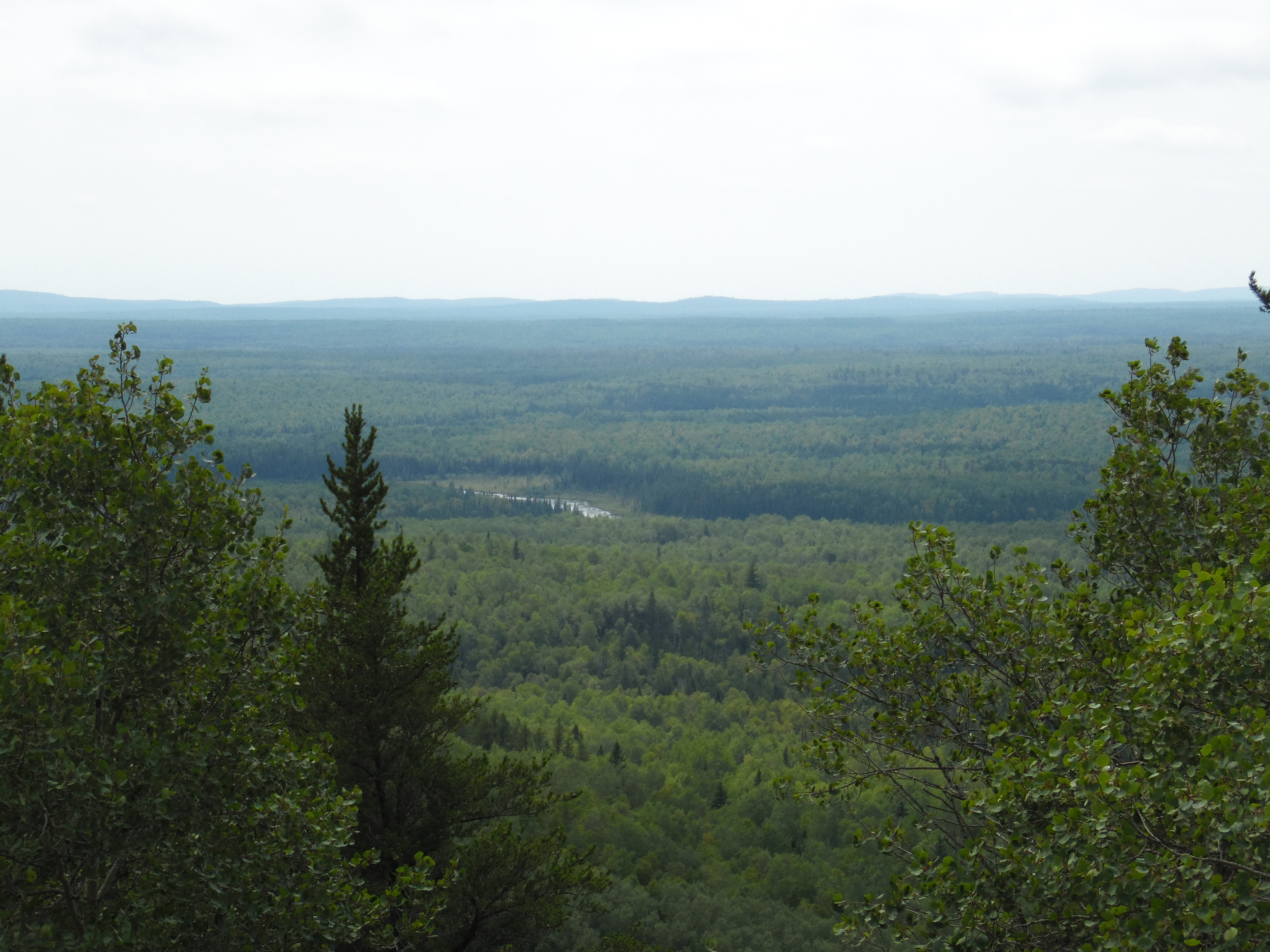
As you head along the trail, this mountain will be visible on your right (assuming you are hiking toward Brule Lake) shortly after leaving the junction with the Eagle Mountain Trail. This is Point 2220 (an unnamed mountain/hill). If you hiked the Eagle Mountain Trail, this is the same mountain you saw across Whale Lake (see photo below), but now you are up close to it. The Brule Lake Trail threads through the valley between the backside of Eagle Mountain and Point 2220. The name is derived from its height, which is 2,220 feet. It is 82 feet shorter than Eagle Mountain (depending on how accurate the surveyors were). The trail elevation is about 2,020 through here, so Point 2220 is rising about 200 feet above you.
View of Point 2220 from across Whale Lake along the Eagle Mountain Trail. The Brule Lake Trail runs just to the left of Point 2220 in that notch. Eagle Mountain is off to your left.
View of the trail on April 10, 2021. This was an early spring; it is usually much snowier still at this time of year. The view shown here is 0.6 miles before reaching the North Branch Cascade River crossing. Note that North Branch Cascade River often floods in the spring or after heavy rains. This flooding can make this water crossing difficult or impossible.
PART TWO:
The rest of the stretch of trail until reaching the North Branch Cascade River crossing was recorded about six weeks later in late spring. This video picks up right where Part 1 (above) leaves off.
View upstream of the North Branch Cascade River.
HIKING FROM THE NORTH BRANCH CASCADE RIVER CROSSING TO THE FISHHOOK LAKE CAMPSITE
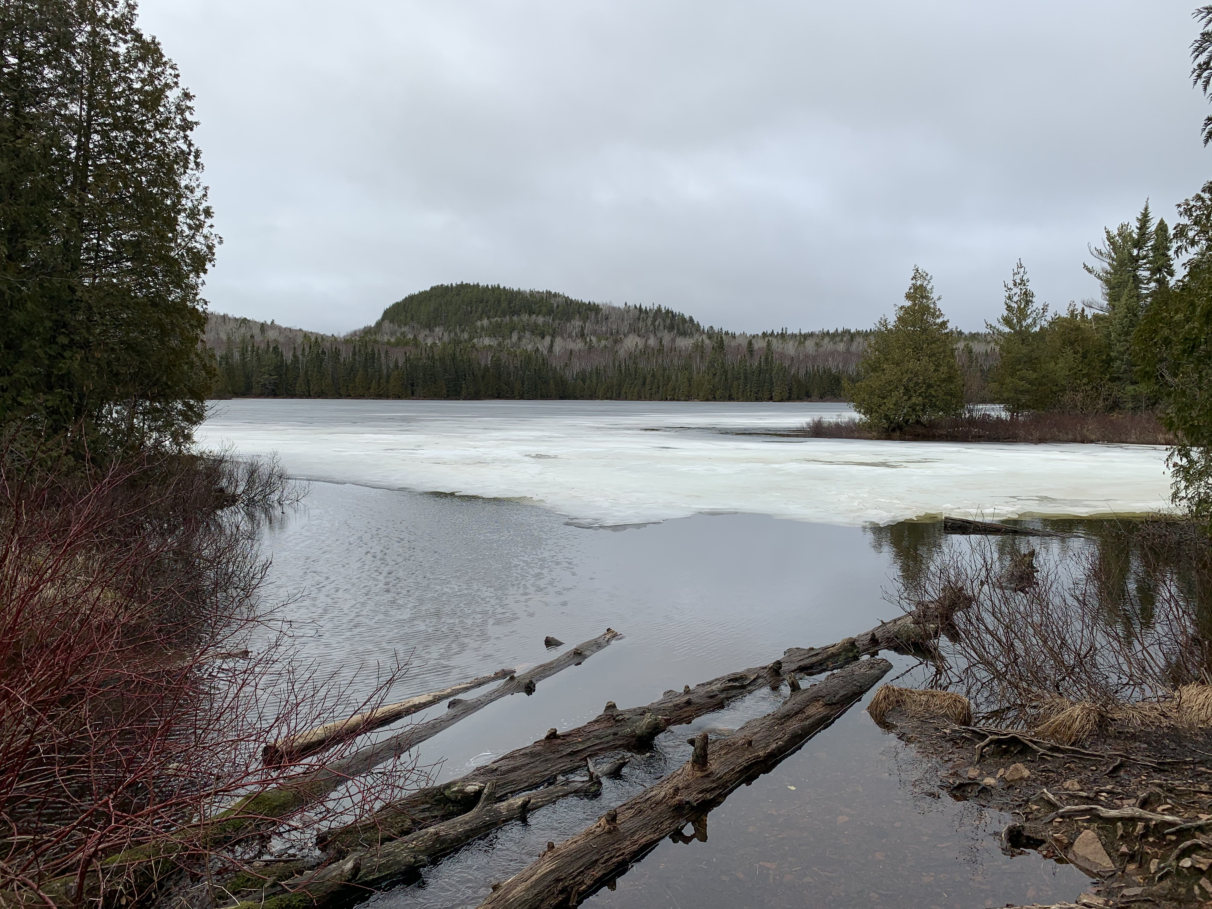
There is a short path off the Brule Trail that leads to this pond. This is actually just a wide, slow section of the North Branch Cascade River. This is about 2,000 feet downstream of where the river flows out of the east end of Fishhook Lake.
Hiking from the North Branch Cascade River to the start of the access trail that leads to the campsite on Fishhook Lake. The access trail to the campsite is easy to spot.
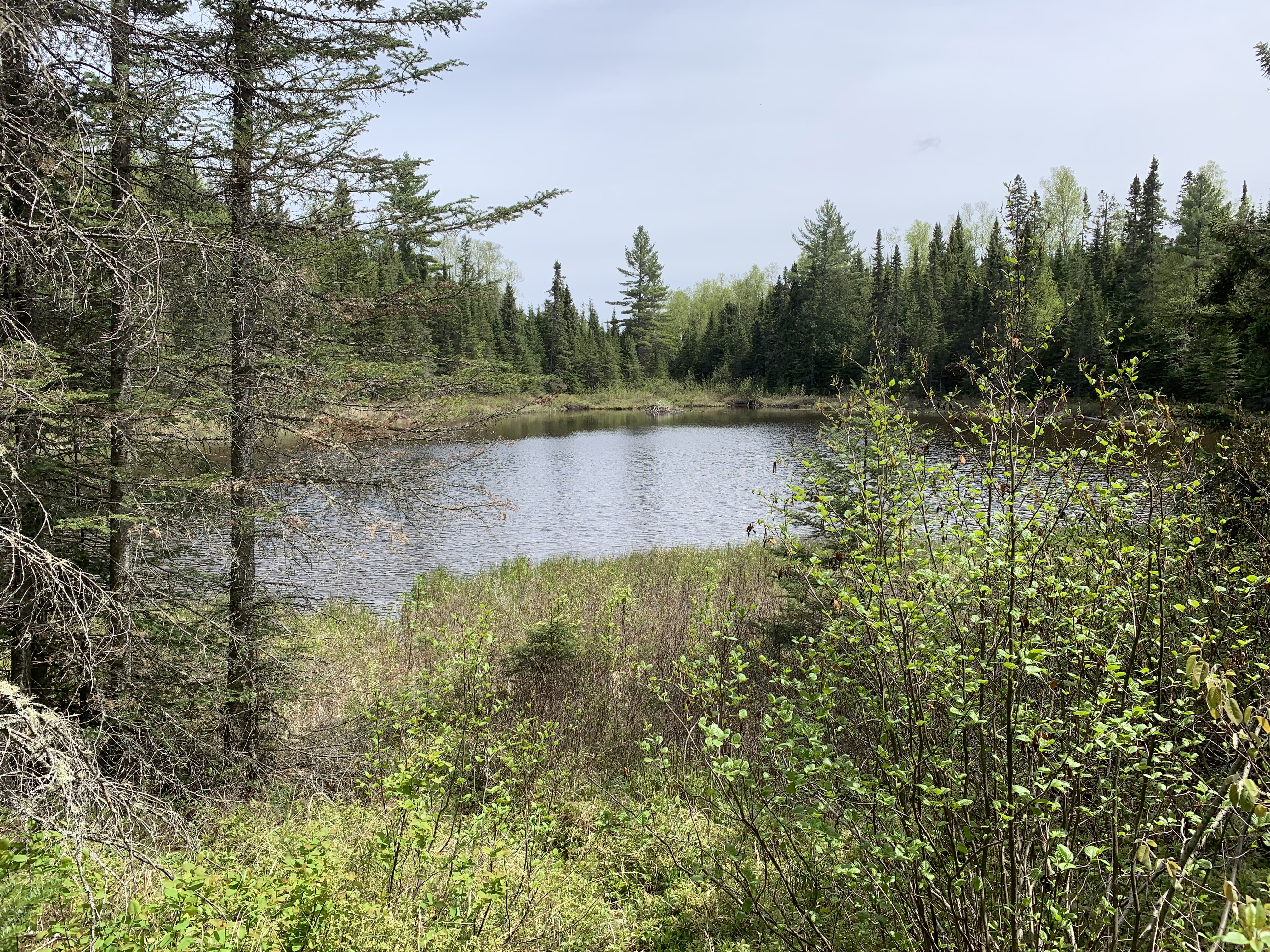
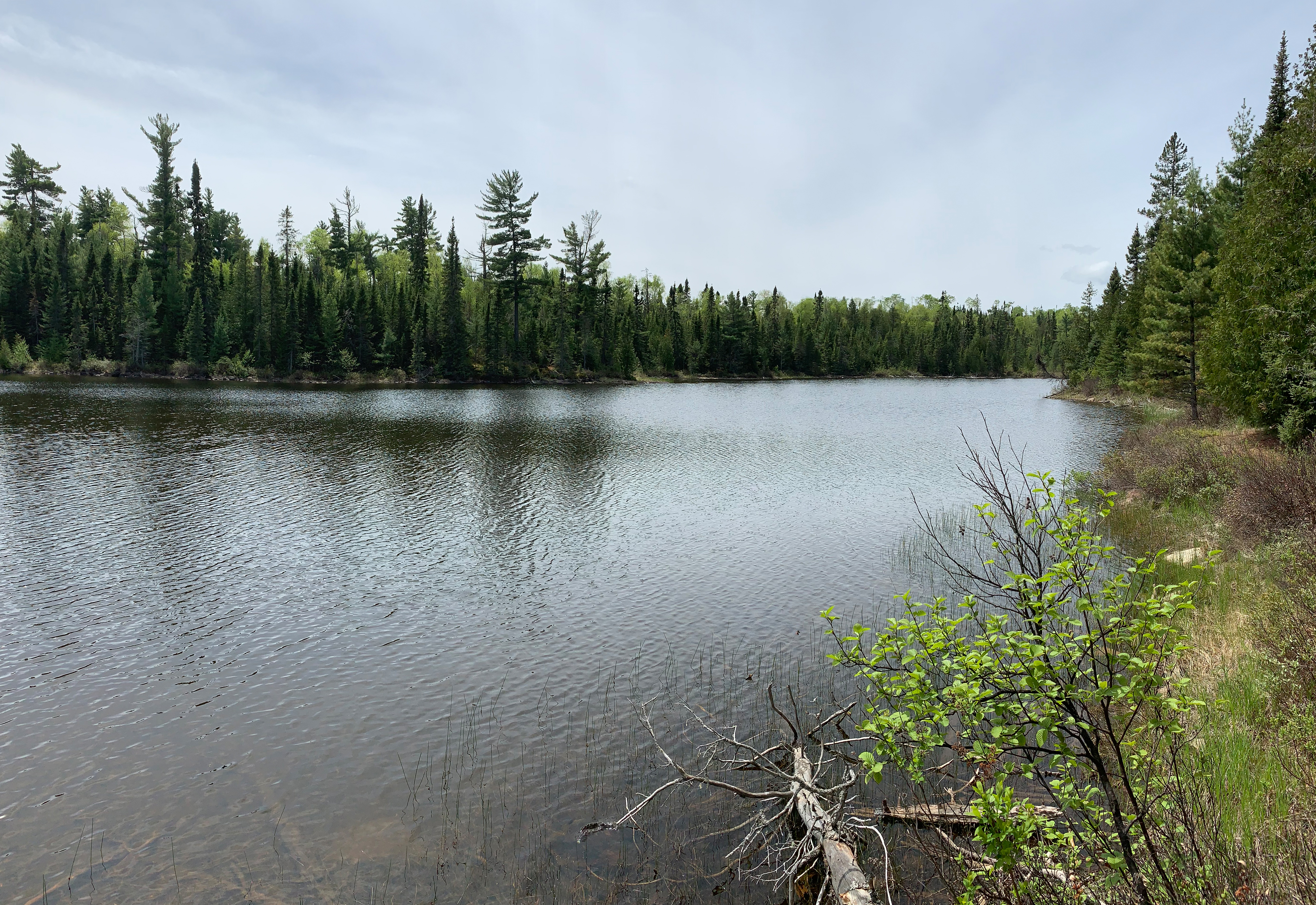
You can see Fishhook Lake from along the Brule Lake Trail. But the best views are had by walking out to the campsite that is on the point on Fishhook Lake.
HIKING FROM THE FISHHOOK LAKE CAMPSITE TO THE BRULE LAKE TRAILEAD
Once you get back to the Brule Lake trailhead, you will have to still walk a little over 1/4 mile back to the parking lot at Brule Lake.