Portage from Lake Superior to the Pigeon River (The Grand Portage)
Length in Rods: 2,720 rods (about 8.5 miles)
Start: Lake Superior at Fort George
Rating: Easy (It is kinda long though)
End: Pigeon River at Fort Charlotte
Date portage was last visited: August 24, 2020; Previous Visit(s): August 22, 2015
The Grand Portage
Fort George on Lake Superior to Fort Charlotte on the Pigeon River
The Grand Portage has probably been used for over 2,000 years. Originally, Native Americans used it to travel from Lake Superior inland to their hunting areas. To them it was called Gichi-onigaming (the Great Carrying Place). Much later, about 350 years ago, The Grand Portage was used by the fur traders (the French up until 1763 and British after that) to travel from Lake Superior to the interior lakes, where fur-bearing animals could be found and trapped.
Starting in 1731, French explorers began arriving around the area of present day Grand Portage. One of the first to arrive was an expedition led by Pierre Gaultier de la Verendrye, along with this sons. Verendrye explored the route from Grand Portage west to Rainy Lake. In 1732 Verendrye's group established Fort St. Charles on the Northwest Angle of Lake of the Woods. More French voyageurs arrived over the next 25 years. Several more forts were established on interior lakes (i.e. Saganaga Lake, Basswood Lake, Little Vermillion Lake, Rainy Lake). These forts were built for protection from the Dakota tribes. In the mid-1730's the Ojibwe tribes moved northward into this region too resulting in battles between them and the Dakota (Sioux). By the start of the 1760's, British fur traders began to arrive in the area.
To facilitate the fur trading business, Fort George was established on Lake Superior in the protected waters of Grand Portage Bay. The first post was constructed in 1768 by an Englishman named John Askin. The British now controlled this part of what was to later become northeastern Minnesota because of the Treaty of Paris signed in 1763. That treaty ended the French and Indian War that was fought between France and Great Britain. In 1779, the Northwest Company built what was to become Fort George, named after the king of course, King George III.
At Fort George, furs were processed so that they would be able to survive transport to the east end of the Great Lakes (a nearly 2,000 mile journey accomplished by using 36 foot Montreal canoes). From there, the furs were sold at markets. Smaller canoes were used on the western end of The Grand Portage to reach the interior lakes and the fur trapping areas. A second fort was established 8.5 miles inland from Lake Superior on the Pigeon River. This was Fort Charlotte (named for the queen of King George III) and it was much smaller than Fort George. Fort Charlotte was still standing in 1793, but by 1823 a surveyor could hardly find any sign of the place. The Grand Portage connects these two forts. The Grand Portage exists to avoid having to do many short portages along the Pigeon River. This is because the lower 21 miles of the Pigeon River has a large number of rapids and several major waterfalls.
These two forts and The Grand Portage were only heavily utilized from about 1780 until 1803. The North West Company, based out of Montreal, Quebec, whom operated this fur trading business, voted at that time to move their operations north to Canada. The newly formed United States had won the Revolutionary War by this time and the British were not welcome in what was now considered part of U.S. territory. In 1804 the Northwest Company over operations further north, into Canada, at a post named Fort Williams. This fort was located on the Kaministiquia River and became known as the Kaministiquia Route. That route followed the river of that same name from Lake Superior upstream to the interior lakes. The Kaministiquia Route and The Grand Portage route intersected at the U.S. - Canadian Border at Lac La Croix. From Lac La Croix, the two routes followed the same path further to the west along the border.
The other portage of great importance to the fur trade was the Methye Portage discovered by Peter Pond in 1778. The portage connected the MacKenzie River basin (rivers emanating from Lake Athabasca and Great Slave Lake) that flow toward the northwest, with rivers flowing to the east toward the Atlantic (and providing access to routes through what is now the BWCA and Voyageurs National Park).
SOME INFORMATION ABOUT HIKING THE GRAND PORTAGE:
A virtual walk of the entire Grand Portage in real time is found in the following sections. The actual trail starts across the road behind the reconstructed Fort George on the opposite side of the fort from Lake Superior. The entire walk took just over 3 hours with all the stops edited out of the videos. However it will take most hikers at least 4 hours in one direction as you need to stop and rest, eat and take in a few of the sights along the way. There are no restrooms until you reach the Fort Charlotte Campground on the Pigeon River. Budget at least 8 to 10 hours if you plan to hike the whole Grand Portage in one day. There are a couple streams crossed along the way in which to filter water, as well as the Pigeon River at Fort Charlotte. Better to probably carry as much liquid as you'll need. It's a little over 17 miles round trip. Makes for a great two day backpack or a very long day hike.
The trail that makes up the Grand Portage is kept in great condition by the U.S. National Park Service. However, this is no flat trail. If you have been to the Boundary Waters Canoe Area, the quality and difficulty of the Grand Portage trail is on par with the easier, best maintained BWCA portages. There are plenty of hills to go up and down along The Grand Portage. You will encounter many muddy spots, especially after a good rain. There is always some blowdown along the route too. Oh yeah, there can be plenty of bugs too. But the main thing that makes The Grand Portage a challenge is that it is just plain loooooong! If you want to break the hike into more than one section, it is possible to park a car along Old Highway 61 and hike from that point. Old Highway 61 intersects The Grand Portage near the mid-point of the trail.
References:
Bolz, J. Arnold, Portage into the Past (Minneapolis: University of Minnesota Press, 1960).
Heinselman, Miron, The Boundary Waters Wilderness Ecosystem (Minneapolis: University of Minnesota Press, 1999), 43, 286-288.
Pauly, Daniel, Exploring the Boundary Waters (Minneapolis: University of Minnesota Press, 2005), 13.
Rom, William N., M.D., Canoe Country Wilderness (Stillwater: Voyageur Press, 1987), 99, 101-103.
Hiking the Grand Portage
Direction: From Fort George on Lake Superior to Fort Charlotte on the Pigeon River
The Grand Portage can also be hiked in the opposite direction from Fort Charlotte to Fort George on Lake Superior.
SHORE OF LAKE SUPERIOR AND FORT GEORGE TO THE GRAND PORTAGE TRAILHEAD (0.2 MILES)
This is the approximate view that voyageurs would experience as they approached Fort George after paddling across Lake Superior. The voyageurs would have been paddling their 30+ foot Montreal canoes. Their route began on the eastern end of the Great Lakes, a roughly 2,000 mile journal to reach this point. Once arriving at Fort George, the voyageurs swapped the big lake going canoes for smaller ones to travel the inland lakes (some of those lakes are now part of the Boundary Waters Canoe Area and Quetico Provincial Park).
Showing up after dusk usually meant you were spending the night outside the fort.
The entrance to Fort George. Fort George was where furs obtained from the interior (areas like the current day BWCA and Quetico) were accounted for, processed and packaged for their trip back to the eastern end of the Great Lakes and even Europe.
The main administrative building at the fort.
One of the Montreal canoes just to the right as you enter the east gate. These are the canoes used to traverse the Great Lakes. Smaller canoes were carried across The Grand Portage and used on the inland lakes..
The fur press contraption used to process the pelts brought through the fort.
This is the main building at Fort George. This is where business transactions were consummated and the administrative staff worked for the Northwest Company. Tower on the right guarded the west gate. If headed down The Grand Portage, head for that gate.
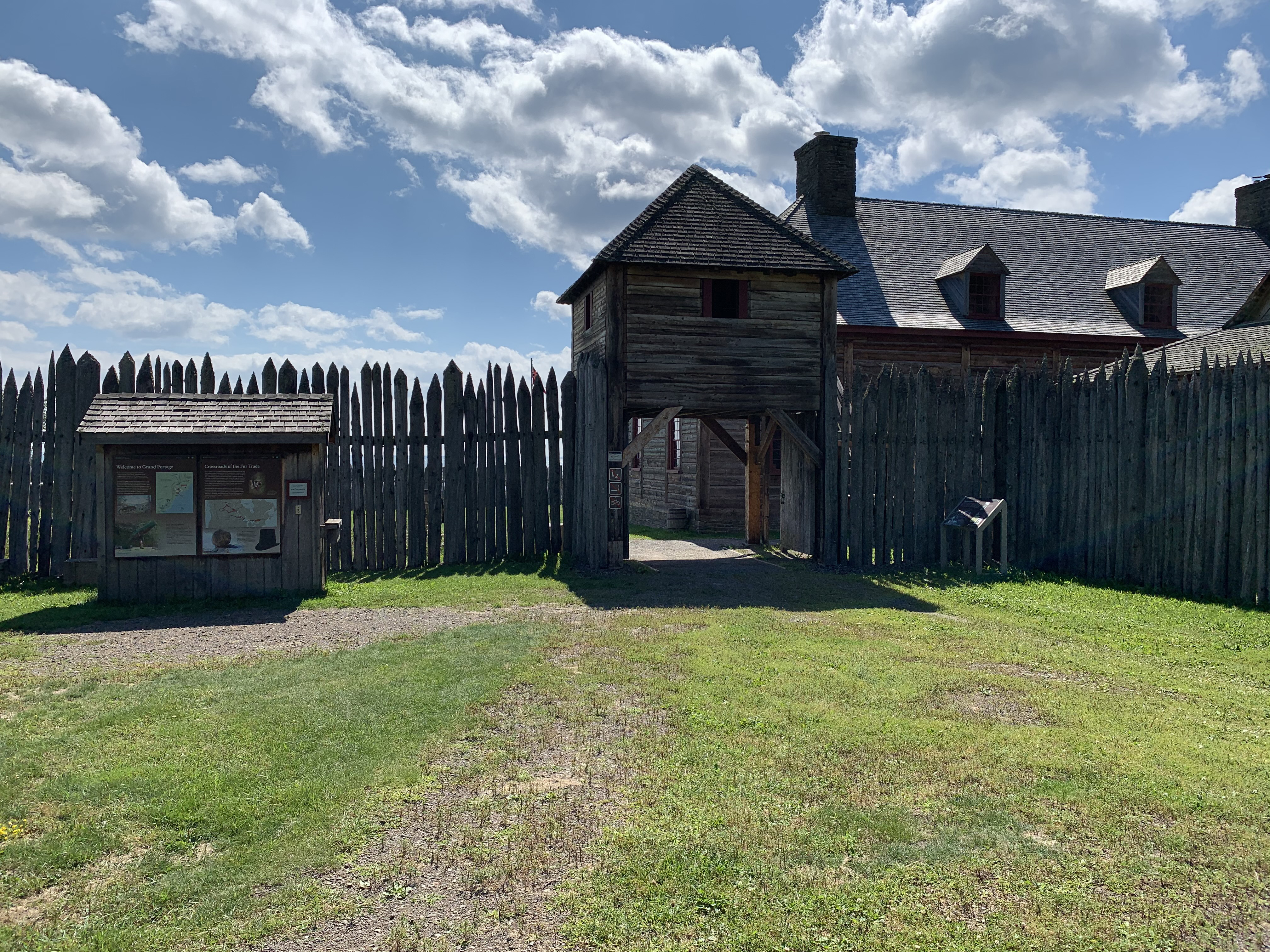
From the landing dock on Lake Superior, cut through Fort George and out the forts western gate. Proceed across the open field to the start of The Grand Portage. This is the gatehouse to Fort George on the inland side of The Fort. The Grand Portage starts back over your left shoulder. Just follow that gravel path (faintly visible at your feet to the left of center) away from the fort.
There are buildings outside the fort's walls too. These housed the trades folk who worked at the fort: Blacksmiths, tanners, skinners, etc. There were often some Native Americans camped around Fort George who also came here to participate in the trading.
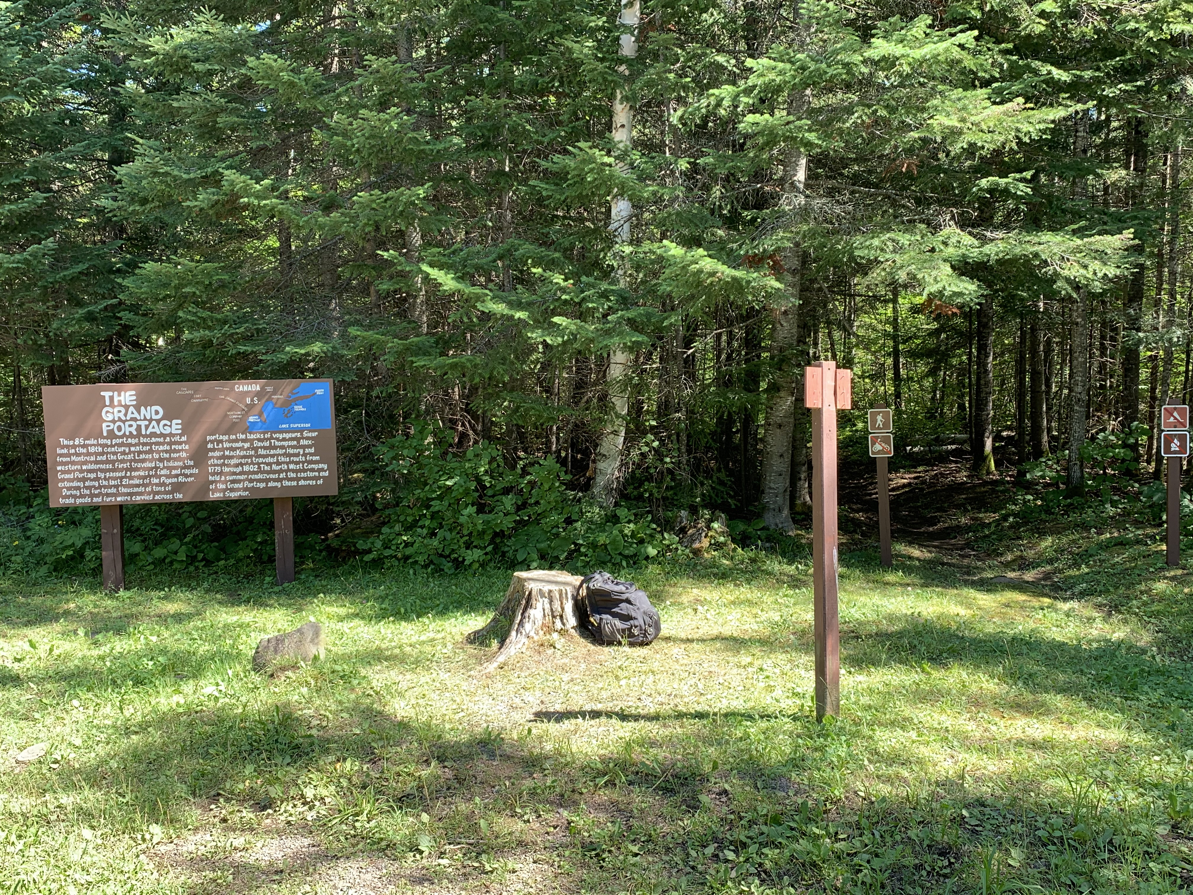
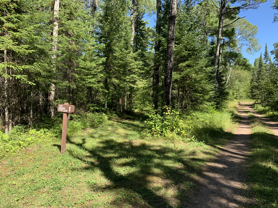
View of Fort George from across the road and right at the beginning of The Grand Portage.
Your hike begins here. It is 8.5 miles to the Pigeon River (2,720 rods) and Fort Charlotte along the U.S. - Canadian Border. (Note: This sign was here in August 2015, but it was not present as of August 2020. There is a similar sign at the Old Highway 61 crossing.)
THE GRAND PORTAGE TRAILHEAD TO MINNESOTA HIGHWAY 61 (0.8 MILES)
This is the trailhead for the portage. It is 8.5 miles to the Pigeon River (2,720 rods). Do not confuse Old Highway 61 for Minnesota Highway 61 as the sign indicates. You cross both of them. The Minnesota Highway 61 crossing is just under a mile down the trail past this sign (not mentioned on the sign). Old Highway 61 is also known as County Road 89 on modern maps.
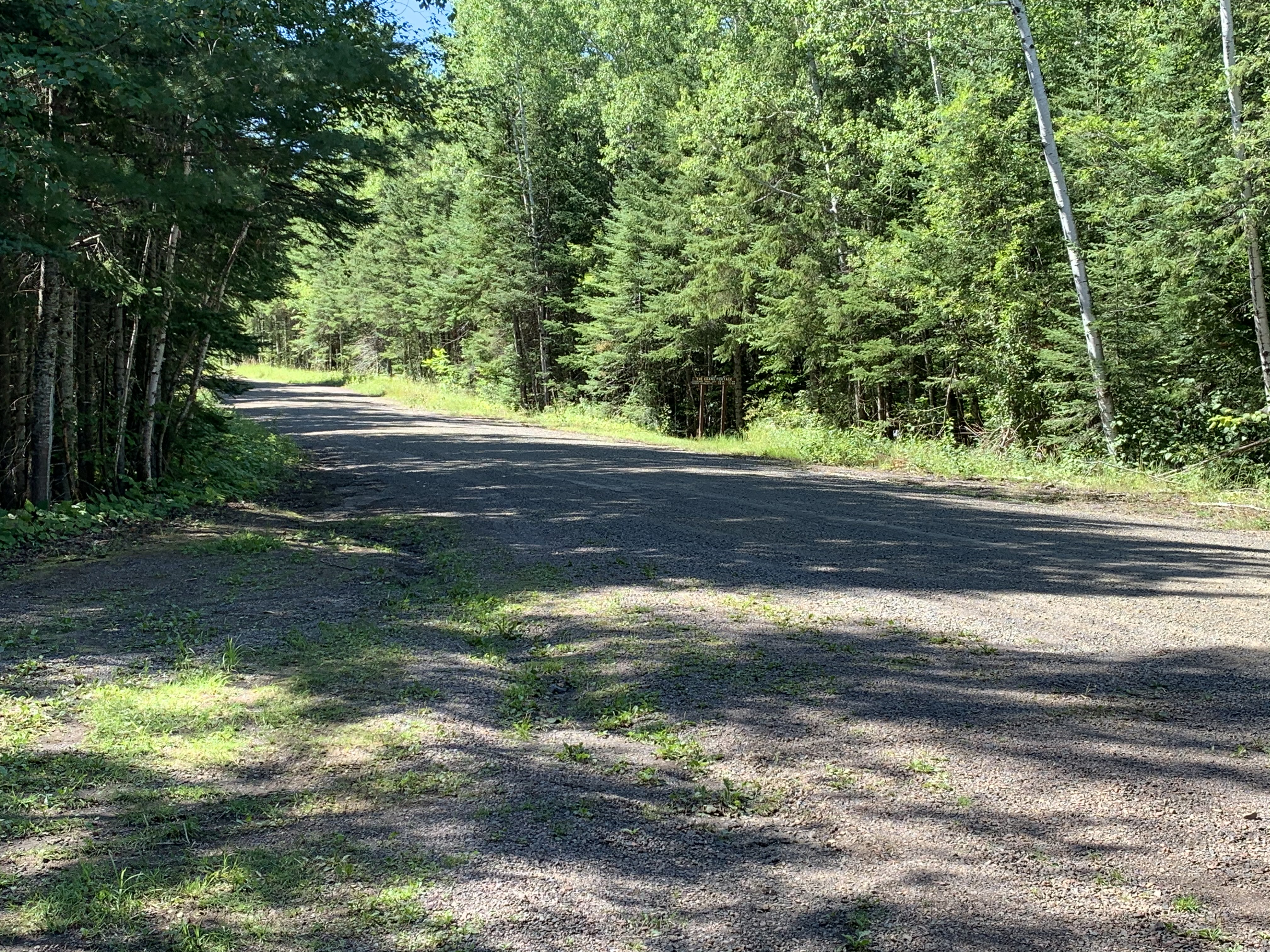
The first section of The Grand Portage goes from Fort George to Minnesota Highway 61. This is about an 0.8 mile hike, or around 260 rods.
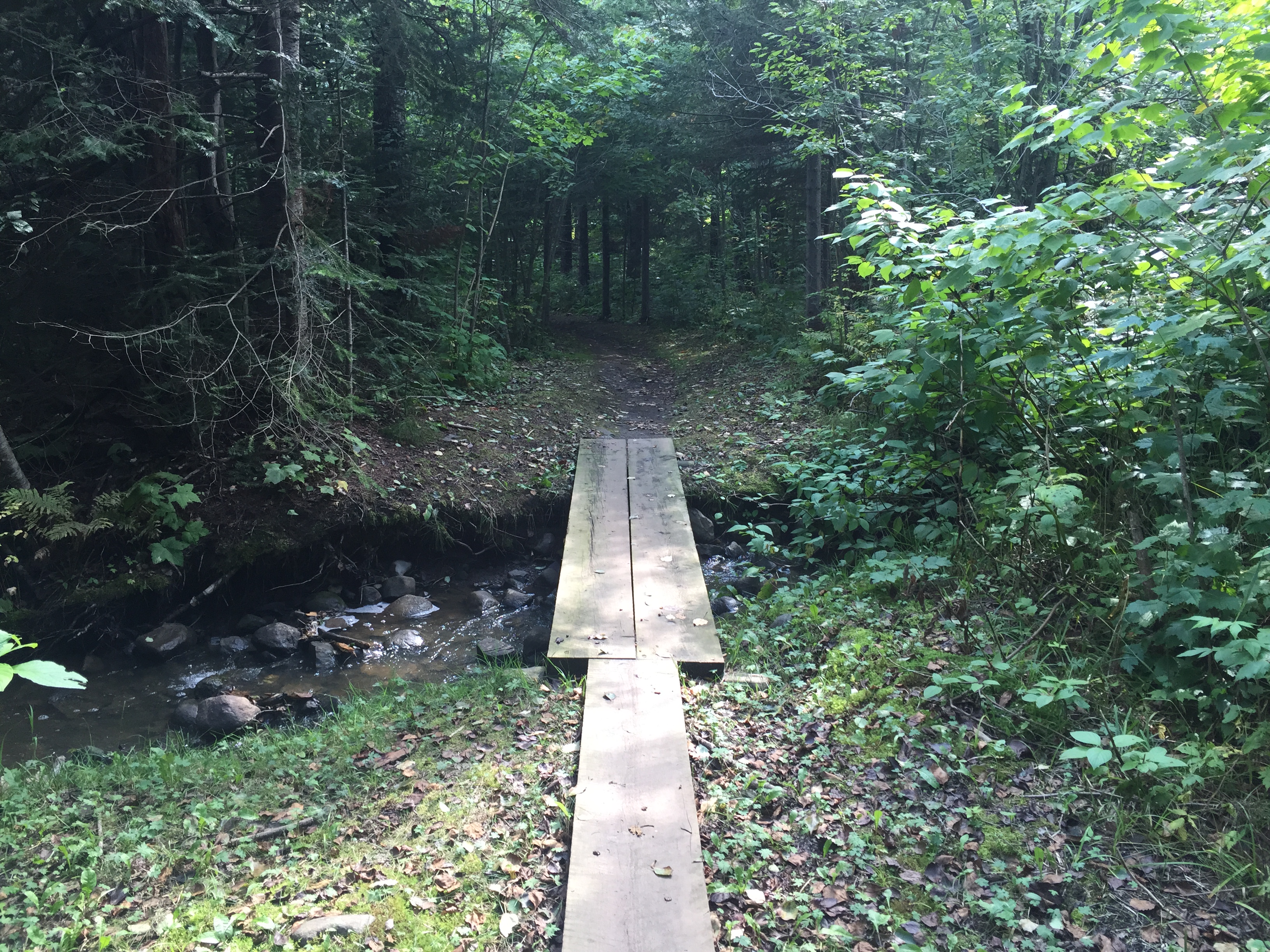
One of several make-shift bridges built to keep your feet dry, that are found along The Grand Portage.
Taking a break along another creek.
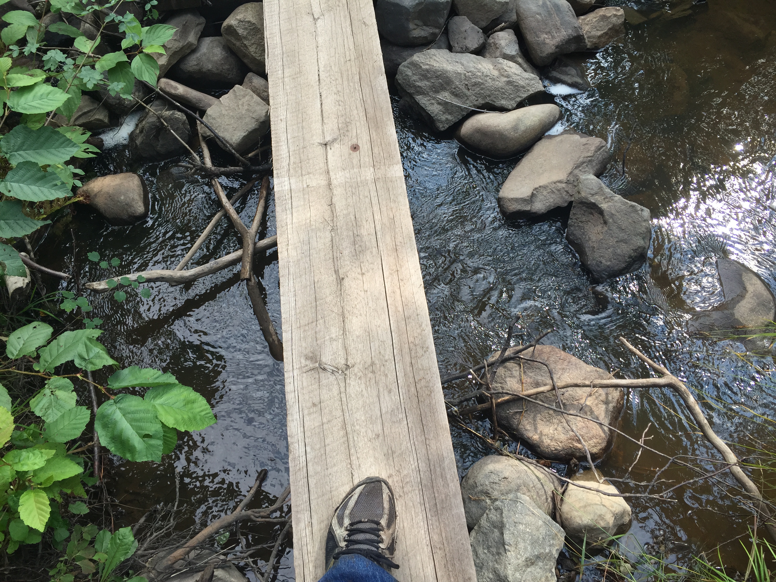
A single board bridge over a small creek.
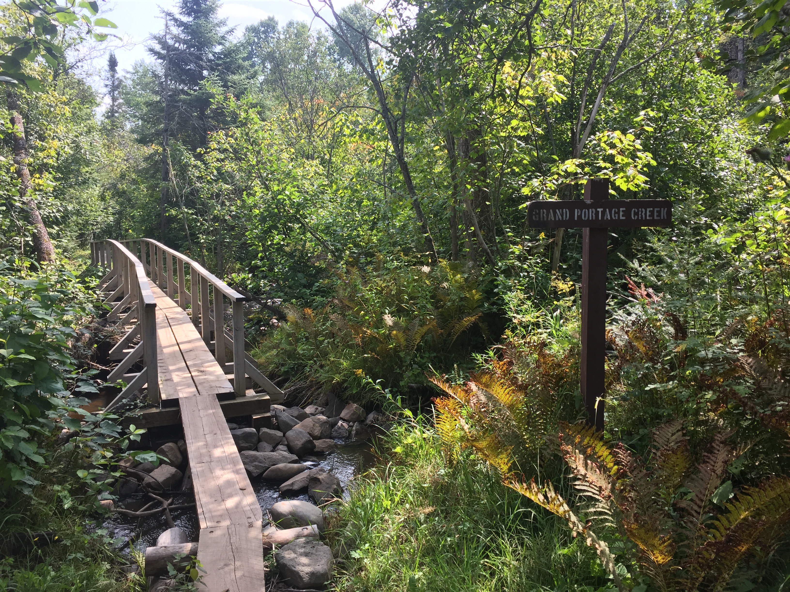
A larger creek that must be crossed. This one even has a name: Grand Portage Creek. The bridge is a little more elaborate.
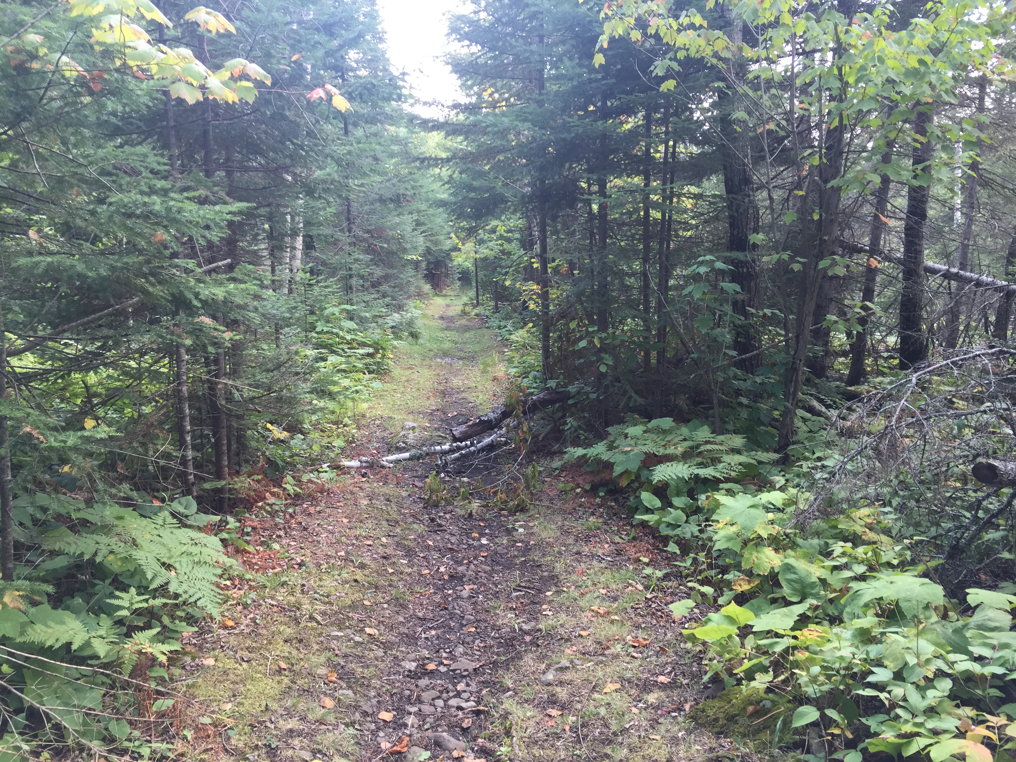
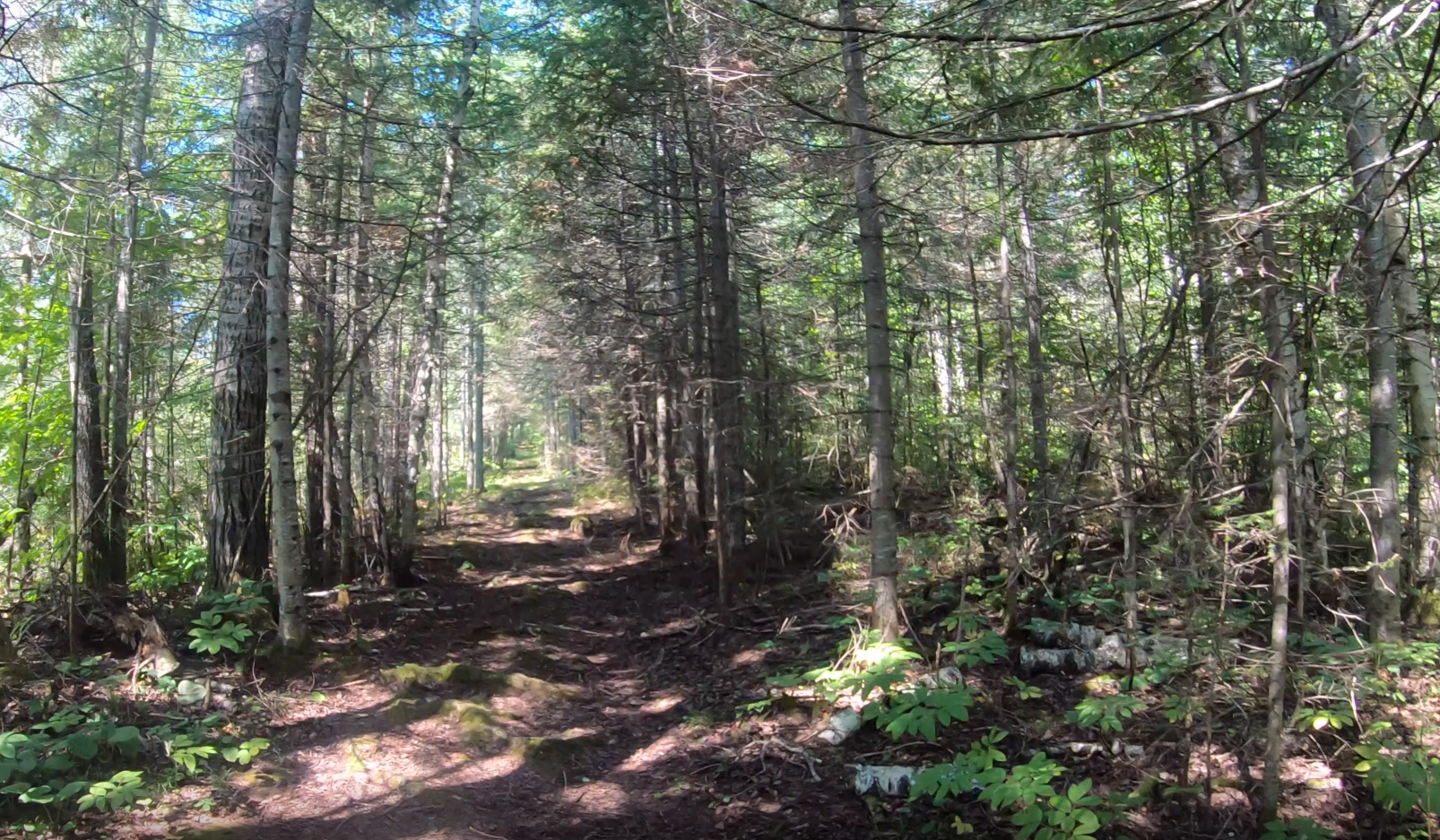
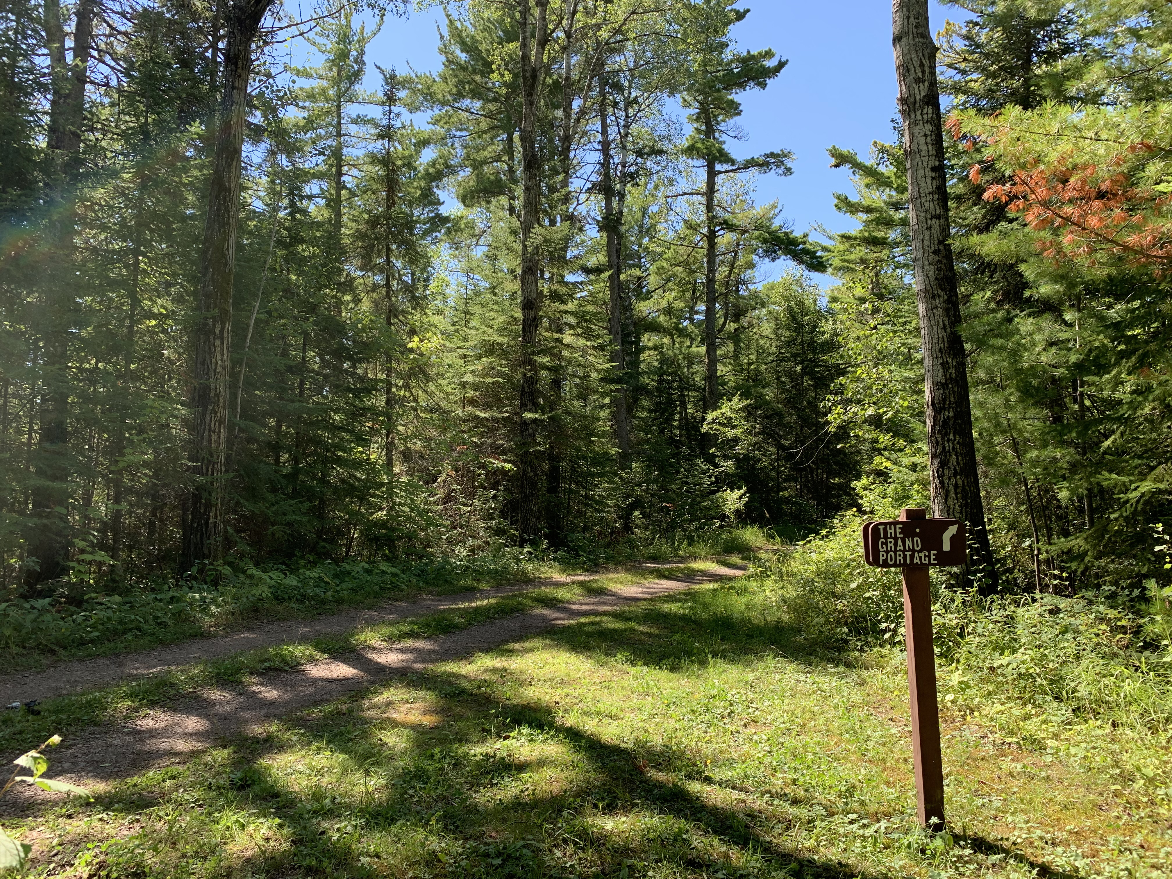
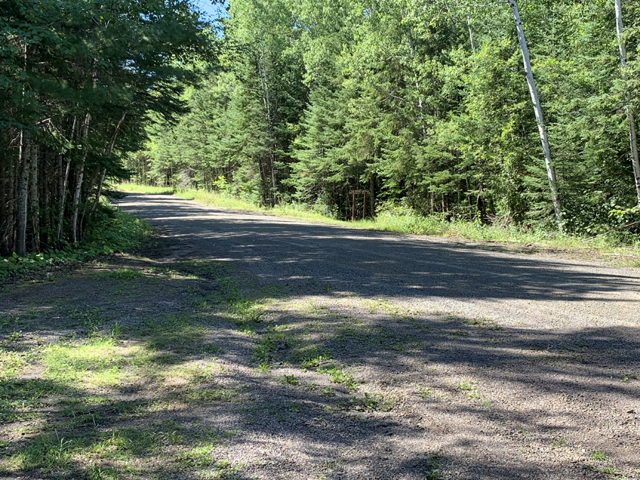
For the most part, the trail has little blow down. The National Park Service does a good job of keeping this trail cleared. The trail is quite wide along much of its length and very well worn (it has been used for many hundreds of years afterall). There are some muddy spots, some steep inclines and sections where the trail is much narrower than you see depicted here. But, this is a typical view of the trail.
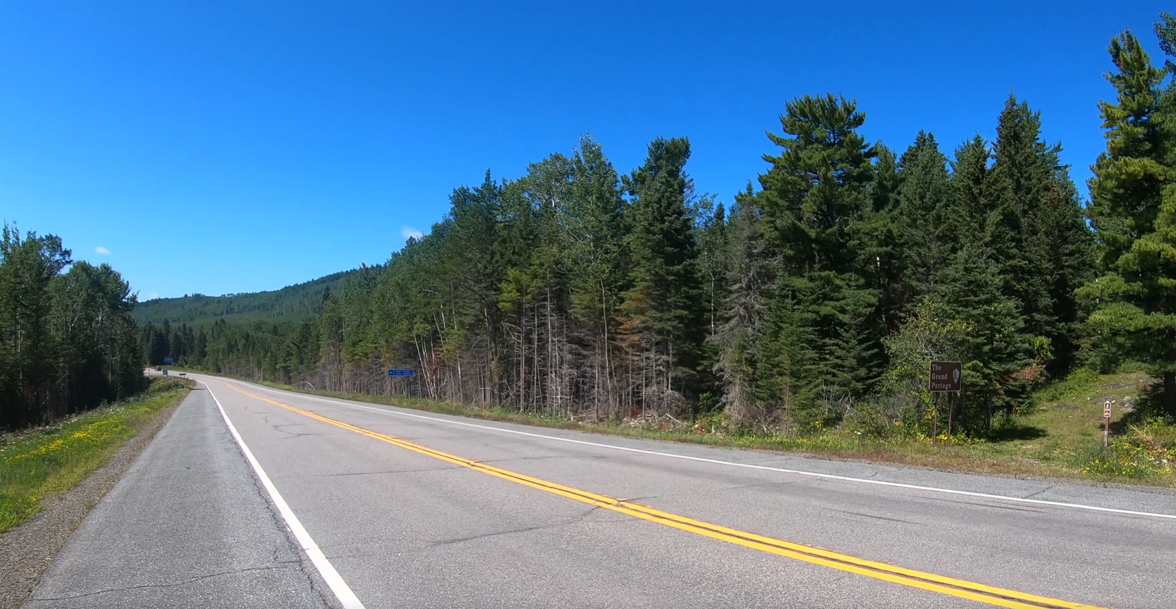
This is the sign marking The Grand Portage where it crosses Minnesota Highway 61 (MN 61). This is not the same as Old Hwy 61. Old Hwy. 61 is about 2.9 miles farther east. MN 61 is about 0.8 down the trail from Fort George and Lake Superior. Be careful crossing here. Traffic from the north comes up on you particularly quickly, as there is a bend just down the road in that direction. Thus you don't have a long sightline looking that way.
The Grand Portage continues east toward Fort Charlotte on the west side of Minnesota Highway 61 (MN61) for another 7.7 miles beyond this point.
MINNESOTA HIGHWAY 61 TO POPLAR CREEK AND THE STAIRWAY (2.1 MILES)
You are looking southbound down Minnesota Highway 61. You can see The Grand Portage resumes on the other side of the road. Use caution when crossing here as traffic from the right (you are looking left here) comes around a curve, just a short ways up the road.
A straight away along the trail. The majority of the trail has this wide tread. There was no evidence of tire tread marks along the trail, so the National Park Service may maintain most of this trail by foot.
The Grand Portage crosses some rolling terrain in this section. The trail steadily gains or loses elevation along this stretch depending on the direction you are going. The overall grade of the trail is uphill going from Lake Superior to the Pigeon River and it is noticeably more strenuous in this direction. Lake Superior by the way is the lowest elevation point in the State of Minnesota at 602 feet above sea level.
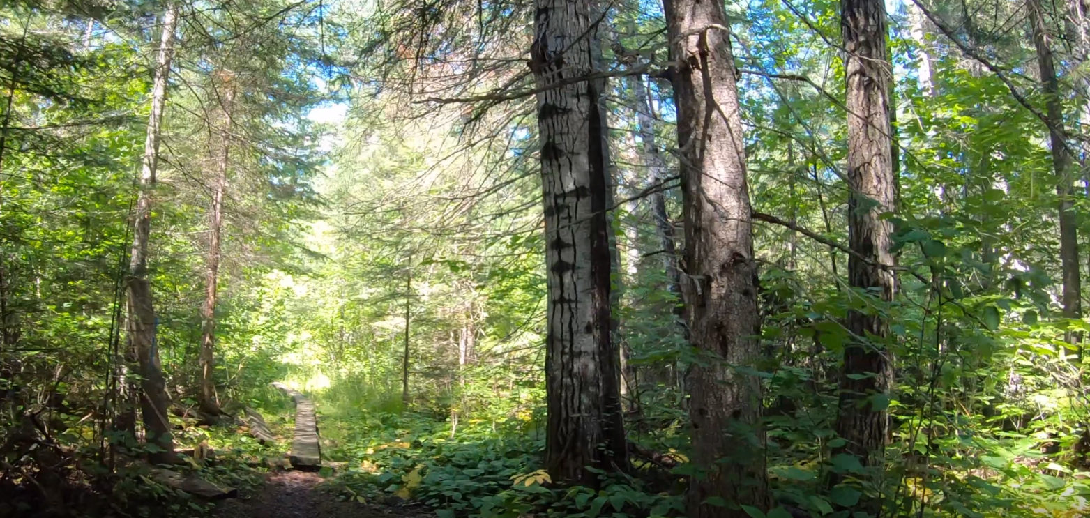
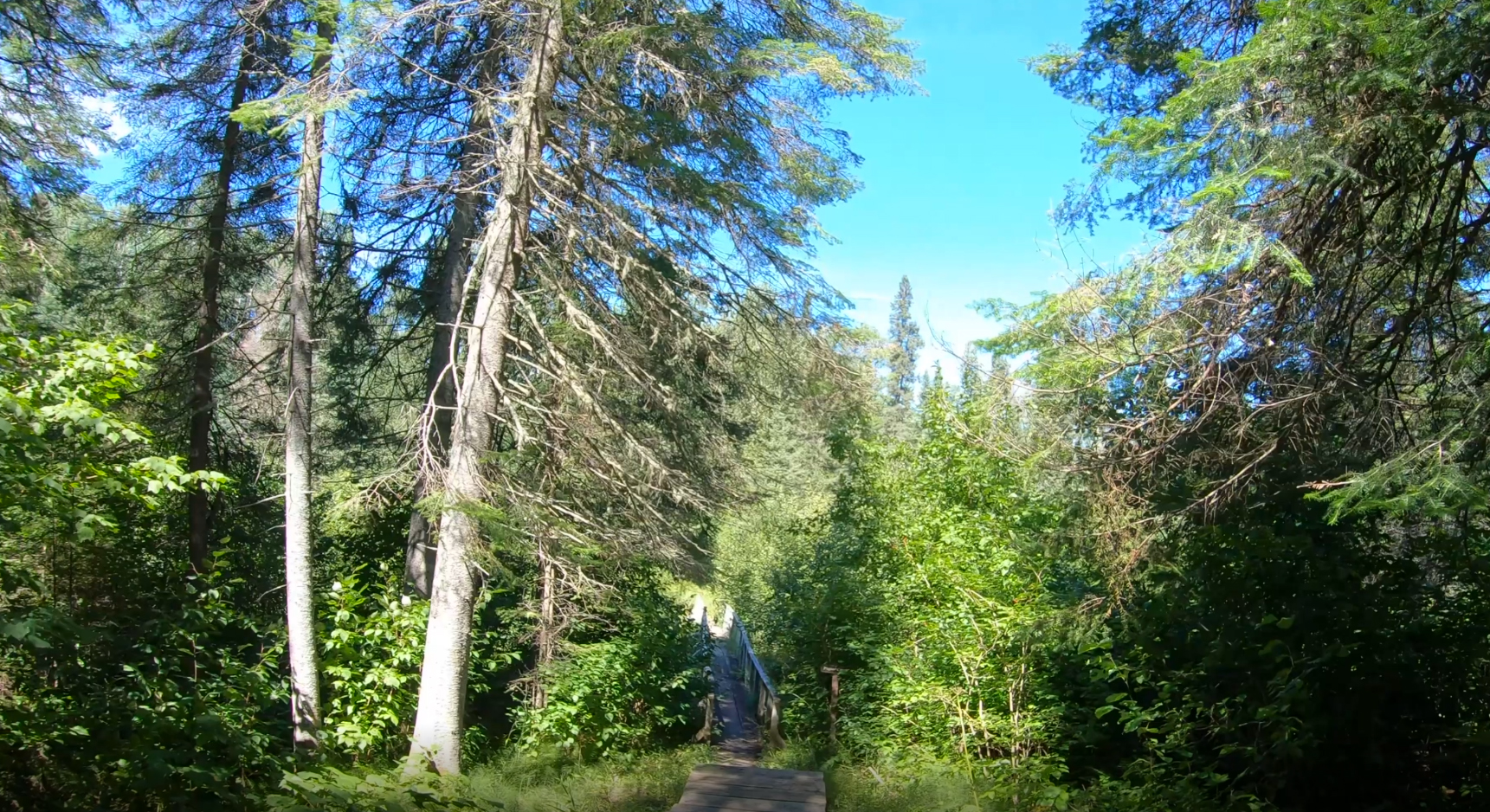
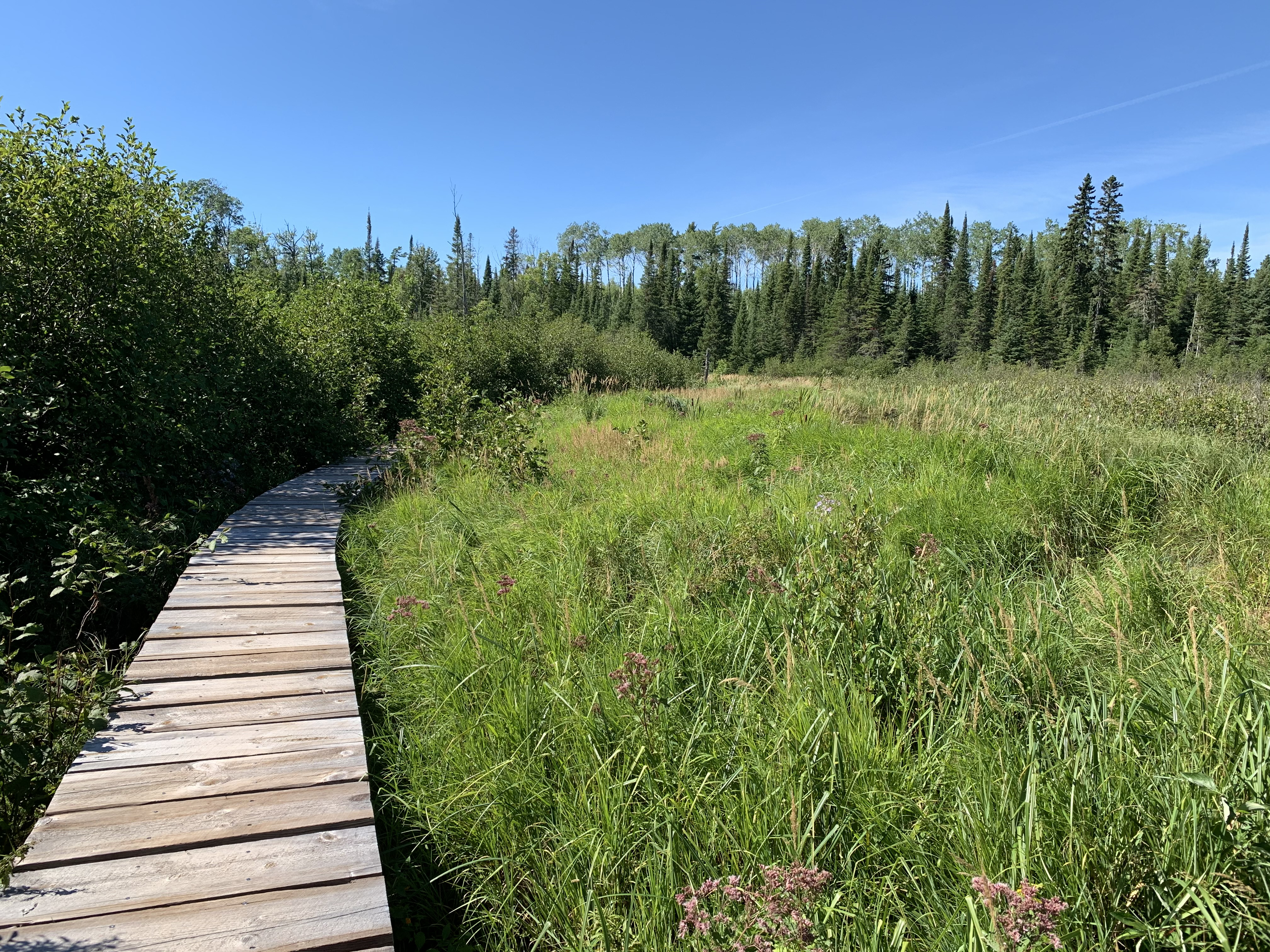
Coming up to one of the many boardwalks along The Grand Portage. There are 78 (by my count) of these boardwalks. Some are really short, some are quite long. In total, the length of all boardwalks combined makes up just about one mile of the trail.
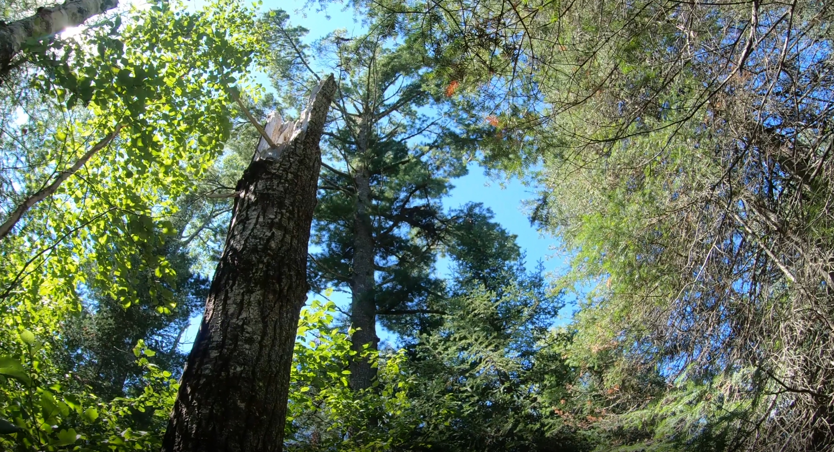
There are some truly impressive white pine trees to be found along this portage.
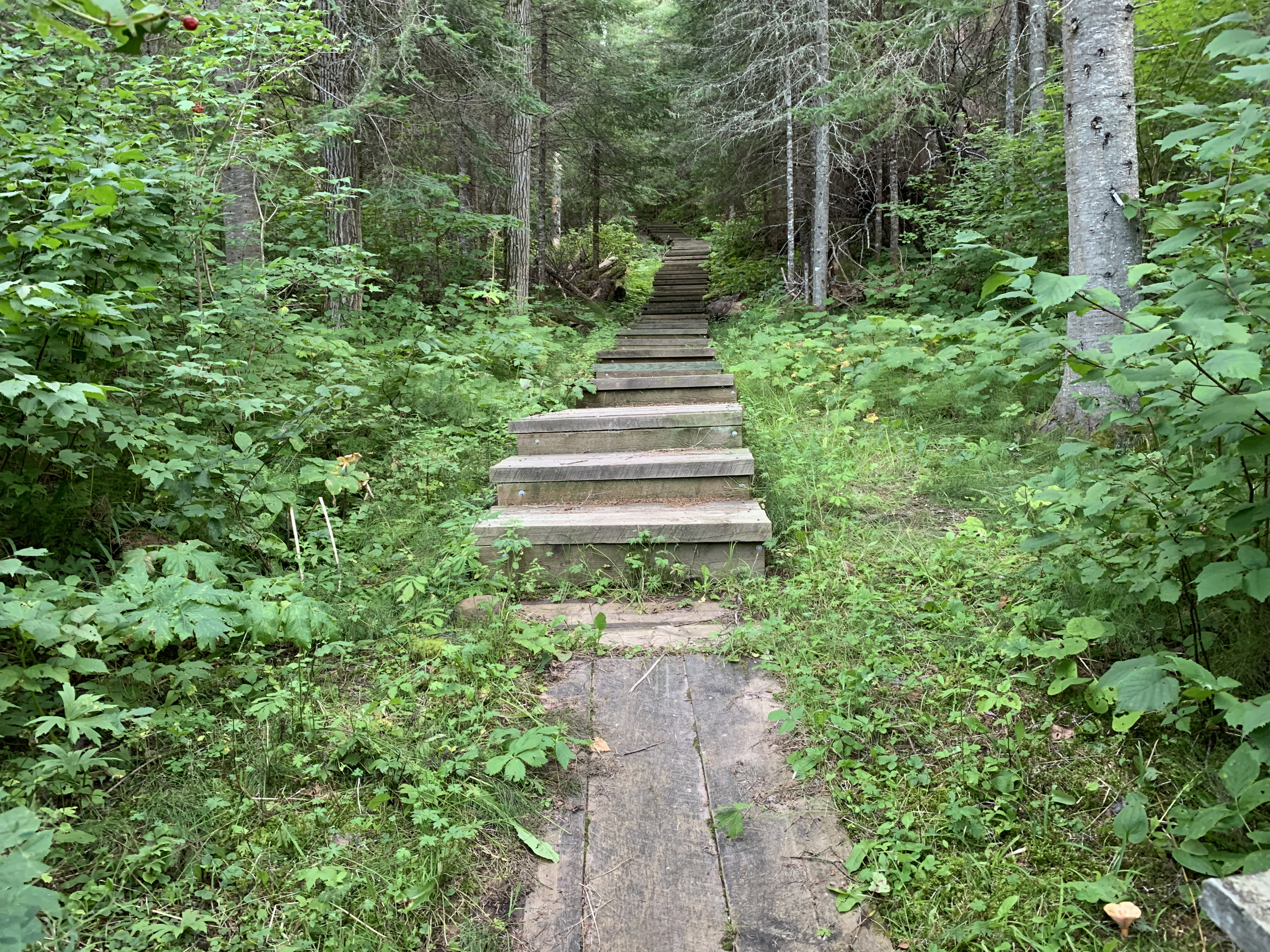
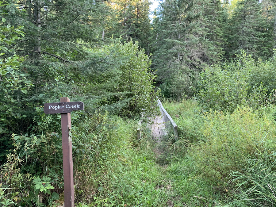
Coming down the stairway to the little bridge that crosses Poplar Creek.
POPLAR CREEK AND THE STAIRWAY TO OLD HIGHWAY 61 (0.8 MILES)
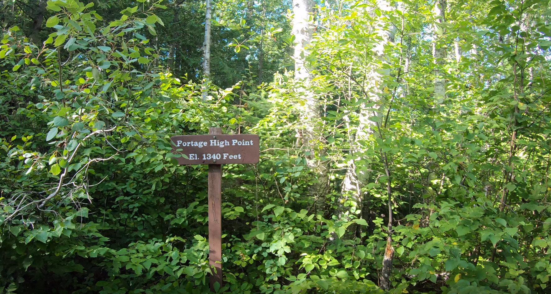
A look back up The Stairway. This long set of stairs begins at the Poplar Creek bridge. Interestingly, the stairs lead up in this direction (that is, going from the Pigeon River towards Lake Superior). Overall, from its maximum elevation of 1,340 feet (a couple miles down the trail from Fort Charlotte), The Grand Portage loses 738 feet of elevation by the time it reaches Lake Superior.
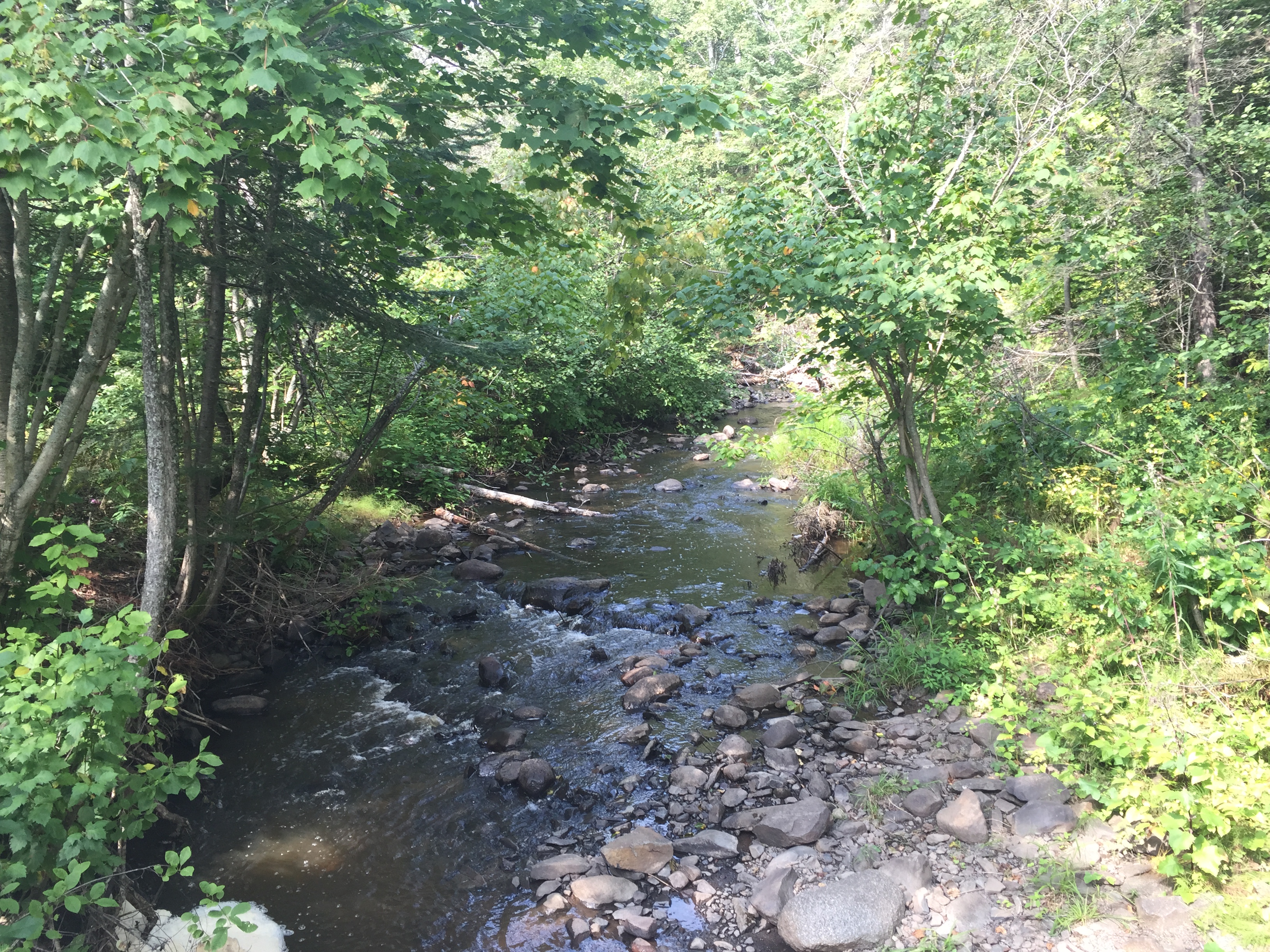
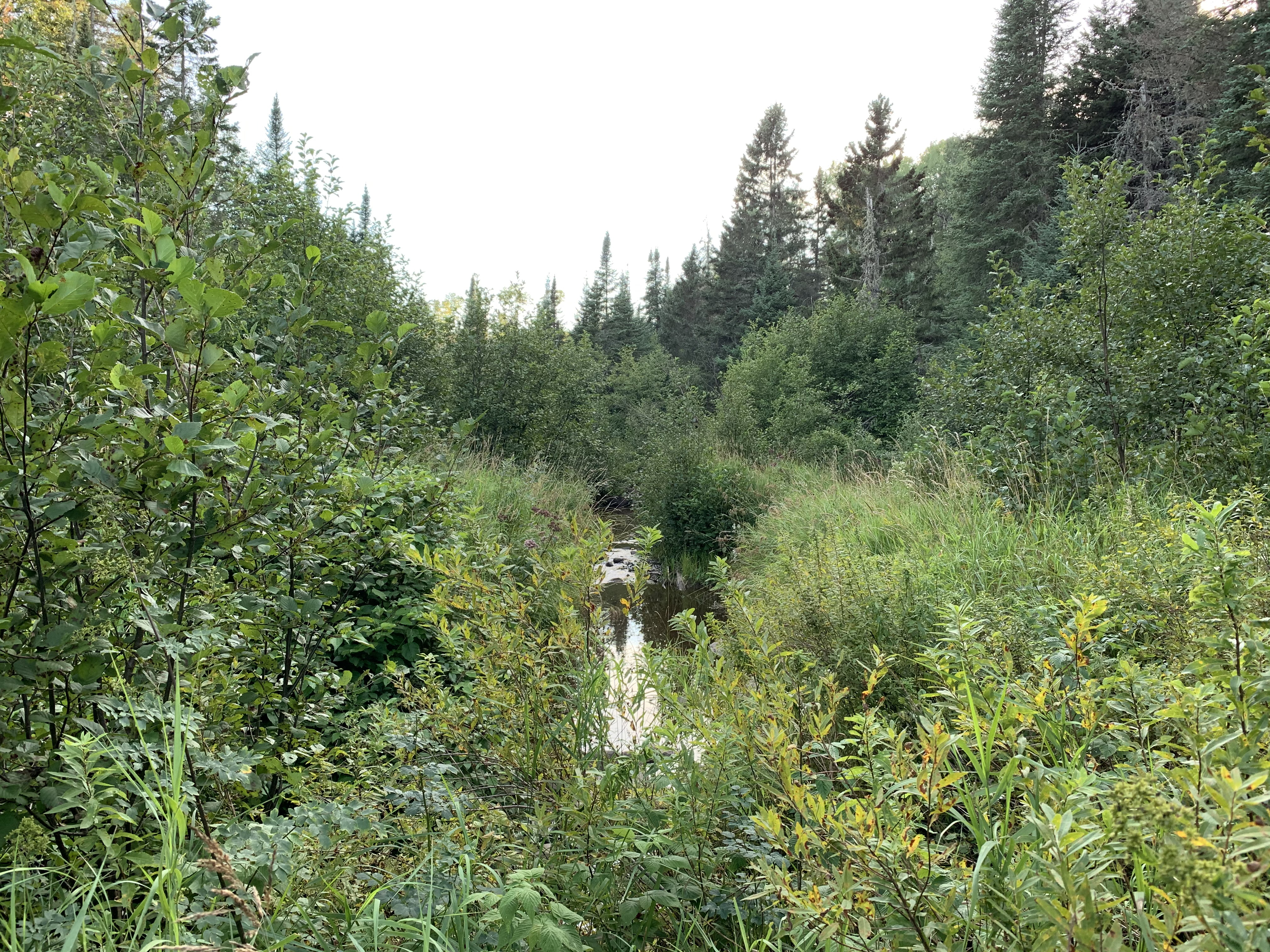
Poplar Creek. It's heavily overgrown by late summer, so difficult to see the creek.
This part of the portage is still somewhat hilly. The portage flattens out quite a bit once you get past Old Highway 61, continuing toward the old Fort Charlotte site.
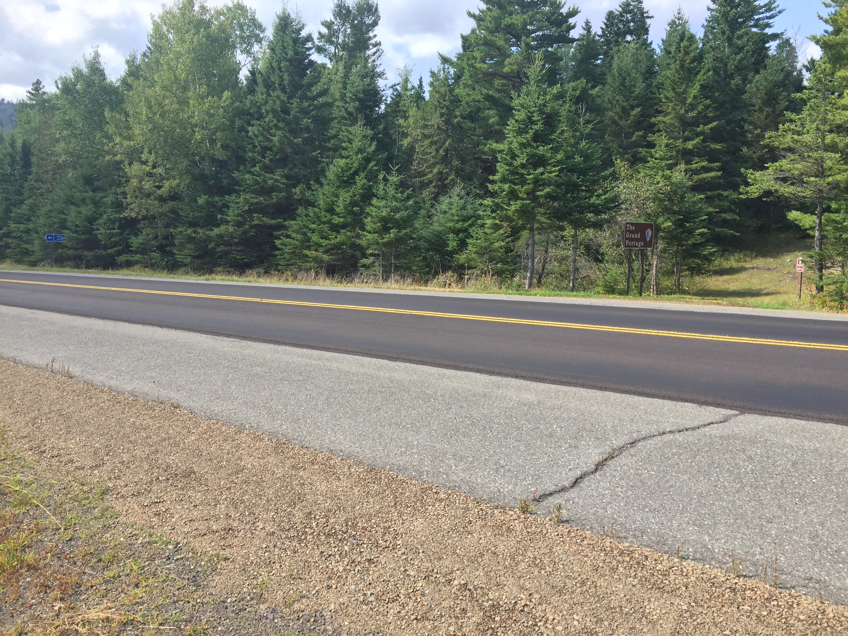
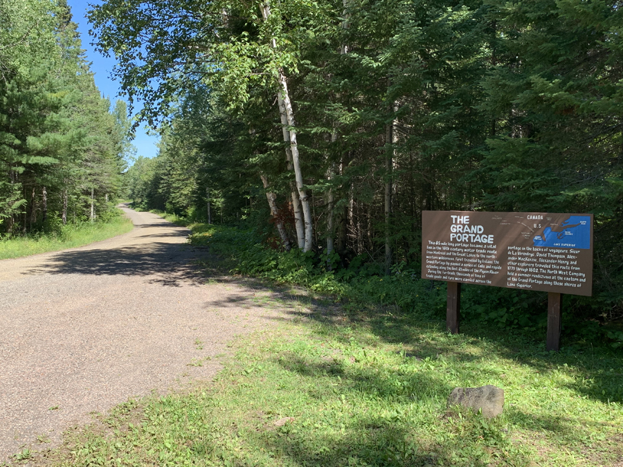
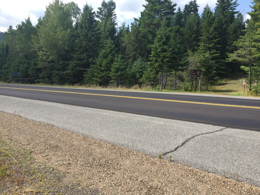
This is where The Grand Portage crosses Old Highway 61. This is a good place to take a break. It's about the halfway point along the trail. That stump makes a nice chair. Very comfortable. A similar sign to the one you see on your left used to be located at the beginning of the portage (Fort George end).
Old Highway 61 looking northbound. About 1.6 miles from here, Old Highway 61 dead ends at the Pigeon River in what used to be the Town of Pigeon River. There used to be a bridge there that allowed one to cross the river into Canada. Article explaining the history of Old Highway 61.
Southbound view of Old Highway 61. You can just make out the continuation of The Grand Portage on the other side of the road (near center of your view).
OLD HIGHWAY 61 TO COWBOYS ROAD (0.9 MILES)
Looking southbound at Cowboys Road. This road to no where intersects Old Highway 61 about 1/2 mile from where you are standing.
Cowboys Road looking northbound. The Grand Portage continues just to the right (out of view). You have to walk along Cowboys Road for a couple hundred feet. If you continue along Cowboys Road, it runs generally north for about 1.5 miles further before turning west. It then continues another two miles past that. Beyond that, the road turns into more of a trail. It eventually ends near The Cascades, a series of rapids along the Pigeon River about one mile downstream from Fort Charlotte.
The trail is flatter west of Old Highway 61. Where the trail crosses Old Highway 61 is a good place to take a break. The Grand Portage continues to pass through some mature forests along this section. Besides the usual songbirds, there seems to be a good population of grouse along the trail. You will also probably be scolded by several red pine squirrels as you travel through their territories.
Just a typical view along this part of the trail.
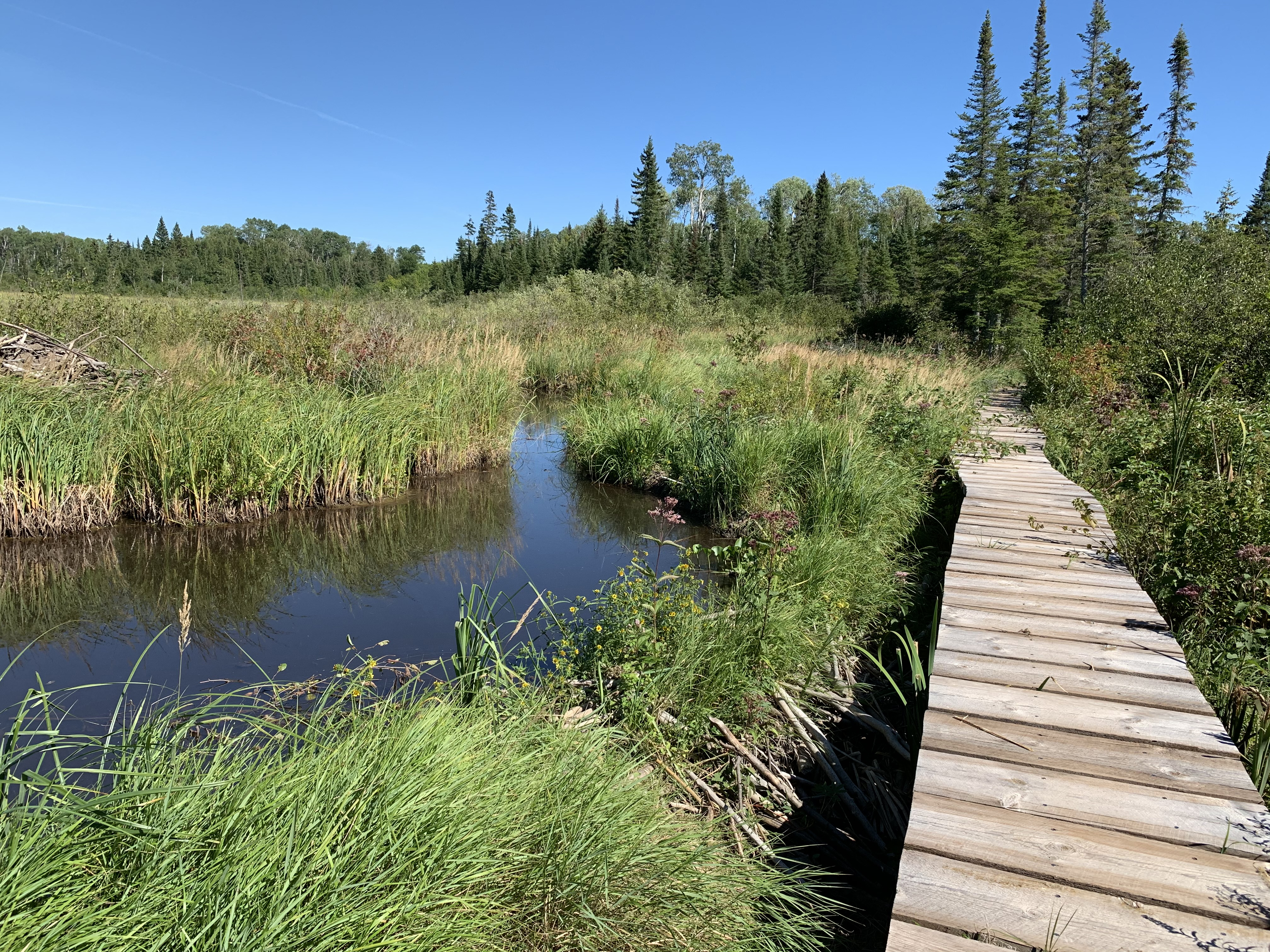
COWBOYS ROAD TO THE BEAVER DAM (1.8 MILES)
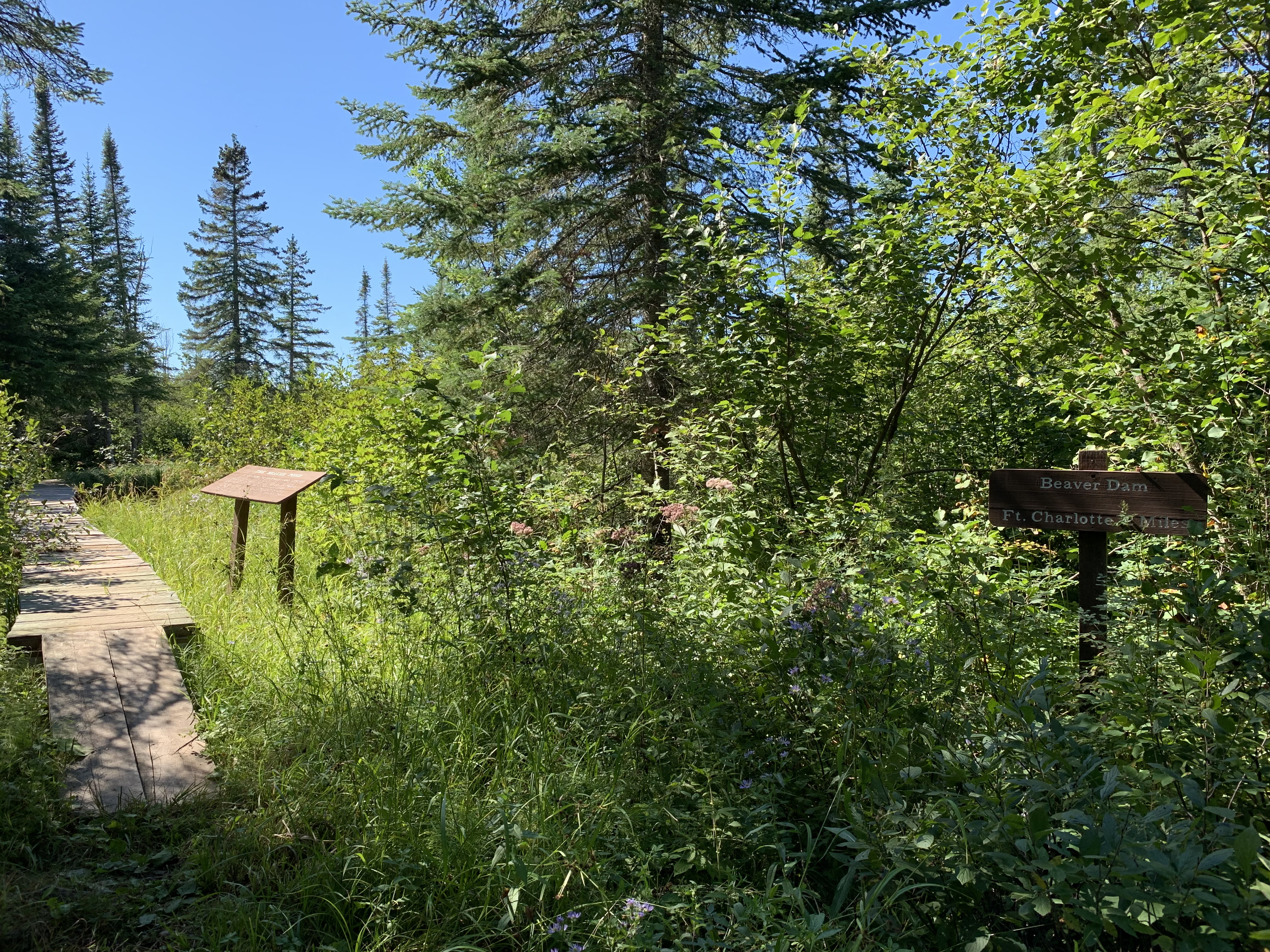
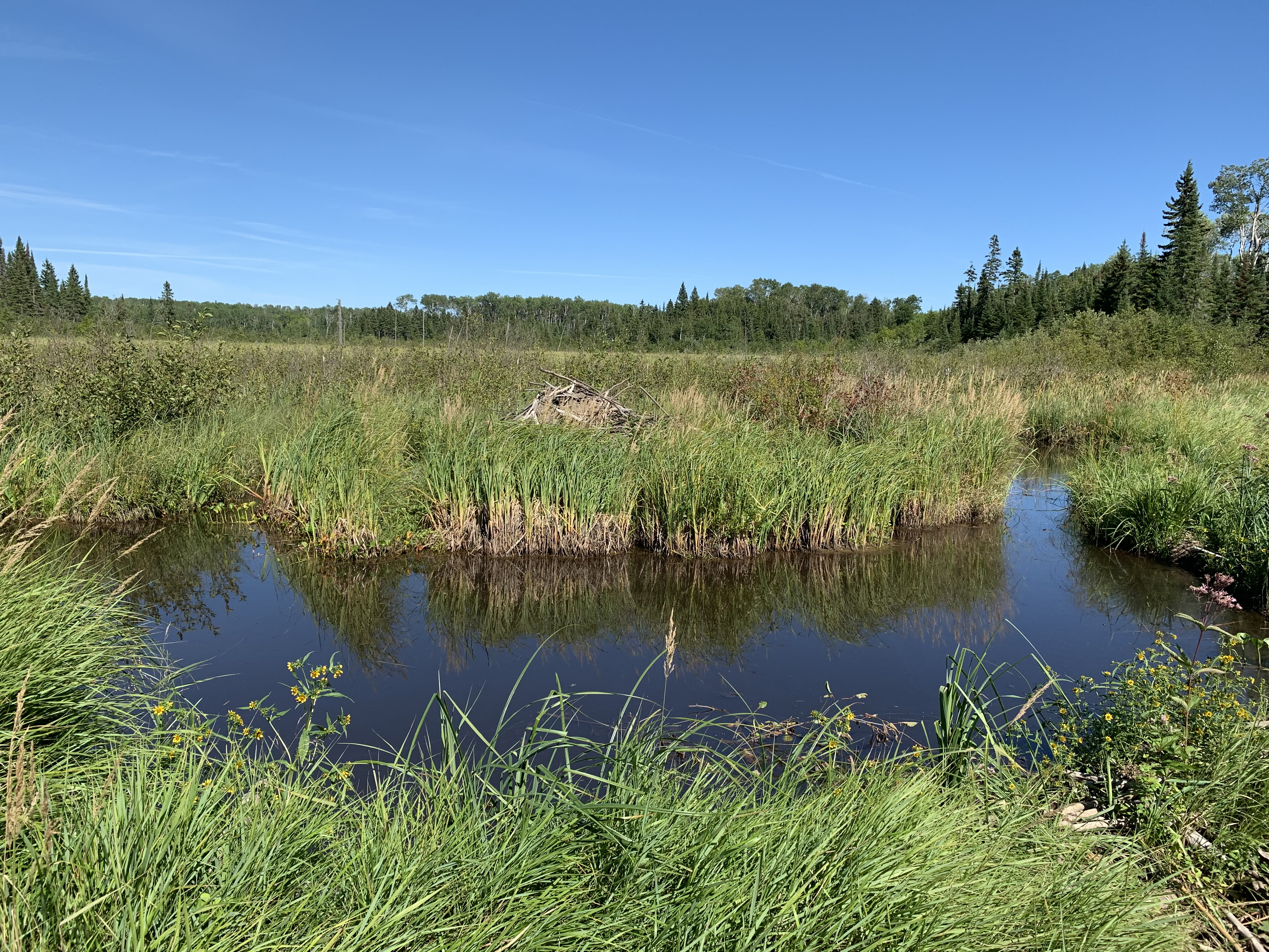
Arrival at the beaver dam. That sign on the right says its 2 miles to Fort Charlotte from here.
The boardwalk over the beaver dam is probably at least 500 feet in length. You can see the actual beaver dam running right along the left side of the boardwalk. The beaver dam has a heavy growth of grass growing on top of it. This is probably an old dam (the older ones have more vegetation growing on top of them, sometimes even trees). To the far left of your view you can make out part of the beaver lodge hidden in the marsh grass.
You start off by walking along a short stretch of Cowboys Road. Beyond the roadway, there is little elevation change along this trail segment as it continues through the forest.
Looking west across the beaver pond. The boardwalk continues until you reach that line of trees in the distance.
The concealed beaver lodge. The beaver dam is right at your feet. Tall grass grows along the top of the dam.
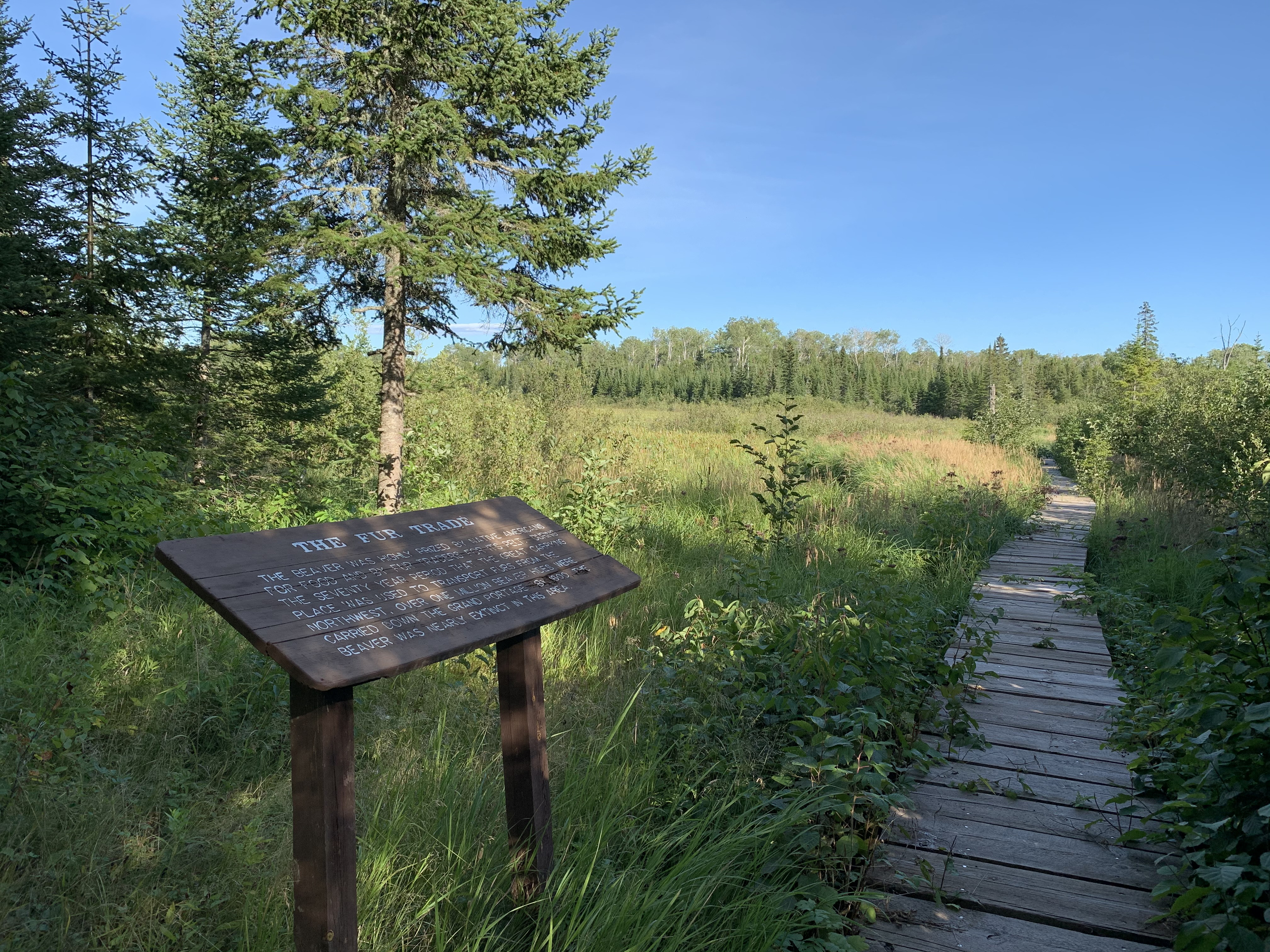
THE BEAVER DAM TO FORT CHARLOTTE ON THE PIGEON RIVER (2.1 MILES)
This informational signage is at the west end of the boardwalk. The sign says "The beaver was highly prized by Native Americans for food and by fur traders for its pelt. During the seventy year period that The Great Carrying Place was used to transport furs from the Northwest, over one million beaver hides were carried down The Grand Portage. By 1800 the beaver was nearly extinct in this area."
You've reached the top! It's all downhill from here, no matter which direction you go.
The Grand Portage reaches its highest elevation along this portion of the trail. It's a gradual ascent/descent though to the top. You finally reach Fort Charlotte.
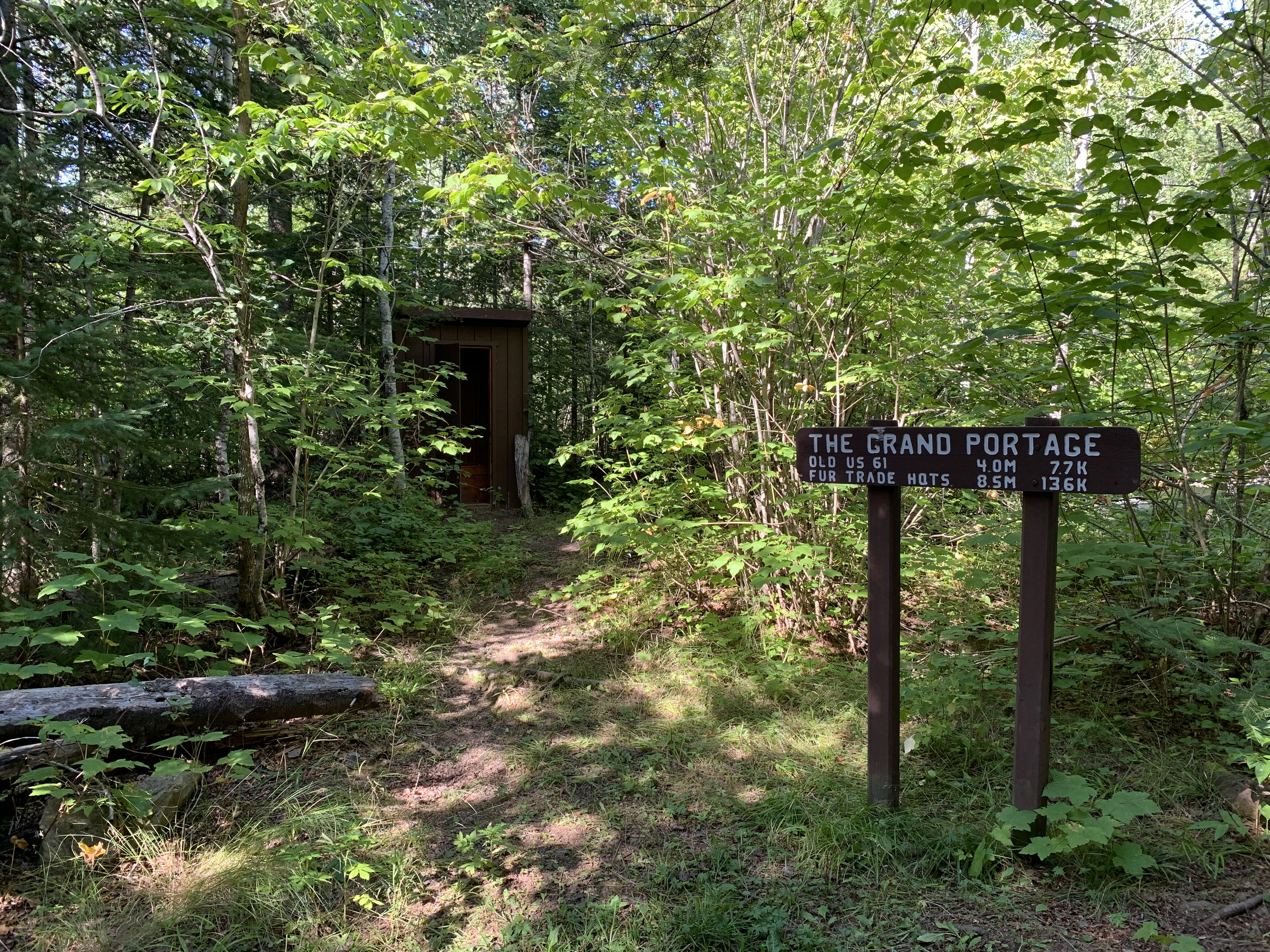
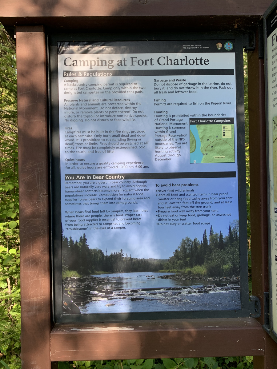
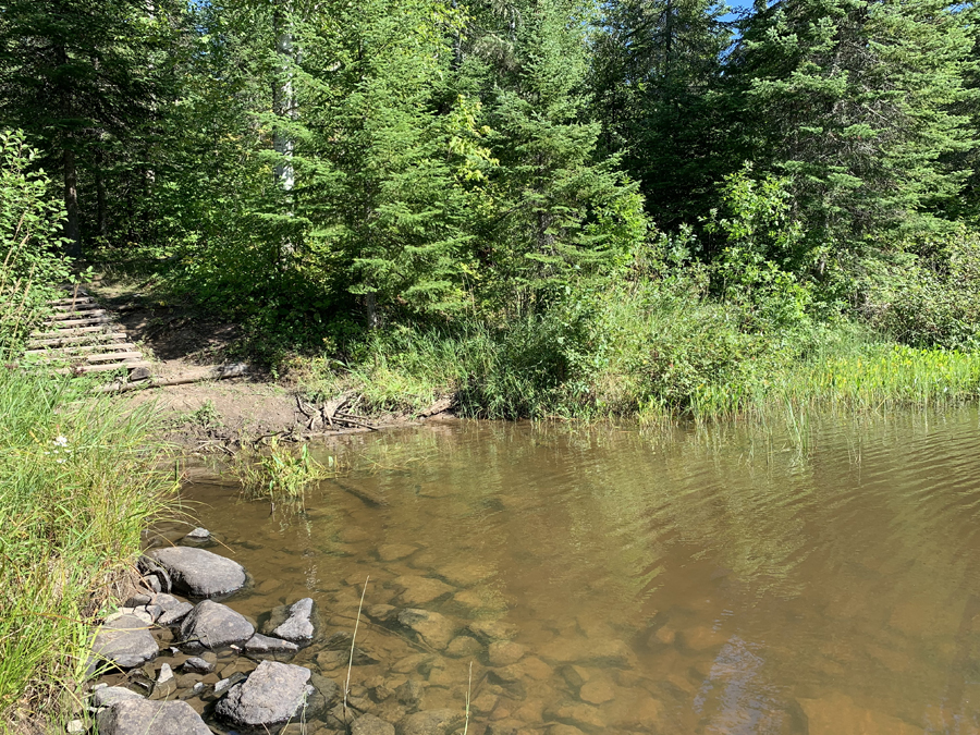
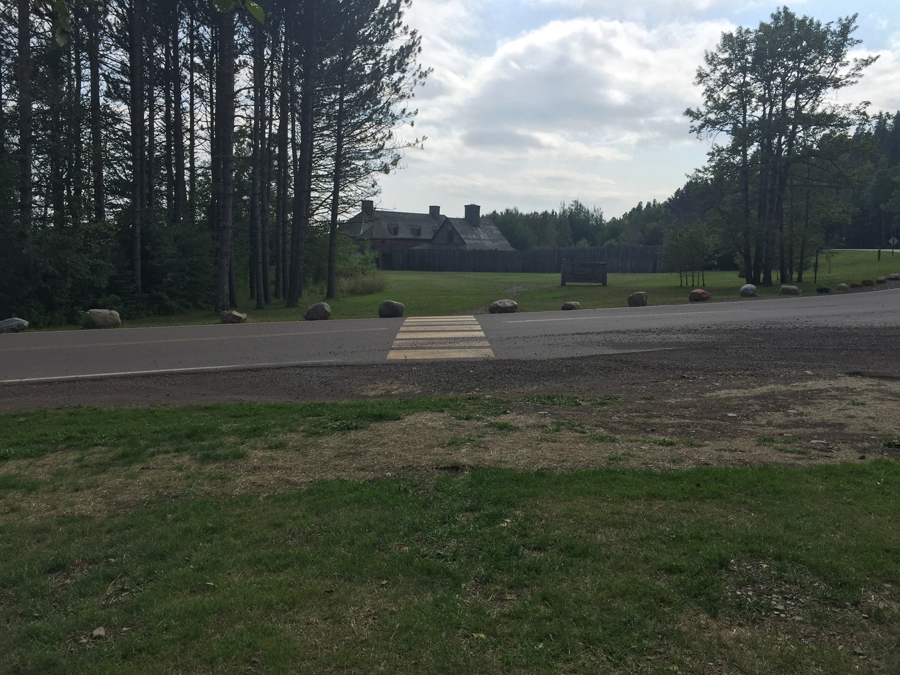
This sign is right at the entrance to the Fort Charlotte Campground. You can just make out the campgrounds outhouse in the background just left of center. This is the only restroom along the whole trail and its not fancy.
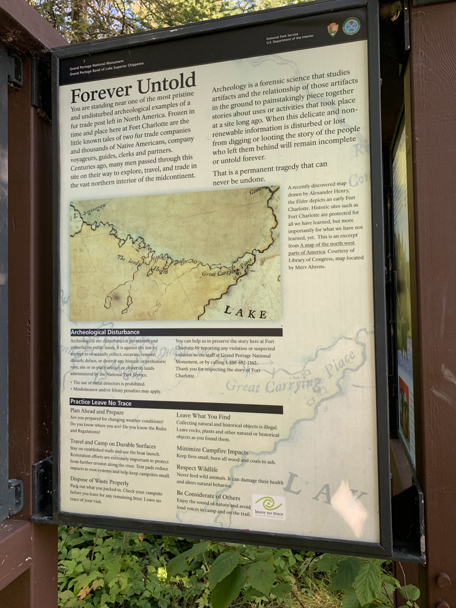
EXPLORING OLD FORT CHARLOTTE SITE AND THE PIGEON RIVER
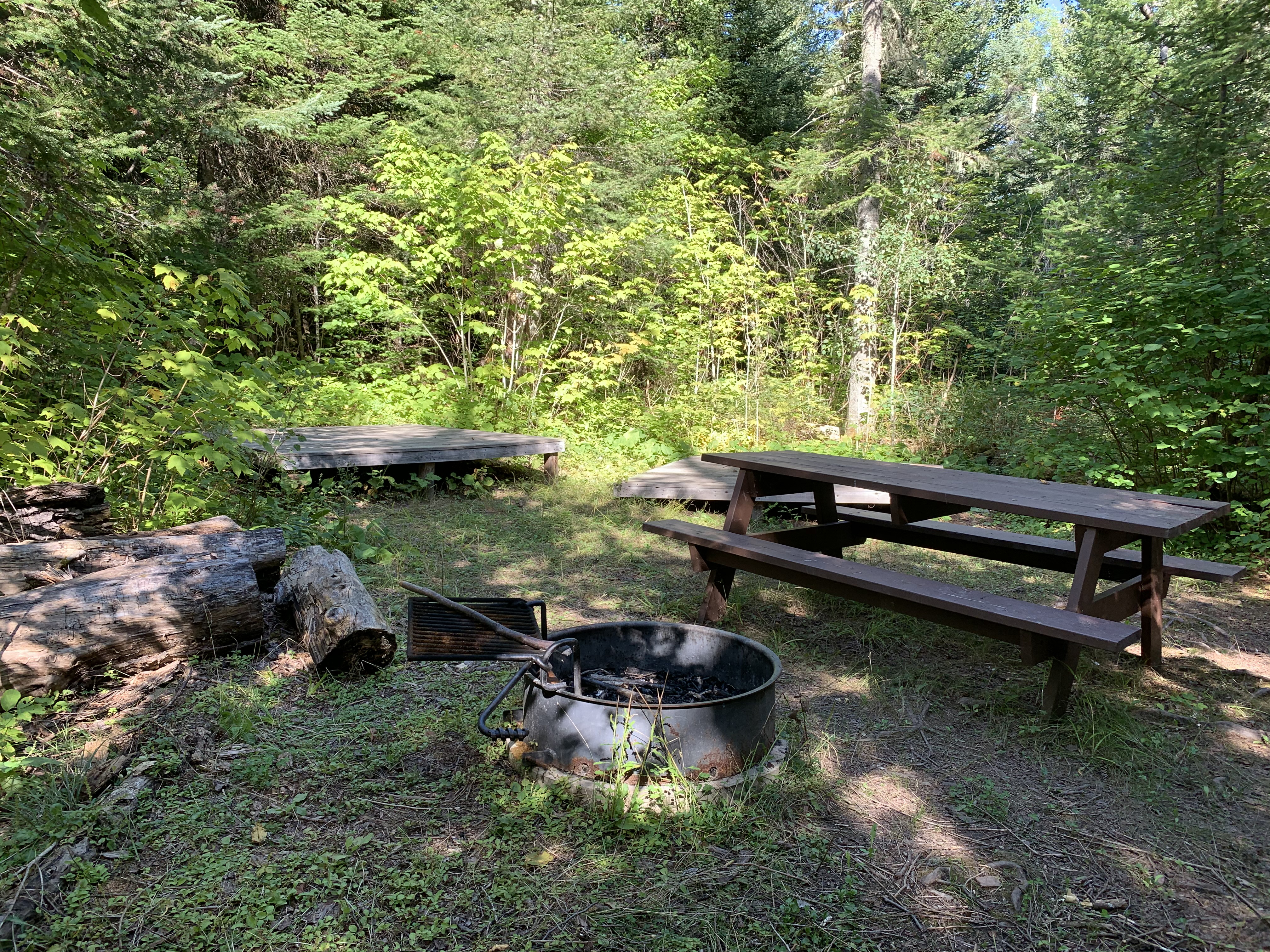
There are two campsites at the campground. Each of these two campsites (which are across the trail from each other) have three tent platforms, a few picnic tables and a metal fire ring. You need a permit from the National Park Service to camp at Fort Charlotte.
Walking through the former Fort Charlotte site from the end of The Grand Portage down to the Pigeon River. The actual location of the old fort was on the right side of the path you are following as you approach the river. The fort was built around 1793. Fort Charlotte was named for Queen Charlotte (1744-1818), King George of England's wife. It was located about where the current day campsite is situated on that side of the path. Fort Charlotte lost importance when the Kaministiquia Route became the preferred route from Lake Superior to the interior lakes. This route began at Fort Williams near present day Thunder Bay, Canada. Operations at Fort Charlotte ended in the early 1800's. A survey done in 1823 found little evidence of the fort remaining. So it has been gone for around two centuries.
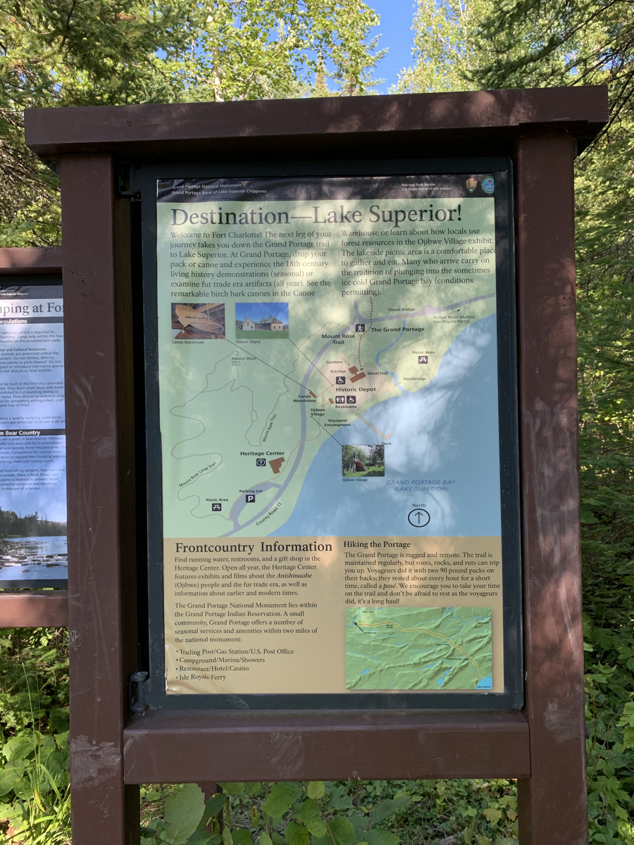
Informational multi-panel bulletin board about the area (click on thumbnails to left to see enlarged view - use your browsers back button to return to this page).
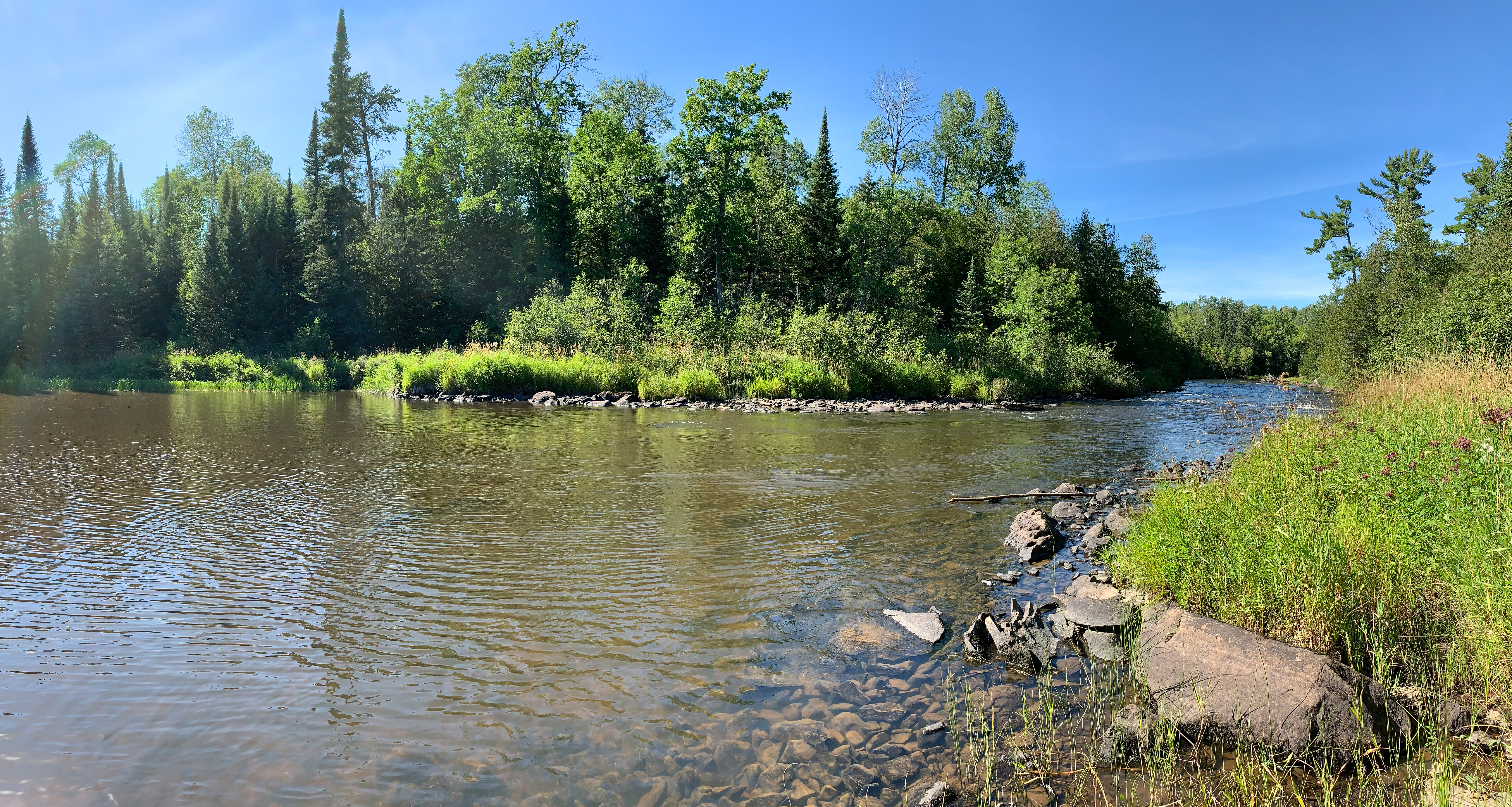
Looking upstream from the canoe landing on the Pigeon River. Partridge Falls is about 1.8 miles upstream from here. That is the only portage until you reach The Fowl Portage. It is about 11 miles or so from here to The Fowl Portage. That portage allows paddlers to bypass some rapids and reach South Fowl Lake. That portage is on the Canadian side of the river. It is a long (about 400 rods) and somewhat difficult portage.
Looking downstream from the Fort Charlotte canoe landing. The Pigeon River in this direction becomes unnavigable shortly beyond this point. Thus the reason for The Grand Portage. A massive set of rapids called The Cascades is about 1/2 mile downstream from here.
Now that you've made it over The Grand Portage, visit:PIGEON RIVER
FORT CHARLOTTE ON THE PIGEON RIVER TO THE BEAVER DAM
The beginning of the rapids just past the canoe landing at Fort Charlotte.
The canoe landing on the Pigeon River. Paddlers arriving here are coming or going to South Fowl Lake on the eastern end of the Boundary Waters Canoe Area. You cannot canoe down the Pigeon River past this point (at least if you want to live). Beyond this point downstream the river is a nearly endless series of rapids and waterfalls all the way to Lake Superior.
Camping at Fort Charlotte requires a permit from the National Park Service. They are usually easy to get. Nothing remains of Fort Charlotte. This fort was named for Queen Charlotte (1744-1818), the queen of King George III of England.
THE BEAVER DAM TO COWBOYS ROAD
About two miles to Fort Charlotte from the Beaver Dam.
This section of the trail is relatively flat. The trail is kept in excellent condition by the National Park Service.
Cowboys Road crossing.
COWBOYS ROAD TO OLD HIGHWAY 61
Looking southbound. Cowboys Road intersects Old Highway 61 about 0.5 miles south of here.
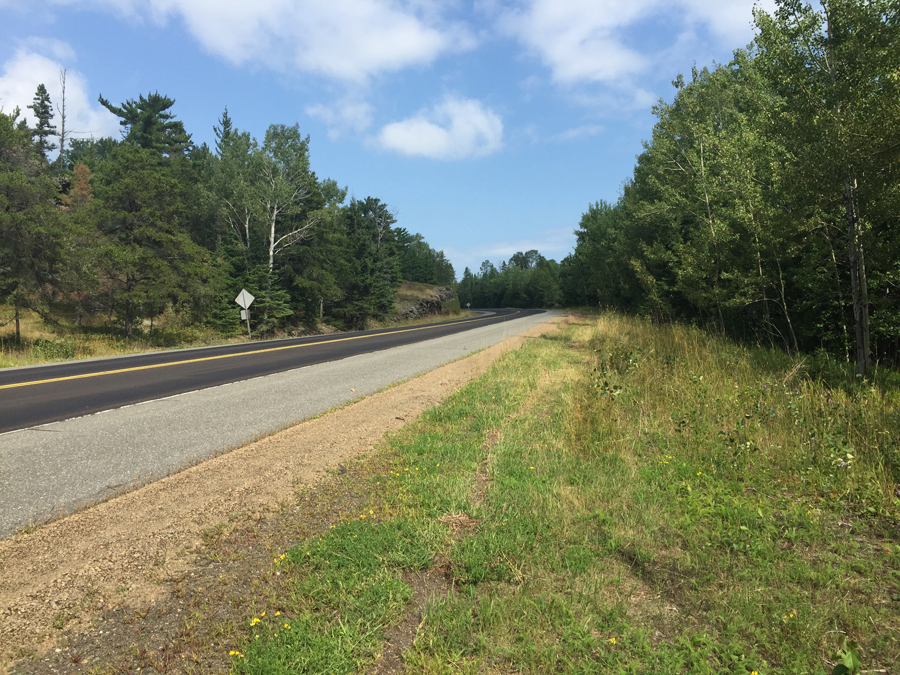
Looking southbound down Old Highway 61. North of Mt. Maude Trail the road is unmaintained. Mt. Maude Trail is just over 3 miles away from this location. This road is currently known as County Road 89 on modern day maps.
OLD HIGHWAY 61 TO POPLAR CREEK AND THE STAIRWAY
Old Highway 61. The Grand Portage trail is just to the right of that sign (out of your view). It's about 1.6 miles from here to the Canadian Border.
As you go east (toward Lake Superior) from this point, the trail is more rolling with lots of elevation changes. In general, you are heading downhill going in this direction and the difference is noticeable.
Heavy grass cover in late summer envelopes the little wooden bridge over Poplar Creek.
POPLAR CREEK AND THE STAIRWAY TO MINNESOTA HIGHWAY 61
The Poplar Creek crossing doesn't offer much of a view of the actual creek.
Even though The Grand Portage is generally downhill going from the Pigeon River to Lake Superior, the stairway in this section is actually up. The stairway starts at Poplar Creek, going in this direction.
The trail continues directly across the road. Be wary of crossing here as the cars are moving fast and one direction has a short sightline.
MINNESOTA HIGHWAY 61 TO FORT GEORGE ON LAKE SUPERIOR
Northbound view of Minnesota Highway 61 where The Grand Portage crosses the road.
This is a long hike. If you don't plan it well, you will be walking in the dark like this.
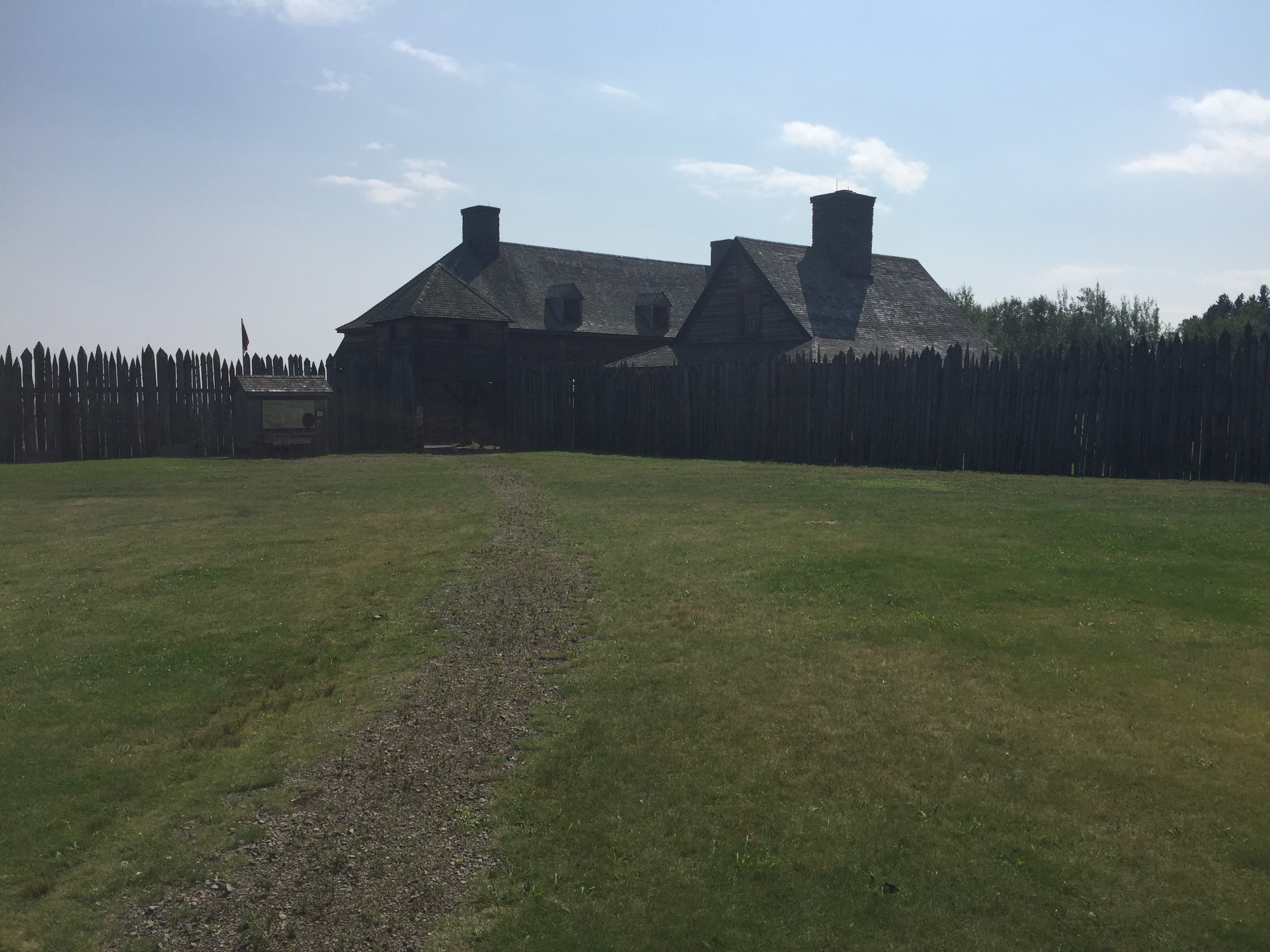
Fort George at the east end of The Grand Portage.
After passing through the west gate, cutting through the fort interior grounds and exiting the east gate, you arrive at Lake Superior. A long dock extends out from the main gate. A bit ironic to see a beaver swimming in Lake Superior right out in front of Fort George, which was a major hub of the beaver fur trade in North America. The beaver was nearly extinct in this part of North America by 1800.