Nearest Ranger Station: Gunflint Ranger Station, Grand Marais, MN along Hwy. 61 on the North Shore
Portage Length from Parking Lot: None
Restroom at Entry Point: Yes
Entry Point 55 - Saganaga Lake
Gunflint Ranger District
From Grand Marais, Minnesota, follow the Gunflint Trail for about 55 miles to the end of the Gunflint Trail. You have two access locations to choose from when visiting Saganaga Lake, as detailed in the next paragraph.
There are two entry point parking lots for Saganaga Lake. One is located on Saganaga Lake and the other is on Gull Lake, about a mile to the southwest. For the Saganaga Lake entry point landing, follow Saganaga Lake Trail (County Road 11). This road is the next right after you pass the road to the Chik-Wauk Museum and Nature Center (which is off Moose Pond Drive). If you continue past Saganaga Lake Trail, you soon come to the end of the Gunflint Trail and arrive at Trail's End Campground. The entry point access for Gull Lake is found here next to Way of the Wilderness Canoe Outfitters and just north of the campground. Using the Gull Lake access may make more sense if you are using the campground or an outfitter. It adds about a mile of extra paddling up through Gull Lake and heading north along the Gull River to Saganaga Lake. Note that the western one-third of Gull Lake is within the BWCA. Motors are allowed on the rest of Gull Lake.
The U.S. Forest Service offers the Trail's End Campground if you need a place to sleep the night before your travels. There are also several lodges and outfitters situated at the end of the Gunflint Trail.
From Saganaga Lake, there are a huge array of route options. The majority of paddlers head to the west end of the lake heading toward Ottertrack Lake or the Ester Lake area. Some travellers are bound for Quetico Provincial Park, which requires a pit stop at the Canadian Ranger Station located in Cache Bay on the west side of Saganaga Lake. It is common to get a tow service to take you to American Point if headed to the western side of the lake. It is quite a long paddle on a very large and exposed body of water. You can also head east along the International Border on the Granite River. Some groups head into the area recently affected by forest fires to the southwest, mostly through Red Rock Lake.
Motorboats are allowed on Saganaga Lake east of American Point.
The eastern shoreline of Saganaga Lake was recently burned by the Ham Lake Fire in 2007.
Exploring the Entry Point
Click on the photos below to see the full resolution image - Use your browsers back button to close photo and return to this page.
There are two public access points for Saganaga Lake as shown below (Saganaga Lake and Gull Lake):
SAGANAGA LAKE PUBLIC ACCESS:
This entry point landing for Saganaga Lake is located off of Moose Pond Drive, which is a spur road off the Sag Lake Trail. Beginning in the parking lot, meander your way down to the shore of the lake. The parking lot at this entry point is managed by Cook County and there is a fee to park here. If you want free parking while on your trip, the Gull Lake Public Access (shown below) offers it.
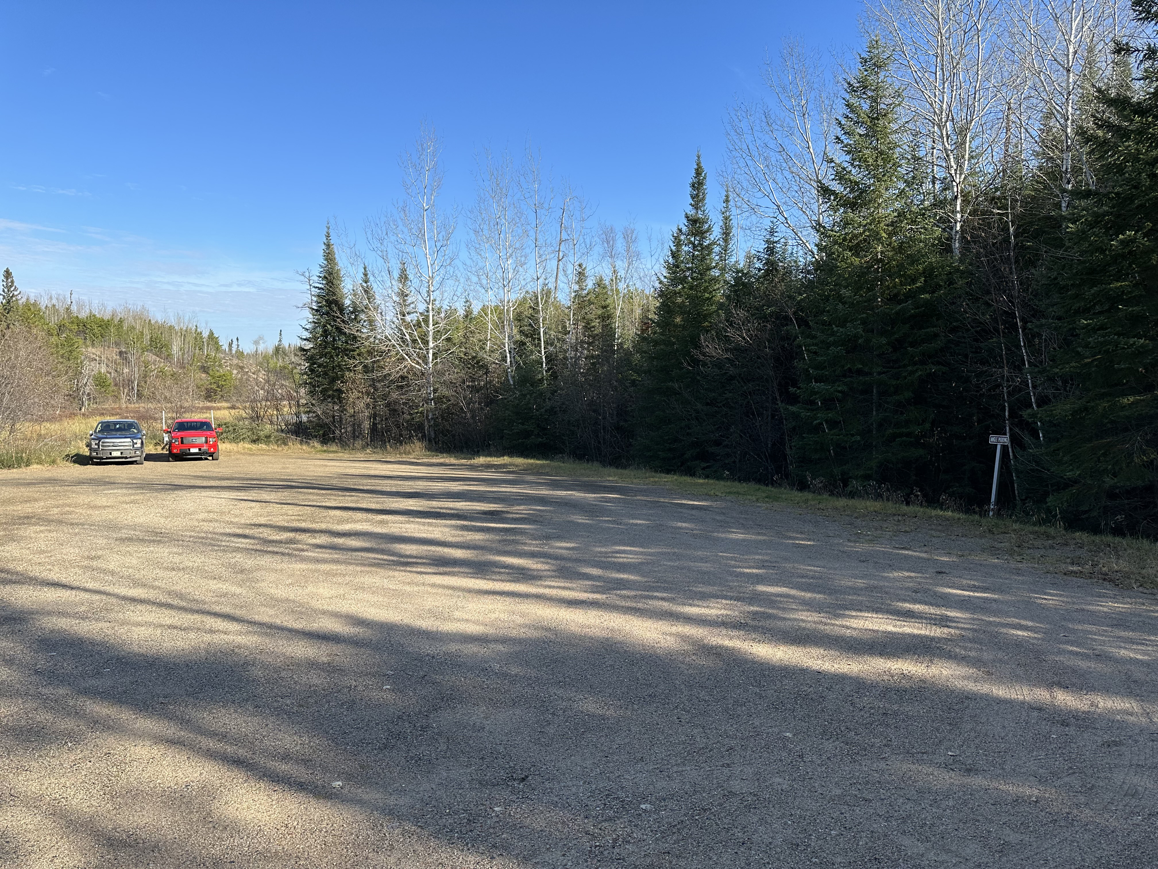
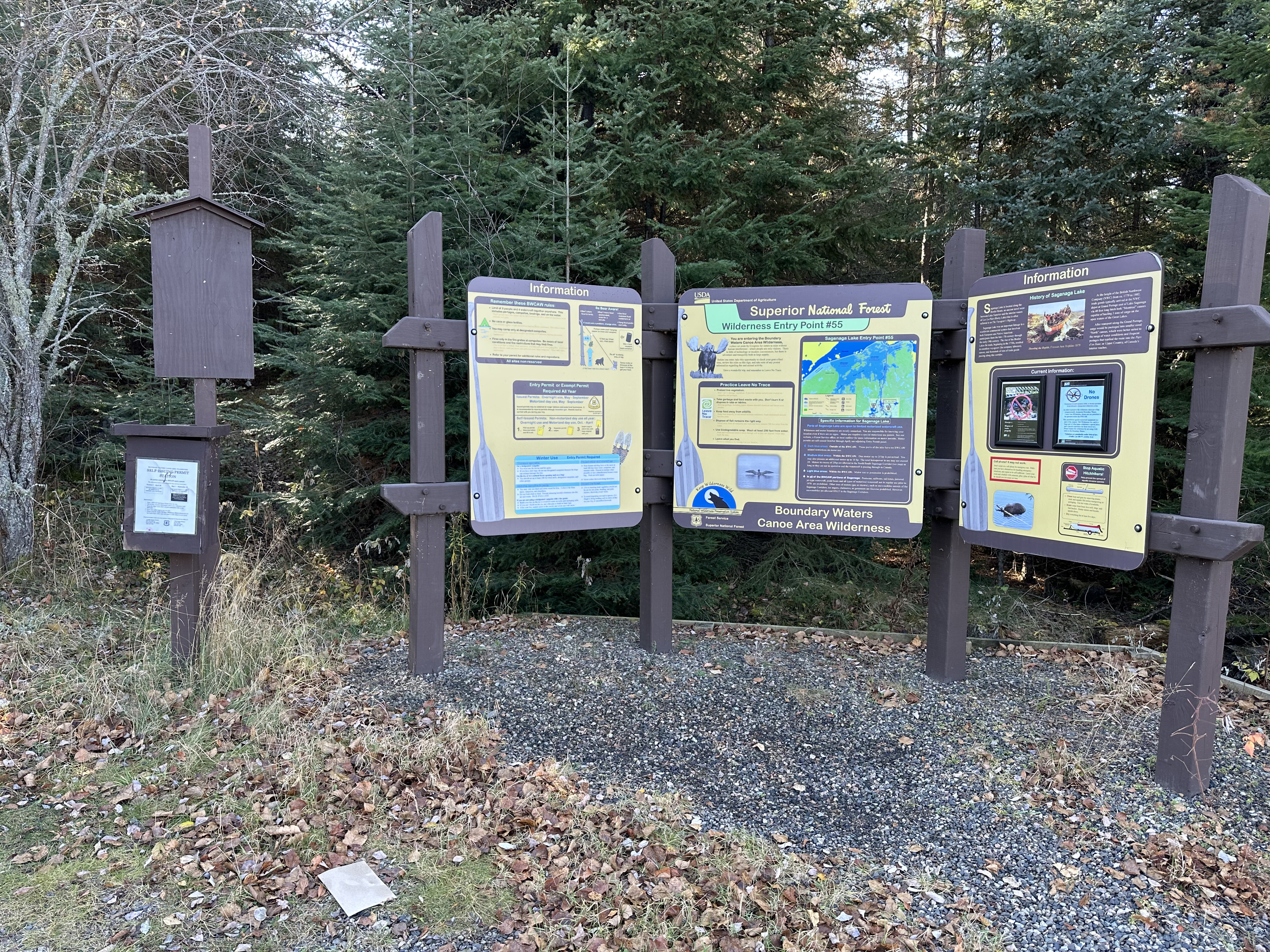
Sign along the road to let you know you're getting close. Notice that this is a fee parking lot.
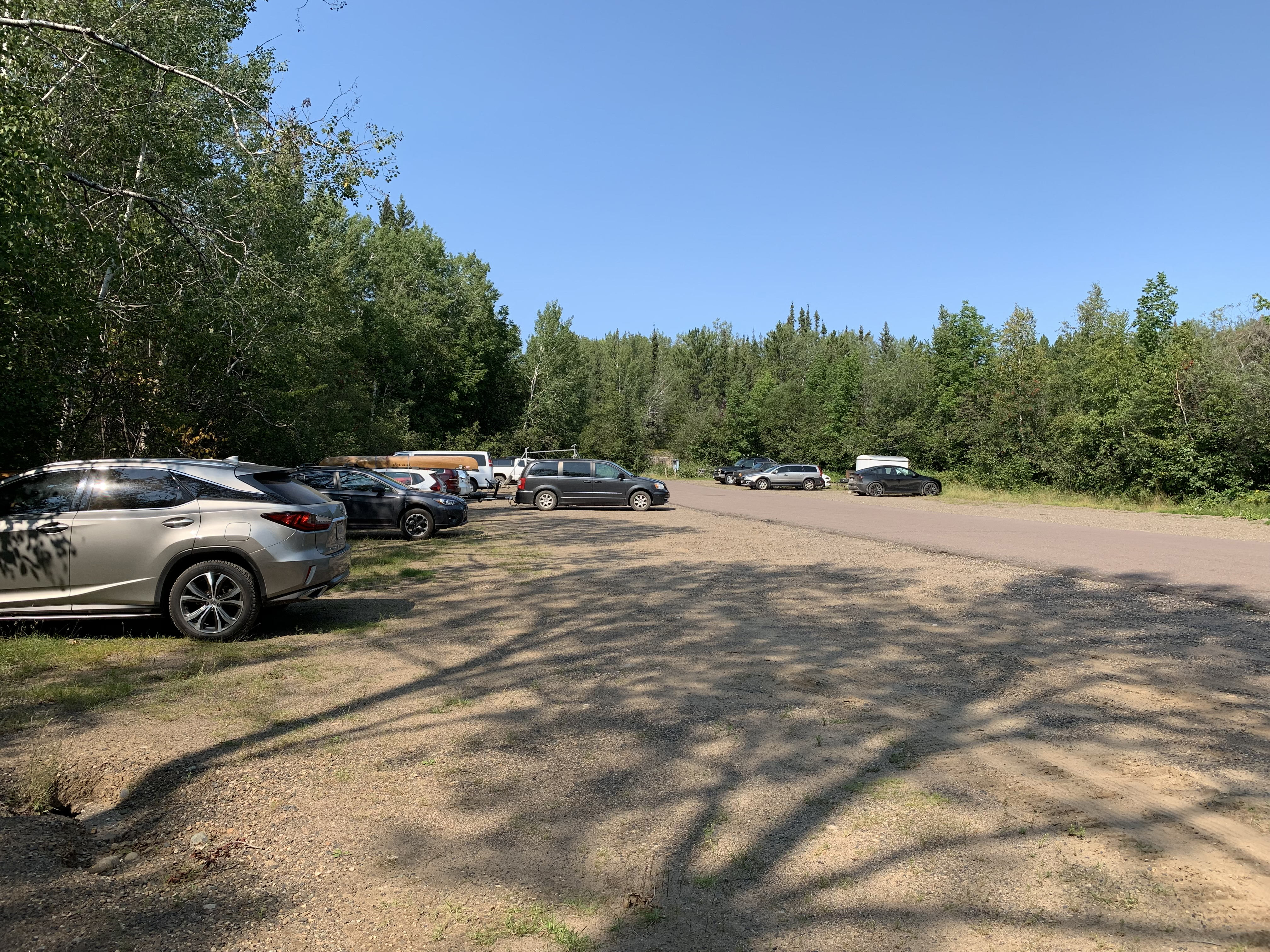
Huge parking lot at this entry point. Saganaga Lake has a high daily permit quota.
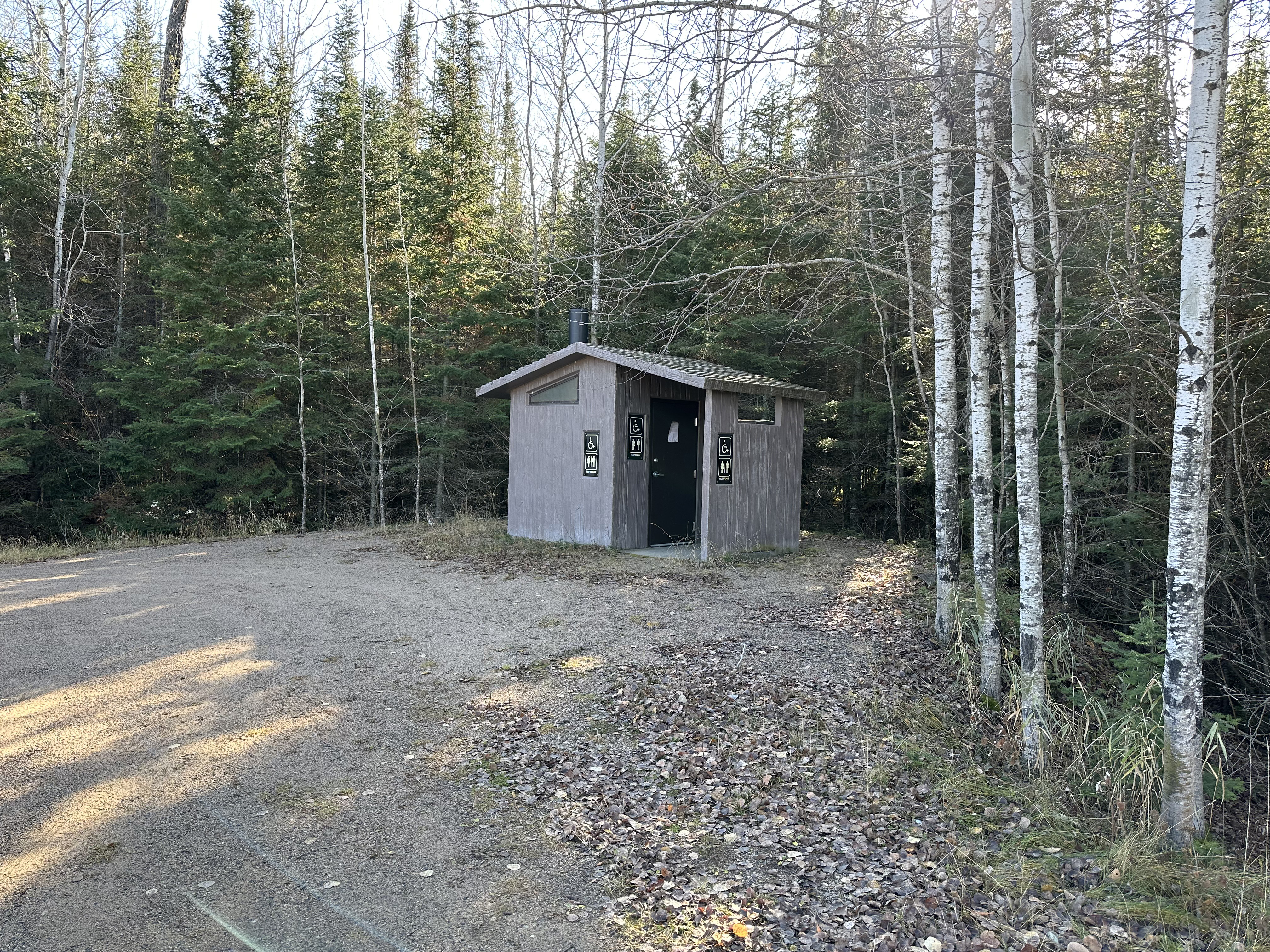
Probably your last chance to use a restroom with a door for a few days...
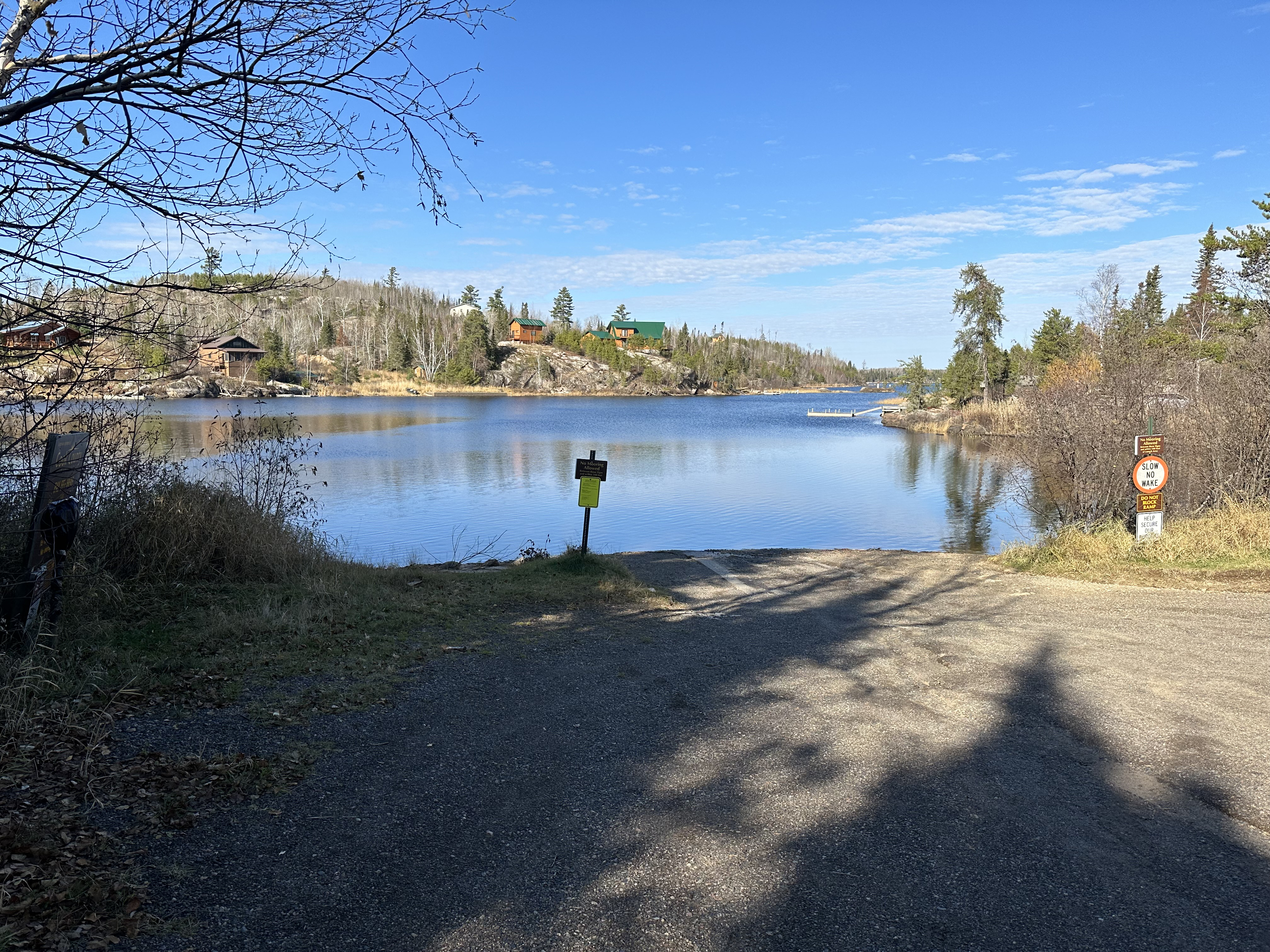
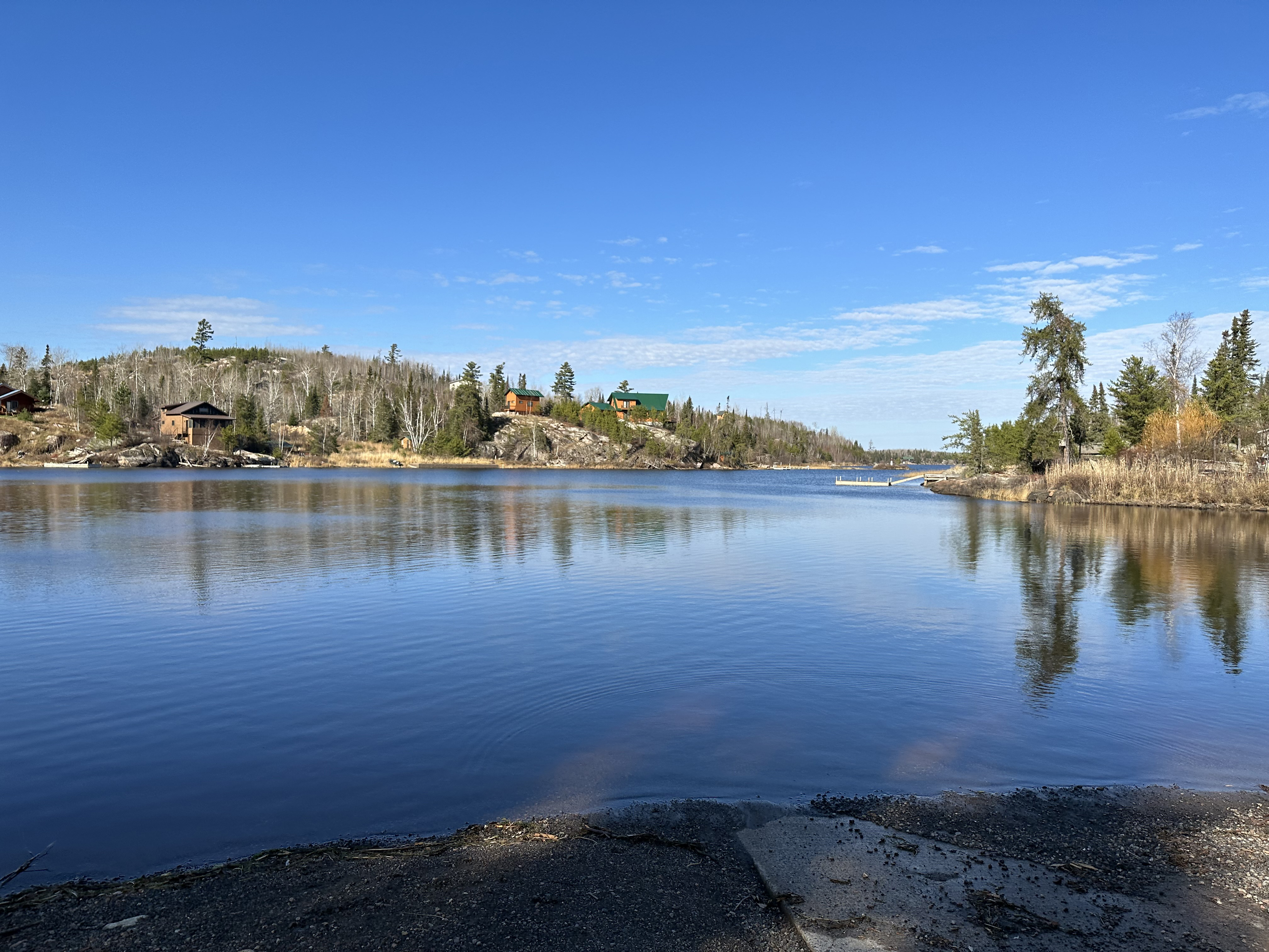
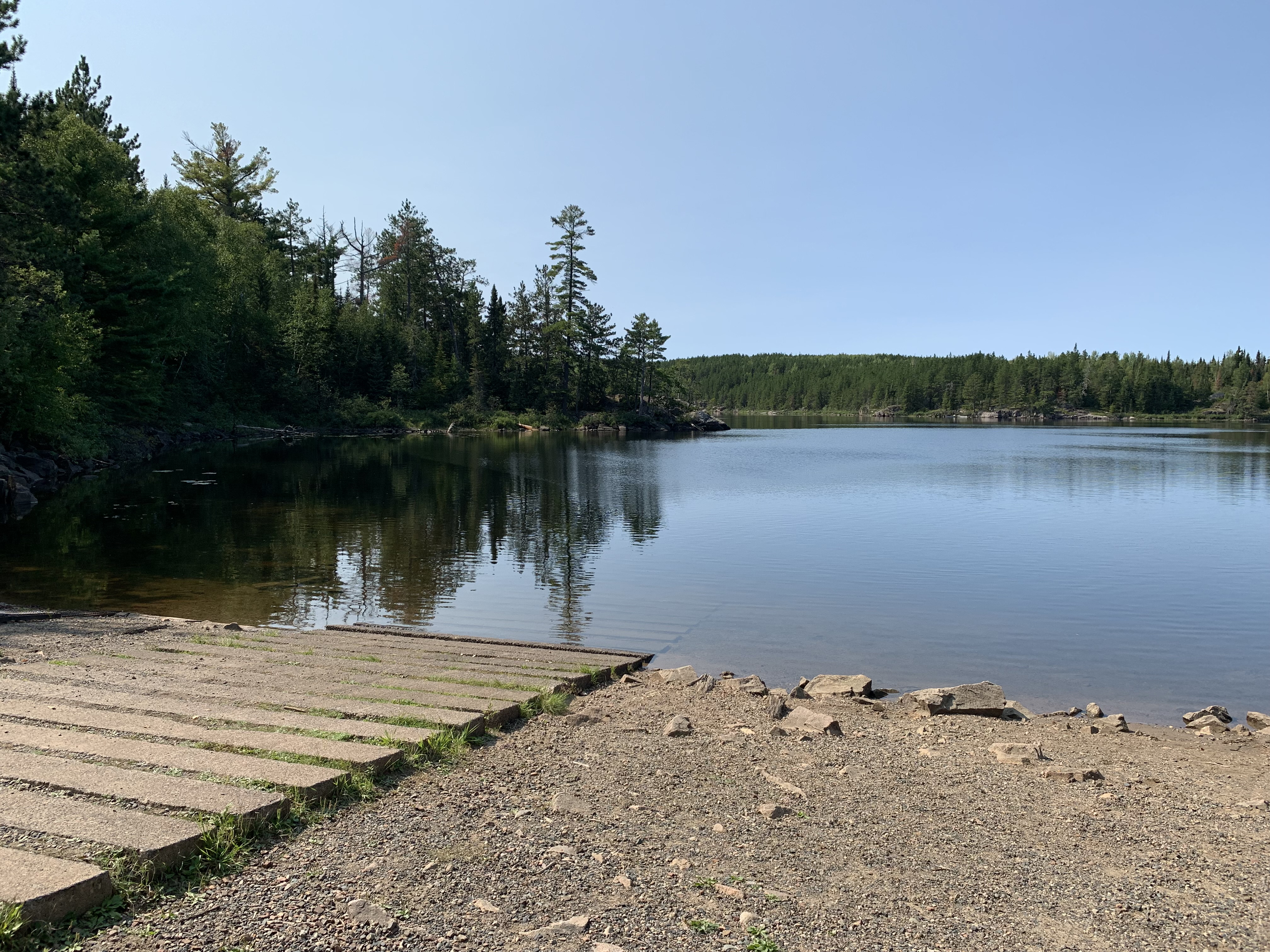
The boat landing area.
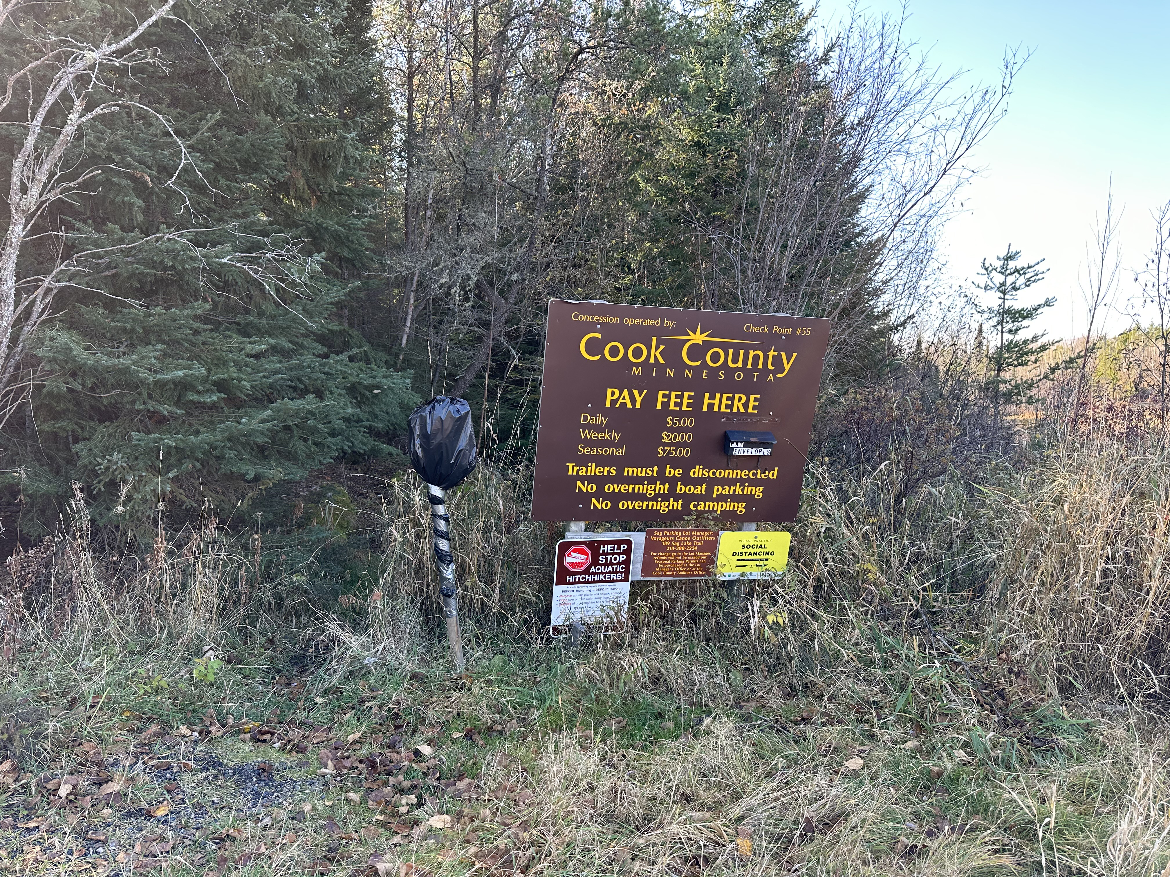
This sign shows what it will cost you to park here for next few days. Believe it is cash only. This photo is from Fall 2022. If you want to avoid parking views, use the alternate entry point landing for Saganaga Lake described below (GULL LAKE/GULL RIVER PUBLIC ACCESS).
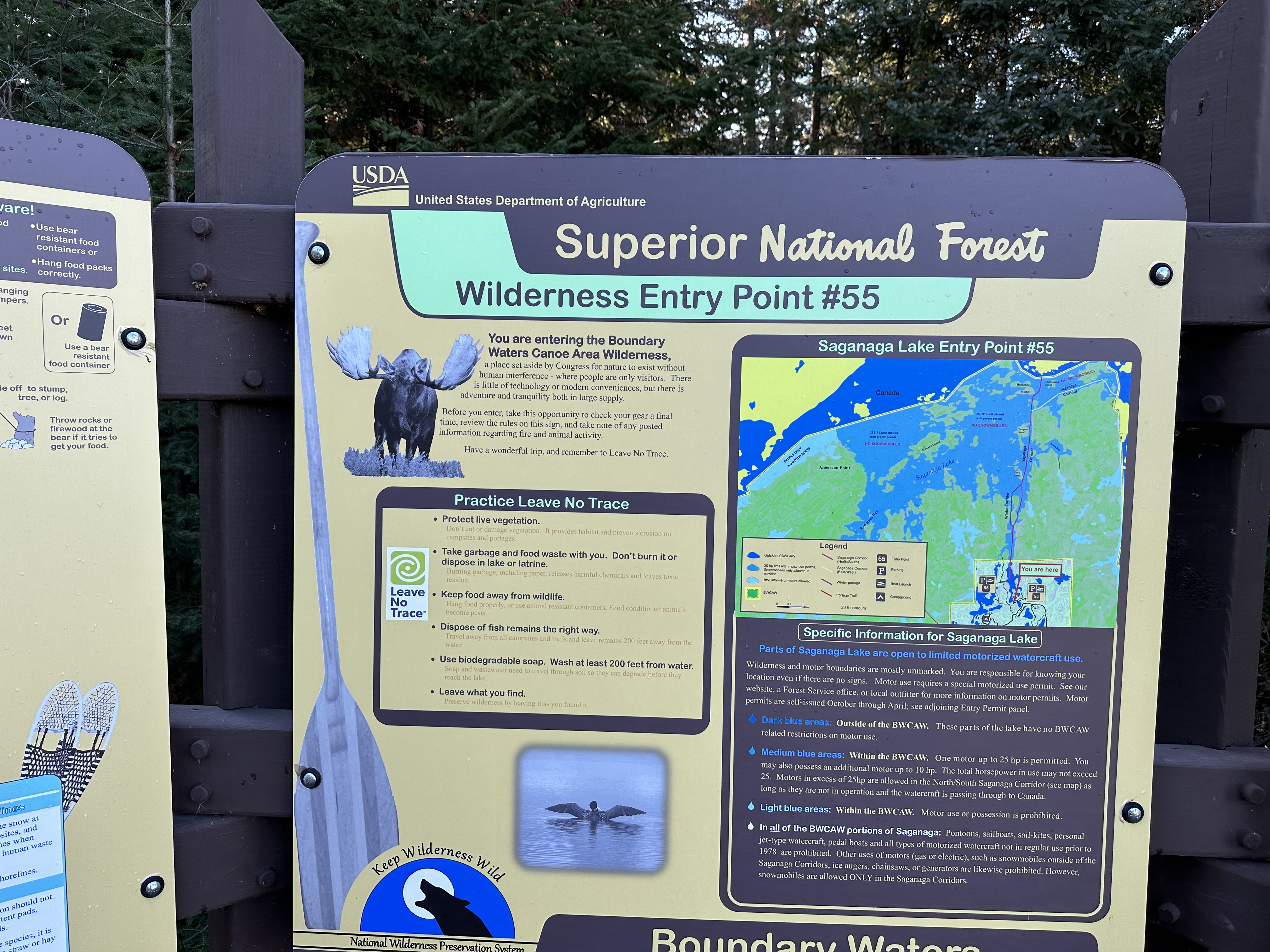
Signage describing this entry point. If you are just doing a day trip, the small box on the far left is where the day permits are located.
Close up of the sign so it is legible.
There is only one direction to paddle from here and that is north. You'll head past that long dock on the right side of the channel and just keep going. You'll stay in this relatively narrow channel for about 2.5 miles. After that it opens up into the main body of Saganaga Lake.
GULL LAKE/GULL RIVER PUBLIC ACCESS:
Unlike the entry point directly on Saganaga Lake, the parking is free at this location. Walk from the parking area down to the shoreline of Gull Lake.
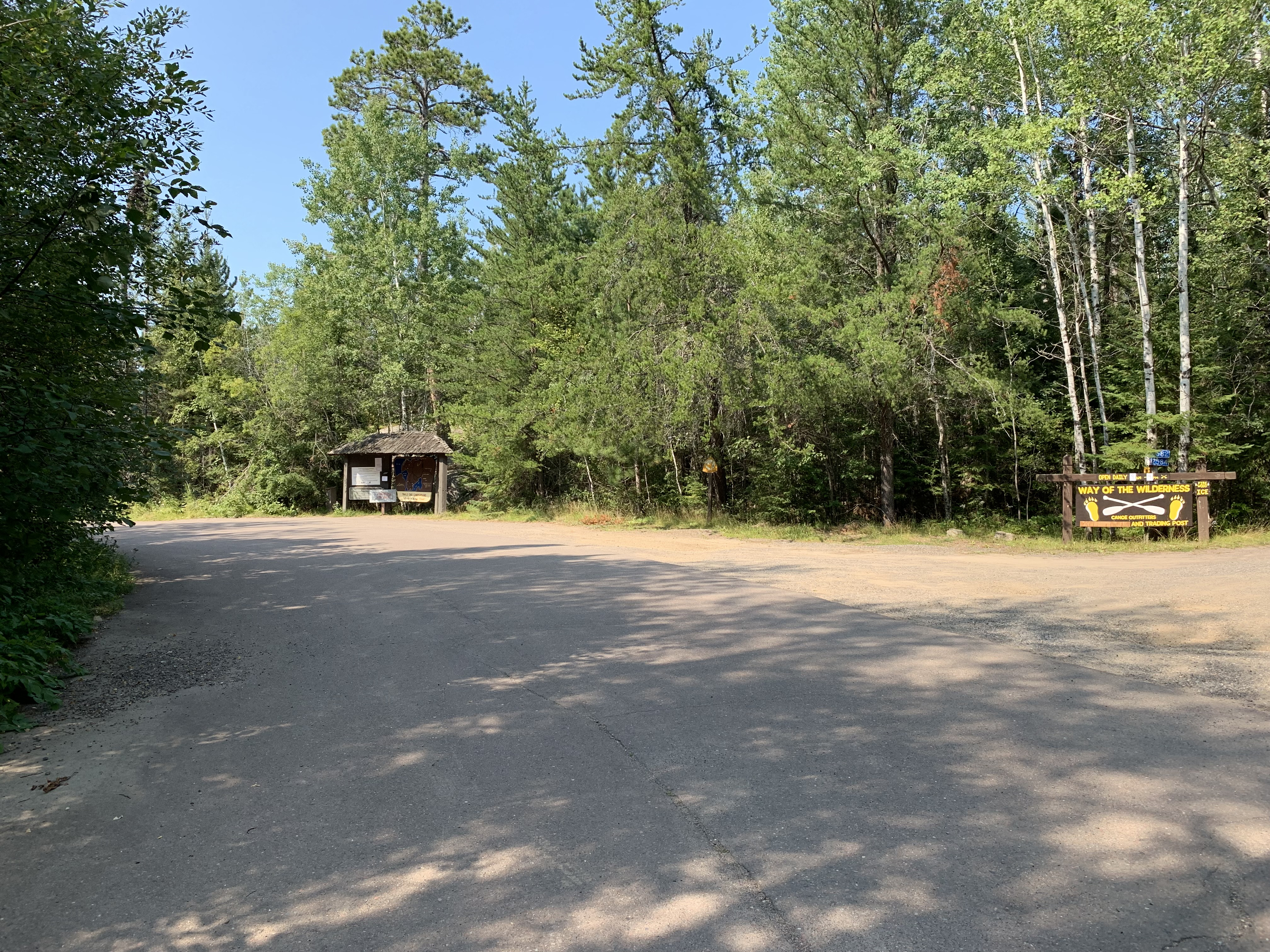
Massive parking lot for cars and vehicles with boat trailers.
From the parking lot, walk down the road a short distance. Head left as you pass the "Way of the Wilderness" establishment.
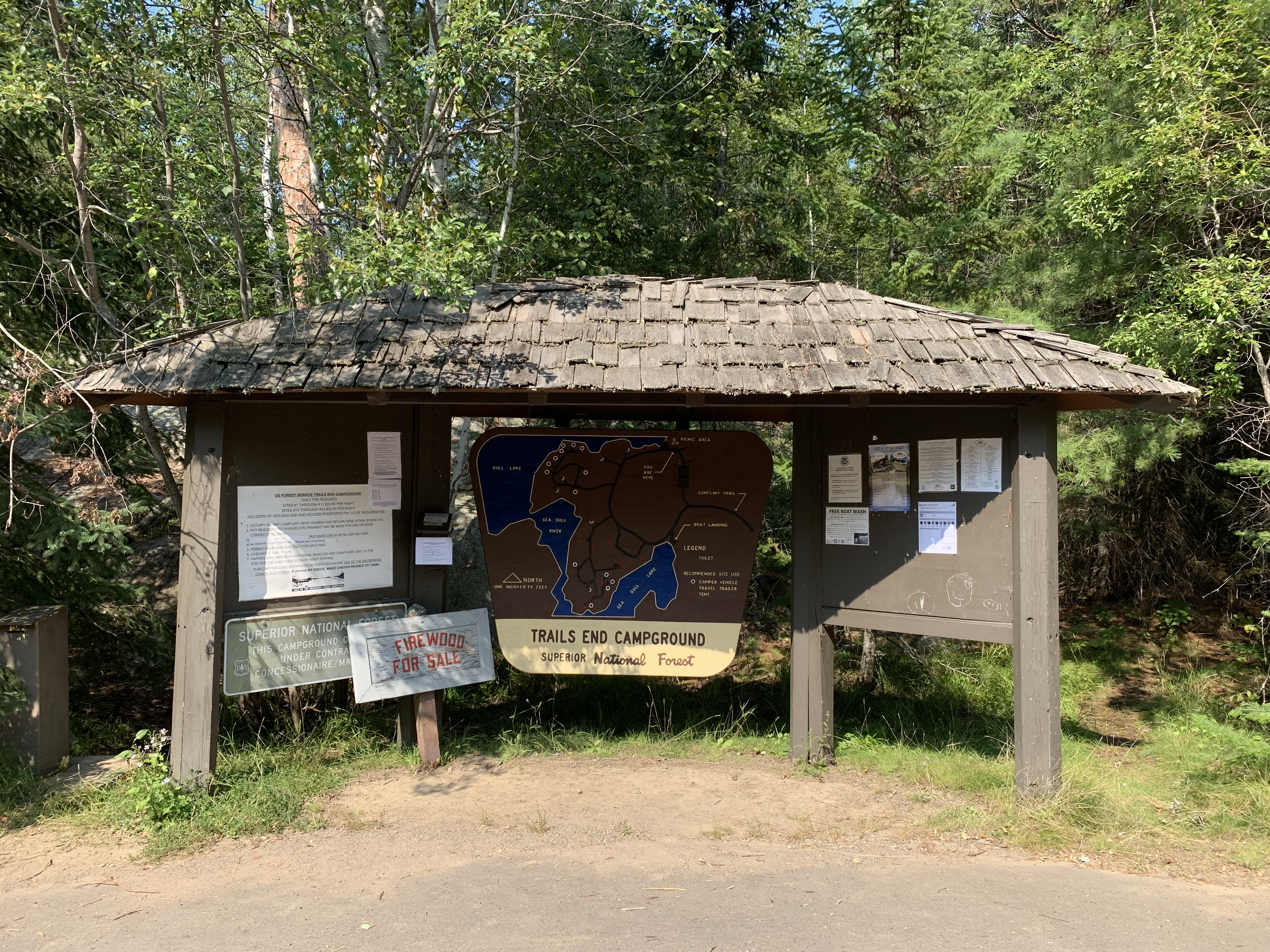
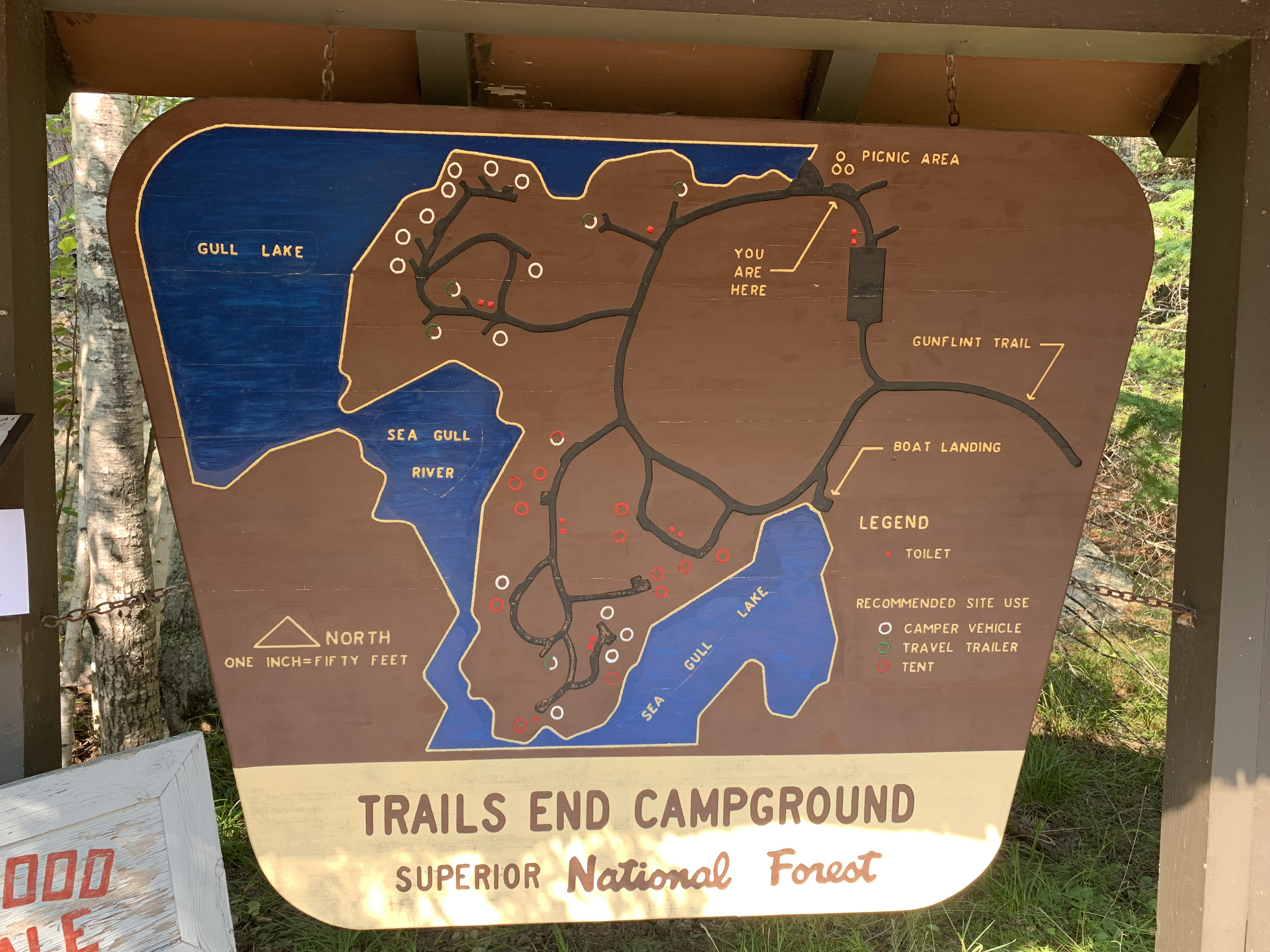
Kiosk for the Trail's End Campground. Map shows campground details.
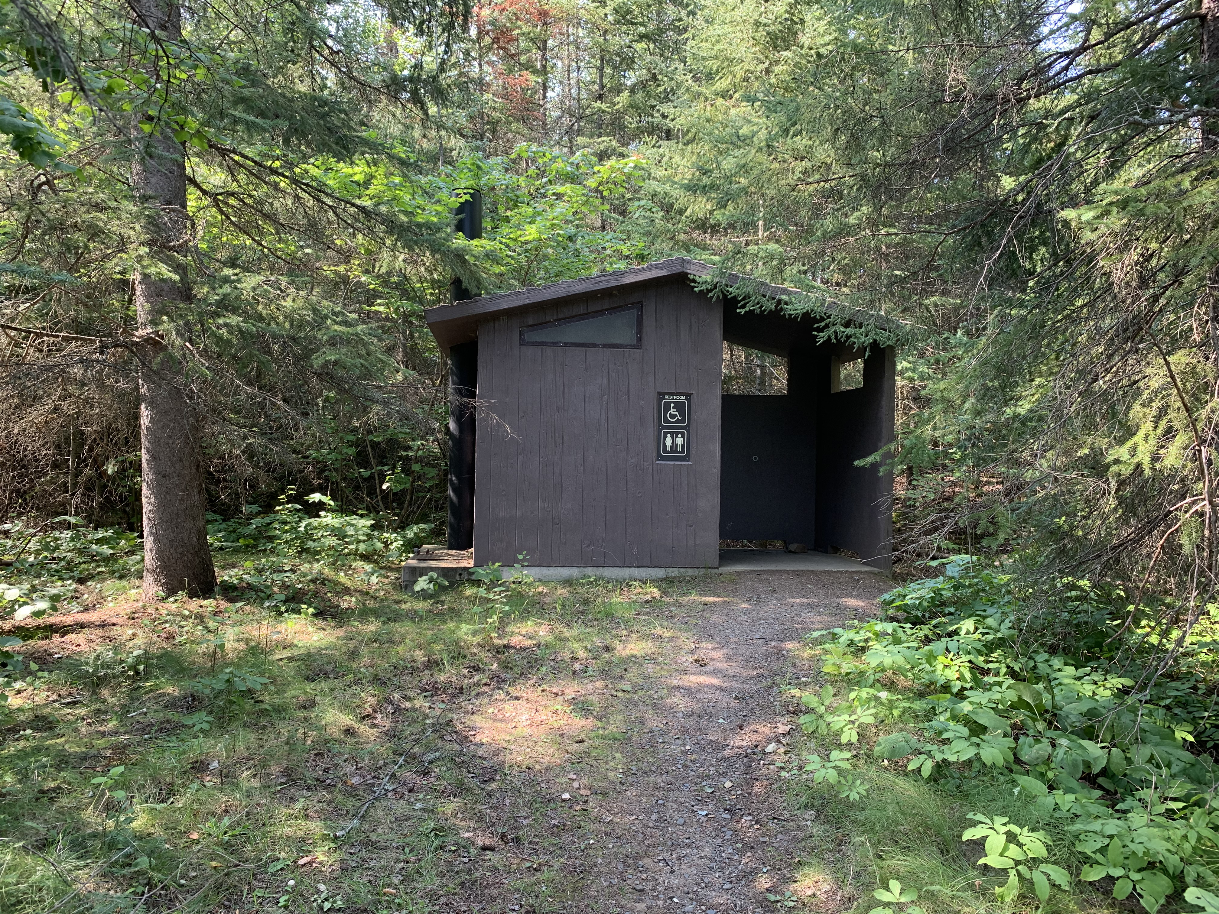
This entry point access has a restroom.
Notice the 'YOU ARE HERE' on the map to orient yourself.
Bulletin board for the Saganaga Lake (via Gull Lake) entry point.
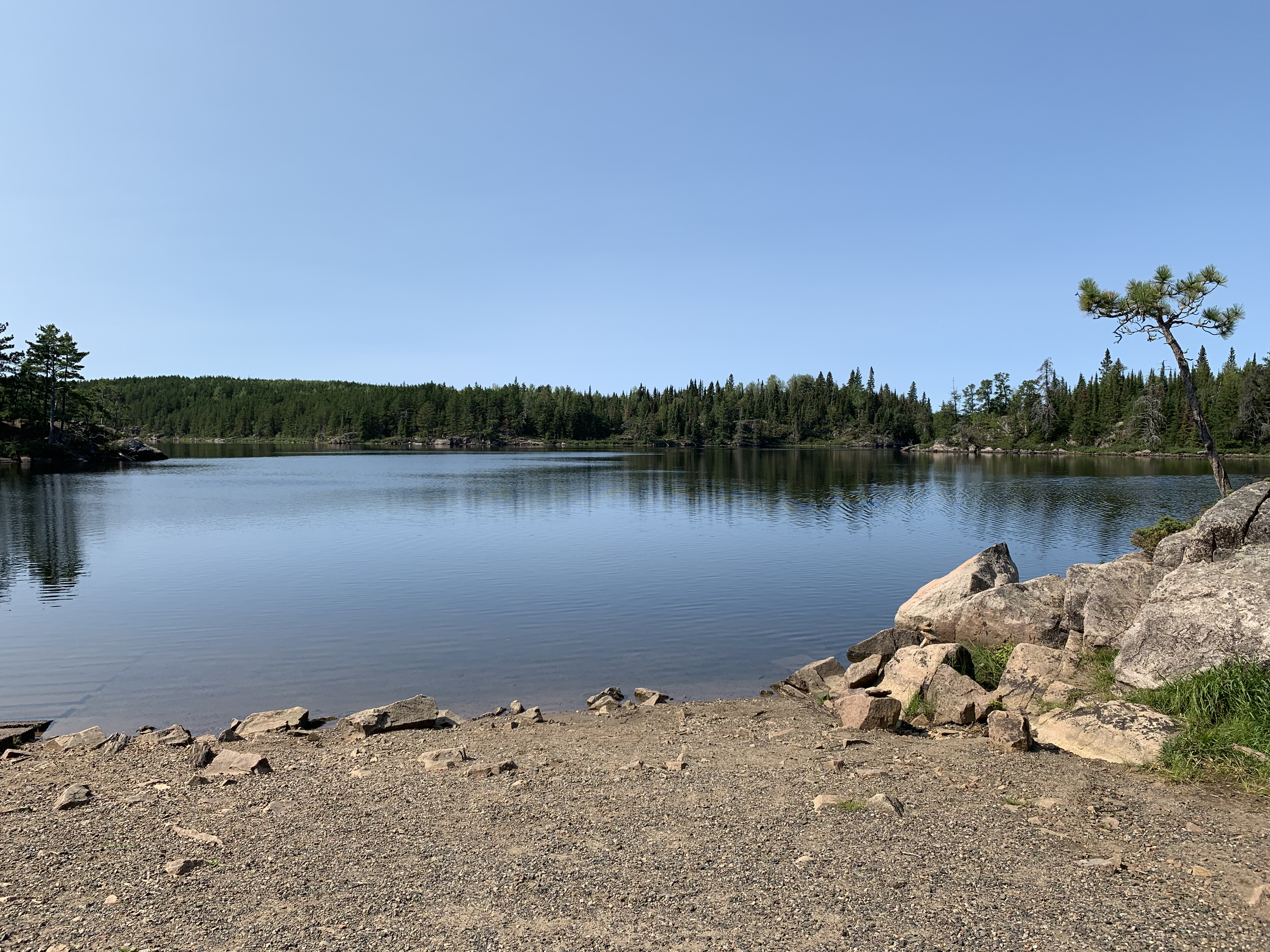
Boat ramp on Gull Lake.
Gull Lake. Looking to the northwest. From here, paddle just past that point on the far left of your view and they turn north to continue across Gull Lake. From the northeast corner of Gull Lake, you'll proceed into a short stretch of the Gull River. Follow that until reaching its mouth on Saganaga Lake. In total it is just over a mile and a half from this landing to where you enter Saganaga Lake.
Now that you've reached the shore of the lake, visit: SAGANAGA LAKE or GULL LAKE