Last Visited: May 5, 2024; Previous Visit(s): July 17, 2022
Maps: Fisher F-13 and F-14; McKenzie #2
Daily Quota: 2
Fire History:
Nearest Ranger Station: Gunflint Ranger Station, Grand Marais, MN along Hwy. 61 on the North Shore
Portage Length from Parking Lot: None
Restroom at Entry Point: No. But there is a latrine toilet at the Duncan Lake/Daniels Lake entry point just to the east down the road
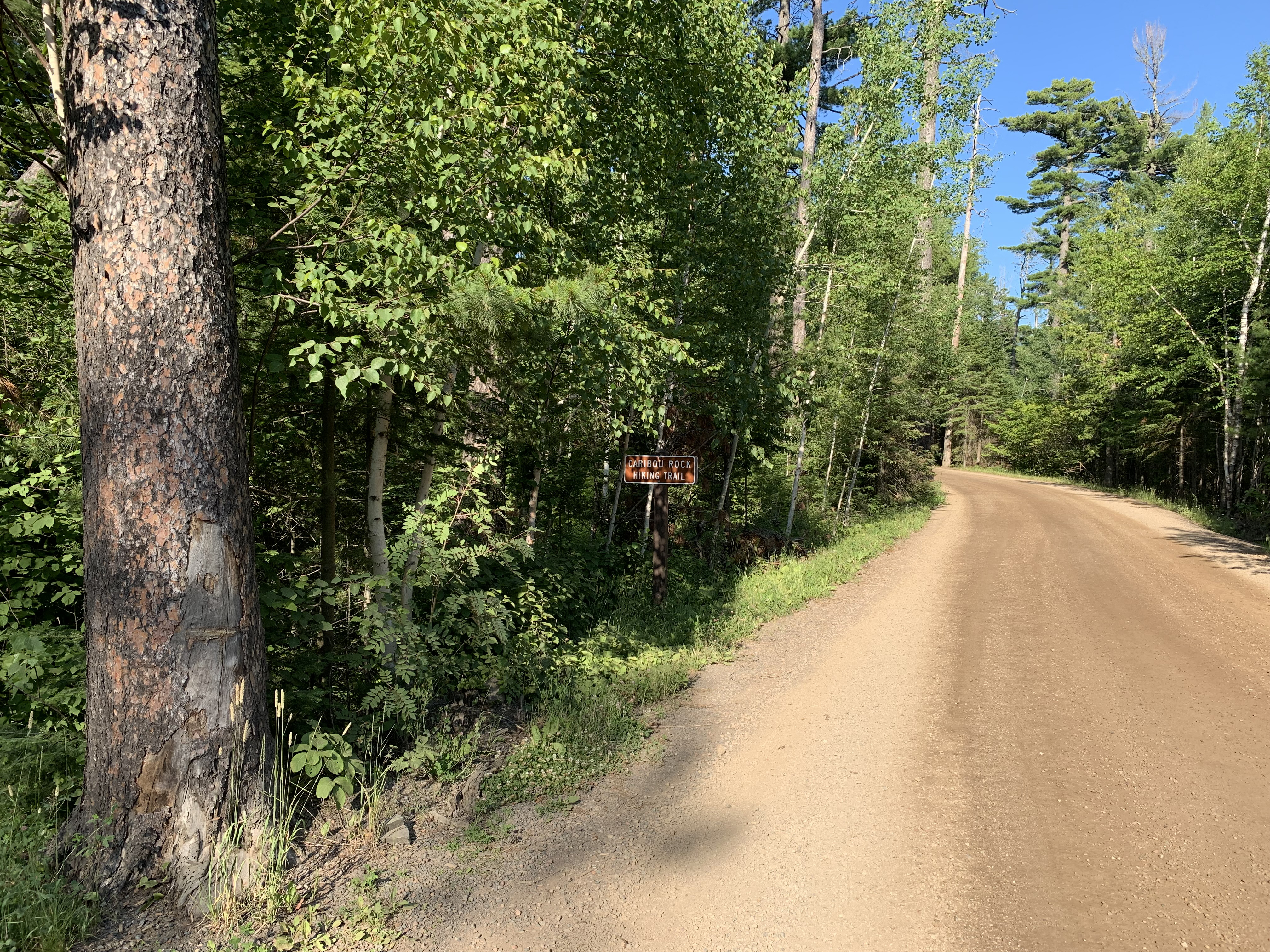
Entry Point 82 - Border Route Trail (Center) and Caribou Rock Trailhead
Gunflint Ranger District
From Grand Marais, Minnesota, follow the Gunflint Trail for about 29 miles to Hungry Jack Road (just before Trail Center). Take a right and drive 1.9 miles to the small parking lot on your right. The trail starts across the road.
The Caribou Rock Trail is an access trail to the Border Route Trail. The Caribou Rock Trail is about 9 miles out-and-back. About 3/4 mile in from the trailhead, there is a fine view of West Bearskin Lake. About a mile further on is another overlook with a view of Moss Lake. The Caribou Rock Trail ends at Rose Lake and Rose Falls. You will also find the Stairway Portage here between Rose Lake and Duncan Lake.
The Caribou Rock Trail intersects the Border Route Trail just before reaching Rose Lake.
Caribou Rock Trail/Border Route Trail/South Lake Trail/Moss Lake Trail Loop
The Caribou Rock Trail can be used to create a loop hike. Follow the Caribou Rock Trail for 3.5-miles to where it intersects the Border Route Trail near the Stairway Portage and Rose Falls. Turn left and follow the Border Route Trail west for 3.8-miles until you reach the intersection with the South Lake Trail. At this point turn left again and now follow the South Lake Trail south for 2.4-miles until reaching the junction with the Moss Lake Trail. Finally make another left and hike the Moss Lake Trail east for 2.9 miles until you come back to the Caribou Rock Trail. Turn right (south) and go 0.2-miles down the hill to the Caribou Rock Trail trailhead (BWCA Entry Point #82). The Caribou Rock Trail is the most difficult trail in this loop. The entire loop is about 12.8-miles. Makes for a long day hike or a more leisurely weekend adventure. This hike has some of the finest views/overlooks in the entire BWCA.
Exploring the Entry Point
Click on the photos below to see the full resolution image - Use your browsers back button to close photo and return to this page.
Sign on side of road for the Caribou Rock Trail. This is also BWCA Entry Point 82 - Border Route Trail (Center).
The start of the trail is just across Hungry Jack Road from the parking lot. If you are just hiking for the day, remember to fill out a BWCA day permit, as the last part of the Caribou Rock Trail is in the Boundary Waters.
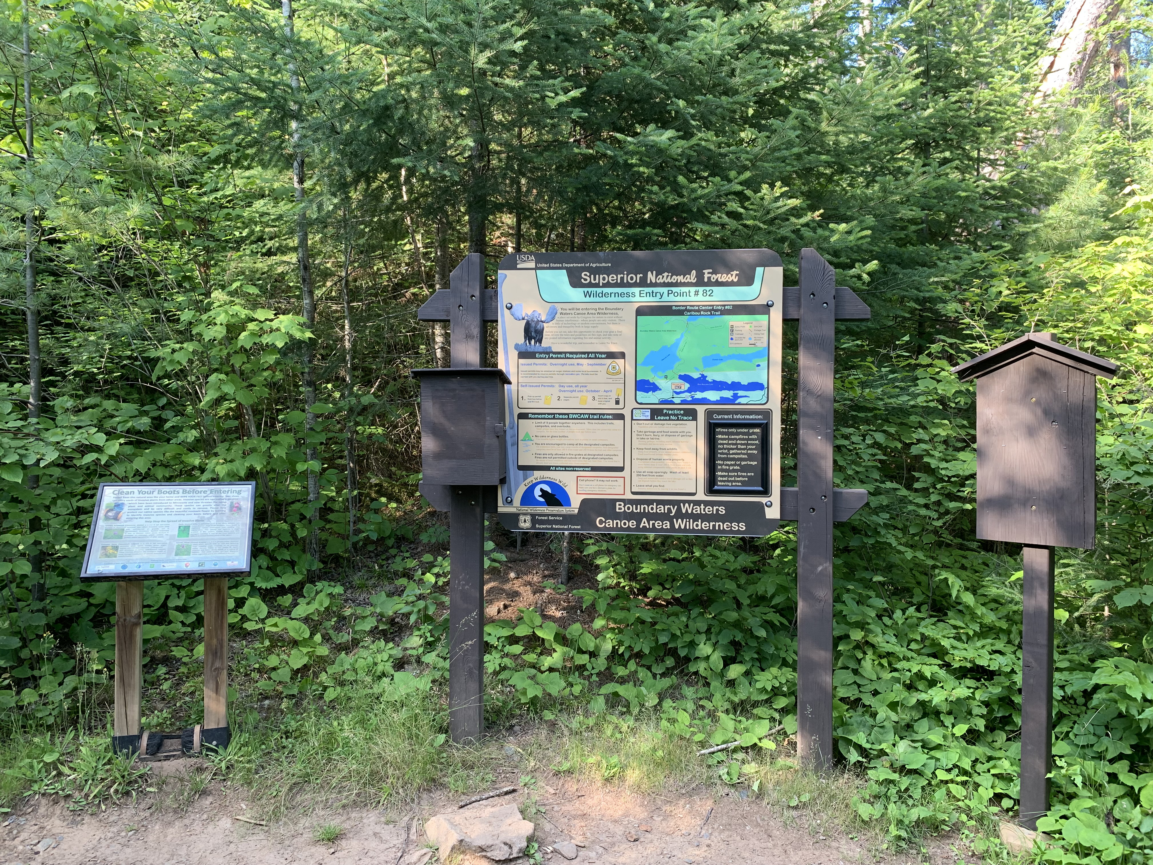
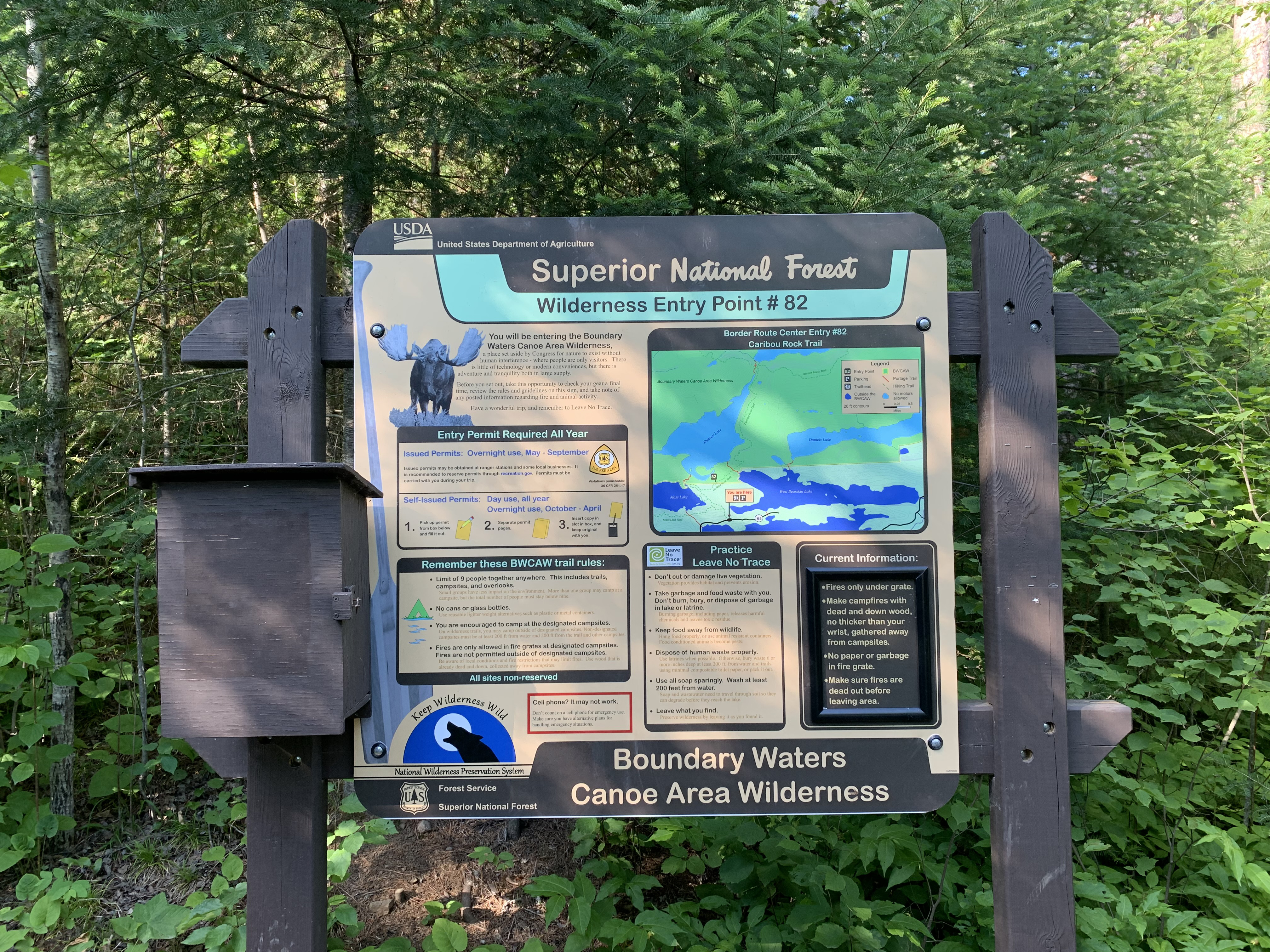
The usual signage found at all BWCA entry points. The box on the left of the middle sign contains BWCA day permit forms.
Signage for the Caribou Rock Trail and BWCA Entry Point 82.
Now that you've reached the trailhead, start hiking the:BORDER ROUTE TRAIL