Crystal Lake
Gunflint Ranger District
CRYSTAL LAKE CAMPSITES:
Campsite 1 (#737): The lakes western campsite
Campsite 2 (#738): The lakes eastern campsite
Most likely the lake is named from its water clarity. The lake was once named Fanny Lake (no joke).
There are two campsites along the north shore of the lake. The fishing for lake trout here has been particularly good. The lake also holds a fishable number of walleye.
There used to be a portage from the south shore of Crystal Lake south to Pierz Lake, but this trail hasn't been maintained since the 1960's era.
If you are looking for a day trip idea from Crystal Lake, the 45 rod portage to Spaulding Lake is challenging for its length. At the eastern end of Spaulding Lake, looking for the remains of an old mine site. This mine was developed by Captain William Spaulding sometime around the 1880's. He arrived shortly after Henry Mayhew built the road into this area starting from Grand Marais. The Spaulding Road (aka Tote Road) was a spur off the main road that led to the Crystal Lake area. Some old mining gear and the dilapidated remains of a long cabin are still evident. Mr. Spaulding spent about 25 years looking for copper and silver, but he didn't find much. Fish are just as scarce in Spaulding Lake as metal was Spaulding's mine, so don't bother to wet a line. Spaulding Lake also used to have a different name. It used to be called Miranda Lake.
There is also a portage from Spaulding Lake to Bench Lake of roughly 100 rods that is extremely difficult. This trail is very steep and also suffered heavy damage from the 1999 windstorm. Bench Lake has recently (2022) been stocked every other year with brook trout fingerlings. There isn't a portage from Bench Lake to Table Lake.
Crystal Lake is spring fed and it drains west into Canoe Lake.
References:
Beymer, Robert, Boundary Waters Canoe Area – Volume 2 – Eastern Region (Berkeley: Wilderness Press, 2006), 242.
Pauly, Daniel, Exploring the Boundary Waters (Minneapolis: University of Minnesota Press, 2005), 389.
Exploring Crystal Lake
Routes to locations on Crystal Lake are shown below:
No routes defined yet for Crystal Lake.
Click on the photos below to see the full resolution image - Use your browsers back button to close photo and return to this page.

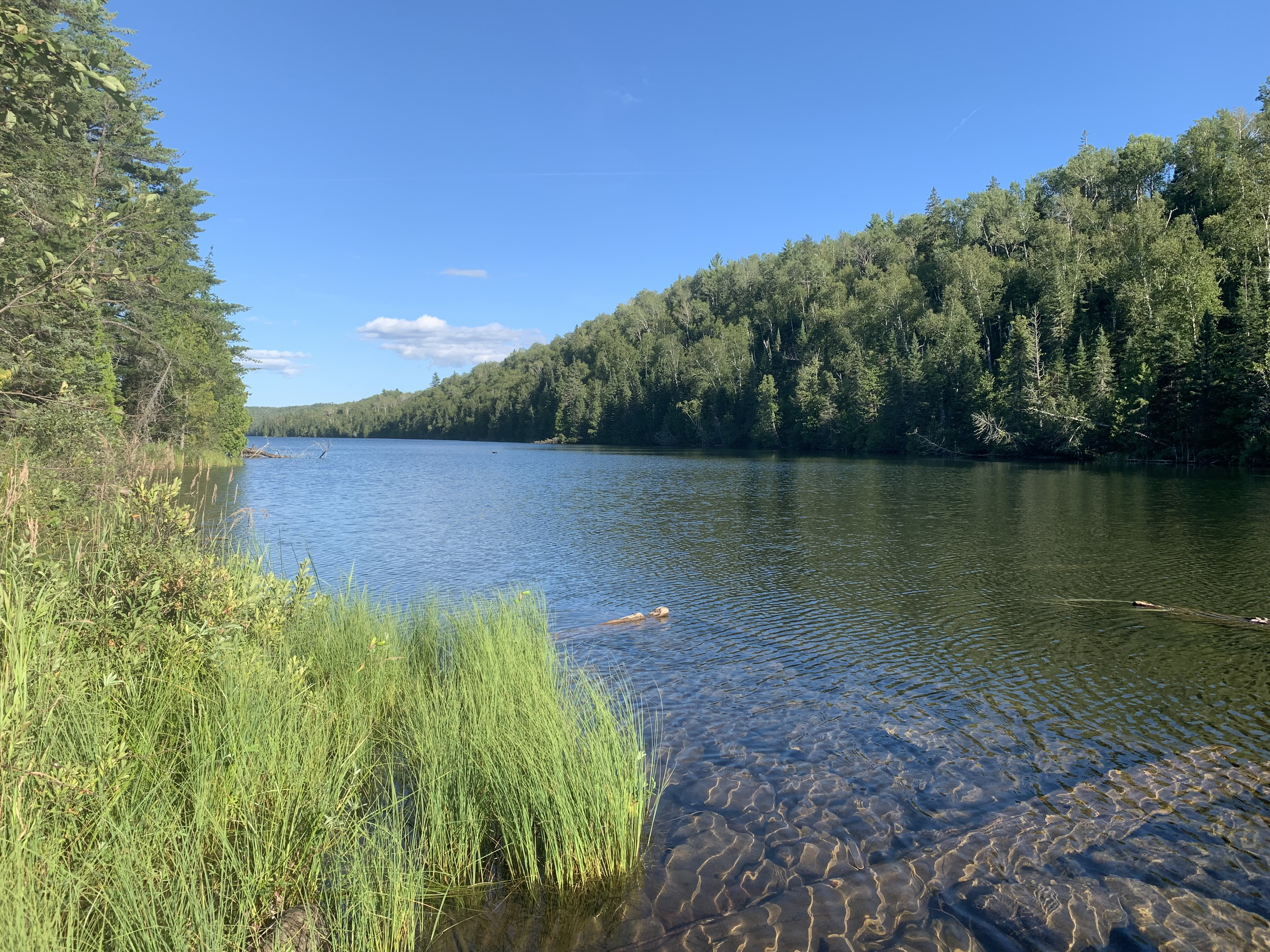
View of Crystal Lake looking east from the Canoe Lake portage. Note the rock crib in the water just offshore.

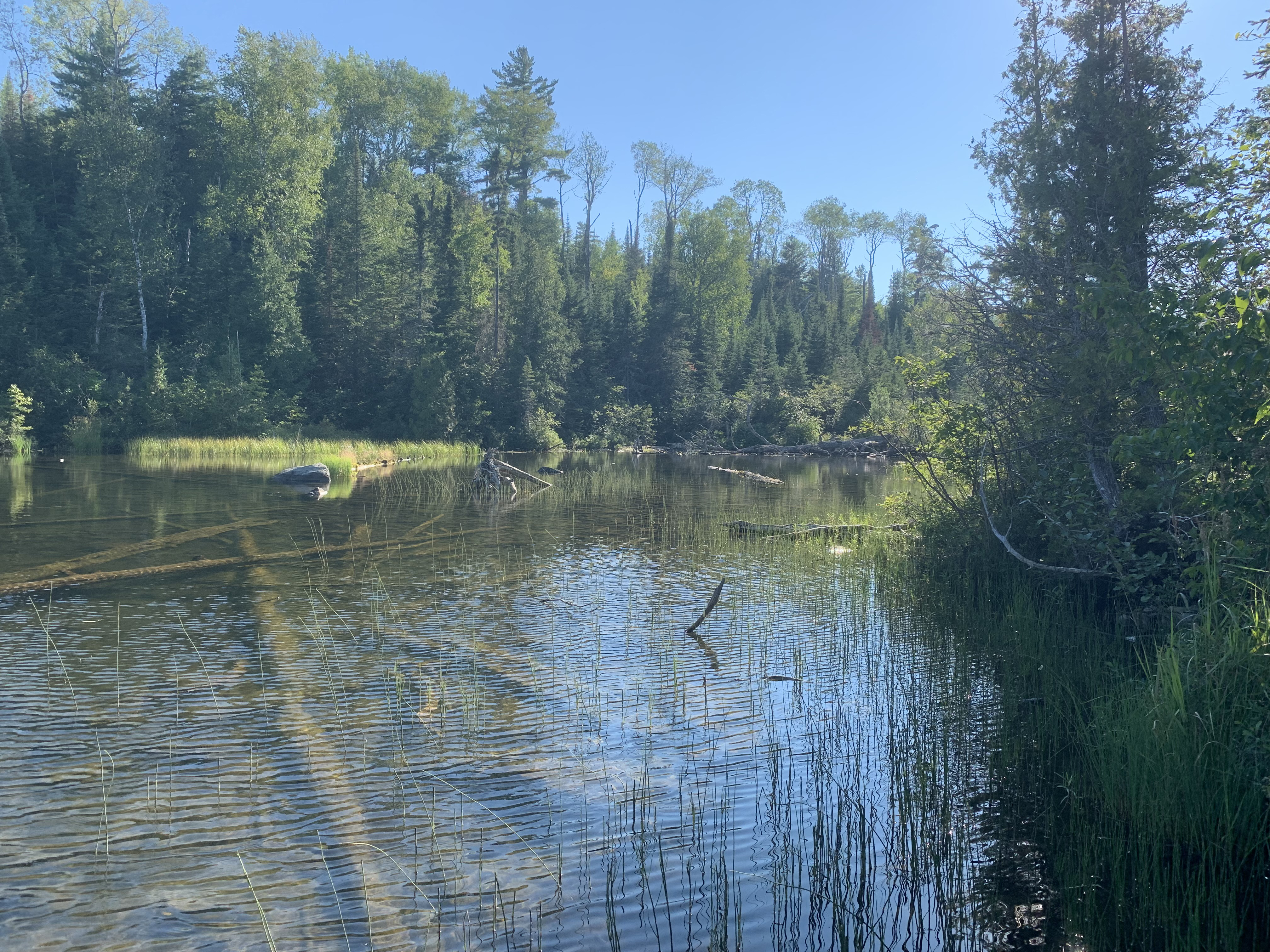
This is the western end of Crystal Lake as seen from the Canoe Lake portage.
Route Connections for Crystal Lake
From Crystal Lake you can portage to Canoe Lake or Spaulding Lake.
Return to Top of Page
|