Edith Lake lies to the east of Brant Lake and to the west of West Round Lake. The water in Edith Lake drains toward Brant Lake through a small creek. If water levels are good, this creek is navigable allowing you to skip the portage between Edith Lake and Brant Lake. Expect to liftover a beaver dam or two or three (it is often easier just to take the portage).
Edith Lake is not in the Boundary Waters Canoe Area. The actual border of the BWCA is crossed at the start of the portage leading to Brant Lake. This is a 33 rod portage. A sign indicates where you enter the BWCA.
Edith Lake supports a good population of small northern pike. There are also reports of yellow perch and even pumpkinseed sunfish in the lake. There are no campsites on the lake. Brant Lake has three campsites, but they are often taken. So if you come this way, make sure you get a reasonably early start. Past Brant Lake you enter a part of the BWCA that sees relatively few visitors.
There is an extremely long board walkway over a boggy section between West Round Lake and Edith Lake. If there has been a lot of rain, this walkway can become a "floating" walkway in which case you will have to walk in knee deep water. This is what makes the BWCA fun! The portage from Edith Lake to Brant Lake is often covered with standing water for much of its length. Probably resulting from a combination of the portage being so flat and also traversing a marshy area.
The north and west shore of Edith Lake was burned by the 2007 Ham Lake Fire. This gives the lake a rather desolate look, although the forest is coming back quick. The mature forest around Edith Lake's shoreline last burned in 1854. Spruce makes up most of the trees that survived the 2007 fire.
References:
Beymer, Robert, Boundary Waters Canoe Area – Volume 2 – Eastern Region (Berkeley: Wilderness Press, 2006), 147, 154, 158.
Pauly, Daniel, Exploring the Boundary Waters (Minneapolis: University of Minnesota Press, 2005), 324, 335.
Click on the photos below to see the full resolution image - Use your browsers back button to close photo and return to this page.
PADDLING FROM THE WEST ROUND LAKE PORTAGE TO NEAR THE START OF THE BRANT LAKE PORTAGE AND THEN TO THE CREEK LEADING TO BRANT LAKE
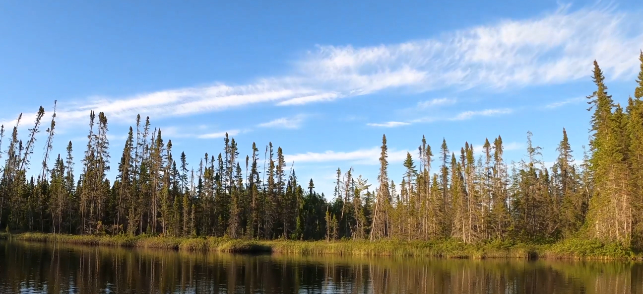
This is a view of Edith Lake from the West Round Lake portage.
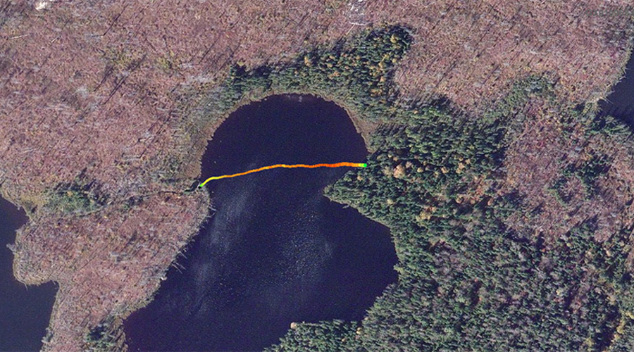
Starting from the West Round Lake portage, you paddle across Edth Lake to the back of its southwest bay near where a small creek flows out to the southwest toward Brant Lake. This creek can be used to get to Brant Lake if the water levels are reasonable, but expect to lift over a beaver dam or two. This is not where the portage is. (About 2:00 minutes into the video, it is pointed out where the location of the Brant Lake portage is.)
Continuance of the paddle across Edith Lake. From the creek, paddle to the northeast and around the corner, almost reaching the portage leading to Brant Lake. (Video ends prematurely -- the portage is just to the left, about 200 feet around the point from where the video ends)
You are looking to the east at Edith Lake while standing at the start of the portage leading to Brant Lake.
Another view of Edith Lake from the Brant Lake portage. Portage to Brant Lake -or- Explore Another Route **********************************************END OF ROUTE***********************************************
PADDLING FROM THE BRANT LAKE PORTAGE TO THE WEST ROUND LAKE PORTAGE
Looking to the northeast from just east of the Brant Lake portage.
A bee line paddle straight from the Brant Lake portage to the West Round Lake portage. The lake is not very big. If you decide to spend some time on Edith Lake, it does have northern pike.
Looking just to the left of the West Round Lake portage landing, as you approach it while crossing Edith Lake. Portage to West Round Lake -or- Explore Another Route **********************************************END OF ROUTE***********************************************
Route Connections for Edith Lake
From Edith Lake, you can portage to Brant Lake or West Round Lake. Also during times when water levels are relatively high, you can paddle the creek from Edith Lake to Brant Lake (assuming it isn't blocked by debris -- i.e. logs, beaver dams, etc).