ROUTES/PORTAGES FROM OWL LAKE:
To Crooked Lake: Walk the 55 rod portage
To Tuscarora Lake: Walk the 68 rod portage
To Hooter Lake: Bushwhack for about 35 rods
To Ogle Lake: Bushwhack for about 35 rods
Owl Lake
Gunflint Ranger District
Owl Lake provides a link between Tuscarora Lake and the Crooked Lake/Gillis Lake area. The lake is often skipped over as paddlers tend to favor spending their time at Crooked Lake and Gillis Lake to the west and Tuscarora Lake to the east.
Owl Lake also has two small lakes just to its south; Hooter Lake and Ogle Lake. Hooter Lake is accessible by a determined bushwhacker. Ogle Lake is more easily (relative term) accessed by bushwhacking in from Jerry Lake. Hooter Lake drains off to the west into Jerry Lake via a small creek. Another unnamed lake is just west of the north tip of Owl Lake.
Owl Lake is fairly deep at 70 feet. The lake also has lake trout in it. However, the lake trout are not numerous according to fish surveys. A small island is in the south part of the lake.
The water from Owl Lake drains into Crooked Lake through a creek that parallels the portage between the two lakes. This flowage drops rapidly over the 55 rod distance losing 38 feet. Thus, you can probably surmise that the portage into Owl Lake from Crooked Lake is uphill; downhill from Owl Lake to Crooked Lake.
There are no campsites on Owl Lake, but Tuscarora Lake, Crooked Lake and Gillis Lake offer plenty of them.
The last fire to heavily impact the forest surrounding Owl Lake was in 1801.
Click on the photos below to see the full resolution image - Use your browsers back button to close photo and return to this page.
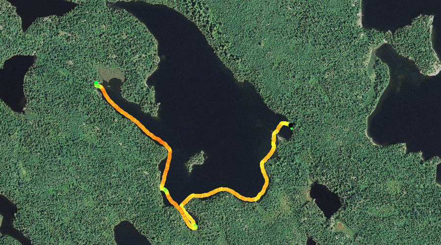
PADDLING FROM THE CROOKED LAKE PORTAGE TO THE TUSCARORA LAKE PORTAGE
This is the southwest corner of Owl Lake, back behind the lake's small island.
From the Crooked Lake portage landing, you paddle south toward Owl Lake's small island. From the island you generally stay along the south and then southeast shore of the lake until you reach the portage landing for Tuscarora Lake.
From atop the jumble of rocks that marks the start of the Tuscarora Lake portage, you take in the view of Owl Lake. Portage to Tuscarora Lake -or- Explore Another Route **********************************************END OF ROUTE***********************************************
PADDLING FROM THE TUSCARORA LAKE PORTAGE TO THE CROOKED LAKE PORTAGE
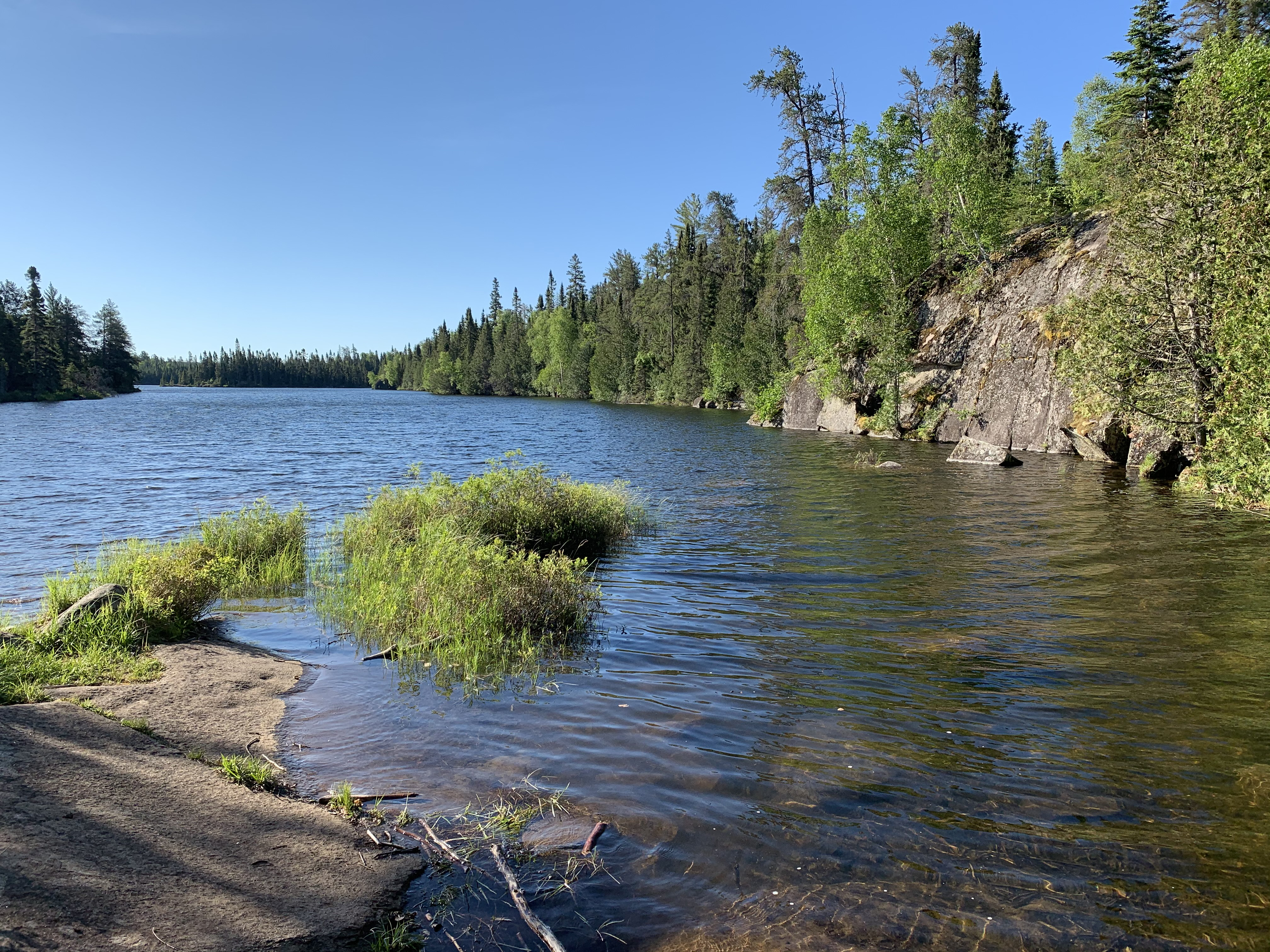
Looking due west from the Tuscarora Lake portage at Owl Lake.
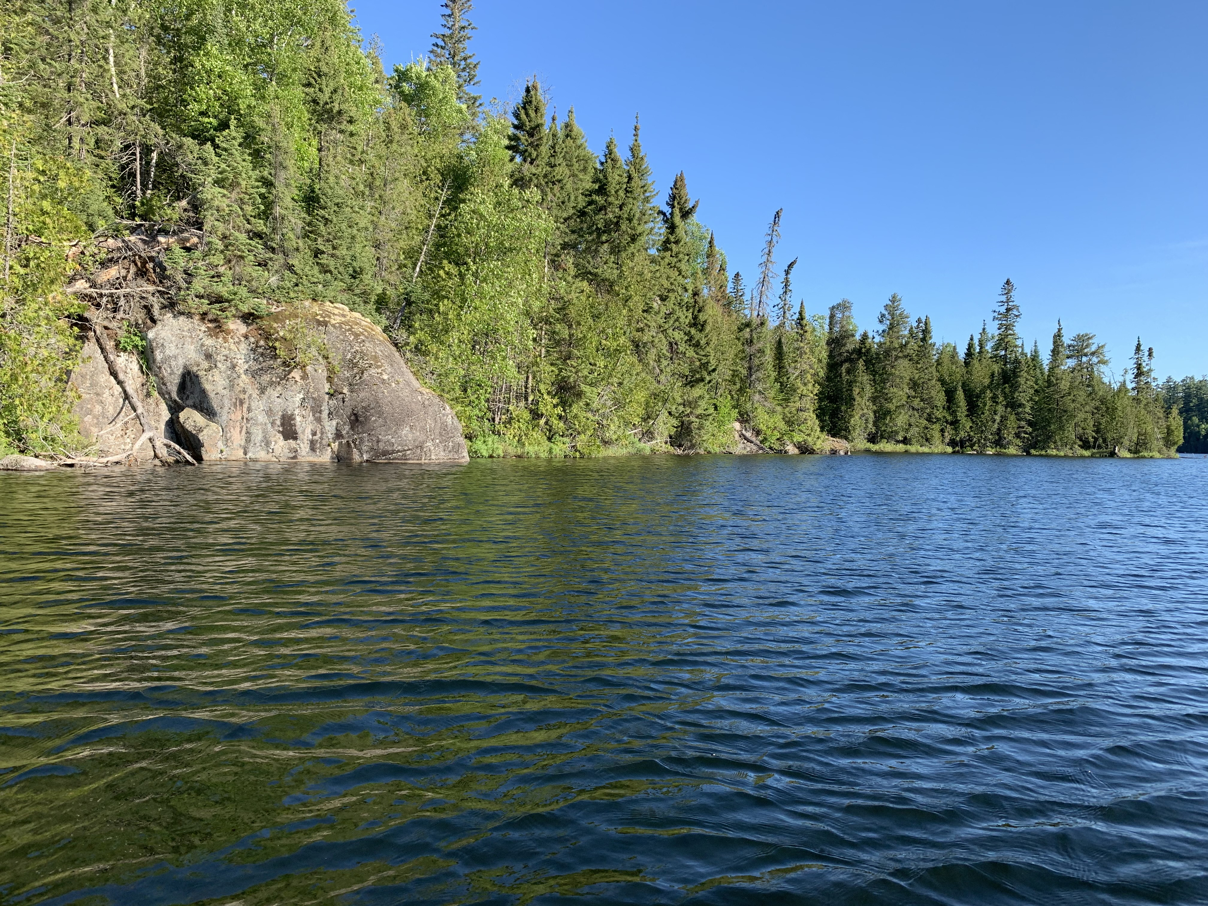
From near the west side of Owl Lake, a look back toward the east. The lakes single island is visible to the right of your view. The point that divides the west arm of the lake from the main body of the lake can be seen to the left.
After leaving the Tuscarora Lake portage, you head toward the south and follow the southern shoreline of the lake. You swing into the small bay on the south end of the lake. From that little bay you head north up the west shoreline. At the entrance to the west arm of Owl Lake, you proceed northwest until you reach the portage landing for Crooked Lake. As you approach this portage, if you look to the left carefully, you can see a large beaver dam that runs between the cliff face and the portage (kind of subtle and hard to see). The bow of your canoe will be pointed straight at it at about 19:00 point in the video. This beaver dam has a strong influence on the water levels of this lake.
Small rock face near the point on the west shoreline, due west of the lakes island.
Here you are looking toward the southeast down the west arm of Owl Lake from the Crooked Lake portage. Just out of view to your right is a large beaver dam that raises the water level of Owl Lake by at least a couple feet, if not more. Portage to Crooked Lake -or- Explore Another Route **********************************************END OF ROUTE***********************************************
Route Connections for Owl Lake
From Owl Lake, you can portage to Crooked Lake or Tuscarora Lake. A bushwhack to Hooter Lake would be be possible for the highly motivated.