GABBRO LAKE CAMPSITES: Campsite 1: (#1708) - In the channel between Gabbro Lake and Little Gabbro Lake Campsite 2: (#1711) - At start of channel to Little Gabbro Lake Campsite 3: (#1713) - Located on an island near mid-lake along Gabrro Lake's western shoreline Campsite 4: (#1716) - On sharp point jutting out from west shoreline in south half of the lake Campsite 5: (#1717) - On island just north of the Bald Eagle Lake portage
Campsite 6: (#1712) - On west shoreline just as you enter main body of the lake from Little Gabbro Lake
Campsite 7: (#2135) - On island in main body of Gabbro Lake, just east of channel to Little Gabbro Lake
Campsite 8: (#1710) - On the tip of the long point jutting out from north shoreline, east of Little Gabbro Lake channel
Campsite 9: (#1714) - Northernmost of the two campsites on the east side of the channel extending up towards Cortes Lake
Campsite 10: (#1715) - Southernmost of the two campsites on the east side of the channel extending up towards Cortes Lake
The lake is named for a type of igneous (volcanic) rock known as gabbro and is part of the Duluth Complex, a rock formation over a billion years old (Pauly, 2005). Nickel sulfide mineralization occurs along the north rim of the Duluth Complex where it comes in contact with even older rock formations further north (Heinselman, 1999).
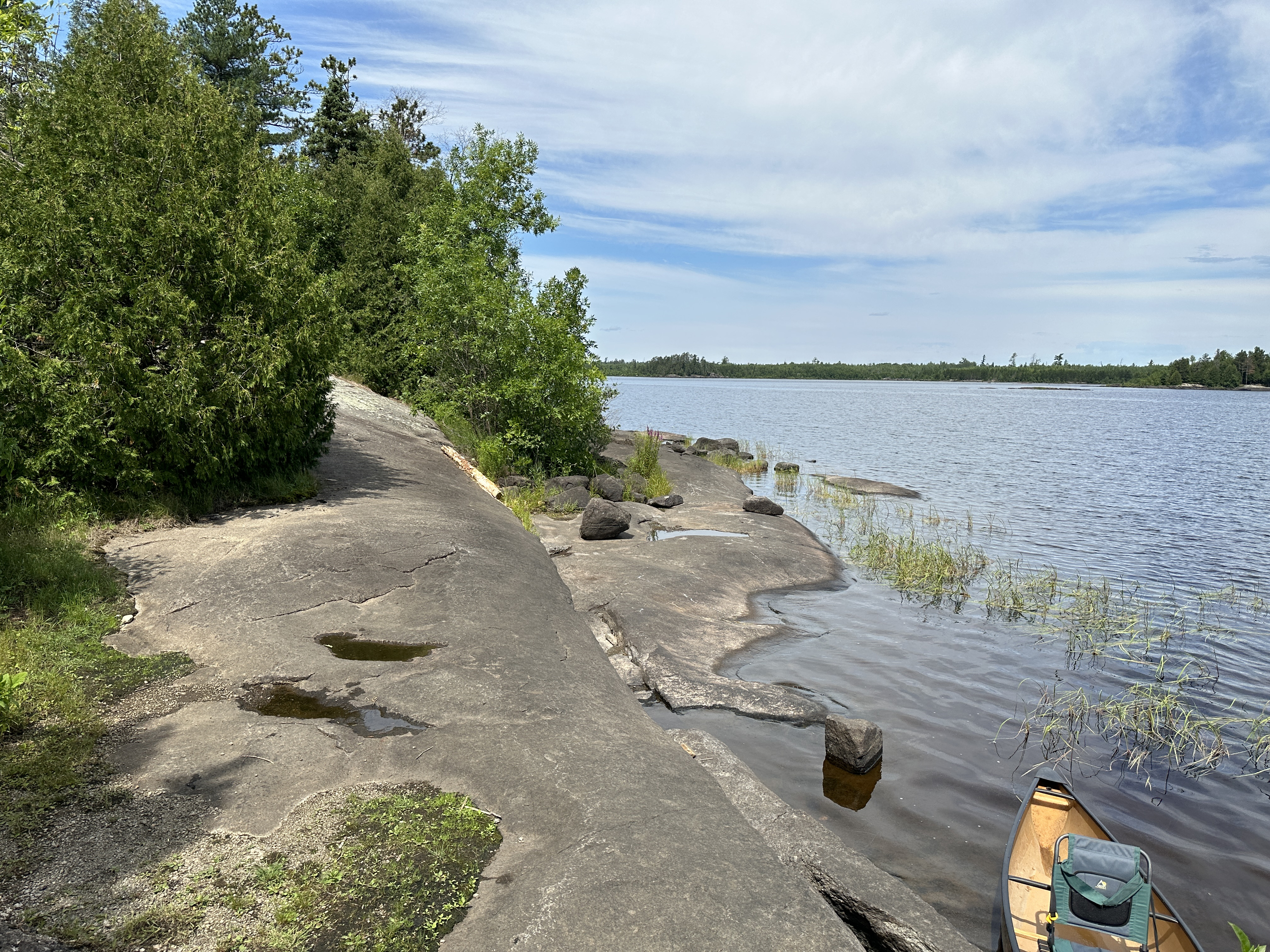
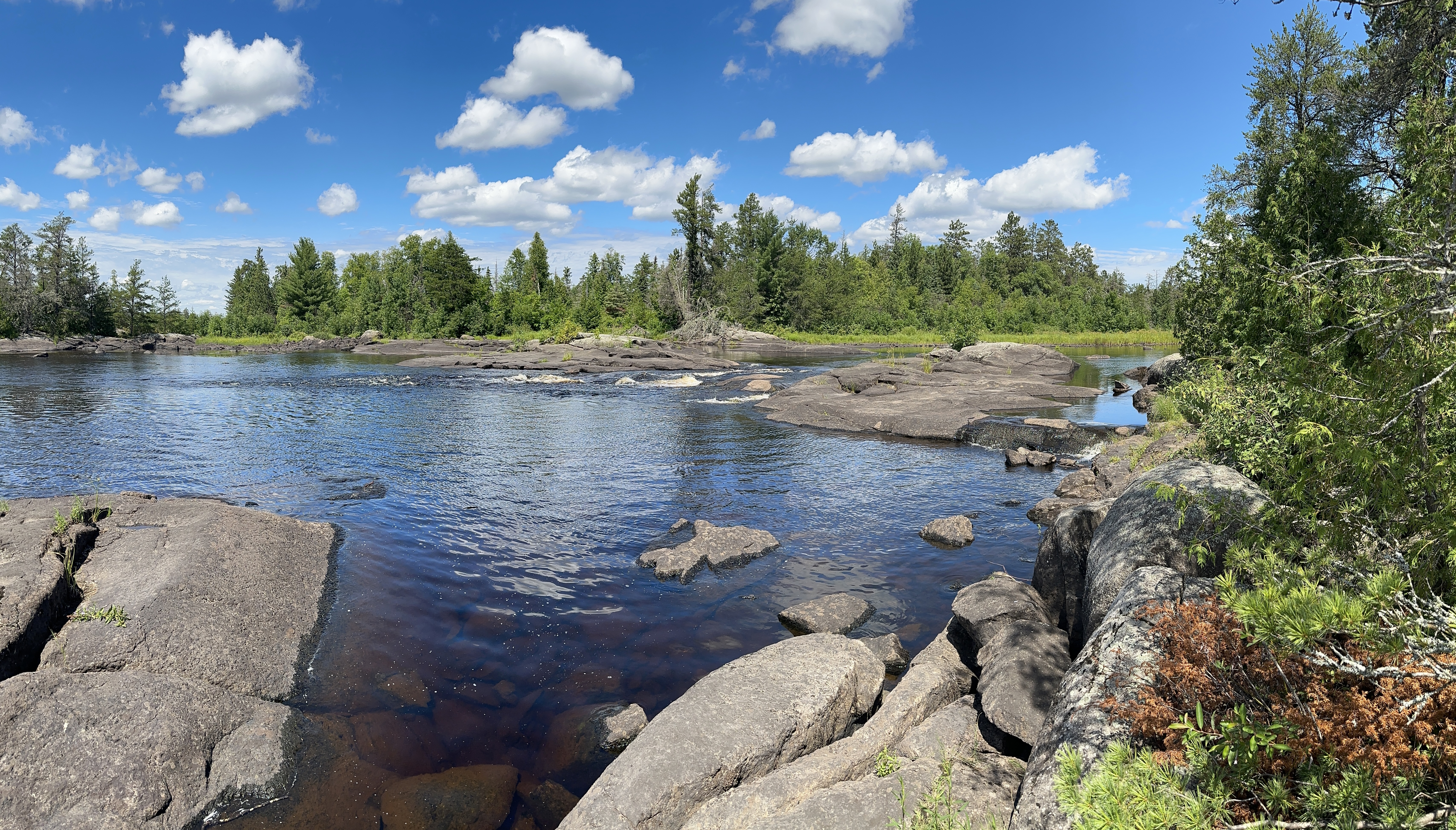
There are some rapids between Bald Eagle Lake and Gabbro Lake. There is an unmarked portage near the end of the island (or barely connected peninsula). This portage is not marked on many maps of the BWCA. Similarly, there is an even smaller set of rapids between Little Gabbro Lake and Gabbro Lake. If you want to portage this section of fast water (particularly in early spring), there is a nice table rock on the south side of the channel that makes for an easy lift over of perhaps 2 rods in length.
A sand beach is located along the southwest shoreline of Gabbro Lake, about its midway point. This beach is in the first bay south of the deep inlet on that side of the lake. Sandy beaches are relatively rare in the BWCA.
A forest fire burned the area to the north of Gabbro Lake and to the east of the South Kawishiwi River in 1995. This fire burned about 3,000 acres (Beymer, 2006).
The area to the south and west of Gabbro Lake saw heavy logging activity as late as the 1950's (Rom, 1987). This area also has extensive metallic mineral deposits like nickel. There are even two creeks that pass through this area named Nickel Creek and Cobalt Creek. Cobalt Creek flows into the south tip of the long bay near the middle of the lakes south shoreline. Nickel Creek flows into Little Gabbro Lake to the west.
Water moves through Gabbro Lake from southeast to west. The source of most of the lakes water is the channel coming from Bald Eagle Lake. Cobalt Creek is also a tributary of Gabbro Lake. Gabbro Lake flows out to the west through the channel connecting it to Little Gabbro Lake.
The fishing in Gabbro Lake is good. There are ten campsites on the lake and some of them are quite large. This lake receives a lot of visitors, so all the campsites have a "lived in" feel.
The long "fjord" extending to the north from the main part of Gabbro Lake leads up toward Cortes Lake, a small lake in the Weasel Lake Primitive Management Area.
References:
Beymer, Robert, Boundary Waters Canoe Area – Volume 1 – Western Region (Berkeley: Wilderness Press, 2006), 185, 186, 190, 213, 220, 226, 227, 233, 241, 247.
Beymer, Robert, Boundary Waters Canoe Area – Volume 2 – Eastern Region (Berkeley: Wilderness Press, 2006), 46.
Heinselman, Miron, The Boundary Waters Wilderness Ecosystem (Minneapolis: University of Minnesota Press, 1999), 13, 119, 120, 200, 201.
Pauly, Daniel, Exploring the Boundary Waters (Minneapolis: University of Minnesota Press, 2005), 215.
Rom, William N., M.D., Canoe Country Wilderness (Stillwater: Voyageur Press, 1987), 43, 44.
Click on the photos below to see the full resolution image - Use your browsers back button to close photo and return to this page.
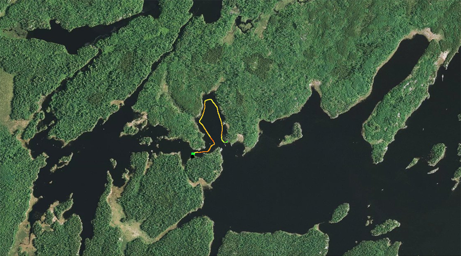
PADDLING FROM LITTLE GABBRO LAKE TO BWCA CAMPSITE 1713
Starting in the channel between Little Gabbro Lake and Gabbro Lake, paddle to the southeast across open water to BWCA Campsite 1713, which is located on a small island. Visit BWCA Campsite 1713 -or- Explore Another Route ***********************************************END OF ROUTE***********************************************
PADDLING FROM BWCA CAMPSITE 1713 TO BWCA CAMPSITE 1716
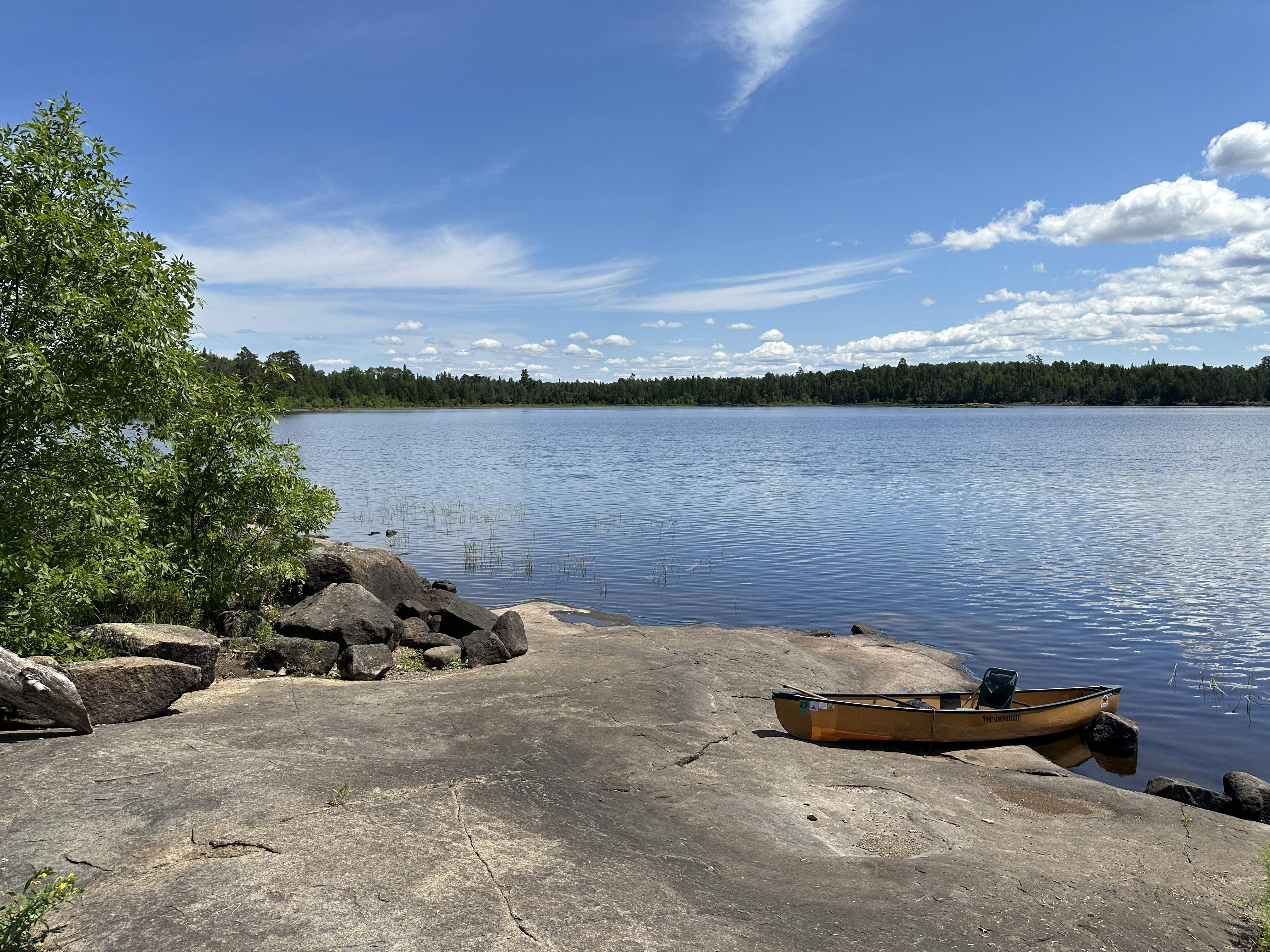
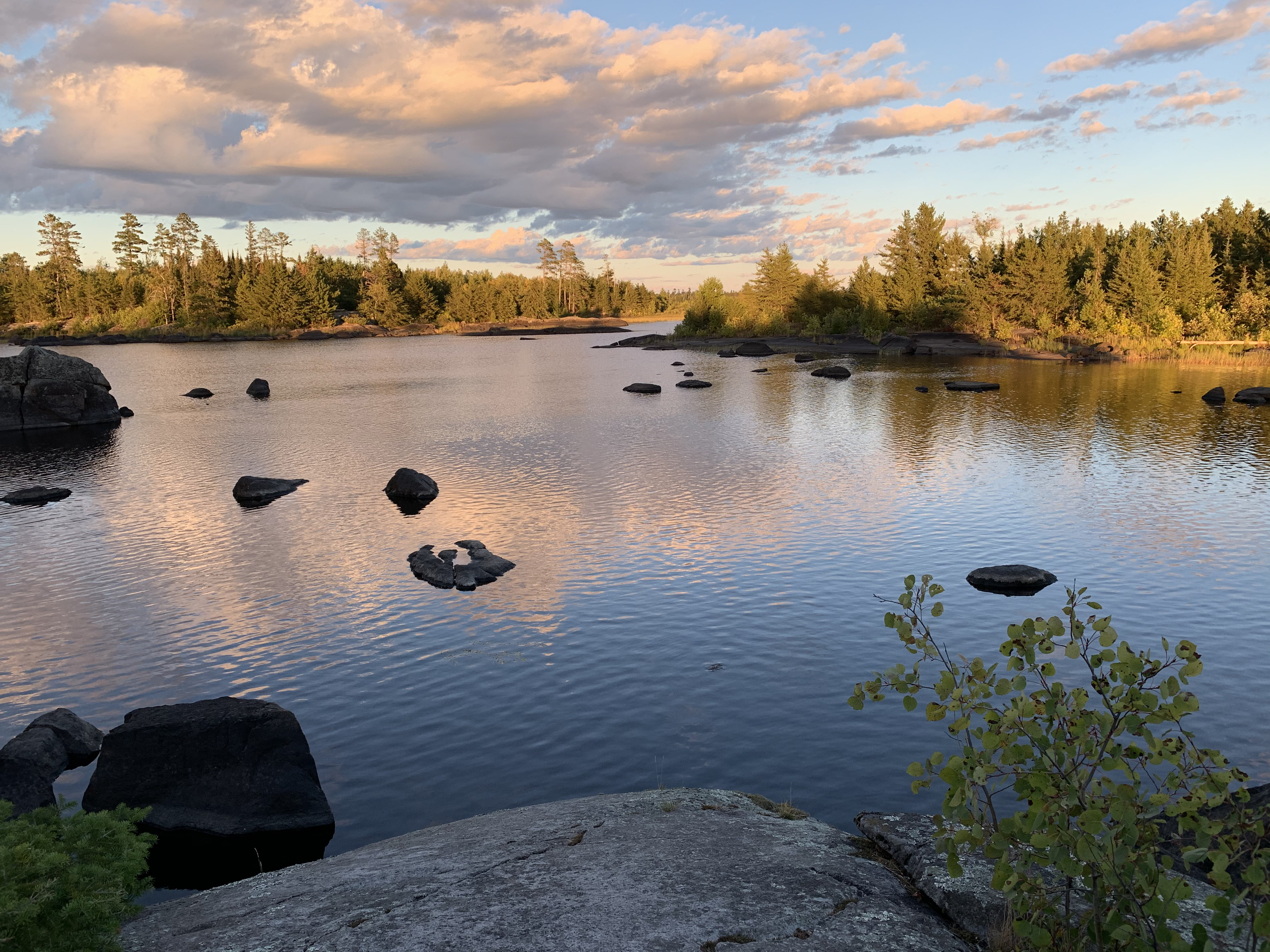
Gabbro Lake as seen from BWCA Campsite 1713.
Follow the shoreline to the southeast to BWCA Campsite 1716, which is situated on a point. Visit BWCA Campsite 1716 -or- Explore Another Route ***********************************************END OF ROUTE***********************************************
PADDLING FROM BWCA CAMPSITE 1716 TO BWCA CAMPSITE 1717
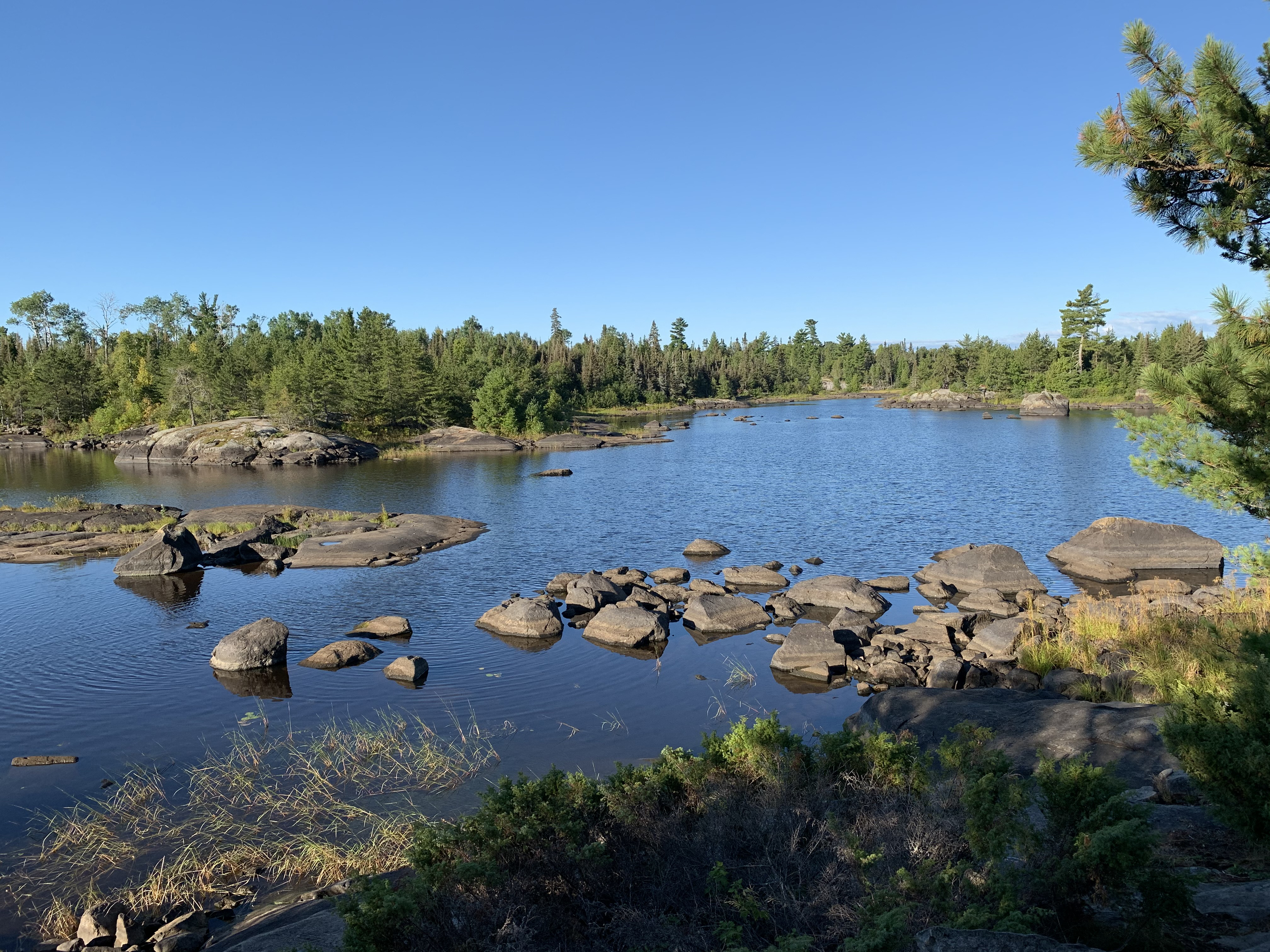
View looking east from BWCA Campsite 1716.
Continue on a south/southeast heading to the campsite at the south end of the lake, just north of the portage. It is located on a long peninsula (may show as an island on some maps). Visit BWCA Campsite 1717 -or- Explore Another Route ***********************************************END OF ROUTE***********************************************
PADDLING FROM BWCA CAMPSITE 1717 TO THE UNMARKED BALD EAGLE LAKE PORTAGE
A quick paddle around the corner to the left (east) to reach the portage landing. There is a small set of rapids here.
View looking east from BWCA Campsite 1716. Portage to Bald Eagle Lake -or- Explore Another Route ***********************************************END OF ROUTE***********************************************
PADDLING FROM THE UNMARKED BALD EAGLE LAKE PORTAGE TO LITTLE GABBRO LAKE
Non-stop paddle from the south end of the lake to the north end where it connects to Little Gabbro Lake in the channel. Paddle Little Gabbro Lake -or- Explore Another Route ***********************************************END OF ROUTE***********************************************
PADDLING FROM LITTLE GABBRO LAKE THROUGH CHANNEL AND AROUND WEST BAY OF GABBRO LAKE
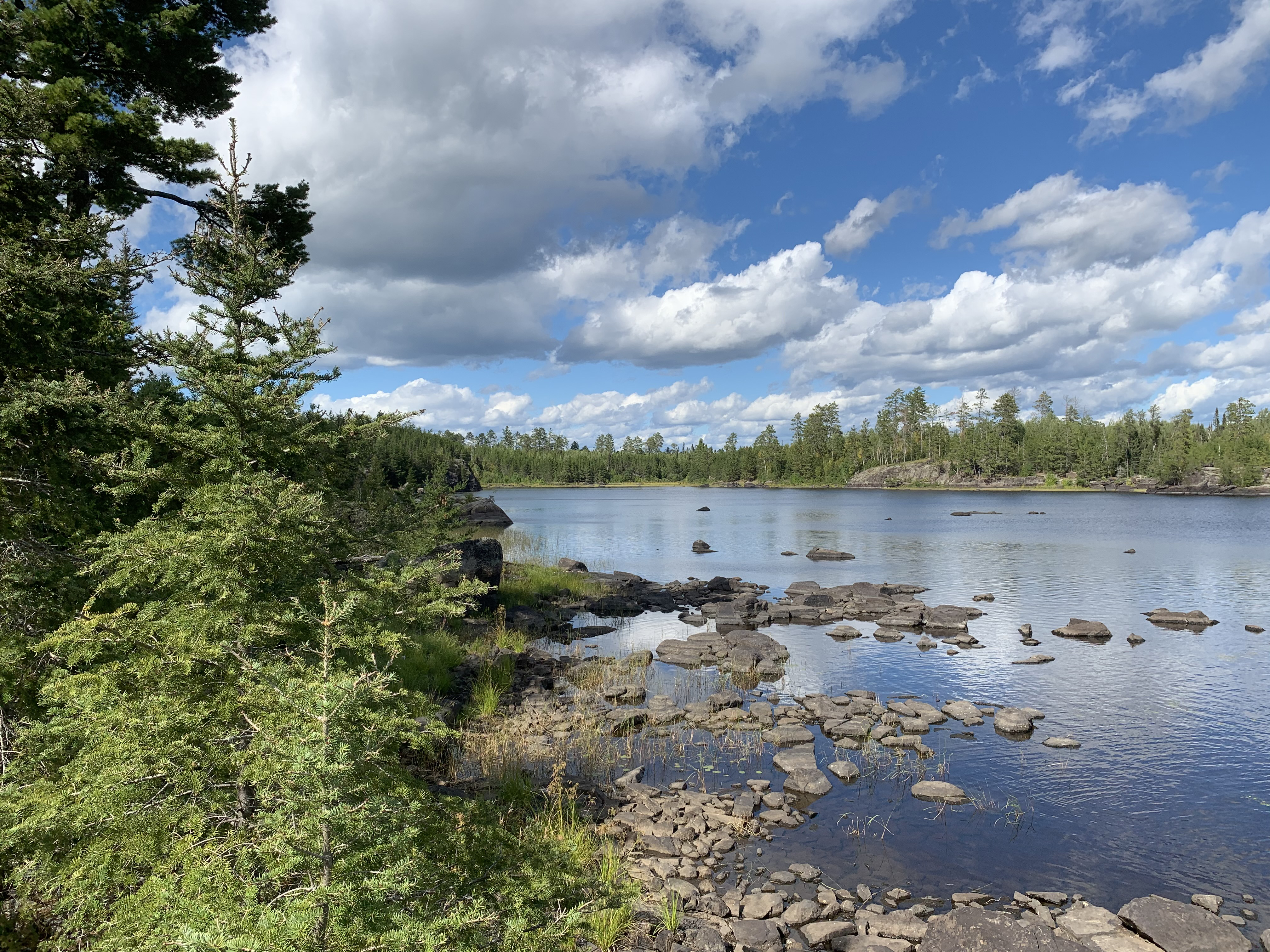
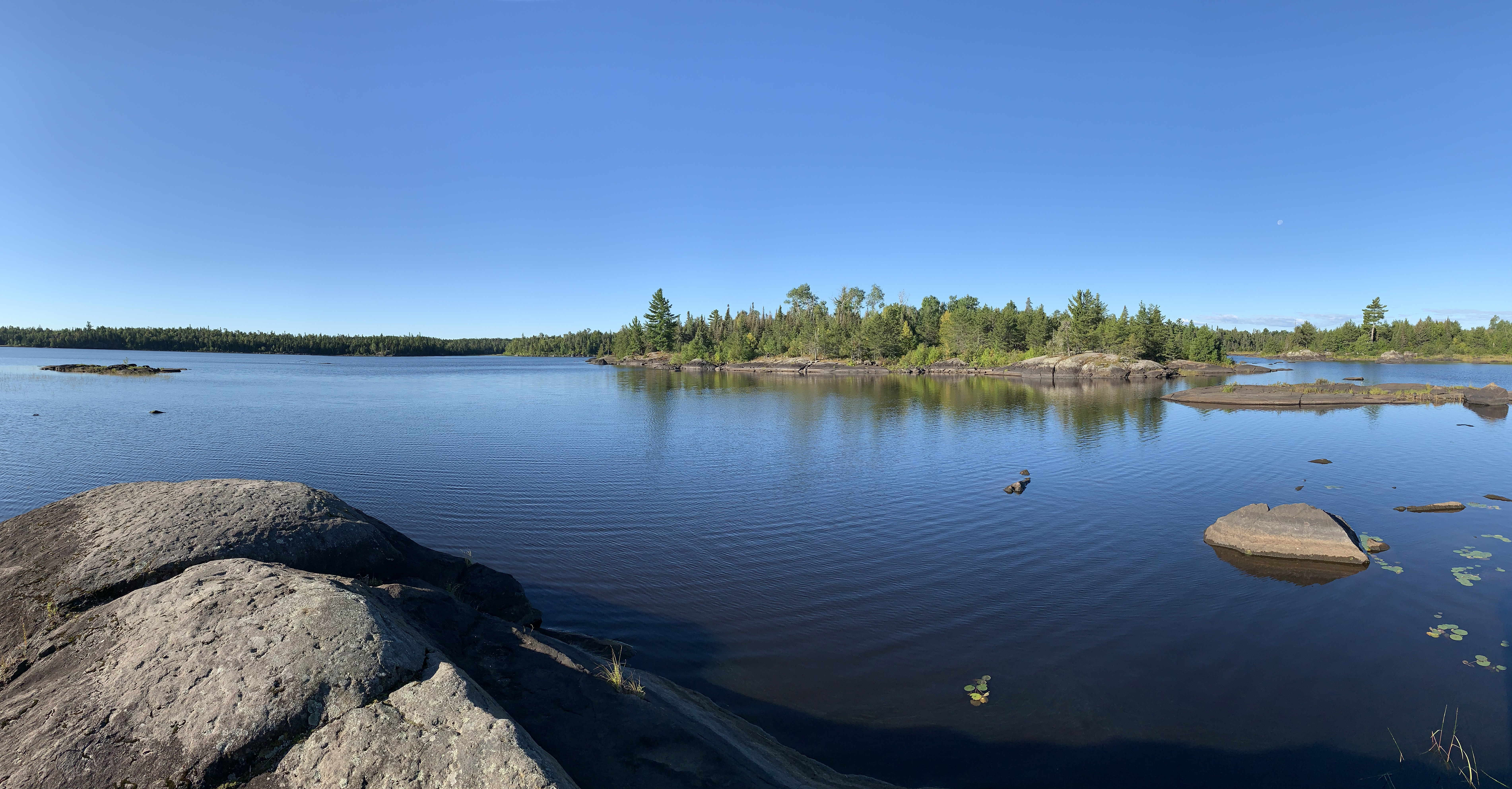
The western bay of Gabbro Lake as seen from the campsite on its western point on the north side of the channel.
Looking almost due east from the campsite on the western side of the small bay, that itself is on the west end of Gabbro Lake. The channel to Little Gabbro Lake would be just to your right and out of view from this vantage point.
Starting from the small rapids at the east end of Little Gabbro Lake, continue east up the channel (and upstream) to the western part of Gabbro Lake. When you reach the bay, turn left (north) and continue along the shoreline of this bay, working your way to the east. You stop at the campsite on the east side of this bay, which is located on the channel leading to the main part of Gabbro Lake.
The narrowest part of the channel between Gabbro Lake's western bay and the main, open part of the lake (which is to the left from this position). Another campsite is located across the bay to the west, about halfway between the center and right side of your view.
This is a southerly view from the channel leading into the western bay of Gabbro Lake. This is also the location of the campsite on the east side of that bay. Explore Another Route ***********************************************END OF ROUTE***********************************************
Route Connections for Gabbro Lake
From Gabbro Lake, you can take an optional portage to Little Gabbro Lake. You can also use the unmarked portage (most maps don't show it) to Bald Eagle Lake.