Route of Swallow and Hopkins Railroad and surrounding area
Route of Swallow and Hopkins Railroad
Click on the photos below to see the full resolution image - Use your browsers back button to close photo and return to this page.
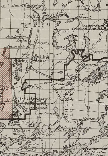
This logging railroad was built by the Swallow and Hopkins Company near the beginning of the 20th century. The railroad started at Winton, Minnesota on the west end of Fall Lake. From there it headed north and soon wrapped aroud Cedar Lake, skirting it to the east. The track continued north, staying east of Low Lake before coming to a split shortly thereafter.
The east track headed northeast then, hugging the eastern shorelines of both Range Lake and Sandpit Lake. As the track left Range Lake, it crossed the Range River right where the river flows out of the lake. The track then followed the existing portage trail. You will notice when walking this portage that it is extremely flat. This was so railcars didn't have to manage any steep grades. The railway followed a similarly level grade along the current day portage from Sandpit Lake to Tin Can Mike Lake. After leaving the modern day portage path, the route then twisted over to the west side of Tin Can Mike Lake (which back then was called Murphy Lake). It ended just a bit farther north on the south end of Horse Lake.
The western track after the split went off to the northwest, nicking the northeastern bay of Little Bass Lake and then turning mostly north and continuing along the east side of Angleworm Lake and Home Lake. A spur track lead to the shore of Angleworm Lake (near the modern day BWCA Campsite 1897 - the southern most campsite on the east side of the lake). The railway eventually ended at the bushwhack portage between the Beartrap River and Beartrap Lake.
A telephone line paralled the entire length of this railway as early as 1927.
Here is a map of the railway as it existed in April, 1927:
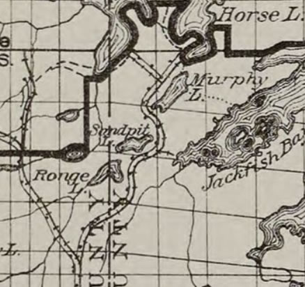
Zoomed map of the Swallow and Hopkins logging era railway:
The railway from the split, north to Horse Lake is shown above. A spur also went to Fourtown Lake (which at the time was called Deer Lake), just before it ended at Horse Lake.
Here is a video of the entire route beginning where the old railways route encroached on the eastern shoreline of Range Lake, until eventually reaching Tin Can Mike Lake. During low water, some of the old rails can still be seen rusting away along the eastern shoreline of Sandpit Lake beneath the cliffs. Large cut logs, some with iron spikes embedded in them, also can be found along the shoreline, especially if the water is low. Along the portages between Range Lake and Sandpit Lake and also the portage to Tin Can Mike Lake, careful observers can spot some relics along these paths. Some of the relics are just off the trail in the brush (easier to spot in the spring and fall). These items include iron bolts, rusty buckets and pieces of metal of unknown purpose.
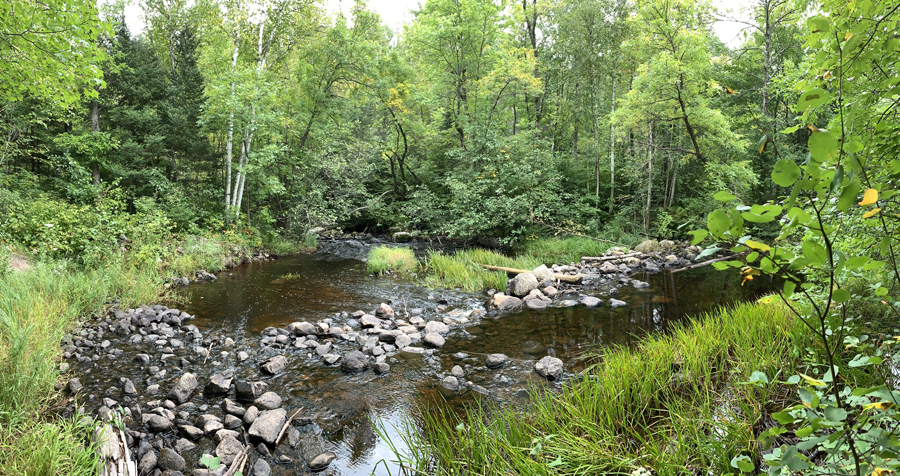
Approximate location where the Swallow and Hopkins line crosses the Range River just downstream of Range Lake along the current day portage.