Nearest Ranger Station: Gunflint Ranger Station, Grand Marais, MN along Hwy. 61 on the North Shore
Portage Length from Parking Lot: 80 rods
Restroom at Entry Point: No
Entry Point 43 - Bower Trout Lake
Gunflint Ranger District
The portage is shown in the wrong location on the older Fisher F-13 maps. It is shown in the correct location on the McKenzie #3 maps. The entry point landing on Bower Trout Lake is on the northeast shore of the lake, due east of the lakes prominent north point. The access road is from Forest Road 152, just south of the T-intersection between Forest Road 152 and South Brule Lake Road. The access road is about 1/2 mile long and is fairly rough, but a standard passenger vehicle can make it to the parking area if the driver takes some care. There is a large gravel pit on the right as you start up the access road.
It is an easy 80 rod portage from the parking lot to the lake.
This entry point has very limited route opportunities. You can only head west from Bower Trout Lake. You must go all the way to Brule Lake before additional route options become available, which will take most groups the better part of a day. This entry point is a good choice for those looking to take a day trip or a short weekend journey into the BWCA. There are two campsites (neither are very good) on Bower Trout Lake. There is one more campsite on Marshall Lake. After Marshall Lake, you must make it to Swan Lake before you'll see more campsites. The portages along the way are all fairly short and none are too difficult. Most of the portages are somewhat rocky and may have a few muddy spots. There are some easy class 1 rapids along the South Brule River that may be so shallow you will have to walk your canoe through them.
The entire area is quite scenic as it lies among the Misquah Hills. These hills are the highest in the state of Minnesota. They provide spectacular backdrops over the the blue water, as their forested slopes rise high above the lakes throughout this area.
Some of the area along this route was subjected to a prescribed burn in September/October of 2016. The intentional ignition was performed to reduce fuel created by the July 4, 1999 windstorm. The burn area extends from Dugout Lake and Iota Lake on the east to about the middle of a north/south line extended through Lac Lake on the west. The burn area starts about 1/2 mile south of the South Brule River and goes north up to nearly Little Trout Lake. Another burn area extends from the west end of Little Trout Lake up along the west side of Misquah Lake which may be part of this same prescribed burn. See Lux Lake Prescribed Burn.
Exploring the Entry Point
Click on the photos below to see the full resolution image - Use your browsers back button to close photo and return to this page.
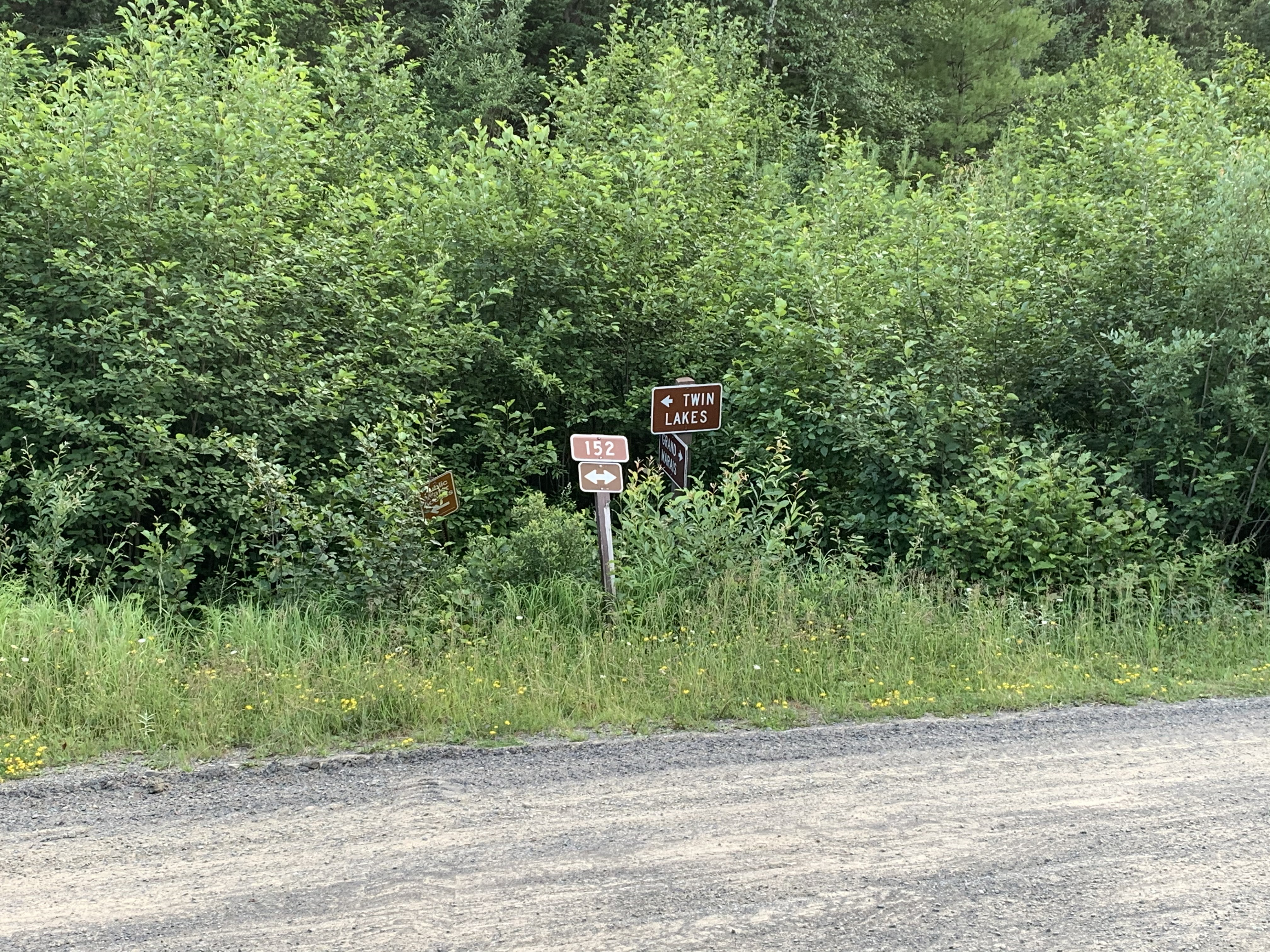
The South Brule Road (Forest Road 325) ends at this T-intersection. Hang a left turn here.
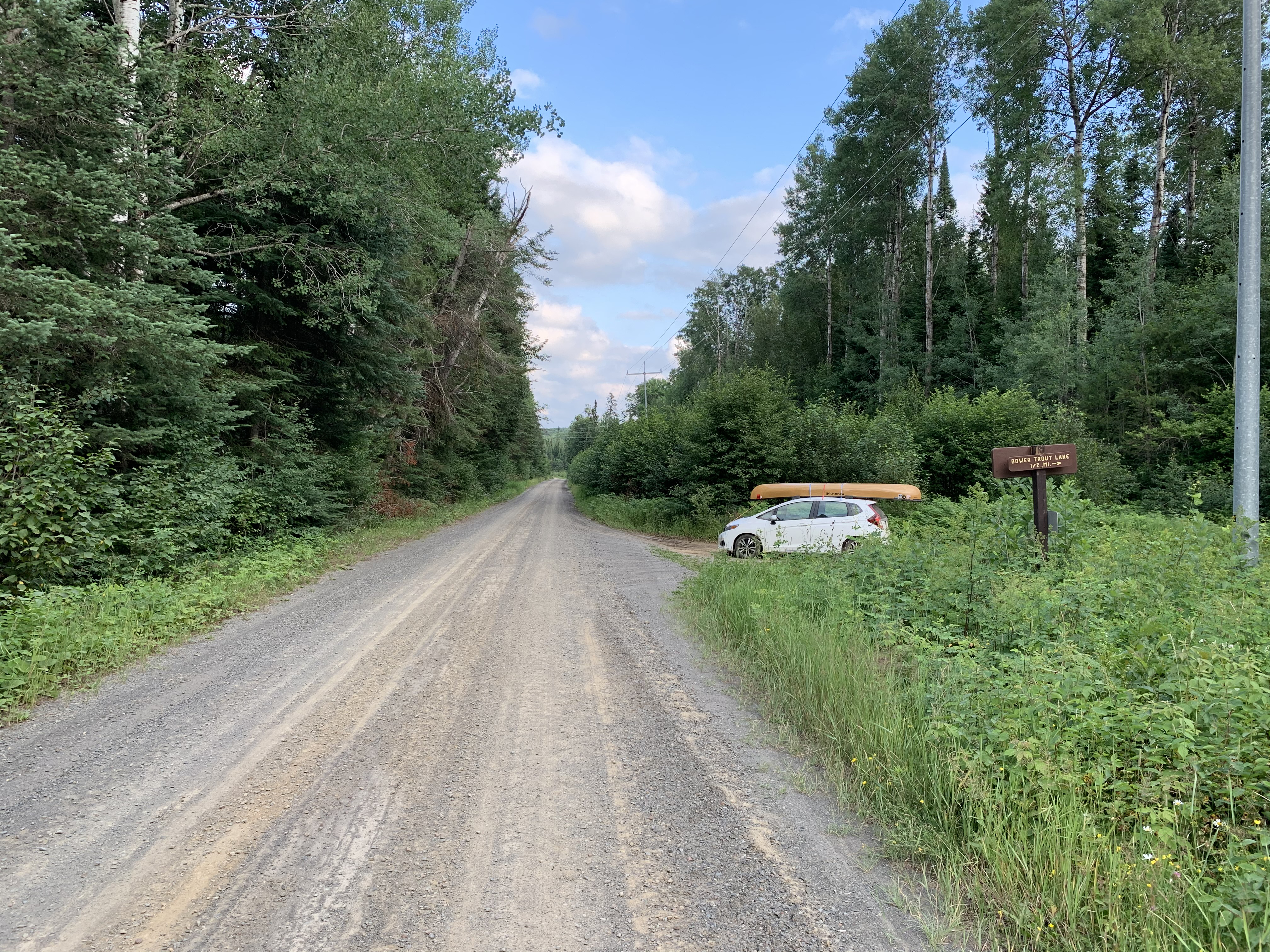
Turn right here onto the access road that leads to the parking lot. This sign is only about 200 feet south down Forest Road 152 from the T-intersection.
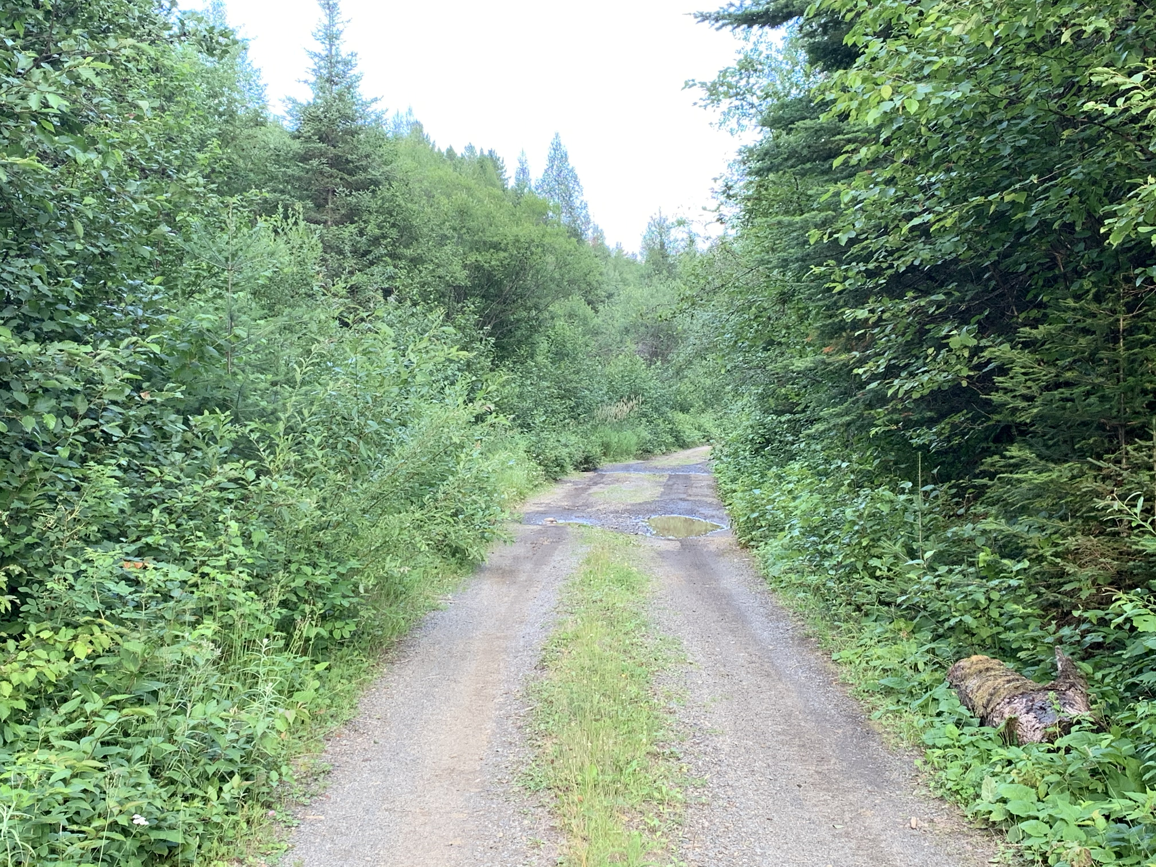
This road is only about 1/2 mile long, but it is rough and narrow (there are worse spots than what you see here along the road). Hope that you don't get really unlucky and have someone coming from the other direction before you get to the Bower Trout Lake parking area.
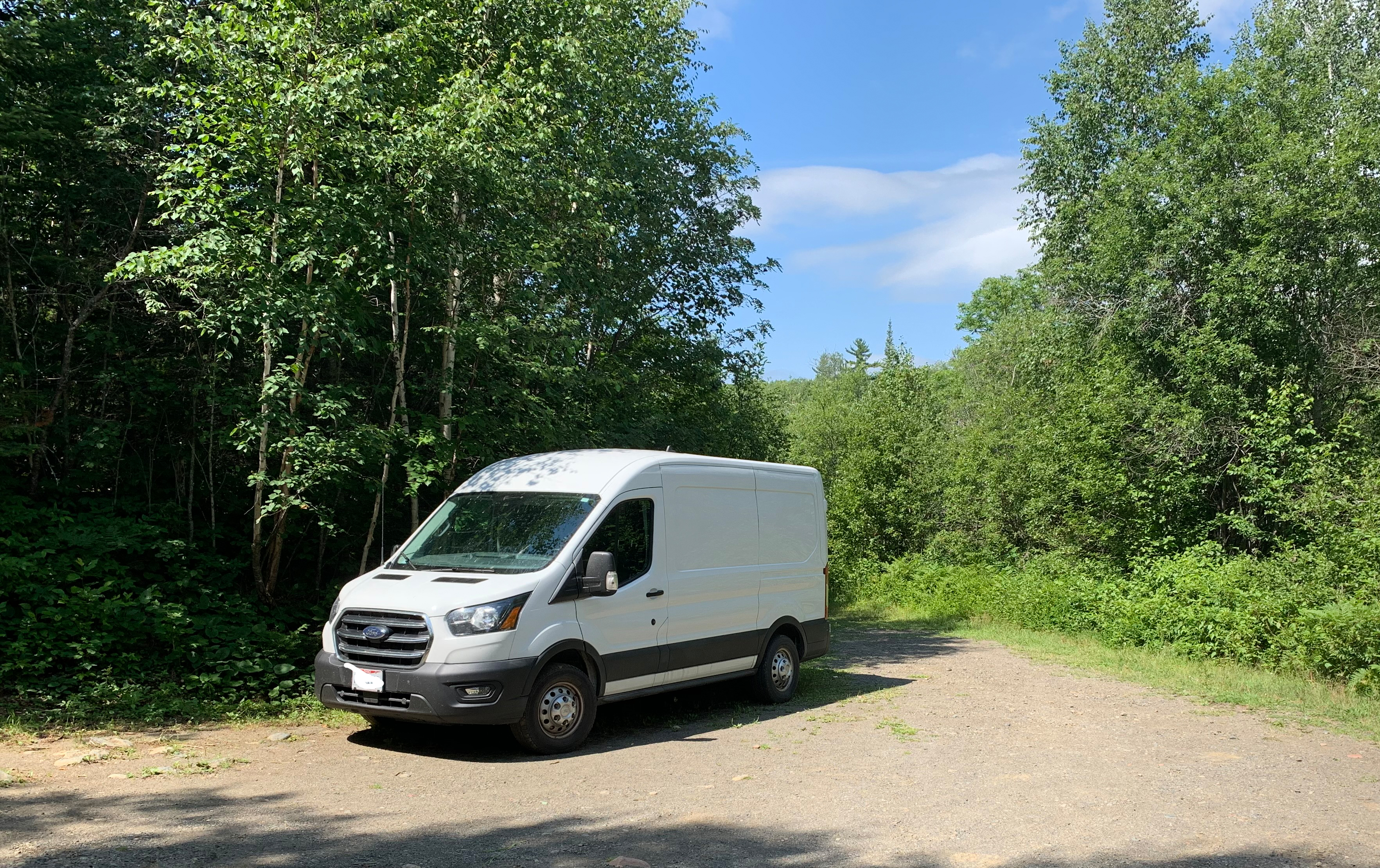
The parking area. There is room to comfortably fit maybe half a dozen vehicles. The portage down to the lake starts right behind the back of that van.
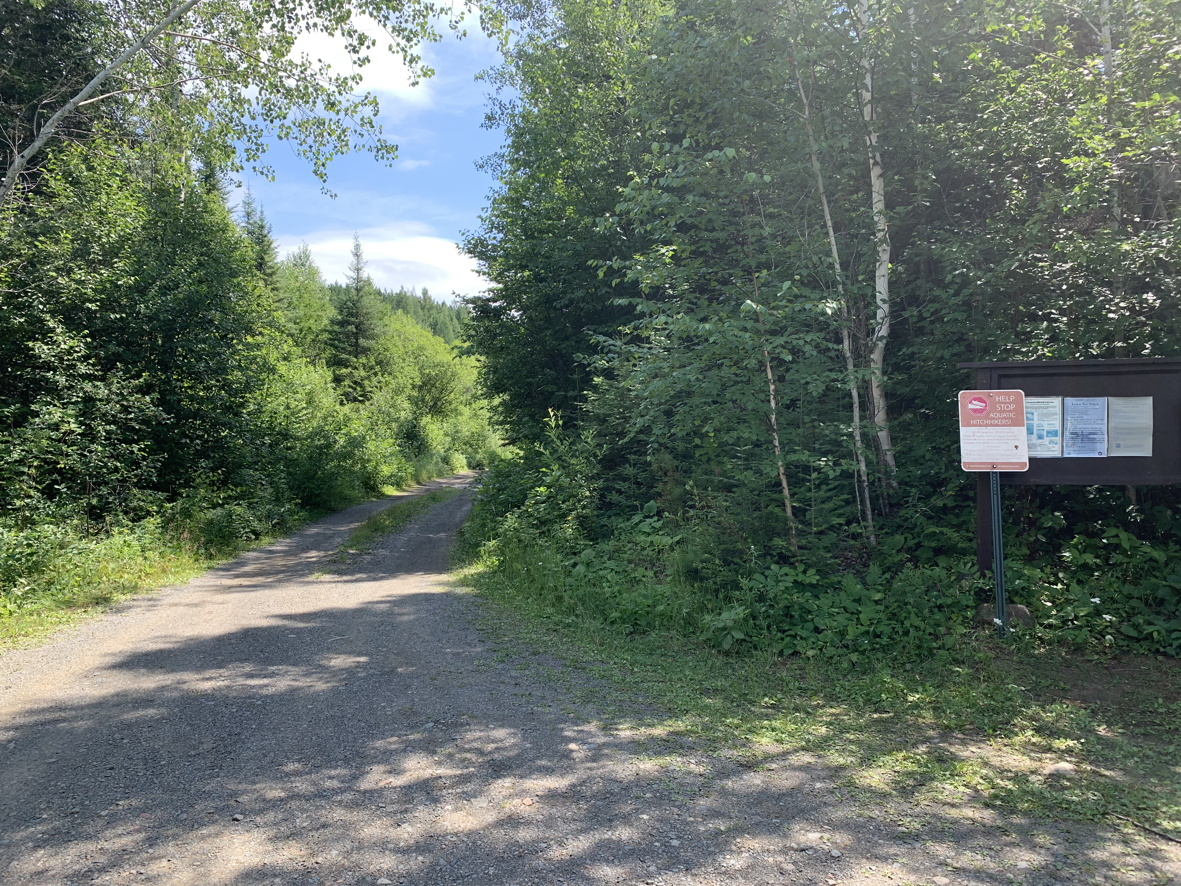
A look east down the access road from the parking lot. The bulletin board for this entry point is visible on the right.
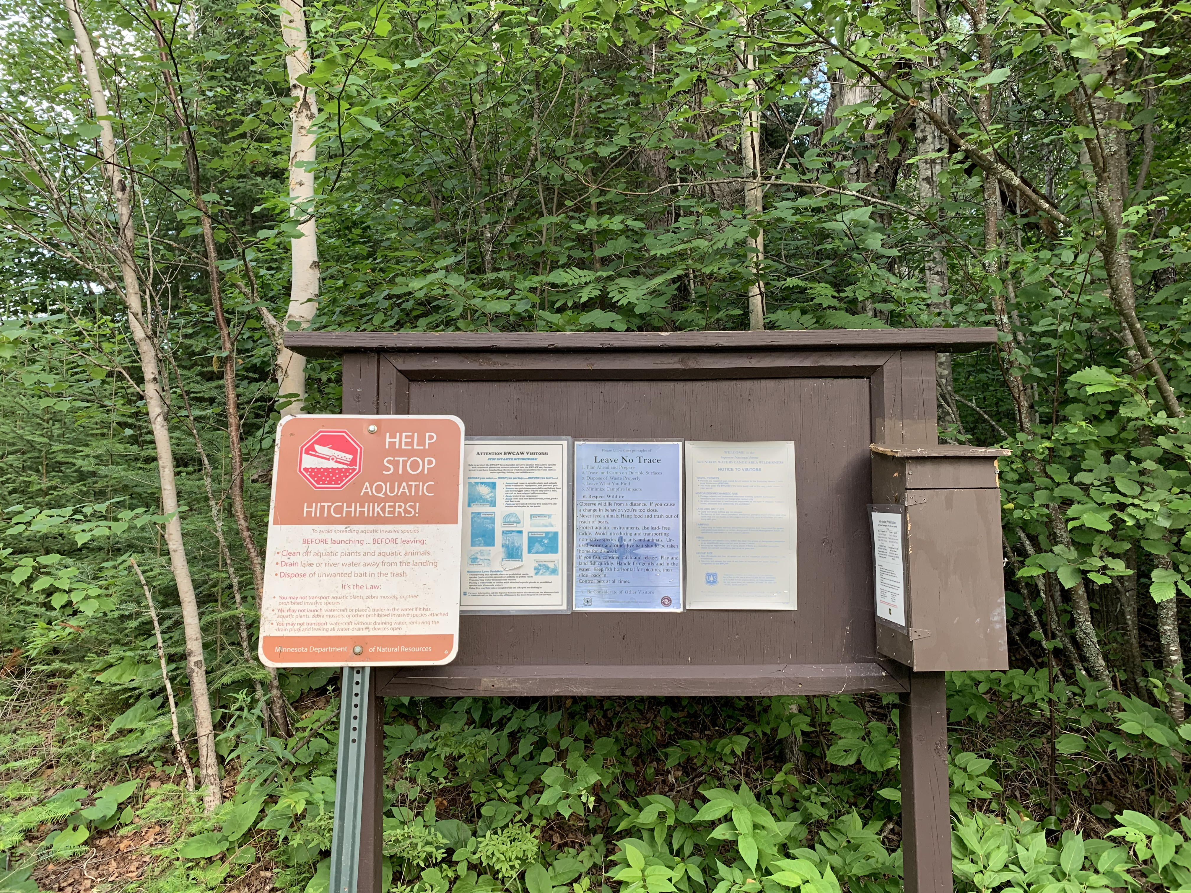
The bulletin board. The box on the right holds day permits which you must fill out and carry with you if you are going to just be here for the day.
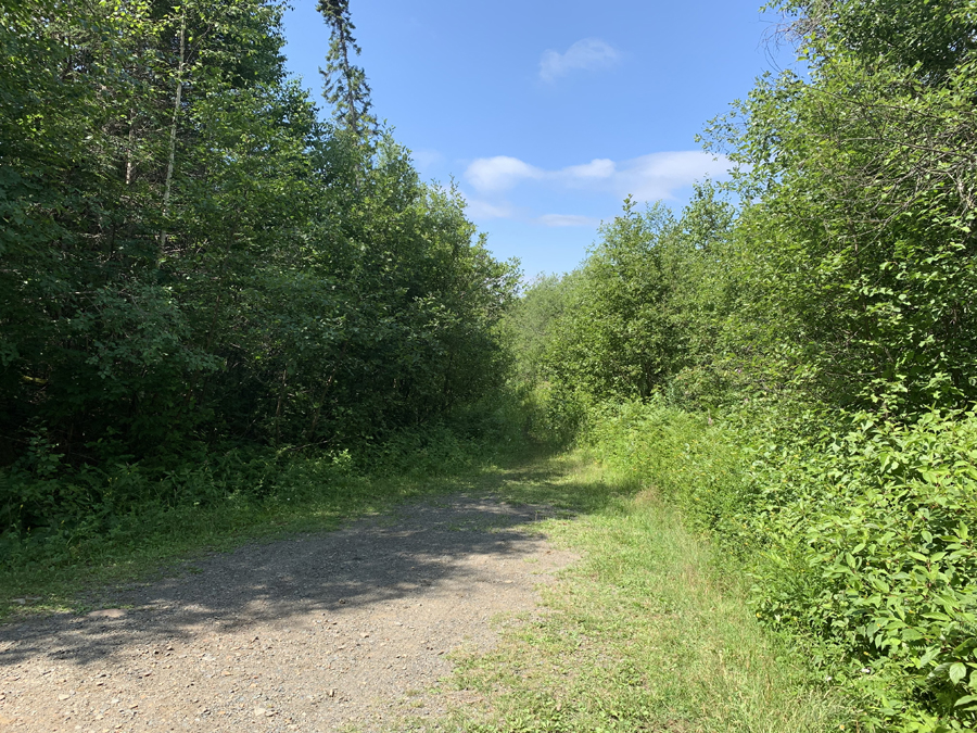
The start of the 80 rod portage that leads to the shore of Bower Trout Lake.
This is an easy walk. There are a couple of boardwalk sections that get you over the wet spots. You might scare up a family of grouse along the way. The portage landing on Bower Trout Lake provides easy access to the water. (See this portage in both directions here.)
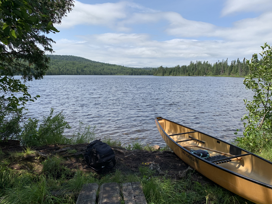
Arrival! The water here is shallow with a relatively smooth bottom. A really nice landing. That hill that rises up across the lake is called Brule Mountain.
Now that you've reached the shore of the lake, visit:BOWER TROUT LAKE