Entry Point 91 - NCT - West (Thru-hike)
Gunflint Ranger District
Directions:
From Grand Marais, Minnesota, take MN-61 north for 19.0 miles.
Turn left onto the Arrowhead Trail (County Road 16)
Follow the Arrowhead Trail north for 18.0 miles to the McFarland Lake Campground. Stay right at the split (don't go into the campground). The parking lot is just a few hundred feet further down the road on the right side.
There are two new entry points (as of 2025) for hikers of the North Country National Scenic Trail wanting to do a through hike of the combined Kekekabic Trail and Border Route Trail (BRT). If hiking eastbound starting from the eastern terminus of the Border Route Trail, you need a permit for BWCA Entry Point 90 - NCT - East (Thru-Hike). If you are hiking westbound starting from the western terminus of the Kekekabic Trail, you need the permit for BWCA Entry Point 91 - NCT - West (Thru-Hike). The reason you need one of these new permits is because you will leave the BWCA crossing the Gunflint Trail near where these two trails connect. It is illegal to exit and then re-enter the Boundary Waters Canoe Area. Before this permit became available, you were required to have two permits (one for the Kekekabic Trail and the another for the Border Route) with overlapping dates.
There are five BWCA entry points accessible from the McFarland Lake Campground. The parking area for BWCA Entry Point 68 - Pine Lake is right next to McFarland Lake and is within the actual campground. Where the Arrowhead Trail road splits, go left into the campground to reach that entry point.
For BWCA Entry Point 69 and BWCA Entry Point 70, the parking lot is on Little John Lake just before the bridge. These two entry points share the same parking lot. Where the Arrowhead Trail road splits, you would stay right to get to these two entry points. You can easily make a short walk through the campground area to get to any of these entry point landings. Note that BWCA Entry Point 83 - Border Route Trail (East) also shares this parking lot. This entry point is used if you are going to hike the Border Route Trail. Finally the parking lot is also used by hikers who are hiking the North Country National Scenic Trail, of which the Border Route Trail is now a part of. For those people hiking the North Country National Scenic Trail and doing a through hike of the BWCA (combined Border Route Trail and Kekekabic Trail), you need a BWCA Entry Point 90 - NCT - East (Thru-hike) permit.
The McFarland Lake Campground has about eight campsites. This is a primitive campground with few amenities. There is a restroom. Each campsite has an open area with a fire ring and picnic table (trestle table). The campground sites are available on a first-come, first-served basis.
Exploring the Entry Point
Click on the photos below to see the full resolution image - Use your browsers back button to close photo and return to this page.
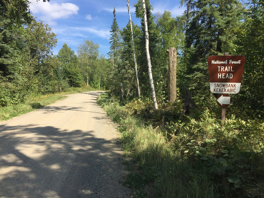
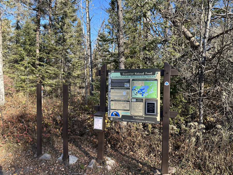
Sign for Snowbank Lake entry point and the Snowbank Lake Trail entry point seen along the Fernberg Trail. The west terminus of the Kekekabic Trail also is located at the same place as the Snowbank Lake Trailhead. In addition, this is the trailhead for BWCA Entry Point 91 - NCT - West (Thru-hike).
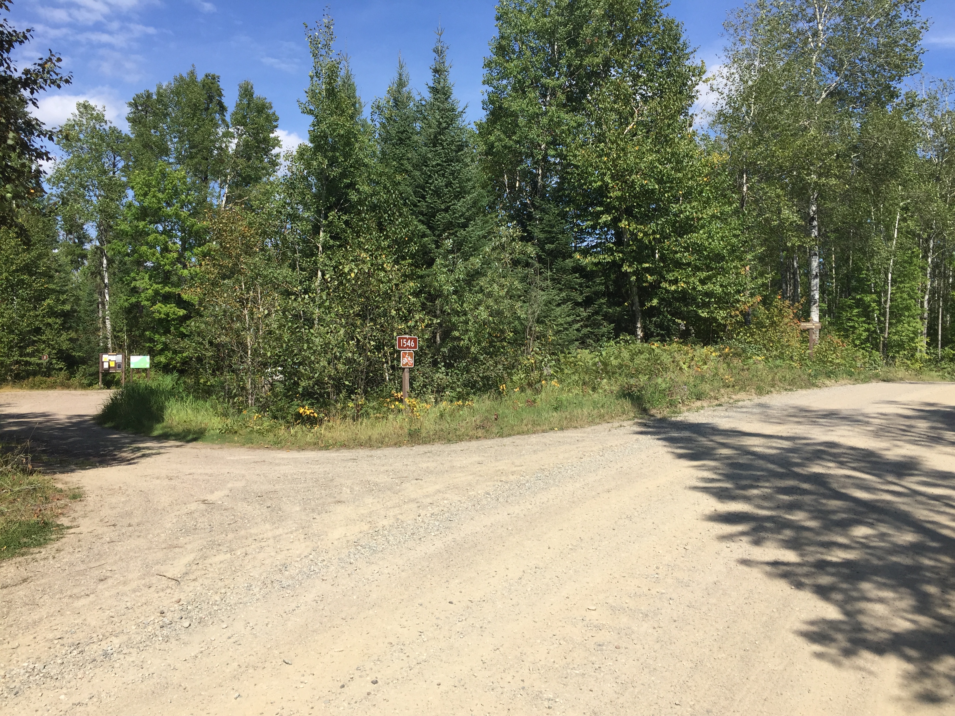
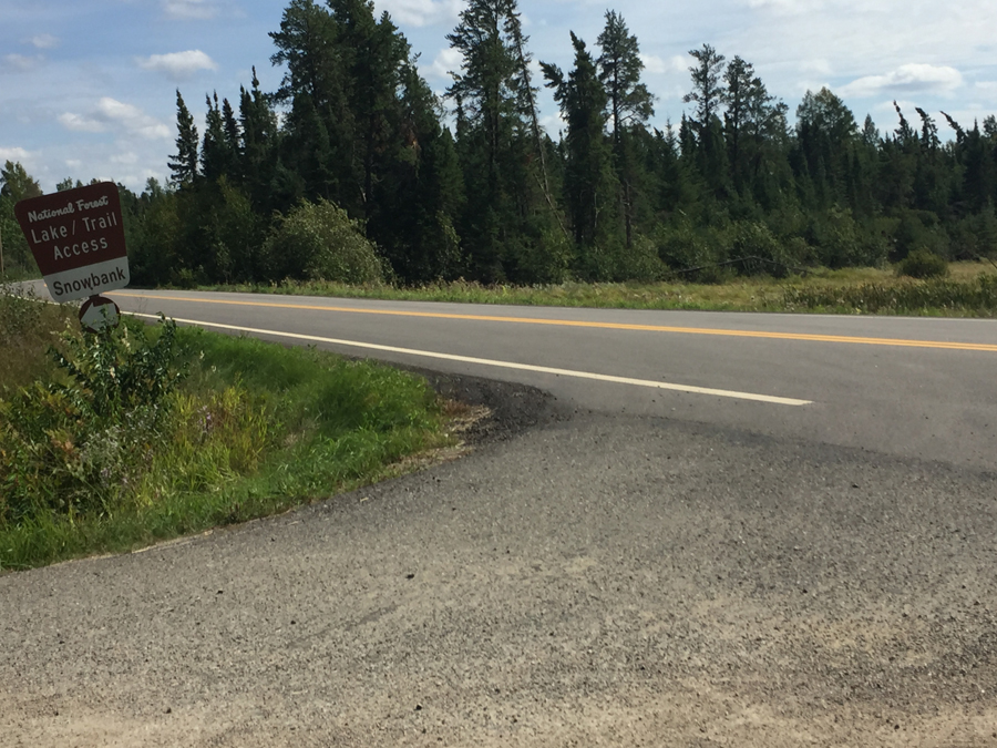
Another sign along Snowbank Lake Road showing the turn off to the parking lot for the trailheads.
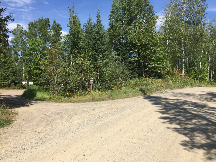
The parking lot is visible on the far left of your view. The Snowbank Lake Trail begins just to the left of those two signs. The Kekekabic Trail starts/ends just to the right, out of your view directly across the road from that faintly visible sign posted to the birch tree near the right side of the photo.

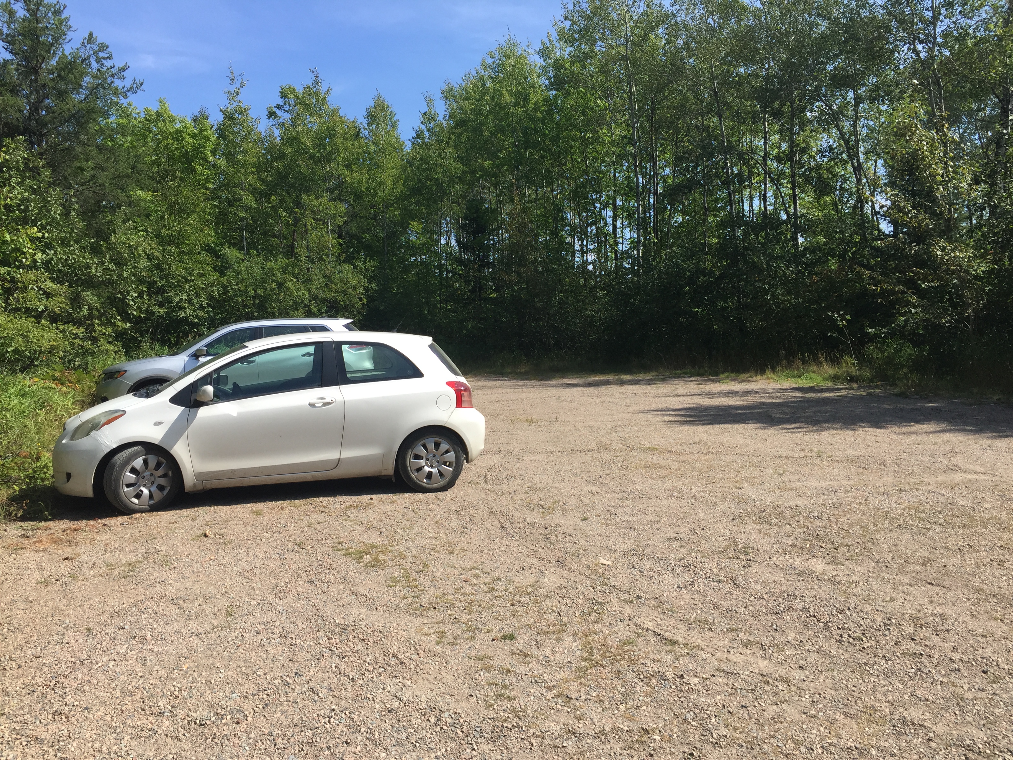
The parking lot where your car will hang out while you hike. It will usually have some company. Hikers of the Snowbank Lake Trail, Kekekabic Trail and the North Country National Scenic Trail all park here.
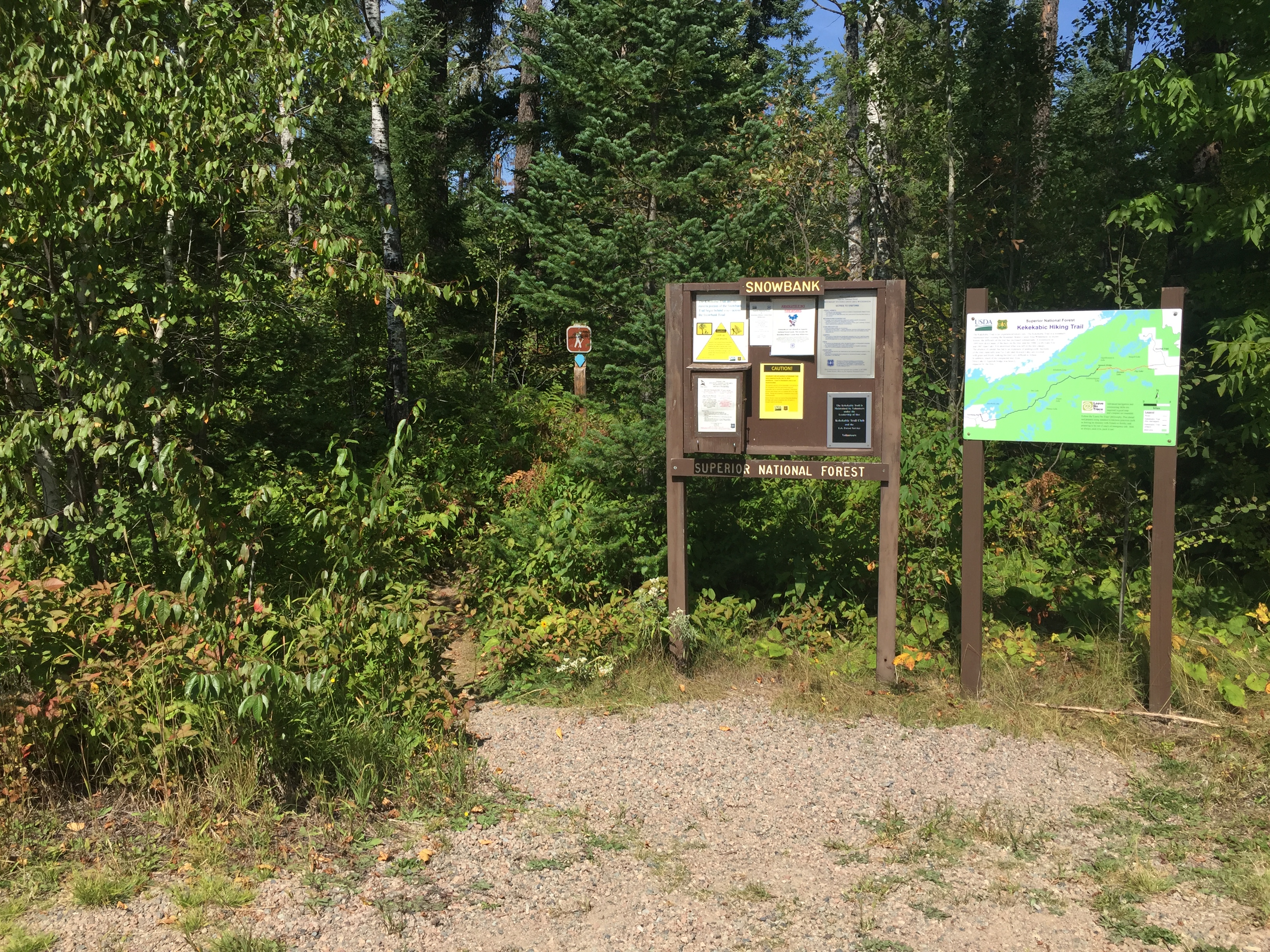
The Snowbank Lake Trail starts just to the left of the sign. The Kekekabic Trail starts across the road from this parking lot. The small box on the lower left of the sign contains forms for filling out a day permit. You need a day permit if you don't have an overnight hiking permit.
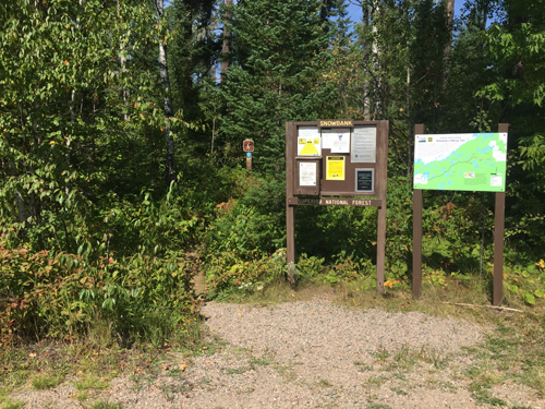
The older set of bulletin boards. These were replaced sometime between 2017 and 2022.

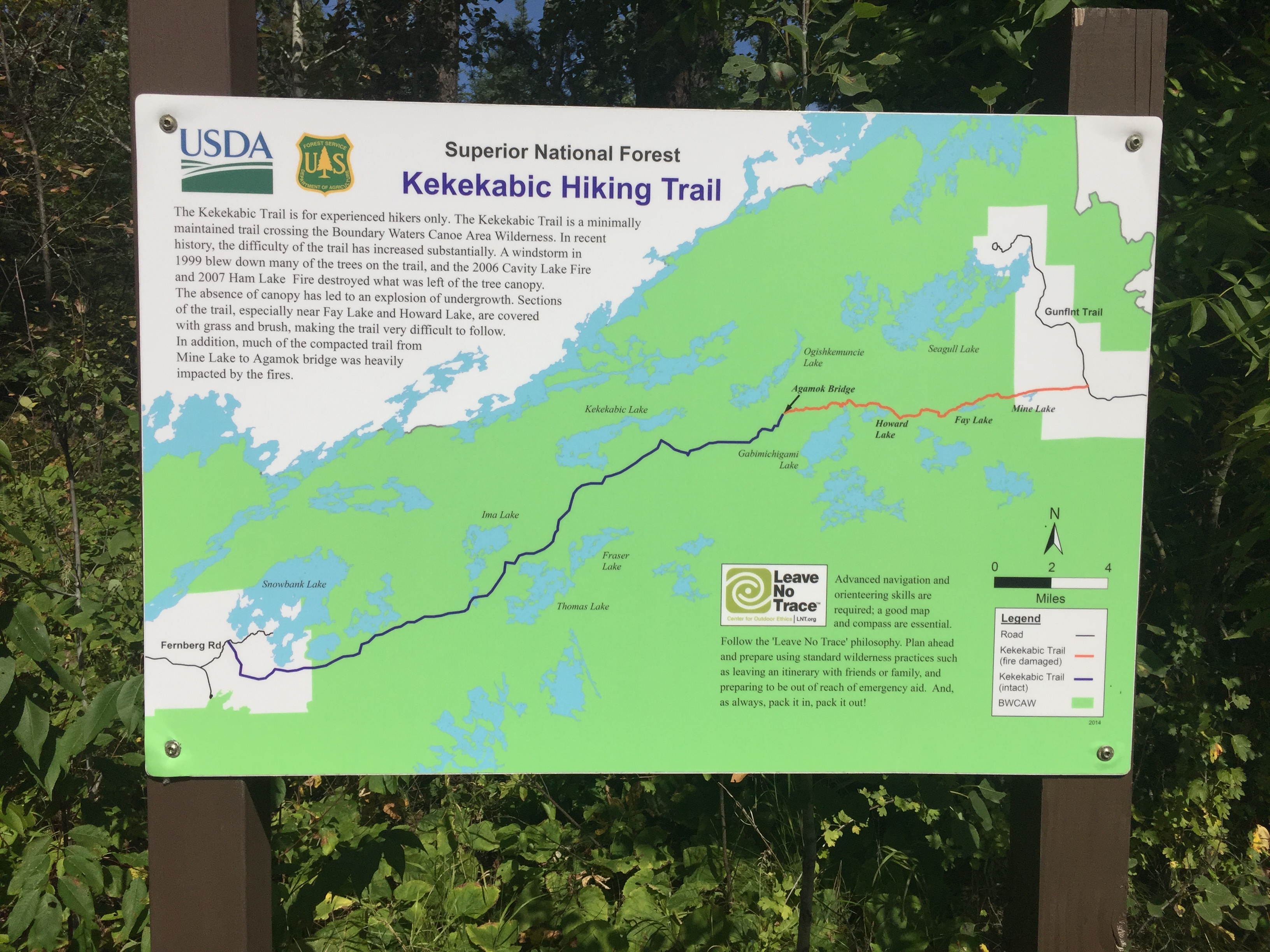
Sign showing "The Kek". You're standing on the very left side of this map by the Fernberg Rd. The trail ends on the right side of the map at the Gunflint Trail. After you walk across the Gunflint Trail, you can continue east along the Border Route Trail. It is where you cross the Gunflint Trail that your Kekekabic Trail overnight permit becomes invalid. It's illegal to continue eastbound onto the Border Route Trail without having a permit for that trail also in your possession. BWCA Entry Point 91 - NCT - West (Thru-hike) is the permit you need to hike both of this trails in succession.
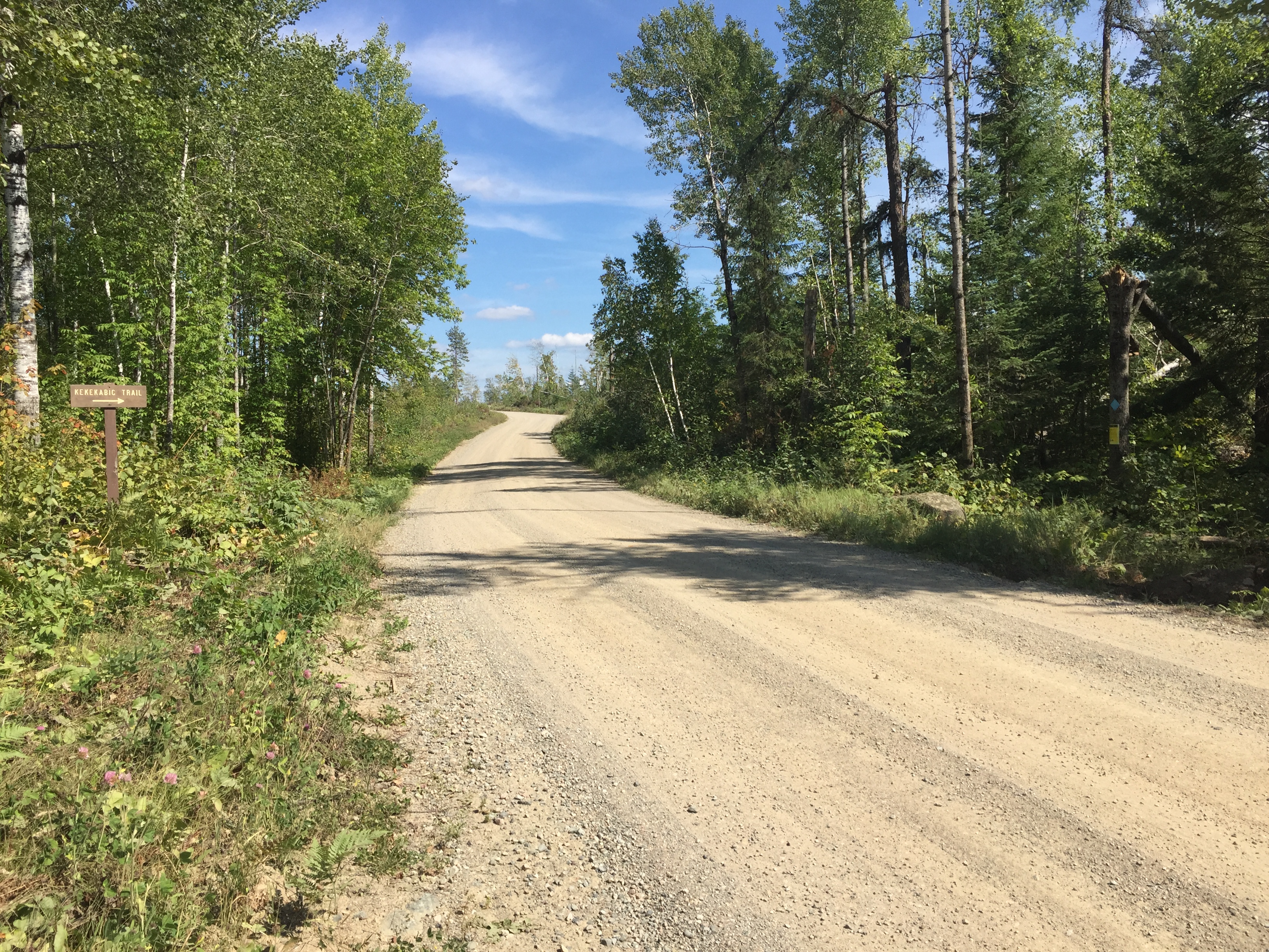
The Beginning of the Kekekabic ("The Kek") Trail -- (This is the west end of the trail - from here you head east)

This sign is just past the entrance to the parking lot. The Kekekabic Trail which runs conterminously with the Snowbank Lake Trail is on the right side of the road from this vantage point. From this point it is about 39 miles to the east end of the Kekekabic Trail which ends at the Gunflint Trail (which is really a road - Cook County Road 12 in fact). The Border Route Trail continues for about 65 more miles further east until it connects to the northern terminus of the Superior Hiking Trail (SHT).
Now that you've reached the trailhead, start hiking the: KEKEKABIC TRAIL
Return to List of BWCA Entry Points (sorted by Entry Point Name or by Entry Point #)
|