Slowfoot Creek
From it's mouth in Delta Lake, this creek quickly shrinks in width to being barely wider than a canoe. In early spring, there was plenty of water to paddle up about the first 500 feet of this creek from Delta Lake. At that point there was a small beaver dam requiring a liftover.
Looking upstream, the creek becomes less navigable as it passes through a marshy area and bends to the left. Satellite imaging shows that the creek widens again and appears to be more canoeable as it approaches Slowfoot Lake.
In spring there were northern pike in the lower reaches of this creek near Delta Lake. This was shortly after ice out.
The forest fires of 1885-1889 affected the area from Fire Lake up to Disappointment Lake.
A fire in 1910 burned a swath of forest from the Horseshoe/Wilder Lake area and moved north, burning the forests around Parent Lake and Disappointment Lake. This fire emcompassed some of the area now in the Drag Lake PMA.
Fire burned the region in 1916-1917 centered on the Drumstick Creek drainage and forest just to its east.
What is a Primitive Management Area (PMA)?
Traveling Slowfoot Creek
Click on the photos below to see the full resolution image - Use your browsers back button to close photo and return to this page.
From the portage that got you into Delta Lake, paddle to the left a couple hundred yards and you come to the mouth of Slowfoot Creek. Paddling up the first several hundred feet of this creek is easy in the spring. It may be more difficult or impossible in the summer, as the creek becomes choked with vegetation. Beyond this point, the creek shrinks and has enough obstacles in it, that some bushwhacking will be necessary.
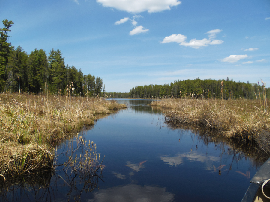
Looking back downstream toward Delta Lake, which is several hundred feet in the distance. This is in late May, so water levels are high and there is no vegetation choking up the creek yet.
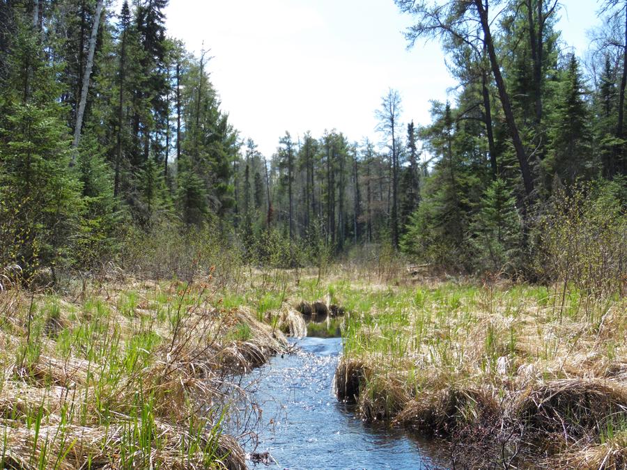
This is perhaps 400 feet up Slowfoot Creek from Delta Lake. The riffles ahead represents the end of the "easy" part of your Slowfoot Creek journey. The creek as you see, is much less passable beyond these riffles.
Return to Top of Page
|

