CARIBOU LAKE CAMPSITES: Campsite 1 (#686): Westernmost campsite along the north shoreline Campsite 2 (#687): Second campsite along north shoreline from the west end of the lake Campsite 3 (#688): Third campsite along north shoreline from the west end of the lake
Campsite 4 (#689): Fourth campsite along north shoreline from the west end of the lake Campsite 5 (#690): Second campsite along the north shoreline from the east end of the lake and near small island
Campsite 6 (#691): Easternmost campsite on this lake and located along north shoreline
Cliffs and hills rise over 300 feet in places above the waters of Caribou Lake, along both its north and south shorelines. While scenic, they aren't as dramatic as The Palisades you will see on Clearwater Lake just to the north.
Really old maps of this area show an extremely long and arduous portage near the middle of Caribou Lake heading north to Clearwater Lake. That portage was moved several decades ago to the east to the existing 200 rod portage. Was able to locate the portage landing on the Clearwater Lake end. A building used to be located at that site on Clearwater Lake. There is a stream that the old portage followed up to an unnamed lake.
Older maps of the area also show a road running along the north shore of Caribou Lake, near its western end. Remains of this road can still be followed. It connects the three western campsites on Caribou Lake to the western portage to Clearwater Lake.
Deer Lake drains into Caribou Lake through a small creek along the south shoreline. Caribou Lake's water flows into Little Caribou Lake which itself drains via a little stream into the Crocodile River just before that river flows into the very west end of Pine Lake.
Click on the photos below to see the full resolution image - Use your browsers back button to close photo and return to this page.
PADDLING FROM THE EAST CLEARWATER LAKE PORTAGE TO THE LITTLE CARIBOU LAKE PORTAGE
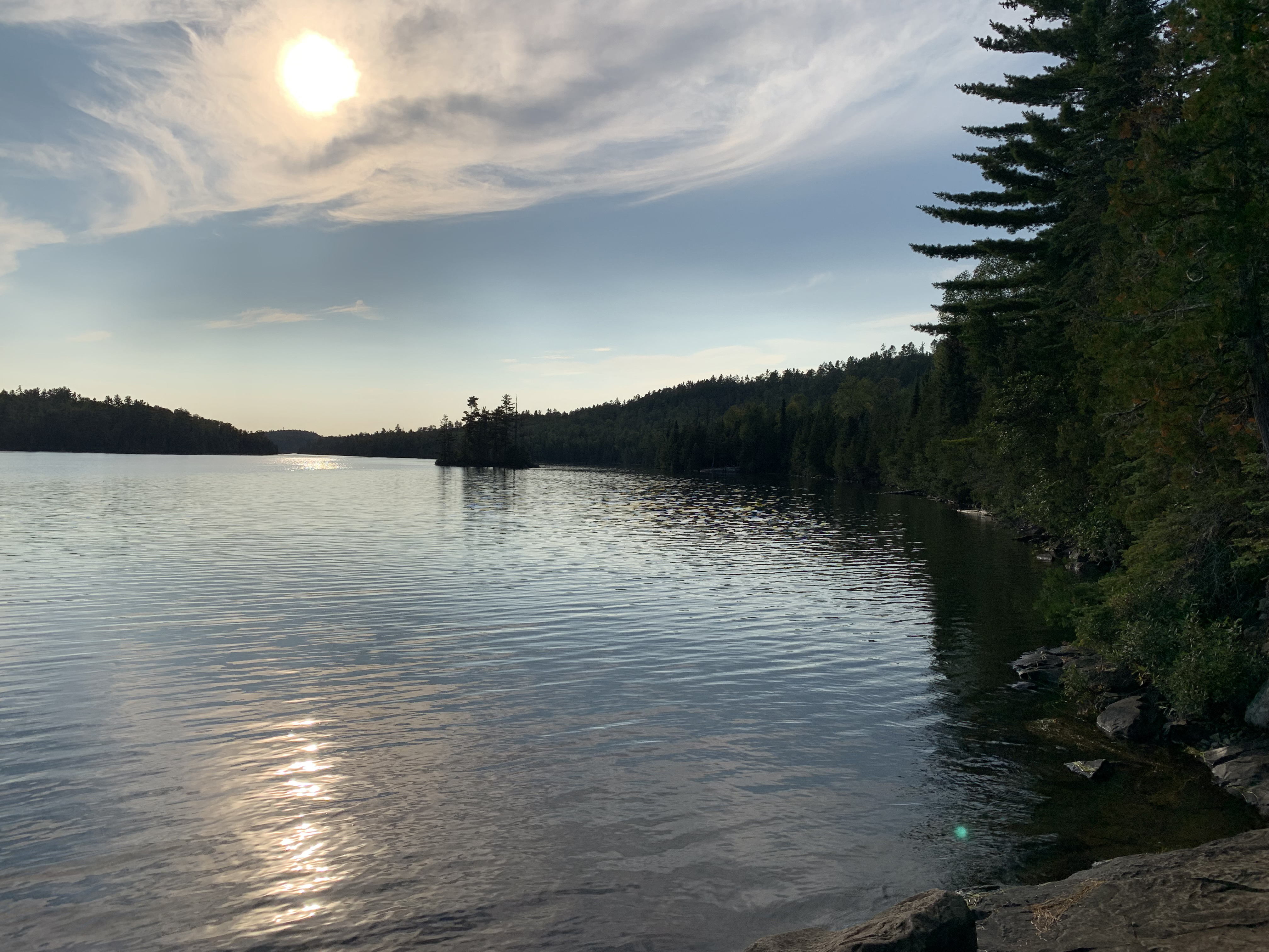
Late afternoon view looking west of Caribou Lake. This viewpoint is from the east portage to Clearwater Lake. The island visible in the middle of your view is right out in from of BWCA Campsite 690.
This is a short paddle to the eastern end of Caribou Lake where the Little Caribou Lake portage is located. Following the north shoreline.
PADDLING FROM THE LITTLE CARIBOU LAKE PORTAGE TO THE EAST CLEARWATER LAKE PORTAGE
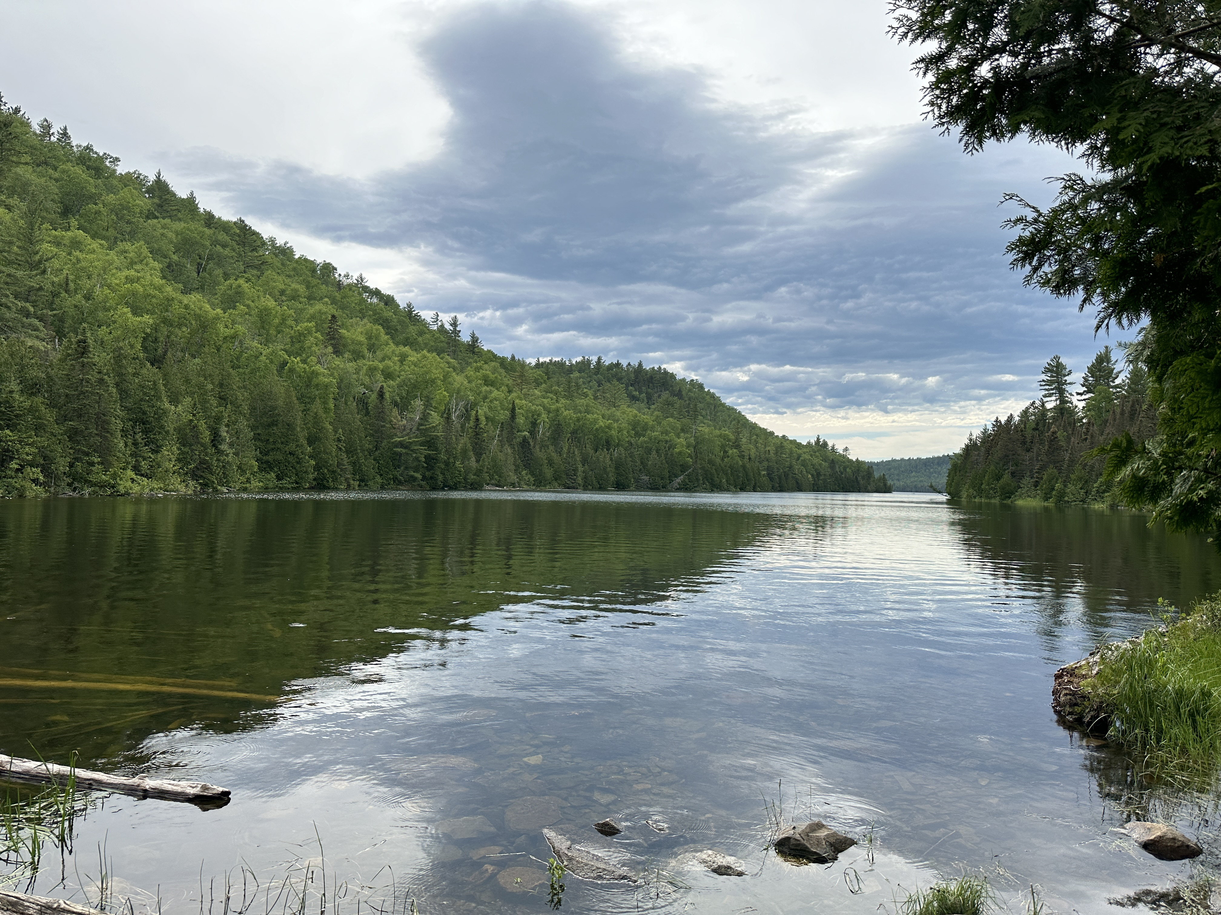
View of the lake from the Little Caribou Lake portage. Looking towards the west.
Paddling west along the north shoreline to the eastern portage to Clearwater Lake. There are two different portages between Caribou Lake and Clearwater Lake, one on each end of the lake. We pass by BWCA Campsite 691 which was occupied.
PADDLING FROM THE EAST CLEARWATER LAKE PORTAGE TO BWCA CAMPSITE 690
A brief paddle to the west along the north shoreline of the lake to the campsite. The campsite is located behind a small island.
PADDLING FROM BWCA CAMPSITE 690 TO BWCA CAMPSITE 688
A long paddle down much of the length of Caribou Lake on a westbound heading. We stay close to the north side of the lake. We paddle past BWCA Campsite 689 which was taken.
PADDLING FROM BWCA CAMPSITE 688 TO BWCA CAMPSITE 687
Quick paddle down the shoreline to the southwest to the next campsite.
PADDLING FROM BWCA CAMPSITE 687 TO BWCA CAMPSITE 686
Another short paddle along the shore heading southwest to the next campsite. There are three campsites strung along the shoreline here, just to the northeast of the Clearwater Lake portage at the western end of the lake.
PADDLING FROM BWCA CAMPSITE 686 TO THE WEST CLEARWATER LAKE PORTAGE
A brief paddle gets you to the portage landing. This portage is at the west end of Caribou Lake.
Route Connections for Caribou Lake
From Caribou Lake you can portage into Clearwater Lake (either from the east or west end of the lake, as there are two portages to this lake), Deer Lake and Little Caribou Lake.