Pine Lake
Gunflint Ranger District
PINE LAKE CAMPSITES:
Campsite 1 (#2061): Westernmost campsite along the north shoreline
Campsite 2 (#729): Second campsite along north shoreline from the west end of the lake
Campsite 3 (#730): Middle of the five campsites along north shoreline between the Little Caribou Lake portage and the West Pike Lake portage
Campsite 4 (#735): Second campsite west of the West Pike Lake portage
Campsite 5 (#732): This campsite is the first site west of the West Pike Lake portage
Campsite 6 (#733): This campsite is just east of the West Pike Lake portage and is accessible to hikers of the Border Route Trail
Campsite 7 (#734): Second campsite to the east of the West Pike Lake portage
Campsite 8 (#753): Campsite is about 800 yards west of the channel to McFarland Lake
Campsite 9 (#754): Located right next to the channel to McFarland Lake
Campsite 10 (#755): On a point south of the McFarland Lake channel, on the very east end of the lake
Campsite 11 (#731): Only campsite on the south shore of the lake, just west of the Vale Lake portage
Campsite 12 (#716): CLOSED. Used to be just east of the Little Caribou Lake portage
Pine Lake is a nearly eight mile long body of water running generally east-west through an ancient bedrock known as the Rove Formation. The lake is lined by high ridgelines, extending up to 500 feet in elevation above the surface of the lake. There are about 10 campsites on the lake, mostly along the north shoreline. Along the south shoreline there are three accessible lakes. Gadwell Lake and Vale Lake require crossing some tough but relatively short portages to reach. Both of these lakes are stocked with brook trout by the Minnesota Department of Natural Resources. The portage to Long Lake toward the eastern end of Pine Lake is longer. Long Lake (and Stump Lake just to its south) have a single seldom used campsite between them. Lake trout are the primary target of those packing fishing equipment on this lake, but the lake also contains plenty of smallmouth bass and walleye too.
Beware the wind on Pine Lake. A strong wind can create large waves on this big lake making it very treacherous.
The portage to Canoe Lake is a bit of a doozy. It ascends roughly 300 feet in elevation, winding its way over three modest hills. At the Pine Lake end of this portage you will find the trail leading to Johnson Falls.
Access to Johnson Falls from the Canoe Lake portage. There is also another landing a short distance west of the Canoe Lake portage that also connects to the trail leading to Johnson Falls. The Johnson Falls trail is fairly long and quite steep in places, especially as you get close to the waterfalls. Johnson Falls consists of two waterfalls, so don't stop once you reach the first one, as the upper falls is even a bit more spectacular.
A prescribed burn was conducted on the southwestern end of Pine Lake sometime after 1990, but before 2005.
Water flows through Pine Lake from west to east. The lake is fed on its western end by the Crocodile River. This river flows into Pine Lake not far downstream of where it cascades over Johnson Falls. Small streams from Table Lake, Vale Lake and Gadwall Lake flow into Pine Lake along its south shoreline. All this water flows out the east end of the lake into McFarland Lake. This is a continuation of the Crocodile River. The mouth of the Crocodile River is where it meets the Royal River at John Lake. Pine Lake is the 31st deepest lake in the BWCA at 113 feet.
References:
Beymer, Robert, Boundary Waters Canoe Area – Volume 2 – Eastern Region (Berkeley: Wilderness Press, 2006), 235, 239, 242, 244, 250, 252, 255, 261, 269.
Heinselman, Miron, The Boundary Waters Wilderness Ecosystem (Minneapolis: University of Minnesota Press, 1999), 99-100, 109, 200.
Pauly, Daniel, Exploring the Boundary Waters (Minneapolis: University of Minnesota Press, 2005), 5, 47, 380, 393, 400.
Exploring Pine Lake
Routes to locations on Pine Lake are shown below:
No routes defined yet for Pine Lake.
Click on the photos below to see the full resolution image - Use your browsers back button to close photo and return to this page.

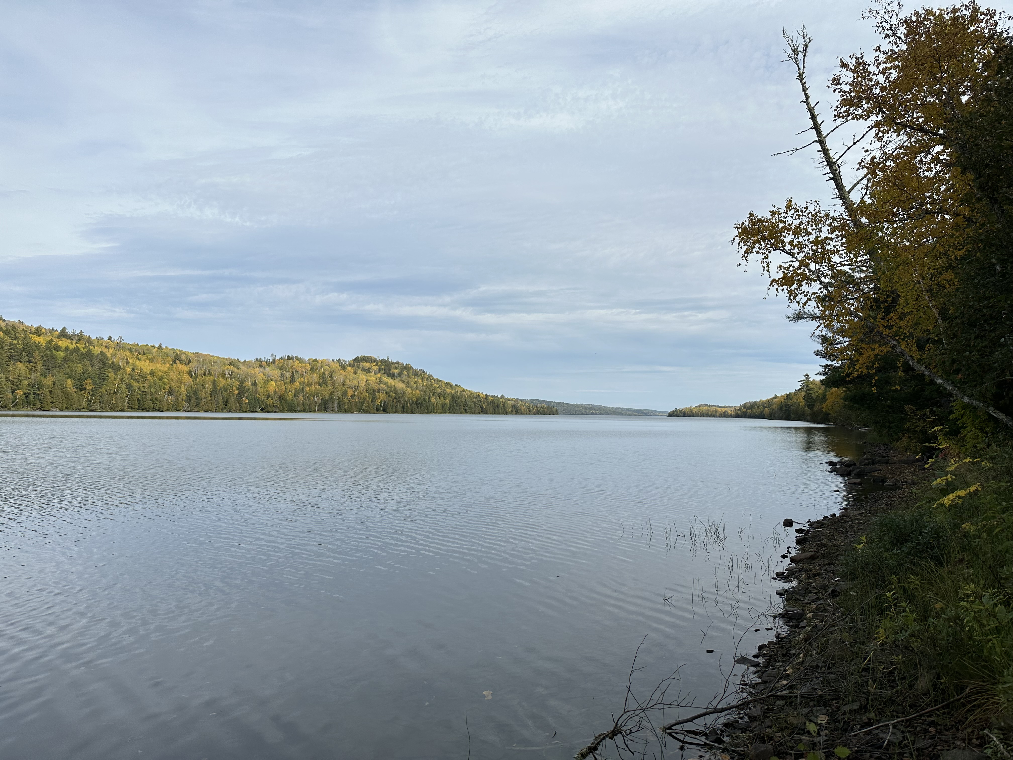
Peering east down Pine Lake from the Canoe Lake portage landing. The most distant shoreline you can see here (just right of center) is just under five miles away.

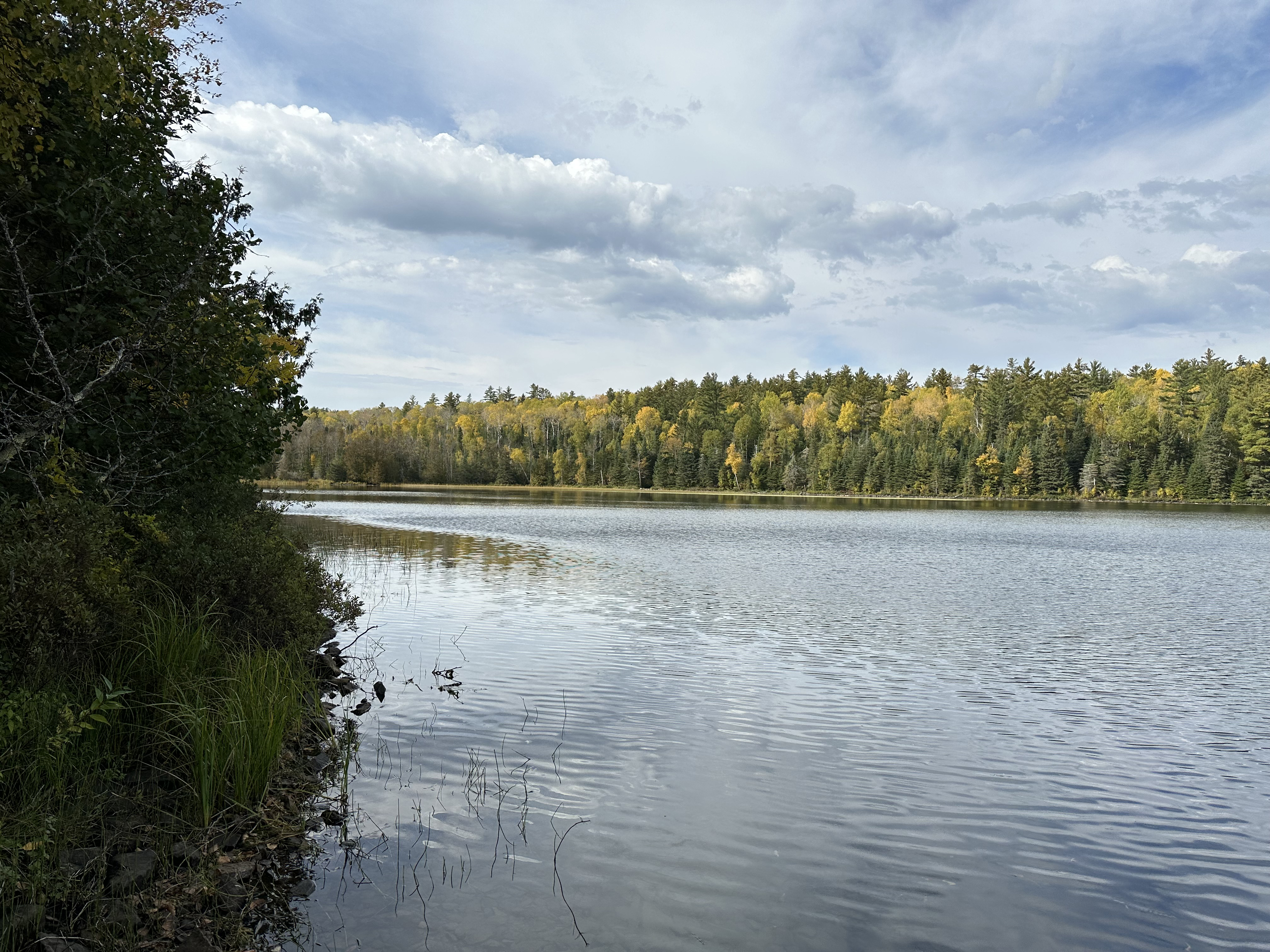
The very western end of Pine Lake. The portage landing to Little Caribou Lake is near the far left on the opposite shoreline.
Route Connections for Pine Lake
From Pine Lake you can portage into Canoe Lake, Gadwall Lake, Little Caribou Lake, Long Lake, McFarland Lake, Vale Lake and West Pike Lake. There is also a hiking trail to Johnson Falls that starts next to the Canoe Lake portage.
Return to Top of Page
|