ROUTES/PORTAGES FROM MINE LAKE:
Trail Access: Kekekabic Trail
Mine Lake
Gunflint Ranger District
Mine Lake is only accessible by hikers of the Kekekabic Trail. That trail was rerouted along Mine Lake to avoid flooded areas in 2019. The rerouting has the trail going higher up the hill along the north side of Mine Lake. There is now a fantastic overlook in this area providing panoramic views of much of the lake. The lake lies just east of the BWCA boundary line.
Mine Lake has suffered three recent fires. A smaller fire in 1987 that was confined to just the area around Mine Lake. In 2004 the large Cavity Lake fire burned much of the forest around the lake. Then in 2007, the Ham Lake fire reburned it. All that remains now are the skeletons of the spruce and jack pine forest that used to grow here.
Beavers are commonly seen from the Kek Trail in the area of Mine Lake.
The flow of water in this area is east to west. The small lake and marshland to the east of Mine Lake flow into the eastern end of the lake. Mine Lake flows out to the west through a creek to Bingshick Lake. This may be the Chub River, but unable to positively verify.
Exploring Mine Lake
Click on the photos below to see the full resolution image - Use your browsers back button to close photo and return to this page.
Panoramic view of Mine Lake from the Mine Lake Overlook along the Kekekabic Trail (November 16, 2023).
While standing on the Kekekabic Trail, view to the west from the eastern end of Mine Lake (October 27, 2022).
Eastern end of Mine Lake where the creek flows in. This creek is the one that has been visible along the south side of the Kekekabic Trail if you've been hiking in from the eastern trailhead (October 27, 2022).
The Kekekabic Trail passing through a grassy and boggy area near east end of Mine Lake (October 27, 2022).
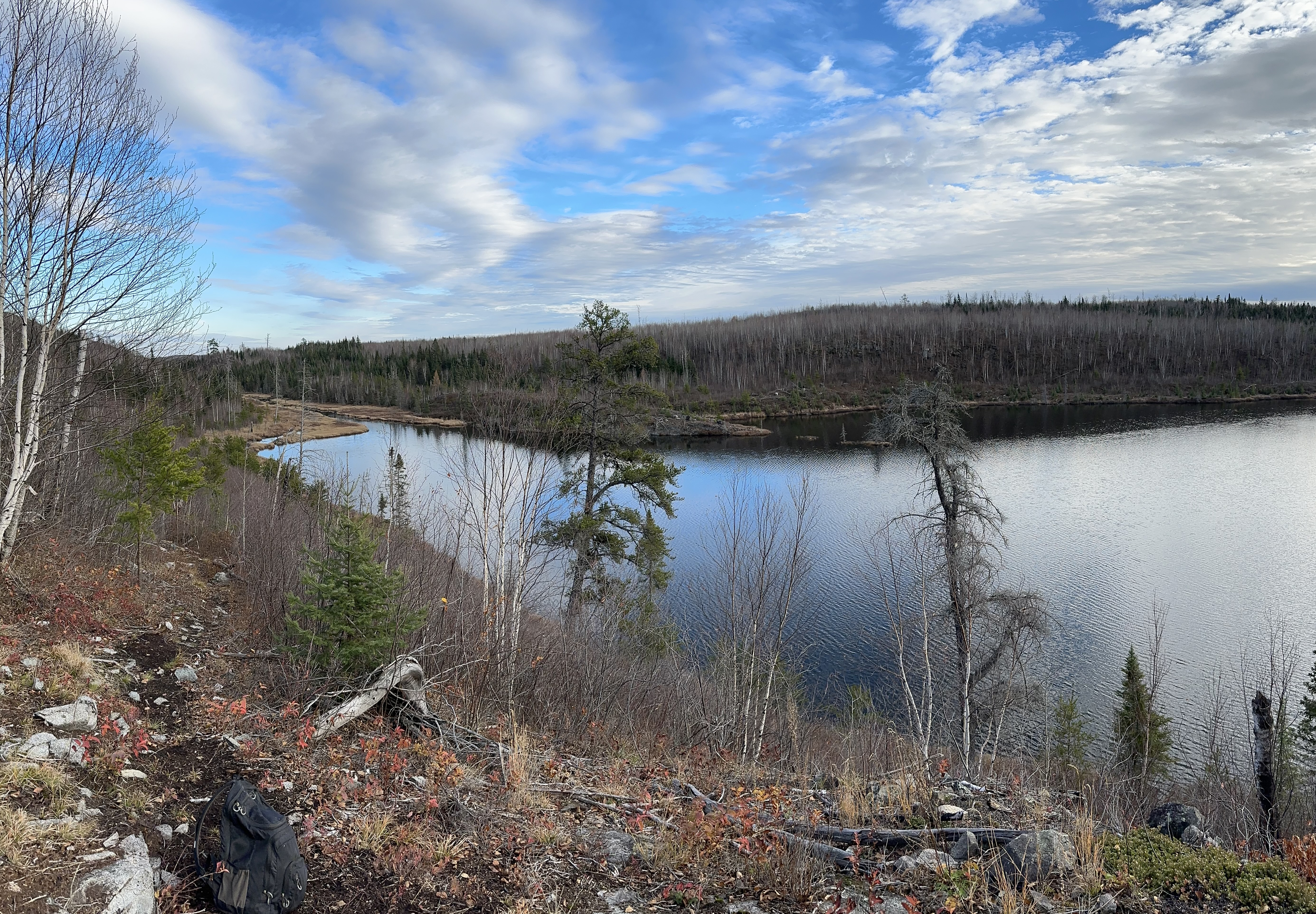
This view is from the Mine Lake Overlook along the Kekekabic Trail. Looking to the east (October 27, 2022).
Long view of Mine Lake from the Mine Lake Overlook on the Kekekabic Trail (November 16, 2023).
Older video footage from a similar vantage point (October 27, 2022).
Another view from the Mine Lake Overlook. Looking to the west. Most of Mine Lake is visible from this vantage point (October 27, 2022).
Route Connections for Mine Lake
The Kekekabic Trail passes along the north side of Mine Lake.