Last Visited: June 22, 2025
Previous Visit(s): April 29, 2021, September 8, 2019; May 2, 2015
Creek Elevation: Headwaters at Picket Lake at 1370 feet. Mouth at Mudro Lake at 1370 feet. Creek drops less than 1 foot over its entire course.
Water Clarity: N/A
ROUTES/PORTAGES FROM MUDRO CREEK:
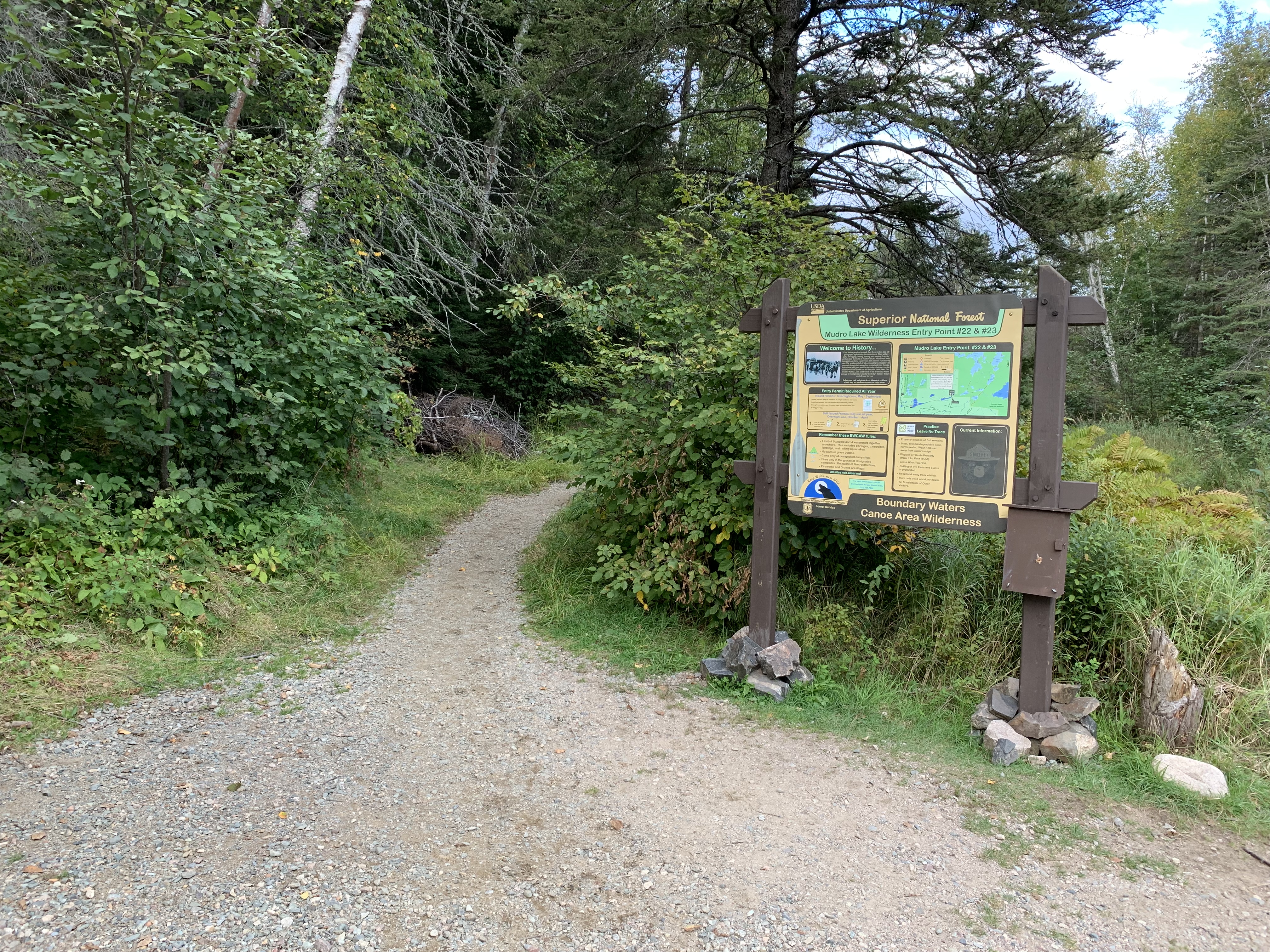
To BWCA Entry Point 22 and 23: Walk the 30 rod portage (can be longer if water is low)
To Mudro Lake: Paddle In
Mudro Creek
Kawishiwi Ranger District
(Travel along Mudro Creek shown in both directions below. Scroll farther down to see the version traveling from Mudro Lake back upstream to BWCA Entry Point 22 and 23).
You may see this creek referred to as Picket Creek. Neither name seems to be formal.
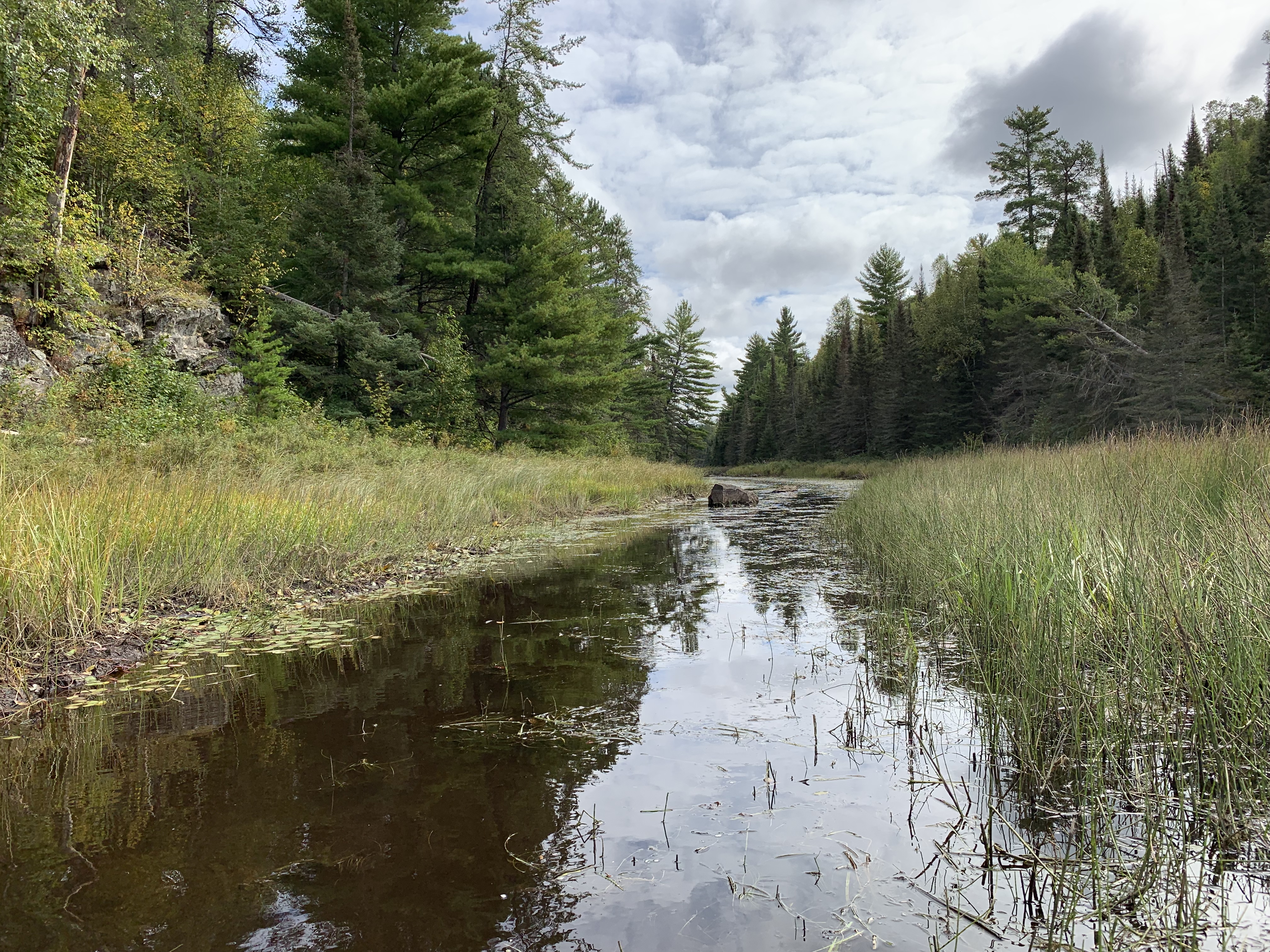
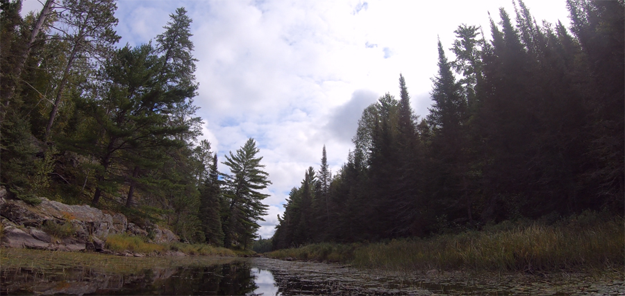
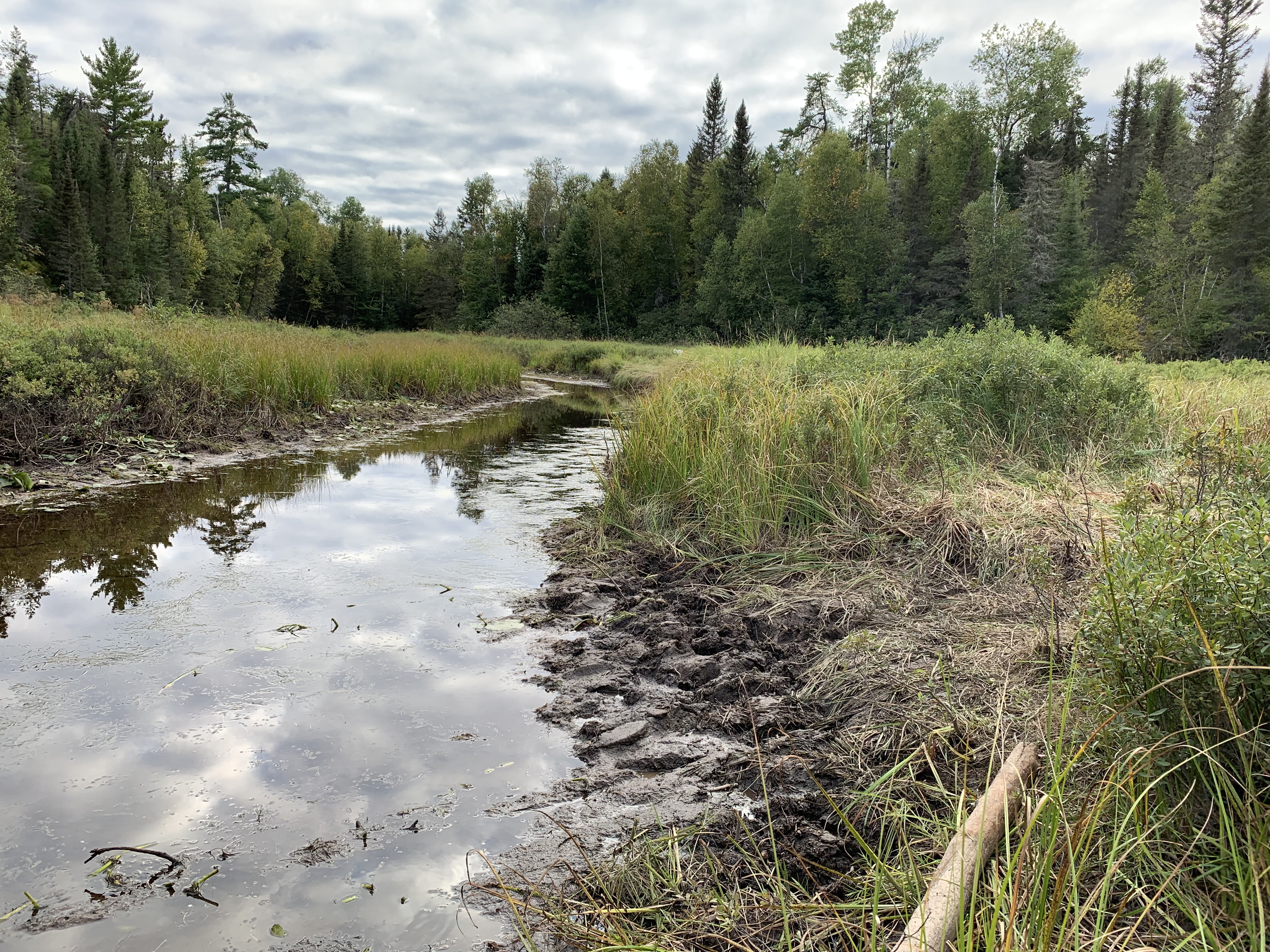
Mudro Creek flows from Picket Lake, underneath the road near to the BWCA Entry Point 22 and 23 parking lot and then east about half a mile to the west end of Mudro Lake. The creek is mostly lined by marsh grass. Some rocky sections with a few large pines can be seen along the creek. The creek has a fairly hard bottom (easy walking) even though the creek is lined by muddy ground covered in tall grass.
The creek is subject to extreme fluctuations in water level. In spring time, when the water is typically high, the portage from the entry point parking lot to the creek is about 30 rods and ends at a sandy landing. However, late in the year, the portage can double in length as you will have to walk farther to find deep enough water in Mudro Creek in which to float a canoe. During high water there may be a beaver dam present. If so, you will have to liftover or otherwise maneuver around the dam. During low water, you may have to walk along much of the creek and even do an extra portage or two to get around some rocky areas of the creek that become impassable in a loaded canoe.
Click on the photos below to see the full resolution image - Use your browsers back button to close photo and return to this page.
PADDLING DOWNSTREAM FROM BWCA ENTRY POINT 22 AND 23 TO MUDRO LAKE
Start of the 30 rod portage from BWCA Entry Point 22 and 23 to Mudro Creek. This is heading downstream (east) towards Mudro Lake. This was during a low water period. During times of higher water this portage is about 30 rods long. During low water it can double in length and the creek must be walked in many places, as it will become too shallow to paddle (April 29, 2021).
Portage from the BWCA Entry Point 22 and 23 parking lot area to Mudro Creek landing during near normal water levels (June 22, 2025).
This is the portage when the water is low. It is about twice as long compared to the high water distance. The high water portage typically ends at the sandy beach about halfway through this video (September 8, 2019).
Older video footage from Spring 2015 showing the portage during high water (May 2, 2015).
The portage is normally about 30 rods long if the water levels are good. If the waters levels aren't so good, you can add another 30 rods or more and these extra rods will be along a muddy, makeshift trail. During low water you make have to walk a ways to find enough water to float your boat. Here is a muddy launching area that is being used because the water is so low (September 8, 2019).
A typical view along Mudro Creek during low water (this is in early Fall 2019). This is roughly halfway between the entry point parking lot and Mudro Lake. You are looking to the east (September 8, 2019).
The paddle down Mudro Creek from the BWCA Entry Point 22 and 23 portage landing to Mudro Lake during conditions when the water levels in the creek were good (June 22, 2025).
Paddling downstream along Mudro Creek. You are heading generally east toward Mudro Lake (September 8, 2019).
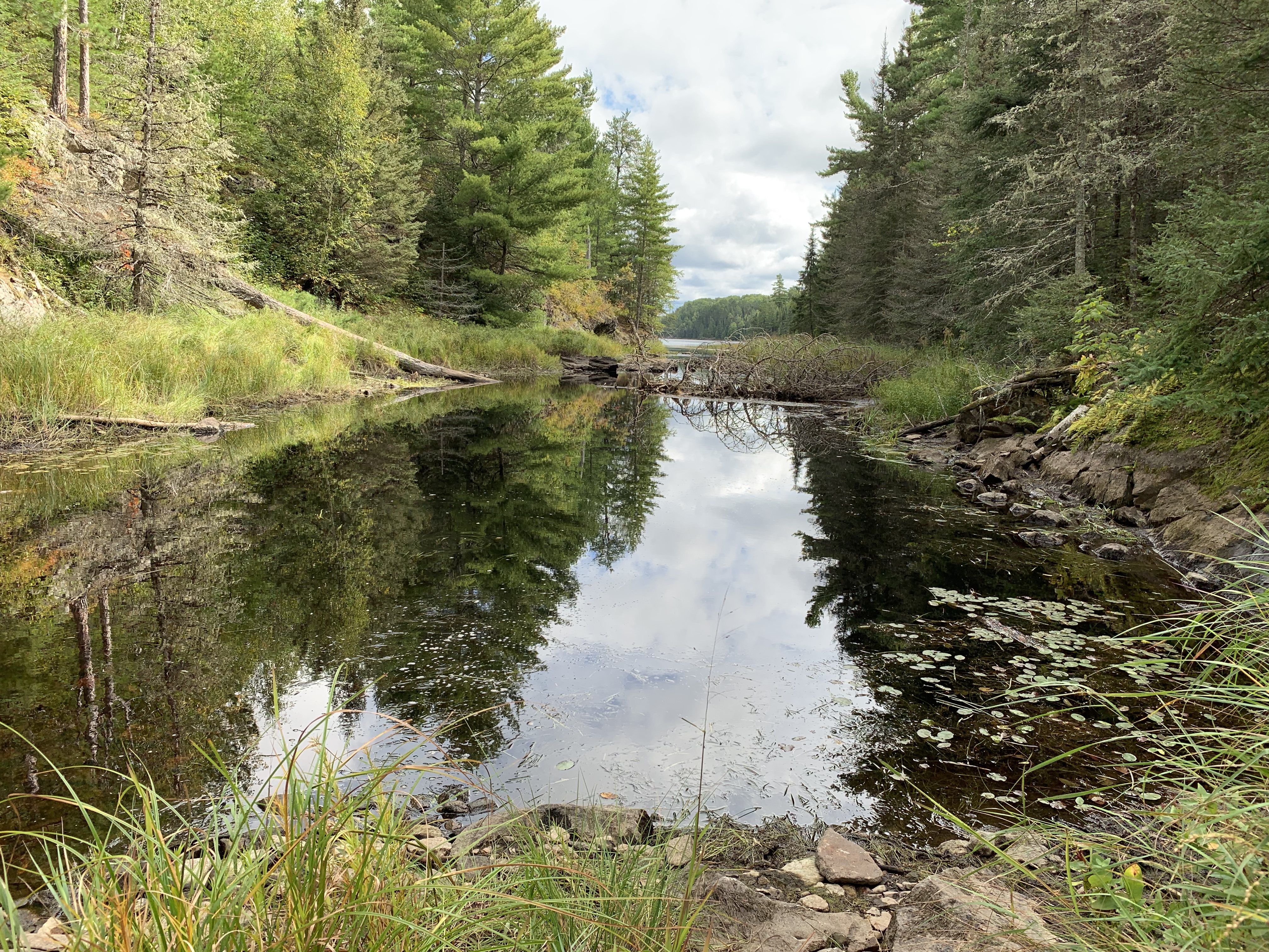
This is the start of an intermittent portage that you will have to negotiate if the water is low. You can paddle right through here if the water is high. A small lightly loaded solo canoe can line through if you don't mind walking in the water (September 8, 2019).
If the water is high enough, you will not have to do this liftover portage. Low water means you will have some work to do here (September 8, 2019).
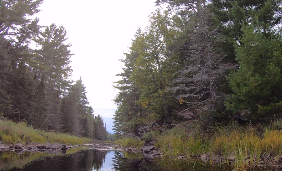
View downstream (east) after crossing the 2 rod intermittent portage. Mudro Lake is visible in the far distance (September 8, 2019).
A brief paddle down the rest of Mudro Creek ending at Mudro Lake (September 8, 2019).
Older video footage of the creek (May 2, 2015). Paddle into Mudro Lake -or- Explore Another Route ***********************************************END OF ROUTE***********************************************
PADDLING UPSTREAM FROM MUDRO LAKE TO BWCA ENTRY POINT 22 AND 23
Looking west (upstream) shortly after entering Mudro Creek from Mudro Lake. This is during low water in Fall 2019. It's late in the afternoon (September 8, 2019).
Paddling the creek with good water levels (June 22, 2025).
Paddling from Mudro Lake all the way to the BWCA Entry Point 22 and 23 landing. You must get out of the canoe several times to make it through this stretch. (September 8, 2019.)
Older video of the same paddle from Mudro Lake to the entry point landing as shown above (May 2, 2015).
Looking upstream to the west. This is upstream of the intermittent portage if you are here during a low water period (September 8, 2019).
The start of the portage leading the the entry point parking lot. This is during low water. Some groups just walk the creek to this point rather than portaging through the tall grass. The creek has a relatively hard bottom in most places (September 8, 2019).
This portage is quick and easy when water levels are near normal or higher than usual (June 22, 2025).
Portaging first through the marsh grass and then along the well maintained portage trail leading to the parking lot (September 8, 2019).
Back at the entry point (April 29, 2021). Explore BWCA Entry Point 22 -or- Explore Another Route ***********************************************END OF ROUTE***********************************************
Route Connections for Mudro Creek
From Mudro Creek you can enter or exit the BWCA at Entry Point 22 or Entry Point 23. You can also paddle into Mudro Lake. Note that from the BWCA Entry Point 22 and 23 parking lot, you can also portage into Picket Lake (not in the BWCA) and head toward the west. It is possible to reach South Hegman Lake (which is in the BWCA) by heading west through Picket Lake and Nels Lake (not in the BWCA), a very difficult route.