SOUTH HEGMAN LAKE CAMPSITES:
Campsite 1: (#1904) - Located on the north shore of the lake
Campsite 2: (#1905) - On the mid-lake point
Campsite 3: (#1906) - East side of the southeast bay of the lake
South Hegman Lake has two campsites. The only other lake in this area with campsites is over a 146 rod dead end portage on Little Bass Lake to the northeast. Access to Little Bass Lake is only from North Hegman Lake. There are no campsites on North Hegman Lake or Trease Lake.
Most groups visit this area to check out the pictographs on North Hegman Lake. Because of the pictographs, this lake sees a fair amount of day traffic by folks using BWCA day permits. All the lakes in this area are lined by cliffs and massive rock formations and it is a beautiful area to visit.
Do not think to use this entry point if you are hoping this is an easier route up to Angleworm Lake instead of doing the 716 rod Angleworm Lake portage. This way isn't easier and is in fact quite a bit more laborious.
North Hegman Lake flows into South Hegman Lake through a creek next to the portage between the two lakes. South Hegman Lake drains out through a small creek in it's southeast bay and it's waters then flow southeast about a half mile into Nels Lake losing 55 feet of elevation in the process.
The last major fire along South Hegman Lake occurred in 1822. This was a 48,000 acre fire. Because it has been a long time since a large fire impacted this area, there are considerable stands of large pines and other trees in this area (Heinselman, 1999). There was a prescribed burn of 74 acres carried out in the vicinity of South Hegman Lake in May, 1996.
References:
Beymer, Robert, Boundary Waters Canoe Area – Volume 1 – Western Region (Berkeley: Wilderness Press, 2006), 128, 130, 133.
Heinselman, Miron, The Boundary Waters Wilderness Ecosystem (Minneapolis: University of Minnesota Press, 1999), 57.
Pauly, Daniel, Exploring the Boundary Waters (Minneapolis: University of Minnesota Press, 2005), 131.
Click on the photos below to see the full resolution image - Use your browsers back button to close photo and return to this page.
PADDLING FROM BWCA ENTRY POINT 77 TO NORTH HEGMAN LAKE PORTAGE
Looking northeast up South Hegman Lake from the Entry Point 77 portage landing. This view on September 27, 2020.
Roughly the same view as image above (April 29, 2016).
This is a meandering route that will show you the majority of South Hegman Lake. It is not a direct route between the two portages. It mostly follows the eastern shoreline of the lake, winding in and out of bays until reaching the North Hegman Lake portage. It passes all three of the lakes campsites (all were occupied at the time) (July 11, 2023).
This is older video footage of the direct route, going up the west shoreline of South Hegman Lake to the North Hegman Lake portage (April 29, 2016).
You're looking off to the northeast at the east shoreline of South Hegman Lake. It is late afternoon on April 29, 2016.
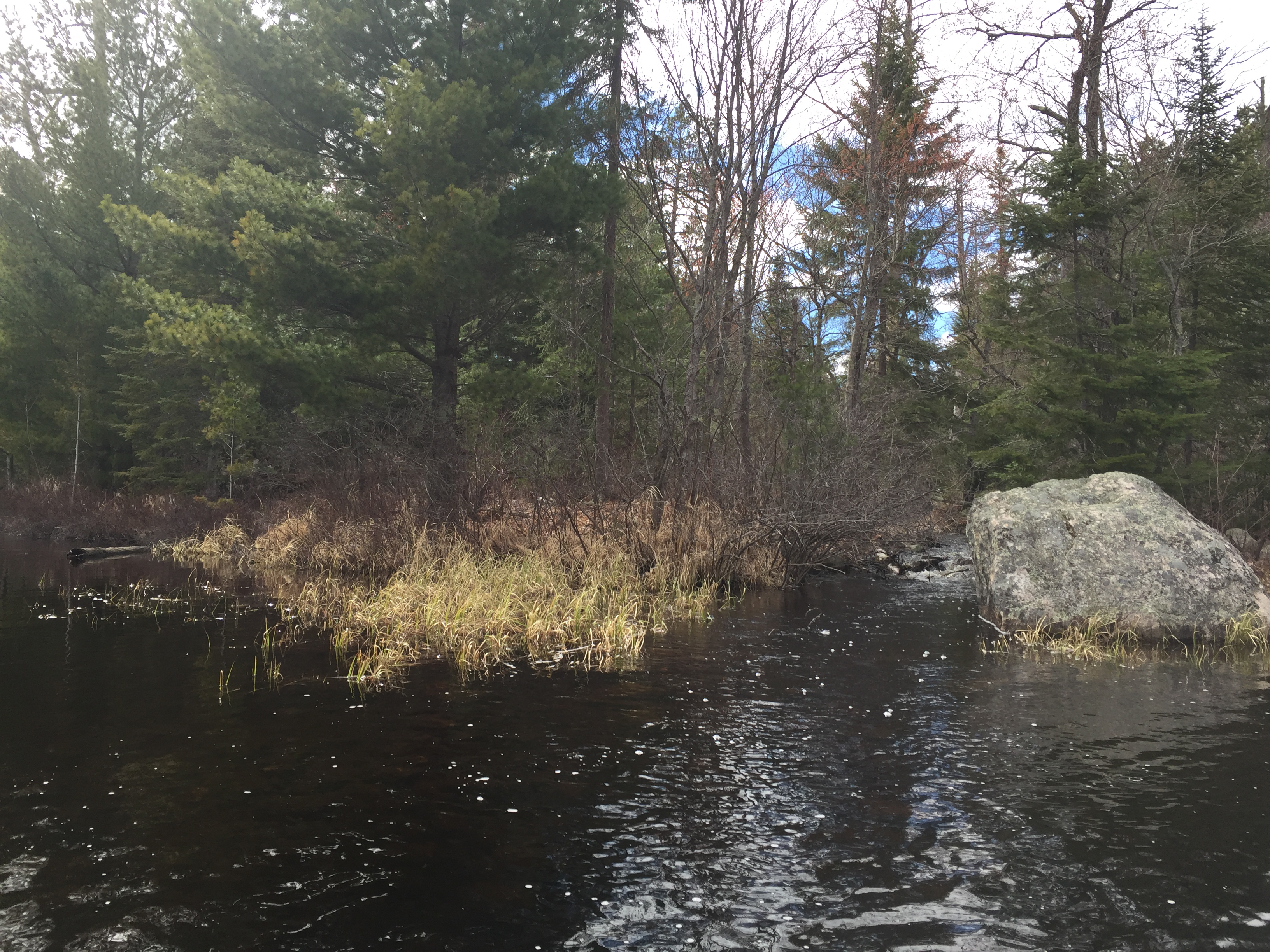
South Hegman Lake peering toward the south from the North Hegman Lake portage landing. A small creek flows in to the lake on the right side of your view by the big boulder out in the water (April 29, 2016).
Otter swimming in South Hegman Lake right at the end of the North Hegman Lake portage. May be eating a northern pike. The otter was pretty engrossed in it's activities and didn't know it was being watched (April 29, 2016).
A view of the small creek that is near the portage between North Hegman Lake and South Hegman Lake. North Hegman Lake flows into South Hegman Lake (April 29, 2016). Portage to North Hegman Lake -or- Explore Another Route ***********************************************END OF ROUTE***********************************************
PADDLING FROM THE NORTH HEGMAN LAKE PORTAGE TO THE BWCA ENTRY POINT 77 PORTAGE
Paddling in the evening from the North Hegman Lake portage south along west shoreline of South Hegman Lake until reaching the BWCA Entry Point 77 portage landing (July 11, 2023).