River Elevation: Headwaters at Baldpate Lake at 1410 feet. Mouth at Stuart Lake at 1249 feet. River drops 161 feet over its entire course.
Water Clarity: N/A
ROUTES/PORTAGES FROM THE STUART RIVER:
To BWCA Entry Point 19: Walk the 450 rod portage
To Contest Lake: Bushwhack for about 40 rods
To Stuart Lake: Walk the 78 rod portage
To Swamp Creek: Paddle In
To White Feather Lake: Bushwhack and/or Paddle In (depending on water levels)
Stuart River
Kawishiwi Ranger District
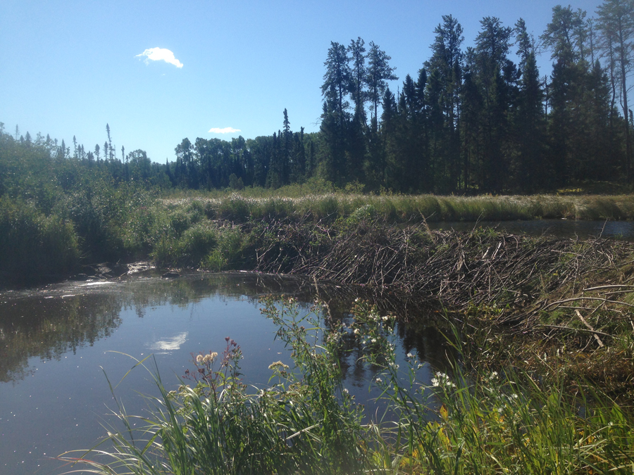
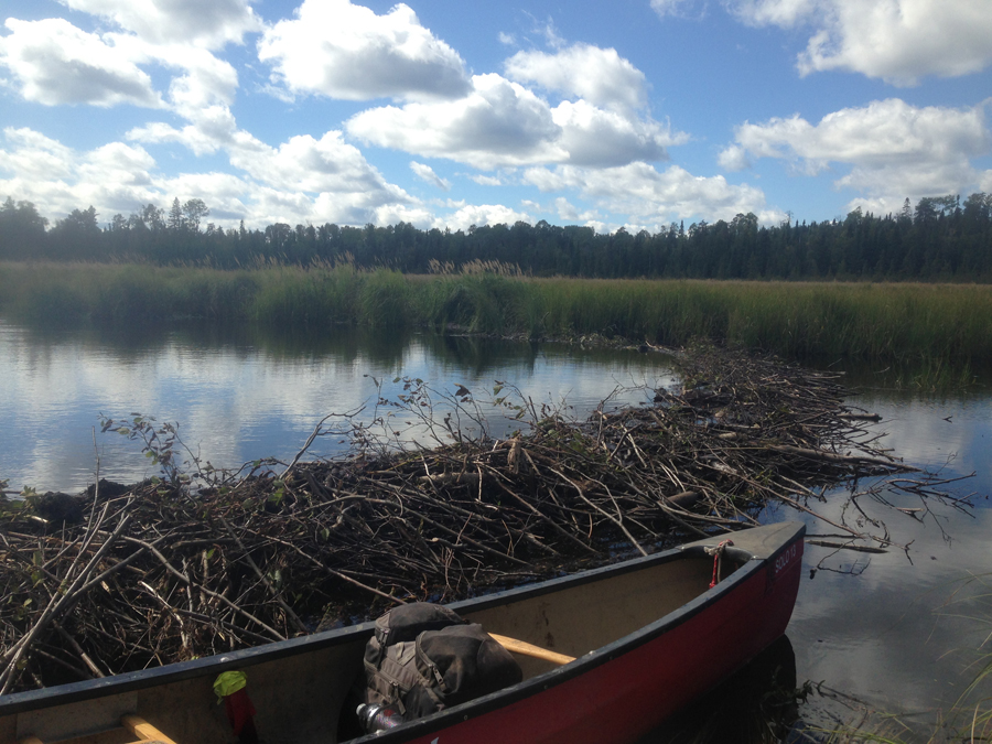
This is a fairly lazy river along most of its course. There are a few minor rapids to portage around. The only significant drop is at the waterfall where the Stuart River pours into Stuart Lake. Low water levels can make this route a bit of work. There is also a committed crew of beavers in the area, that build dams at somewhat regular intervals along the river. Thigh deep mud awaits the unwary around the beaver dams, so make sure you step on firm ground!
The Stuart River does have northern pike in it. Fish the deeper sections or below the rapids where the water is moving.
There are no campsites along the entire Stuart River, so get an early start to make it up to Stuart Lake at a reasonable time.
The Stuart River begins in Baldpate Lake and flows generally northward until it dumps into Stuart Lake. From the entry point portage, almost all paddlers head to the left, downriver in the direction of Stuart Lake. It is possible to travel upriver toward Baldpate Lake. There are three unmarked portages (probably more like bushwhacks) required to reach that lake. It is about two miles from the portage landing.
A federal logging sale in 1964 put the forest just west of the Stuart River near Jerry Creek in play for future logging. This was just before the U.S. Congress passed the Wilderness Act on September 3, 1964 which made the BWCA a unit of the recently created National Wilderness Preservation System.
References:
Beymer, Robert, Boundary Waters Canoe Area – Volume 1 – Western Region (Berkeley: Wilderness Press, 2006), 109, 111, 114, 122.
Pauly, Daniel, Exploring the Boundary Waters (Minneapolis: University of Minnesota Press, 2005), 125, 126.
Traveling the Stuart River
Click on the photos below to see the full resolution image - Use your browsers back button to close photo and return to this page.
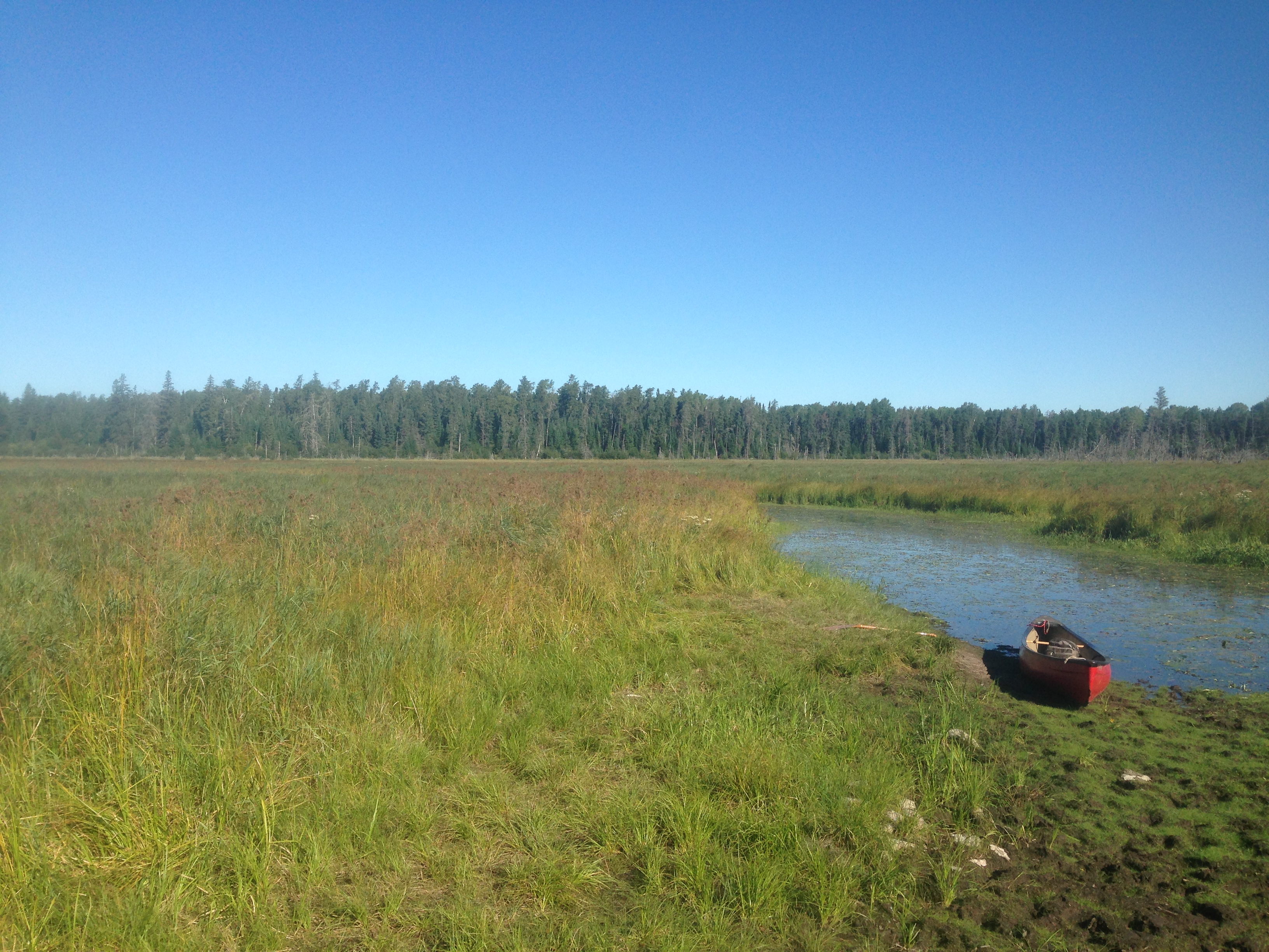
Stuart River landing for BWCA Entry Point 19. An example of what it looks like during low water levels in September.
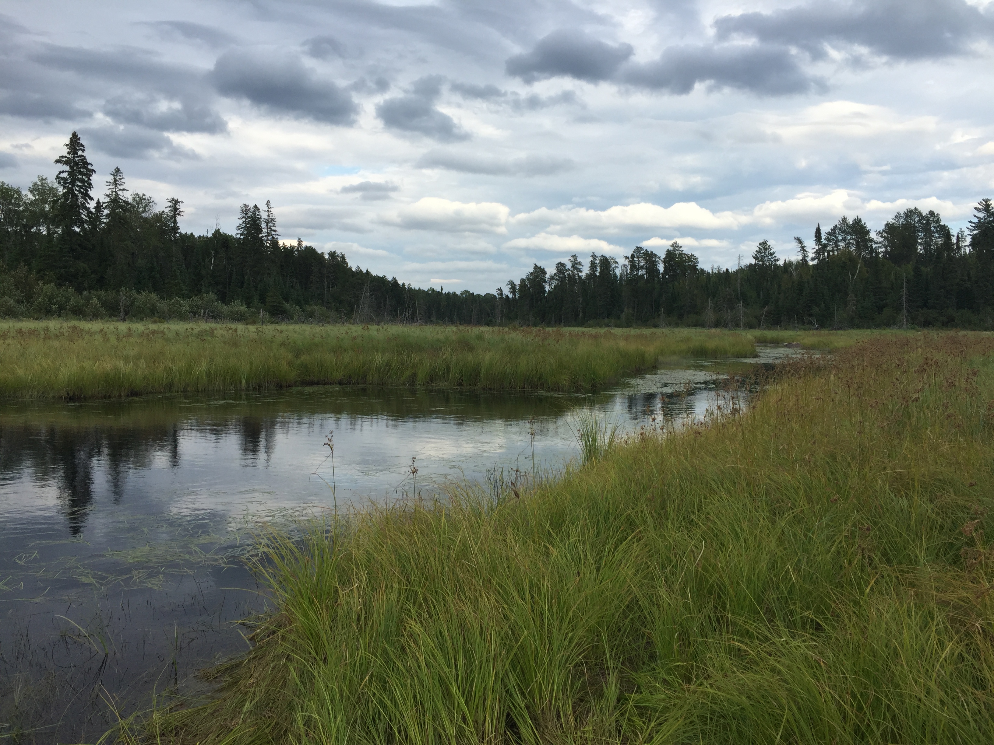
Looking upstream from the BWCA Entry Point 19 landing. This is during normal water levels and also in September, but in a different year from the image above.
Taking in a 360 degree view of the Stuart River entry point canoe landing.
Standing at the BWCA Entry Point 19 canoe landing at sunset. You will be portaging back to the parking lot in the dark.
A large beaver dam along the Stuart River somewhere between the Stuart River entry point landing and White Feather Lake.
Paddling a short stretch of the Stuart River downstream about one-third mile to the mouth of the small channel that leads through a marsh to White Feather Lake.
Paddling upstream along Stuart River from the 69 rod portage (upstream end of it), to the "difficult to even notice" creek that flows out of Contest Lake. It takes you about one minute to cover the distance from the portage to the creek mouth.
This beautifully arcing beaver dam was in place downstream of Contest Lake, not long before reaching the Stuart Lake portage. Nice architecture, yes?