Creek Length: About 2 miles. Starts from an unnamed lake just northwest of Skoop Lake, through Skoop Lake, then Ada Lake and drains into Sawbill Lake.
Campsites: None
Wildlife Seen on Visit: Waterfowl
Last Visited: May 26, 2016
Creek Elevation: Along its course, Ada Creek drops from about 1,845 feet at its headwaters at the unnamed lake, and drains into the north end of Sawbill Lake at 1,787 feet.
Ada Creek begins in an unnamed lake east/northeast of Skoop Lake. The creek than flows into the east side of Skoop Lake. From Skoop Lake, Ada Creek meanders south and pours into the north end of Ada Lake. From Ada Lake, the creek continues southward, wider now with more flow, until it reaches its mouth at the north end of Sawbill Lake.
Ada Creek has sections of flat and turbid water. It is a scenic area of the BWCA, but requires a good amount of effort to pass through. A few fairly long portages get paddlers around the unnavigable sections, but these portages are well traveled by the hoards heading north from the Sawbill Lake entry point. The 110 rod portage between Ada Lake and Skoop Lake is probably the toughest, but it can also be completely avoided if the water levels in the creek are deep enough (except for about 12 rods of it). If you must do this portage, it runs right next to the creek and requires boulder hopping and walking through mud to traverse.
References:
Beymer, Robert, Boundary Waters Canoe Area – Volume 2 – Eastern Region (Berkeley: Wilderness Press, 2006), 57, 60, 133, 139, 151.
Pauly, Daniel, Exploring the Boundary Waters (Minneapolis: University of Minnesota Press, 2005), 251.
Click on the photos below to see the full resolution image - Use your browsers back button to close photo and return to this page.
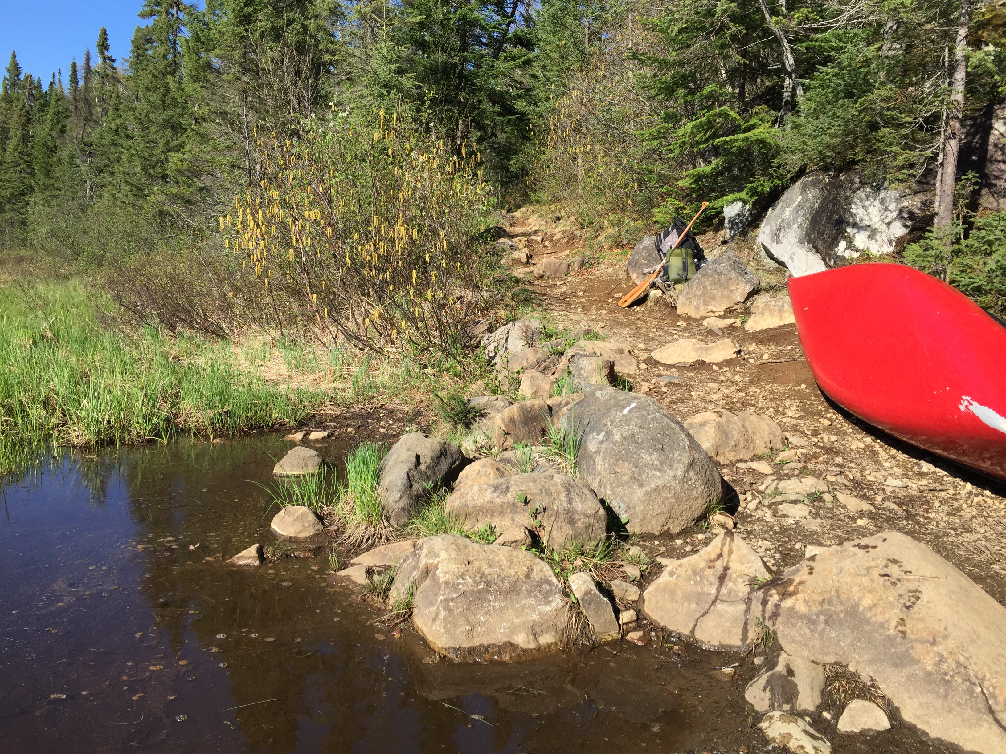
PORTAGING FROM SAWBILL LAKE TO ADA CREEK
This is the start of the portage to Ada Creek. This portage is located on the north end of Sawbill Lake.
A fairly easy portage from Sawbill Lake to Ada Creek that generally stays close to the creek along its course. A few rocks to stub your toes on.
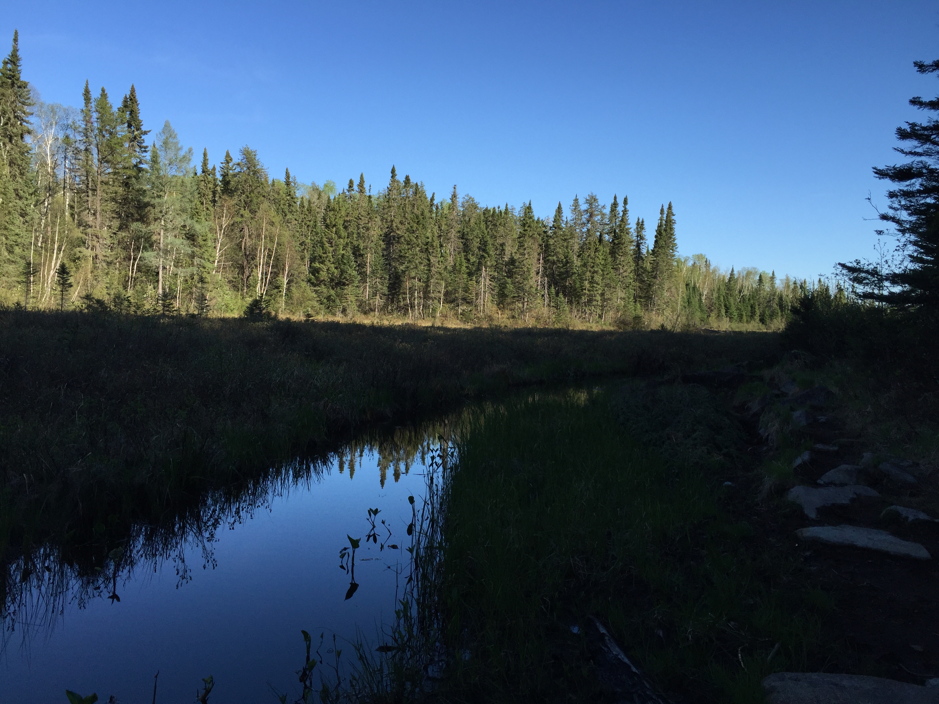
The portage from Sawbill Lake to this point is along Ada Creek. However this section of the creek has rapids or is otherwise obstructed. The portage ends as this wide, lake-like section of Ada Creek. From here, you paddle directly across the section you see before you, paddling beneath that cliff in the far distance (near the center of your view) to the next portage. Explore Another Route ***********************************************END OF ROUTE***********************************************
PADDLING FROM SAWBILL LAKE PORTAGE TO THE ADA LAKE PORTAGE
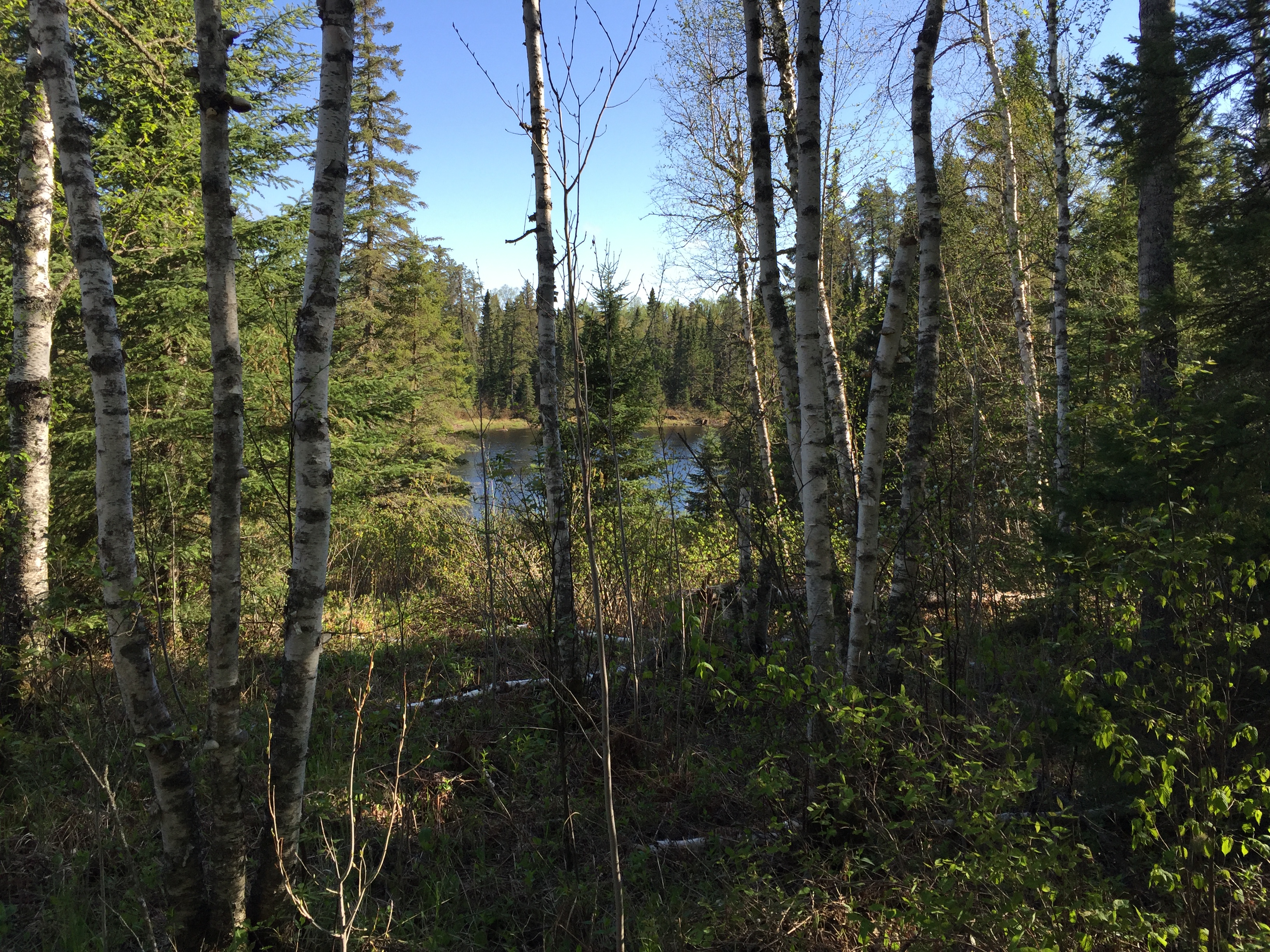
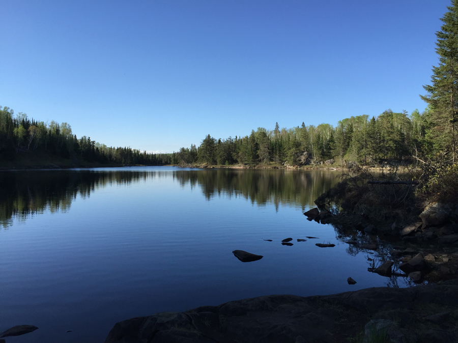
This is a paddle along the wide section of Ada Creek. This section starts at the Sawbill Lake portage and extends north upstream to the start of the portage that leads to Ada Lake. It is a scenic area to paddle through.
The finish of the paddle across the wide section of Ada Creek terminates at the edge of this marsh. It is at this location you find the portage to Ada Lake.
The portage is rocky and is visible on the very right side of your view. The creek passes out of view to the right into the marsh. It is possible to continue paddling upstream along the creek to Ada Lake instead of using the portage (assuming water levels are high enough), but doing this is somewhat longer and will likely involve hauling over several beaver dams. Explore Another Route ***********************************************END OF ROUTE***********************************************
PORTAGING FROM ADA CREEK TO ADA LAKE
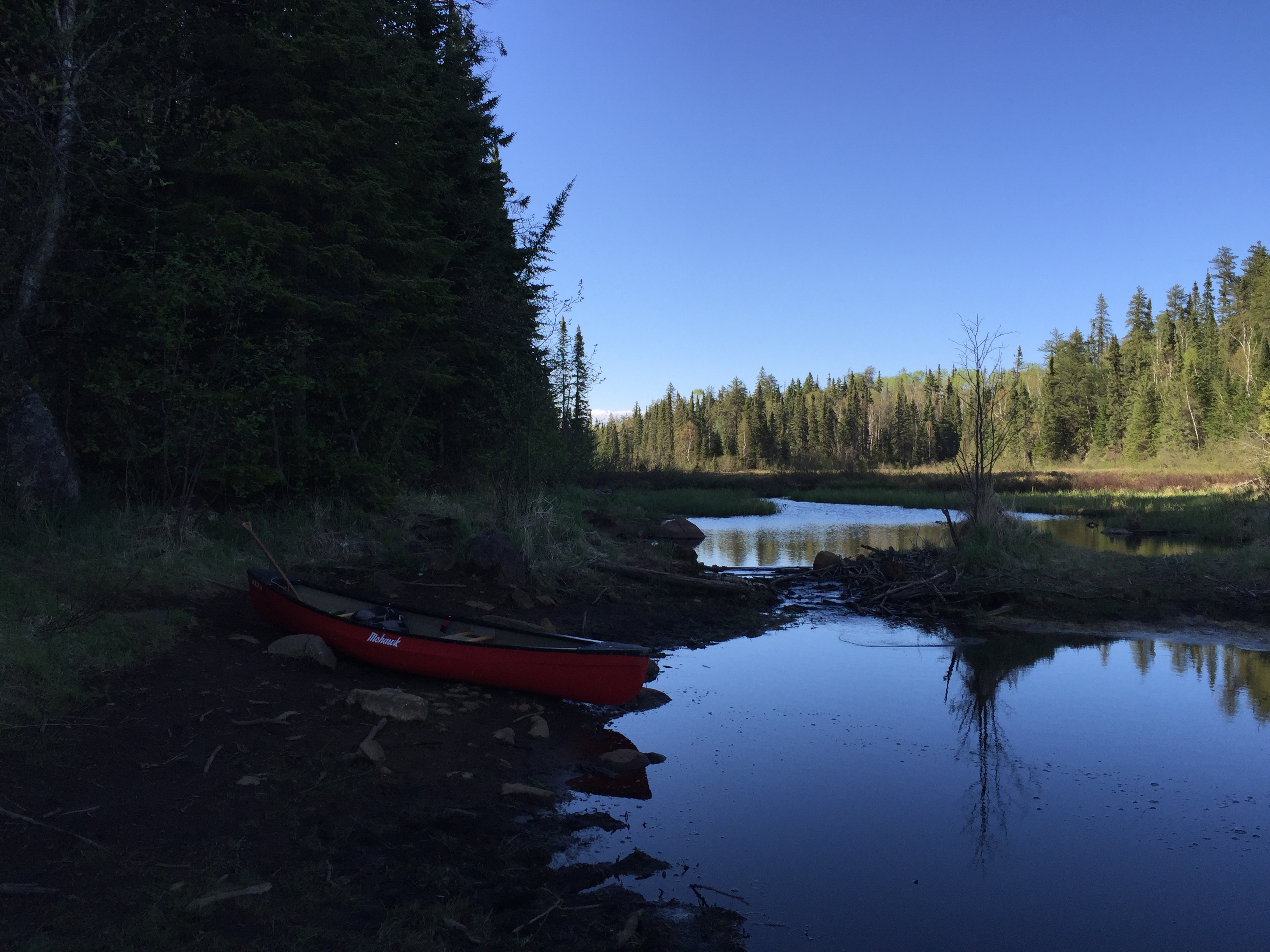
Ada Creek. This is the start of the portage to Ada Lake.
View of unnamed pond along the 80 rod portage between Ada Creek and Ada Lake.
Portaging from Ada Creek to Ada Lake. A few minor rocks and tree roots to step over. The path has only minimal elevation changes along the route.
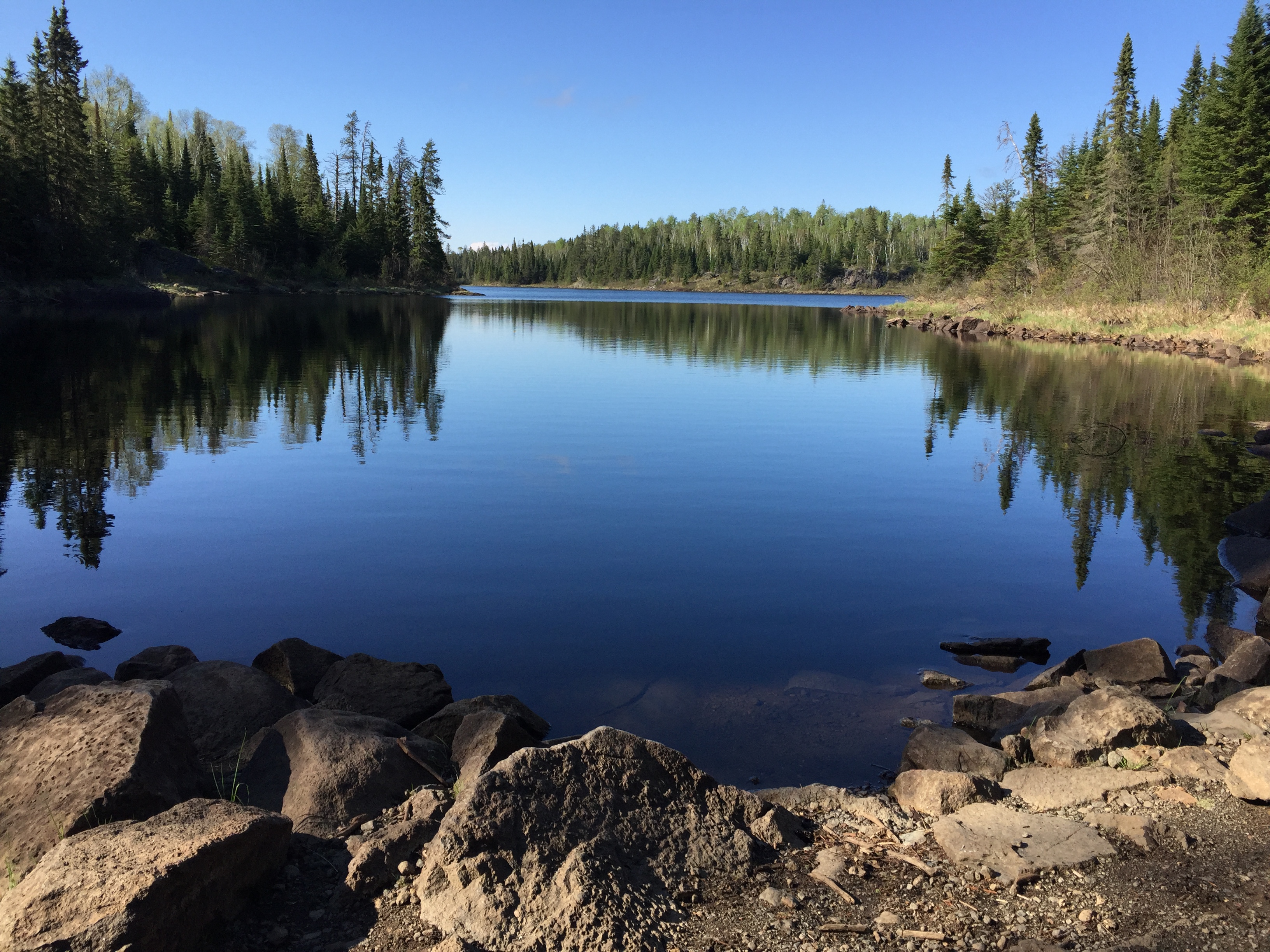
Ada Lake from the Ada Creek portage. Looking toward the north. Paddle Ada Lake -or- Explore Another Route ***********************************************END OF ROUTE***********************************************
PORTAGING FROM ADA LAKE TO SKOOP LAKE (ALONG ADA CREEK)
The portage from Ada Lake to Skoop Lake begins here. The portage runs right along the left bank of Ada Creek. If the water levels are sufficient, it is possible to just paddle along the creek (except for a 12 rod portage). Many maps show this as two short portages at each end of the creek near the lakes. It is really a single longer portage. If you must use the portage, it is muddy, rocky and overall quite difficult.
Ada Creek is very narrow, muddy and slow moving as it parallels this rocky and sloppy 110 rod portage between Ada Lake and Skoop Lake. During periods of higher water, you can paddle most of this section instead of using the portage trail. A challenging portage if water levels are low.
This portage is a real bear. It is muddy even during fairly dry periods. There are many rocks to step over and balance upon. The portage can be skipped if there is enough water in the creek to paddle it.
Skoop Lake from the Ada Lake portage. (Image not expandable) Paddle Skoop Lake -or- Explore Another Route ***********************************************END OF ROUTE***********************************************