Java Creek
Tofte Ranger District
A short creek that begins at Java Lake and flows south to Handle Lake. The creek then flows through Handle Creeks and then flows south and east to its mouth at Sawbill Lake.
Java Creek is usually navigable from Sawbill Lake to Handle Lake (may be some beaver dams). The creek mostly flows through wetlands betweeen Sawbill Lake and Handle Lake, with a brief stretch through forest lined banks just before Handle Lake. However, the mouth of the creek may be plugged with debris (i.e. blowdown and/or beaver dam). This was the case in the summer of 2023. A short bushwhack around the debris will get you into the creek from Sawbill Lake. Upstream of Handle Lake, Java Creek is much less navigable. It would be a difficult bushwhack to reach Java Lake. Sections of the creek between Java Lake and Handle Lake can be paddled.
References:
N/A
Traveling Java Creek (Upstream)
Click on the photos below to see the full resolution image - Use your browsers back button to close photo and return to this page.
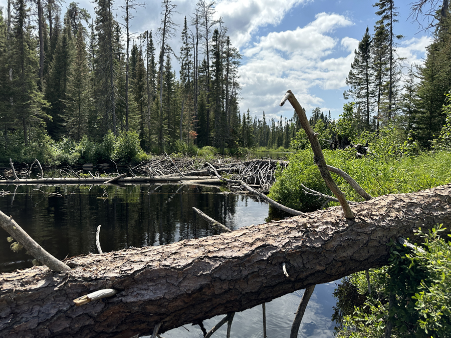
Mouth of Java Creek. Large beaver dam in the background. There was traces of a bushwhacking trail starting right next to the large log in front of you (just to the right, out of view). This tree extended across the creek. Other trees in background in front of the beaver dam also blocked the way (July 1, 2023). Upstream of the beaver dam, the creek was wide open as far as eye could see (several hundred feet beyond). It is only about 3,400 feet from here to Handle Lake.
Route Connections for Java Creek
From Java Creek you can paddle between Handle Lake and Sawbill Lake, although you may encounter several beaver dams. It is also possible that a short bushwhack will be necessary if debris blocks the mouth of the stream or has fallen across the creek upstream of Sawbill Lake.
Return to Top of Page
|


