KELLY LAKE CAMPSITES: Campsite 1: (#825) - Southernmost campsite on the lake. Just southeast of the Burnt Lake portage Campsite 2: (#827) - On south shore of small bay due east of the Burnt Lake portage Campsite 3: (#826) - At the back of the small bay (east shore) due east of the Burnt Lake portage Campsite 4: (#824) - On the point that is northeast of the Burnt Lake portage
Campsite 5: (#927) - North end of the lake just east of the Jack Lake portage
Kelly Lake is probably named for Frank Kelly who worked for the General Logging Company in the 1920's and 1930's. Mr. Kelly previously worked for the U.S. Forest Service (Sawbill: History and Tales - Mary Alice Hansen - see page 212).
Kelly Lake runs southwest/northeast and is basically just a wider section of the Temperance River. To the west of Kelly Lake are two large hills. The southern hill has an elevation of 1,986 feet and the northern hill rises to 2,022 feet. Neither hill is named. These hills separate the Kelly Lake basin from that of Burnt Lake. The portage to Burnt Lake meanders along the southern side of the south most of these two hills. Because of this, the portage between these two lakes is a tiring one. The elevation of Kelly Lake is 1,747 feet. Another hill, not quite as high, reaches a height of 1,933 feet to the east of the lake, near its northern end.
Kelly Lake can be shallow in spots, especially the north end. Later in the season, especially if the water is low, some pushing through weeds may be required.
There is an interesting mine that can be visited along the portage between Kelly Lake and Jack Lake. This is the Frank Johnson Mine. This mining operation dates back to the 1890's. There are many artifacts still scattered about the forest just outside of the mine. The trail leading to this mine can be found near the Jack Lake landing along the portage path.
As mentioned, Kelly Lake is just a wide section of the Temperance River. The Temperance River flows in from Jack Lake (at the north end of Kelly Lake) and out into Peterson Lake at the south tip. Jack Lake lies four feet above Kelly Lake in elevation and Peterson Lake is one foot below Kelly Lake. Pipe Creek also drains into Kelly Lake, just east of where the Temperance River enters the lake. This creek loses 75 feet of elevation between Tobacco Lake and Kelly Lake (a distance of slightly more than two miles). This is a fairly steep grade, indicating it has some strong rapids or waterfalls along its length. The source of Pipe Creek is West Pipe Lake.
Bill Plouff used to have a cabin on Kelly Lake. The cabin was still standing and in good condition at least until 1956 as detailed in the book by Mary Alice Hansen. Mary ran Sawbill Lake Lodge and Outfitters. Bill was a silver prospector. Nearby Plouff Creek gets its name from the Plouff family. Bill Plouff also did some guide work back in the 1920's and 1930's (Hanson, 2007).
The area just to the east of Kelly Lake was harvested for timber as late as the mid-1960's (Heinselman, 1999).
Click on the photos below to see the full resolution image - Use your browsers back button to close photo and return to this page.
PADDLING FROM THE PETERSON LAKE PORTAGE TO BWCA CAMPSITE 825
After leaving the portage, hug the eastern shoreline of Kelly Lake until arriving at the campsite (October 6, 2024). Visit Campsite 825 -or- Explore Another Route ***********************************************END OF ROUTE***********************************************
PADDLING FROM BWCA CAMPSITE 825 TO THE BURNT LAKE PORTAGE
The portage is just across the lake to the west and requires only a few minutes of paddling to reach (October 6, 2024).
Portage to Burnt Lake -or- Explore Another Route ***********************************************END OF ROUTE***********************************************
PADDLING FROM THE BURNT LAKE PORTAGE TO BWCA CAMPSITE 827
Paddling Kelly Lake from the Burnt Lake portage to BWCA Campsite 827, which is just a short paddle across this narrow lake in the little bay (October 6, 2024).
Visit Campsite 827 -or- Explore Another Route ***********************************************END OF ROUTE***********************************************
PADDLING FROM BWCA CAMPSITE 827 TO BWCA CAMPSITE 826
A short paddle from the campsite on the south shore of the small bay to the campsite at the east end of this bay (October 6, 2024).
Visit Campsite 826 -or- Explore Another Route ***********************************************END OF ROUTE***********************************************
PADDLING FROM BWCA CAMPSITE 826 TO BWCA CAMPSITE 824
Quick paddle out of the small bay across from the Burnt Lake portage to the campsite on the point (October 6, 2024).
Visit Campsite 824 -or- Explore Another Route ***********************************************END OF ROUTE***********************************************
PADDLING FROM BWCA CAMPSITE 824 TO THE JACK LAKE PORTAGE
Sticking mostly to the east shoreline, paddle from the campsite, which is located on a point, to the Jack Lake portage. BWCA Campsite 927 at the north end of the lake was occupied. This campsite is located between the Jack Lake portage and where Pipe Creek flows into the lake (October 6, 2024).
Portage to Jack Lake -or- Explore Another Route ***********************************************END OF ROUTE***********************************************
PADDLING FROM THE JACK LAKE PORTAGE TO THE BURNT LAKE PORTAGE
You will paddle most of the length of Kelly Lake between these two portages (October 6, 2024).
This is older footage of the paddle between the Jack Lake portage and the Burnt Lake portage. The atmosphere is misty and the rain has become fairly steady. Through the rain, the route generally follows the western shoreline until reaching the portage to Burnt Lake (May 27, 2016).
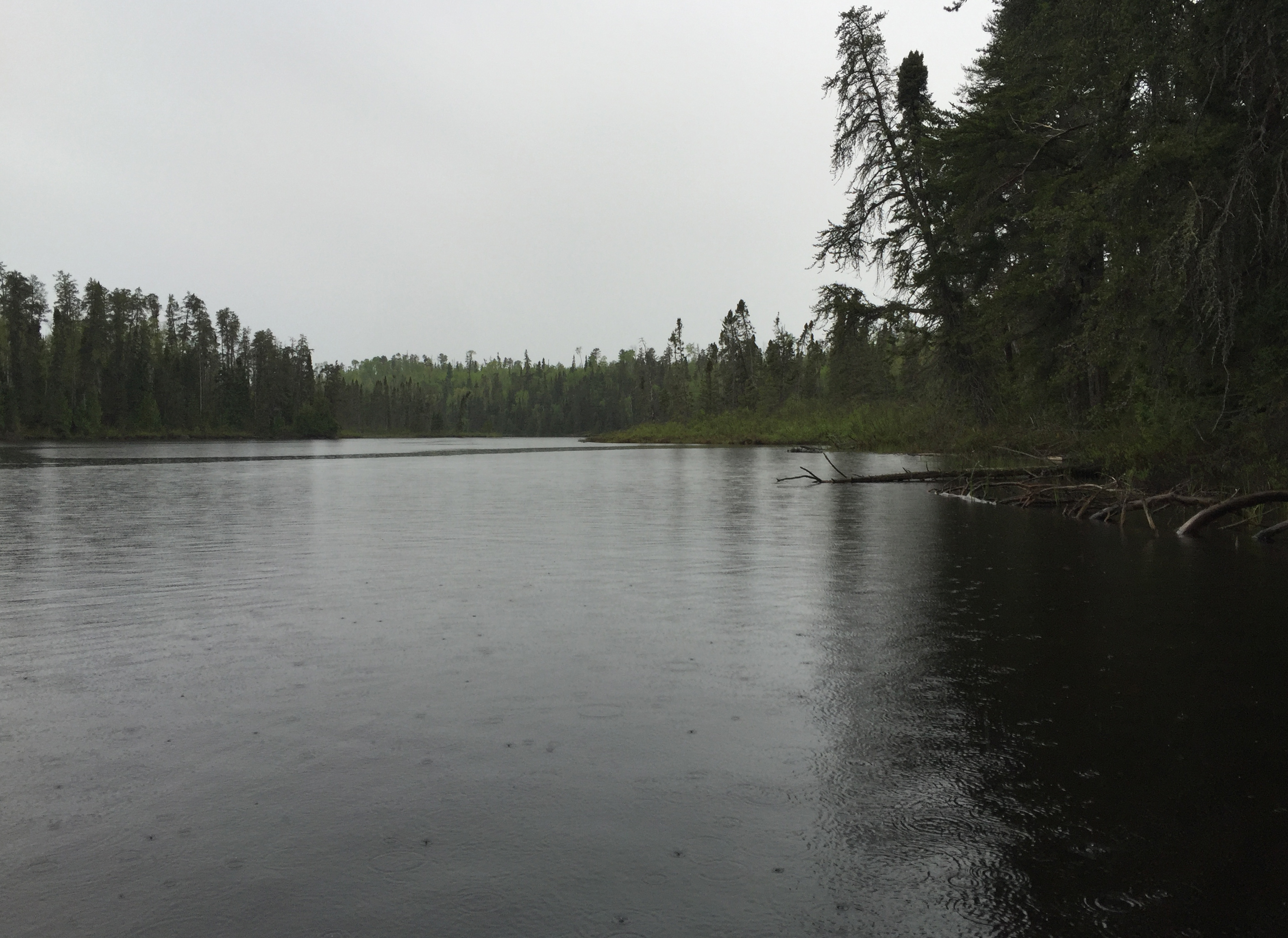
Looking south down Kelly Lake from near the Jack Lake portage on a gloomy, rainy afternoon (May 27, 2016).
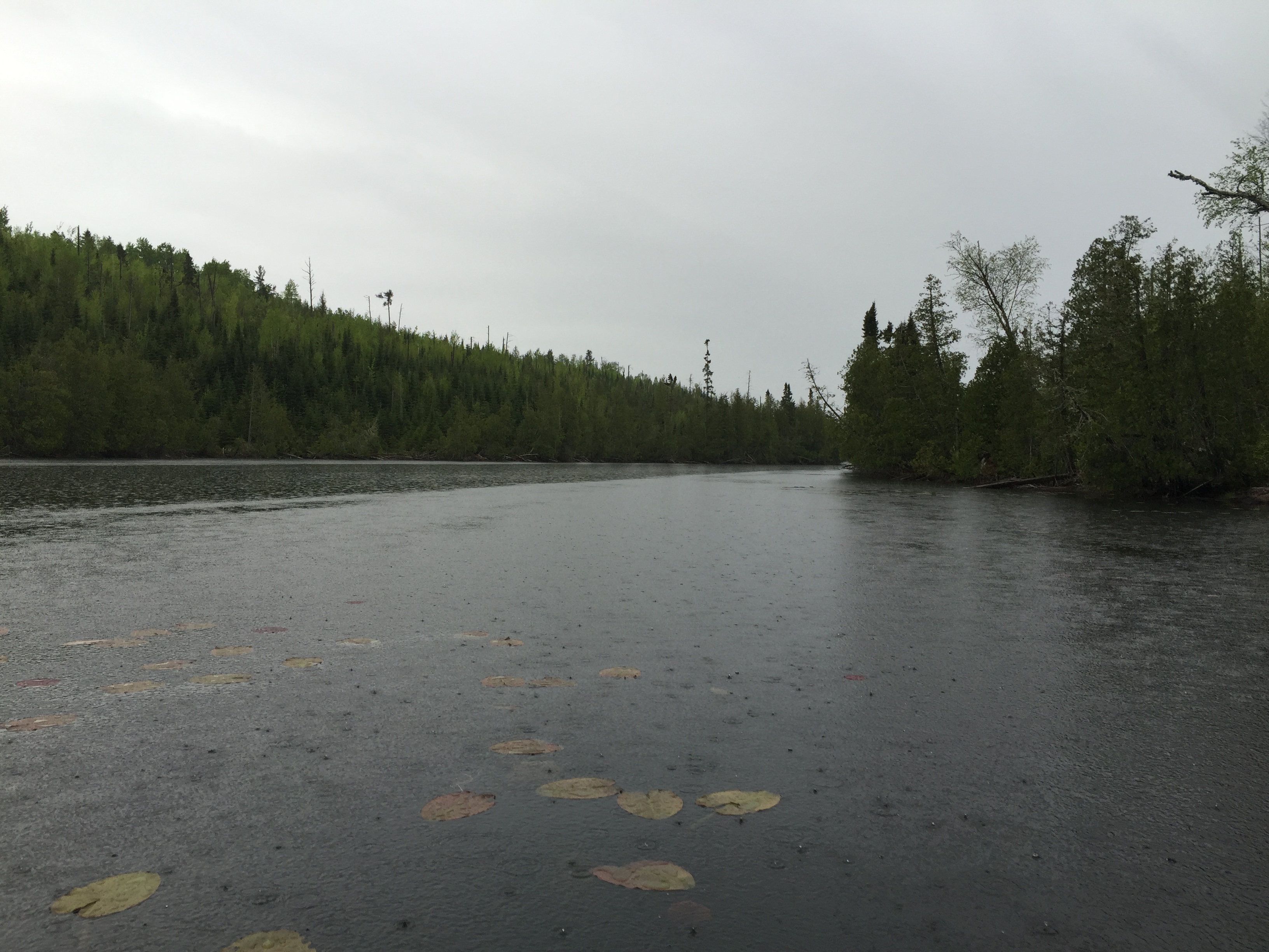
The upper part of Kelly Lake is pretty shallow and can get very weedy in the summertime. Here in late May, the lily pads are only just starting to reach the lakes surface (May 27, 2016).
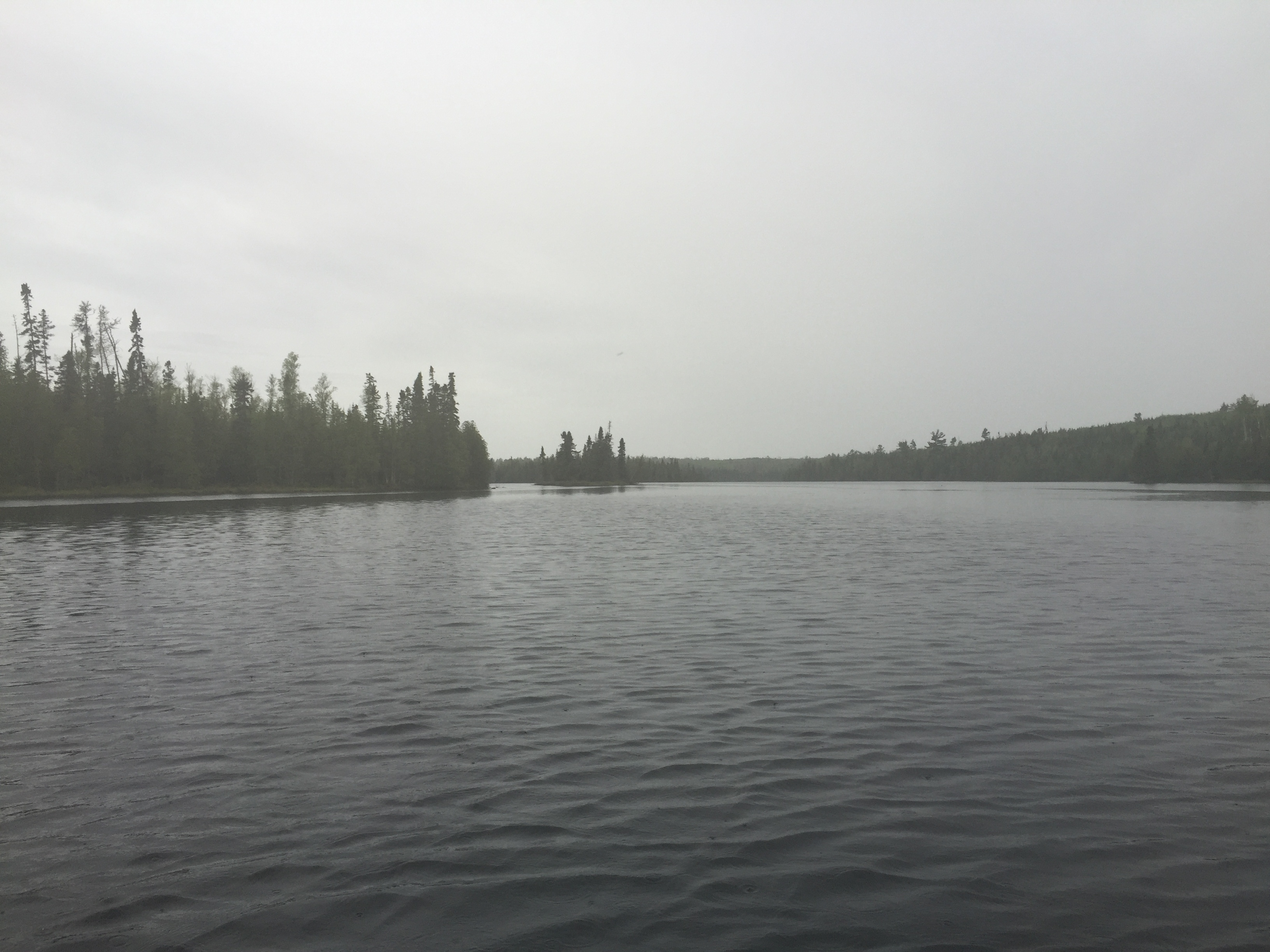
After canoeing down the narrow northern section of the lake, Kelly Lake starts to finally look less like a river and widdens up a bit (May 27, 2016).
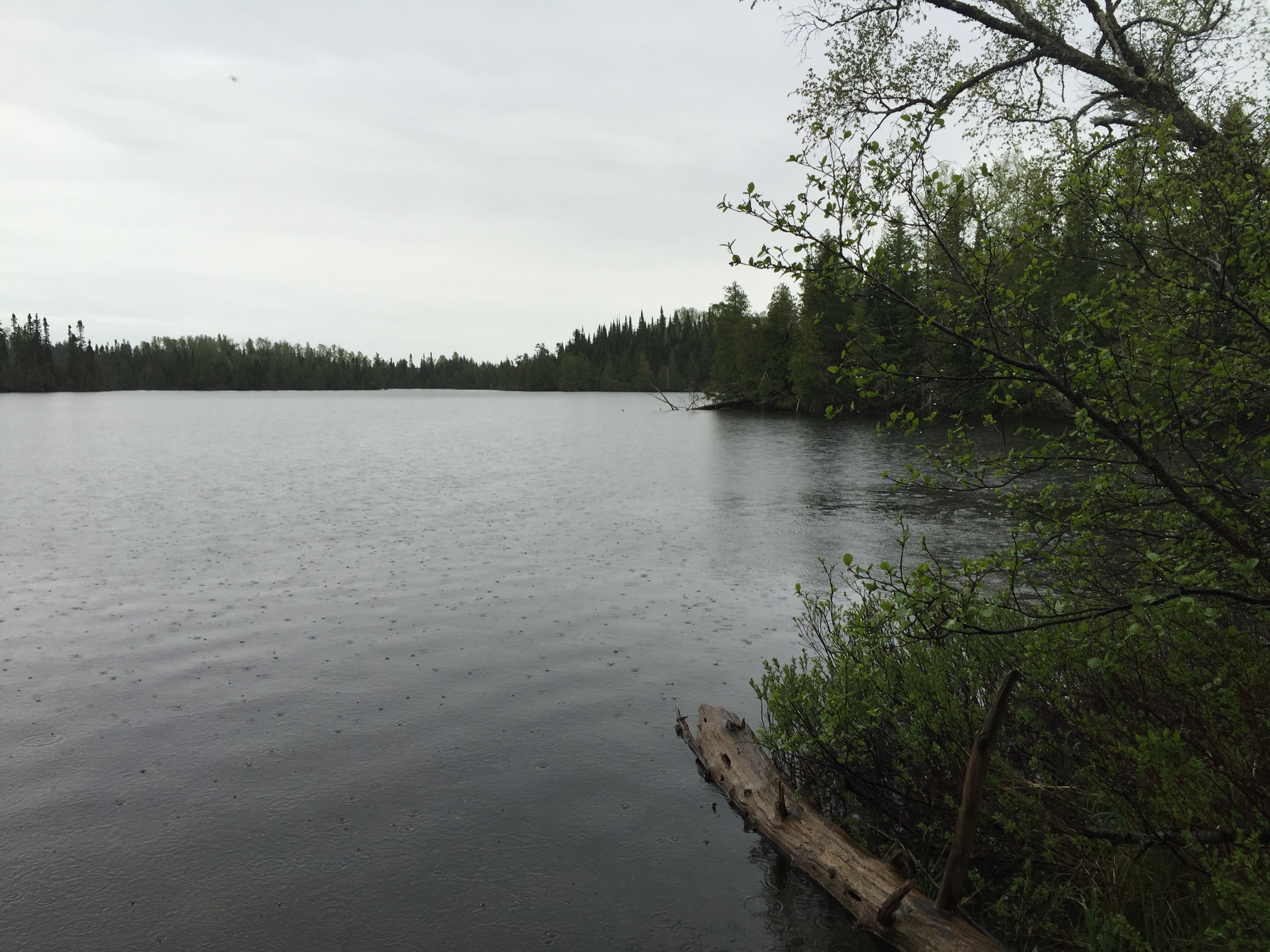
The far shoreline is the very south end of Kelly Lake. Just over your right shoulder is the portage path leading to Burnt Lake. This portage is long, but not particularly difficult. The portage does climb a bit at the start, as it ascends the south side of a hill. The portage descends as it approaches Burnt Lake (May 27, 2016).
Portage to Burnt Lake -or- Explore Another Route ***********************************************END OF ROUTE***********************************************
PADDLING FROM THE BURNT LAKE PORTAGE TO THE PETERSON LAKE PORTAGE
A short paddle across the south end of Kelly Lake (October 6, 2024).
Portage to Peterson Lake -or- Explore Another Route ***********************************************END OF ROUTE***********************************************
Route Connections for Kelly Lake
From Kelly Lake, you can portage to Burnt Lake, Jack Lake or Peterson Lake. You can also paddle/bushwhack into Pipe Creek which isn't navigable for most of its length.