This drainage begins up around Bugo Lake, flows through Record Lake and ultimately pours into River Lake (the lake is just a wide section of the Kawishiwi River).
This area avoided being scorched by the 2011 Pagami Creek Fire that burned much of the southwestern part of the BWCA and was the largest fire in recent history at about 100,000 acres (almost 10% of the entire BWCA). This is one of the few areas in the Fungus Lake PMA that was not burned.
There was a large fire in this area around 1863-1864. This fire is known as the North Kawishiwi River/Alice Lake/Cypress Lake/Saganaga Lake Complex. This blaze began south of the current BWCAW's southern boundary, near the town of Isabella, Minnesota.
PADDLING FROM RIVER LAKE UPSTREAM TO RECORD LAKE (FULL VIDEO)
Paddling Record Creek from River Lake upstream to Record Lake in the Fungus Lake PMA.
PADDLING FROM RIVER LAKE UPSTREAM TO RECORD LAKE
Most of Record Creek is navigable between River Lake (Kawishiwi River) and Record Lake. A short section, perhaps 20 rods, starting about 50 rods upstream of Record Creek's mouth at River Lake, requires some bushwhacking. This bushwhack is along the bottom of a cliff through brush and over rocks. There was a single large beaver dam in 2015 about 40 rods downstream of Record Lake that required a liftover. Record Creek is also navigable south of Record Lake until it begins to disappear into a peat bog just to the northeast of Bugo Lake. There were no obstructions to the creek for the first half mile south of Record Lake in 2015. The creek is stained a rather dark color, likely from it flowing through peat bogs.
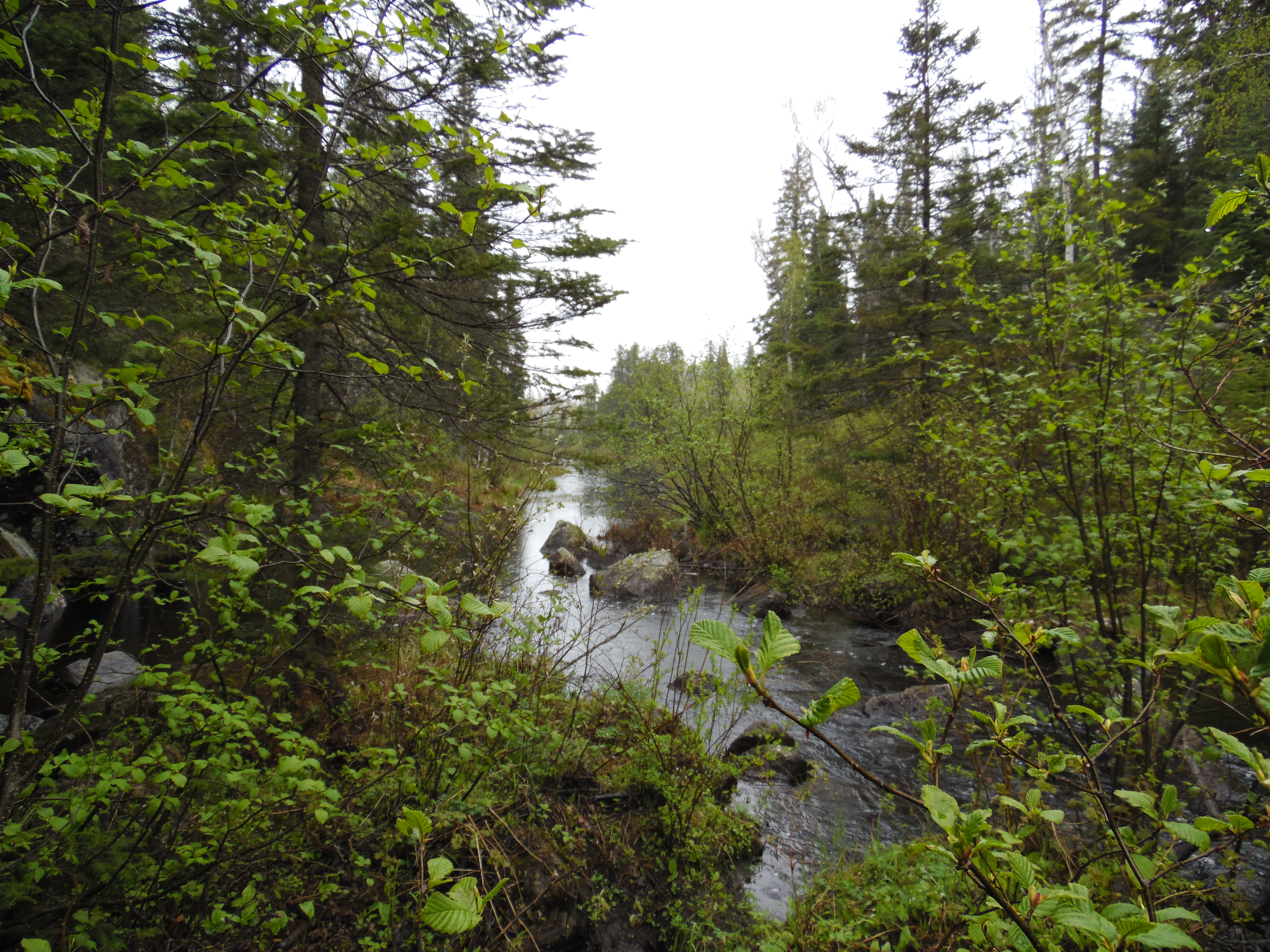
From the end of the portage between River Lake (Kawishiwi River) and Malberg Lake, you quickly hang a left and enter Record Creek. You paddle until you come to the first rapids and discover a workable bushwhack to the right of the creek along the base of the cliffs.
Exit canoe and looking to the north (downstream) from the bottom of the rapids. The location where Record Creek flows into River Lake (Kawishiwi River), is just beyond your sight.
Pausing to look upstream at the rest of the rapids. You can see that the top of the rapids is the location of a beaver dam (middle right of your view). Beyond the beaver dam, you can see your route in the distance as it follows the creek through this remote valley.
Through the steady rain, move your canoe along the right side of the creek below the cliffs. Appears that this path is used a few times a year; just enough to keep it passable.
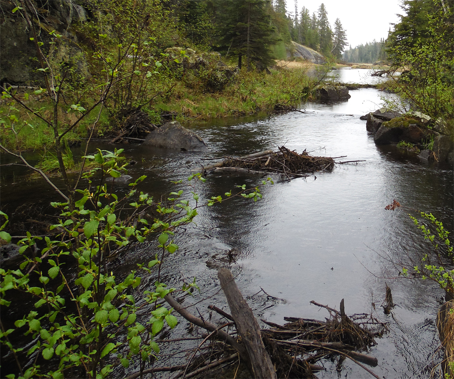
Standing next to the beaver dam at the head of the rapids, you look south (upstream) where the creek valley appears to open up.
Passing through a wide section of Record Creek. The water is quite shallow here. The small, dark log on the boulder you see to your left shows how much higher the water can be.
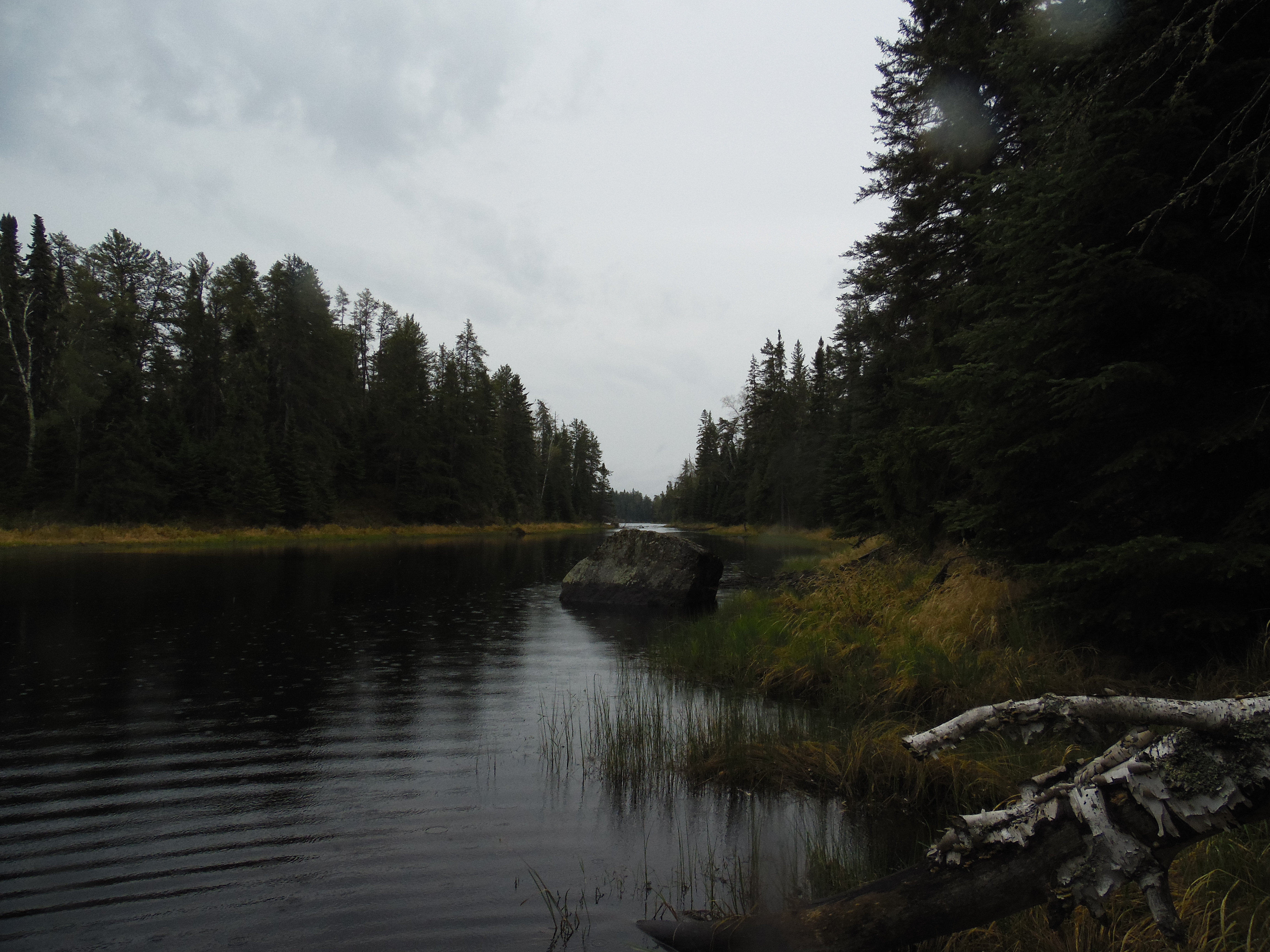
Past the rapids now, you continue paddling along Record Creek to the south (upstream). The valley, once wide open with marsh along the banks of the creek, now narrows and the banks steepen into low cliffs in places. Eventually you see that your way is blocked upstream by a sizeable beaver dam.
The creek passes through a narrow valley with low cliffs on each side. Eventually you spot a large beaver dam ahead and hear the sound of moving water.
Paddle up to the beaver dam. The water is shallow and the bottom is hard sand. The easiest liftover is on the right side.
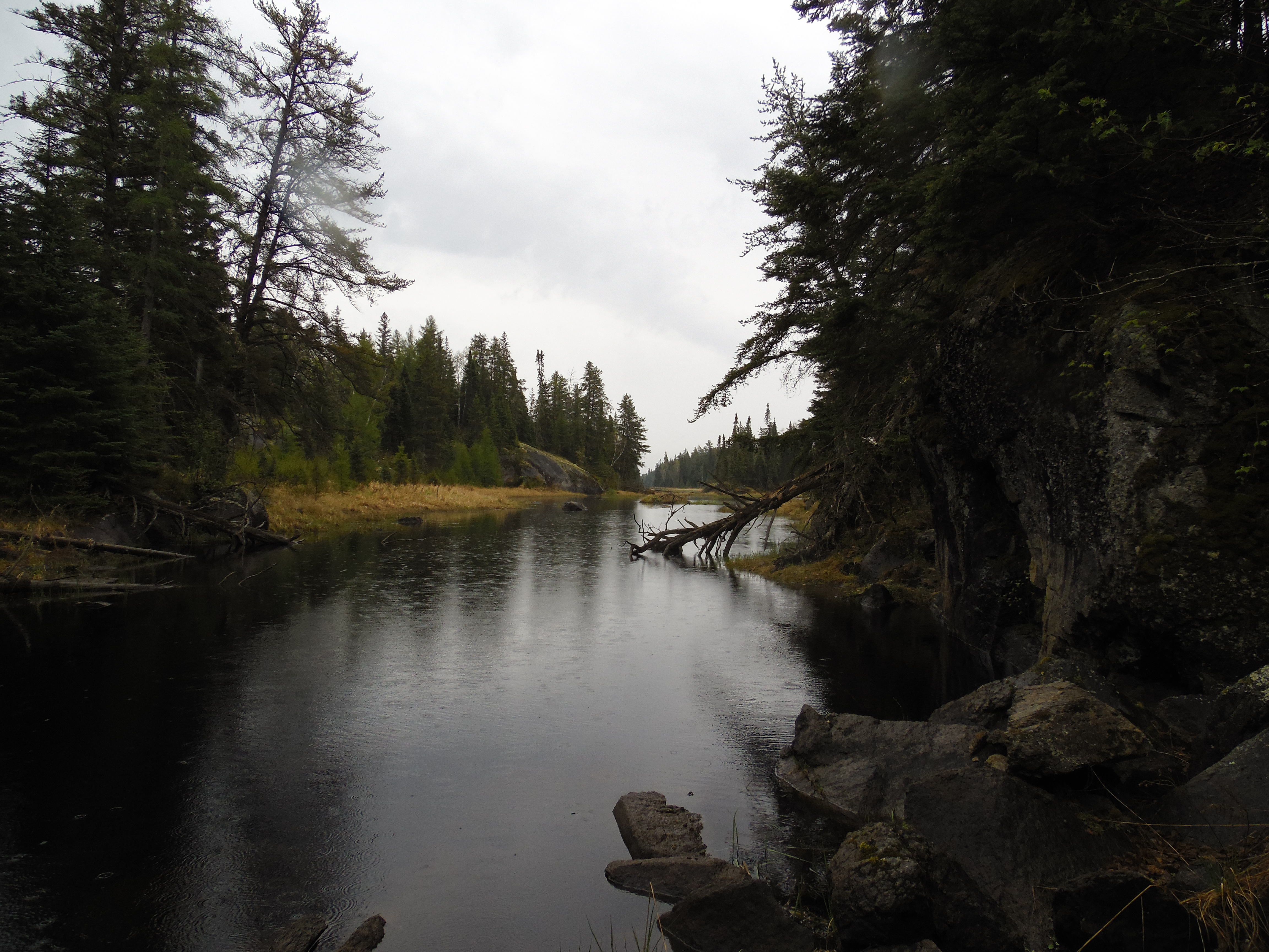
Standing next to the large beaver dam, looking further upstream and you can just make out Record Lake in the distance.
After clearing the beaver dam, paddle the final stretch up to Record Lake. ***********************************************END OF ROUTE***********************************************
PADDLING FROM RIVER LAKE UPSTREAM TO RECORD LAKE
You have now paddled through Record Lake and are now south of that lake and back in Record Creek. You continue south toward Bugo Lake...
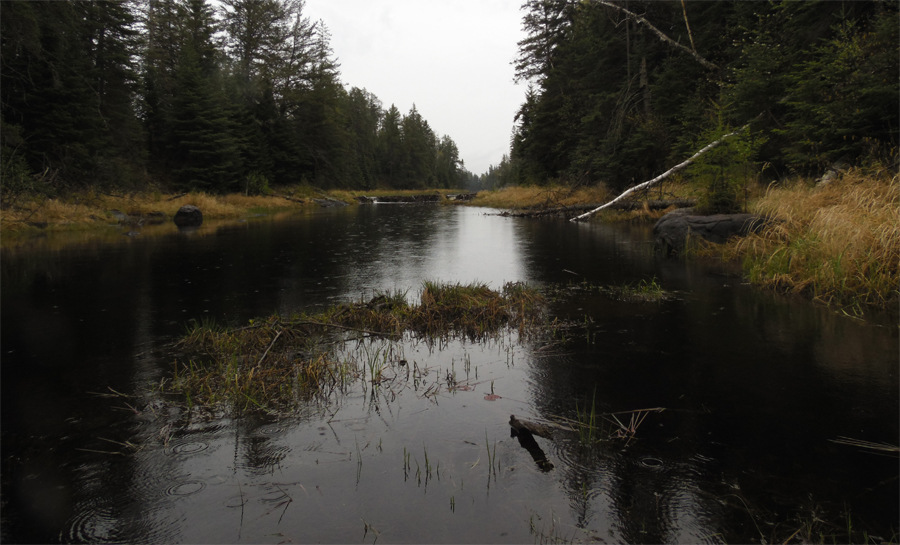
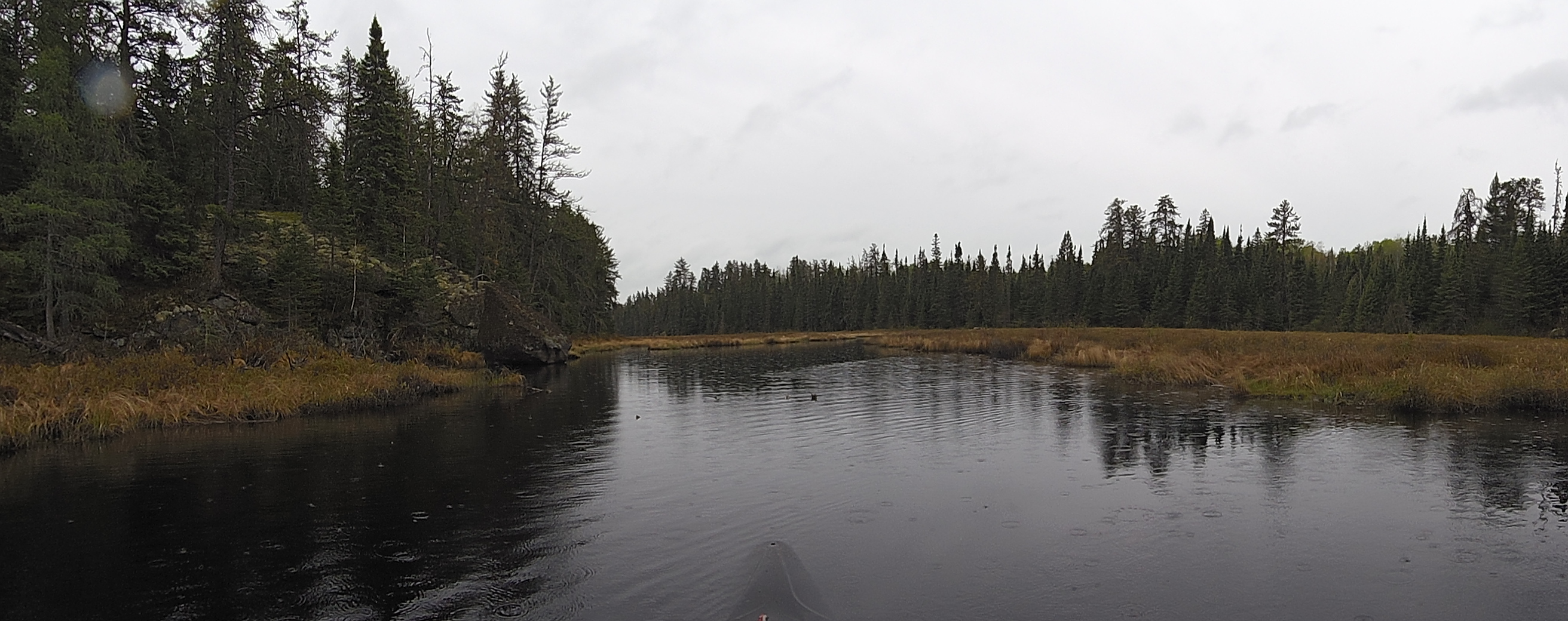
Starting from the south end of Record Lake in its southeast bay, you again pick up Record Creek and follow it south. The creek now passes through a much wider valley than before. Continue until reaching a prominent rocky point where you stop...for now.
This view is from about a third of a mile south of Record Lake. As you see, Record Creek flows through a much more open valley here, with wider swaths of bog along its edges.
A look around the area as you near a rocky point. You are about 1/3rd mile south of Record Lake. Bugo Lake is about 3/4 mile beyond this point. ***********************************************END OF ROUTE***********************************************