Campsites: 10 (2 visited; at least 2 of these may be closed)
Wildlife Seen on Visit: None
Last Visited: July 25, 2021
River Elevation: Starts at Lake Isabella at an elevation of 1,551 feet. River channel ends at Bald Eagle Lake at an elevation of 1,452 feet. However, the Isabella River is technically a tributary of the Kawishiwi River, so it flows through Bald Eagle Lake, into Gabbro Lake and finally through Little Gabbro Lake before flowing via two channels into the Kawishiwi River. Major tributaries of the river are: Island River, Little Isabella River and the Snake River. Mitawan Creek and Diana Creek are tertiary tributaries to the river.
Water Clarity: N/A
ROUTES/PORTAGES FROM THE ISABELLA RIVER:
To Bald Eagle Lake: Paddle In
To Island River: Paddle In
To Lake Isabella: Walk the 42 rod portage
To Little Isabella River: Paddle In
To Mitawan Creek: Paddle In
To Quadga Lake: Walk the 100 rod portage (heading downstream) or 39 rods (going upstream)
To Rice Lake: Paddle In
To Powwow Trail: Hike It
To Snake River: Paddle In
Isabella River
Kawishiwi and Tofte Ranger Districts
ISABELLA RIVER CAMPSITES: Campsite 1: (#1927) - Shared campsite with Powwow Trail Campsite 2: (#1726) - Just upstream of Bald Eagle Lake on the east bank
The Isabella River flows out of the western end of Lake Isabella through a shallow, boulder jumbled channel. The effects of the 2011 Pagami Creek Fire will be visible along your journey down the Isabella River until you get a couple miles downstream of the Quadga Lake portage. Shortly downstream of Lake Isabella, the river forms two channels of rapids passes under a wooden bridge. The wooden bridge marks the location where the Powwow Trail crosses the Isabella River. There is a portage on the north side of the river to get canoeists and their gear around the rapids. The first campsite downstream of Lake Isabella is across the bridge and to your immediate right. This campsite is also used by hikers of the Powwow Trail.
Just shy of two miles down river of the Powwow Trail bridge, the Island River flows into the Isabella River. This is the Isabella River's largest tributary. The Island River is navigable for many miles upstream from its confluence with the Isabella River. There is a Native American pictograph site that can be viewed along the Island River located about 4.5 miles upstream. The Island River has several campsites of its own and traveling the river requires crossing a few short portages.
Just over a mile downstream of the Island River, you come to Rice Lake. The lake is aptly named as it is covered in wild rice (manoomin). Several miles further on you come to a portage heading north. This leads to Quadga Lake. There are several campsites on that lake too.
Just downstream of the Quadga Lake portage, Mitawan Creek flows into the Isabella River along the south bank. Mitawan Creek is navigable for a substantial distance upstream, depending on water levels and makes for an interesting side trip.
Continuing downstream,a little less than two miles, you come to the mouth of the Little Isabella River. This is a small river and BWCA Entry Point 75 allows paddlers to enter the wilderness on this river, eventually making their way several miles downstream to the Isabella River. It is about here that the affects of the 2011 Pagami Creek Fire disappear. As you continue travel along the river from here until Bald Eagle Lake, you'll see mature forest on both banks again. After passing the mouth of the Little Isabella River, it is at least five miles of continuous paddling (with a couple short portages). Eventually you come to the longest portage along the river, which is about 140 rods in length.
Once over the 140 rodder, a few minutes of paddling brings you to mouth of another small river. The Snake River is used by canoeists entering from BWCA Entry Point 84. Shortly downstream of the Snake River, you reach the mouth of the Isabella River at Bald Eagle Lake.
References:
Beymer, Robert, Boundary Waters Canoe Area – Volume 1 – Western Region (Berkeley: Wilderness Press, 2006), 223, 225, 226, 230-233, 238, 240, 241, 245-247.
Beymer, Robert, Boundary Waters Canoe Area – Volume 2 – Eastern Region (Berkeley: Wilderness Press, 2006), 45.
Heinselman, Miron, The Boundary Waters Wilderness Ecosystem (Minneapolis: University of Minnesota Press, 1999), 13, 116, 118, 123.
Pauly, Daniel, Exploring the Boundary Waters (Minneapolis: University of Minnesota Press, 2005), 214, 215, 218-220.
Traveling the Isabella River (Downstream)
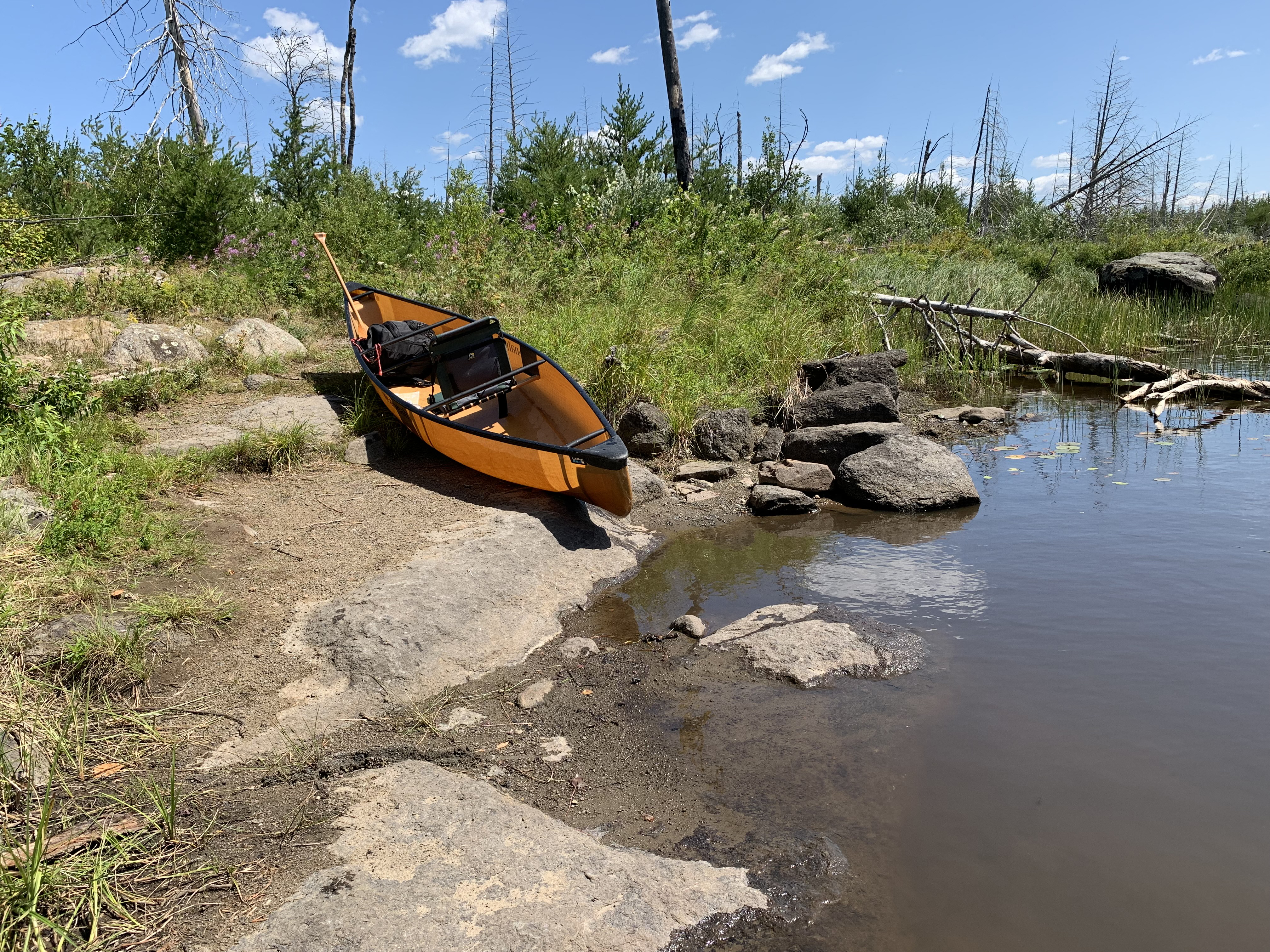
The start of the portage leading from Lake Isabella to the Isabella River. This is a 42 rod portage. You have to meander through a field of boulders with your canoe to reach the landing. Water is shallow, but often murky.
This portage is of trivial difficulty. It is flat and is free of obstacles along its entire length. The portage will intersect with the Powwow Trail about the halfway point. If you are looking for the campsite, hook a left when you come to the intersection and proceed across the makeshift log bridge and then the fixed wooden bridge.
Large table rock forms the canoe landing at this end of the portage. The left side of this "table" seemed to offer the easiest place to land or launch a canoe.
MISSING THE SECTION OF RIVER BETWEEN THE POWWOW TRAIL CROSSING AND THE MOUTH OF THE SNAKE RIVER
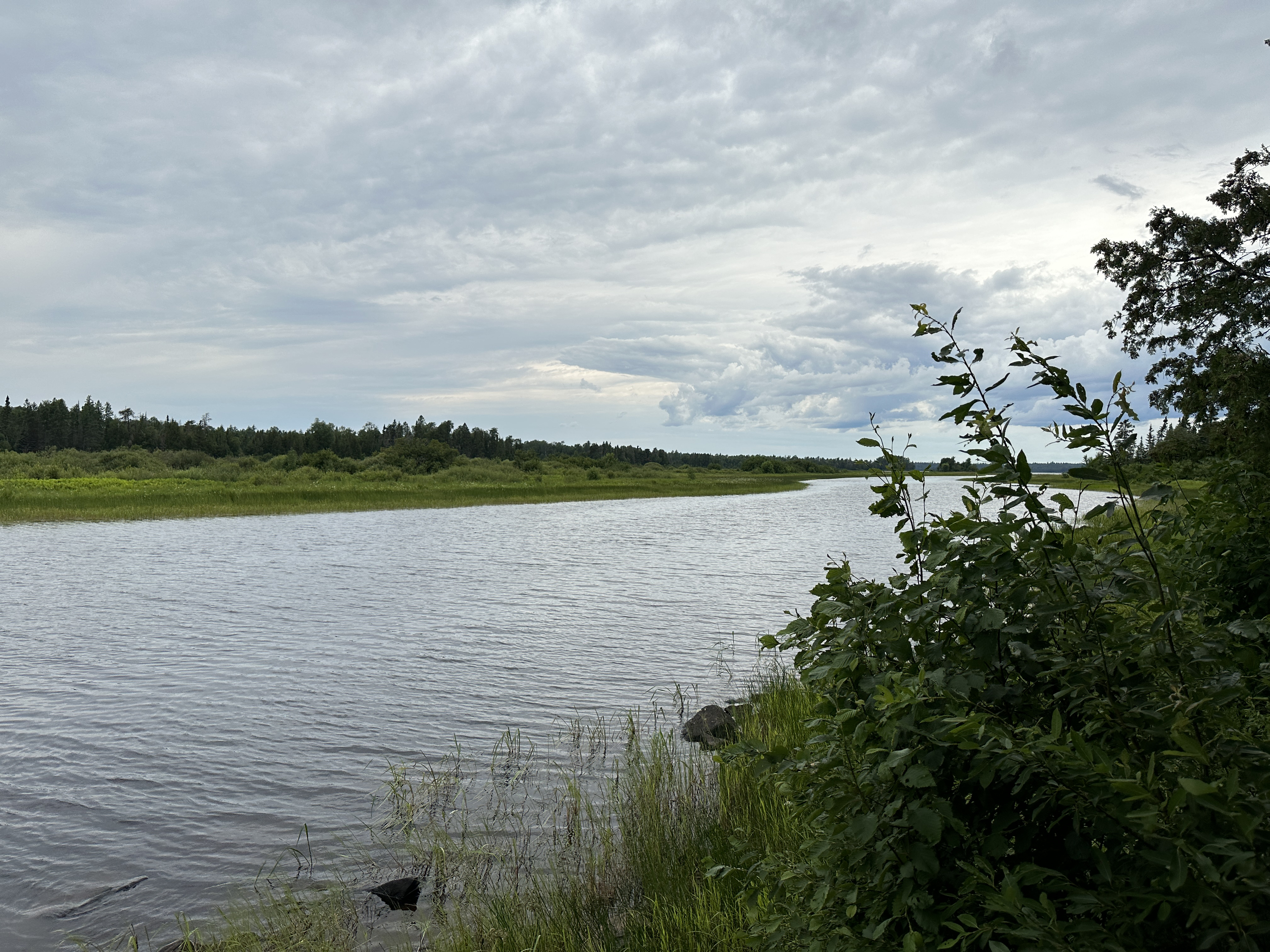
This section is from the mouth of the Snake River, downstream to where the Isabella River flows into Bald Eagle Lake.
View downriver from BWCA Campsite 1726.
Traveling the Isabella River (Upstream)
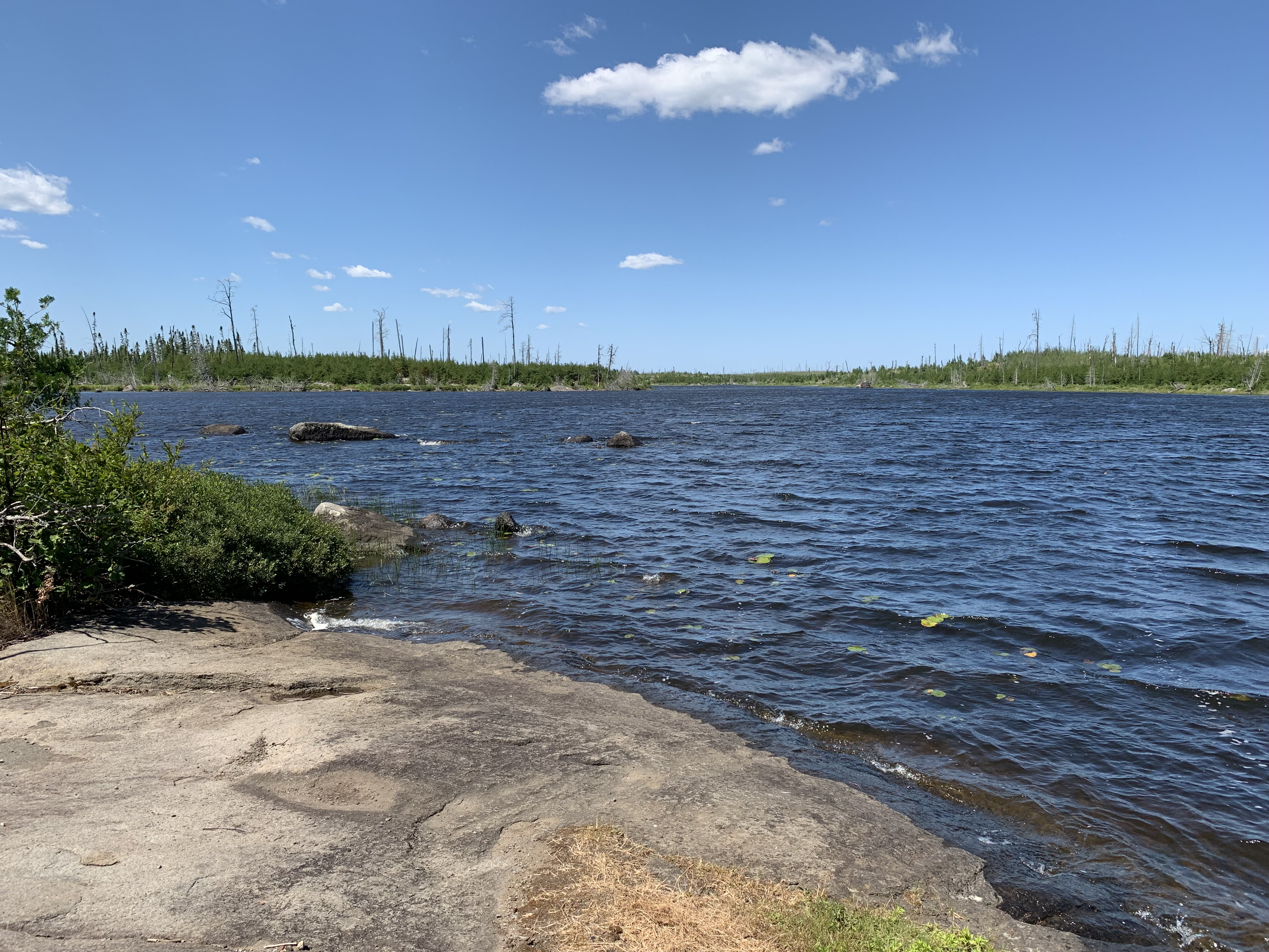
Paddling upstream from the Isabella River's mouth at Bald Eagle Lake to BWCA Campsite 1726, which is located on the left (east) bank of the river.
Looking upstream from BWCA Campsite 1726.
Continuing upriver along the Isabella River to the mouth of the Snake River.
MISSING THE SECTION OF RIVER BETWEEN THE MOUTH OF THE SNAKE RIVER AND THE POWWOW TRAIL CROSSING
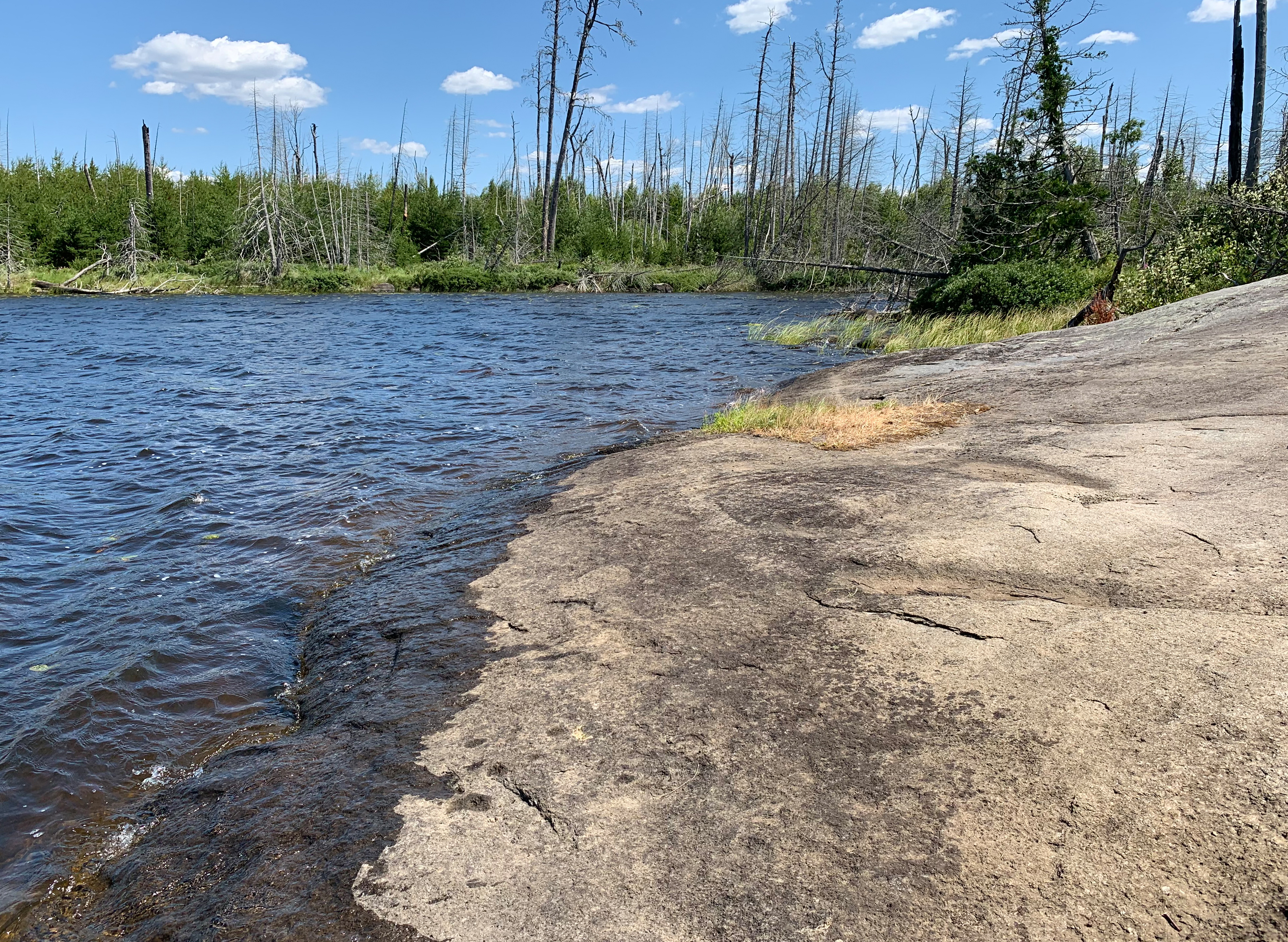
As you approach this table rock, pull up on the right side which seemed to offer the best place to land.
Simple portage. You'll encounter the intersection with the Powwow Trail about the midway point.
The landing isn't too bad, but weaving through that minefield of rocks can be tricky. If water is really low (like you see here), you almost certainly will have to walk your canoe or do some rockhopping through the worst of it.
Route Connections for the Isabella River
From the Isabella River, you can portage into Lake Isabella and Quadga Lake. You can paddle into both Bald Eagle Lake and Rice Lake. There are several rivers and creeks you can also paddle into and they include the Island River, the Little Isabella River and the Snake River. There is also Mitawan Creek, which is navigable for some distance upstream of its mouth at the Isabella River.