RUSH LAKE CAMPSITES: Campsite 1 (#613): North side of lake, not far from the lakes eastern end, on a point Campsite 2 (#612): Back of the small bay on the south side of the lake Campsite 3 (#583): Towards the back of the southwest arm of the lake Campsite 4 (#584): West end of Rush Lake along the north shoreline
There was extensive logging done on the south side of Rush Lake, evidenced by the numerous logging roads that were built in the area. Some of these roads now make up sections of the Banadad Ski Trail. Most of these logging roads were built to support the Finn Lake Sale of timber to the Consolidated Papers Company, which was based in Wisconsin. This timber sale occurred in 1954. These logging roads extended west from near Poplar Lake where they connected with the old General Logging Railroad, all the way west to the Long Island Lake and Cash Lake area. Logging operations in this area continued until as late as 1972 (Heinselman).
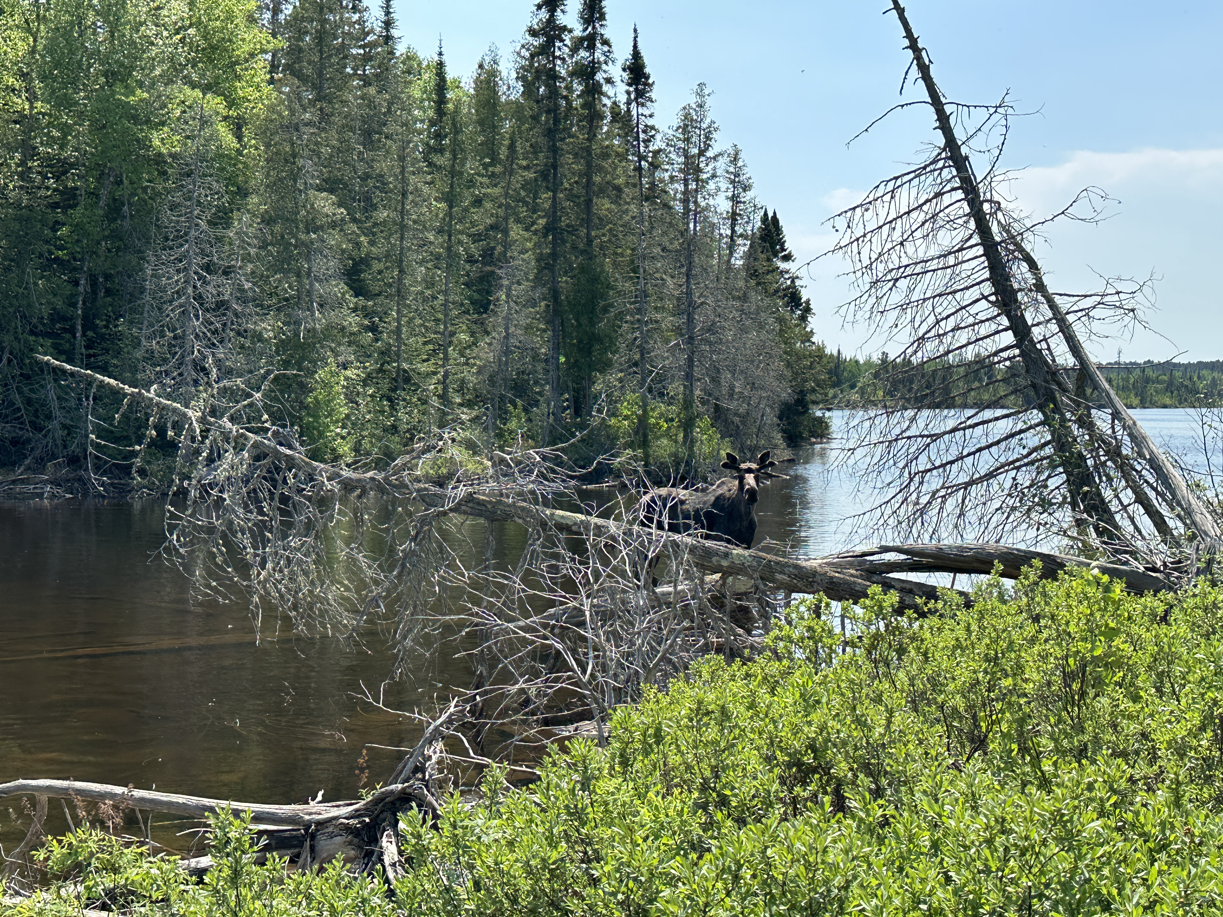
There are good chances to observe a moose sighting in this area.
The canoe route extending from Poplar Lake on the east all the way to Long Island Lake on the west is seldom traveled. The one mile portage from Poplar Lake to Skipper Lake discourages a lot of groups for tackling this route. The portages along this route are also all fairly rugged. The advantage is you'll have little competition for campsites and experience some untraveled and scenic lakes.
The eastern most campsite, along the north shoreline of Rush Lake (#613) is particularly good.
There is good fishing for an abundant population of northern pike in this lake.
Water flows through Rush Lake from west to east. A small stream flowing out of Banadad Lake feeds the west end of Rush Lake. You'll see this stream at the portage. Another small creek flows out the east end of the lake into Little Rush Lake.
The Banadad Ski Trail crosses the portage between Banadad Lake and Rush Lake over a small wooden bridge. The trail is also good for hiking in the summer, but bring your bug spray!
References:
Beymer, Robert, Boundary Waters Canoe Area – Volume 2 – Eastern Region (Berkeley: Wilderness Press, 2006), 126, 129, 132.
Heinselman, Miron, The Boundary Waters Wilderness Ecosystem (Minneapolis: University of Minnesota Press, 1999), 118.
Pauly, Daniel, Exploring the Boundary Waters (Minneapolis: University of Minnesota Press, 2005), 301.
Click on the photos below to see the full resolution image - Use your browsers back button to close photo and return to this page.
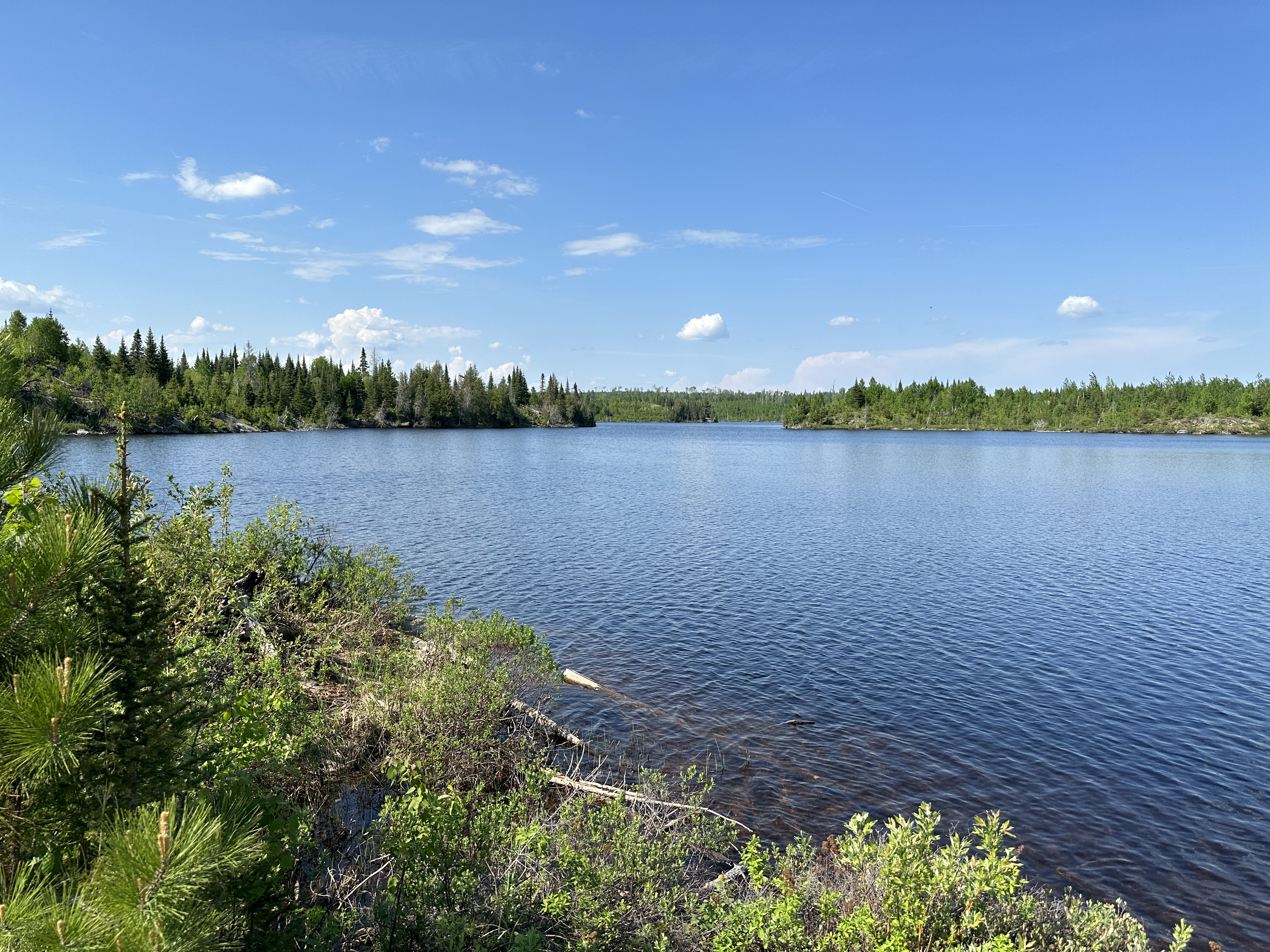
PADDLING FROM THE LITTLE RUSH LAKE PORTAGE TO BWCA CAMPSITE 613
Moose welcoming you to Rush Lake. This bull was standing at the Rush Lake end of the Little Rush Lake portage.
Paddling from the Little Rush Lake portage to BWCA Campsite 613, which is located along the north shoreline on the point.
PADDLING FROM BWCA CAMPSITE 613 TO BWCA CAMPSITE 612
Paddling from BWCA Campsite 613, which is located along the north shoreline on the point, south, nearly straight across the lake, into the south bay on the south shoreline of Rush Lake where BWCA Campsite 612 is to be found.
This image show the view to the north. BWCA Campsite 613 is on that point in the middle of your view, visible through that gap which defines the entrance to the bay.
PADDLING FROM BWCA CAMPSITE 612 TO BWCA CAMPSITE 583
Paddle to the northwest out of the small bay and then head west along the south shoreline of Rush Lake. Stay south of the long peninsula that juts out from the west end of lake and make your way back into the southwest arm of the lake. Here you find BWCA Campsite 583, which is positioned on a small point of rock.
PADDLING FROM BWCA CAMPSITE 583 TO BWCA CAMPSITE 584
Starting at BWCA Campsite 583, which is located in the back of the southwest arm of Rush Lake, paddle along the long peninsula and sneak through a gap before reaching its eastern end. Then paddle across the lake to the north shoreline. Once along the north shore of the lake, follow it west to reach BWCA Campsite 584.
PADDLING FROM BWCA CAMPSITE 584 TO THE BANADAD LAKE PORTAGE
Paddle southwest across the lake to its southwest corner. Here you find a small stream flowing in from Banadad Lake. Next to the stream is the short portage.
Route Connections for Rush Lake
From Rush Lake, you can portage to either Little Rush Lake, One Island Lake or Banadad Lake. You can also hike the Banadad Trail which crosses the portage between Banadad Lake and Rush Lake.