Poplar Lake provides access to three BWCA entry points. The primary public water access is located on the very western tip of the lake.
Poplar Lake is the home of three entry points into the Boundary Water Canoe Area. Entry Point 47 to Lizz Lake is the only one that doesn't require a monumental portage to start your trip and thus that entry point is always the most popular. Lizz Lake entry point allows three permits per day and they are usually all taken for any given day. Choosing this entry point gives you easy access to Caribou Lake, Horseshoe Lake, Vista Lake and the area to the west around Gaskin Lake.
BWCA Entry Point 48 leads to Meeds Lake. The portage from Poplar Lake to Meeds Lake is nearly a mile long. There are often extra permits available at the last minute for this entry point. There are two permits available per day for this entry point.
BWCA Entry Point 49 - Skipper Lake is the least traveled route out of Poplar Lake. Typically less than 40% of these permits are used during the season. Once across the mile long portage from Poplar Lake to Skipper Lake, you will encounter few other paddlers in the string of lakes heading to the west all the way to Long Island Lake. These lakes include Rush Lake, Banadad Lake, Sebeka Lake and Ross Lake. It is also possible to access this entry point from Portage Lake, heading south through One Island Lake to Rush Lake. The daily quota for this entry point is two permits.
Poplar Lake is fed by a small creek flowing in from Skipper Lake. Poplar Lake itself flows out to the east/southeast through Poplar Creek at the far east end of the lak. Poplar Creek eventually empties into the Brule River.
General Logging Comapny built an extension of the Alger-Smith railroad to Poplar Lake. The area was primarily logged during the period 1946 to 1963.
There haven't been any recent fires along Poplar Lake. The last major fire was in the 1750's.
While Poplar Lake is outside of the BWCA, only the north shore of the lake is developed. Along this shoreline you will see many private cabins and a few business establishments, including Rockwood Lodge and Outfitters, Poplar Haus Restaurant and Bar, Nor'Wester Lodge and Outfitters and Trail Center (restaurant, lodge and groceries). The north side of the lake has easy access to the Gunflint Trail.
Click on the photos below to see the full resolution image - Use your browsers back button to close photo and return to this page.
PADDLING FROM THE POPLAR LAKE PUBLIC WATER ACCESS TO THE SKIPPER LAKE PORTAGE
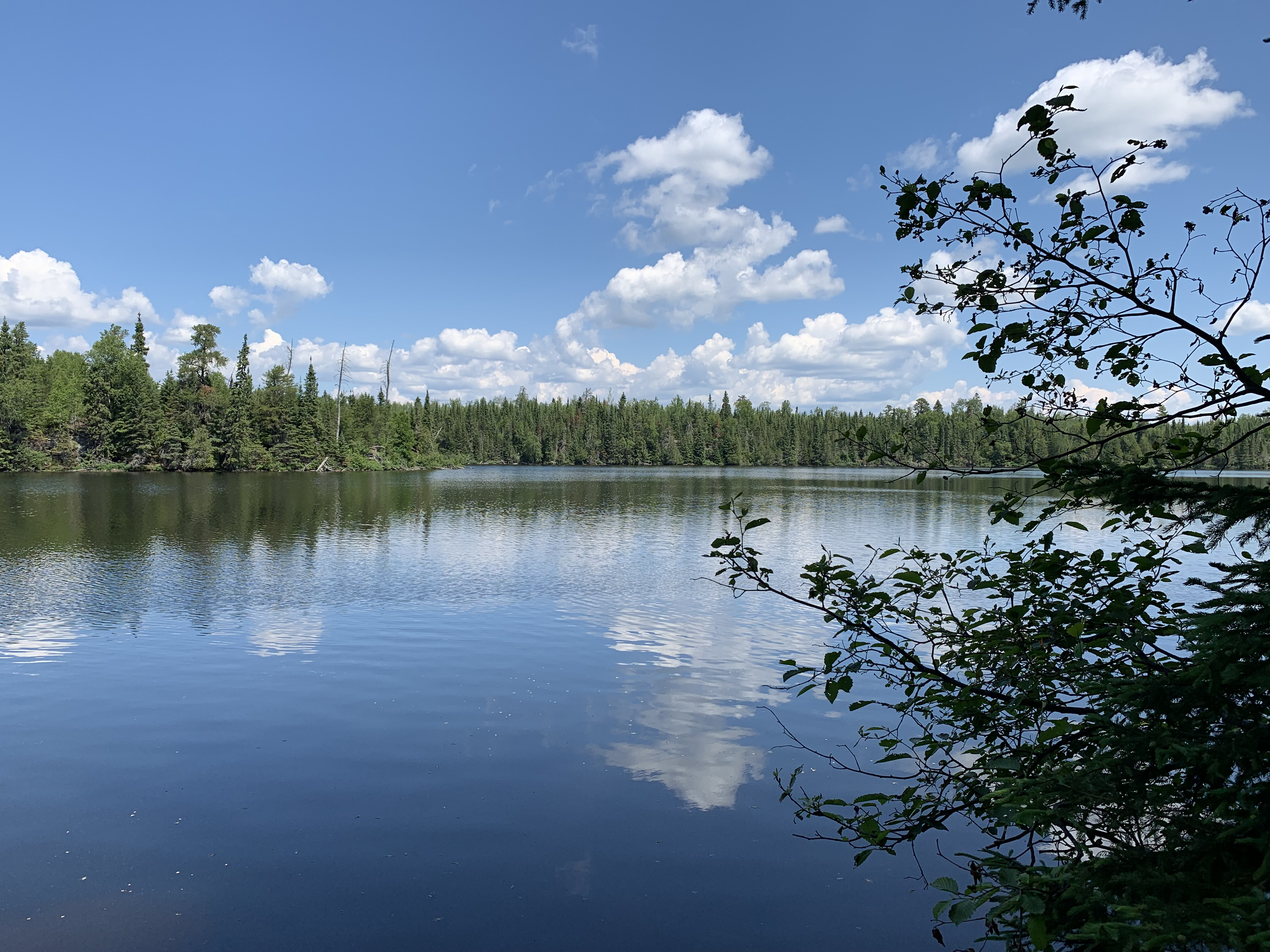
A look at the west end of Poplar Lake from the public water access landing.
Paddle west down the channel after leaving the landing. Stay along the right shoreline. After clearing the relatively narrow channel, round the first point and head north a short ways to the Skipper Lake portage landing. Portage to Skipper Lake -or- Explore Another Route **********************************************END OF ROUTE***********************************************
PADDLING FROM THE SKIPPER LAKE PORTAGE TO THE POPLAR LAKE PUBLIC WATER ACCESS LANDING
It's a short paddle from the long Skipper Lake portage to the public access on the west end of Poplar Lake. Explore BWCA Entry Point 49 -or- Explore Another Route **********************************************END OF ROUTE***********************************************
PADDLING FROM THE SKIPPER LAKE PORTAGE TO THE MEEDS LAKE PORTAGE
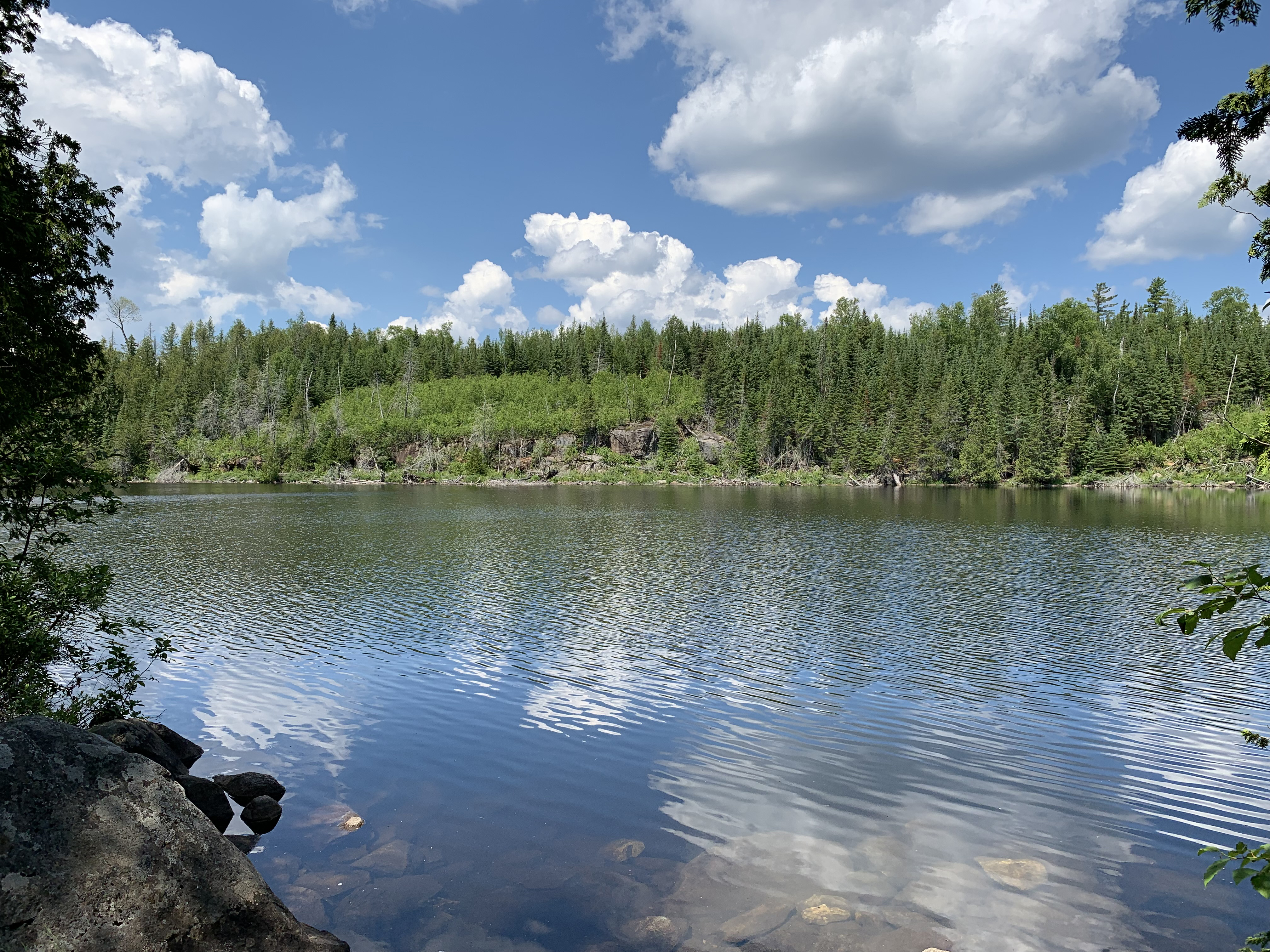
View from the Skipper Lake portage.
Keeping the south shoreline to your righthand side, you soon pass between a small island to the left and a small point. Continuing past the point, another larger island is visible to your left. Just past this island you round a large point, bending from your southeast heading to a west heading. Here you enter the long west arm of Poplar Lake. Follow the south shore of this arm and soon come to the Meeds Lake portage landing. Portage to Meeds Lake -or- Explore Another Route **********************************************END OF ROUTE***********************************************
PADDLING FROM THE MEEDS LAKE PORTAGE TO THE LIZZ LAKE PORTAGE
Looking across the western arm of Poplar Lake while standing at the Meeds Lake portage landing.
Leave the portage landing and paddle east down the west arm of Poplar Lake until reaching the main body of the lake. Continue along the south shoreline of the lake on an east heading. Near the end of this route you'll bend to the southeast and paddle to the back of a small bay where you will find the obvious portage landing for Lizz Lake. Portage to Lizz Lake -or- Explore Another Route **********************************************END OF ROUTE***********************************************
PADDLING FROM THE LIZZ LAKE PORTAGE TO THE PUBLIC WATER ACCESS ON THE WEST END OF POPLAR LAKE
Northwest view from the Lizz Lake portage.
This route will have you paddling about half the length of Poplar Lake. From the Lizz Lake portage, you will pretty much stay on a northwest heading the entire distance to the public water access on the very western end of Poplar Lake. Explore Another Route **********************************************END OF ROUTE***********************************************
PADDLING FROM THE PUBLIC WATER ACCESS ON THE WEST END OF POPLAR LAKE TO THE LIZZ LAKE PORTAGE
VIDEO GOES HERE
Paddling from the Public Water Access on the west end of the lake to the Lizz Lake portage which is located near the middle of the lake along the south shoreline, at the back of a small bay. Portage to Lizz Lake -or- Explore Another Route **********************************************END OF ROUTE***********************************************