ROUTES/PORTAGES FROM MOOSE LAKE:
To BWCA Entry Point 25: Pull out
To Finch Lake: Bushwhack of about 110 rods
To Flash Lake: Walk the 250 rod portage (outside BWCA - the way to Snowbank Lake)
To Newfound Lake: Paddle In
To Wind Lake: Walk the 175 rod portage
Moose Lake
Kawishiwi Ranger District
MOOSE LAKE CAMPSITES: Campsite 1 (#1661): North shore of lake just east of Wind Lake portage Campsite 2 (#1309): Eastern most campsite on north shoreline Campsite 3 (#1306): North most campsite on lake
Campsite 4 (#1308): South most site on east shoreline (may not exist)
Campsite 5 (#1307): Due west of Jinx Lake. Middle site on east shore
Moose Lake is the southern most of a string of three large lakes that extend up to Prairie Portage on the Canadian Border. Moose Lake itself is almost five miles long. Moose Lake is the location of BWCA Entry Point 25, which is the busiest entry point in the BWCA. Roughly the north half of Moose Lake is in the BWCA. The boundary line is just north of the entry point. A couple outfitters can be found along the road leading to the entry point. The outfitters supply gear and a motorboat shuttle service up to Prairie Portage. Moose Lake is usually a pass through lake for canoeists, with most paddlers heading up Moose Lake, Newfound Lake and Sucker Lake to either Prairie Portage (and maybe Quetico beyond), or to points east and northeast like Ensign Lake and Vera Lake.
Moose Lake has a good supply of northern pike and modest walleye fishing.
Moose Lake is fed by Jasper Creek which flows into the south end of the lake. Another small tributary on the south end of the lake is Uncle Judd's Creek. Water from Moose Lake flows north toward Basswood Lake. A short creek from Thermal Lake flows into the north end of Moose Lake.
It is possible to portage directly to Snowbank Lake from Moose Lake although this portage route is outside of the BWCA. The portage is near the entry point and is 250 rods to Flash Lake and another 140 rods to Snowbank Lake. Long portages, but otherwise easy. Another long portage from Moose Lake is a 175 rod walk to Wind Lake. If you are planning to paddle to Prairie Portage, the trip is nearly six miles.
The Swallow and Hopkins Company logged much of the forest around Moose Lake in the late 1890's and during the first decade of the 1900's. The dam at Prairie Portage on Basswood Lake was built in 1902 to raise water levels on Moose Lake, Sucker Lake, Newfound Lake and Birch Lake to make it easier to float log rafts. Two fires burned both the east and west sides of Moose Lake in 1910. Both of these probably started as slash fires. Slash is the debris that remains after a forest has been logged (Heinselman, 1999).
Several gabions, which are wirework containers filled with rocks, were temporarily installed in the narrows between Moose Lake and Newfound Lake to maintain water levels in Moose Lake and lower water levels downstream to help facilitate the dam construction at Prairie Portage (Ely Echo, November 5, 1975).
References:
Beymer, Robert, Boundary Waters Canoe Area – Volume 1 – Western Region (Berkeley: Wilderness Press, 2006), 155, 157-159, 162, 165.
Pauly, Daniel, Exploring the Boundary Waters (Minneapolis: University of Minnesota Press, 2005), 163.
Rom, William N., M.D., Canoe Country Wilderness (Stillwater: Voyageur Press, 1987), 7.
Click on the photos below to see the full resolution image - Use your browsers back button to close photo and return to this page.
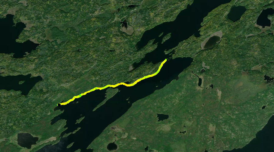
PADDLING FROM BWCA ENTRY POINT 25 TO THE WIND LAKE PORTAGE
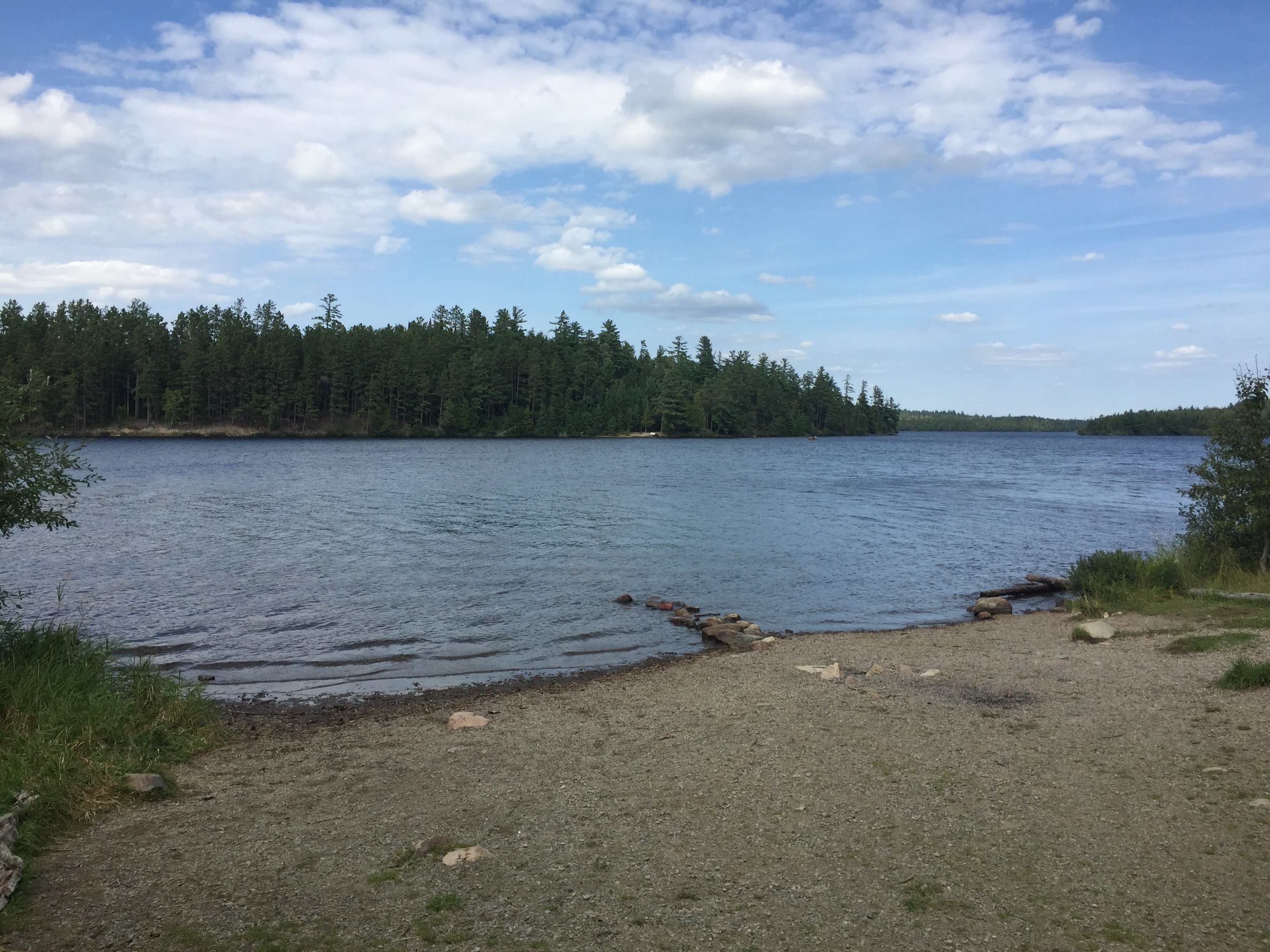
Looking generally north from BWCA Entry Point 25. An easy portage of 10 rods is behind you that leads up to the car unloading area. The boundary of the BWCA starts right in the middle of your view at that "speck that sort of looks like a beach" on the island in front of you.
From the entry point landing, paddle to the northeast passing along the south side of the large island. From the east tip of the island, head north, threading between several other smaller islands. Reach the portage to Wind Lake.
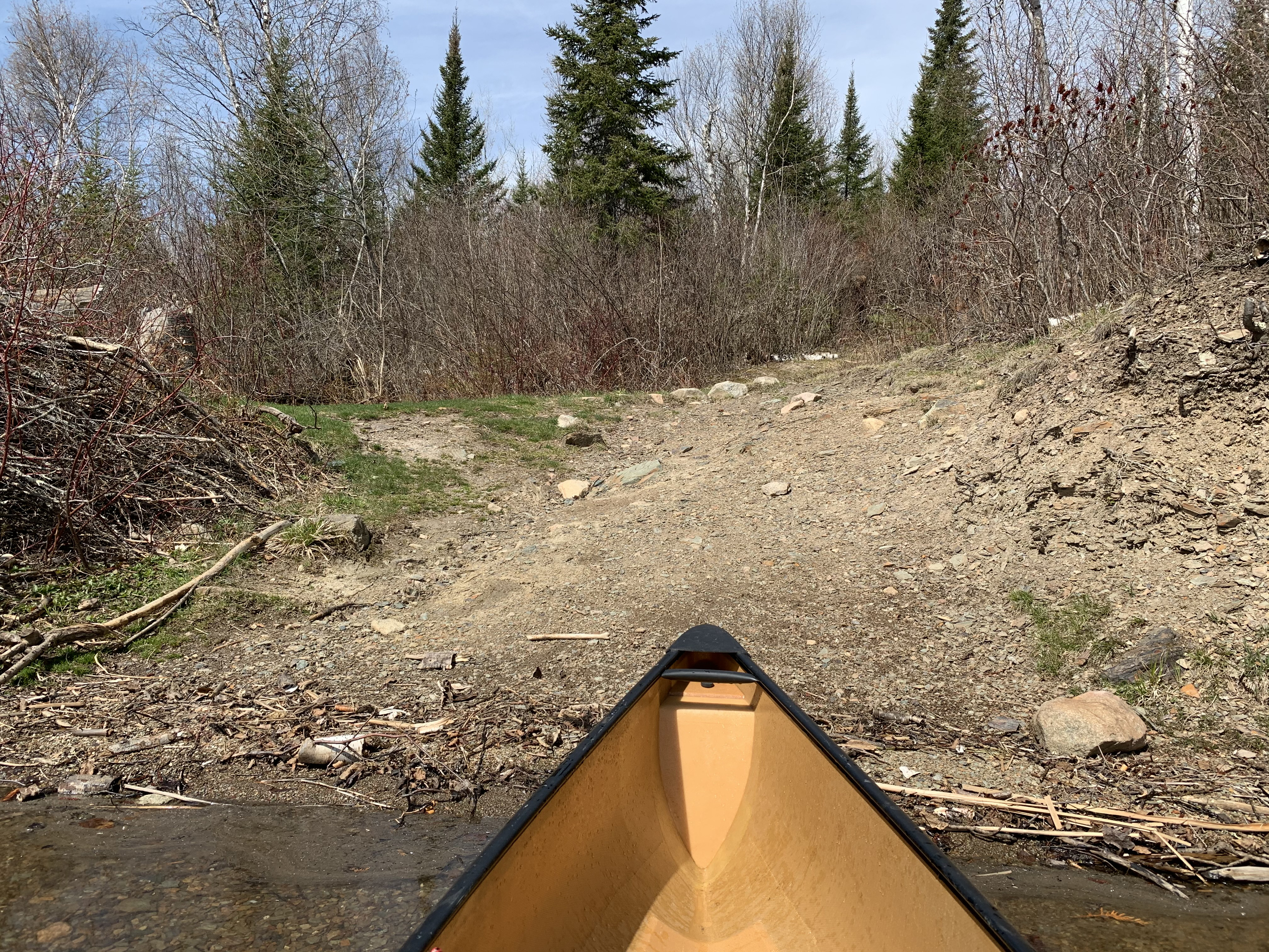
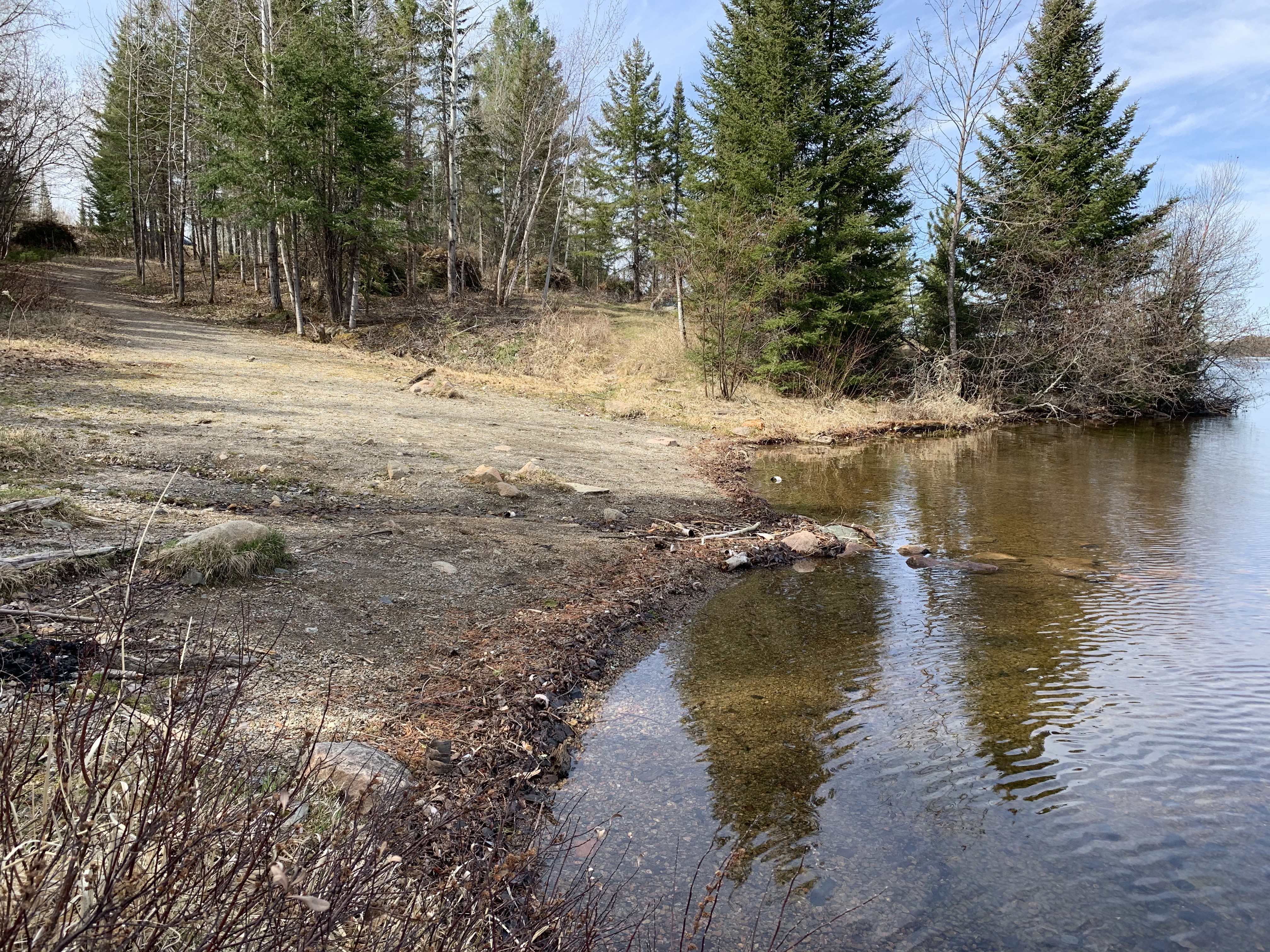
Pulling up to the Wind Lake portage. This landing is heavily eroded making it visible from well out on the lake. Portage to Wind Lake -or- Explore Another Route ***********************************************END OF ROUTE***********************************************
PADDLING FROM THE WIND LAKE PORTAGE TO BWCA CAMPSITE 1661
Paddle a short ways east of the Wind Lake portage. You soon come to BWCA Campsite 1661. The location is easily visible from the water. Visit BWCA Campsite 1661 -or- Explore Another Route ***********************************************END OF ROUTE***********************************************
PADDLING FROM BWCA CAMPSITE 1661 TO BWCA CAMPSITE 1309
Continue east along the north shoreline of Moose Lake to BWCA Campsite 1309. Visit BWCA Campsite 1309 -or- Explore Another Route ***********************************************END OF ROUTE***********************************************
PADDLING FROM THE WIND LAKE PORTAGE TO NEWFOUND LAKE
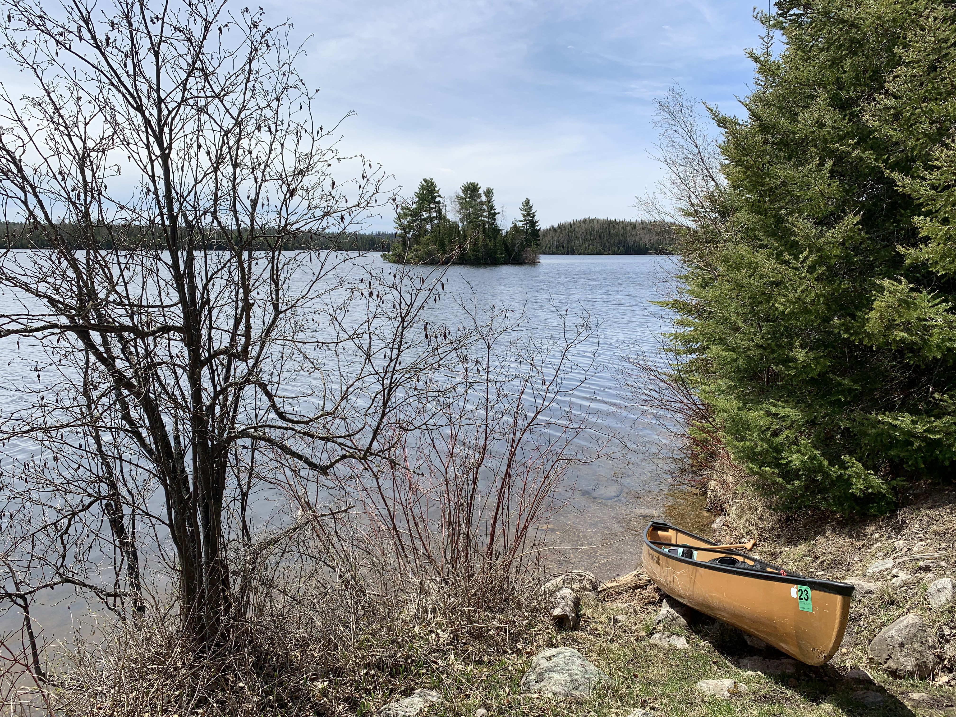
View toward the south of the small island that lies a short distance east of the Wind Lake portage. This is from the first campsite east of the Wind Lake portage.
Set off from the Wind Lake portage and follow the north shore of Moose Lake all the way up to the entrance to Newfound Lake. Briefly pull up to the canoe landings for the two campsites found along this shoreline of Moose Lake.
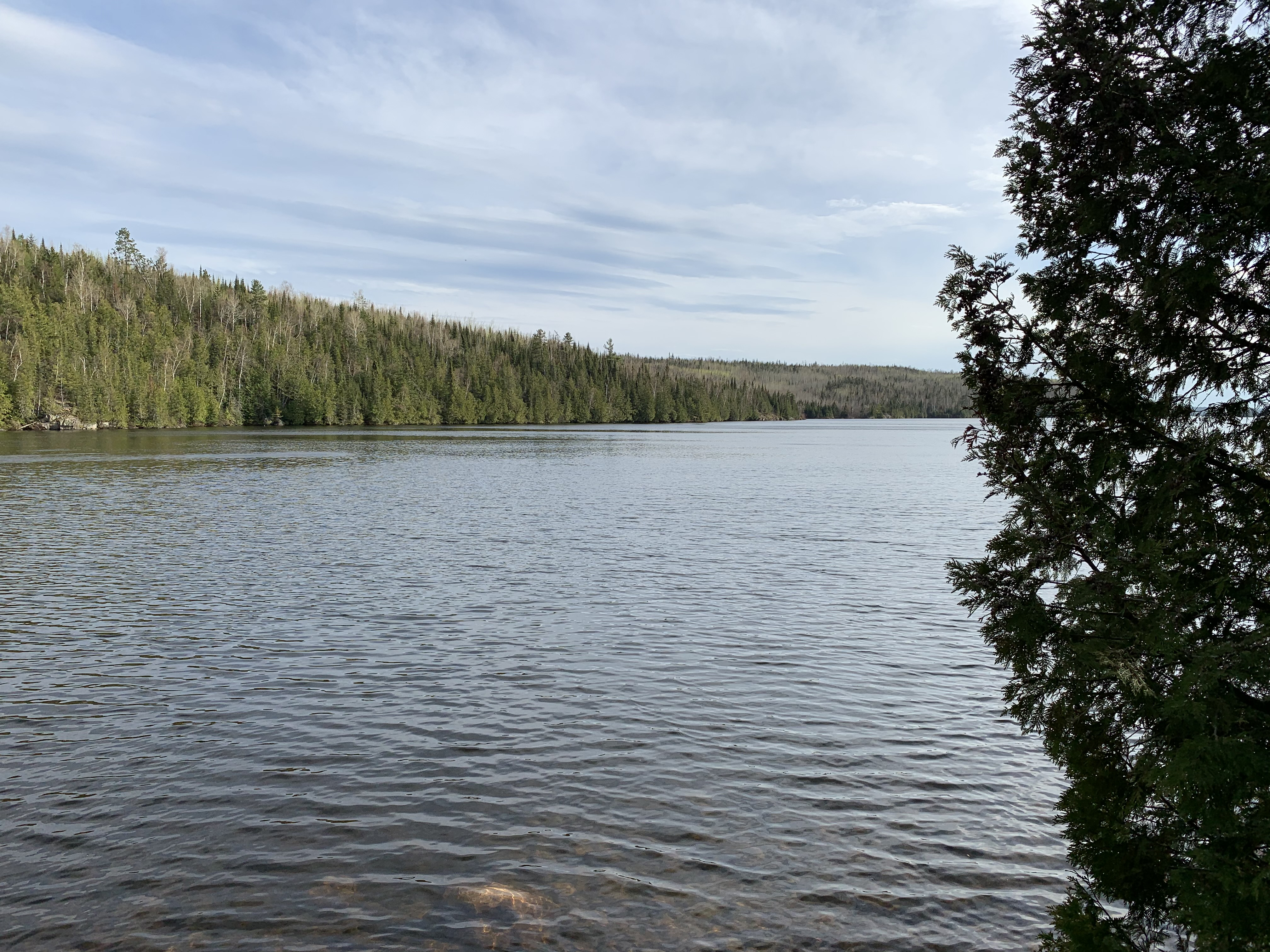
Moose Lake as seen from the north end of the lake, just east of the channel to Newfound Lake. Paddle into Newfound Lake -or- Explore Another Route ***********************************************END OF ROUTE***********************************************
PADDLING FROM NEWFOUND LAKE TO THE BWCA ENTRY POINT 25 LANDING
Starting from the location where Newfound Lake and Moose Lake join, paddle southwest along the southeast shoreline of Moose Lake until reaching the landing for BWCA Entry Point 25. Make a quick stop at a campsite not long after leaving Newfound Lake.
The BWCA Entry Point 25 canoe landing. Explore BWCA Entry Point 25 -or- Explore Another Route ***********************************************END OF ROUTE***********************************************
Route Connections for Moose Lake
From Moose Lake, you can portage to Flash Lake (which is outside of the BWCA and the way the go if you want to reach Snowbank Lake). You can also take the long portage to Wind Lake. You can paddle into Newfound Lake (this is the way if you destination is Birch Lake or Ensign Lake). You can also choose to exit the BWCA at Entry Point 25. Lastly you could bushwhack to Finch Lake.