Big Moose Lake
LaCroix Ranger District
BIG MOOSE LAKE CAMPSITES:
Campsite 1 (#181): On north end of lake near the Big Moose Trail
Almost all traffic arriving at Big Moose Lake comes from BWCA Entry Point 8 - Moose River South, which is a bit over two miles up the Moose River from the northwest corner of the lake. Few paddlers make the long portages from either Cummings Lake or Duck Lake. Both of these long portages are rugged. The Moose River South entry point only allows one permit per day. The campsite on the north end of the lake is sometimes taken by people hiking the Big Moose Trail. BWCA Entry Point 8 is by far the easiest way to get to this lake, as other routes all involves long and difficult portages.
The north end of Big Moose Lake still has virgin stands of big pine missed by logging operations. Some of these big trees can be seen along the Big Moose Trail.
Harry Homer, Sr. had logging operations near the south end of Big Moose Lake, along the Cummings Lake portage around 1941-42 and probably for several years after. Homer Lake is named after him. Some of the tracts were also owned by the Oliver Iron Mining Company. Most of these logs were hauled out of the forest along a winter logging road that existed just east of Big Moose Lake (the road traveled over the existing marshland in that area) (Heinselman, 1999).
Some of the very last logging operations to occur in the newly formed BWCA took place just northwest of Big Moose Lake in 1978 and 1979. A 160 acre tract of forest was clear cut during that period (Heinselman, 1999).
The forest fire occurring in the 1755-59 period was one of the largest historical fires on record for the BWCA. It burned nearly 165,000 acres (Heinselman, 1999).
Another sizeable fire burned near Big Moose Lake in 1894. This was the Chad-Cummings-La Croix Boulder Bay-Crooked Lakes complex. It affected 65,920 acres (about 103 square miles). Started near Cummings Lake and burned toward the northeast around Big Moose Lake and Big Lake and on up to Boulder Bay on Lac La Croix (Heinselman, 1999). Much of this 1894 vintage forest is still standing, because it was never logged after the fire.
Big Moose is a large lake, but is only 23 feet deep. Therefore most of its water is in the productive littoral zone, the area of a lake that is both shallow enough and also gets sufficient light to support rooted plants. Therefore it is good habitat for many species of animals (including fish). Fishing in this lake is consistently good, especially for walleye.
The relatively clear waters of Big Moose Lake flow out to the north via the Moose River. There are no other notable tributaries flowing into the lake.
References:
Beymer, Robert, Boundary Waters Canoe Area – Volume 1 – Western Region (Berkeley: Wilderness Press, 2006), 58, 59, 62, 67, 70-72, 80.
Heinselman, Miron, The Boundary Waters Wilderness Ecosystem (Minneapolis: University of Minnesota Press, 1999), 56, 57, 114, 125, 139, 201.
Pauly, Daniel, Exploring the Boundary Waters (Minneapolis: University of Minnesota Press, 2005), 82-84, 88, 90.
Exploring Big Moose Lake
Click on the photos below to see the full resolution image - Use your browsers back button to close photo and return to this page.
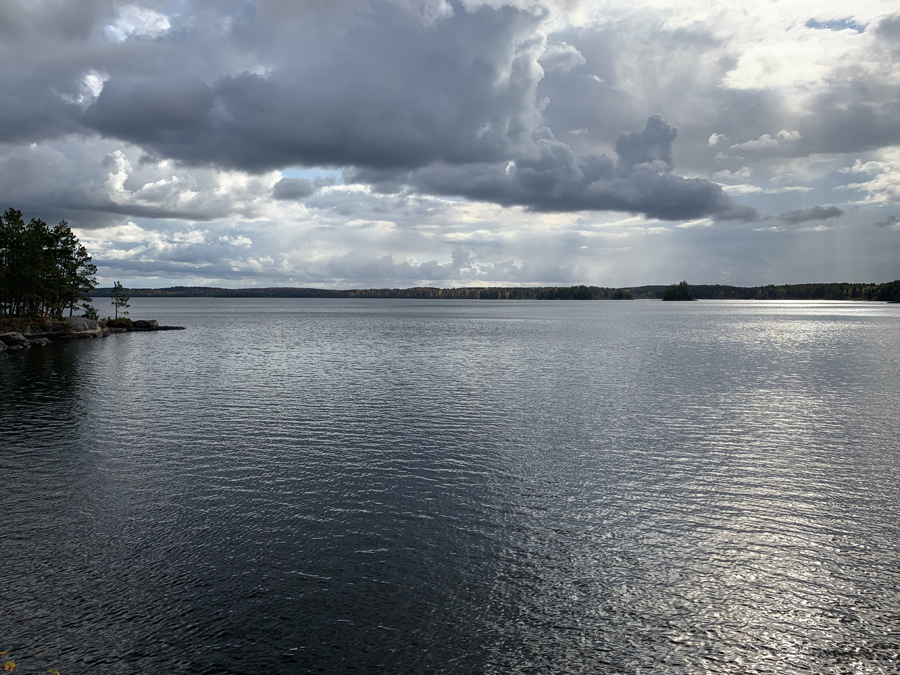
View straight south from the end of the Big Moose Trail. The distant shoreline is a little over two miles away.
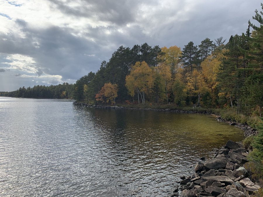
Looking west/southwest at the shallow bay on the north tip of the lake.
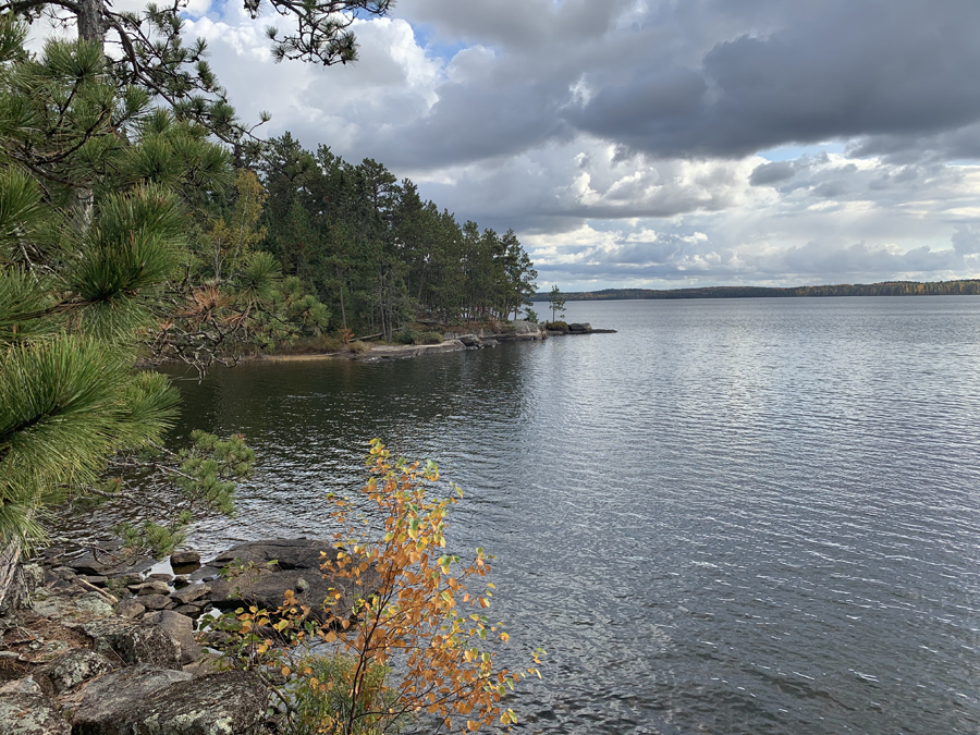
The point in the middle of your view is the location of the campsite on the north end of the lake. This view is from the end of the Big Moose Trail. You can follow a brushy trail along the edge of the lake from here over to the campsite.
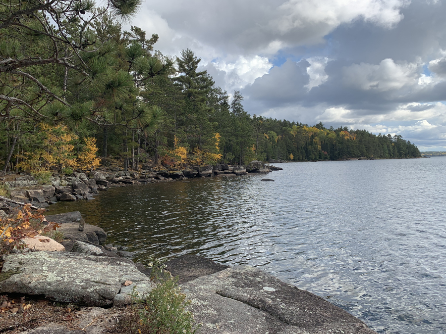
Looking toward the south down the east shoreline of the large north bay of Big Moose Lake. This vantage point is from the campsite located there.
Route Connections for Big Moose Lake
From Big Moose Lake you can portage to Cummings Lake, Duck Lake or the Moose River. You can also hike the Big Moose Trail.
Return to Top of Page
|


