The access road to the Lake Isabella Entry Point is the same as that for the Island River entry point, but its one mile or so farther down the road. From Minnesota Highway 1, head to the town of Isabella if coming from the North Shore (Lake Superior). Once in Isabella, just head out of town on Forest Road 912. There are many signs along these gravel forest roads that show the mileage and direction to the many BWCA entry points in the area. The signs are posted at almost every intersection.
Before you reach the Island River bridge crossing, you will enter the 2011 Pagami Fire burn area. It stretches for many miles. The Lake Isabella entry point wasn't spared by the fire. Except for a stand of pine trees near the parking lot, there aren't many mature trees eft standing in the area, although new growth (particulary jack pine) is rapidly greening the area up.
The portage down to the lake is very easy and mostly downhill.
Heading out from the canoe landing, you have two route choices - east or west. Most groups head to the west down the Isabella River. Places to visit along the Isabella River include Quadga Lake and access to two small rivers; the Snake River and the Little Isabella River. If you follow the Isabella River all the way to its mouth, you will have reached Bald Eagle Lake. A nice little loop can be done on the lakes around Bald Eagle Lake. Many paddlers do out and back trips to this entry point. If headed east, you will have to face the Perent River. There are many short portages along this river as you follow east to Perent Lake. Perent Lake is a large and popular lake that is typically accessed from BWCA Entry Point 36 - Hog Creek. You could put one car at the Isabella Lake entry point and one at the Hog Creek entry point and do a shuttle if you don't want to double-back to your starting point.
Exploring the Entry Point
Click on the photos below to see the full resolution image - Use your browsers back button to close photo and return to this page.
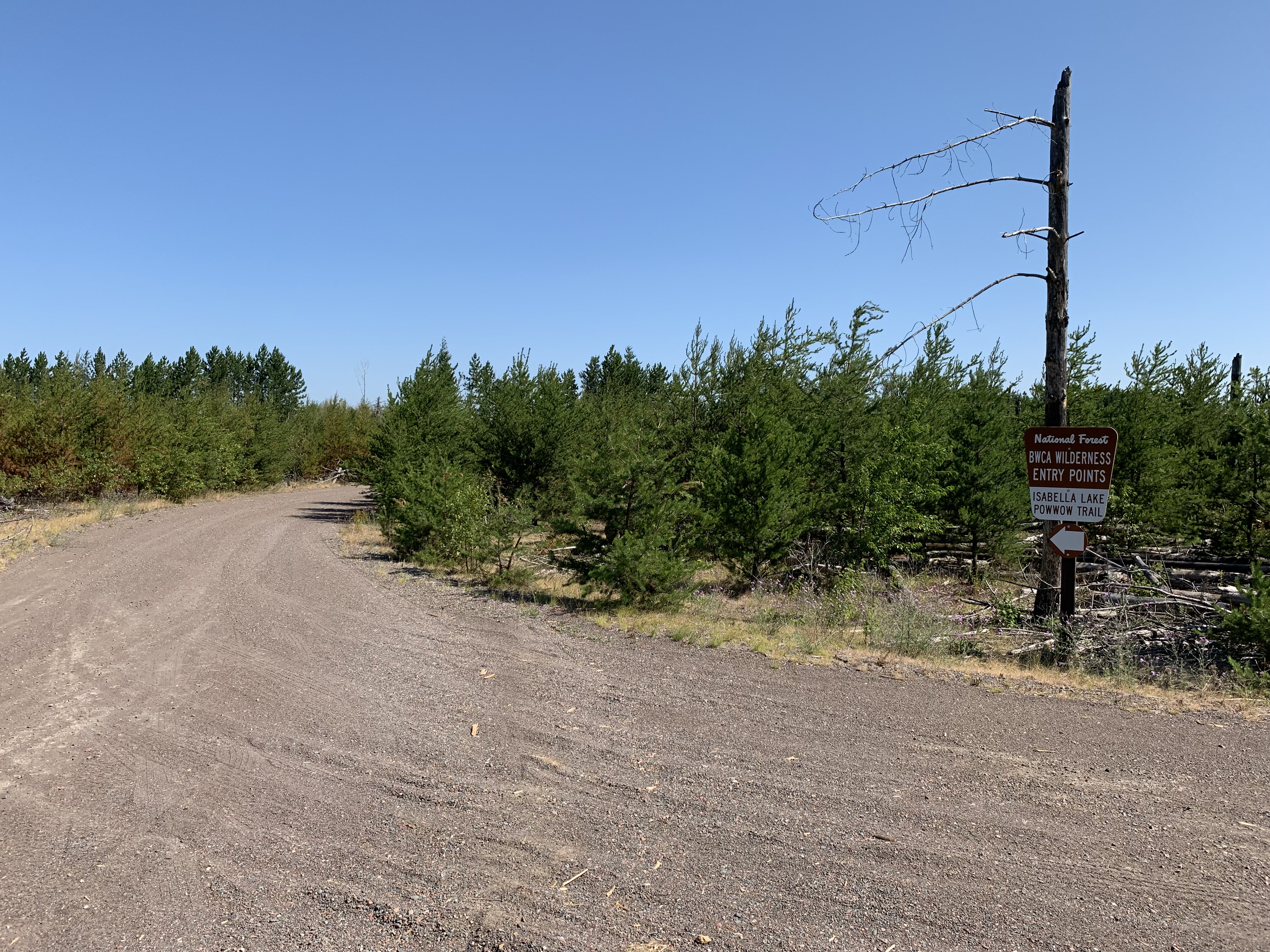
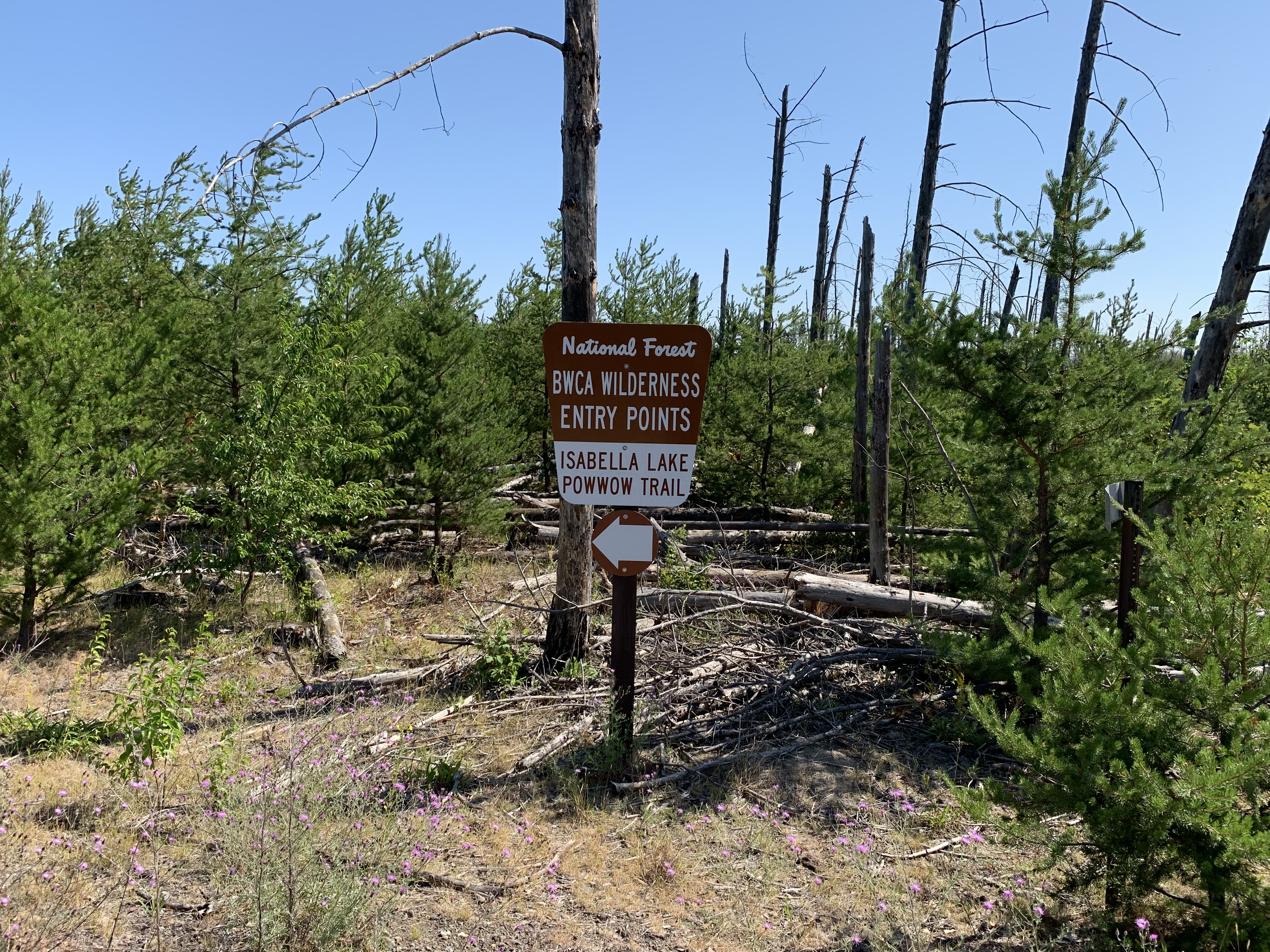
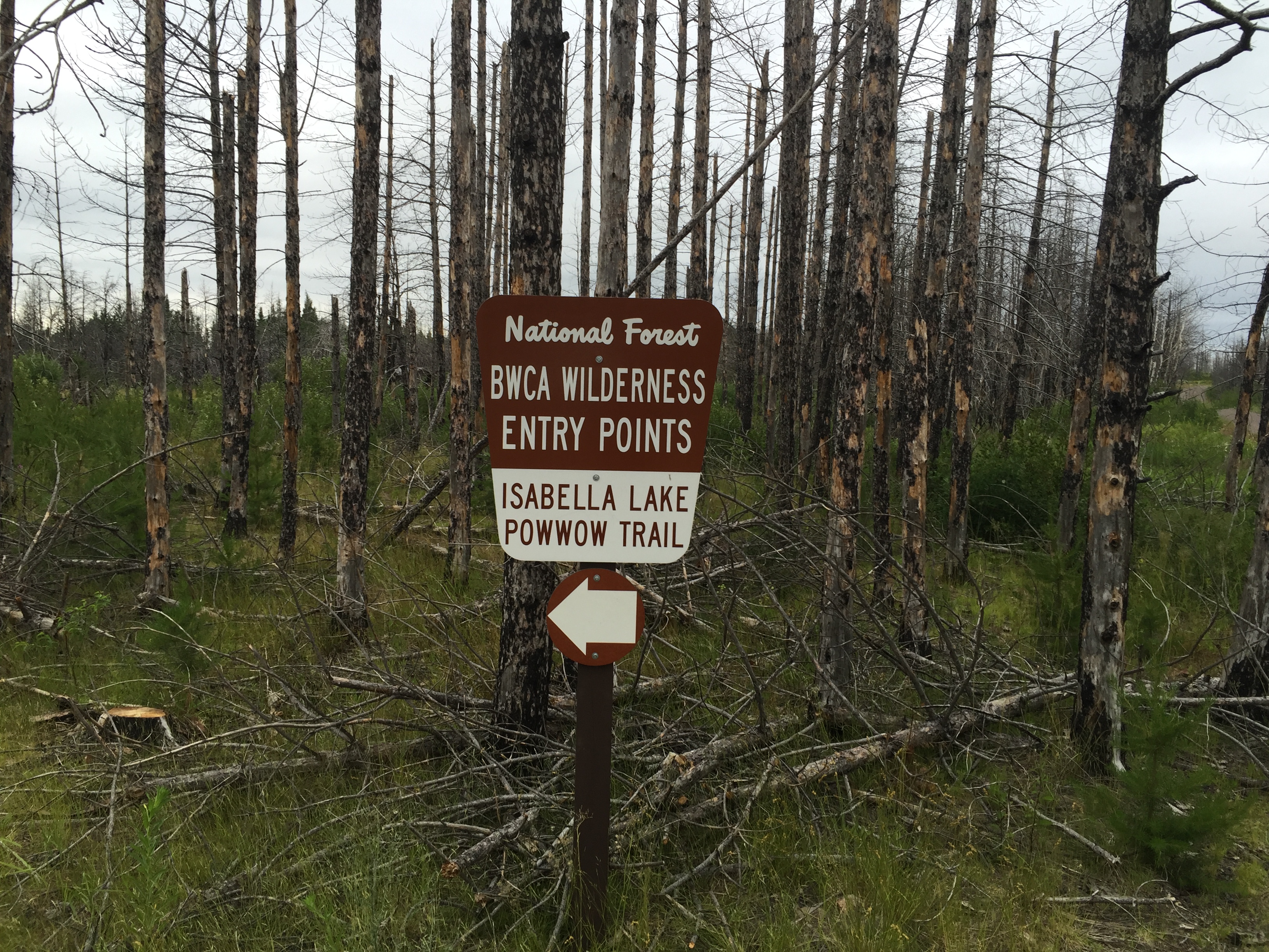
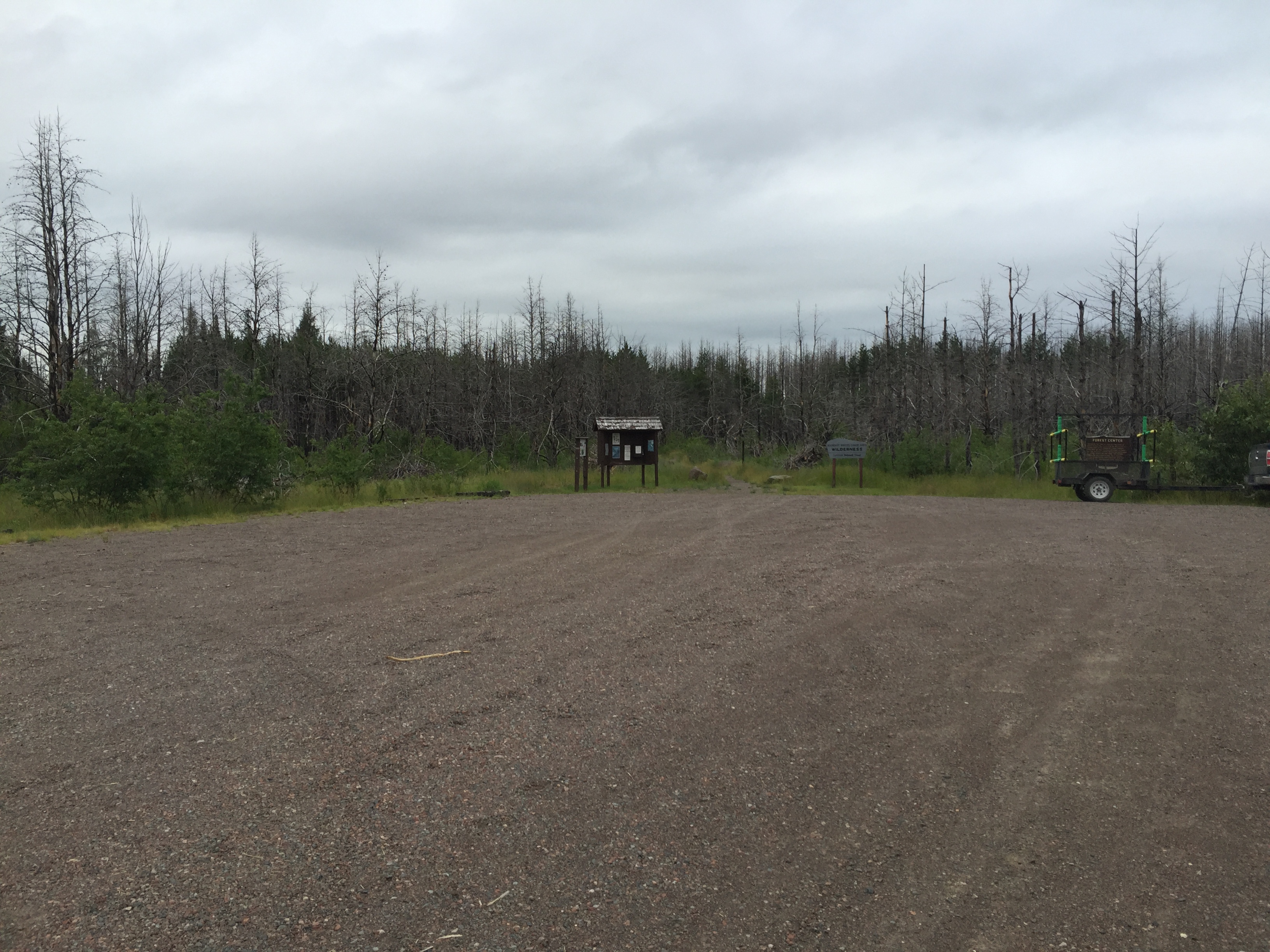
Sign along Tomahawk Road (also known as Forest Road 377). Almost there (July 2021). Most of the burned trees have now fallen.
Nearly same view as above (July 2016). Notice how almost all the burnt tree skeletons are still standing.
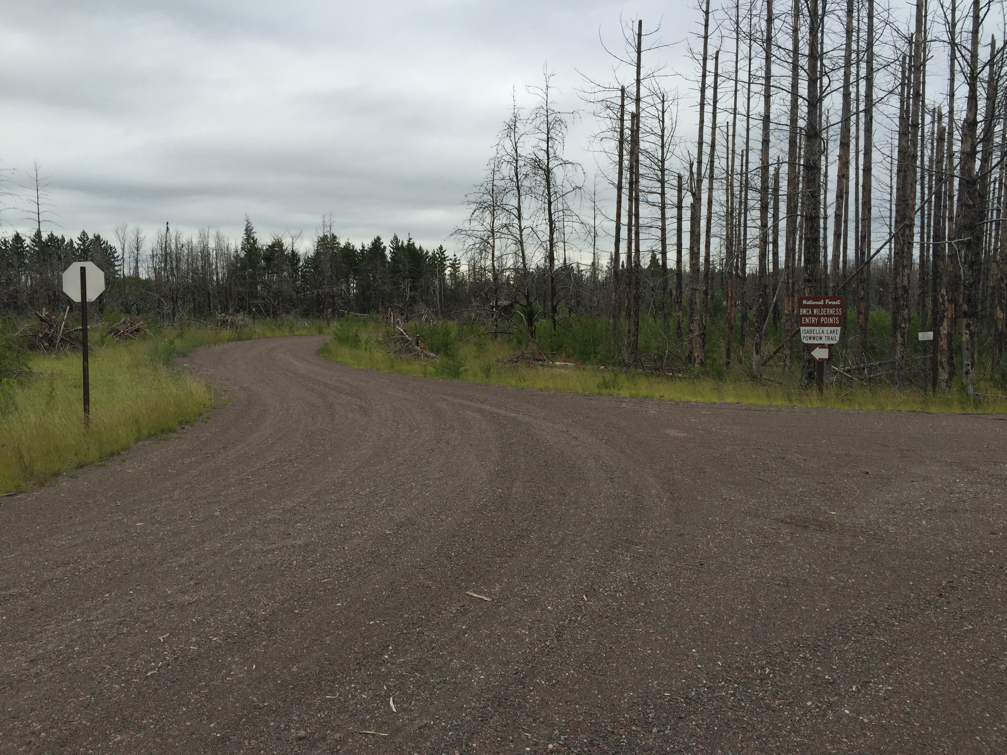
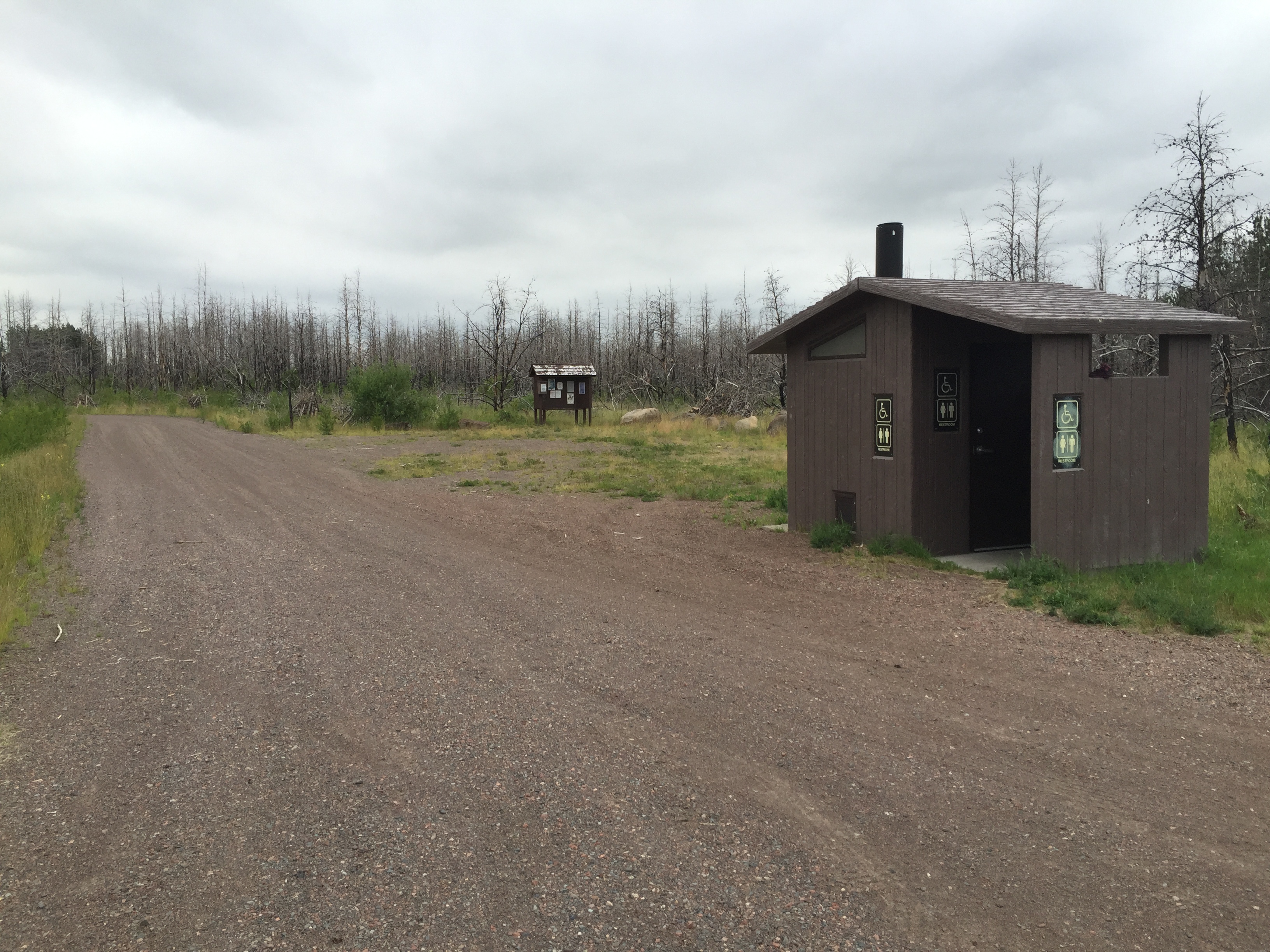
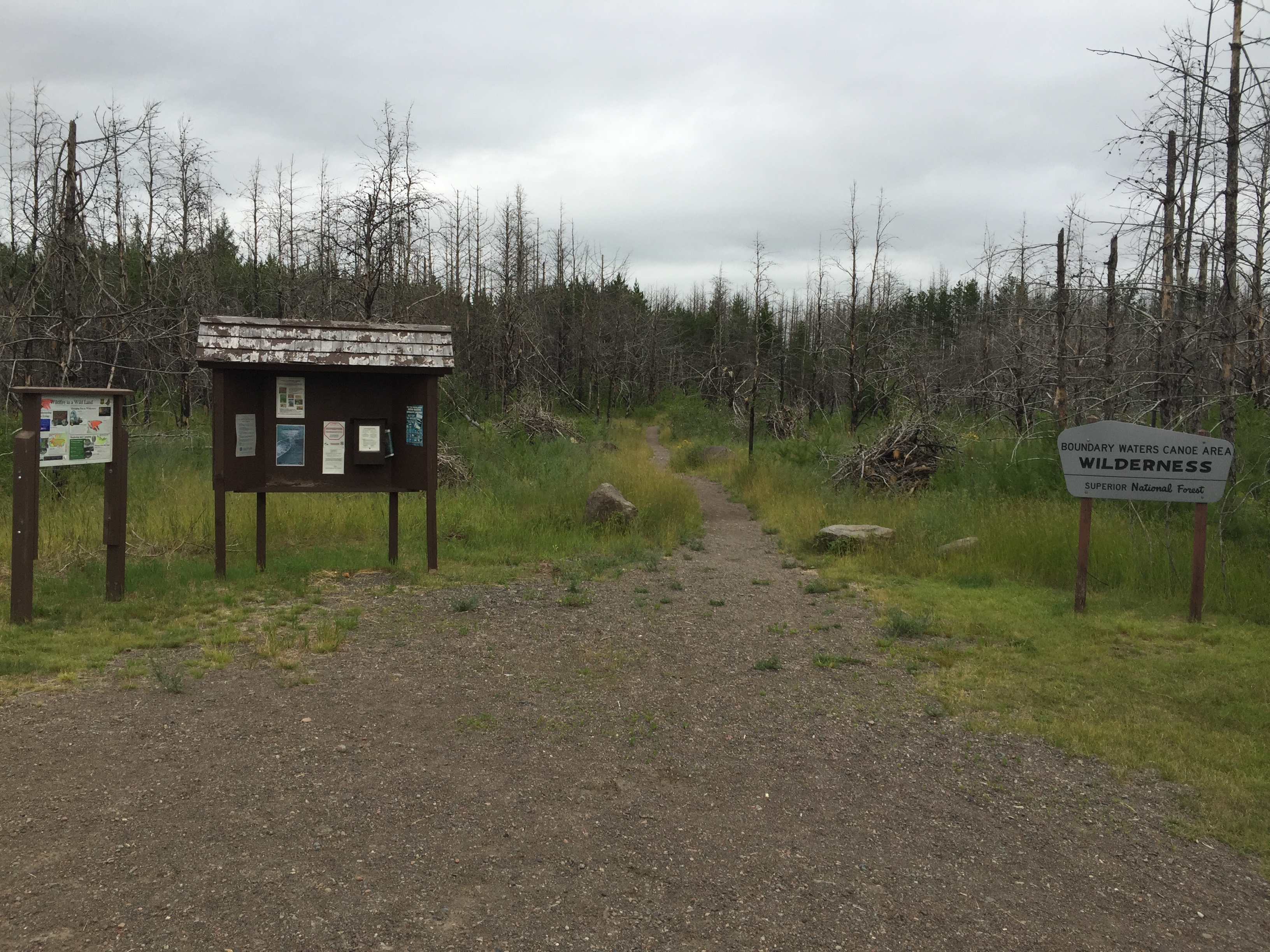
Signage indicates this parking lot is used for both BWCA Entry Point 35 - Isabella Lake and BWCA Entry Point 86 - Powwow Trail. Good view of the burned timber in the background (July 2021).
Similar image to that shown above (July 2016).
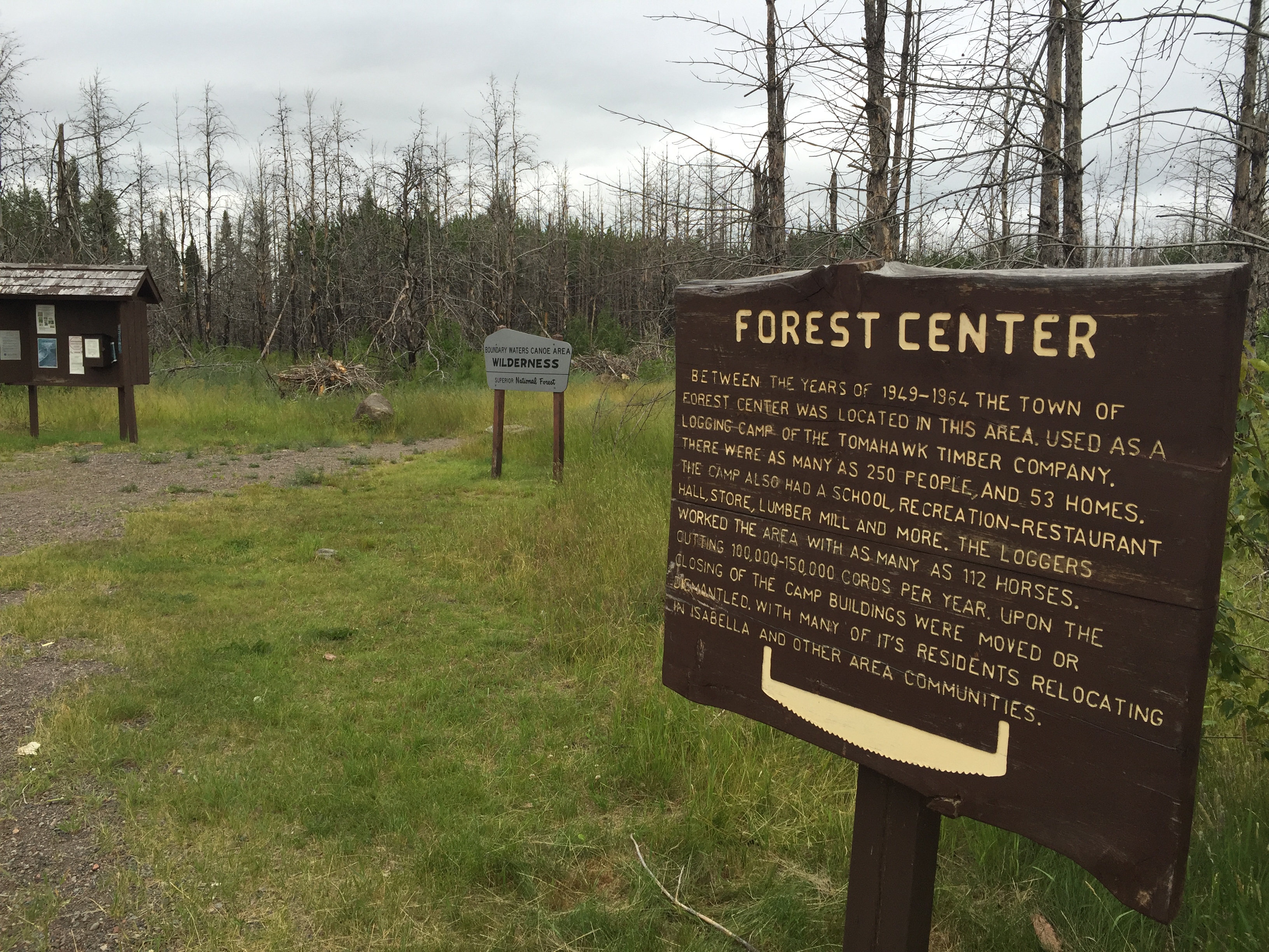
A finer privy you won't find for many miles in any direction courtesy of the U.S. Forest Service. The bulletin board in the distance is the one for the Powwow Trail. To the far left is the entrance road that leads out to the main drag (Tomahawk Road). Once on the main road, it is under a mile to the nearby Island River crossing/entry point (July 2016).
Similar to view above, slightly different angle. See how much the forest has changed (July 2021).
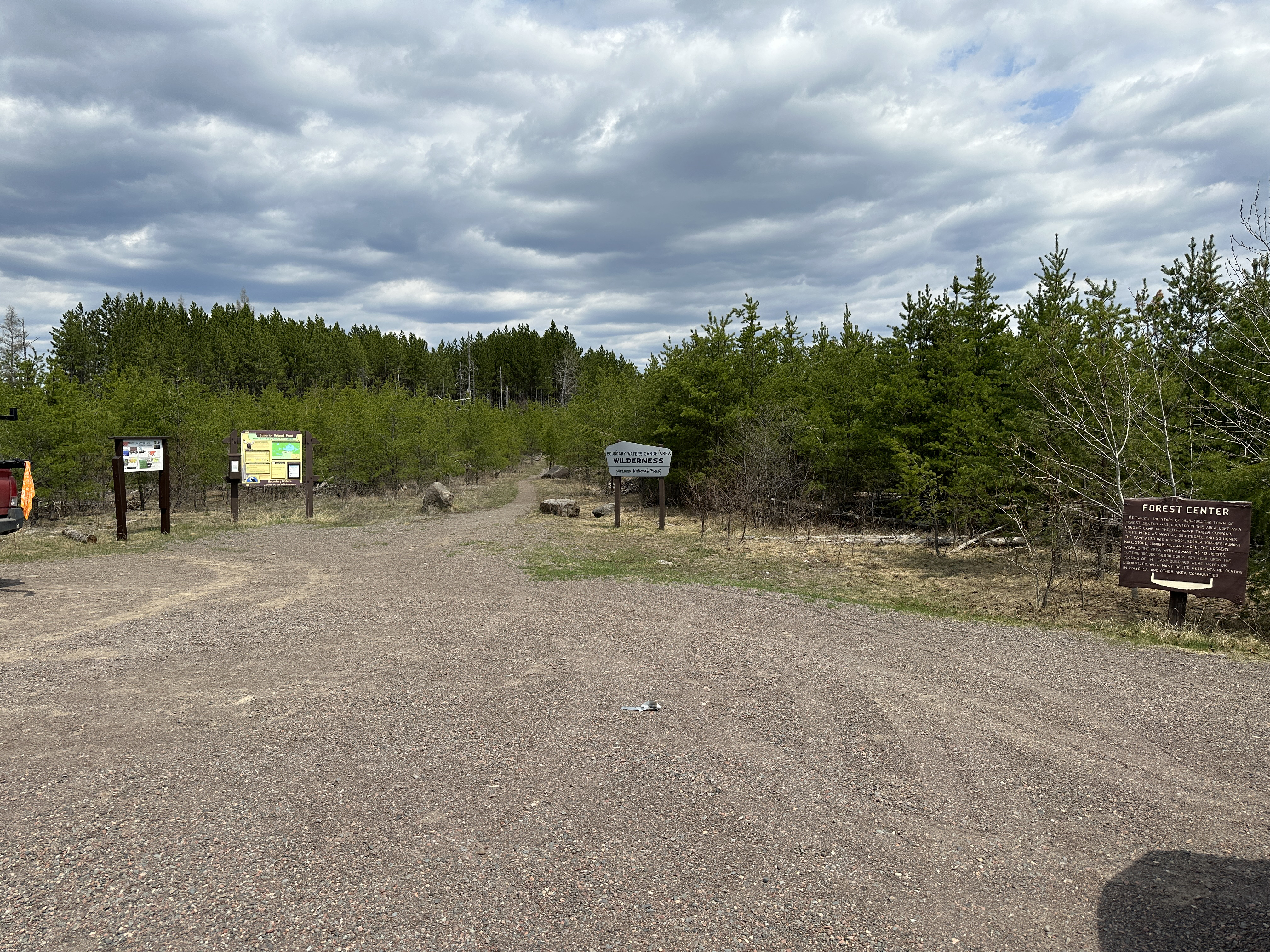
A wider view of the parking lot (July 2016). You are looking toward the start of the portage that leads to the lake. There is another bulletin board over your left shoulder (out of view) that is for users of the Powwow Trail. The Powwow Trail was effectively destroyed by the 2011 Pagami Creek Fire. However, because of the efforts of a lot of volunteers (Good job!), the trail is now back in action (as of late 2019).
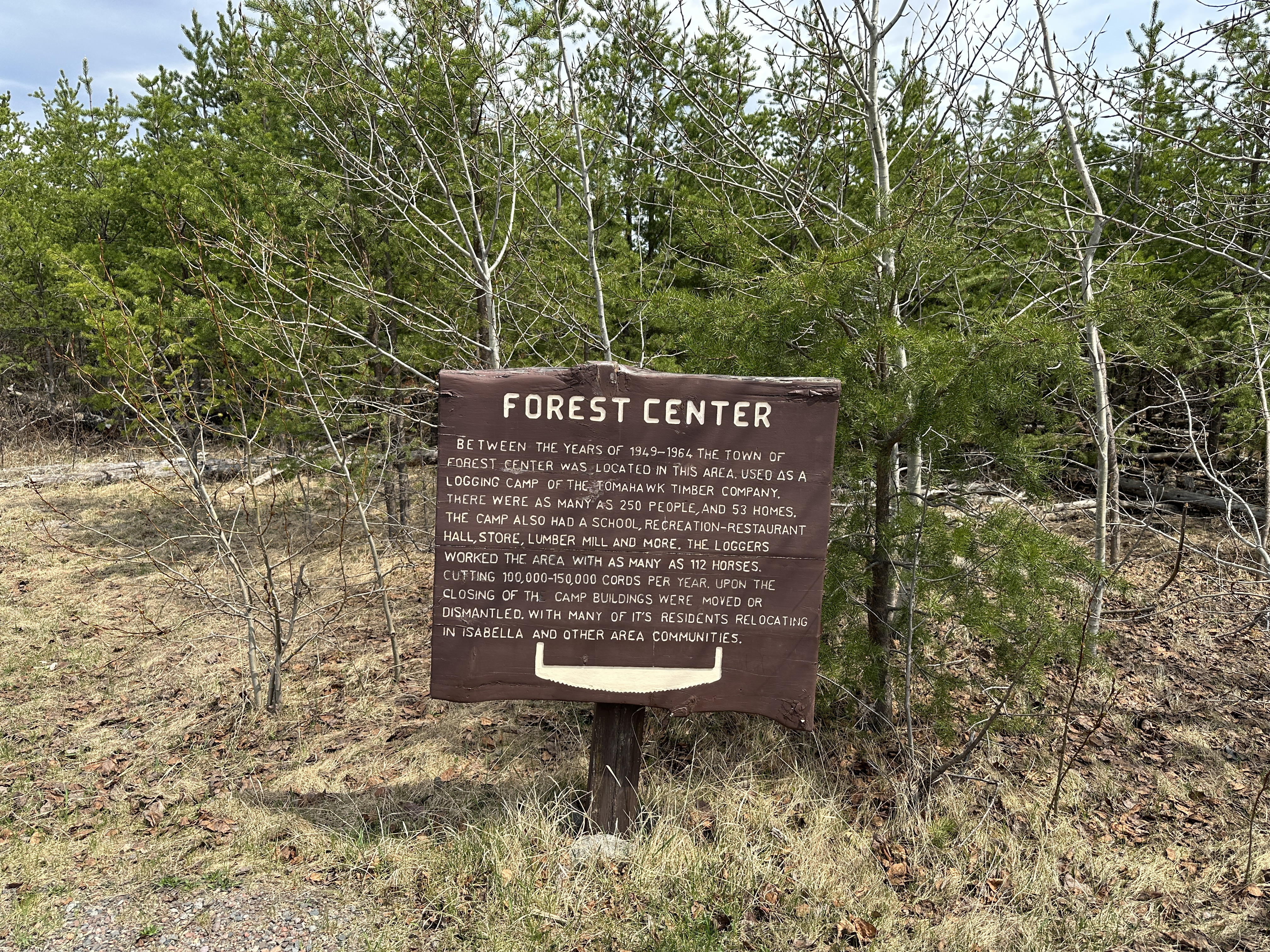
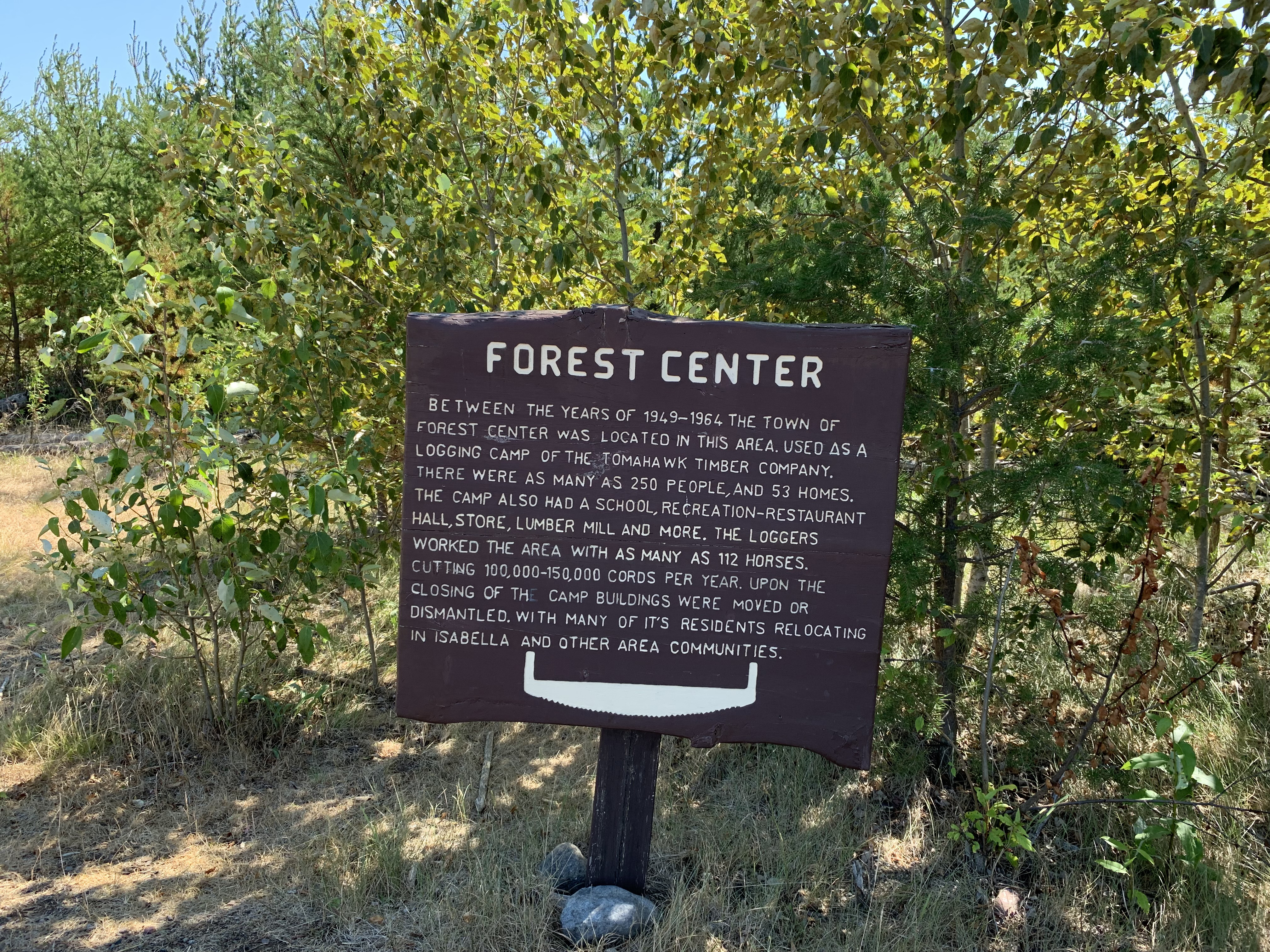
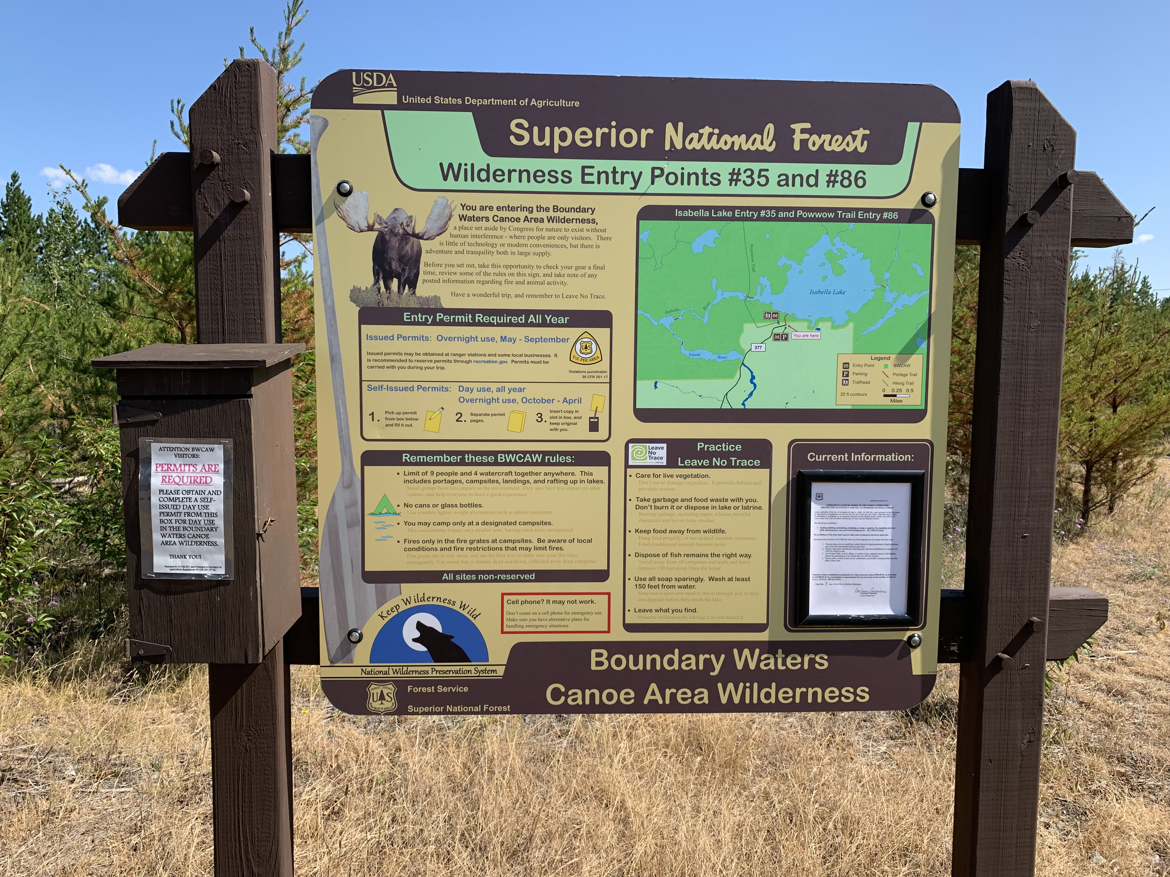
Most recent image of this sign (May 12, 2023).
The sign explains the historical significance of this place (July 2021).
View of this sign from a few years back (July 2016).
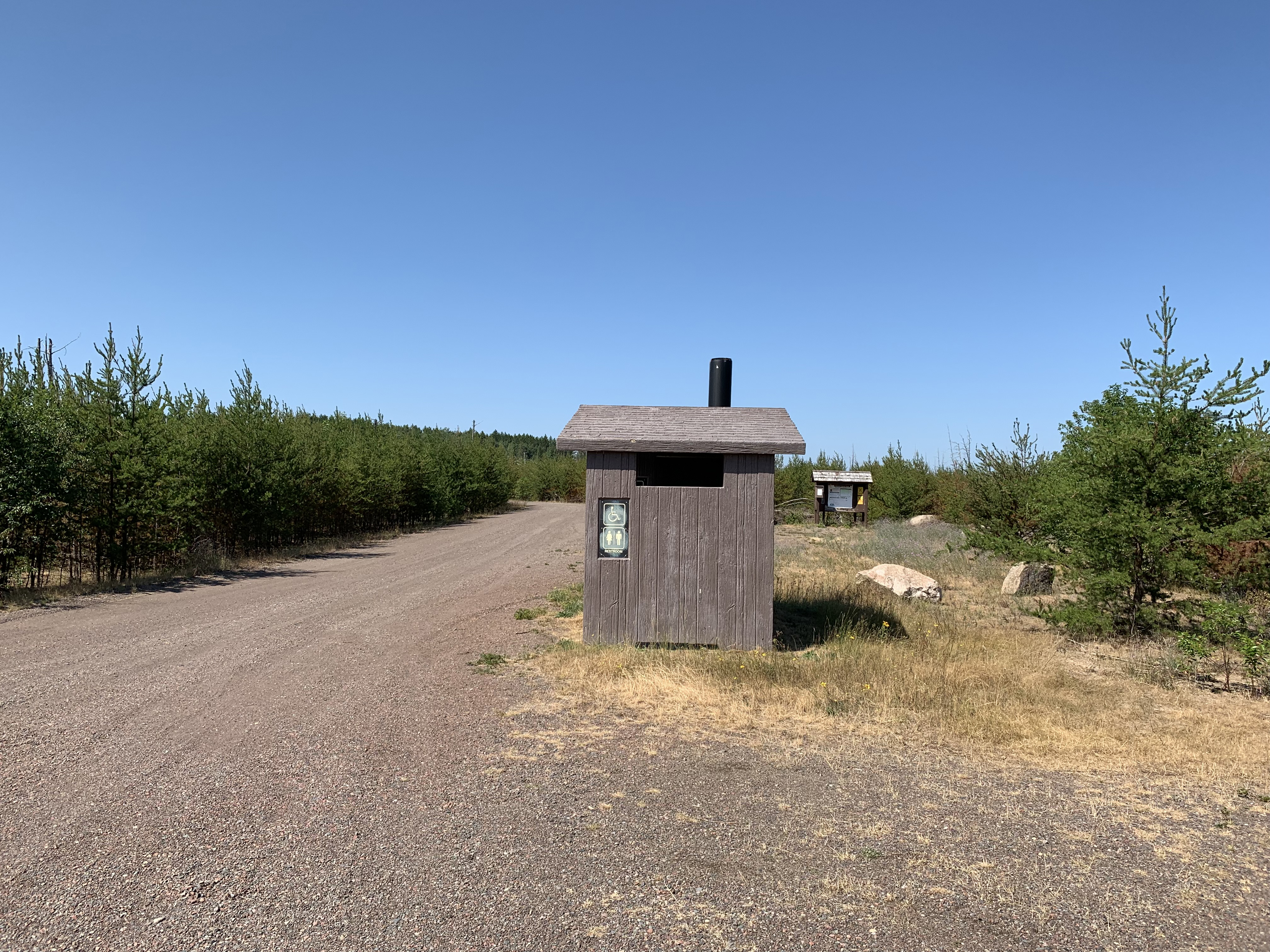
The 71 rod portage down to Isabella Lake begins here at the end of the parking lot (May 12, 2023).
Similar to the photo shown above (July 2021).
Close to the same photo as shown above (July 2016).
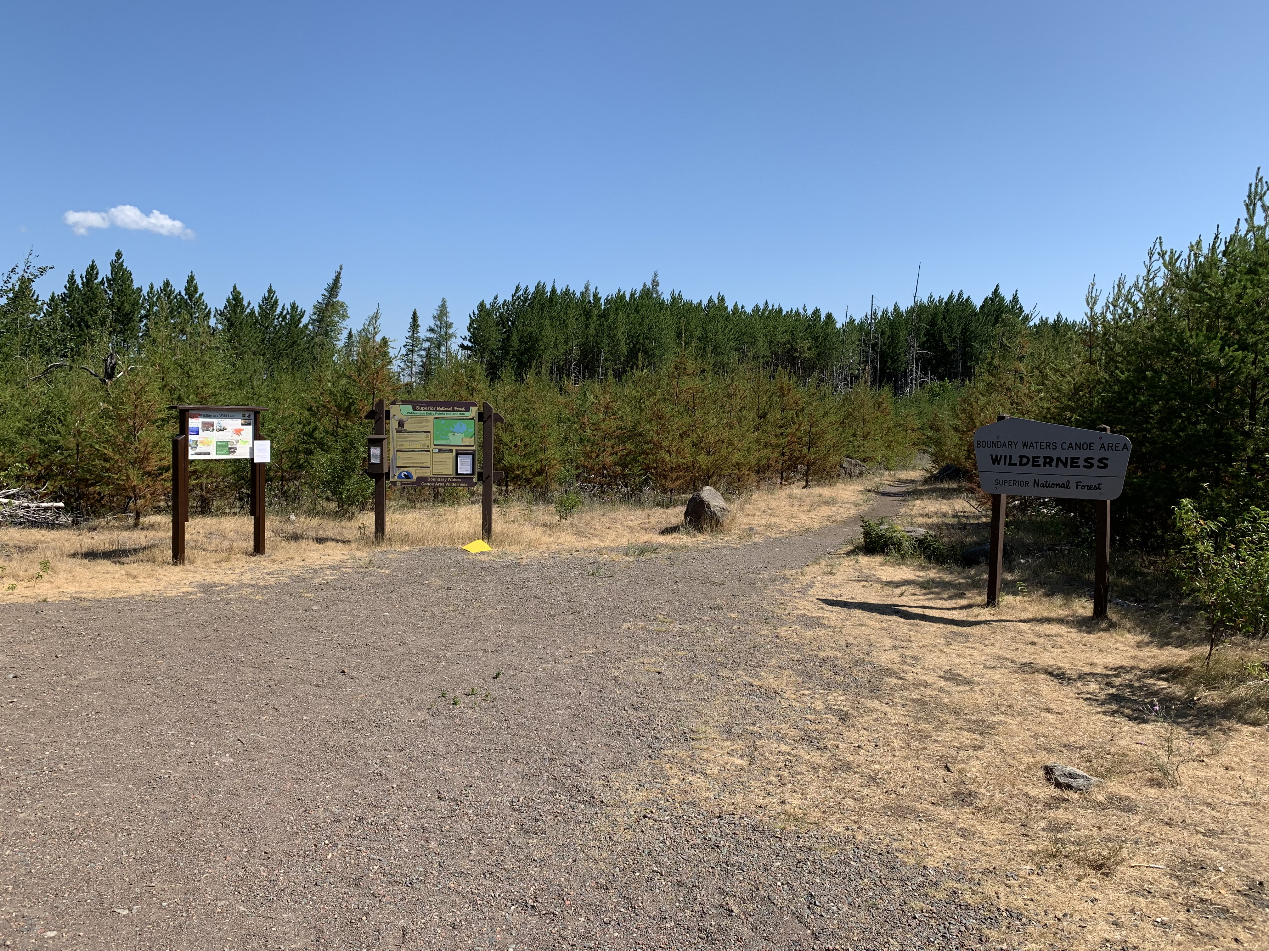
Close up of the newer bulletin board (July 2021).
A very easy portage, mostly downhill to the lake. Passes through an area of planted pine trees that had the bases of their trunks blackened, but otherwise survived the massive forest fire (May 12, 2023). (See this portage in both directions here.)
Past video of this portage (July 25, 2021).
Older footage of this portage (July 2016).
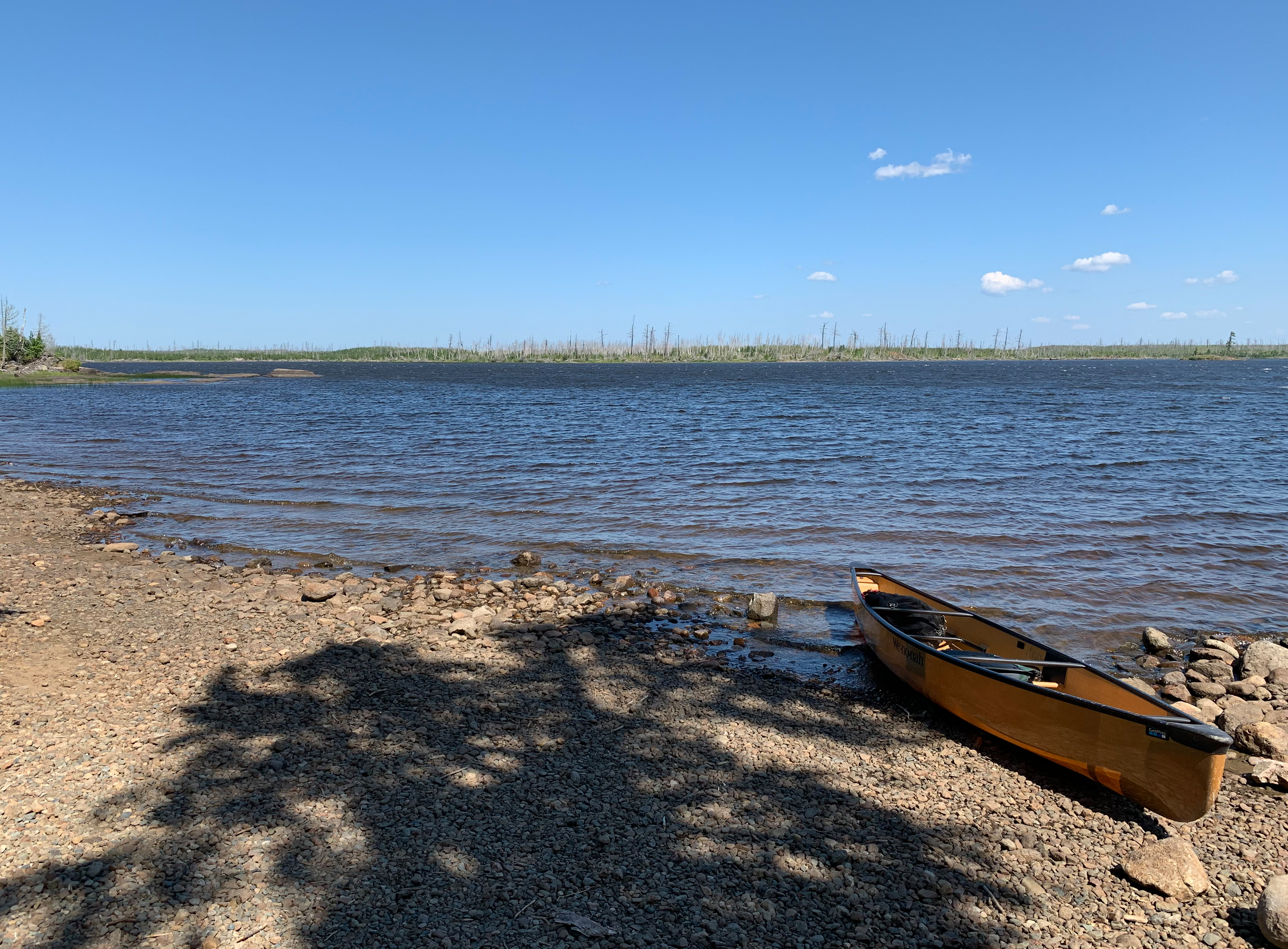
Shoreline of Lake Isabella. This is during drought conditions, so much of the beach is exposed (July 2021).
Now that you've reached the shore of the lake, visit:ISABELLA LAKE