CROSS BAY LAKE CAMPSITES: Campsite 1 (#559): Campsite at the south end of the lake near Rib Lake portage Campsite 2 (#557): At the sharp bend in the mid-point of lake on west shore
Campsite 3 (#558): Closed.
Cross Bay Lake is more like a wide section of the Cross River. At least five waterways empty into Cross Bay Lake. These are Dawkins Creek and Extortion Creek from the east, the river from Rib Lake flowing in from the south (this may still be considered the Cross River), a small creek pouring down from Snipe Lake to the west, and another small creek draining the area to the south of Cross Bay Lake which lies in the Hairy Lake PMA. There is a trail near a small waterfall along this creek that provides access to an unnamed lake at the top of a steep hill in the Hairy Lake PMA. Cross Bay Lake itself drains into Ham Lake to the north through a series of strong rapids (thus the reason for the 24 rod portage to Ham Lake).
Fishing is known to be good in this lake for northern pike and walleye, even though the Minnesota DNR does not have a fishing report for this lake.
Pitcher plants (an insect eating plant similar to the venus fly trap) and blue flag iris grow abundantly along the shoreline of Cross Bay Lake in late spring and early summer.
There are two campsites on the lake. There used to be three sites, but one was closed. The northern of the two campsite has nice views, but a below average landing spot and is found at the sharp bend on the west side of the lake. The campsite on the south end of the lake near the waterfall has spectacular views and is perhaps the better of the two sites on this lake.
References:
Beymer, Robert, Boundary Waters Canoe Area – Volume 2 – Eastern Region (Berkeley: Wilderness Press, 2006), 60, 124, 134, 136, 139, 151.
Pauly, Daniel, Exploring the Boundary Waters (Minneapolis: University of Minnesota Press, 2005), 311, 312, 326.
Click on the photos below to see the full resolution image - Use your browsers back button to close photo and return to this page.
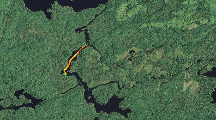
PADDLING FROM THE HAM LAKE PORTAGE TO THE MOUTH OF EXTORTION CREEK
The view from the Ham Lake portage. You would paddle to the right after embarking from this point. Just to the left out of view is the start of a series of rapids cascading down to Ham Lake.
Paddling south down Cross Bay Lake after embarking from the Ham Lake portage. This stretch of paddling ends at the mouth of Extortion Creek.
The narrow northern end of Cross Bay Lake. This section is more like a river and there is a slight but noticeable current. Watch out for underwater boulders paddling through here! Paddle into Extortion Creek -or- Explore Another Route **********************************************END OF ROUTE***********************************************
PADDLING FROM THE MOUTH OF EXTORTION CREEK TO THE MID-LAKE CAMPSITE
From the mouth of Extortion Creek, paddling south through the wider part of Cross Bay Lake. At the end of the paddle you reach the mid-lake campsite (northern most of the two campsites on the lake), which is found at the sharp bend in the lake. The campsite does not have a particularly good place to land your canoe.
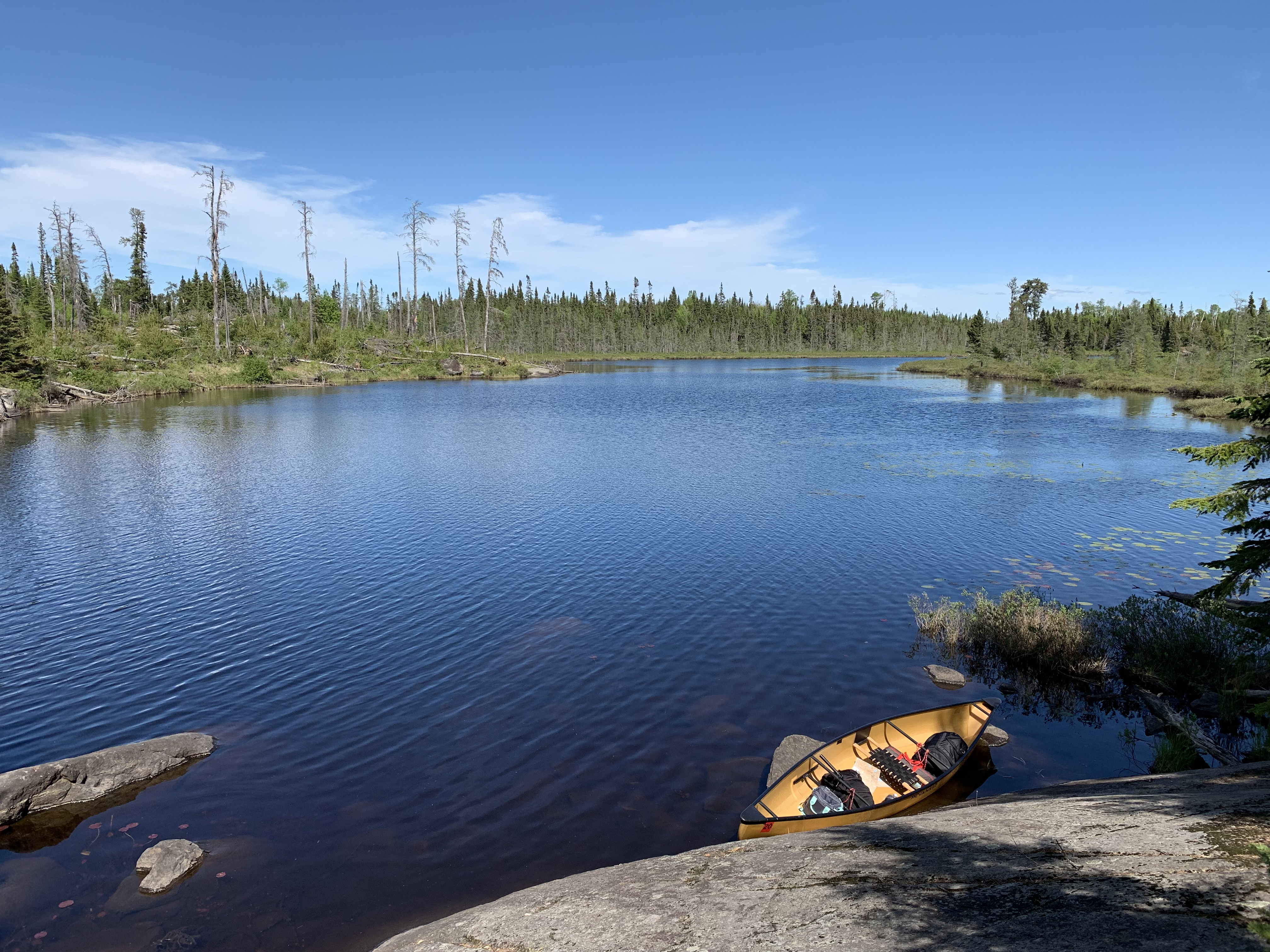
PADDLING FROM THE MID-LAKE CAMPSITE TO THE RIB LAKE PORTAGE
A nice view of the lake can be had from the mid-lake campsite (July 15, 2019).
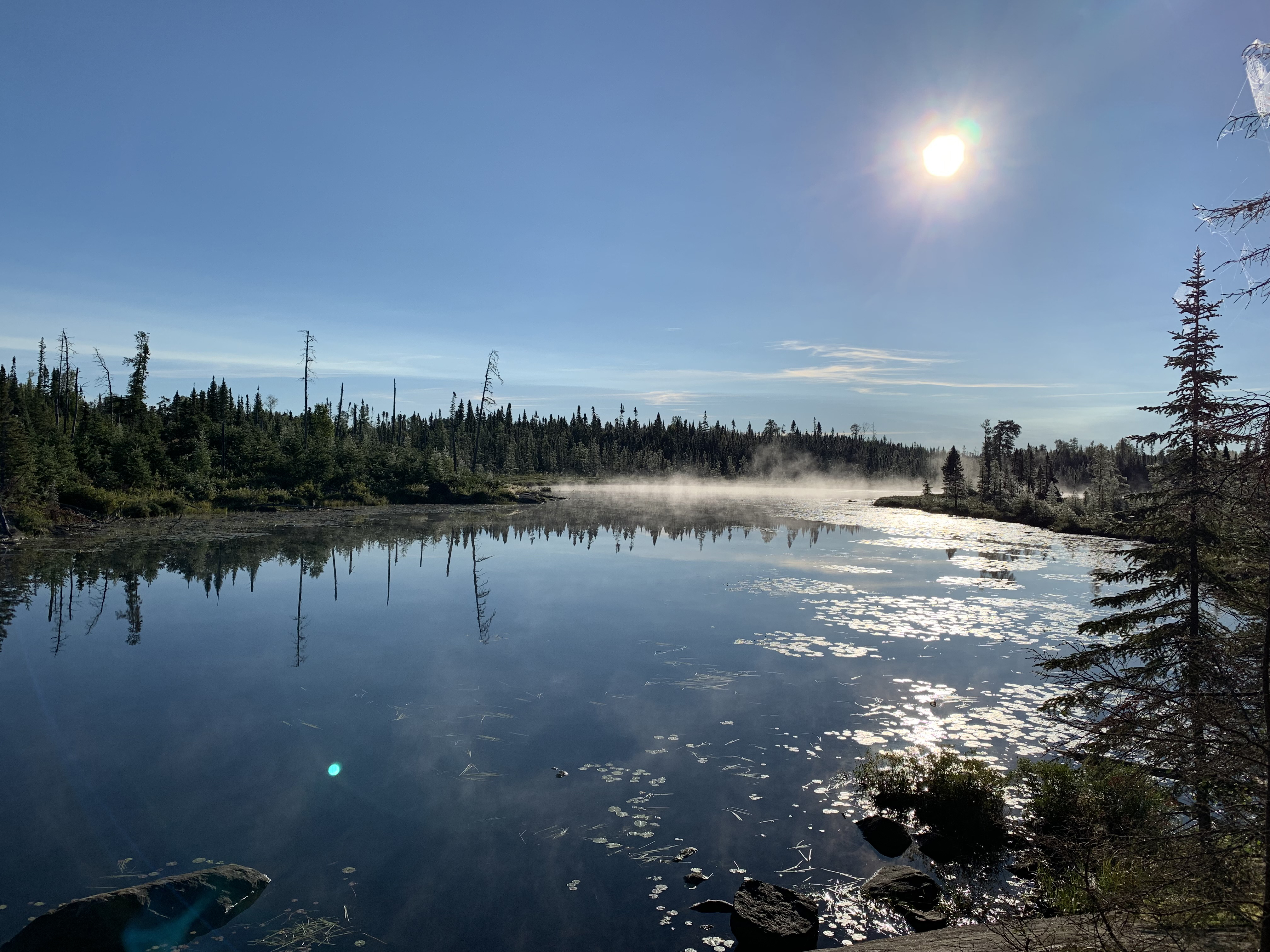
Nearly the same view as above, but several years later (September 3, 2022).
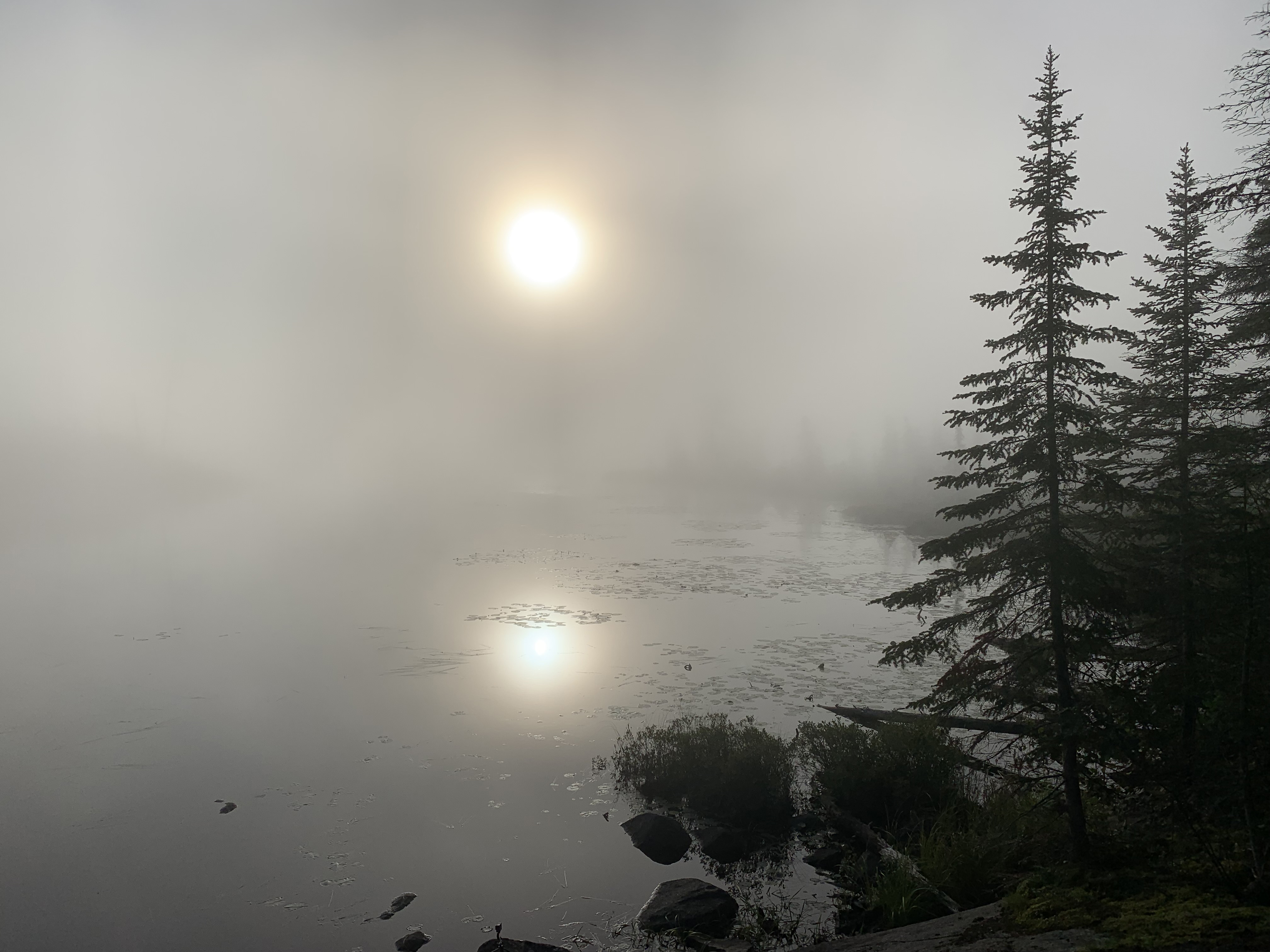
Morning on Cross Bay Lake as viewed from BWCA Campsite 557 (September 4, 2022).
Another view of the northern lights - 10 PM (September 3, 2022) [Image taken with a iPhone 11 Pro].
This is the small rocky island just south of the mouth of Dawkins Creek out in the middle of the lake.
Paddling from the mid-lake campsite (found at the sharp bend in the lake), continue southward down the lake until you reach the Rib Lake portage. You pass the mouth of Dawkins Creek to your left. As you finally turn to the east (left) and enter the homestretch to the portage, you may hear a waterfall off to your right in the southwest corner of the lake. That waterfall is along a small creek that drains an unnamed lake. Portage to Rib Lake -or- Explore Another Route **********************************************END OF ROUTE***********************************************
PADDLING FROM NEAR MOUTH OF DAWKINS CREEK TO WATERFALL (WHICH MARKS ROUTE TO LUCKY PAY LAKE)
This view is from just west of the mouth of Dawkins Creek. View is to the south. Cross Bay Lake's only significant island is visible just to the right of center.
From just west of the mouth of Dawkins Creek, paddle south along the west shore of Cross Bay Lake until pulling up onto shore just north of the small unnamed lake shown on your map. You should hear (and possibly see) a small waterfall back in the woods. This is the location of the start of the bushwhack up the cliff/hill to that unnamed lake. There is a faint trail here. A short ways up the trail is a ledge next to the waterfall that you have to climb up (can be a bit tricky). This is one of the ways into the Hairy Lake Primitive Management Area (PMA). See the PMA page on this website if you don't know about these special areas of the BWCA.
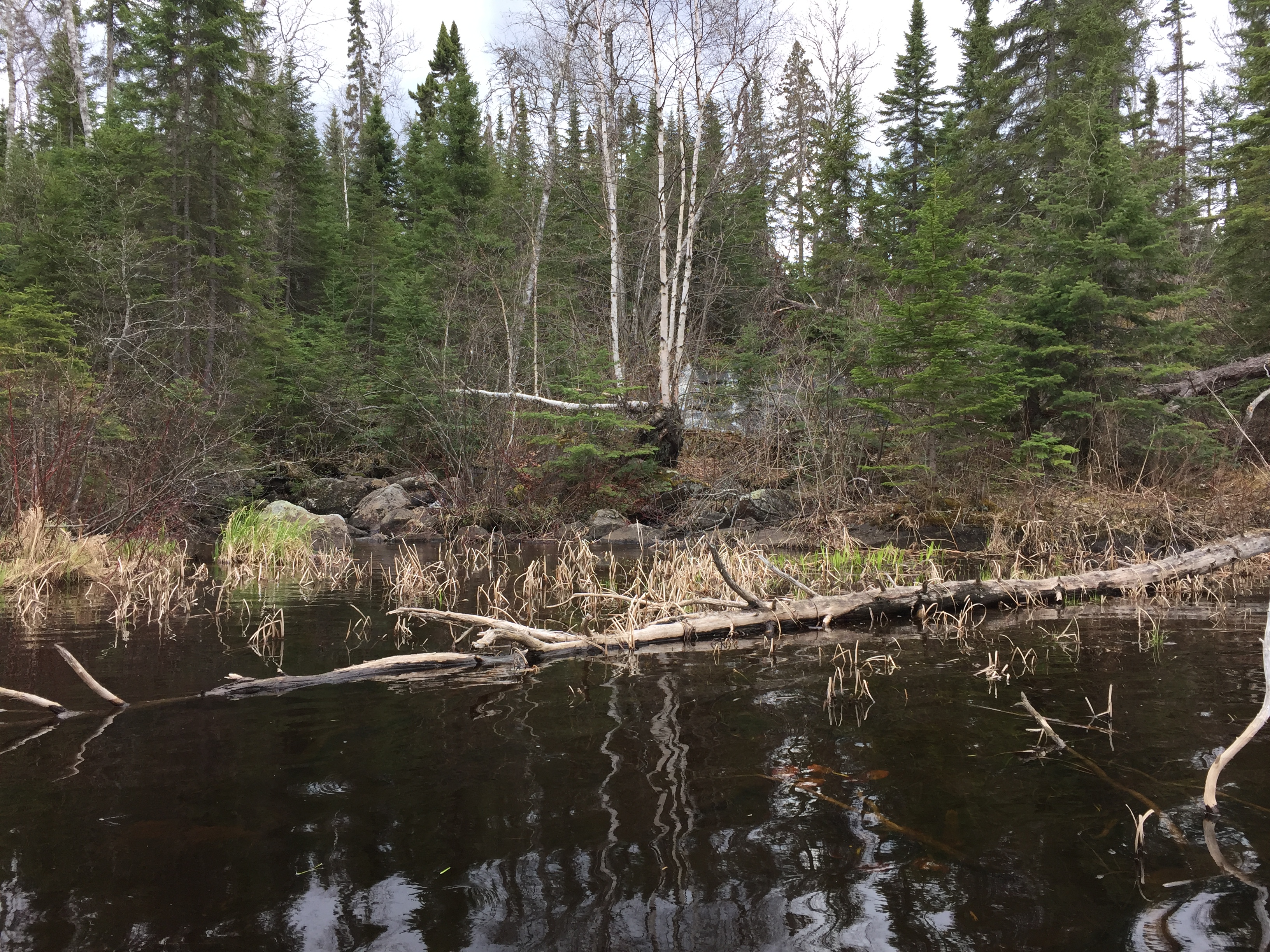
Hard to see, but in the spring (as shown in this view) a small waterfall is seen back in the woods (center of view). There is a faint but obvious path through the woods that leads right up to it. You can easily hear this waterfall before you can see it. If you go to the top of this waterfall, there is a small unnamed lake. This is the lake south of Cross Bay Lake but north of Lucky Pay Lake. This lake is an entry gateway into the Hairy Lake Primitive Management Area (PMA). Bushwhack to the unnamed lake in the Hairy Lake PMA -or- Explore Another Route **********************************************END OF ROUTE***********************************************
PADDLING FROM THE SMALL WATERFALL TO THE RIB LAKE PORTAGE
From the small waterfall, your paddle down Cross Bay Lake continues. Still staying with the west shoreline, you eventually reach the Rib Lake portage. This portage is there to circumvent a waterfall and some rapids coming down from Rib Lake (this stream could still be part of the Cross River).
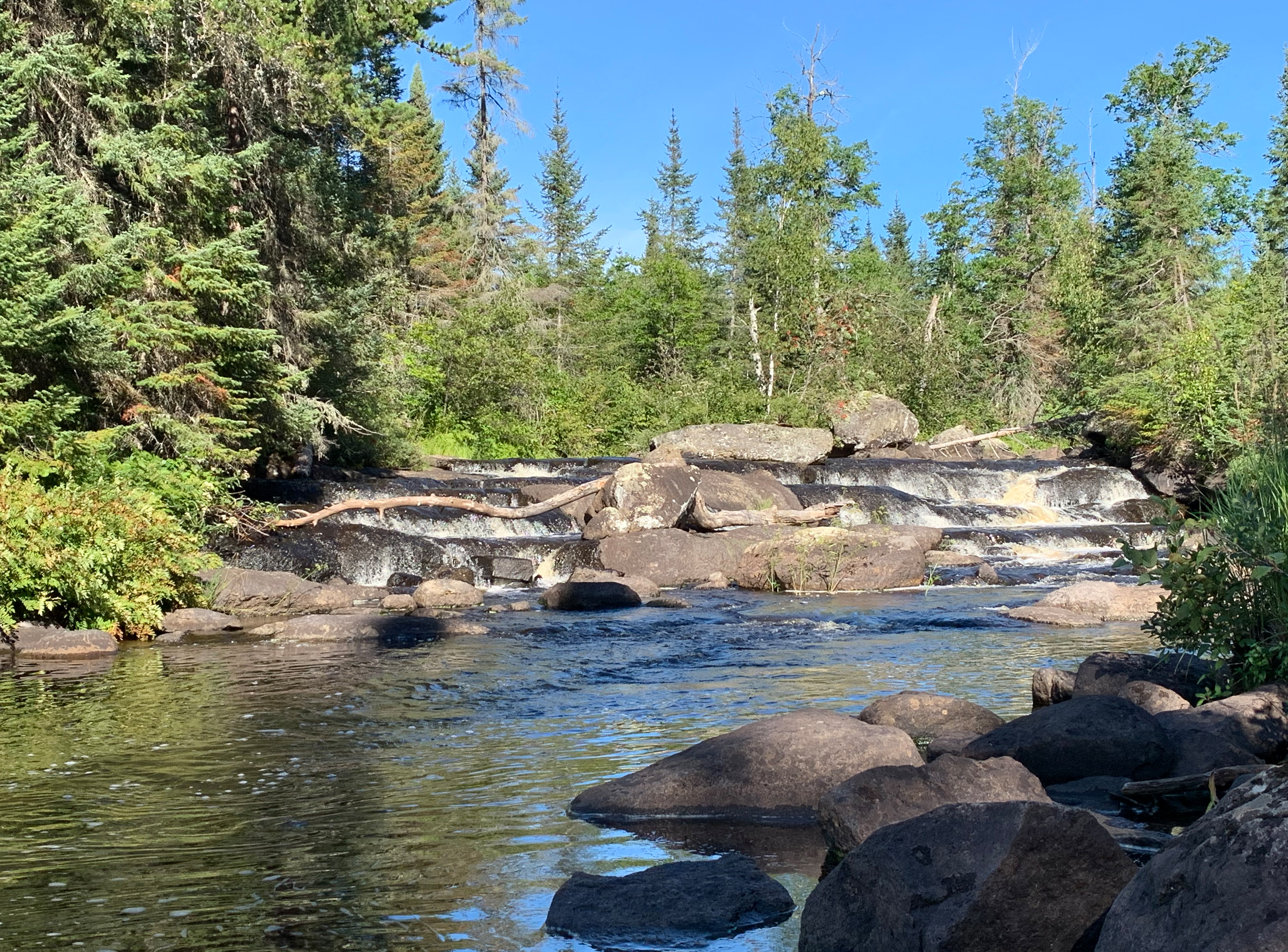
Staircase rapids near the Rib Lake portage (September 3, 2022).
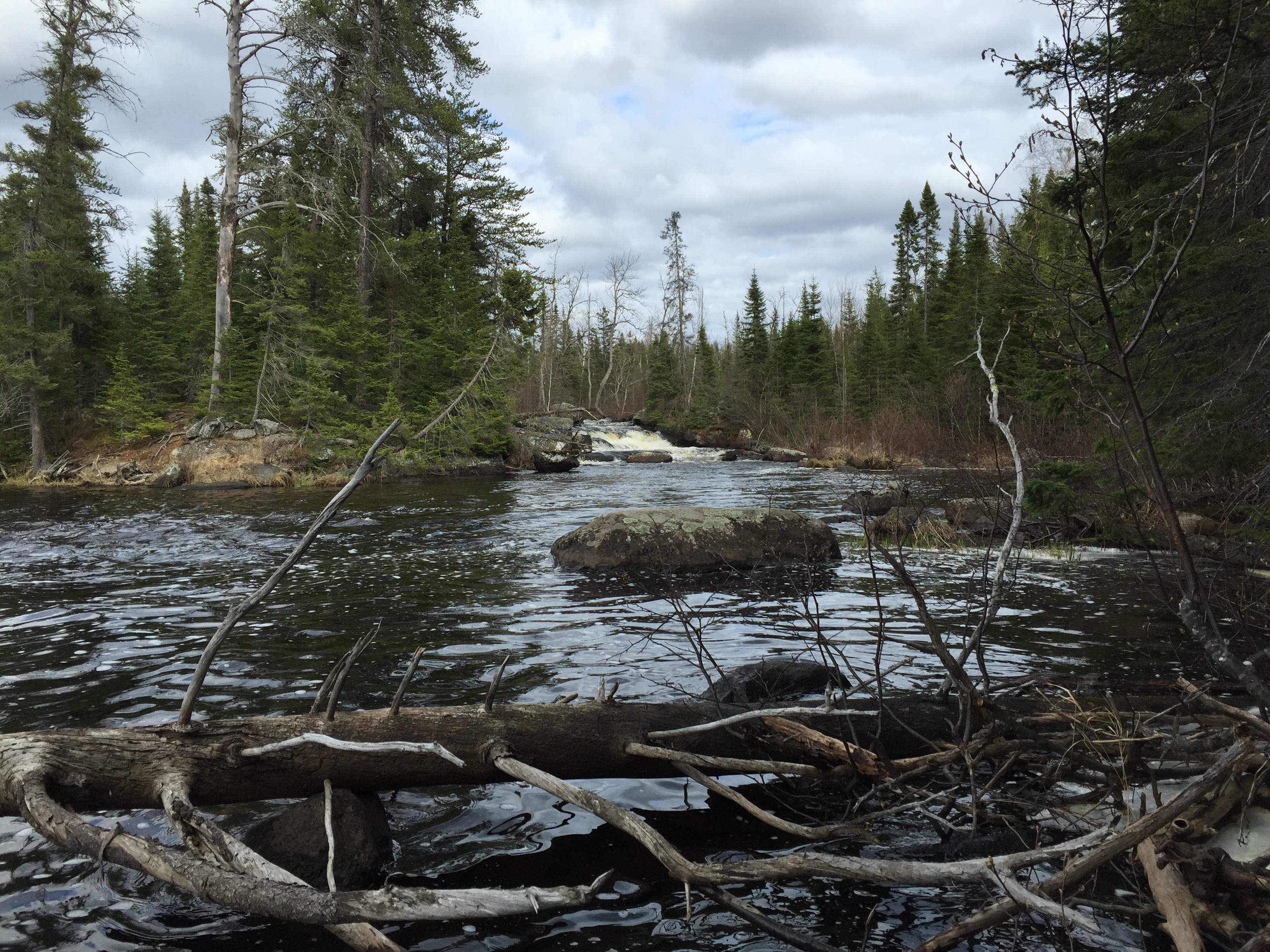
A look at the waterfall flowing in from Rib Lake. The Rib Lake portage starts on the far left of your view (May 12, 2016). Portage to Rib Lake -or- Explore Another Route **********************************************END OF ROUTE***********************************************