Possible origin of the name could be because there was some machinery and industry present on this lake in the 1800's and early 1900's for timber harvesting and/or mining.
Cam Lake is similar in size to Town Lake along this route, but it is much prettier. The lake is surrounded by high hills and cliffs and has one large island. The bay where the island is located is particularly scenic. A large talus debris field can be seen from out on the lake, just west of the Brule Lake portage.
The portages to and from this lake are rugged. The Brule Lake portage landing on the south end of Cam Lake is a tricky spot. You have to crawl out of your canoe onto huge boulders and then immediately lug your gear and canoe up a steep hill. Probably the worst landing of any of the portages between Cherokee Lake and Brule Lake, and most are pretty rough. Cam Lake supports descent fishing for northern pike, but no campsites. If you are coming from Cherokee Lake and heading to Brule Lake, you may be too tired by this point to bother with fishing. A better option may be to visit Cam Lake from Brule Lake.
Cam Lake collects water from Gasket Lake to its north through a little creek visible along the portage. Cam Lake itself drains south into big Brule Lake through another creek. The creek descends 30 feet and runs along the portage. Thus, this portage is generally downhill coming from Cam Lake and heading to Brule Lake.
References:
Beymer, Robert, Boundary Waters Canoe Area – Volume 2– Eastern Region (Berkeley: Wilderness Press, 2006), 77.
Pauly, Daniel, Exploring the Boundary Waters (Minneapolis: University of Minnesota Press, 2005), 262.
Click on the photos below to see the full resolution image - Use your browsers back button to close photo and return to this page.
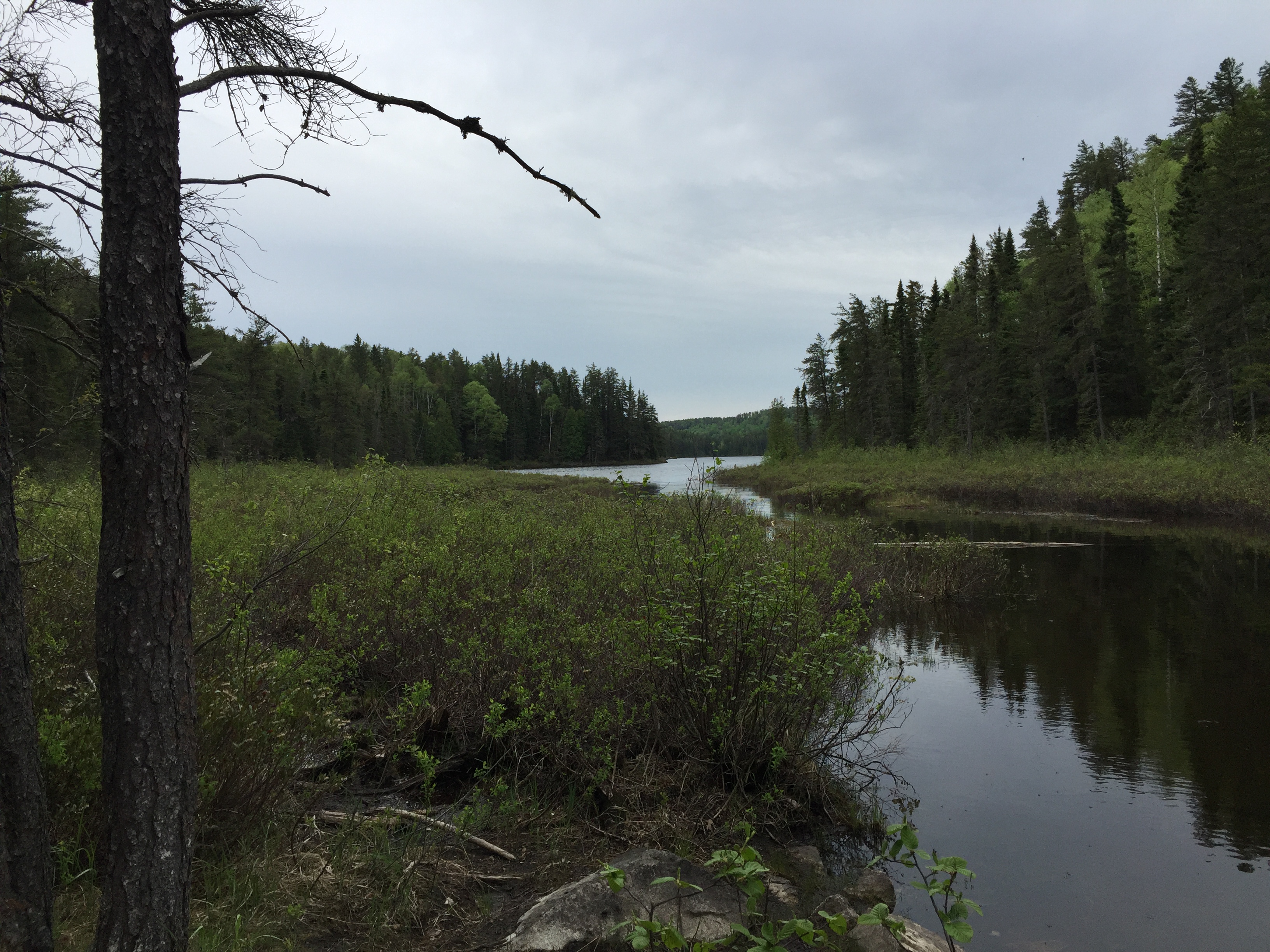
PADDLING FROM THE GASKET LAKE PORTAGE TO THE BRULE LAKE PORTAGE
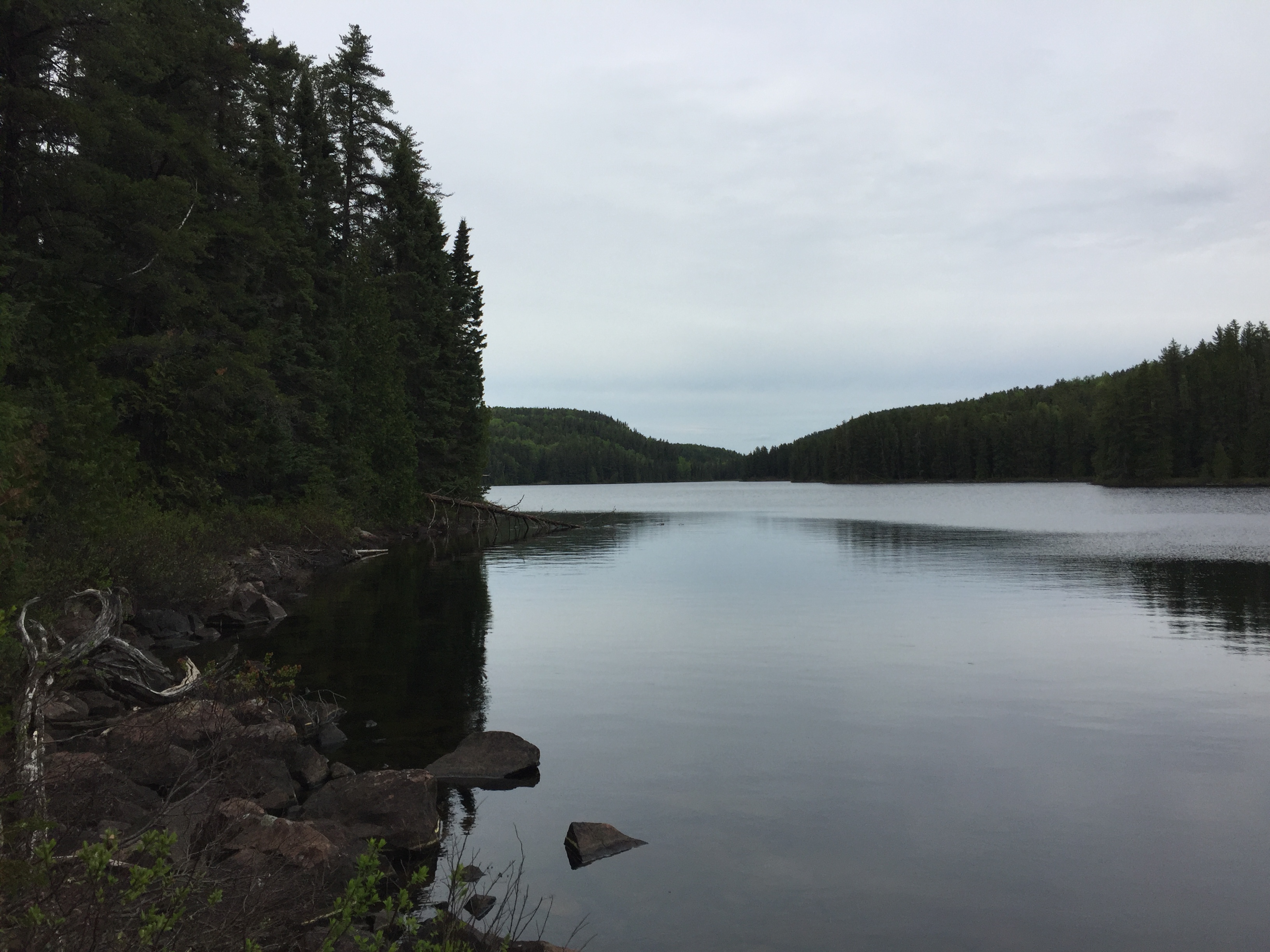
Looking south down the long channel leading out into Cam Lake. The Gasket Lake portage landing where you stand is mildly squishy underfoot, but should present little difficulty to intrepid paddlers.
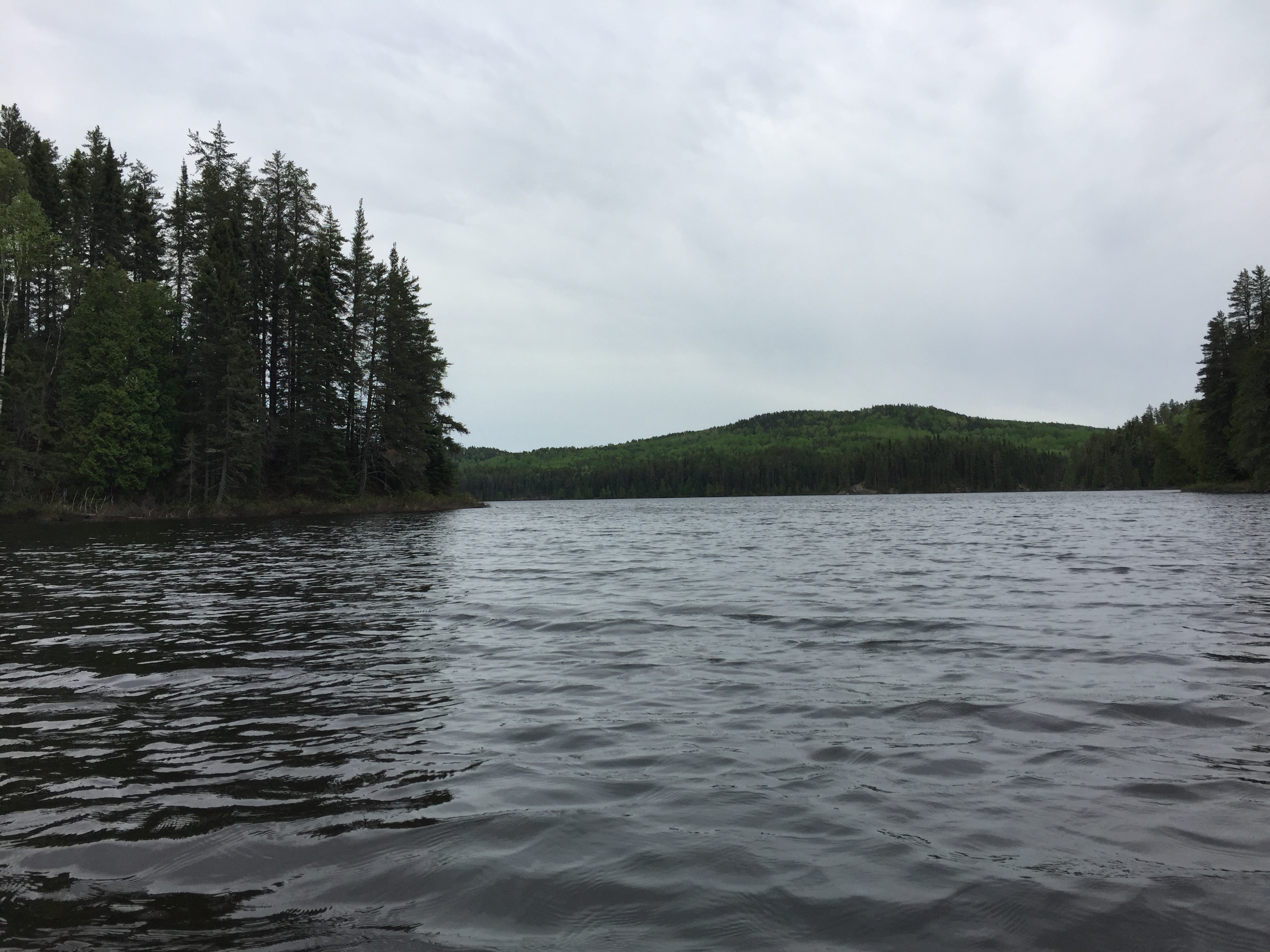
That hill in the distance, just to the right of center, rises to just over 2,100 feet. The surface of Cam Lake is at 1,864 feet.
You begin by paddling out through the narrow channel from the Gasket Lake portage. You stay along the east shoreline as you paddle southward. Cam Lake is surrounded by several prominent hills. You end your voyage across Cam Lake at the Brule Lake portage boulder pile. This is a difficult portage landing.
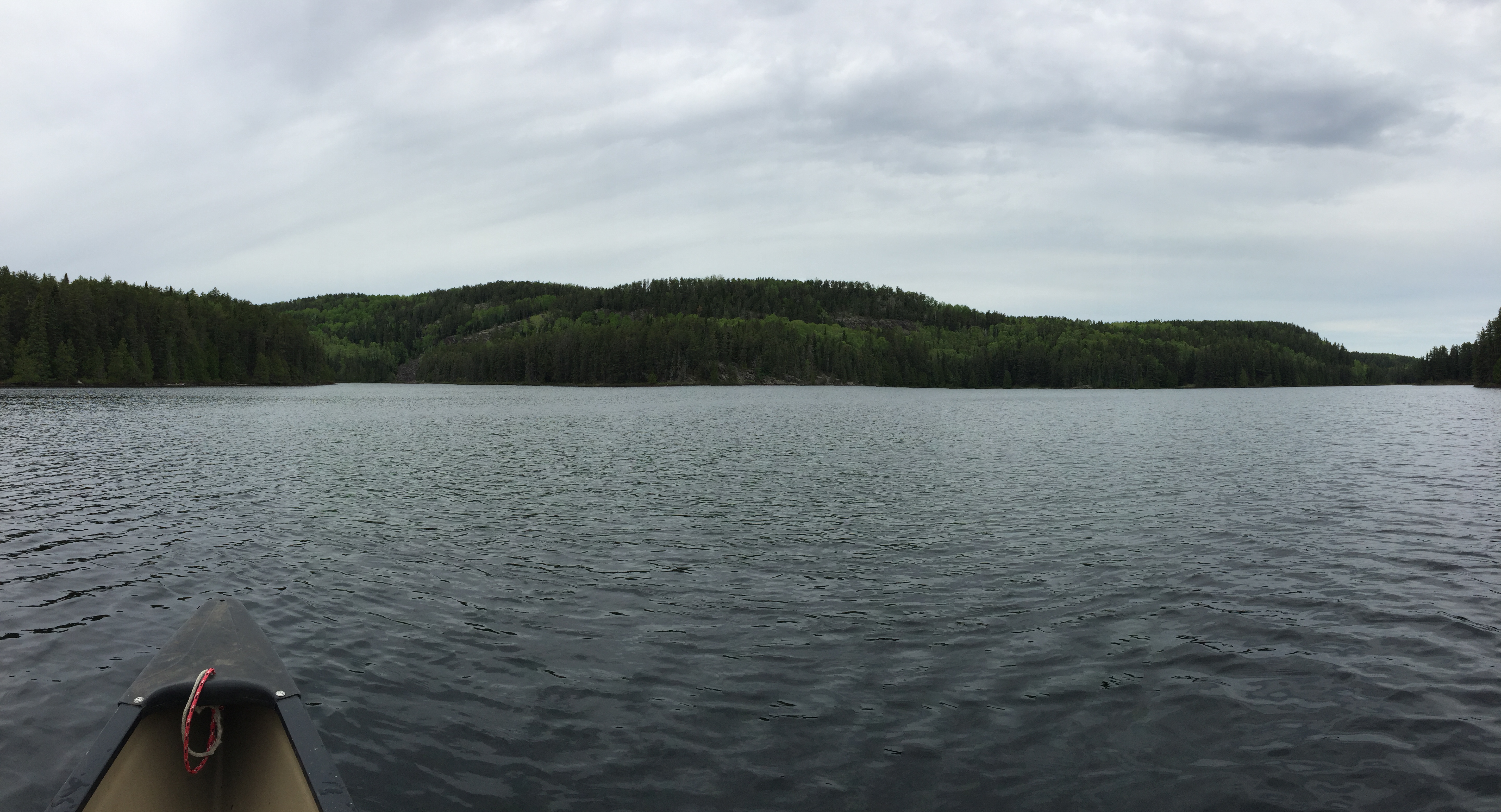
The Brule Lake portage is in that notch to the left side of your view. The west bay of Cam Lake extends over to the right.
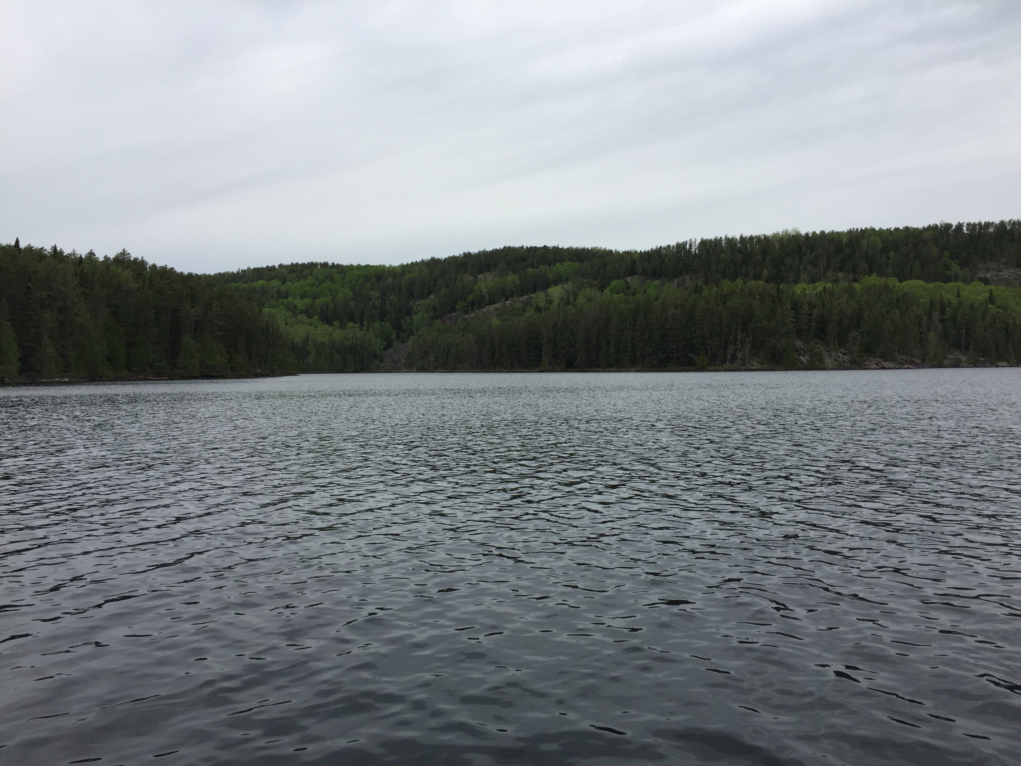
Heading toward the Brule Lake portage which is located near that large talus debris slope, just to the left of the center of your view. This is from near the middle of Cam Lake.
A view to the north of Cam Lake from the start of the Brule Lake portage. Portage to Brule Lake -or- Explore Another Route ***********************************************END OF ROUTE***********************************************