Gasket Lake is named after a mechnical part similar to Cam Lake which lies just to its south. This is one of the prettiest little lakes you can visit in this part of BWCA. You can bet your boots that you will have to earn the right to see this gem of a lake; the portages between Brule Lake and Cherokee Lake are some of the most rugged in the Boundary Waters. While no moose were seen on the visit here, there was plenty of evidence of these gangly critters. Only encountered a single canoe with two guys in it between Cherokee Lake and Brule Lake on a trip just before Memorial Day weekend, so the area appears to be only lightly traveled.
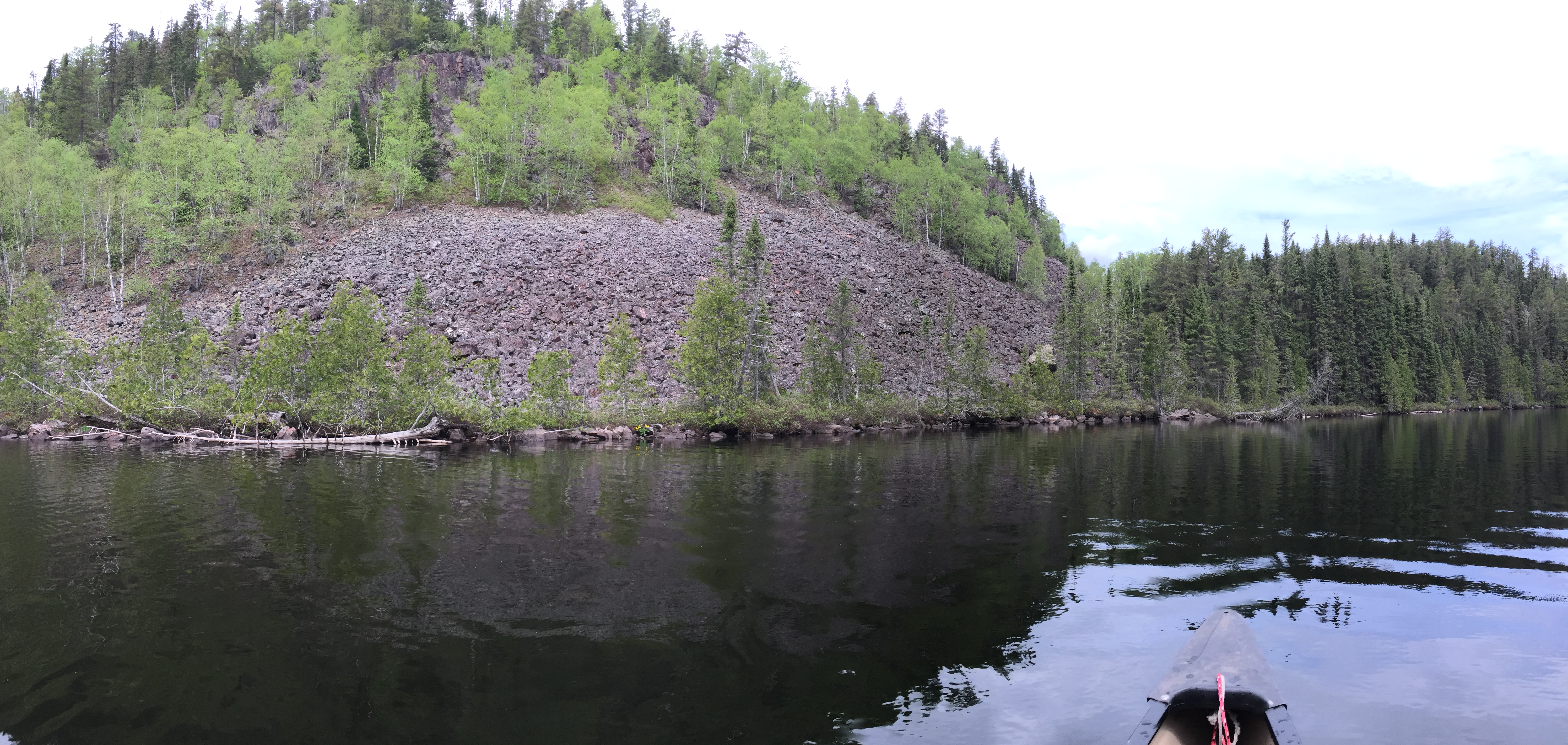
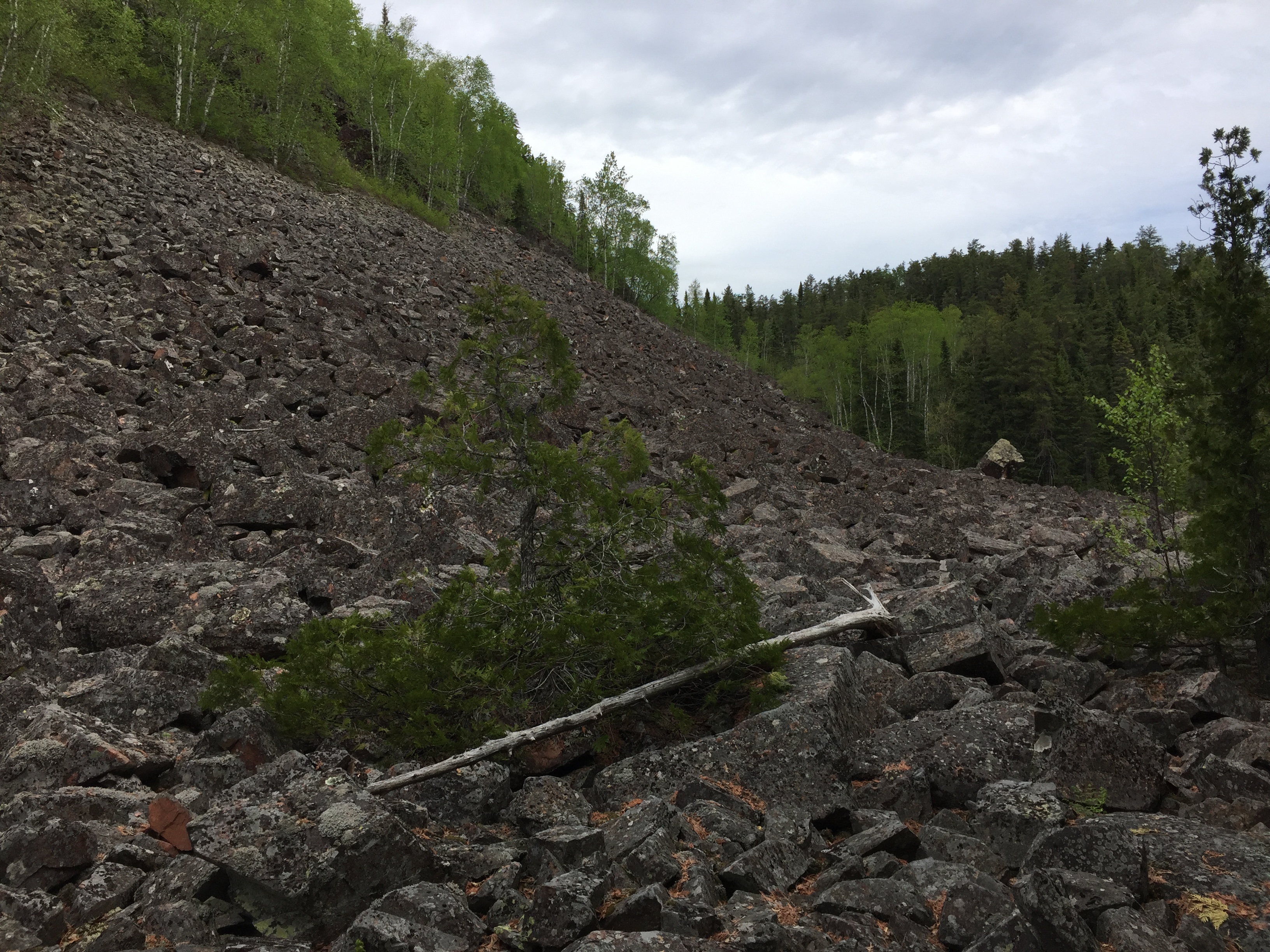
Gasket Lake has a huge cliff overlooking its southwest corner. Massive amounts of stone from pebbles to boulders the size of a small house have tumbled down in front of this cliff forming a gigantic talus debris slope that extends right down to the water. You can get a good view of the talus and even walk out onto it from the portage landing to Cam Lake, which is on the south end of Gasket Lake. The cliff is over 250 feet high. The hill rises up further behind the cliff to over 2,100 feet above sea level. The east side of Gasket Lake is also quite spectacular with several cliffs of its own. The hills on the east side of the lake rise over 300 feet above the lake, topping out at just over 2,200 feet in elevation and is one of the highest elevations in Minnesota. The water of Gasket Lake is clearer than average, but the fishing seems to be sub par. The lake seems to be fairly shallow, except along parts of the east shore below the cliffs. The scenery makes the lack of fish easily bearable.
The portage between Vesper Lake and Gasket Lake is over the Laurentian Divide, so it involves quite a bit of elevation change.
There are no campsites on this lake; the same goes for Vesper Lake to the north and Cam Lake to the south. Make sure you leave plenty of time to get from Cherokee Lake to Brule Lake, as there is only a single campsite along this route on the south shore of Town Lake. The going will be rather slow through here because of the challenging portages.
Gasket Lake has no inlets, just runoff and springs from the surrounding hills and cliffs. The water from the lake flows out a tiny creek to the south into Cam Lake.
References:
Beymer, Robert, Boundary Waters Canoe Area – Volume 2 – Eastern Region (Berkeley: Wilderness Press, 2006), 77.
Click on the photos below to see the full resolution image - Use your browsers back button to close photo and return to this page.
PADDLING FROM THE VESPER LAKE PORTAGE TO THE CAM LAKE PORTAGE
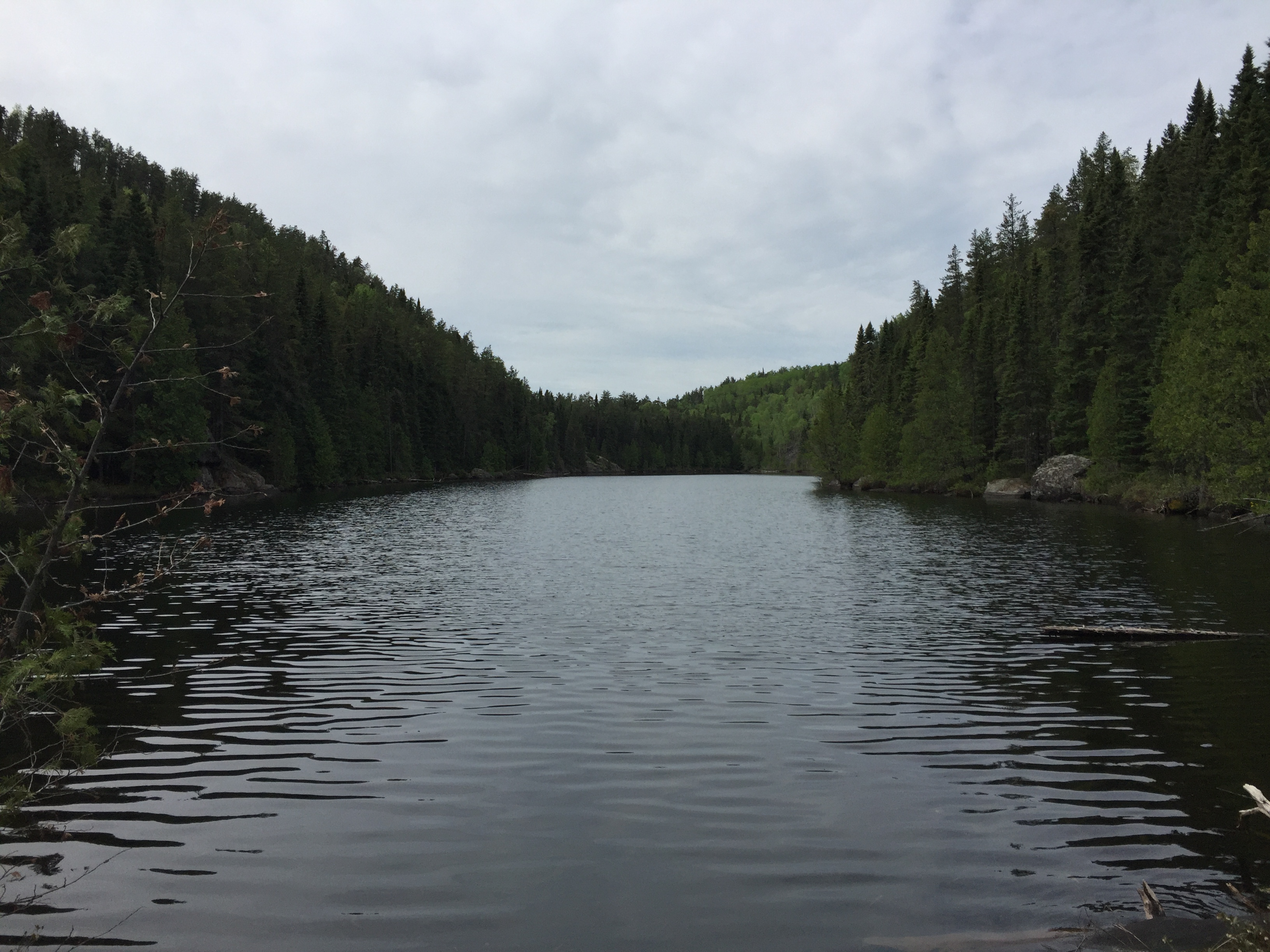
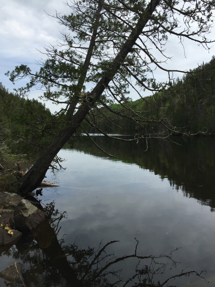
A view down narrow Gasket Lake toward the south. You are viewing the lake from the Vesper Lake portage. This lake somewhat resembles an alpine lake.
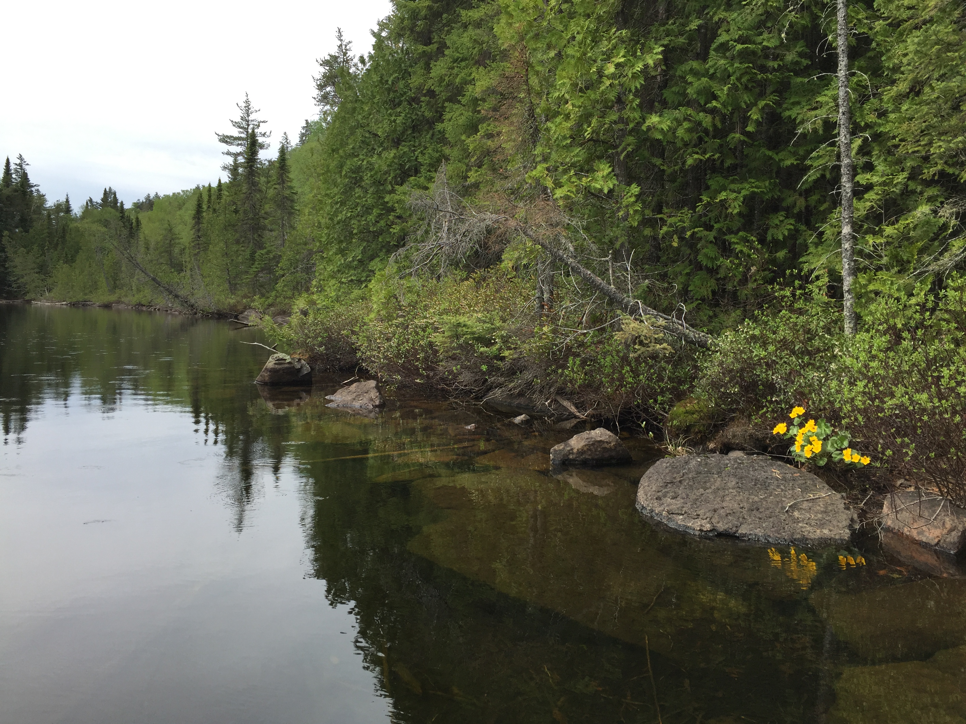
Gasket Lake is quite clear. Many colorful flowers grow along its shoreline. I think this yellow flowered plant is a marsh marigold.
Paddling south down Gasket Lake starting from the Vesper Lake portage. (Missed some of the middle of the lake due to camera issues.) Last part of the video is paddling the south part of Gasket Lake up to the Cam Lake portage. A huge talus slope has formed below a high cliff to your right and this feature dominates the southwest shoreline of the lake near the portage.
As you approach the south end of the lake, a huge talus slope is visible along the southwest shoreline.
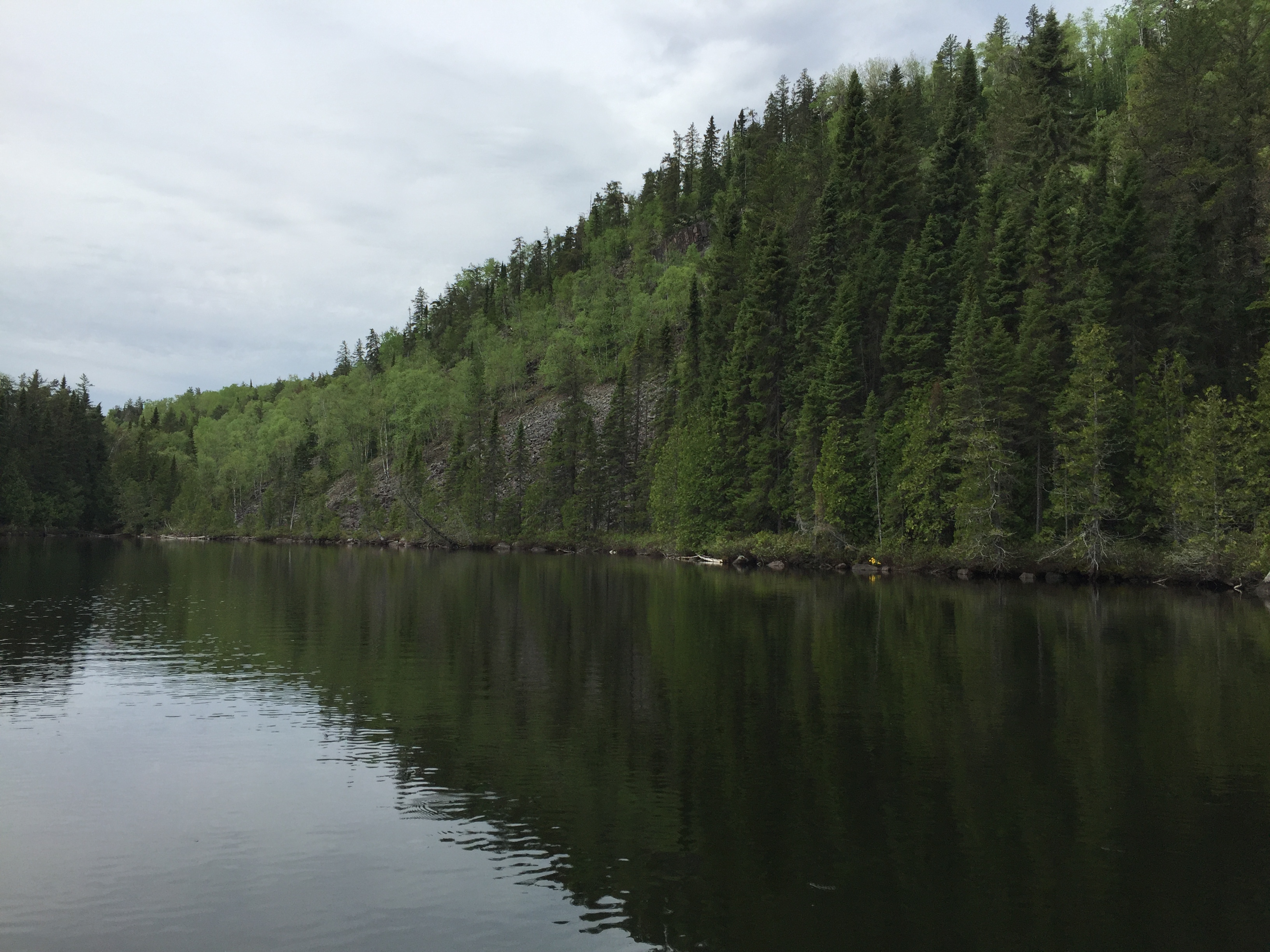
A view of the talus slope below the high cliff as seen from the east side of the lake. The cliff rises almost 200 feet above the water.
Gazing north up Gasket Lake from near the beginning of the Cam Lake portage.
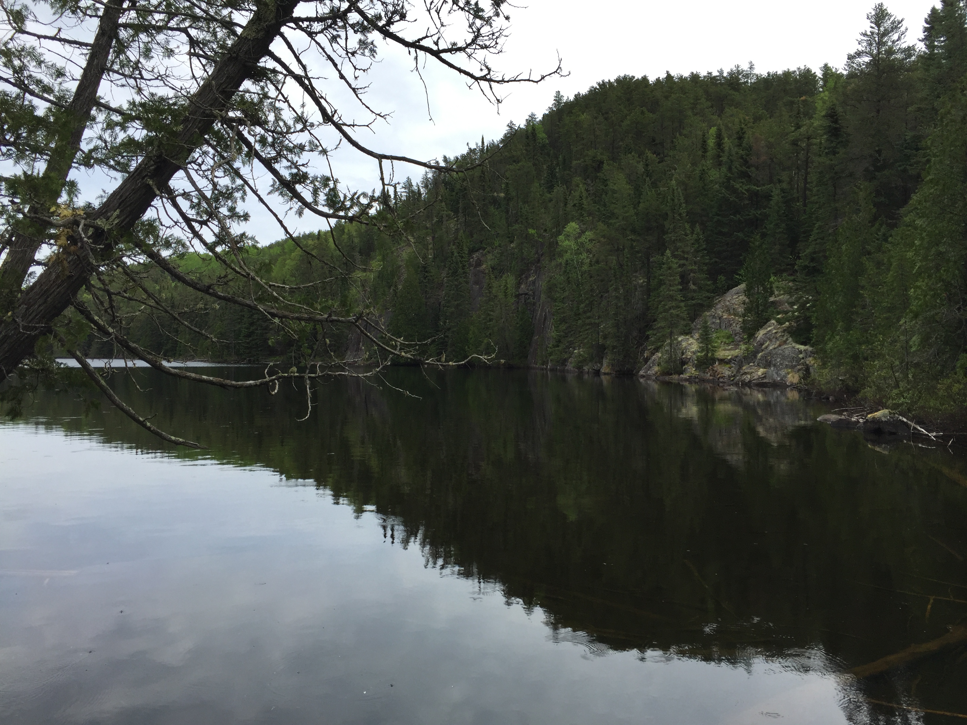
The east shore of the lake has several high cliffs rising up directly from the waters edge. Your view is of the southeast shore of the lake looking toward the northeast. The hill in the background is one of the highest elevations in Minnesota and rises over 300 feet above Gasket Lake.
It is easy to walk out onto the talus slope. It is accessible from the Cam Lake portage. Portage to Cam Lake -or- Explore Another Route ***********************************************END OF ROUTE***********************************************