Janis Lake
Have not yet visited this Primitive Management Area lake. The information displayed on this page are notes used for planning a future trip to this area. Use the information on this page at your own risk.
Probably doesn’t get its name from the singer Janis Joplin! Janis is a form of the name ‘Jane’ and probably refers to some woman whose existence is now lost to history.
Much of the area around Janis Lake was torched by the 2011 Pagami Creek Fire. The lake did offer some protection to the forest along its shores, so some trees remain in the area.
In 1875, a fire began in the August Creek area, a notable stream that runs through this region. This fire swept along August Creek and then spread and burned the forests around Bald Eagle Lake and Clearwater Lake.
What is a Primitive Management Area (PMA)?
Approach to Janis Lake
Click on the photos below to see the full resolution image - Use your browsers back button to close photo and return to this page.
You view (photo is somewhat blurry) looking at mouth of the small creek flowing into the marshy southwest corner of Spinnan Lake. Entering this creek will start you on your way out to Janis Lake.
It is a long ways out to little Janis Lake. Would recommend trying this route during high water as it appears from satellite images that perhaps half of the creek between Janis Lake and Spinnan Lake could be navigable in a lightly loaded canoe. This creek flows through a peat bog with the burned out shell of a forest farther back from the creeks banks.
About two-thirds of a mile (220 rods or so) along, the creek passes through a small pond. From the west side of this pond, leave the creek altogether and head south/southwest along the edge of the peat bog until you are due north of Janis Lake. This traverse of the peat bog is about 100 rods in length. The GPS point due north of Janis Lake is: 47.868991, -91.477645. If you’re not using GPS, this location is at the south end of the peat bog. From here, head straight south through burned forest. It is only another 35 rods to the north shore of Janis Lake. The total route is just over a mile in length between Spinnan Lake and Janis Lake.
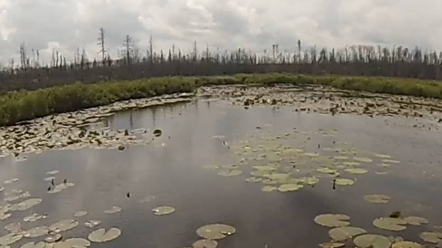
Exploring Janis Lake
Janis Lake is a small, shallow lake with some vegetation on its surface. The north half of the lake was spared extensive damage from the 2011 Pagami Creek Fire; the southern half of the lake was not so fortunate. If you have made it all the way to Janis Lake, you are now in position to proceed on the easiest route to Kayoshk Lake. This lake gets its name from the Ojibwa word ‘gayaashk’ which means ‘gull’. Kayoshk Lake is south of Janis Lake and lies just over half a mile away through fire scorched forest.
|

