LAKE TWO CAMPSITES: Lake Two Campsite 1 (1679) - Located up the long north arm of lake Lake Two Campsite 2 (1527) - On island 1/4 mile south-southeast of Lake One portage Lake Two Campsite 3 (1523) - West end of prominent point in southwest part of lake Lake Two Campsite 4 (1522) - At the back of dead end bay along the south edge of lake Lake Two Campsite 5 (2330) - Only site on the small island near the middle of the lake Lake Two Campsite 6 (1529) - Second site to the east of the Lake One portage Lake Two Campsite 7 (1526) - On south side of lakes largest island (most maps show it incorrectly on north side) Lake Two Campsite 8 (1525) - On point near mid-lake jutting out from south shoreline Lake Two Campsite 9 (1528) - Just northeast of Lake One portage Lake Two Campsite 10 (1530) - On prominent point just west of long north arm of lake Lake Two Campsite 11 (1524) - Just west of the Rifle Lake portage Lake Two Campsite 12 (1487) - East most campsite on the lake back in bay
Lake Two is another lake along the Kawishiwi River. Do not expect to find solitude on this lake (or any of the numbered lakes for that matter). Water flows into Lake Two from Lake Three and flows out of the lake to Lake One through two separate channels. One channel forms the long north finger of Lake Two. A series of strong rapids at the north tip of this finger flows down into Lake One. There is no portage around these rapids and this area has a lot of current and can be quite dangerous. These rapids begin just past the campsite you'll find in that area (BWCA Campsite 1679).
The other outflow from Lake Two is over a set of rapids on the north side of the lake. These rapids form two sections separated by a small lake (known as Confusion Lake). The standard travel route between Lake One and Lake Two is via the two short portages, separated by Confusion Lake. These portages are beaten flat by the heavy traffic they receive.
Lake Two offers relatively easy access to part of the Weasel Lake Primitive Management Area (PMA). Access is via an unmaintained portage along a small creek located in the southwestern bay of Lake Two. This unmaintained portage leads to Rock Island Lake. You need a separate permit to camp there, as it is within a PMA. There used to be a maintained route that is shown on old maps that went from Lake Two to Clearwater Lake. This was a long and miserable portage even before it was severely damaged by the 2011 Pagami Creek Fire. This route is no longer maintained and would be a difficult bushwhack.
Lake Two has about 13 miles of shoreline. Northern pike, smallmouth bass and walleye are all present in the lake. The entire south side of Lake Two was burned by the 2011 Pagami Creek Fire. Most of the campsites alonged the burned shoreline are back in service. Many were not completely burned either; they have a few large trees still standing that survived the fire.
Between 1893 and 1923 the area around Lake Two saw heavy logging carried out by the Knox Lumber Company, which was then followed by the St. Croix Lumber Company. The dam between Lake One and Lake Two was built during this time to facilitate floating logs along the Kawishiwi River drainage (Heinselman, 1999).
If you are looking for the quietest campsites on Lake Two (off the beaten path at least a little bit), check out BWCA campsites 1679 (up the long north arm), 1522 (back of the south bay) and 1487 (east end of lake back in the bay).
References:
Beymer, Robert, Boundary Waters Canoe Area – Volume 1 – Western Region (Berkeley: Wilderness Press, 2006), 186, 189, 192, 201, 213, 219, 225, 233, 241, 247.
Beymer, Robert, Boundary Waters Canoe Area – Volume 2 – Eastern Region (Berkeley: Wilderness Press, 2006), 46.
Heinselman, Miron, The Boundary Waters Wilderness Ecosystem (Minneapolis: University of Minnesota Press, 1999), 100, 200.
Pauly, Daniel, Exploring the Boundary Waters (Minneapolis: University of Minnesota Press, 2005), 181.
Click on the photos below to see the full resolution image - Use your browsers back button to close photo and return to this page.
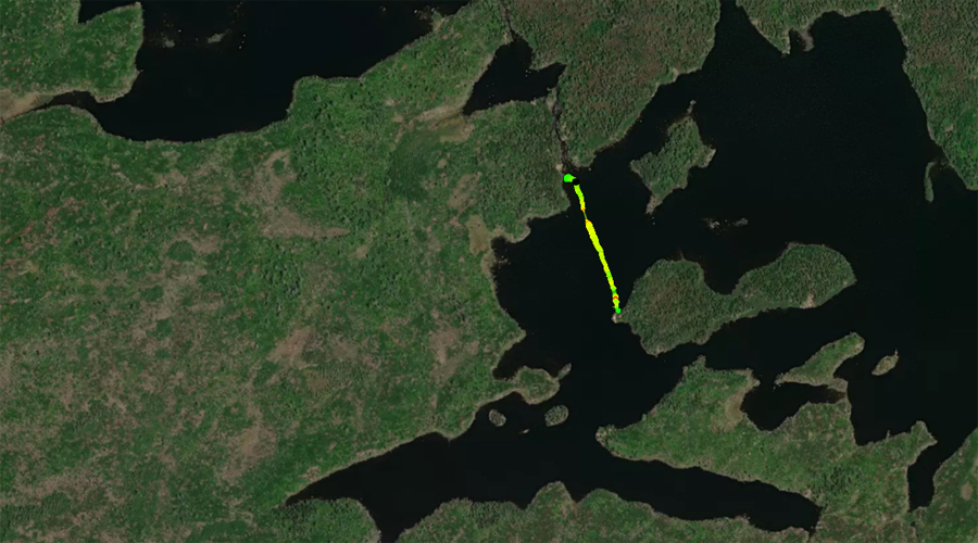
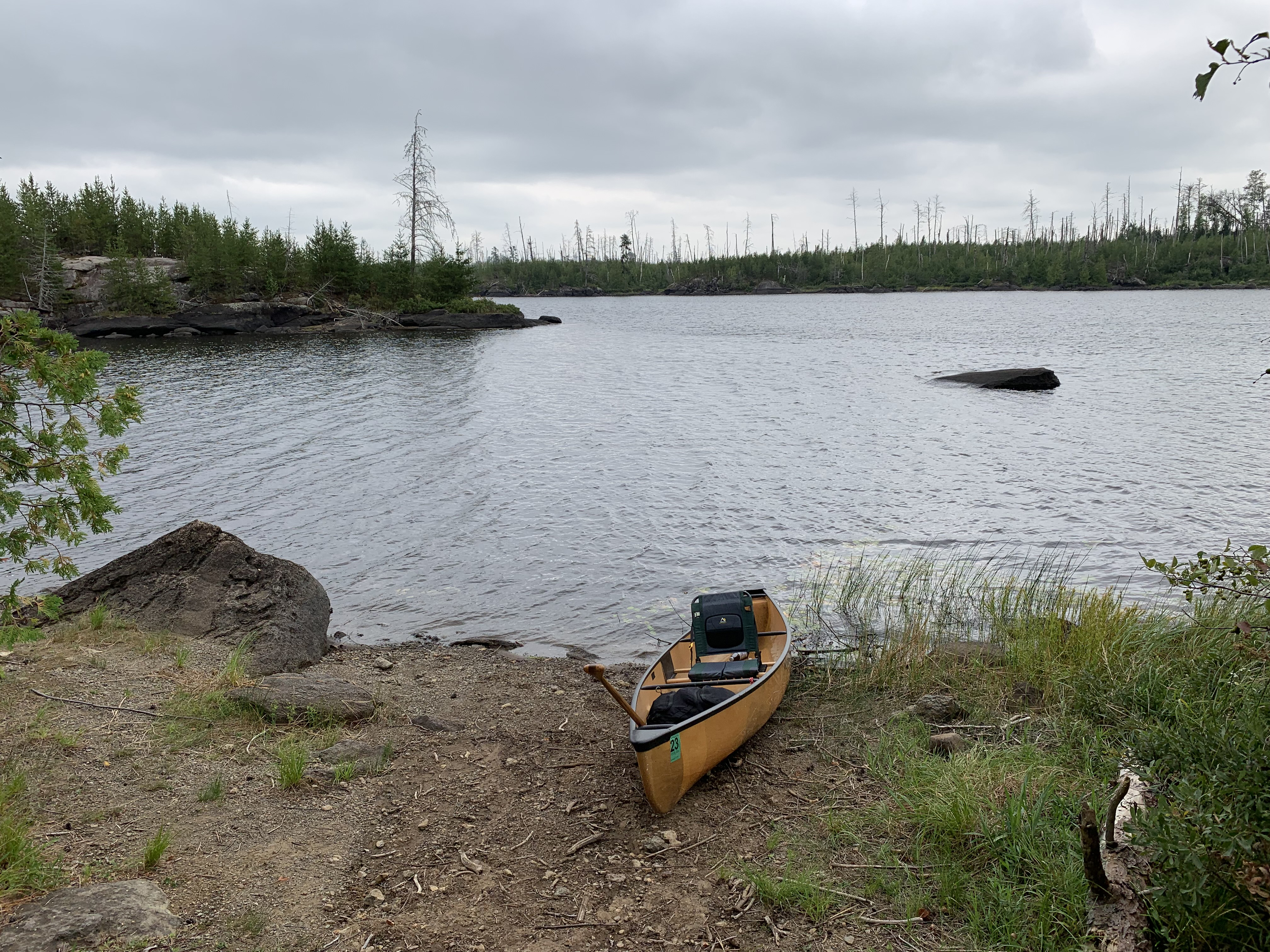
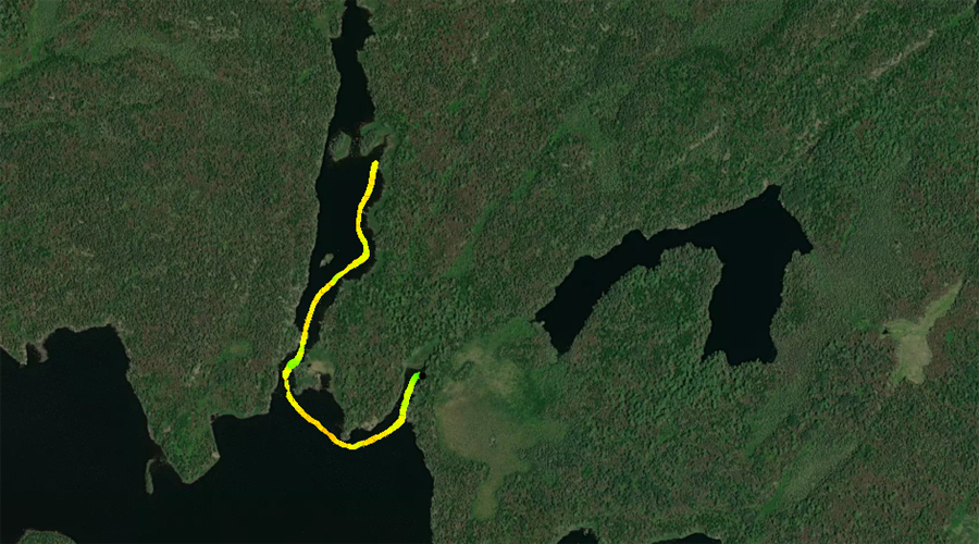
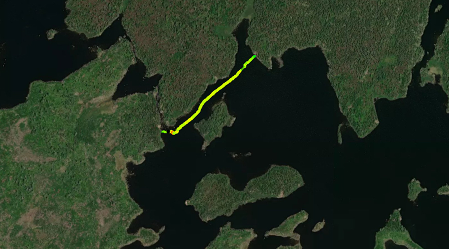
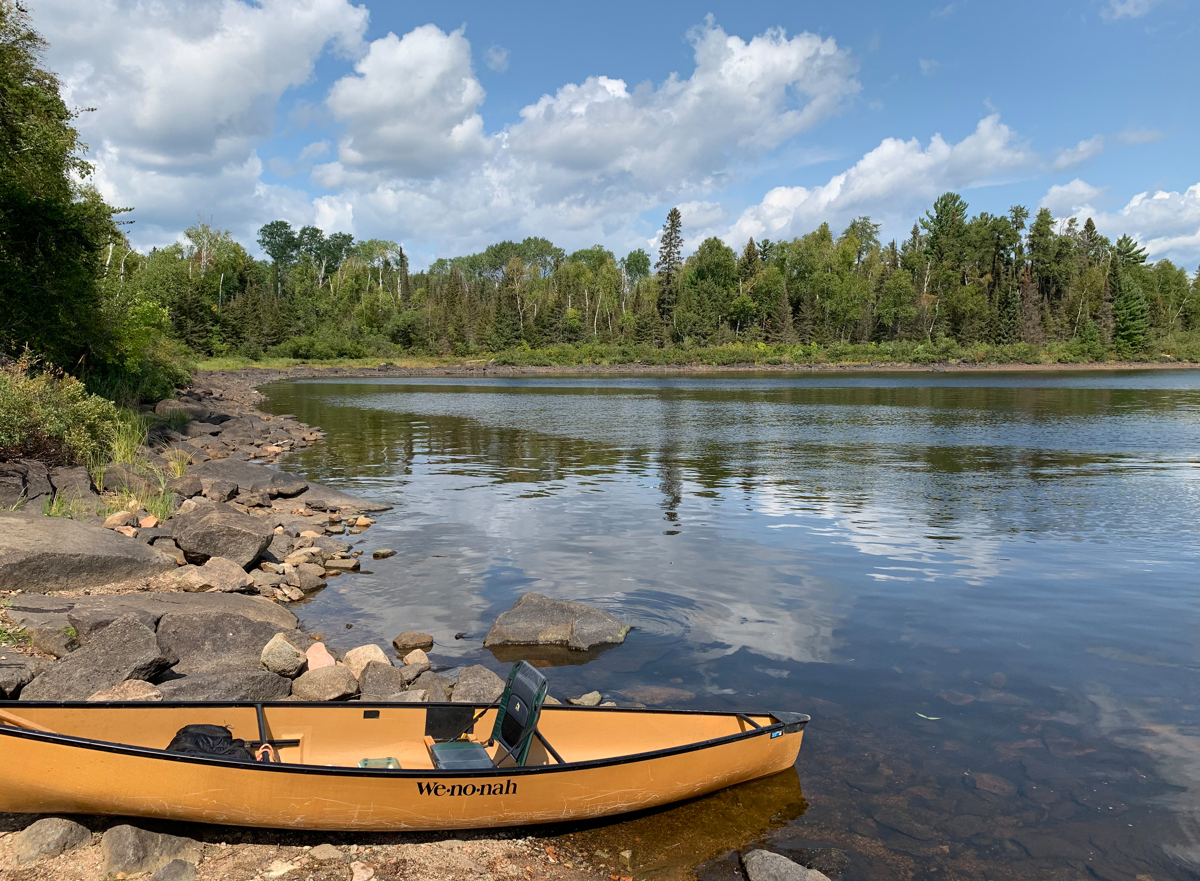
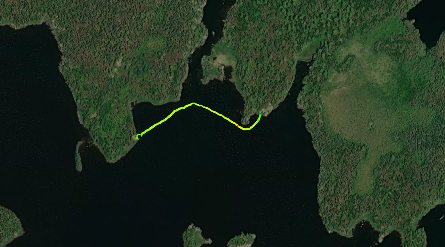
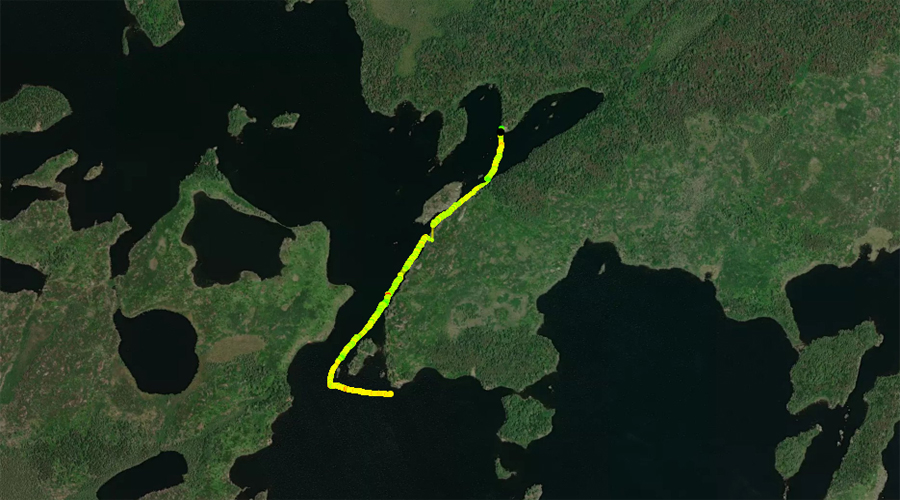
PADDLING FROM THE LAKE ONE PORTAGE TO BWCA CAMPSITE 1527
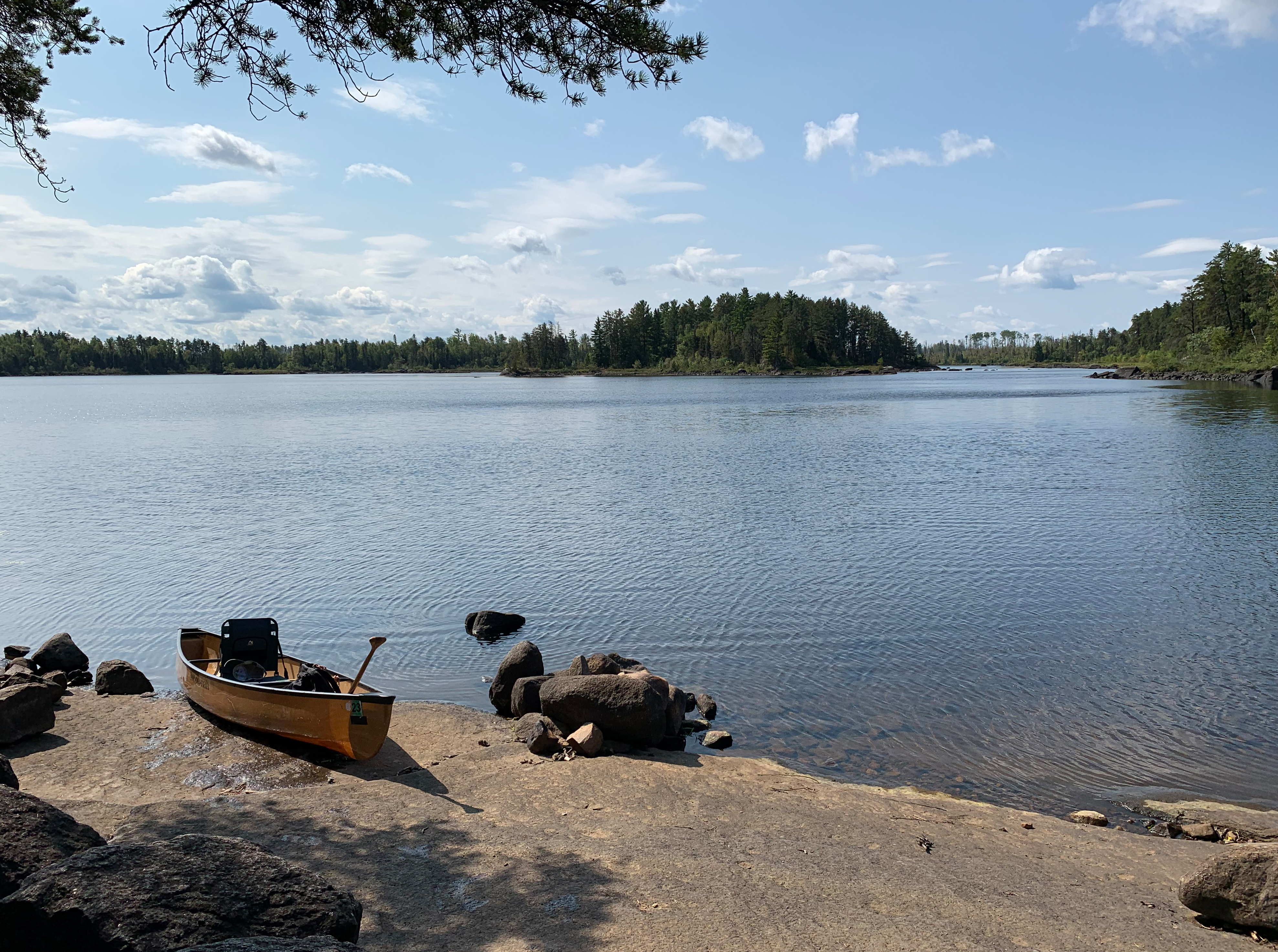
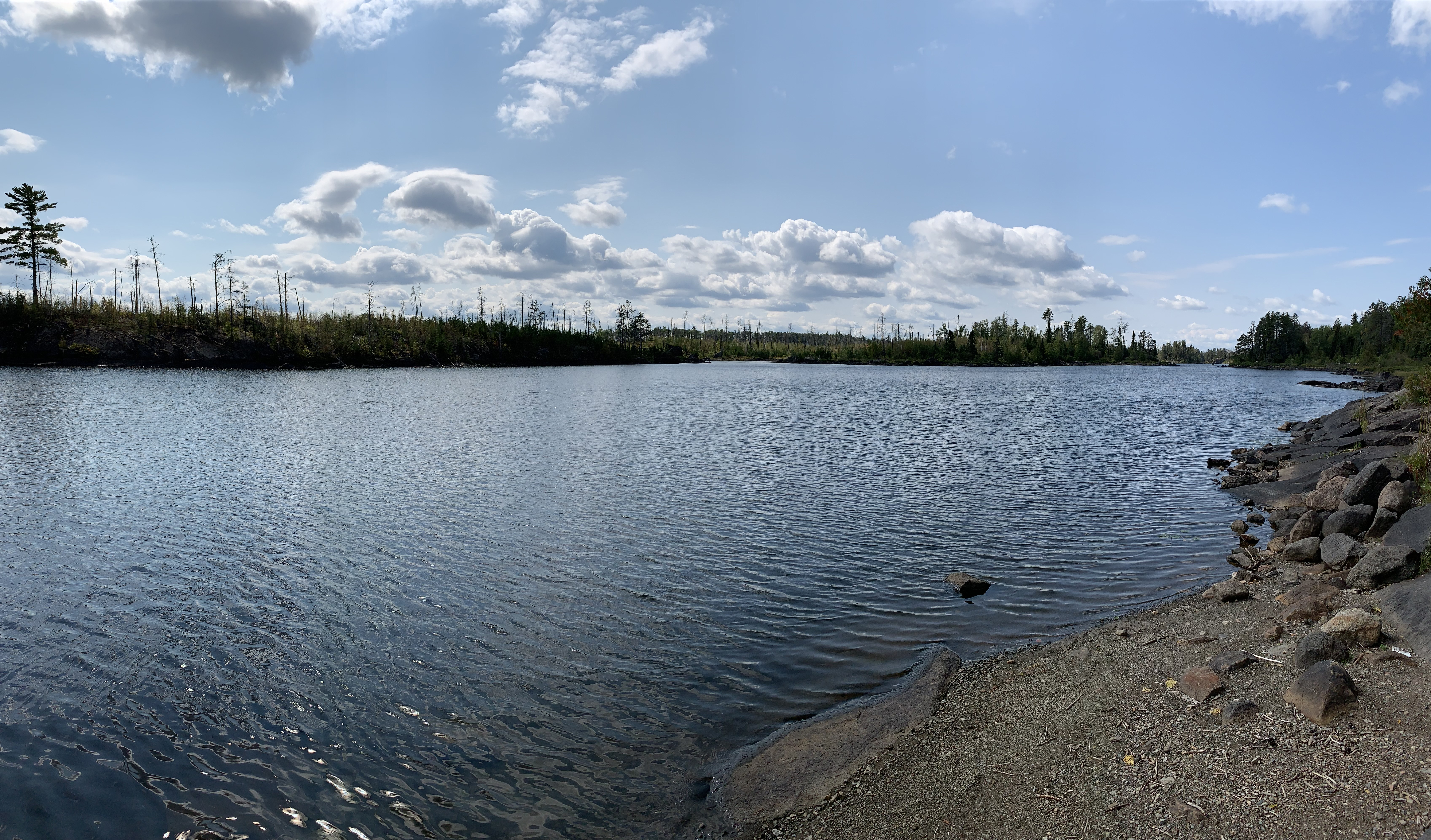
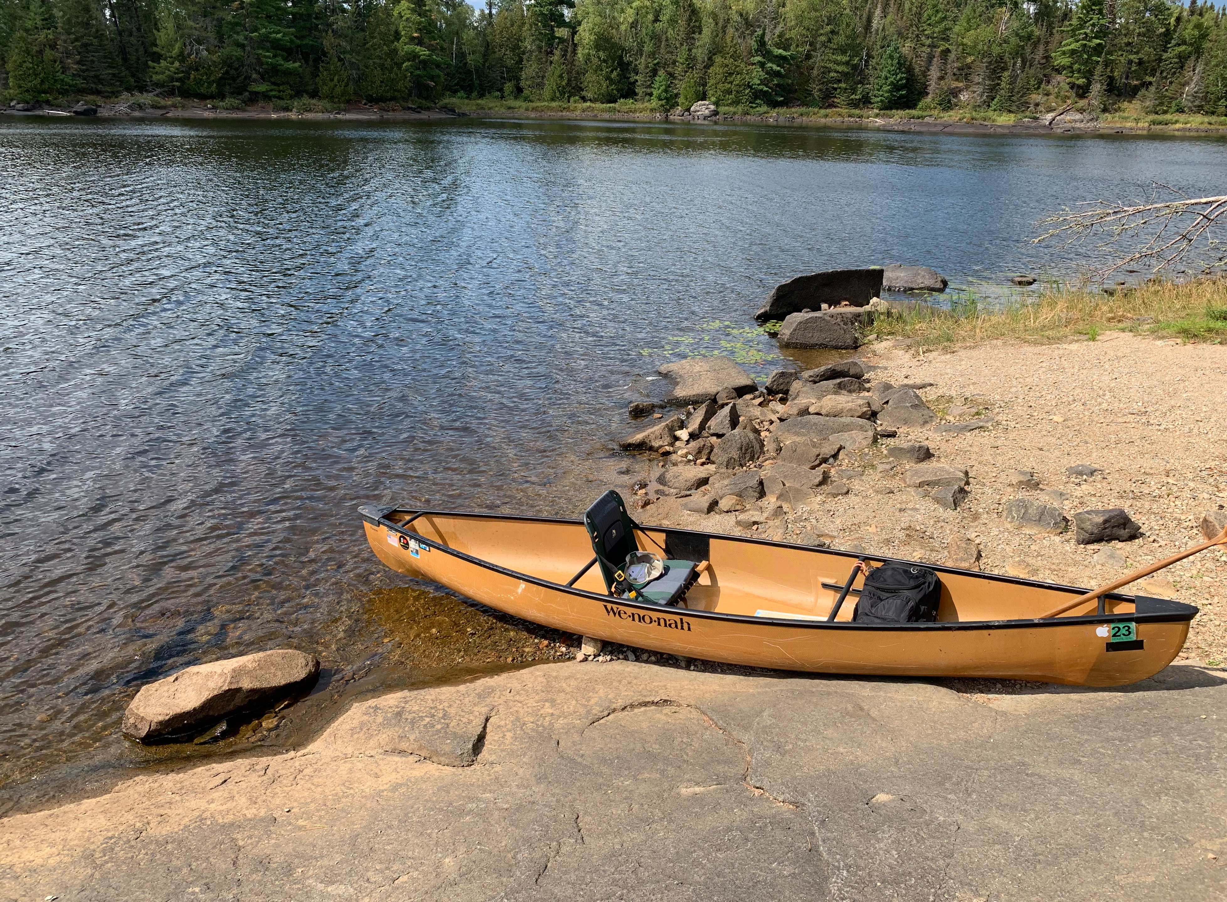
The landing at the Lake One portage on Lake Two during low water conditions (August 7, 2021).
A short paddle of about a quarter of a mile or so to the south/southeast to reach the campsite.
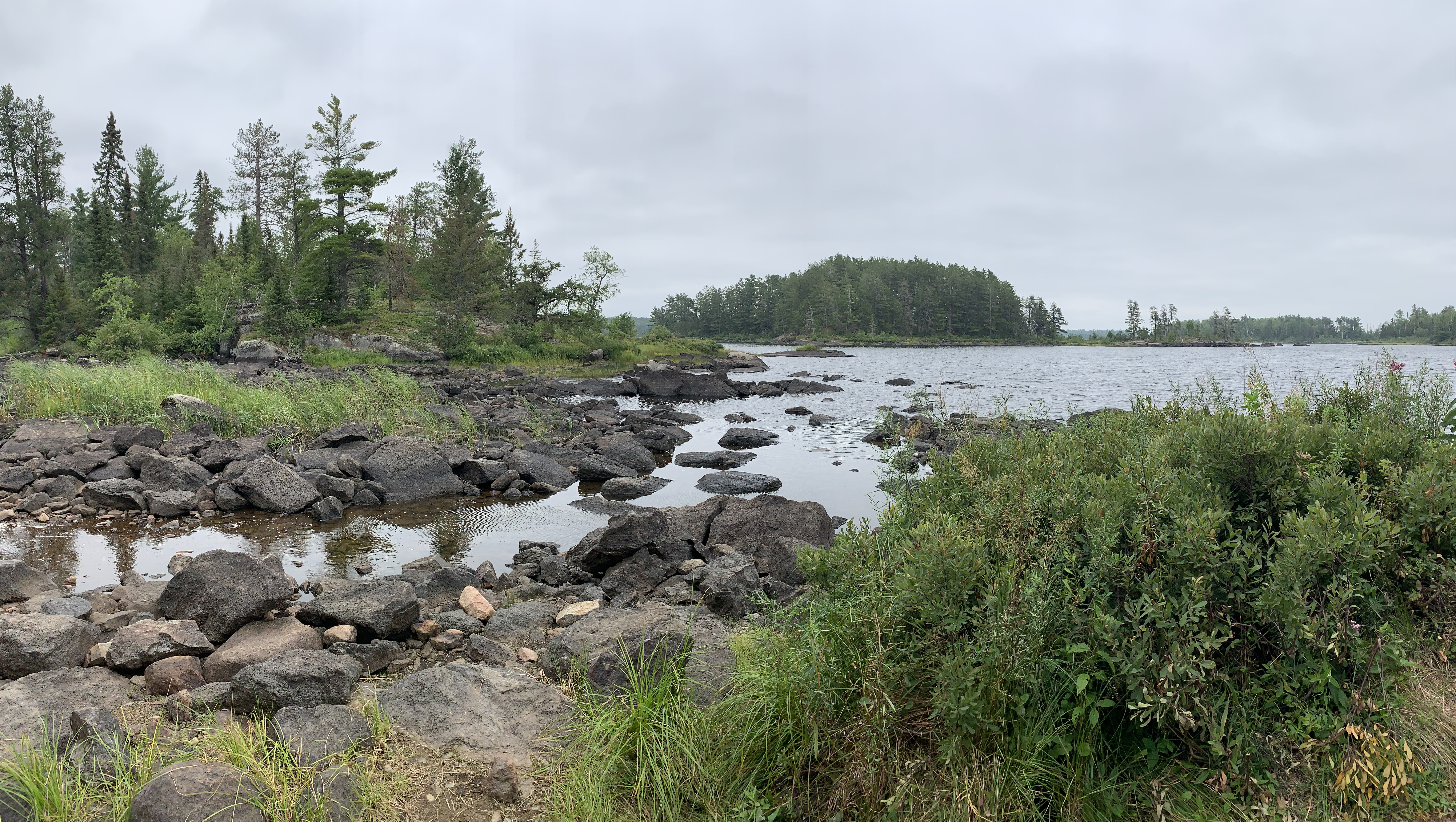
View after landing your canoe at BWCA Campsite 1527. View to the north/northeast. The Lake One portage landing is along that far shoreline on the extreme left (August 7, 2021). Visit the Campsite -or- Explore Another Route ***********************************************END OF ROUTE***********************************************
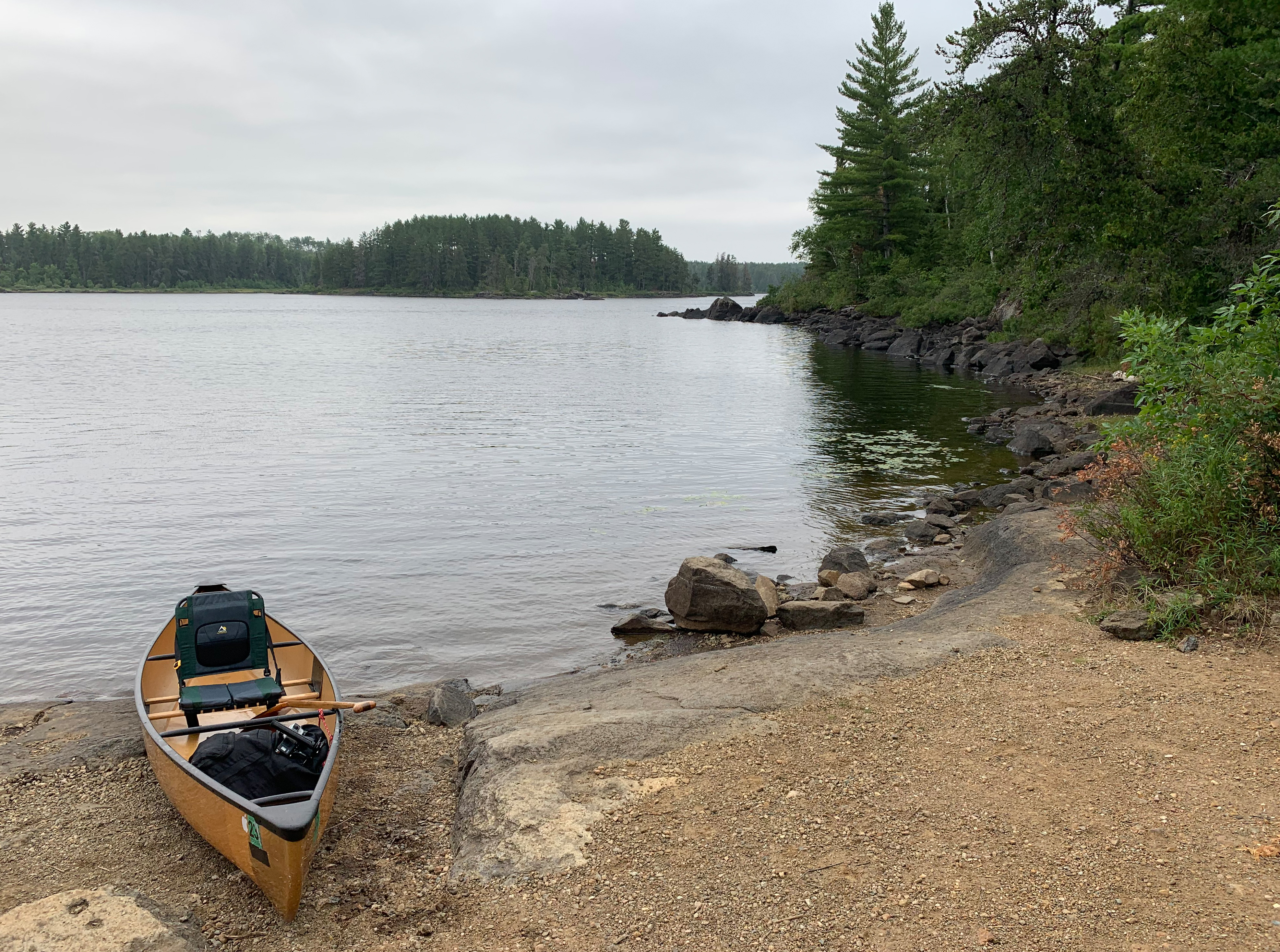
PADDLING FROM BWCA CAMPSITE 1527 TO THE LAKE ONE PORTAGE
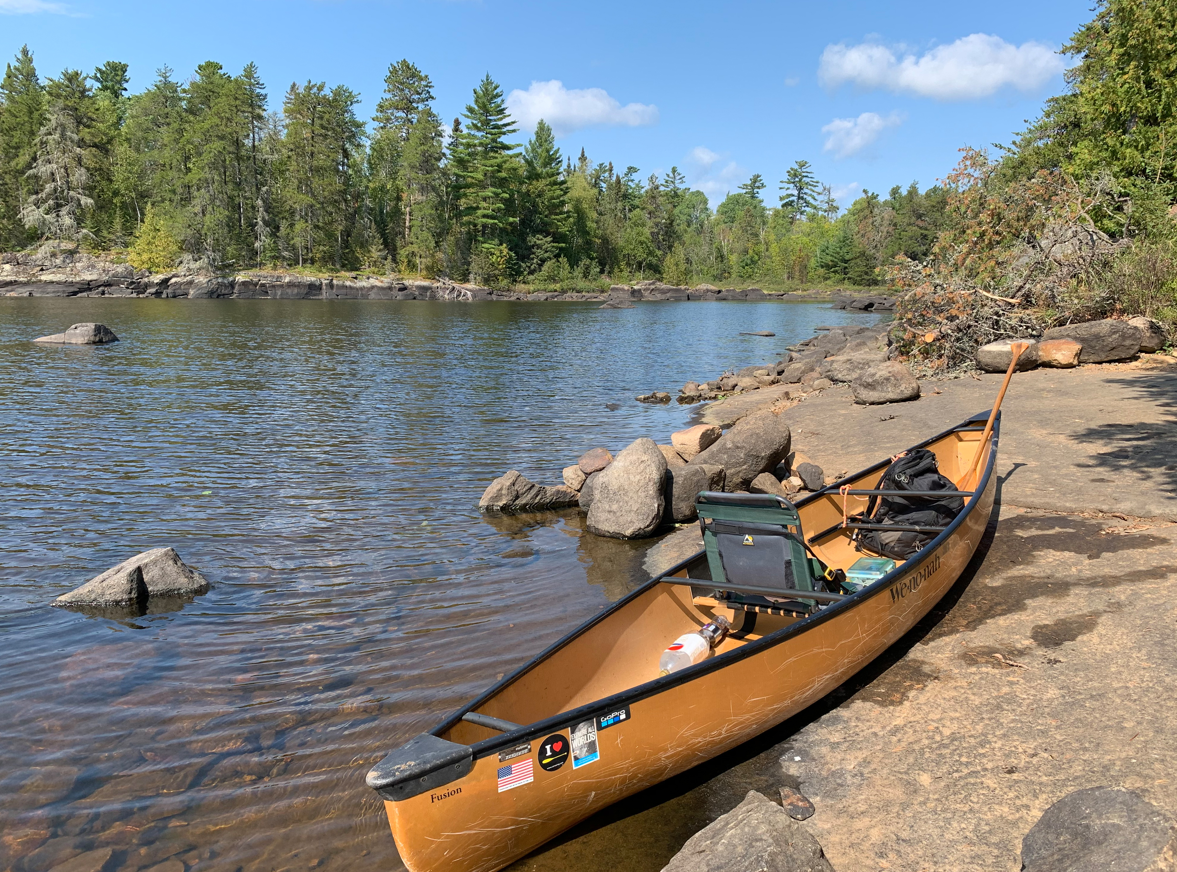
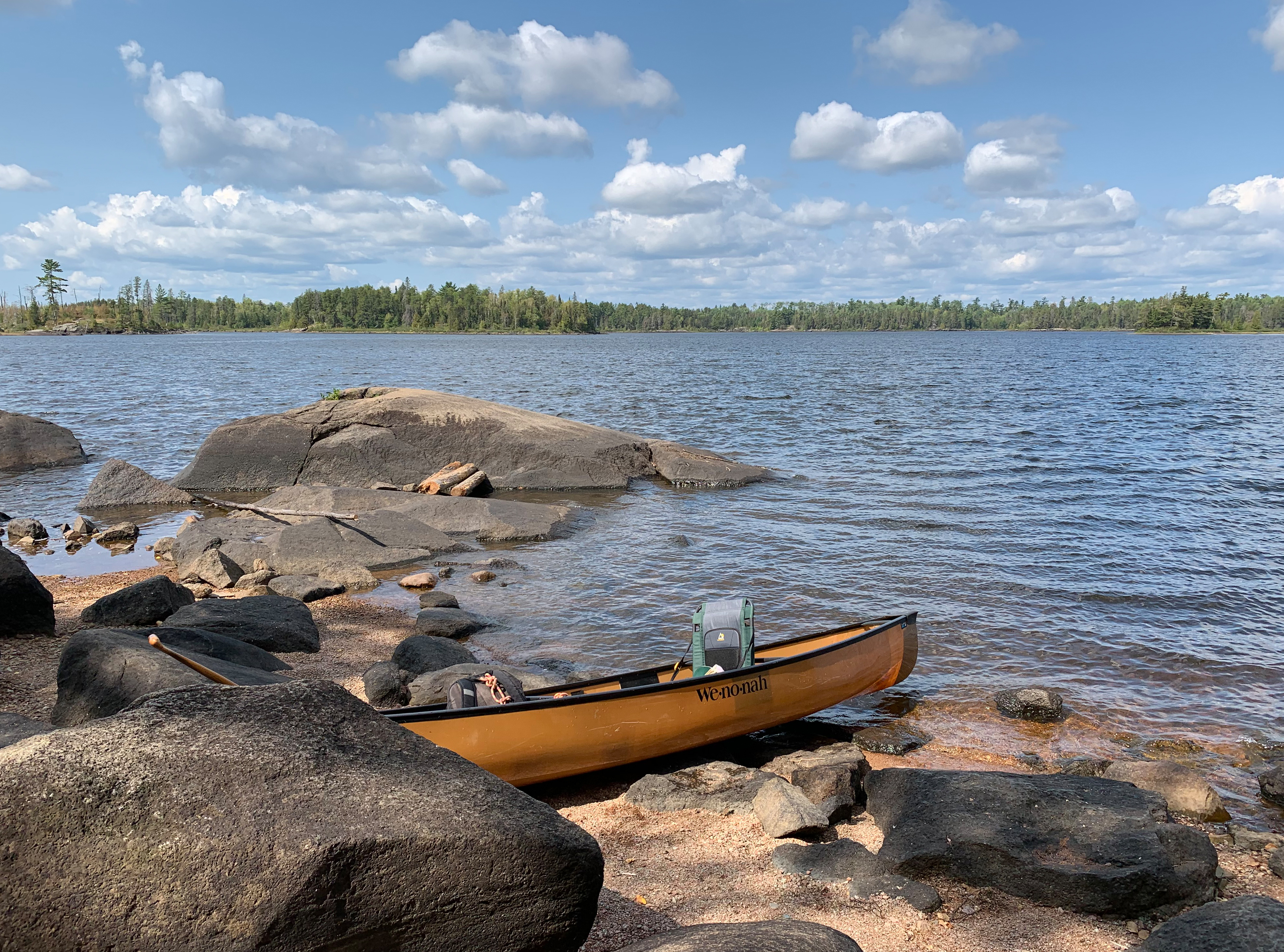
Paddling from the island where the campsite is located over to the start of the portage to Lake One.
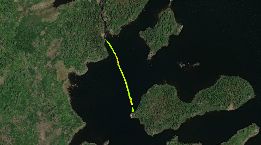
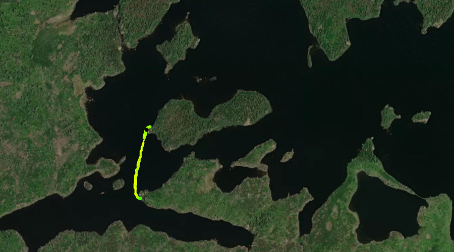
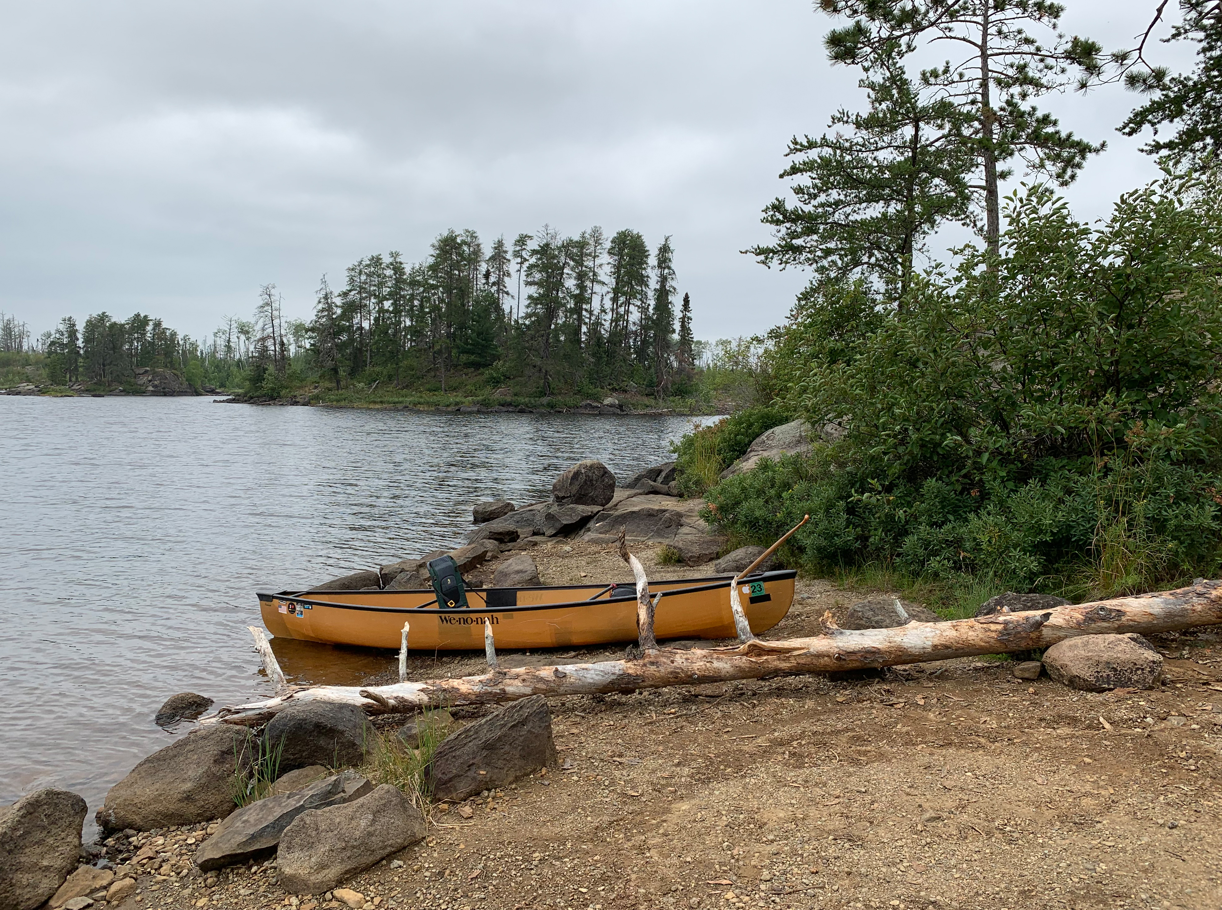
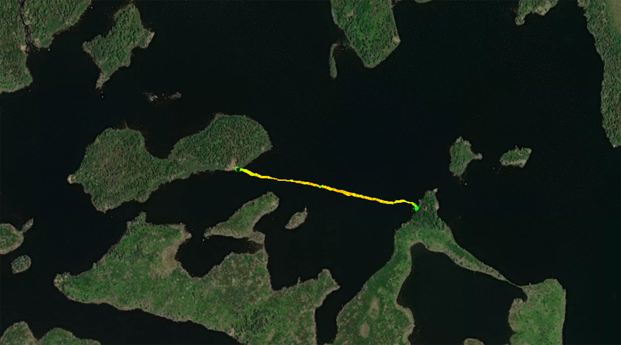
PADDLING FROM BWCA CAMPSITE 1527 TO BWCA CAMPSITE 1523
These campsites are easily visible from each other. From Campsite 1527, paddle nearly straight south about 1,000 feet to Campsite 1523.
View of the small island to the west of the campsite (August 7, 2021). Visit the Campsite -or- Explore Another Route ***********************************************END OF ROUTE***********************************************
PADDLING FROM BWCA CAMPSITE 1523 TO BWCA CAMPSITE 1522
Proceed around the point from the campsite and head eastward along the north shore of this dead end bay. At the back of the bay in the northeast corner is Campsite 1522. The actual campsite is up a steep slope from the canoe landing.
Gazing toward the southwest (August 7, 2021). Visit the Campsite -or- Explore Another Route ***********************************************END OF ROUTE***********************************************
PADDLING FROM BWCA CAMPSITE 1522 TO BWCA CAMPSITE 2330
Head back out of the bay by paddling to the west. Round the point where BWCA Campsite 1523 is located. Next proceed northeast and pass through the narrows between the peninsula to the south and the large island to the north. You can see BWCA Campsite 1526 (which is occupied) shortly after clearing the narrows to your left, on the island (many maps show this campsite on the north side of this island, which is incorrect). Continue a little farther east and round the east tip of the island to find the landing for BWCA Campsite 2330. Note that this campsite isn't always on an island, depending on water levels. If water levels in Lake Two are low, this campsite is technically on a peninsula.
The small island to the southeast of this campsite is partially visible to the left side of this image (August 7, 2021). Visit the Campsite -or- Explore Another Route ***********************************************END OF ROUTE***********************************************
PADDLING FROM BWCA CAMPSITE 2330 TO THE LAKE THREE CHANNEL
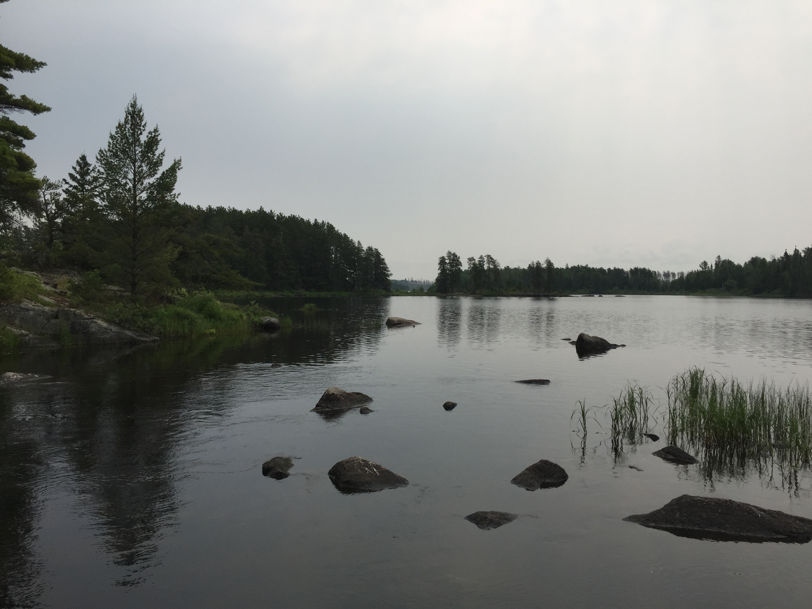
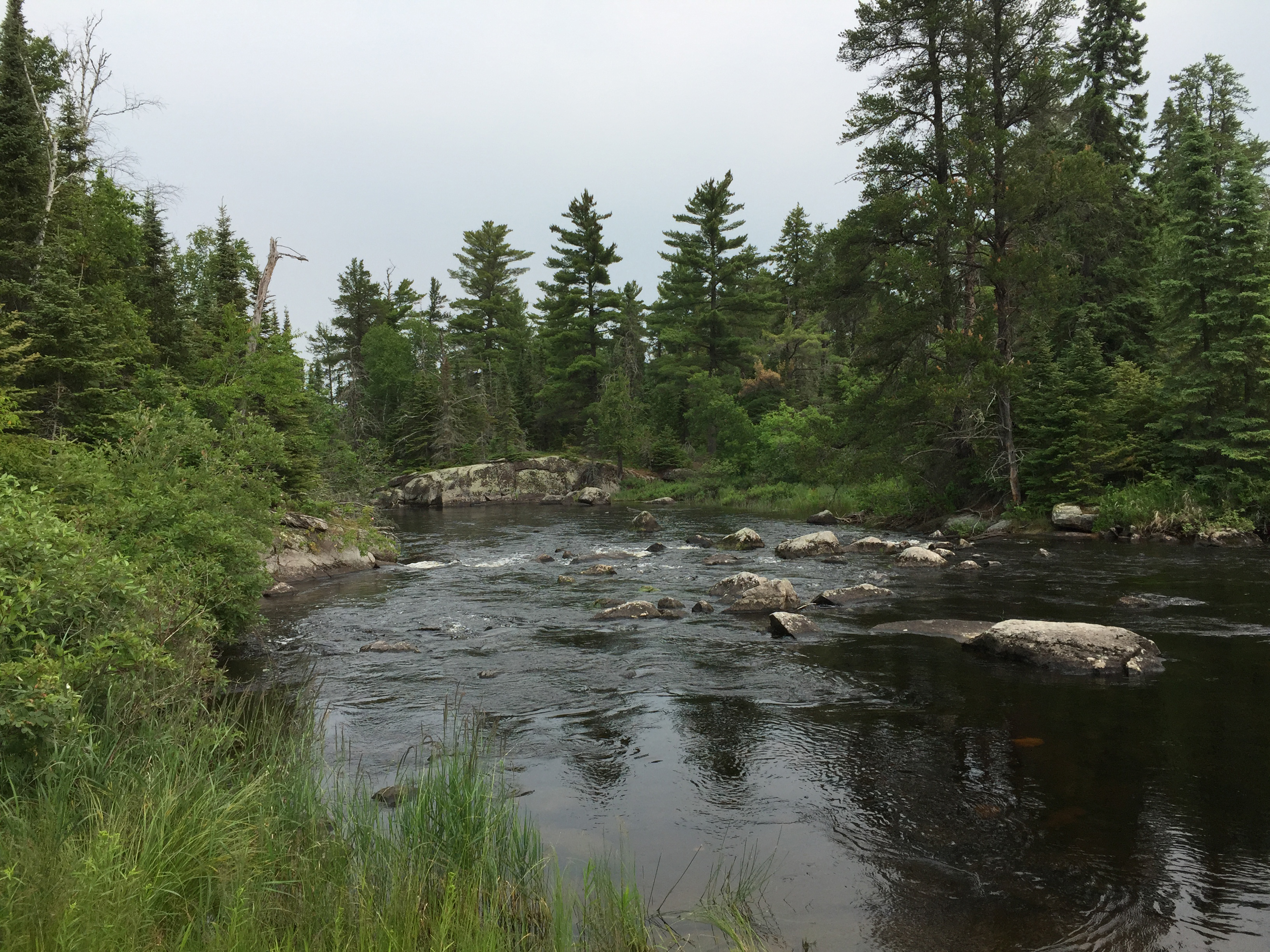
Fron the campsite, head to the east, passing out in front of BWCA Campsite 1525 on the mid-lake point. After making your way around the point, head southeast until reaching the Lake Three channel. Just before reaching the channel, stop and look into the large bay that is separated from the main body of Lake Two by a wall of rubble. This bay is a separate pond during low water periods, with the bay draining into Lake Two via a tiny outflow. From our viewing vantage point, can see an eagles nest on the far side of this pond near the top of a large burned tree (a big monitor or TV will help). Paddle into Lake Three -or- Explore Another Route ***********************************************END OF ROUTE***********************************************
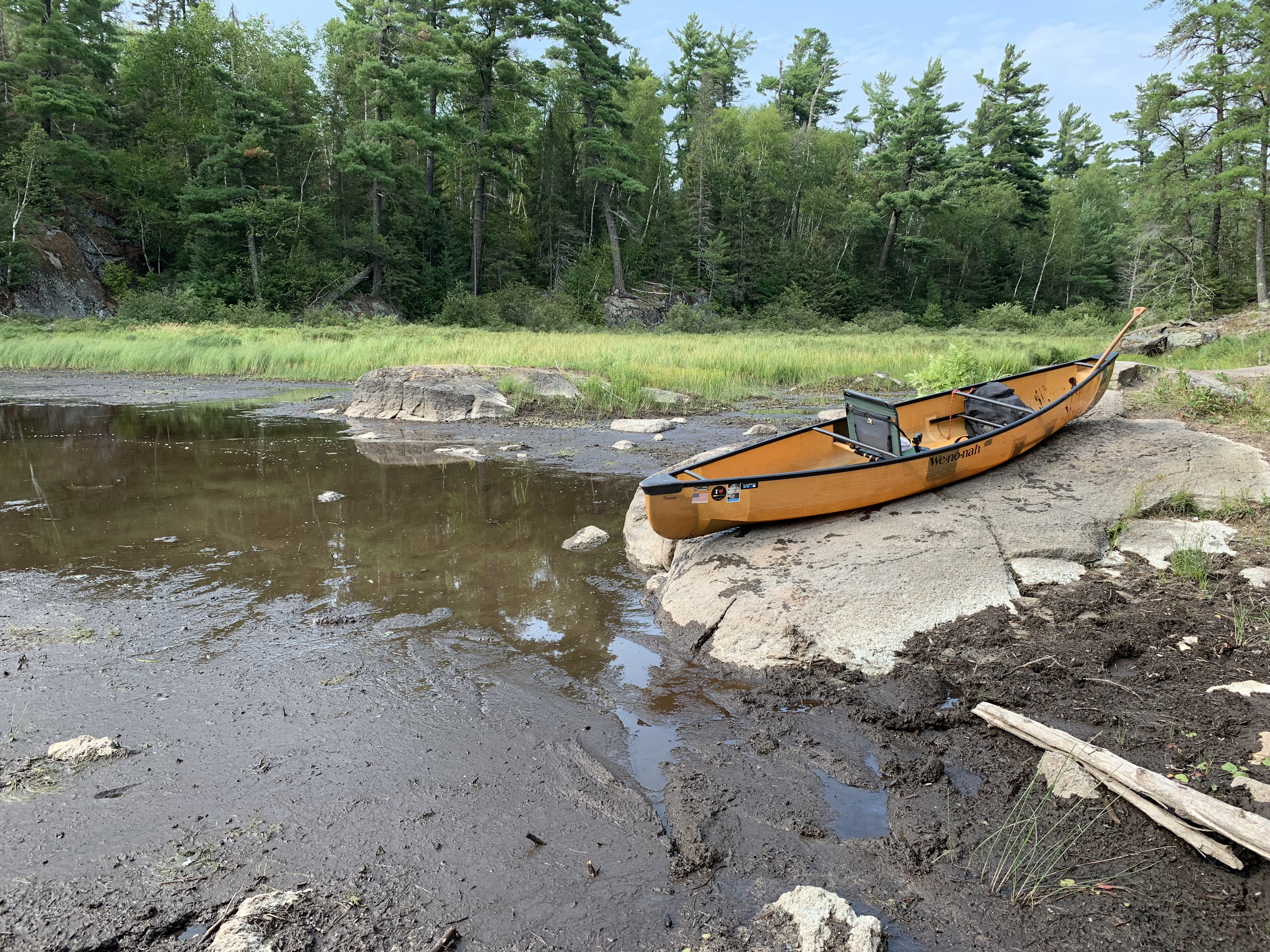
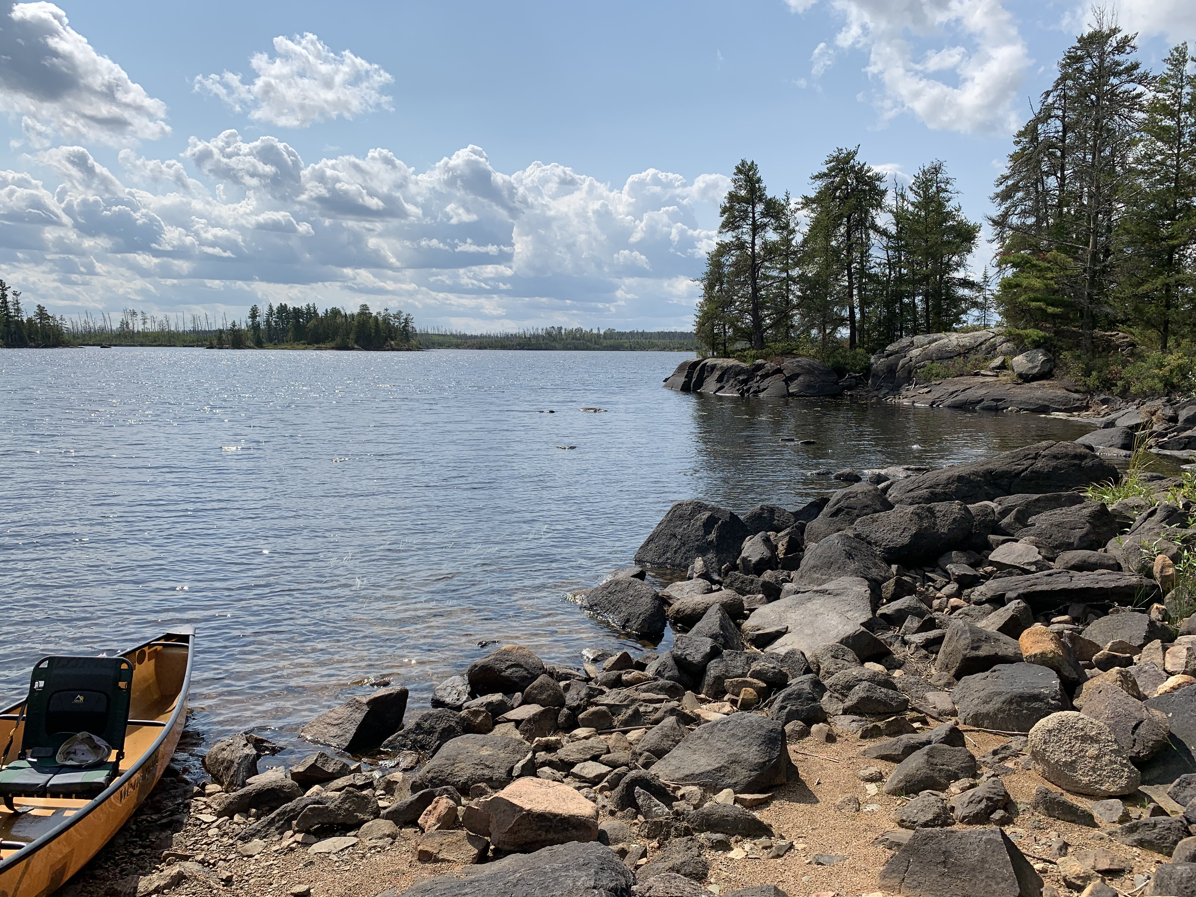
PADDLING FROM THE LAKE THREE CHANNEL TO THE RIFLE LAKE PORTAGE
Pass between the small island and the east shoreline just after exiting the channel heading northbound. Pass near to BWCA Campsite 1487 (already occupied). Continue following the shoreline of Lake Two toward the northwest until reaching the Rifle Lake portage. Water is low, so getting to the actual landing is interesting...
Make your way through the mud and silt to the landing (August 7, 2021). Portage to Rifle Lake -or- Explore Another Route ***********************************************END OF ROUTE***********************************************
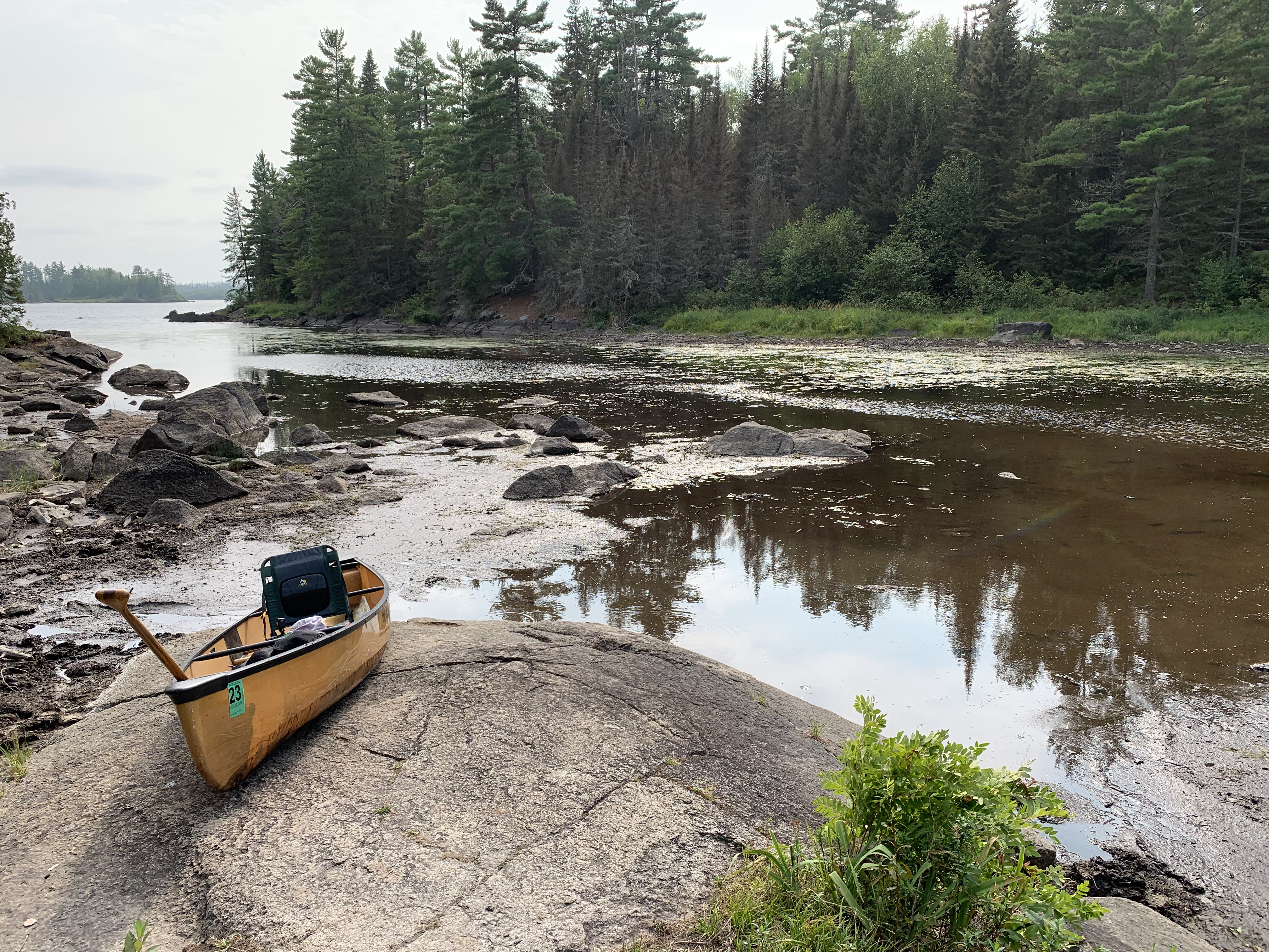
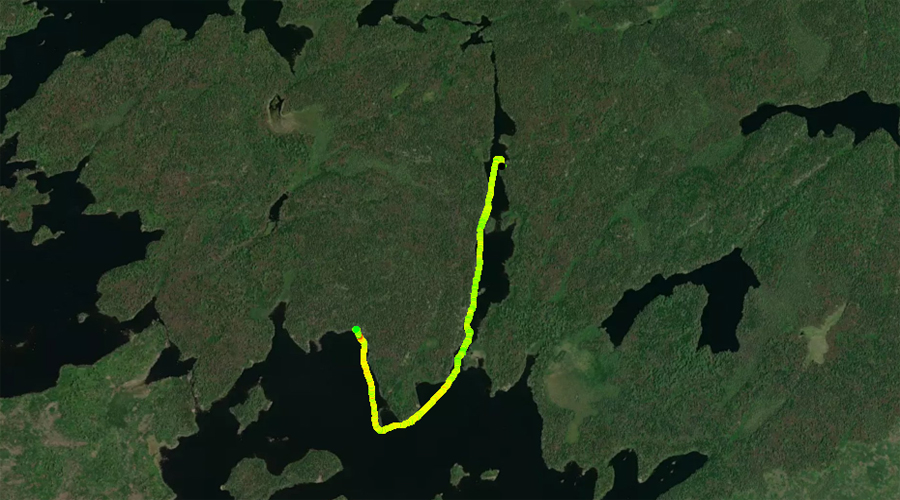
PADDLING FROM THE RIFLE LAKE PORTAGE TO BWCA CAMPSITE 1679
This portage landing is much more difficult with low water (August 7, 2021).
Leave the portage landing and make the turn west then north into the long northern arm of Lake Two. You pass by BWCA Campsite 1524. There is some moving water as you head north into this long channel. This is actually the Kawishiwi River. The distance up to BWCA Campsite 1679 is not trivial. This is easily the remotest campsite on Lake Two, but worth the effort to visit. Come this way probably offers up the most scenic paddle on the lake. The route shown in this video was during a period of low water. If the water is high, expect quite a bit of current through here. There is not a route using this channel to Lake One. Just past the campsite which is about halfway up the channel, the river quickens and becomes a series of rapids flowing down into the east end of Lake One. Visit the Campsite -or- Explore Another Route ***********************************************END OF ROUTE***********************************************
PADDLING FROM BWCA CAMPSITE 1679 TO BWCA CAMPSITE 1529
Paddle upstream toward the south out of the north arm of the lake until reaching the main body of Lake Two. Once clear of the channel, head west, soon passing BWCA Campsite 1530 (occupied). There is a small island just west of the point that the campsite is on. Pass to the west of it. From there, head north along the shoreline until reaching BWCA Campsite 1529. The landing for this campsite is to the far left as you face the pile of stones that marks the campsites fire pit, which is easily visible from the lake.
The landing for this campsite is to the left as you face the campsite. Can be a little hard to find (August 7, 2021). Visit the Campsite -or- Explore Another Route ***********************************************END OF ROUTE***********************************************
PADDLING FROM BWCA CAMPSITE 1529 TO THE LAKE ONE PORTAGE
Evening paddle along the north shore of the lake. Campsite 1528 is just up the shore to the north from the tip of the first point you pass (occupied). After paddling past that campsite, head southwest between the island and the shoreline. Reach the portage to Lake One soon after.
Lake One portage landing. This is what it looks like during really low water levels (August 7, 2021). When the water level of Lake Two is around average, the canoe landing is up near the forest on the far left of this view. Portage to Lake One -or- Explore Another Route ***********************************************END OF ROUTE***********************************************
PADDLING FROM THE LAKE ONE PORTAGE TO BWCA CAMPSITE 1528
Lake One portage landing during a period of extremely low water levels.
From the Lake One portage, paddle northeast along the shoreline passing to the west of the offshore island. Arrive at the campsite near the point.
Looking back in the direction of the Lake One portage. Island visible middle of view. The portage to Lake One is through that channel to the right of the island. Visit the Campsite -or- Explore Another Route ***********************************************END OF ROUTE***********************************************
PADDLING FROM BWCA CAMPSITE 1528 TO BWCA CAMPSITE 1526
Looking into the small north bay just west of the campsite.
Head to the southeast and out around the east end of the large island in the northern part of Lake Two. Once rounding the east tip of the island, paddle a short distance to the west until arrival at this island campsite. This campsite is located on the south side of this island (many maps show it on the north side).
View to the south. There is another campsite located on that point in the center of your view. Visit the Campsite -or- Explore Another Route ***********************************************END OF ROUTE***********************************************
PADDLING FROM BWCA CAMPSITE 1526 TO BWCA CAMPSITE 1525
View from BWCA Campsite 1526 to the west down the channel between the island and the peninsula sticking out from the south shore of Lake Two.
Paddle almost straight east until reaching BWCA Campsite 1525 on the sharp point that juts out from the south shoreline of Lake Two.
View to the northwest from BWCA Campsite 1525. Visit the Campsite -or- Explore Another Route ***********************************************END OF ROUTE***********************************************
PADDLING FROM BWCA CAMPSITE 1525 TO BWCA CAMPSITE 1530
Northwesterly view from BWCA Campsite 1525.
Paddle almost due north across the lake to reach BWCA Campsite 1530.
Looking generally southward from BWCA Campsite 1530. Visit the Campsite -or- Explore Another Route ***********************************************END OF ROUTE***********************************************
PADDLING FROM BWCA CAMPSITE 1530 TO BWCA CAMPSITE 1524
View to the north from BWCA Campsite 1530. This is the small bay just north of the campsite.
Short paddle from BWCA Campsite 1530 to BWCA Campsite 1524. Pass in front of the entrance to the north arm of the lake. This long north arm is actually one of the two outlets of the Kawishiwi River from Lake Two. The other outlet is next to the Lake One portage.
Peering south from BWCA Campsite 1524. Visit the Campsite -or- Explore Another Route ***********************************************END OF ROUTE***********************************************
PADDLING FROM BWCA CAMPSITE 1524 TO BWCA CAMPSITE 1487
South view from BWCA Campsite 1524.
Paddling generally east to BWCA Campsite 1487. Shortly after starting out, pass by the small bay that leads to the Rifle Lake portage. From there continue along the shoreline and proceed back into the eastern bay of Lake Two. Here you will find BWCA Campsite 1487.
View of the small bay just west of BWCA Campsite 1487. Visit the Campsite -or- Explore Another Route ***********************************************END OF ROUTE***********************************************
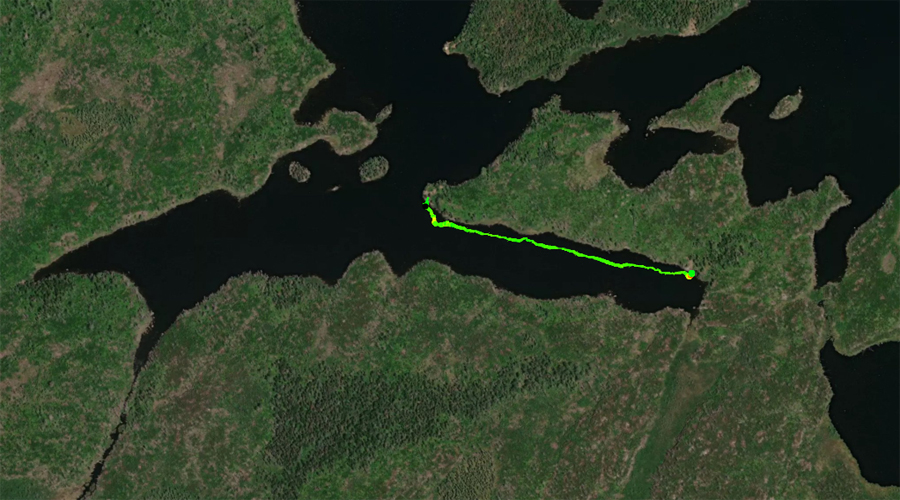
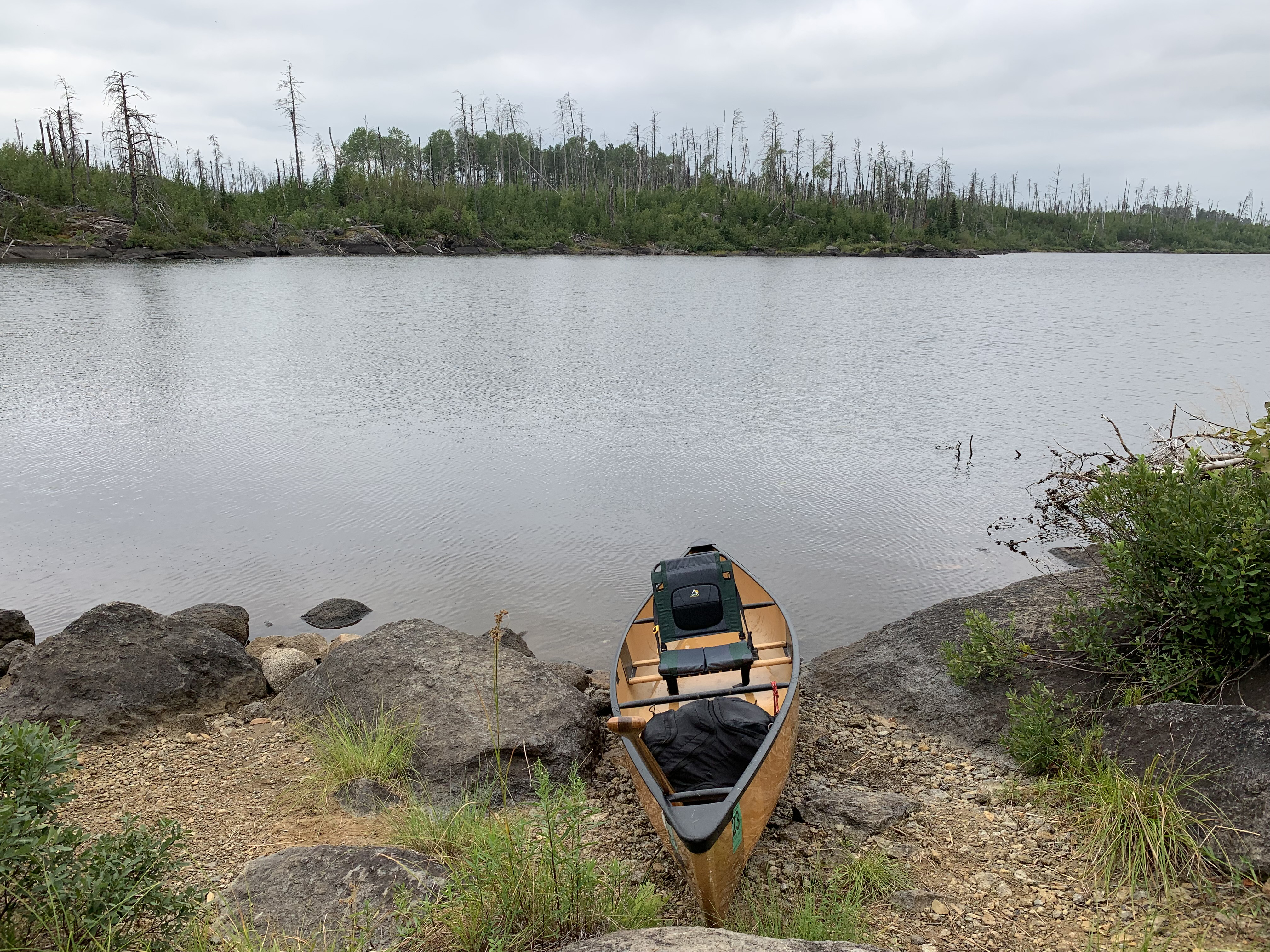
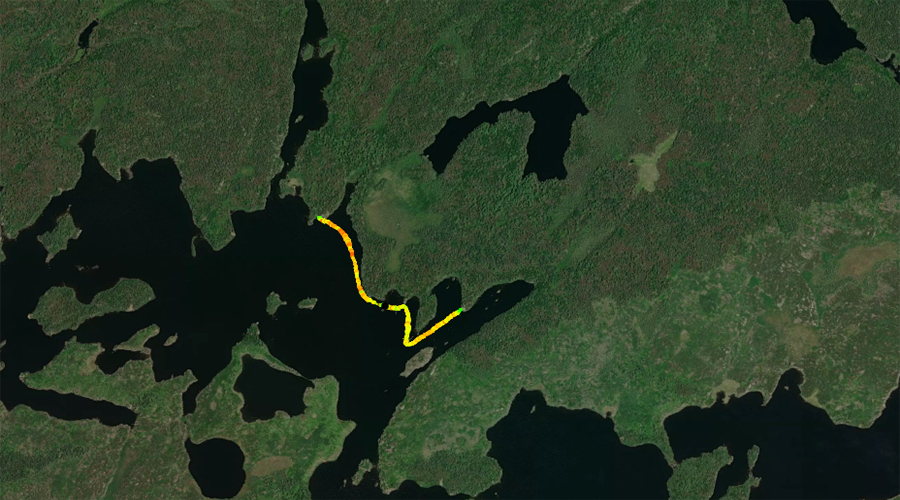
PADDLING FROM BWCA CAMPSITE 1487 TO THE LAKE THREE CHANNEL
Paddling along the eastern shoreline of Lake Two and heading into the channel leading to Lake Three.
PADDLING FROM THE LAKE THREE CHANNEL TO THE LAKE ONE PORTAGE
Paddling from the Lake Three channel to the Lake One portage. Route follows the south shore of Lake Two, passing south of the lakes largest island and approaching the Lake One portage from the south.
Arrival at the portage to Lake One. Portage to Lake One -or- Explore Another Route ***********************************************END OF ROUTE***********************************************
PADDLING FROM LAKE ONE PORTAGE TO EAST END OF LAKE TWO JUST NORTH OF THE LAKE THREE CHANNEL
View to the north from the portage leading back to Lake One. The rapids start just out of your view to the left. You can see the current lines in the water as it is pulled toward the edge (July 3, 2015).
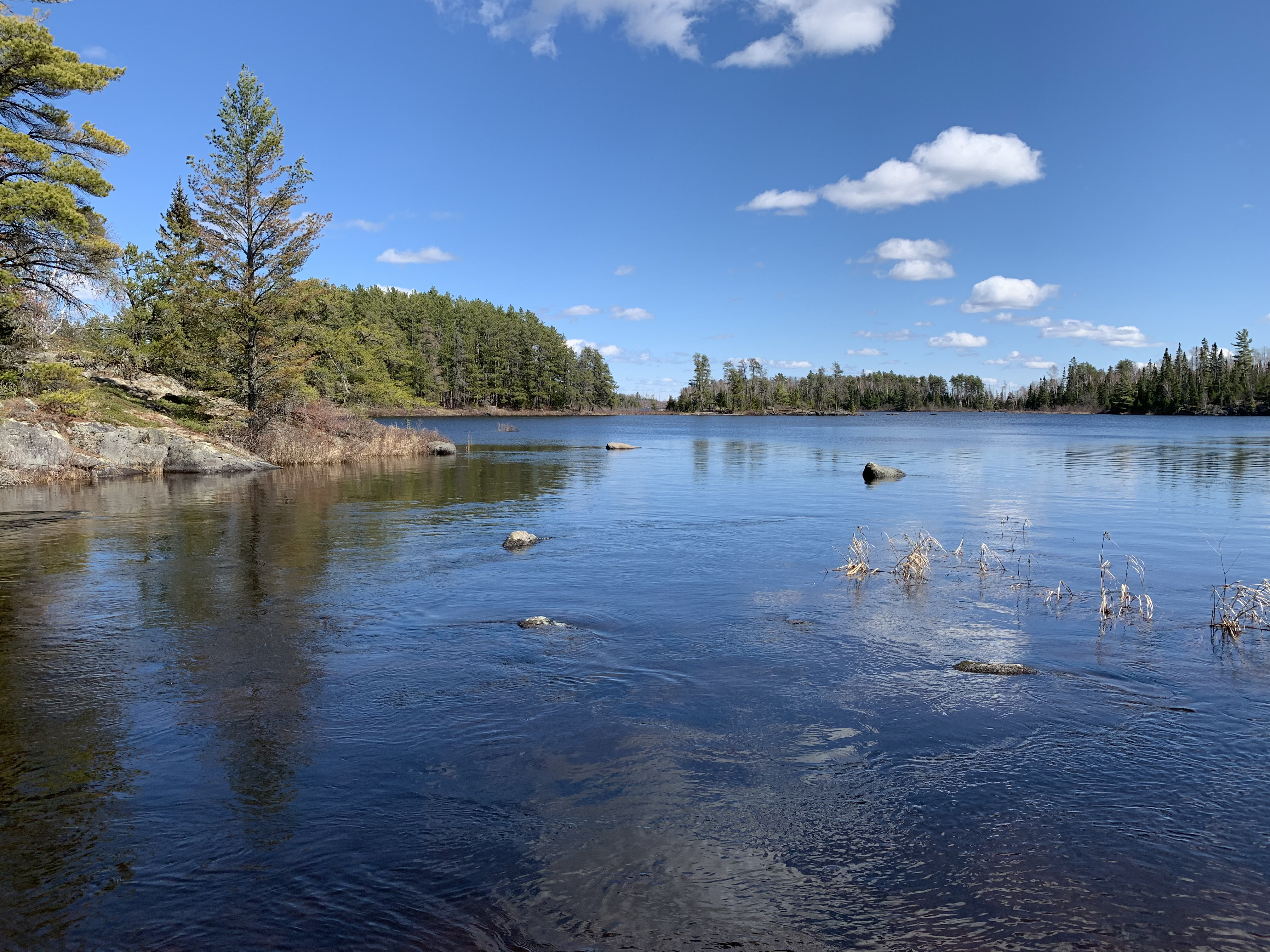
Nearly the same view as the image above, but on a clear day in a different season (April 29, 2021).
A moderate current takes the waters of Lake Two over the precipice and down the rapids towards Lake One. Lake One and Lake Two are two lakes along the Kawishiwi River.
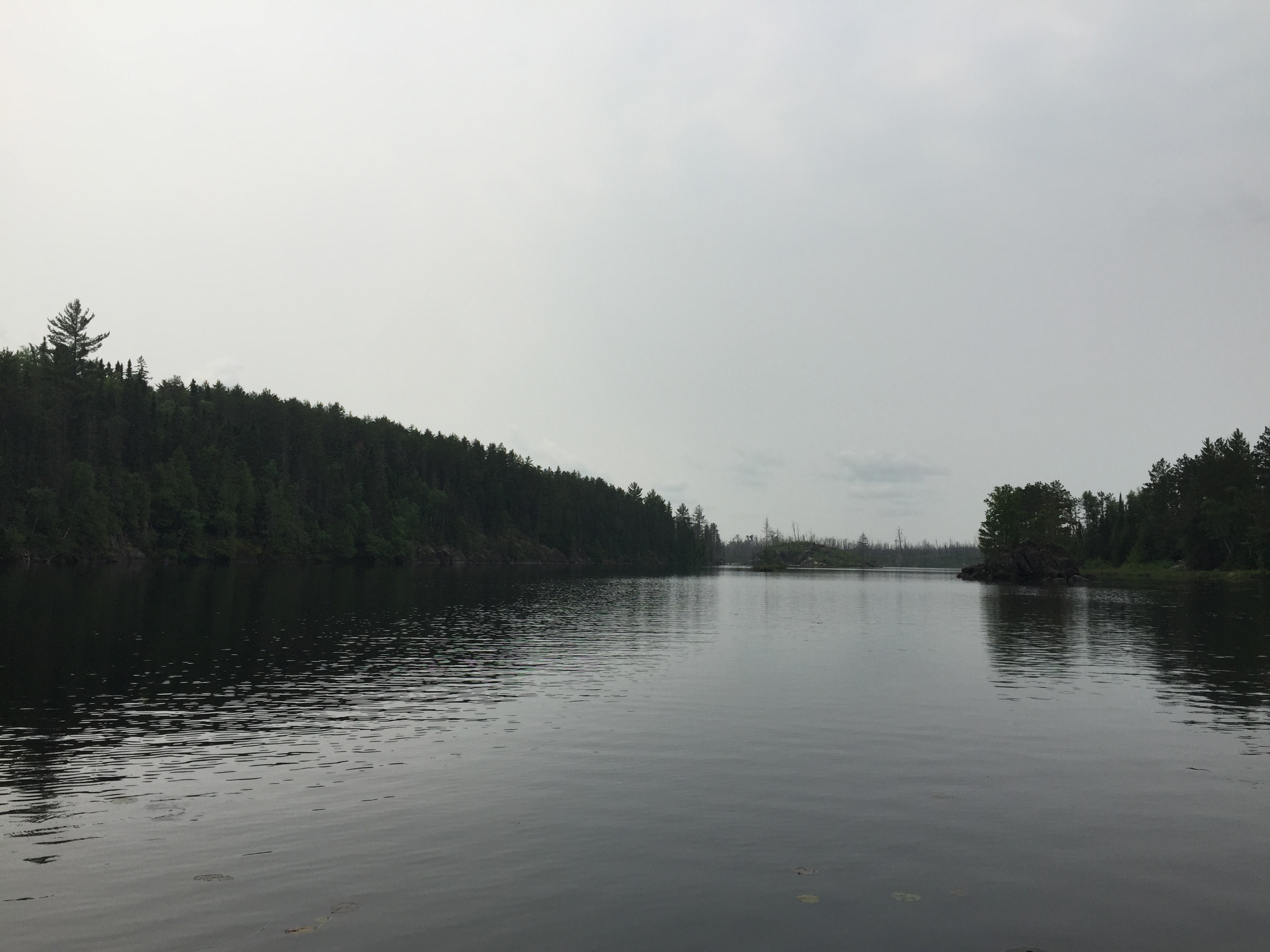
Setting off from the Lake One portage, you glance at the top of the rapids cascading down toward Lake One as you paddle by. This route take you up the west side of the lake between the west shore and a large island. From there you travel east sort of staying with the north shore of the lake. Just past the middle of Lake Two, you pass to the north of two small islands. From there you head to the north shoreline and follow it to the entrance to the eastern bay of the lake. This bay is just north of the Lake Three channel.
A pretty bay on the east end of Lake Two just north of the channel to Lake Three. Explore Another Route ***********************************************END OF ROUTE***********************************************